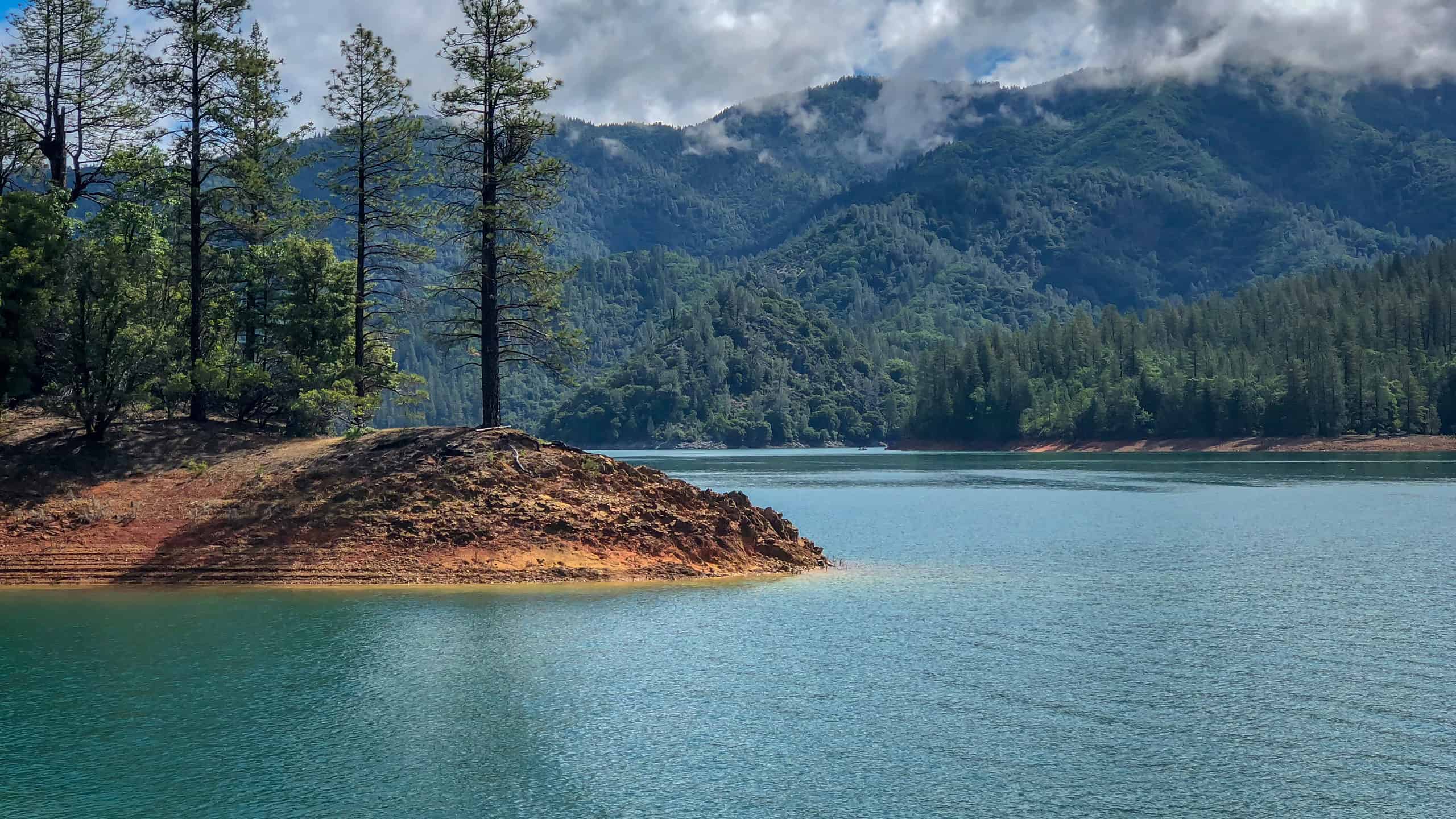

Located on the upper Sacramento River in Shasta County, Shasta Lake is the largest man-made lake in California. Also known as Lake Shasta, this large man-made lake or reservoir has a surface area of around 30,000 acres. By acreage, Shasta Lake ranks as the seventh-largest lake in the state of California. That said, few lakes in California contain more water than Shasta Lake.
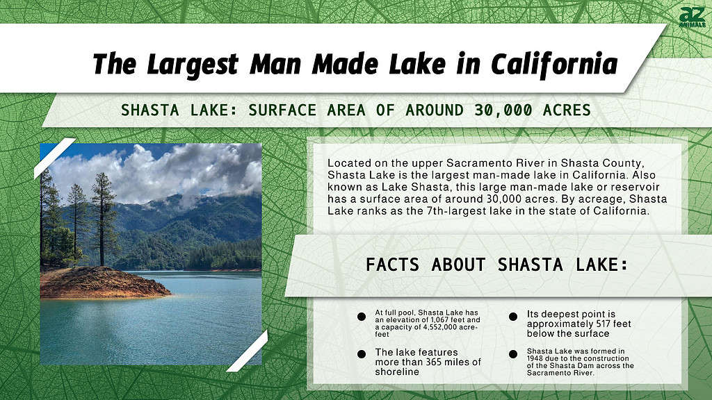
When measuring the volume of a lake, scientists set a maximum level—or full pool elevation—that it can maintain without releasing over a weir, spillway, dam, or some other structure. At full pool, Shasta Lake has an elevation of 1,067 feet and a capacity of 4,552,000 acre-feet. This makes Shasta Lake the third-largest body of water in California, behind only Lake Tahoe and the Salton Sea. Its deepest point is approximately 517 feet below the surface, and the lake features more than 365 miles of shoreline.
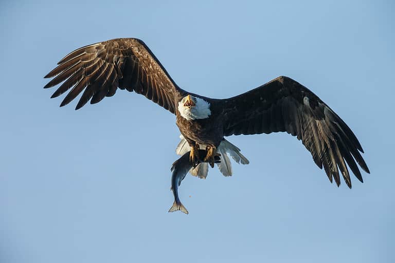
The entire reservoir rests within Shasta County in the Whiskeytown-Shasta-Trinity National Recreation Area. Visitors to the reservoir can enjoy a myriad of activities, including boating, water skiing, fishing, hiking, and camping. You can access the lake from over a half dozen marinas that offer services like boat, kayak, and paddle board rentals, along with food, ice, and souvenirs. Nature enthusiasts can also come to appreciate the local plants and animals in the area, including deer, bears, bald eagles, osprey, and other resident and migrating bird species.
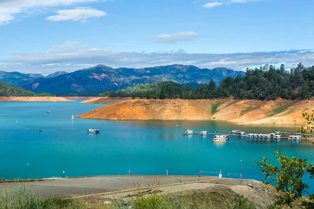
Shasta Lake is the largest man-made lake in California with a surface area of roughly 30,000 acres.
©iStock.com/Strekoza2
Where Is Shasta Lake Located on a Map?
Shasta Lake is located about 15 minutes north of the city of Redding, the major economic and cultural hub in the Shasta Cascade region of Northern California. The Shasta Dam Visitors Center is approximately 11 miles, or a 20-minute drive, from the city.
History of Shasta Lake
Shasta Lake was formed in 1948 with the construction of the Shasta Dam across the Sacramento River. Authorities created the Shasta Dam to hold, control, and deliver water to California’s Central Valley, the state’s primary agricultural region. While initially conceived in 1919, the project to construct the dam stalled due to a lack of financing during the Great Depression. Eventually, the Federal Bureau of Reclamation intervened in order to see the project to completion. The project took eight years to complete, with construction taking place from 1937 to 1945. By the time of its completion, the concrete gravity dam measured 3,460 feet long and 602 feet high, making it the eighth tallest dam in the United States. At the time, the dam ranked as the second tallest in the country and featured many cutting-edge engineering and design techniques.
The dam served an essential role during World War II as it provided electricity to California factories. However, the project was not without its share of controversy. Namely, the creation of the dam led to the flooding of numerous Wintu Indian sites. The vast majority of historic Wintu villages, hunting, and historic sites were buried under hundreds of feet of water as a result of the construction of the dam. Along with these Native American sites, the dam also buried several towns, including Baird, Copper City, Elmore, Etter, Morley, Pitt, and Winthrop. The largest, Kennett, was formerly a critical copper mining town that once was home to nearly 10,000 people. Many fishers and nature conservationists also objected to the construction of the dam because of its effect on salmon and other fish populations and the local landscape.
Shasta Lake started to form in 1944 as construction of the Shasta Dam neared completion. As the lake grew, it submerged parts of several tributaries of the Sacramento River, including the Pit and McCloud rivers. Today, Shasta Lake continues to serve as a primary water reservoir for Central California. The Shasta Dam generates hydroelectricity for the region and also protects against the intrusion of saline water. Finally, the lake attracts thousands of visitors yearly who come to appreciate the scenery or enjoy water sports.
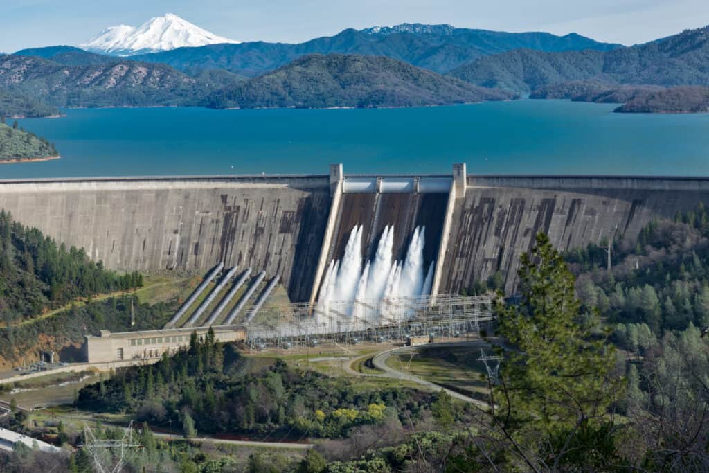
Shasta Lake was formed in 1948 due to the construction of the Shasta Dam across the Sacramento River.
©Wirestock Creators/Shutterstock.com
Shasta Lake Geography
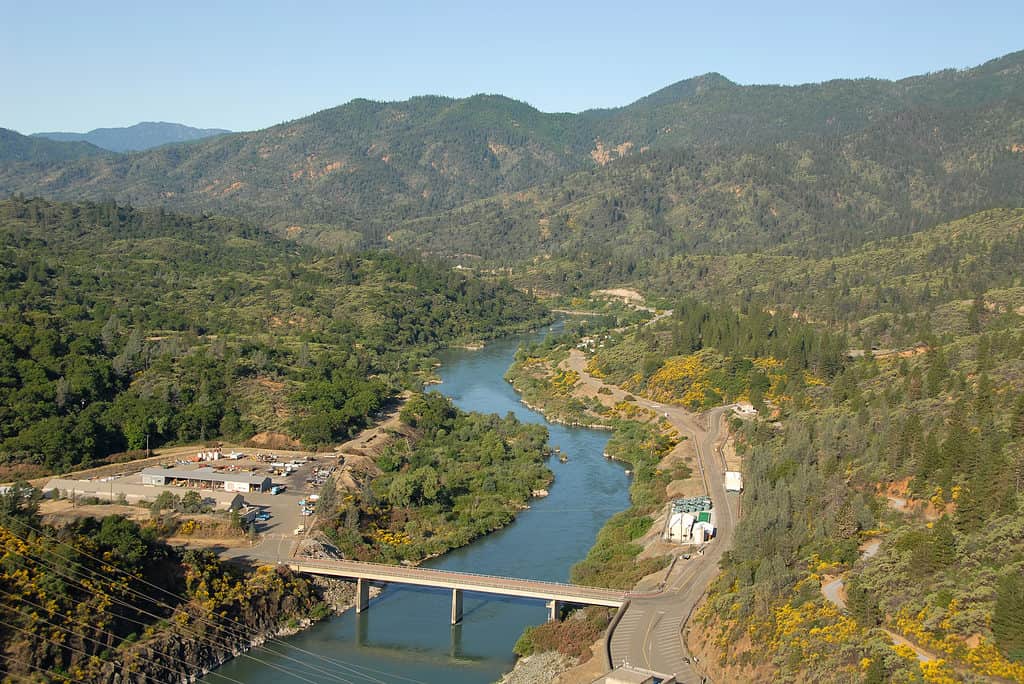
Four primary rivers feed into Shasta Lake: the Sacramento River, McCloud River, Pit River, and Squaw Creek. Steep mountains hem most of Shasta Lake’s shoreline, on top of which grow evergreen trees and shrubs. Near the McCloud arm of Shasta Lakes lies the Shasta Lake Caverns, a network of underground caves.
The town of Lakehead is located on the northern shore of Lake Shasta. To the south of Lakehead lies the city of Redding. Several marinas that offer food, retail, and rental services surround the borders of the lake. The largest marina on Shasta Lake, Bridge Bay Marina, hosts a restaurant, bar, retail stores, and boat and personal watercraft rentals. Other marinas include Digger Bay Marina, Shasta Marina Resort, Antler’s Marina, Silverthorn Marina, Jones Valley Resort, Holiday Harbor, and Sugarloaf Marina.
The Sacramento River is one of four primary rivers that feed into Shasta Lake in California.
©Hank Shiffman/Shutterstock.com
Shasta Lake Reviews
Reviews of Shasta Lake vary from the sublime to subpar. Most visitors state that the lake and scenery are beautiful. The lake’s rocky shoreline and forests make for prime viewing while hiking or camping, and it is a prime spot to enjoy boating, kayaking, water skiing, and wakeboarding. That said, some people complain that the water level in the lake has dropped precipitously in recent years. This likely has to do with the prolonged drought affecting California, which has necessitated stricter water controls.
Additionally, many reviews state that the shoreline around the lake could use better upkeep. People complain about trash near the beaches and marinas, including broken glass, needles, and beer cans. The water can get highly choppy when many boats are present, and the water itself is not fit for swimming in some spots.