
Nevada is home to state-wide lofty peaks and incredible trekking routes for adventurous hikers. If you’re eying up the highest point in Clark County, look no further. Discover its height, location, hiking routes, amazing animals, and what activities you can enjoy there.
County Clark’s Highest Point
The highest point in Clark County is Mount Charleston, towering into the skyline at 11,916 feet.
Located in the Mount Charleston Wilderness in the Humbolt-Toiyabe National Forest of the Spring Mountain National Recreation Area, it lies 35 miles northwest of famous Las Vegas. It’s officially registered as Charleston Peak.
Despite its lofty statistics, Mount Charleston is only the eighth tallest peak in Nevada. However, because it is geographically separate from other peaks and surrounded by low basins, it is especially prominent and highly visible on the horizon.
The summit is bare and rocky, but the trail leading to its peak passes through forests and alpine meadows that provide a variety of ecosystems for unusual creatures. More on that later.
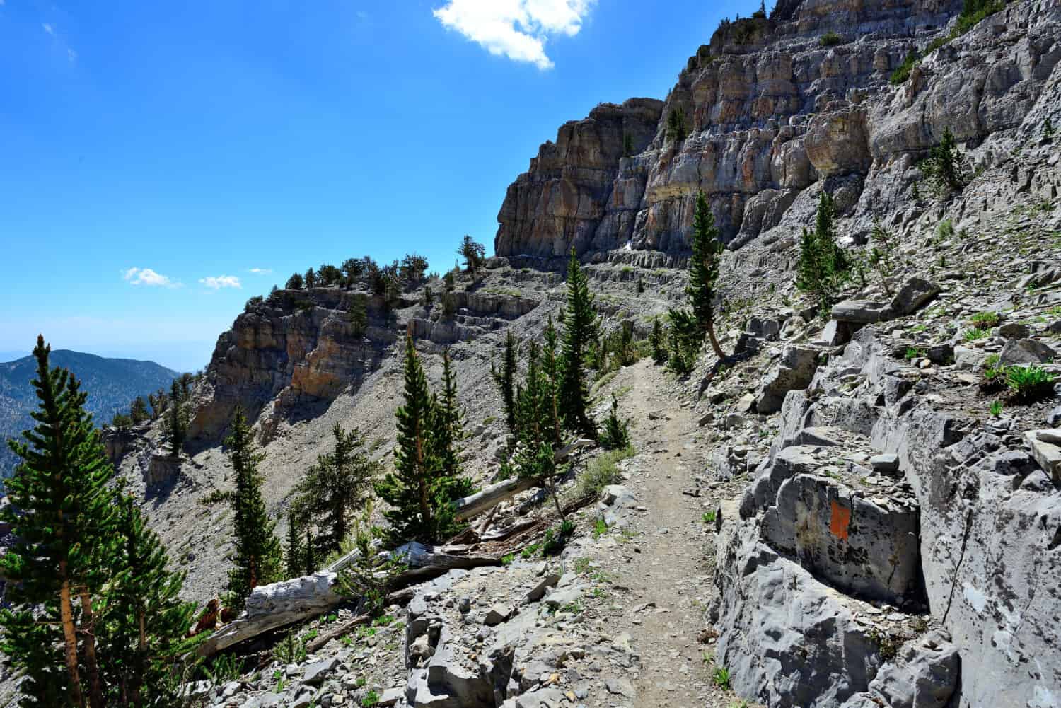
Mount Charleston’s trail is one of the most popular hikes in Nevada. It was named after the South Carolina town by the U.S. Civilian Army Corps in 1869 as they surveyed the area for railroad construction.
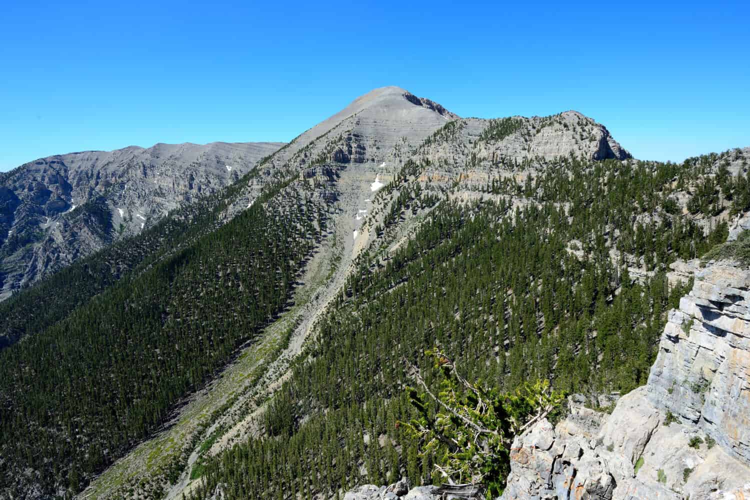
Mount Charleston was named after Charleston in South Carolina in 1869.
©Eric M. Williams/Shutterstock.com
Nevada’s Highest Point
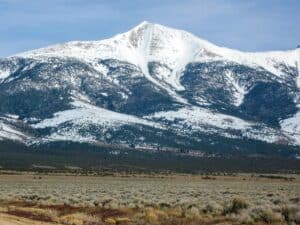
Mount Charleston is the highest peak in Clark County, but the highest point in all of Nevada is 13,147-foot-tall Boundary Peak. It’s the White Mountain’s most northerly peak in Esmeralda County in Inyo National Forest.
Boundary Peak is part of Montgomery Peak, mostly located in neighboring California. It’s only ¾ of a mile from the border. Because it’s a ridge of another mountain, some folks don’t think it deserves the title of Nevada’s highest peak. Instead, they believe Wheeler Mountain is more worthy of the title. Wheeler Mountain is 13,065 feet tall, so there’s not much in it. It’s officially the second-highest peak in Nevada.
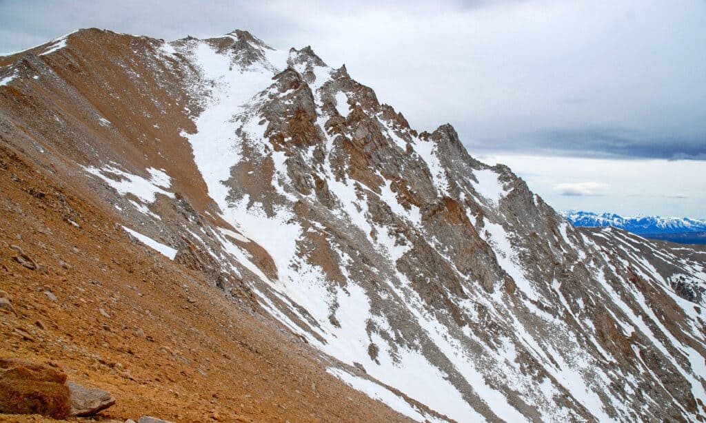
Boundary Peak is the tallest point in Nevada at 13,147 feet tall.
©nyker/Shutterstock.com
Where Is Charleston Peak Located on a Map?
Charleston Peak is 35 miles northwest of Las Vegas. Its latitude is 36.27156 degrees north, and its longitude is 115.6946 degrees west.
Take the US-95 north from Las Vegas I-15 towards Reno for twenty minutes and turn west onto State Route 157. The road climbs 5,000 feet over the following 20 miles, so you know something tall is ahead.
Pass through Rainbow and Old Town villages on Echo Road to the north loop trailhead or head left for the south loop trailhead.
Can You Drive to Mount Charleston?
No, to reach the 11,916-foot-tall peak, visitors have to hike.
Trailhead car parks fill up fast on weekends and over the summer vacation months, so planning ahead is important. There’s some unofficial parking on the road shoulder, but if all’s lost, head back to park on Echo Road and add half a mile to your hike.
What Is There to Do at Mount Charleston?
The highest peak in Clark County is famous, and there’s plenty to do there if you appreciate the wilderness and enjoy sporty activities. If not, the temptation of glam Las Vegas is just a short drive away.
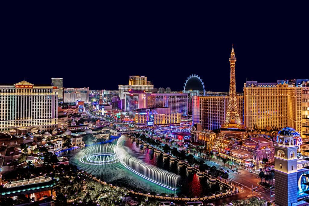
Las Vegas lies just 35 miles southeast of Mount Charleston.
©iStock.com/RandyAndy101
Hiking
From June to October, hikers enjoy snow-free treks, but because the summit is bare, exposed, and tall, it is windy there. Some hikers report painfully high winds on Mount Charleston even in summer, but the peak delivers spectacular panoramic views of Death Valley, the Sierra Nevada, and glitzy Las Vegas.
Two maintained trails for hikers lead to the top. The north loop and the south loop. Combined, they take all day. Seasoned walkers recommend 14 hours to complete the double trail.
South Loop
From the Cathedral Rock Picnic Area (not the trailhead on the highway.) The south loop rises steeply. Most of its elevation happens in the first four miles of the 3,000-foot-tall southern ridge switchbacks just past the top of Griffith Peak.
This route then encompasses flat alpine meadows, so hikers can breathe and enjoy the spectacular elevated views. Then it’s back to elevation gain and pretty windy as you approach the peak’s treeline. Hikers say this is a shock compared to the peaceful alpine meadows.
The south loop is an 8.3-mile trek up and pretty challenging for the average hiker. Due to its alpine meadow sections, this is the most popular of the two trails.
In 1955, a CIA MC-54M plane crashed near the summit of Charleston Peak. Fourteen people died when it crashed during a heavy blizzard. Hikers can view the remains just off the south loop trail. The plane’s propeller is displayed alongside a granite monument in the Spring Mountains Visitor Center gateway.
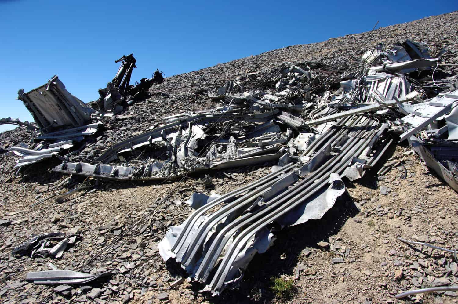
Wreckage from a plane crash in 1955 still lies on Mount Charleston’s south loop trail.
©Bruce Grubbs/Shutterstock.com
North Loop
The 8.5-mile north loop’s elevation is gained in the second half of the hike and is chiefly used to descend from the south loop trail. However, there are excellent views of Las Vegas from this direction.
The first section passes through a bristlecone forest northeast of the summit towards Mummy Mountain and Fletcher Peak. Continue along Trail Canyon and choose the left junction for a shorter hike. The right is an extra two miles. Head into Kyle Canyon and mountain edge switchbacks lead to the summit.
Charleston Peak’s north loop trail contains mountain edge switchbacks treacherous in winter.
©Eric M. Williams/Shutterstock.com
Winter Hiking
Mount Charleston changes in winter. It’s always challenging, but heavy-duty waterproofs and snow gear are essential when rain and snow arrive because arctic conditions can kill unprepared folks. No joke. Due to its extreme winter weather, Mount Charleston is usually enjoyed in the summer.
Shorter Hikes
If ascending the highest peak in Clark County is too strenuous, a shorter but epically scenic route might suit better. Two of the best include:
Cathedral Rock Trail: Three miles in summer only due to avalanche risk, this beautiful trail takes hikers past three waterfalls and up a summit that overlooks Kyle Canyon.
Fletcher Canyon Trail: Scramble over the canyon, streambed rocks, and ascend 4.2 miles through mahogany and pine forests to the canyon’s ridge.
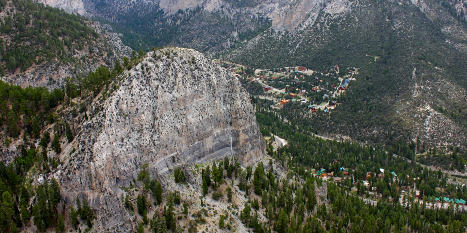
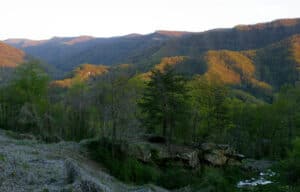
Cathedral Rock is a prominent point in the Charleston Mountain range.
©Jason Patrick Ross/Shutterstock.com
Ice and Rock Climbing
Charleston Peak’s ice-climbing ranges from W12 to W15+ in tough conditions. Hard limestone rock climbing routes in caves and over ledges are challenging here, too. Experienced rock climbers can tackle the epically named Disaster Dog or The Punisher. Other popular sports on Mount Charleston include bouldering, scrambling, and scree slope sliding.
Skiing
Lee Canyon offers skiing and snowboarding facilities. They’re popular in winter, and early booking is advised.
Camping
Many campsites and picnic areas dot Mount Charleston and the Spring Mountains. Some are RV accessible with facilities like electricity and water, but wild camping is permitted on Mount Charleston if campers register with the park authorities beforehand.
Charleston Peak campsites:
- Mahogany Grove Campground
- Hilltop Campground
- McWilliams Campground
- Fletcher View Campground
Clark County’s Highest Points
Nevada boasts more mountain ranges than any other state. It contains 314 named ranges plus over 100 anonymous desert-cutting peaks. 15 Clark County peaks reach over 10,000 feet tall.
In Clark County, the tallest peaks sit in the Charleston Range, and many snap at the heels of Charleston Peak.
- Charleston Peak: 11,916 feet
- Mummy Mountain: 11,527 feet
- Lee Peak: 11,289 feet
- Devil’s Thumb: 11,069 feet
- Griffith Peak: 11,059 feet
Animals Prowling Clark County’s Tallest Peak
Mount Charleston’s barren peak is bare and windy, so little lives at its 11,916 feet elevation, but its ascending lush forest and alpine meadows are rich with wildlife, including the endemic Palmer’s Chipmunk. This small rodent has solid black-and-white lines on its 8.8-inch tan body. It’s only found in the Spring Mountain range at 7,000-10,000 feet, chiefly occupying bristlecone and juniper forests.
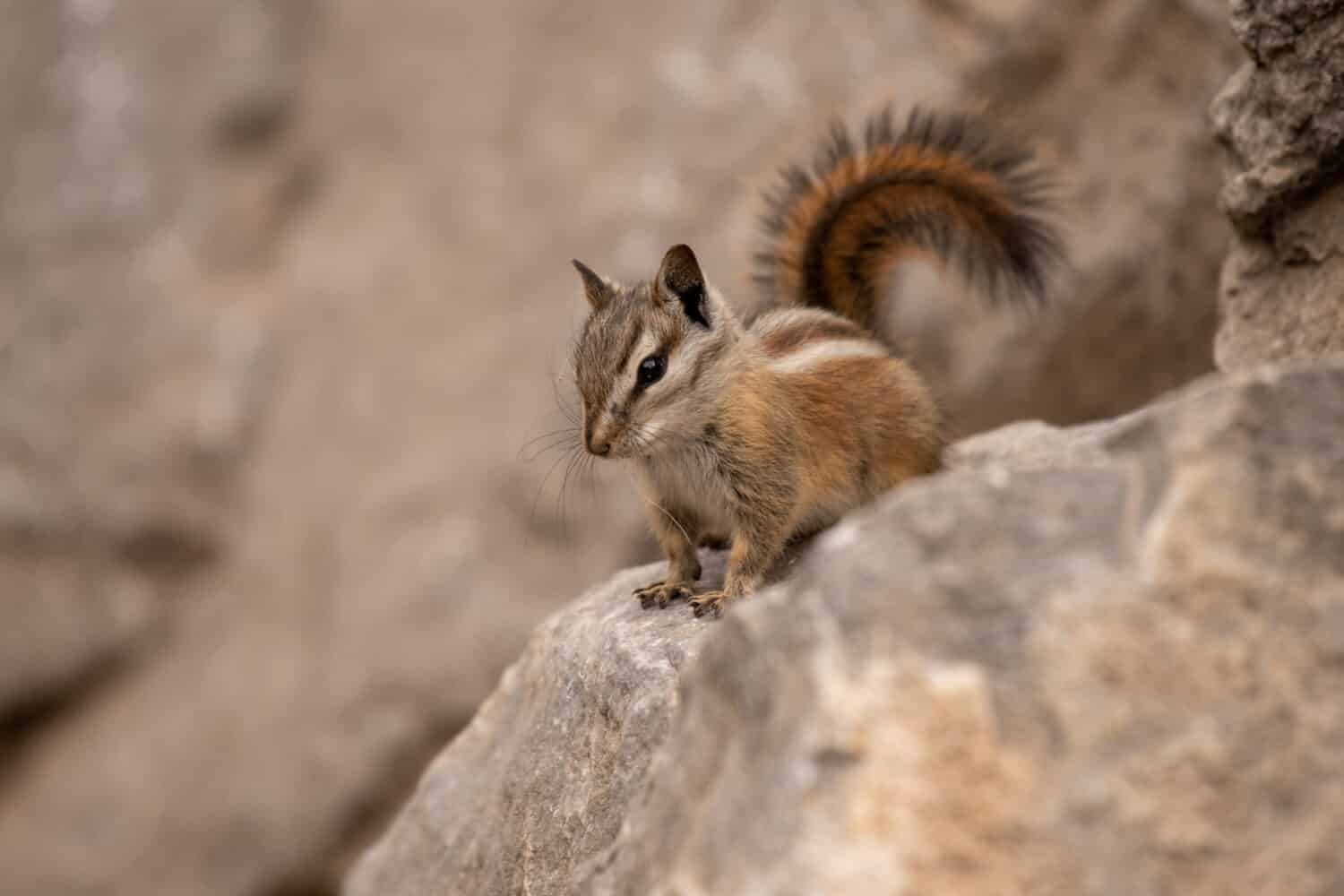
Palmer’s chipmunk is endemic to the Spring Mountain range’s bristlecone forests.
©Sean R. Stubben/Shutterstock.com
Another endemic Charleston Peak creature is the Mount Charleston ant (Lasius nevadensis.) Very little is known about this elusive ant, but in the 1950s, one nest was located in a dry pine and spruce forest and another on a rocky, north-facing slope in a pine and white fir forest.
This five-millimeter-long orangey-red ant hasn’t been seen since 1955. Experts think it only emerges once a year during mating season.
More common animals on Charleston Peak include:
- Mule deer
- Desert bighorn sheep
- Elk
- Golden mantle ground squirrel
- Wild donkeys (burros)
- Coyote
- Bobcat
- Mountain lion
- Badger
- Weasels
- Shrews
- Bats
- Rattlesnakes
- Stella jay
- Chickadee
- Red-tailed hawk
- Broad-tailed hummingbirds
One ferocious predator missing from Charleston Peak is the bear. No bears live on Mount Charleston because the Mojave Desert surrounds it.
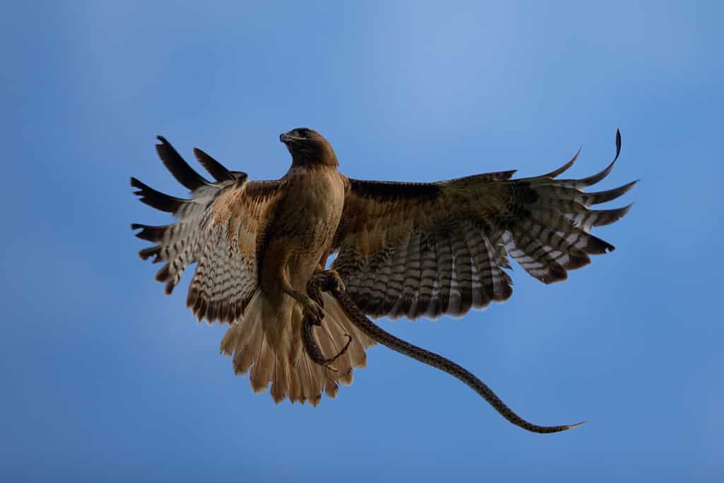
Red-tailed hawks hunt rodents and snakes on Mount Charleston.
©ranchorunner/Shutterstock.com
The photo featured at the top of this post is © iStock.com/Florian Schipflinger
How to Add Us to Google News


Thank you for reading! Have some feedback for us? Contact the AZ Animals editorial team.