
Key Facts:
- The highest point in Cook County, Illinois, reaches an elevation of 950 feet.
- The peak does not have a name.
- It’s situated in Cook County’s Forest Preserve in the northwest township of Barrington.
- Ancient glacier movements created the peak.
Cook County, Illinois, is home to over five million people, but one hundred years ago, that figure stood at just 600. Its massive growth makes it one of the fastest-growing U.S. counties. More than 40% of Illinois’ residents live there.
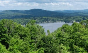
Overall, Cook County stretches 1,635 square miles. 945 square miles are land, and 690 square miles are water, chiefly held in Lake Michigan. It’s a densely populated urban area, so where does this leave Cook County’s natural world? In this article, we’ll discover the highest point in Cook County and its surrounding nature.
What’s the Highest Point in Cook County?
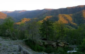
The highest point in Cook County is a 950 feet tall un-named point in northwest Barrington township. It’s not the loftiest peak in the United States, but it’s an immersive hike and high enough to gain an uninterrupted view of the surrounding forest preserves.
Where Is the Highest Point Located on a Map?
It’s located in the county’s northwest corner in the midst of the Cook County Forest Preserve. Helm Woods nature reserve is the trailhead.
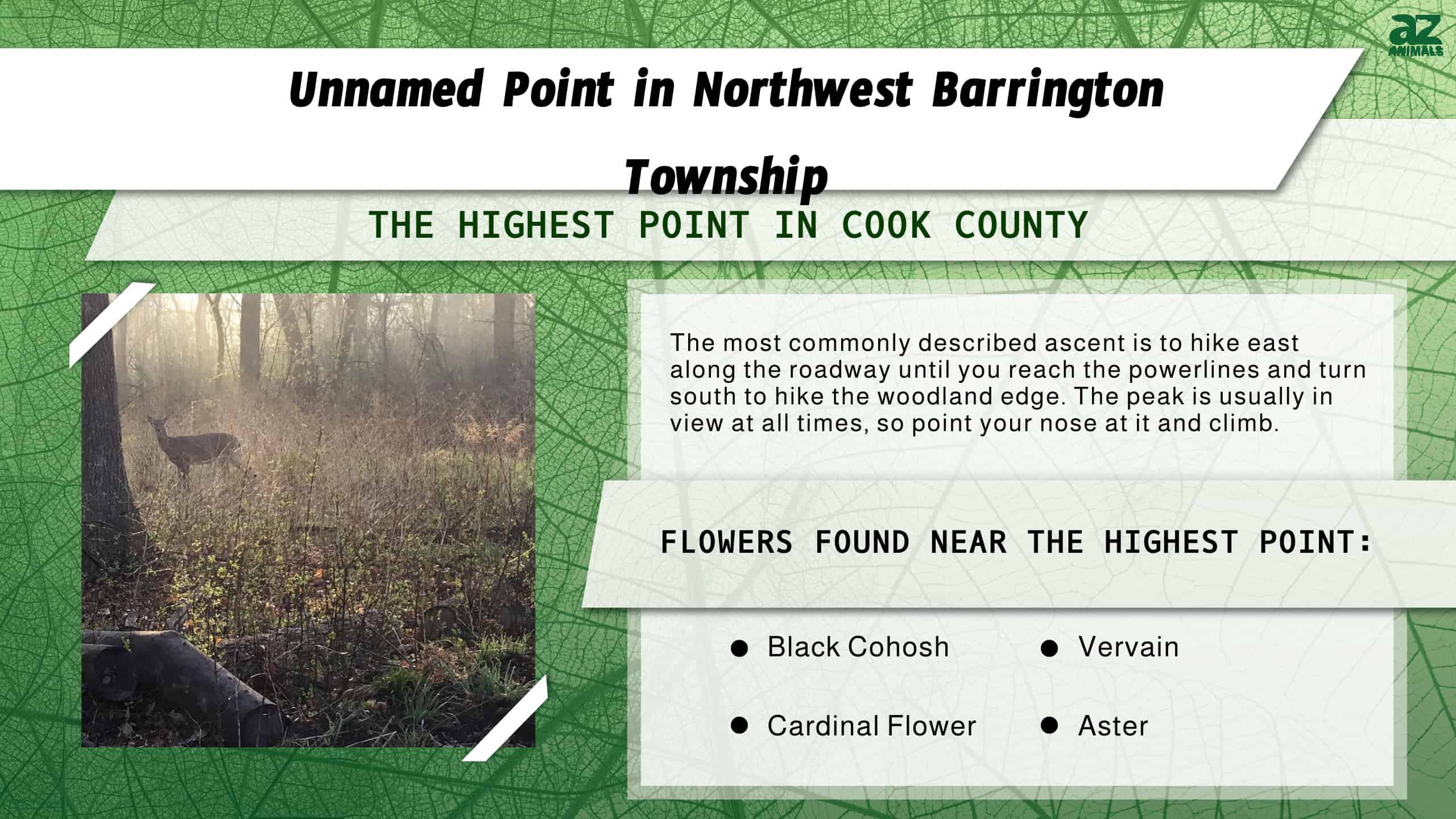
From route 62 on the east of Carpentersville, drive along Helm Road and pull into Helm’s Road nature reserve. The highest point is visible from here, and numerous tracks and walkways lead hikers to the highest point. The most commonly described ascent is to hike east along the roadway until you reach the powerlines and turn south to hike the woodland edge. The peak is usually in view at all times, so point your nose at it and climb.
Cook County Forest Preserves
Cook County maintains 70,000 acres of wild spaces which comprises 11% of Cook County. The preserves contain various ecosystems, including prairie, woodland, wetland, valleys, and creeks. Prairie is the largest ecosystem here. Prairie types include:
- Black soil prairie: Rich soils previously plowed by settlers that flourish with life.
- Wet prairie: standing water and soggy soil support turtles and plants like cord grass.
- Dolomite prairie: a few inches of soil-covered rock support hardy, dry-loving plants and reptiles.
- Gravel hill prairie: A hillside prairie that’s windy, dry, and sunny. Cook County’s highest peak is a gravel hill prairie.
Alongside prairies, Cook County’s forest preserves include savannahs, forests, woodland, floodplain forests, flatwood, marshes, swamps, and wetland ecosystems. The highest point in Cook County, Illinois, is rich in biodiversity.
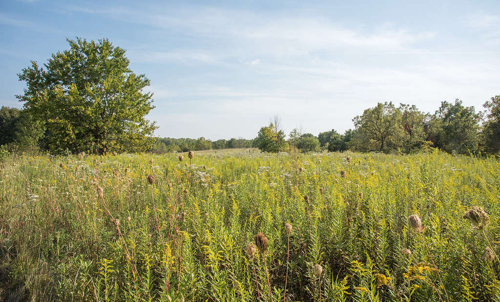
The chief ecosystem in Cook County, Illinois, is prairie.
©iStock.com/EAGiven
Cook County’s Highest Point: Geology
The highest point in Cook County is unnamed, but its 950 feet tall peak is created from moraine.
Moraine is material left behind by glacier movement. Rocks, soil, debris, silt, and sand, all dragged along by glaciers millions of years ago, built this peak. Then, elements wore it down to expose rocks, boulders, and stones.
What’s the Trail Like?
Hikers describe the trail as an easy hike that will take several hours if you march but more if you admire and dawdle your way up! It’s not a challenging hike with scrambles or scree.
The trail comprises of road, a maintained trail, then an unmaintained trail, open countryside, bushwhack, and some swampy ground and mud in rainy seasons.
Walking boots, long pants, and sleeves are essential to guard against ticks, poison ivy, buckthorn, and grass friction. No facilities exist on this trail, so take plenty of water, snacks and dress for the weather. Dogs are welcome but must be kept on a leash.
Even in summer, it’s a pleasant, cool walk with shade in most areas. Few bugs, such as mosquitoes, bother hikers, and lots of eye-stretching open woods and fields make this trail a relaxing, modest climb.
Where Is It on a Map?
Cook County’s highest point is found at 42.124 degrees north and 88.2374 degrees west. This map indicates the exact spot.
Can You Drive to the Highest Point in Cook County?
No, it’s not possible to drive there. It’s atop a hiking trail. Parking is available near Helm’s Road nature reserve at the trailhead.
What’s the Lowest Point in Cook County?
Cook County’s lowest point is on Lake Michigan’s shoreline. It’s less than 580 feet in elevation.
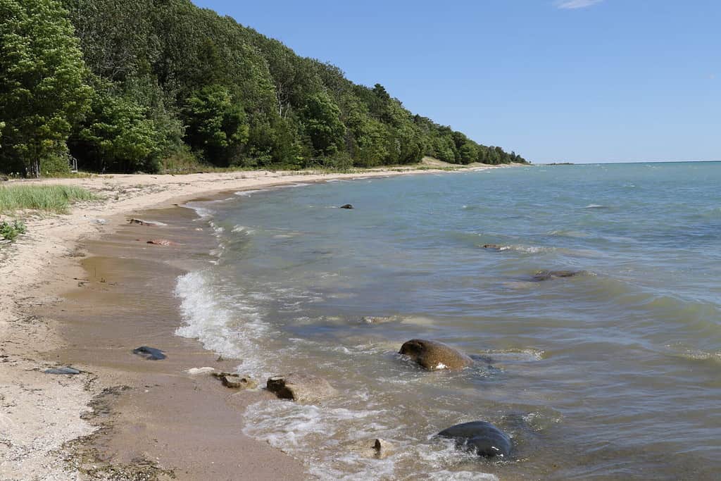
Lake Michigan’s shoreline is Cook County’s lowest elevation point.
©Thomas Barrat/Shutterstock.com
Is It Really the Highest Point?
Yes, but there are other claims.
When settlers arrived in Cook County, they put down roots in Park Ridge. Some folks claim this is the highest point, but that’s incorrect.
Another suggested highest point in Cook County is Meineke Hill, but its elevation is 778 feet, so not as high as the unnamed 950 feet tall point we’ve discovered. Meineke Hill is more of a family fun area than our unnamed peak. It’s good for sledding in the winter and water fights in the summer.
Plants at Cook County’s Highest Point
Because Cook County forest preserve ecosystems are so varied, there’s a corresponding varied amount of plant life. Each ecosystem is home to special plants, and collection is strictly prohibited. That includes flowers, foliage, seed, and firewood. Just a note — metal detecting is also off-limits, and if you find an artifact, the rangers want to know about it.
Here are a few of the thousands of plants that thrive in Cook County’s forest preserves.
Grasses
At the highest point, grasses are the most common plant, especially low-growing, tough grasses like sedge that can cope with dry conditions and winter snow.
- Fox sedges
- Switch grass
- Beak grass
Flowers
On the trail and in the surrounding forest preserves these plants thrive.
- Milkweed
- Large flowered trillium
- Hyssop
- Aster
- Black cohosh
- Vervain
- Cardinal flower
Shrubs
- Arrowwood
- Black chokeberry
- Bladder-wood
- Dogwood
Trees
- Eastern redbuds
- Nanny berry
- Service berry
Invasive plants causing issues in Cook County’s forest preserves include buckthorn and honeysuckle. These plants aren’t native. They’re a problem because they block out light and, in the case of honeysuckle, strangle native woodland plants.
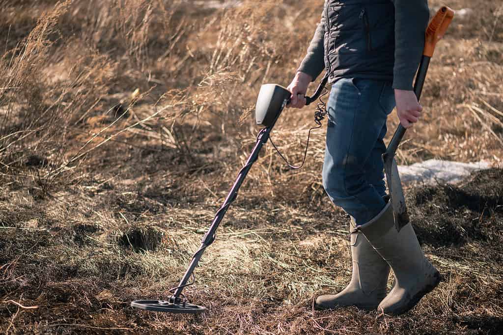
Hunting and metal detectors are banned in Cook County’s forest preserves and at its highest point.
©iStock.com/undefined undefined
Animals at Cook County’s Highest Point
Fitting into the varied plant ecosystems are numerous incredible animals. Some, such as the official state insect, the monarch butterfly, take advantage of specific prairie plants like milkweed, so it’s an important habitat for native species.
Alongside monarch butterflies, hikers might spot American robins, Illinois’ state bird the northern cardinals, red-tailed hawks, and red-headed woodpeckers. Enjoying the prairie lands, trekkers find the official state animal, white-tailed deer, plus coyotes, striped skunks, and Hine’s emerald dragonflies who also dip into the waters with turtles, ducks, otters, and the exotically named black-crowned night heron.
Animals that make Cook County’s forestland their homes include gray squirrels, various snakes, including common garter snakes and eastern fox snakes, bobcats, eastern red bats, and blue-spotted salamanders.
Reports suggest mountain lions may inhabit Illinois, but no stable population exists. Since 2015, killing or injuring mountain lions in Illinois has been illegal. Hunting isn’t allowed on any forest preserve land in Cook County; it’s on a look-and-enjoy basis only.
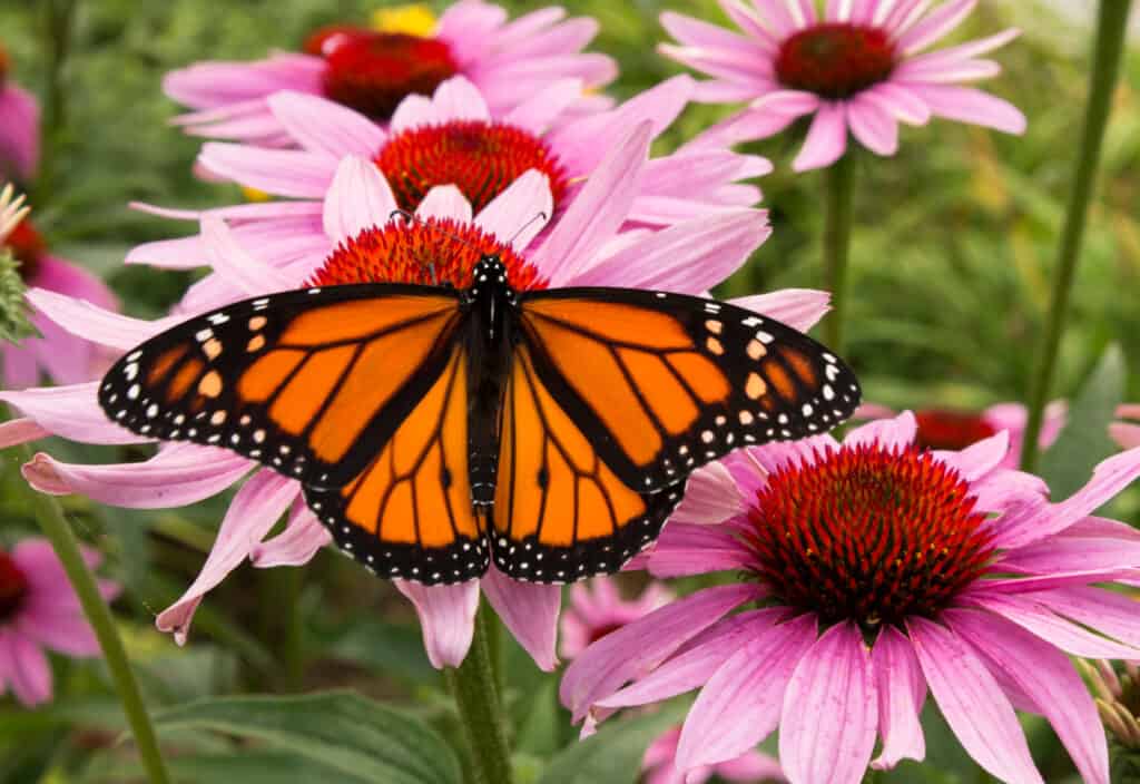
Monarch butterflies feed on milkweed flowers that grow in Cook County’s forest preserves.
©Media Marketing/Shutterstock.com
Highest Point in Illinois
The highest point in Illinois is Charles Mound, standing at 1,235 feet on private farmland close to the Wisconsin border.
The mound is named for Elijah Charles, who settled at the mound’s base in 1828. Charles was one of the region’s first settlers.
The Highest Point in Cook County, Illinois
Cook County’s highest peak is by no means a towering snow-covered mountain. It’s an unnamed 950 feet point in the County’s forest preserves near Barrington township.
Prairie, woodland, swamps, marshes, forests, savannahs, and flat plains support incredible plants and wildlife, such as milkweed for resident monarch butterflies and rare large flowering trillium that blooms from late April to early June.
Created by glaciers, it’s a steady, easy-going trail to reach the top, but don’t expect any facilities and keep your dog on a leash because what it lacks in elevation, it makes up for in habitats.
The photo featured at the top of this post is © The Other 95%, CC BY-SA 4.0

How to Add Us to Google News


Thank you for reading! Have some feedback for us? Contact the AZ Animals editorial team.