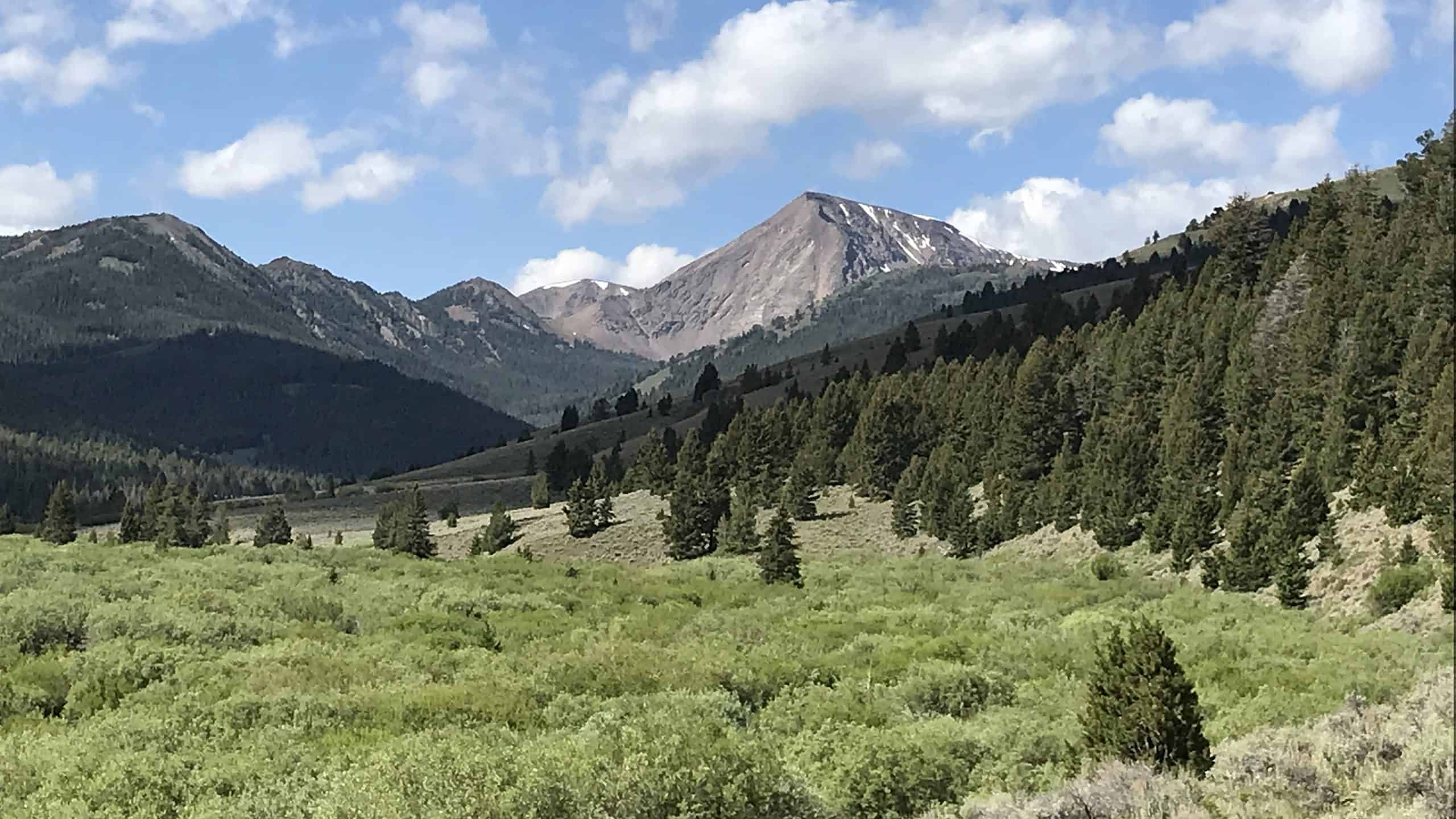

Idaho is home to some of the most beautiful scenery in the United States — snow-capped mountains, pristine lakes, a rainforest, and even a small part of Yellowstone National Park.
And what better way to experience all this natural beauty than by visiting the highest points in Idaho?
How The Mountains Of Idaho Were Formed
The Laramide orogeny was a long and complex mountain-building event that started around 70 million years ago and lasted until about 50 million years ago. It affected the entire Western United States, including Idaho.
It occurred when a large mass of oceanic crust (the Farallon tectonic plate) collided with the North American tectonic plate, causing the land near the West Coast to compress and buckle.
This resulted in the creation of the Rocky Mountains.
The Rocky Mountains are the largest mountain range in North America, and they extend from New Mexico all the way up to Alberta and British Columbia in Canada.
The Rocky Mountains extend from New Mexico all the way up to Alberta and British Columbia in Canada.
©Nyker/Shutterstock.com
The Idaho Batholith
As the two tectonic plates pushed against each other over millions of years, the Farallon plate was gradually pushed underneath the North American plate. The friction and pressure of this caused the Earth’s crust to melt, turning the rock into magma.
This magma slowly rose to the surface and cooled, creating a large mass of granite. This is known as the Idaho batholith.
So while the Rocky Mountains were being formed by the collision of two tectonic plates, the rigid mass of the Idaho batholith was slowly pushing upwards from the Earth’s mantle. These two upward forces combined to create the unique mountains of Idaho.
This is also why granite is so commonly found throughout the state of Idaho.
The Laramide orogeny was a long and complex mountain-building event that started around 70 million years ago.
©bmswanson/Shutterstock.com
The Mountains Of Idaho Today
Idaho’s mountains are home to animals such as:
- Mountain goats
- Elk
- Caribou
- Bighorn sheep
- Grizzly bears
- Mountain lions
- Coyotes
- Wolverines
- Pygmy rabbits
- Bald eagles
- Mountain bluebird
These animals and more inhabit the conifer and pine forests of the mountains.
The state of Idaho hosts 13 National Forests, which cover over 21 million acres (85,000 km2) of land. All 5 of the top highest peaks on this list are located in one of these national forests. This makes them easily accessible and a fantastic place for hiking and camping.
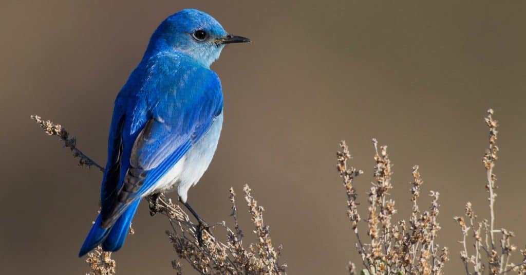
The Mountain Bluebird is the state bird of Idaho.
©Danita Delimont/Shutterstock.com
The Top 5 Highest Points in Idaho
Mount Breitenbach – 12,140 feet
Mount Breitenbach is the fifth-highest summit in Idaho. It is the fourth-highest peak in the Lost River Range, and it is one of Idaho’s nine 12ers (peaks with an elevation of over 12,000 feet).
The mountain is located in the Salmon-Challis National Forest, in the east-central part of the state.
There’s a 7-mile trail you can take to the top, but it is generally considered challenging and difficult to navigate. If you are able to get there, you’ll see incredible views of the nearby No Regret Peak, Mount Church, Donaldson Peak, Leatherman Peak, and Borah Peak.
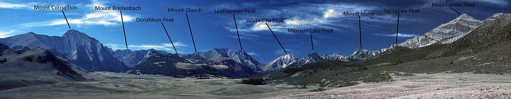
Mount Breitenbach is one of Idaho’s nine peaks over 12,000 feet.
©G. Thomas Fredlyfish4, CC BY-SA 3.0, via Wikimedia Commons – Original / License
Diamond Peak – 12,197 feet
Diamond Peak is the 4th highest point in Idaho, and it is the highest peak of the Lemhi Range.
It is located in the Caribou–Targhee National Forest, which borders both Yellowstone National Park and Grand Teton National Park.
Diamond Peak has a prominence of over 5,000 feet. This means that it rises 5,000 feet above the surrounding area, making it a very distinct and visible peak, even from a distance.
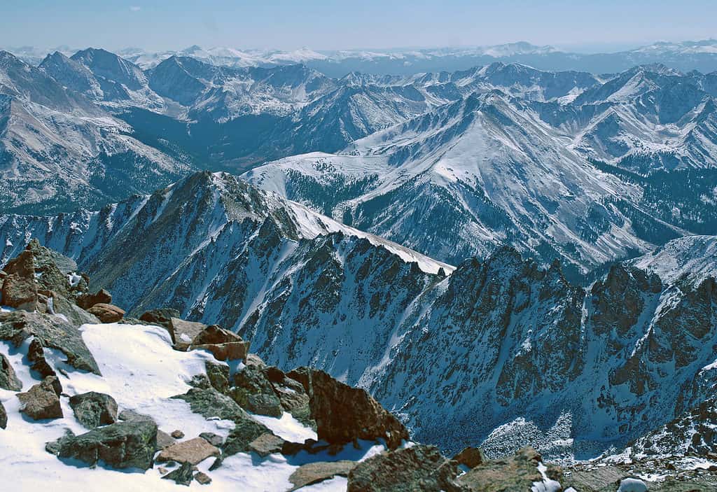
The 6.5-mile trail to the summit is marked as a Class 3, with parts of it being a Class 4. This means that it is considered a challenging hike, and is not recommended for beginners. It is rocky and steep, but those who reach the peak will be rewarded with stunning views of Idaho. From here, you can see the other 12ers of Lost River Range in the distance, 30 miles away.
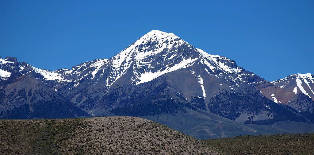
Diamond Peak rises over 5,000 feet above the surrounding area, giving it a very prominent appearance.
©Forest Service Northern Region from Missoula, MT, USA, CC BY 2.0 via Wikimedia Commons – Original / License
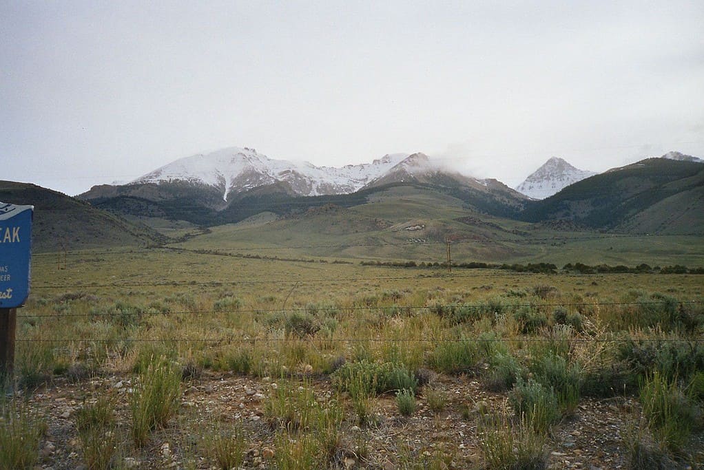
Mount Church – 12,200 feet
Mount Church is the third highest point in Idaho. It’s named after Frank Church, who served as the state’s Senator from 1957 to 1981.
Mount Church is near the middle of the Lost River Range. This makes it a good central location to view most of the nearby mountains and the surrounding Salmon-Challis National Forest.
It has a relatively low prominence, which means that it doesn’t stand out as much from the surrounding area as some of the other mountains on this list.
The peak of Mount Church is reached by way of a 10-mile trail that also passes over the nearby Donaldson Peak. It is a very difficult climb that is not recommended for beginners. It is generally recommended that climbers wear gloves and a helmet to protect themselves from the sharp and loose rocks that may tumble down the trail.
Leatherman Peak – 12,233 feet
The second highest point in Idaho is Leatherman Peak.
©Rolf Blauert Dk4hb, CC BY-SA 3.0 via Wikimedia Commons – Original / License
The second highest point in Idaho is Leatherman Peak. It is not too far from Mount Church, Bad Rock Peak, and Borah Peak.
It is easy to spot in the landscape as its western face rises from Leatherman Pass, a low point on the ridge of the Lost River Range.
The trail to the top is described by some as the easiest of Idaho’s 12ers, but it is still challenging. If you go when there is little snow near the summit, you may see the interesting, folded, twisted rock formations on the southeast face and on Bad Rock Peak.
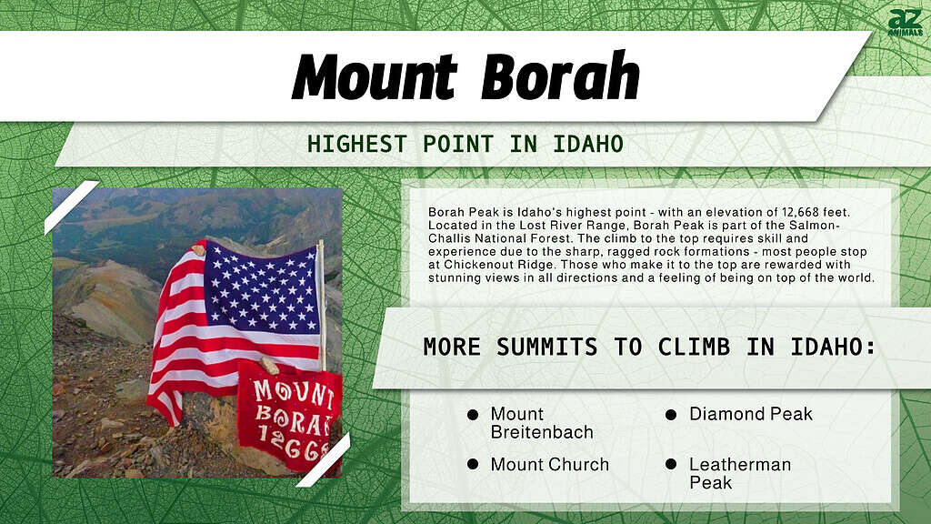
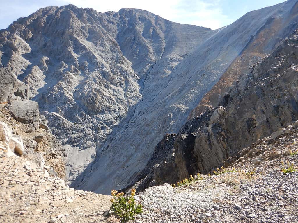
Borah Peak – 12,668 feet
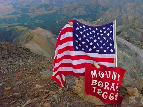
Idaho’s Mount Borah is a steep incline and has Chicken Out Ridge to contend with, but in the end, it is a great hike. Go slow, she’s a steep one.
©Bentleyphotos/iStock via Getty Images
Borah Peak is Idaho’s highest point. It also has one of the most prominent peaks in the United States. It rises over 6,000 feet above the surrounding area.
Borah Peak is located in the Lost River Range, and it is part of the Salmon-Challis National Forest.
The mountain is nearly always capped in snow, all year round. This adds to the already difficult rocky terrain.
The standard trail to the summit includes a point called Chickenout Ridge, which, as the name implies, is a place where many people turn back. This spot requires a bit more technical skill to scramble over the sharp, jagged rock formations.
Those who make it to the top are rewarded with stunning views in all directions. With nowhere taller in sight, you will feel like you are on top of the world — or at least, the top of Idaho.
Many climbers turn back at Chickenout Ridge before reaching the summit of Borah Peak.
Where is Borah Peak Located on a Map?
Borah Peak, which is also called Mount Borah or Beauty Peak, is situated in the central region of the Lost River Range, within the Challis National Forest in eastern Custer County, and is the highest mountain in Idaho and one of the most notable peaks in the contiguous United States.
Here is Borah Peak on a map:


How to Add Us to Google News


Thank you for reading! Have some feedback for us? Contact the AZ Animals editorial team.