
If you’re a fan of bagging the highest peaks, you’ll find a peaceful, undulating trail to Wayne County’s highest point. This article discovers the tallest peak there, plus the history and animals you might uncover on a visit.
Key points:
- The highest point in Wayne County, MI, is 990 feet tall.
- It’s situated in Maybury Park on a well-marked trail.
- The undulating trail to the peak is not strenuous.
Wayne County is Michigan’s most populous county, with 1,793,561 residents at last count. Its county seat is Detroit, and it was named after Anthony Wayne, a revolutionary war general. Out of Wayne County’s 673 square miles, 61 are water, and the rest are land, but where in this land is the highest peak? Let’s discover the highest point in Wayne County, what’s there, and how you can find it.
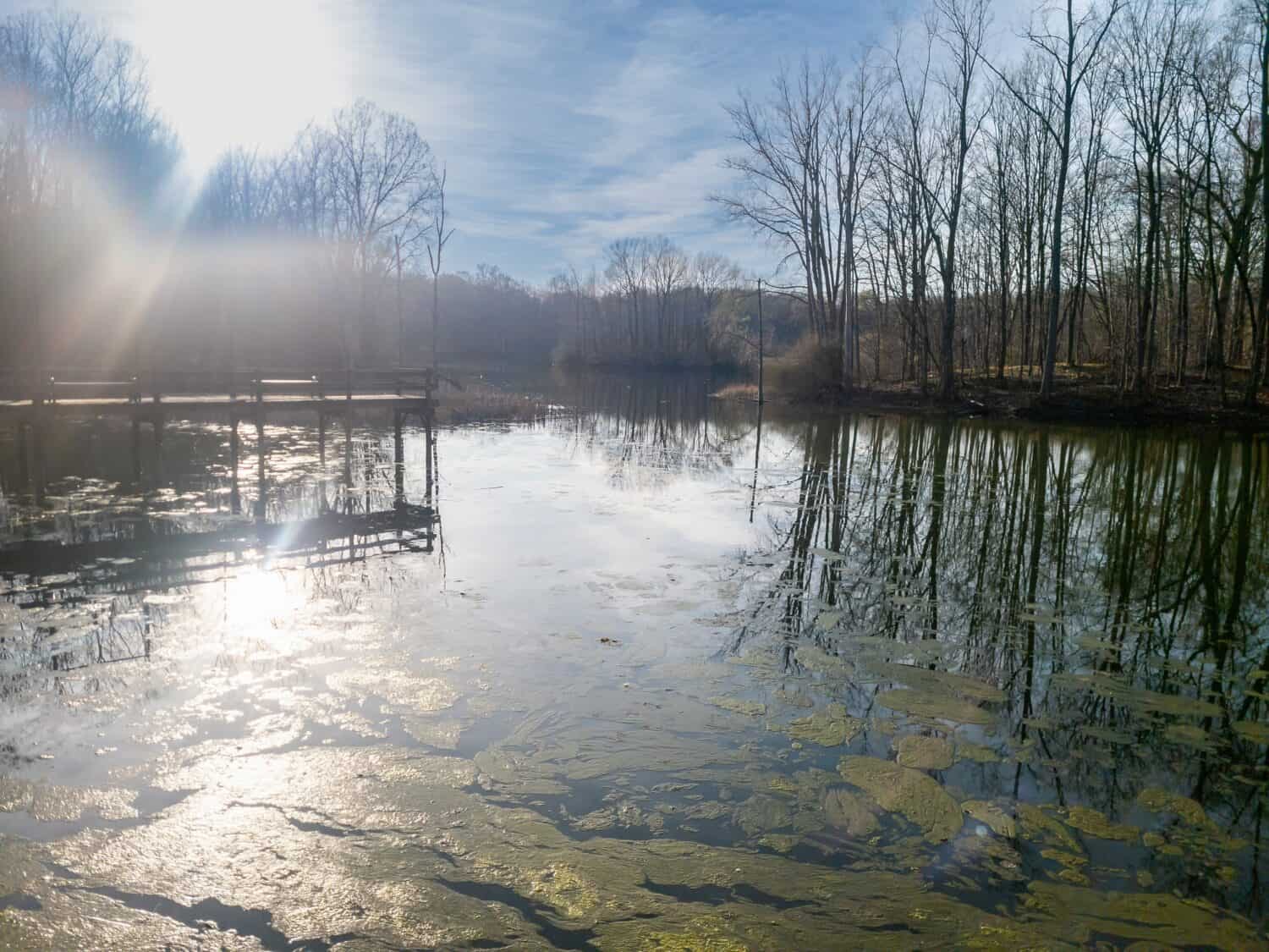
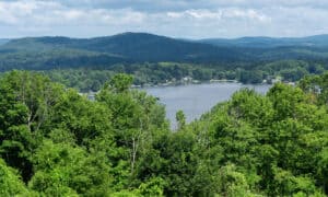
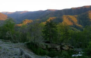
Wayne County’s highest peak is located in Maybury Park.
©Davslens – davslens.com/Shutterstock.com
Wayne County’s Highest Point
The highest point in Wayne County is a 990-foot-tall unnamed peak in Maybury State Park.
Maybury Park is located in Wayne County’s northwest corner. The route there is an easy trek on a marked lollipop-type pathway with gradual inclines, so it’s one to tick off your highest peak list without too much difficulty.
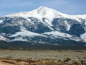
Compared to Michigan’s highest point, Wayne County’s peak isn’t that high. 1,979-foot-tall Mount Arvon is Michigan’s loftiest spot. It’s in the middle of an ancient forest in Michigan’s Upper Peninsula.
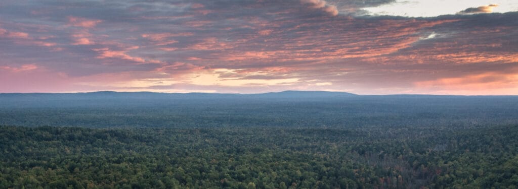
Mount Arvon is the tallest peak in Michigan.
©RomanKahler / CC BY-SA 4.0, via Wikimedia Commons – License
Is Maybury Park Really the Highest Point?
A few Google searches throw up many highest peaks in Wayne County, and that’s because there’s a Wayne County in Georgia, Mississippi, West Virginia, New York State, Ohio, Tennessee, and Pennsylvania too! Today, we’re looking at Wayne County in Michigan.
Where Is the Highest Point in Wayne County Located on a Map?
The trailhead GPS coordinates are 42.432076, -83.540671, and the peak is located at 42°25’55.5″N 83°32’26.4″W.
It’s inside Maybury Park, which is situated off 8 Mile Road west of Northville between Beck and Napier roads. Currently, the charge to enter Maybury Park is six dollars, and all Michigan state park visitors need a DNR Recreation Passport.
What’s the Trail Like?
The entire trail is located inside Maybury State Park. The trailhead begins on the 9-star west trail. There’s a sign on a large tree to mark the spot. You’ll find a small picnic area, toilets, and an attendant booth that sells maps there.
The trail runs across a low ridge just east of the picnic area. Woodchips cover the footway. Stay right off the fork when it arrives. After a while, you’ll reach a second picnic area and park maps. There’s a bike trail off this rest area that heads north, but the trail you want is east. Its rolling terrain is easygoing in most weather, though it’s a little muddy after rain.
Near the peak, there’s a small clearing with a lone pine tree. A short walk through the grassed area leads you to an obvious uphill rise which is the highest point. It’s not marked, but hikers report it’s clearly the highest point in this area. The highest point is large enough to wander around, take photos, or eat your packed lunch.

Maybury Park in Wayne County has good mountain biking trails.
©iStock.com/lzf
Can You Drive There?
The trailhead has a couple of parking areas called the east and west parking lots. The west parking lot is the closest, but that’s far as you can get by car. The highest point in Wayne County is only accessible by foot.
Hikers report that the trail isn’t suitable for bikes, but nearby is a bike trail. It’s just east beyond the hikers’ trailhead.
What Is There to Do at Wayne County’s Highest Point?
The actual peak is pretty quiet. Not many hikers head that way, so you’re usually guaranteed solitude. No facilities exist at the highest point.
However, Maybury Park is a thriving area with lots to do. There’s no camping here, but 12 miles of well-marked easy trails traverse its lush green forest. The park’s mature forest and open meadows stretch for 1,000 acres, so there’s room for playgrounds, hikers, bikers, horses, cross-country skiing, and fishing.
The Northville runners take weekly runs in Maybury Park, and there’s a track chair for less able visitors. The track chair is capable of beating four inches of water, snow, and sand – much more than a traditional wheelchair.
Educational program organizations use the park for overnight stays, and the Friends of Maybury Park runs the adjacent working farm that raises food for the old sanatorium (more on that below). Today, visitors can enjoy a 1900s farmhand experience there.
Maybury Park’s History
Maybury Sanatorium once occupied the site, but it closed in the 1970s. The state acquired the land as a public amenity, and it became Wayne County’s first state park in 1975.
Forty buildings comprised the original sanatorium that quarantined patients and provided respite from what they called “consumption.” It had a school, generated its own power, and grew food.
By 1969 tuberculosis was less of a problem, so Maybury Sanatorium was no longer needed. Today, visitors can follow a self-guided tour and follow the trail past areas of interest, such as where the sanatorium buildings were located and what happened in them. Find the trail straight off the east parking lot.
Animals at Wayne County’s Highest Point
Maybury’s educational working farm keeps over 100 farm animals, but on the trail to Wayne County’s highest peak, hikers spot plenty of Michigan’s wild animals, including the following ones.
Eastern Massasauga Rattlesnake
Eighteen snake species live in Michigan, but this is the only venomous snake.
They’re shy creatures that hide when people approach, but you might spot them sunbathing near wooded areas. Keep dogs on leads and watch where you’re treading to avoid accidents involving rattlesnake bites.
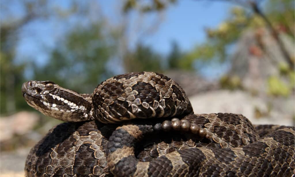
Eastern Mississauga rattlesnakes are Michigan’s only venomous snake.
©Ryan M. Bolton/Shutterstock.com
Wild Turkey
Unlike domestic turkeys, wild turkeys are strong fliers. They live in flocks in wooded areas and spend their days foraging through grass for seeds, nuts, and insects. At night, wild turkeys use high trees to roost in safety.
You’ll probably hear them gobbling before catching sight!
White-tailed Deer
White-tailed deer live in forests and fields where they forage grass, shoots, twigs, and flowers. Males can reach seven feet long, but females tend to stay a little smaller. Their white tails are a giveaway when they run from danger. These incredible deer can run at 35 mph and jump fences.
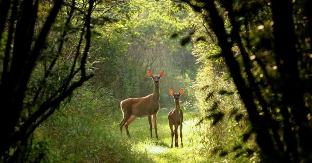
White-tailed deer live near Wayne County’s highest point. They can run at 35 mph!
©iStock.com/Karel Bock
Red-tailed Hawk
Michigan is home to the epic red-tailed hawk, which glides over woods and fields searching for its rodent, frog, snake, rabbit, or squirrel prey. Once spotted, red-tailed hawks descend at 120 mph to pin their unfortunate dinner down.
Red-tails hawks are recognizable by their distinctive red tail feathers and dark brown belly band. This is the most common hawk in Michigan and essential for healthy ecosystem regulation.
Squirrels
Speedy gray squirrels inhabit Wayne County’s forests, scampering up and down tree trunks with their 180-degree flexible wrist joints. Squirrels eat nuts, seeds, eggs, and sometimes young birds, depending on their opportunities.
They stash nuts and fruits away for winter to stave off hunger. Gray squirrels are regularly named as one of America’s most intelligent animals.
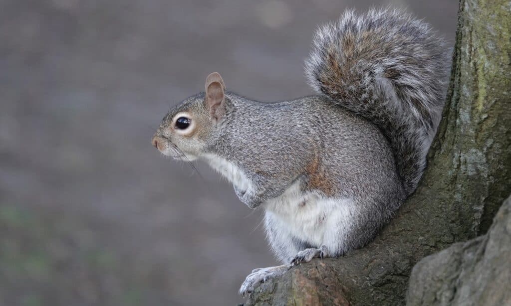
Eastern gray squirrels’ feet rotate 180 degrees to climb headfirst down tree trunks.
©iStock.com/Nigel Harris
American Robin
Migratory American robins are widely distributed throughout North America. Their distinctive red breasts and sharp tuneful songs make them an easy spot near Wayne County’s highest point.
These thrush family members hunt out earthworms, insects, and grubs and, despite their small size, reach 36 mph in flight.
Monarch Butterfly
Iconic monarch butterflies flit about Maybury Park’s open grassland, feeding and laying their eggs on milkweed. Most of us are familiar with this large beauty, but it’s always a joy to spot.
Monarchs are most visible in late spring and early summer. Their black, orange, and white coloration is easy to recognize.
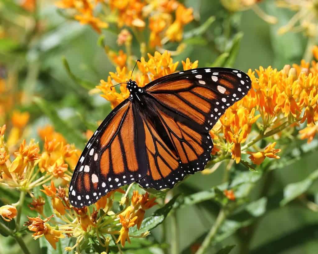
Monarch butterflies lay their eggs exclusively on milkweed.
©David Trevarthen/Shutterstock.com
Wayne County’s Highest Point
So, we’ve discovered Wayne County’s highest point is a 990-foot-tall unnamed peak in Maybury Park.
You’ll have to hike to bag it, but it’s not a challenging route. In fact, it’s a well-marked, gentle walk with its trailhead in a busy family-oriented park. Hikers say it takes several hours to reach the top at a fair-paced walk, but it’s always best to arrive back at the car by nightfall.
If you have spare time, try the old Sanitorium stroll or visit the neighboring Maybury Park educational farm.
The photo featured at the top of this post is © EQRoy/Shutterstock.com
How to Add Us to Google News


Thank you for reading! Have some feedback for us? Contact the AZ Animals editorial team.