
The Deschutes River, nestled in the heart of Oregon, begins in the Cascade Range, winding its way hundreds of miles through diverse landscapes, from dense forests to dramatic canyons and deserts, to its confluence with the Columbia River. Its meandering course reveals its geological and ecological beauty. It is popular for its recreational opportunities, making it a cherished natural treasure in Oregon. But how deep is the Deschutes River, you may ask? Let’s explore its varying depths, geology, ecology, history, and more.
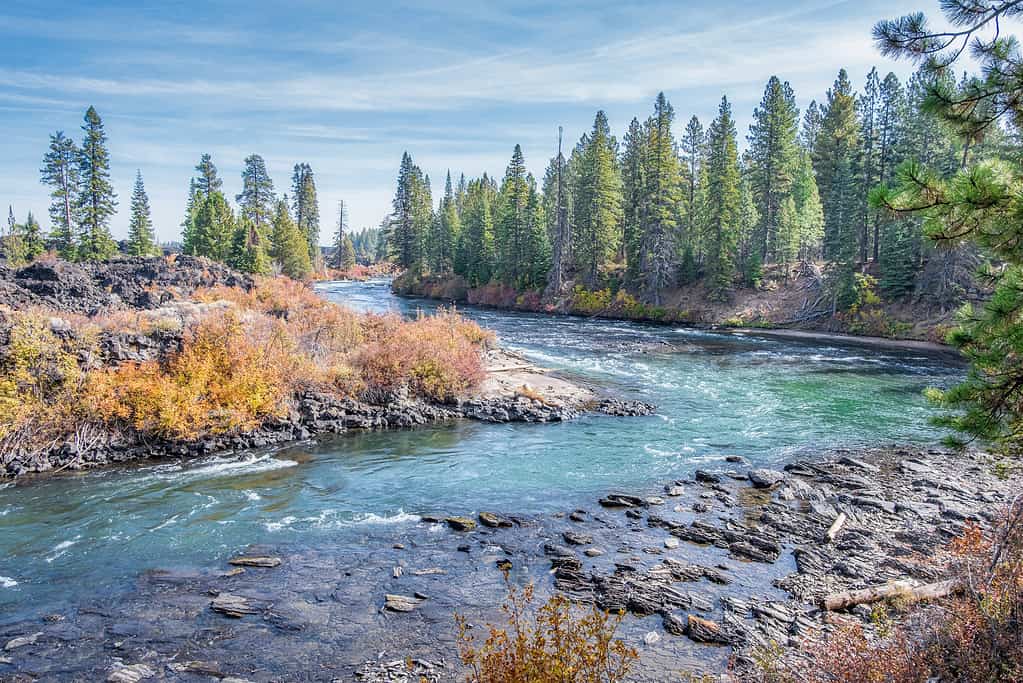
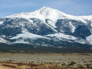
The Deschutes River experiences a wide variety of landscapes, including dense forests, canyons, deserts, and more.
©garytmarsh/iStock via Getty Images
Depth of the Deschutes River
The Deschutes River is a prominent river that runs through north-central Oregon. It is crucial to acknowledge that the depth of the Deschutes River is not constant throughout its entire length. The river experiences variations in depth due to factors such as terrain, sediment deposition, and seasonal changes in water flow. Therefore, determining a single average depth for the entire river is not feasible.
Moreover, there is not a lot of readily available information about the river’s depth. Originating in the Cascade Range of Oregon, it embarks on a journey that meanders through diverse landscapes across 252 miles (406 kilometers). The river’s depth is subject to significant fluctuations as it snakes its way northward from its source in central Oregon. The average depth is estimated to range from 14 to 60 feet (4.3 to 18.3 meters). In areas where the river flows through canyons and gorges, its depth likely reaches much deeper, possibly 100 feet (30.5 meters) or more, similar to the Rogue River or Columbia River in Oregon. In certain regions, the river can experience levels that can measure two feet or less. Geological features and seasonal atmospheric fluctuations contribute to its varying depth.
Furthermore, to obtain precise and up-to-date information on the average depth of the Deschutes River, one would need to refer to specific sections of the river and consider data from local authorities and environmental agencies. It’s essential to understand that the Deschutes River’s depth is a dynamic feature that can change over time due to natural processes and human activities.
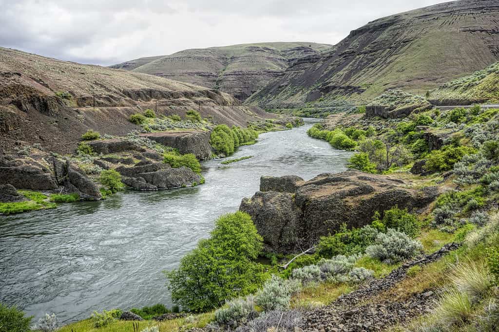
Without human influence, the Deschutes River is a natural and stable flowing river.
©Wirestock/iStock via Getty Images
Location of the Deschutes River
The Deschutes River starts in the expansive Cascade Mountain Range of Oregon. It winds its way through diverse landscapes before merging into the mighty Columbia River. This extraordinary journey takes it through some of the most captivating locations in Oregon, offering a glimpse into the rich geology and ecology of nature and history that defines this region.
Source
The source of the Deschutes River can be traced to Little Lava Lake, nestled amidst the pristine wilderness of the Deschutes National Forest at an elevation of 4,744 feet above sea level. From this source, the river emerges as a stream, where it begins its descent through a landscape of dense forests and alpine meadows.
Range
As the Deschutes River gains momentum, it embarks on a journey through a series of breathtaking locations. It flows southward, carving its way through the northernmost terrain of the Central Oregon High Desert. One of the most notable waypoints along its path is the city of Bend, where the river’s presence is an integral part of the community’s identity. In this thriving urban city, the Deschutes River provides scenic beauty and recreational opportunities such as kayaking, fishing, tubing, and swimming.
Further downstream, the Deschutes River converges with the Crooked River, which adds to its flow and character. As it continues, the river passes through the Warm Springs Reservation.
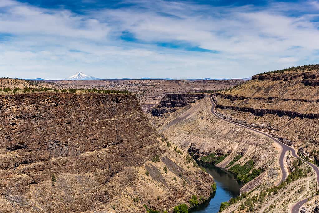
As the river continues its journey, it weaves through various canyons. In the Middle Deschutes River, the river runs through the start of the Deschutes Canyon. The lower Deschutes River cuts through a deep rimrock-lined canyon, which ranges from 900 to 2,600 feet (274 to 867 meters) in depth. This dramatic landscape features towering basalt layers that rise like sentinels on either side of the river, creating a dramatic and awe-inspiring vista. Before its end, in the Lower Deschutes River, the river flows through the massive Deschutes-Umatilla Plateau. Furthermore, the river’s course is renowned for its world-class whitewater rafting experiences along various sections of the river.
Mouth
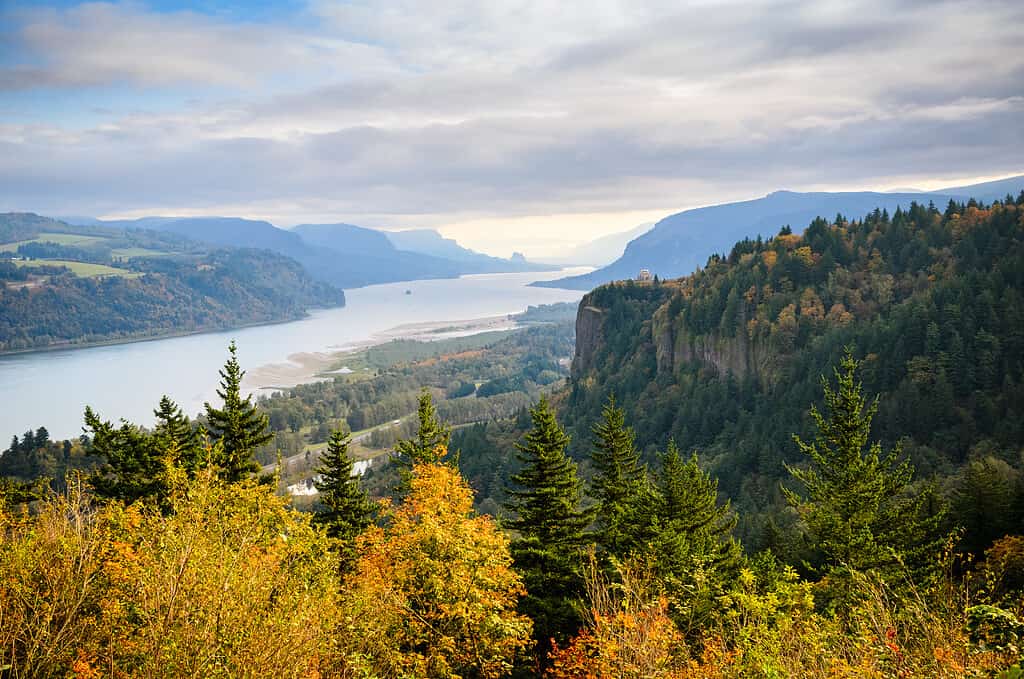
Finally, the Deschutes River reaches its end as it meets the Columbia River. This confluence is a pivotal moment, where the waters of the Deschutes River merge with the mighty Columbia River, one of North America’s largest rivers. This union holds significance in the diverse ecosystems and communities it touches.
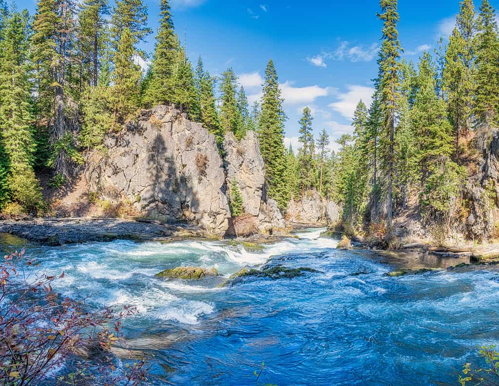
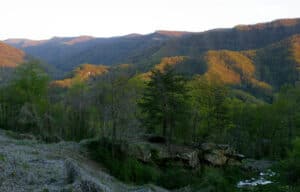
The middle Deschutes River is most popular for recreational activities, though recreational activities can be enjoyed throughout most regions along its entire length.
©Strekoza2/iStock via Getty Images
History of the Deschutes River
The history of the Deschutes River is old and rich in natural and cultural significance. This iconic river’s journey through time is a reflection of the dynamic forces that have shaped its course and the human interactions that its waters have influenced.
Indigenous Beginnings
For millennia, indigenous peoples, including the Warm Springs bands, which make up a combination of various tribes. They have called the Deschutes River basin home for thousands of years. They forged deep connections with the river, relying on its resources and its waters for transportation.
19th and 20th Centuries
Its name, “Deschutes,” is derived from the French “Rivière des Chutes,” which translates to “River of the Falls.” This name was given during the period of fur trading. It was a nod to the dramatic waterfall near its mouth, which no longer exists.
The arrival of European explorers and settlers in the 19th century brought significant changes to the Deschutes River’s history. The Oregon Trail, a historic pioneer route, involved crossing the river while running parallel to the Columbia River, making it a resource for those heading westward in search of new opportunities. Towns like Bend and Redmond, which now thrive along its banks, heavily relied on the river’s resources.
In the early 20th century, the construction of a hydroelectric dam along the Deschutes River harnessed its power for electricity generation. This development, while advancing modern society, also brought environmental changes and challenges.
Present Day
Today, the Deschutes River is an incredibly popular river for recreation and scenic viewing, such as whitewater rafting, fishing, tubing, boating, and much more. Organizations and government agencies work tirelessly to protect and improve its ecosystems, ensuring that future generations can continue to enjoy the river.
The history of the Deschutes River is a testament to the interplay between nature and human civilization. It has been a source of sustenance, transportation, power, and recreation throughout the years. As we move forward, the story of the Deschutes River continues to evolve, with a growing emphasis on recreation and conservation.
The Deschutes River’s source is Little Lava Lake in central Oregon.
©AlbertPego/iStock via Getty Images
Ecology of the Deschutes River
The Deschutes River supports a diverse array of flora and fauna, making it a vital ecosystem in its own right. It is characterized by a gradient of ecosystems as it journeys from its headwaters to its confluence with the Columbia River. These ecosystems include lush forests, arid high deserts, and aquatic and riparian zones, each offering unique habitats and opportunities for wildlife.
Fish
One of the most notable features of the Deschutes River ecosystem is its role as a haven for fish, particularly salmon and steelhead. Both species can be observed in the Deschutes River year-round as they migrate to its waters. Their presence not only sustains local wildlife but also contributes to the health of the entire ecosystem. Fish such as brown trout and rainbow trout are most common in the Upper Deschutes River, which is its further southern sections on a map. Moreover, other fish in this region include whitefish, transient kokanee, and transient fingerling coho. Fishing is the most popular recreation activity in the middle and primarily upper Deschutes River.
Plants
The river’s banks are lined with a diverse array of plant life along its different sections. Species that can be found along its path include willows, cottonwoods, sedges, adlers, sagebrush, bunchgrass, and much more. These riparian plants provide essential habitats for numerous bird species, including bald eagles, ospreys, and kingfishers. The Deschutes River is also frequented by waterfowl such as ducks and herons, adding to its ecological richness.
Other Animals
As the river flows through the arid landscapes of the Central Oregon High Desert, it supports an array of terrestrial wildlife. Mule deer, coyotes, and bobcats are among the mammals that call these desert lands home. The river’s lush riparian zones provide a critical source of water and forage for these animals.
Beyond its aquatic and terrestrial inhabitants, the Deschutes River ecosystem is home to an abundance of invertebrate life, including aquatic insects and macroinvertebrates. These small but crucial organisms serve as the foundation of the river’s food web, supporting fish and other aquatic species.
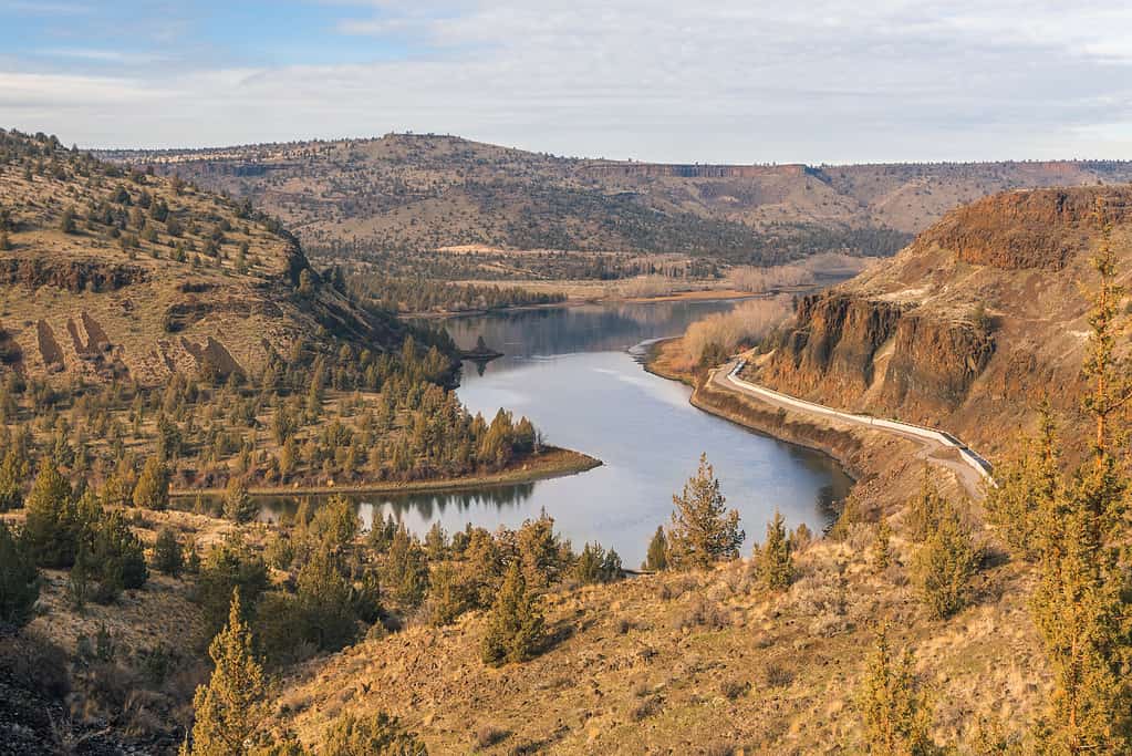
The Deschutes River flows northward.
©Don Miller/iStock via Getty Images
Geology of the Deschutes River
The geology of the Deschutes River consists of volcanic origins, erosion, and geological forces that have shaped the landscape over millions of years. This iconic river flows through a region defined by dramatic geological features, adding to its natural beauty and complexity.
The Cascade Mountains are part of the Pacific Ring of Fire, characterized by volcanoes that are still active. The Deschutes River basin bears the legacy of ancient volcanic eruptions that deposited layers of basalt, ash, and sedimentary formations. This is visible in the towering canyons that define parts of the river’s course.
Moreover, one of the most striking geological features along the Deschutes River is its canyons. These canyons are the result of powerful and recurring hydrologic and volcanic activity that have sculpted the landscape and river over millions of years. The river’s stable natural flow, combined with its steep-walled canyons, is a testament to the river’s impressive geology.
The geology of the Deschutes River also includes the presence of geological faults. The region can experience tectonic activity, and these faults play a role in shaping the landscape. Faults can create abrupt elevation changes and contribute to the formation of canyons and gorges, further enhancing the river’s geological diversity.
In addition to volcanic rock and erosional features, the Deschutes River’s geology also involves sedimentary deposits. Over time, the river has carried and deposited sediments along its course, contributing to the creation of fertile floodplains and providing essential nutrients to the surrounding ecosystems.
The Deschutes River’s geological history is not static. Ongoing geological processes, including erosion and sedimentation, continue to shape the landscape slowly but surely. Understanding the river’s geology is essential for managing and preserving its resources.
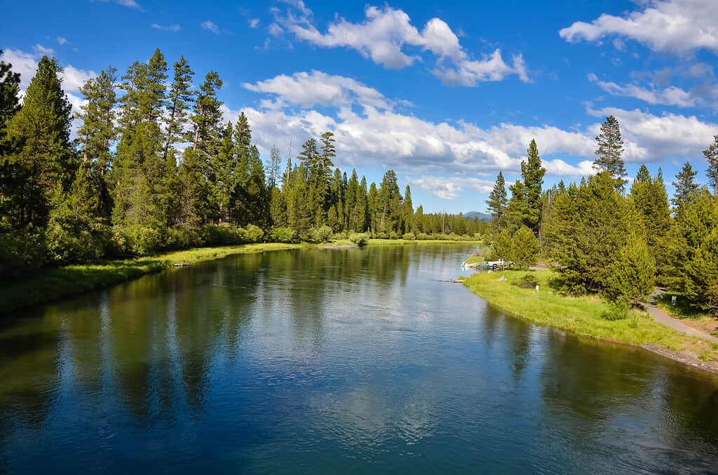
The Deschutes River is approximately 252 miles long.
©steve davis/iStock via Getty Images
Activities and Destinations on the Deschutes River
The Deschutes River, a natural gem of central Oregon, presents a wealth of recreational activities and delightful destinations for nature enthusiasts and adventure seekers alike. With its diverse ecosystems and dynamic flow, the Deschutes River offers an array of opportunities to connect with the natural world and embark on unforgettable experiences.
Activities on the Deschutes River
Whitewater Rafting
The Deschutes River is celebrated for its thrilling whitewater rapids, making it a prime destination for whitewater rafting. Its rapids range from mild to challenging, catering to a wide range of skill levels. There are sections for whitewater adventures, including rapids for skill levels ranging within classes II through IV. One of the most popular sections is Bid Eddy.
Floating and Tubing
Floating and tubing on the Deschutes River is a quintessential summer activity that offers a leisurely and refreshing way to experience the river’s natural beauty. Tubers can float down certain sections of the river, basking in the sun and taking in the picturesque surroundings. It’s a perfect option for those seeking a more relaxed and scenic river experience.
Canoeing and Kayaking
Beyond whitewater rafting excitement, the Deschutes River welcomes canoeists and kayakers to explore its calmer stretches. Paddling along the tranquil currents offers a peaceful and immersive river experience, ideal for observing wildlife and scenic vistas or reaching remote campsites. Kayaking, canoeing, and even paddleboarding can be enjoyed at varying sections of the river.
Fishing
The Deschutes River is a renowned fishing destination, particularly for salmon and steelhead. These prized fish undertake epic migrations from the Pacific Ocean to their spawning grounds in the river’s headwaters. Anglers can cast their lines and revel in the thrill of catching these iconic species. Moreover, fishing is the most popular recreational activity in the upper and middle Deschutes River sections. The Upper Deschutes River is home to fish such as transient kokanee and various species of trout.
Hiking
The river’s banks are adorned with scenic trails, allowing hikers to explore the diverse landscapes along the Deschutes River by foot or horseback. Notable trails include the Deschutes River Trails, Steelhead Falls Trail, and the Scout Camp Trail.
Mountain Biking
The Deschutes River Trail and nearby mountain biking routes offer exhilarating rides through captivating terrain. Those keen to seek the thrill and freedom of mountain biking can navigate a variety of trails, from challenging technical routes to leisurely paths with stunning river views.
Camping and Backpacking
Numerous campgrounds line the river’s banks, both remote and drive-up. They provide opportunities for nature enthusiasts to immerse themselves in the tranquil beauty of the Deschutes River. Camping under the starry skies while listening to the soothing sounds of the river is a memorable experience at the numerous campsites all along the river’s path.
Wildflower Viewing
Spring and early summer bring a burst of wildflowers to the riverbanks, creating a colorful tapestry of blooms. Botany enthusiasts and nature lovers can indulge in observing a variety of native wildflowers, including lupines and Indian paintbrush.
Photography and Art
With its striking landscapes, abundant wildlife, and ever-changing vistas, the Deschutes River offers photographers and artists of other disciplines endless opportunities to capture the beauty of the natural world. Sunrise and sunset photography, painting, or even dancing along the river can yield breathtaking experiences.
Destinations on the Deschutes River
Bend, OR
This vibrant desert city serves as a gateway to the Deschutes River and offers visitors many amenities. Bend is renowned for its outdoor recreational opportunities, breweries, restaurants, and cultural attractions.
Deschutes River Canyon
A hallmark of the river’s geology, the Deschutes River Canyon features towering cliffs and rugged terrain. It’s a must-visit for hikers and those seeking to marvel at the geological wonders of the river.
Maupin, OR
Positioned along the Deschutes River, Maupin is a small, charming town and a popular launching point for whitewater rafting trips. It provides accommodation options, dining establishments, and a welcoming atmosphere for those seeking outdoor recreation.
Smith Rock State Park
Located on Crooked River near its confluence of the Deschutes River, Smith Rock State Park is to striking rock formations and rock climbing opportunities. Hiking trails within the park offer breathtaking views of the Crooked River and surrounding landscapes.
Warm Springs
The Warm Springs Indian Reservation is a significant cultural and ecological destination along the river. Visitors can learn about the rich heritage of the Warm Springs Tribes, enjoy recreational activities such as fishing, and explore the Museum.
Sunriver
Sunriver is a family-friendly destination that is nestled near the river, offering golf courses, bike paths, and a serene atmosphere. It’s an excellent place for a relaxing vacation with opportunities for swimming and paddleboarding. Moreover, the popular full-service luxury resort, Sunriver Resort, offers incredible lodging, dining, spa treatments, events, and outdoor experiences.
Terrebonne
Located near Smith Rock State Park, Terrebonne provides a gateway to outdoor adventures, including rock climbing, hiking, and horseback riding. The town itself offers dining and lodging options as well as services for visitors.
Cove Palisades State Park
Situated at the confluence of the Deschutes River and Crooked River canyons, this park offers a scenic reservoir, camping facilities, and hiking trails. It’s a fantastic spot for water-based activities such as boating and fishing.
Lake Billy Chinook
Formed in a canyon by the confluence of the Deschutes, Metolius, and Crooked Rivers, this reservoir is a recreational haven. It offers boating, swimming, camping, and the chance to explore picturesque canyon walls.
Crooked River Ranch
Perched above the Deschutes River, also near the Crooked River, this unique community offers hiking trails, golf courses, and a tranquil environment. It’s an ideal location for relaxation and exploration.
The Deschutes River is a treasure trove of recreational activities and captivating destinations. Whether you seek adventure on its whitewater rapids, tranquility in its scenic campgrounds, or a glimpse of its diverse wildlife, the Deschutes River offers an immersive experience in the heart of central Oregon’s natural beauty. From thrilling outdoor adventures to serene moments of connection with nature, the river invites visitors to explore its diverse offerings and create cherished memories.
The Deschutes River ends with its confluence with the Columbia River.
©zrfphoto/iStock via Getty Images
Where is the Deschutes River Located on a Map?
The Deschutes River is located in the western United States, specifically in the state of Oregon. It starts in central Oregon, about 38 miles southwest of the city of Bend. It ends at the Columbia River, about 15 miles east of The Dalles. Moreover, it originates in the Cascade Range of central Oregon and flows northward, eventually joining the Columbia River.
The photo featured at the top of this post is © garytmarsh/iStock via Getty Images

How to Add Us to Google News


Thank you for reading! Have some feedback for us? Contact the AZ Animals editorial team.