
Located in the midwestern United States, Ohio is known for its beautiful landscapes, which range from plains and marshes near Lake Eerie to the foothills of the Appalachian Mountains. The Buckeye State boasts plenty of popular tourist attractions, but what about its more far-flung destinations? Keep reading to discover the 15 most remote spots in Ohio and how you can safely get to them.
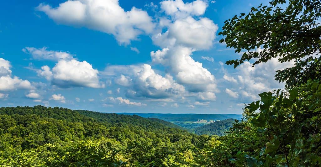
1. Wayne National Forest
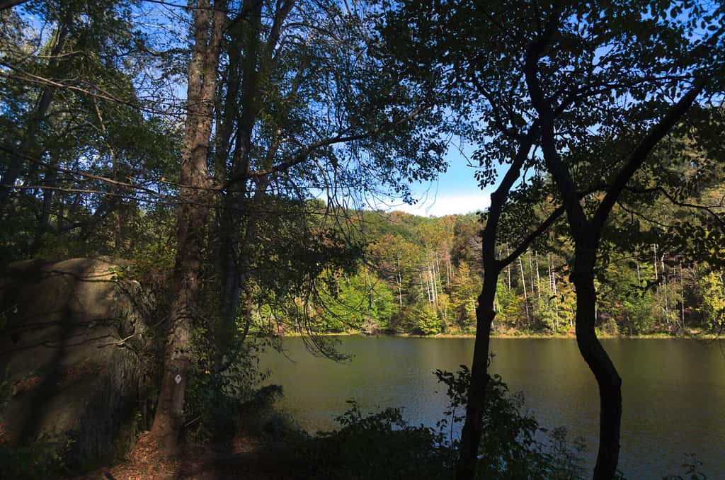
Lake Vesuvius spans 143 acres in the Wayne National Forest.
©Harry Steele/Shutterstock.com
Officially established in 1905, the Wayne National Forest stretches for nearly 250,000 acres among the foothills of the Appalachian Mountains, making it one of the most remote spots in Ohio. The area was created as part of a restoration project for lands that were damaged by mining. Therefore, the Wayne National Forest is composed of relatively young riparian and conifer forests. Lake Vesuvius is located in Wayne National Forest, with beautiful views and abundant fishing. Additionally, the forest boasts numerous trails, campgrounds, and outdoor activities.
To reach the Wayne National Forest, head east from Columbus on US-33 for 50 miles. Near Haydenville, take OH-595 North and follow the road for nine miles. Turn left on Main Street, and after one block, turn right on OH-93 North. In half a mile, turn right onto Salem Hollow Road, and the entrance to the national forest will be up the road in about three miles.
Coordinates: 39.563758171332545, -82.18736990211634, Athens Ranger District
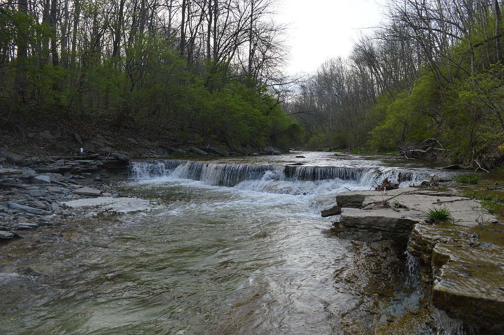
2. Hocking State Forest
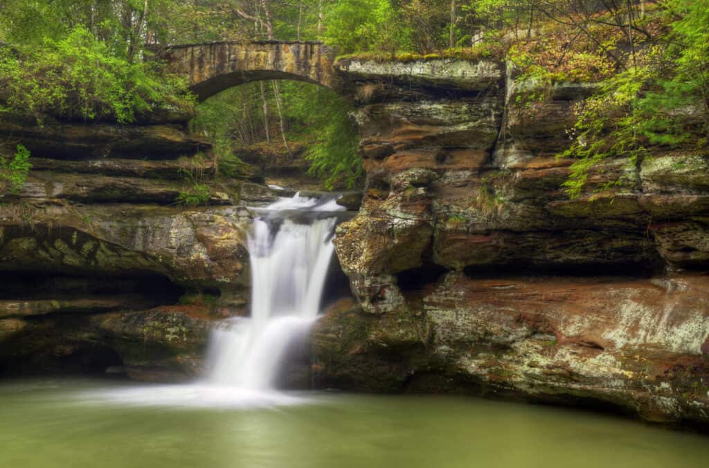
Hocking State Forest contains rivers, waterfalls, dense forests, and several caves.
©Michael Shake/Shutterstock.com
Located in southeastern Ohio, Hocking State Forest may be secluded, but it has plenty of outdoor activities to enjoy once you’re there. The state forest has multiple trails for camping, hunting, horseback riding, and mountain biking. The state park is divided into seven areas that are named after each area’s defining natural feature: Rock House, Conkle’s Hollow, Ash Cave, Old Man’s Cave, Cedar Falls, Whispering Cave, and Cantwell Cliffs.
To reach Hocking State Forest, take US-33 South from Columbus for 40 miles. Then, take the OH-664 exit toward Logan/Bremen. Continue on OH-664 South for about 10 miles to reach the state forest.
Coordinates: 39.43497169371745, -82.54763677218345
3. Helltown
Known as “Helltown,” Boston Township is a ghost town within the Cuyahoga Valley National Park.
©Kenneth Keitfer/Shutterstock.com
Officially known as Boston Township, this remote spot is located within the Cuyahoga National Valley National Park in Summit County. Boston Township earned its nickname in the mid-1970s. The town was included in the boundaries of what is now the national park, forcing many residents to leave their homes. The abandoned buildings stood for decades, giving the community an eerie appearance and contributing to urban legends about hauntings and satanic activity.
To reach Helltown, take OH-8 North out of Akron for 12 miles. Then, take the exit for East Boston Mills Road. Stay right at the fork, and follow signs for Boston Mills Road/Hines Mill Road/Cuyahoga Valley National Park. The Boston Mill Visitor Center will be ahead on the right, which contains information about the surrounding Cuyahoga Valley National Park.
Coordinates: 41.26275720252461, -81.56034586221851
4. Edge of Appalachia Nature Preserve

Rhododendrons are among the plants that grow at the Edge of Appalachia Nature Preserve.
©igaguri_1/iStock via Getty Images
Situated in southern Ohio near the Kentucky state line, the Richard and Lucile Durell Edge of Appalachia Preserve System is one of the most biologically diverse areas in the midwestern United States. The nature preserve stretches for over 20,000 acres and is home to various flora and fauna, including green salamanders, the Indiana bat, and cerulean warblers.
The Edge, as it’s known to locals, has five hiking trails that each highlight different habitats and natural features. To get to the Edge, take OH-32 East out of Cincinnati for 30 miles. Turn right onto OH-247 South and continue for about 10 miles. Turn left onto West Main Street, and in a half mile, take a slight right onto OH-125 East. After six miles, turn right onto Waggneer Riffle Road, and the Edge of Appalachia Nature Preserve will be ahead.
Coordinates: 38.76614887773286, -83.46158887090719
5. Seneca Lake

Seneca Lake boasts 45 miles of shoreline.
©Richard345/Shutterstock.com
Located in the eastern portion of the state, Seneca Lake stretches for over 3,500 acres. Despite its remote location, it is a popular fishing spot for largemouth bass, crappie, channel catfish, and more. There are several campgrounds around Seneca Lake. In addition to fishing, there are several hiking trails and geocaching opportunities.
To reach Seneca Lake, take I-70 East from Columbus for about 80 miles. Then, merge onto I-77 South and continue for about six miles. Take the exit for OH-313 and continue for about five miles. Turn right onto OH-574 South, and after two miles, turn left onto Park Road.
Coordinates: 39.90699225663204, -81.42185516904205
6. Magee Marsh Wildlife Area
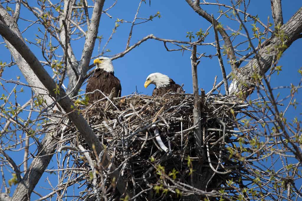
In the spring, bald eagles nest at Magee Marsh Wildlife Area.
©Dennis W Donohue/Shutterstock.com
Situated on the edge of Lake Eerie in northeastern Ohio, the Magee Marsh Wildlife Refuge has been a popular hunting destination since the late 1800s. The area provides a home for birds such as bald eagles, Canada geese, and mallards. Magee Marsh is an important stop for more than 300 species of migrating birds.
To get to Magee Marsh Wildlife Refuge, take OH-579 East out of Toledo for about 11 miles. Then, turn right onto OH-2 East and follow that road for three miles. Turn left onto Park Road 1, and the Magee Marsh visitor center will be on the left.
Coordinates: 41.613321901807716, -83.18863916285477
7. Mineral Springs Lake
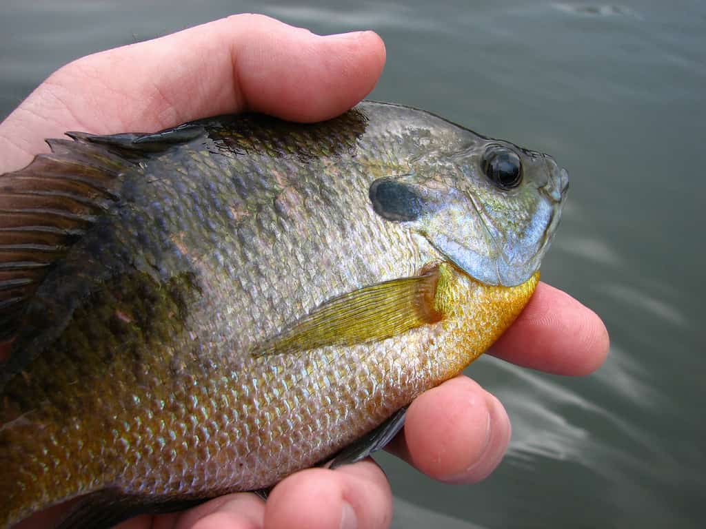
Mineral Springs Lake is an excellent destination for bluegill fishing.
©iStock.com/Dewitt
Consistently ranking among the state’s cleanest bodies of water, Mineral Springs Lake is a spring-fed lake that stretches for over 500 acres in south-central Ohio. The Mineral Springs Lake Resort offers an abundance of outdoor activities, including fishing, boating, and kayaking. The lake is home to several species of fish, including bass and bluegills, and even a species of non-stinging freshwater jellyfish.
To reach Mineral Springs Lake, take OH-32 East out of Cincinnati for about 40 miles. Turn right onto Steam Furnace Road and drive for two miles, then turn left onto Mineral Springs Road. After another two miles, turn left onto Bluegill Road, and the Mineral Springs Lake Resort will be on the right.
Coordinates: 38.92640299038553, -83.36740582368962
8. The Wilds
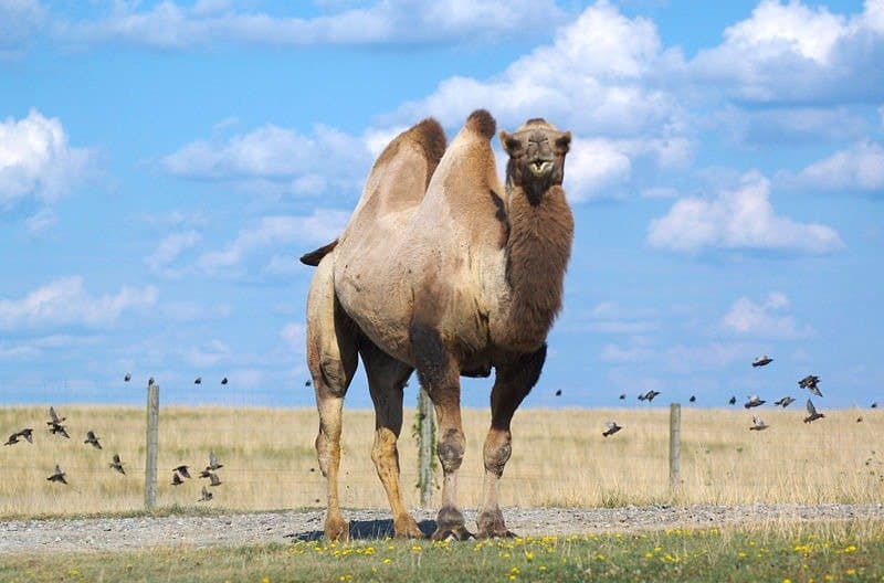
Visitors can see camels and zebras at The Wilds Conservation Center in Ohio.
©Jeff Kubina from Columbia, Maryland, United States., CC BY-SA 2.0, via Wikimedia Commons – License
This conservation center is located in southeastern Ohio and encompasses 10,000 acres of forests and pastures. Previously used for surface mining, The Wilds is now home to Bactrian camels and deer, cheetahs, giraffes, ostriches, and southern white rhinos.
Visitors can book a guided, open-air bus tour or a horseback safari for a chance to view the wildlife. This remote spot offers unique overnight options such as private yurts at Nomad Ridge or tent camping at The Outpost.
To get to The Wilds, take OH-146 East from Zanesville for about 10 miles, then turn right to take OH-284 South for seven miles. Turn left onto International Road, then turn left in a half mile. In another half mile, turn left again, and The Wilds will be ahead on the left.
Coordinates: 39.829647056407715, -81.73303940463778
9. Hell Hollow Wilderness Area
Hell Hollow earned its name due to its rugged, steep cliffs.
©Nicholas_T / CC BY 2.0 – License
Located just a few miles from Lake Eerie near the Pennsylvania state line, Hell Hollow Wilderness Area features a loop trail along a high cliff with dramatic views of the valley floor 100 feet below. 262 stairs lead down to the valley and Paine Creek. According to Audobon Ohio, Hell Hollow is an Important Bird Area, making this remote spot a great bird-watching destination.
To get to Hell Hollow Wilderness Area, take I-90 East from Cleveland for about 20 miles. Then, take exit 205 for Vrooman Road. Turn right, and when you reach the traffic circle, take the second exit for OH-86 South. Follow that road for three and a half miles, then turn left onto Leroy Thompson Road and drive for two miles. Turn left onto Leroy Road, and then Hell Hollow Metropolitan Park will be on the right after about two miles.
Coordinates: 41.72286244796545, -81.12358716171914
10. Moonville Tunnel
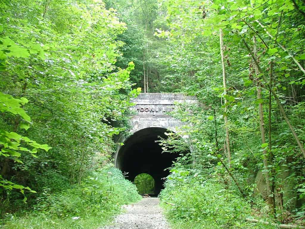
All that remains of Moonville today is the tunnel, a cemetery, and the foundation of the old schoolhouse.
©ChristopherM / CC BY-SA 3.0 – License
Now a ghost town near the Zaleski State Forest, in the late 1800s, the community of Moonville was home to around 100 people, mostly miners and railroad workers. The only way to access the community was by train, which had to pass through the Moonville Tunnel. The tunnel has a long-standing reputation for being haunted by the ghosts of people who perished while walking along the tracks.
Visitors can walk parts of the now-abandoned rail line, including the section through Moonville Tunnel. To reach the tunnel, take US-50 East from McArthur for about five miles. Then, turn left onto OH-278 North and continue on that road for about eight miles. Turn right onto Wheelabout Road, then continue for about three miles until you see a parking area. The trail is across the creek, and the tunnel is about 100 yards ahead.
Coordinates: 39.308491142419825, -82.32202634909983
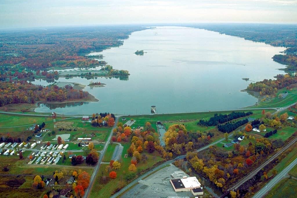
11. Pymatuning Lake

Pymatuning Lake is a reservoir that covers 14,000 acres.
©iStock.com/Capturing Moments by Christina
This lake is located in northeastern Ohio, where it sits on the Ohio-Pennsylvania state line. Pymatuning Lake contains plenty of walleyes, muskies, and yellow perch, making this remote spot a popular destination for fishing. Additionally, the Pymatuning State Park offers camping, hiking, hunting, six different boat ramps, and educational programs.
To reach the state park from Cleveland, take I-480 East to US-422 East. Continue on US-422 East for about 25 miles, and then turn left onto OH-168 North. Drive for six and a half miles, then turn right onto OH-87 East. Continue for about 18 miles, then turn left to merge onto OH-11 North. Take the exit for US-322 East and continue for about 10 miles. Turn left onto Pymatuning Lake Road, and after one mile, turn right to enter Pymatuning State Park.
Coordinates: 41.54654959004953, -80.52935390779953
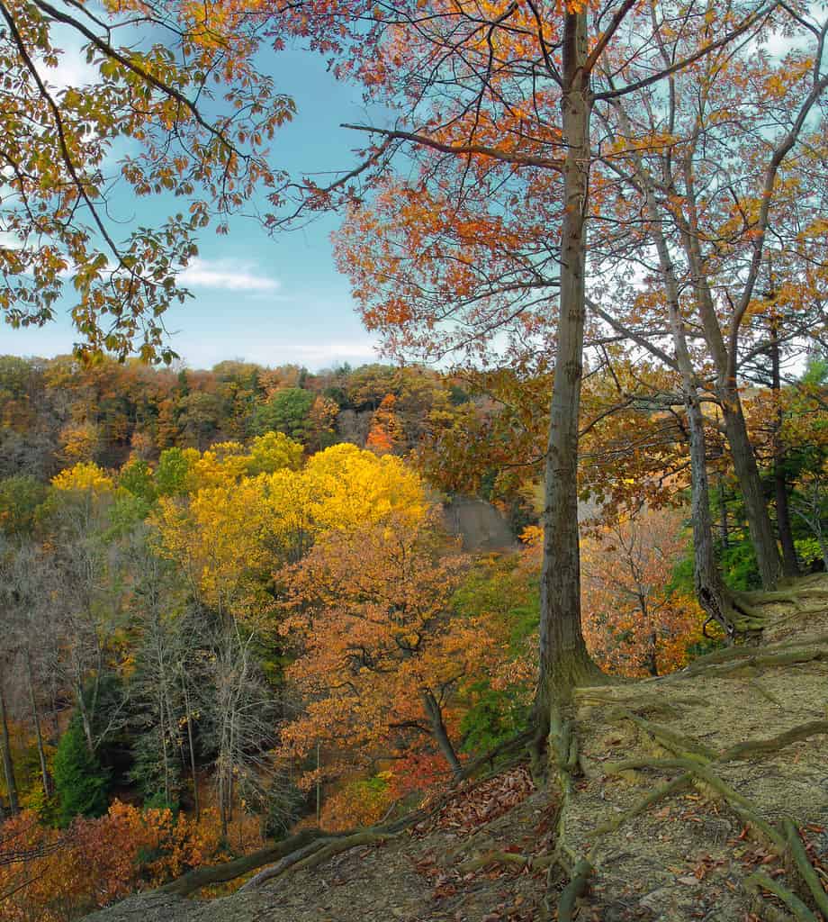
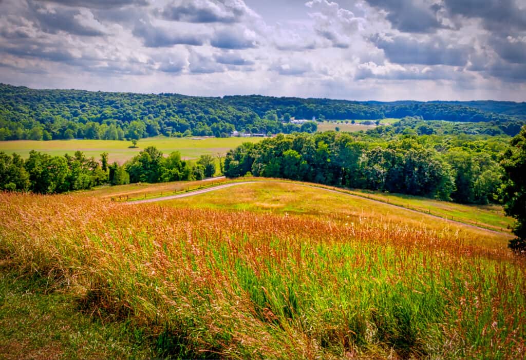
12. Paint Creek State Park
The waters of Paint Creek were formerly used to power early mills.
©Kyle Hartshorn / CC BY 2.0 – License
Located in south-central Ohio, Paint Creek State Park is located at the boundary between the Appalachian Plateau and the flatter, western region of the state. The park encompasses over 5,500 acres, including a lake that is a great destination for fishing and boating. The park has trails for hiking, horseback riding, and biking, offering views of the abundant wildflowers, trees, and animals.
To get to Paint Creek State Park, take US-50 West from Bainbridge for four miles, then turn right onto Rapid Forge Road. Continue for another four miles, then turn left onto Taylor Road. The state park entrance will be ahead in one mile.
Coordinates: 39.2703149989656, -83.38504565881182
13. Shawnee State Forest
Shawnee State Forest is also known as “The Little Smokies of Ohio.”
©iStock.com/Corey B. Stevens
Stretching for over 60,000 acres, including a wilderness area of over 8,000 acres, the Shawnee State Forest is the largest state forest in Ohio. The area is used for sustainable timber harvesting, research, and recreation. Visitors can explore the hiking, biking, or horseback trails or climb the Copperhead fire tower.
To get to Shawnee State Forest, take OH-32 East out of Cincinnati for about 35 miles. Then, turn right onto OH-247 South and drive for 10 miles. Turn left onto West Main Street, and in a half mile, stay right for OH-125 East. Follow that road for 20 miles, then turn right onto State Forest Service Road 16.
Coordinates: 38.74554865587646, -83.20513362614874
14. Mount Jeez
Mount Jeez is part of the Mohican Hills range and provides views of the Pleasant Valley below.
©James Marciniak/Shutterstock.com
Offering stunning views from its summit, Mount Jeez is situated in north-central Ohio. Mount Jeez stands at 1,310 feet of elevation, where it overlooks the Malabar Farm State Park. This park was the vision of conservationist and award-winning author Louis Bromfield, and it features a working farm, nature trails, fishing, and camping.
To reach Mount Jeez, take OH-95 West out of Wooster for about 25 miles. Turn right onto OH-603 North, and after a half mile, turn right again onto Pleasant Valley Road. In a half mile, turn right, and Mount Jeez will be just ahead.
Coordinates: 40.655918254932665, -82.38358644732065
15. Mosquito Creek Lake
Mosquito Creek Lake is a popular destination for fishing and boating.
©Margaret Luzier, U.S. Army Corps of Engineers / This image or file is a work of a U.S. Army Corps of Engineers soldier or employee, taken or made as part of that person’s official duties. As a work of the U.S. federal government, the image is in the public domain.
Located within the Mosquito Lake State Park, this is one of Ohio’s largest lakes. It is a popular destination for fishing and boating, with several fishing tournaments that happen each year. There are also plenty of hiking trails weaving through the area’s dense forests. Additionally, Mosquito Creek Lake and the surrounding marshes and woodlands provide an important habitat for migrating birds.
To get to Mosquito Creek Lake, take OH-11 North out of Youngstown to exit 57. Then, turn left onto OH-305 West and drive for a mile and a half. Turn right on OH-46 North and follow that road for about five miles.
Coordinates: 41.39952834153584, -80.75577270171968
Summary of Ohio’s Most Remote Spots
| Name | Coordinates |
|---|---|
| Wayne National Forest | 39.563758171332545, -82.18736990211634 |
| Hocking State Forest | 39.43497169371745, -82.54763677218345 |
| Helltown | 41.26275720252461, -81.56034586221851 |
| Edge of Appalachia Nature Preserve | 38.76614887773286, -83.46158887090719 |
| Seneca Lake | 39.90699225663204, -81.42185516904205 |
| Magee Marsh Wildlife Area | 41.613321901807716, -83.18863916285477 |
| Mineral Springs Lake | 38.92640299038553, -83.36740582368962 |
| The Wilds | 39.829647056407715, -81.73303940463778 |
| Hell Hollow Wilderness Area | 41.72286244796545, -81.12358716171914 |
| Moonville Tunnel | 39.308491142419825, -82.32202634909983 |
| Pymatuning Lake | 41.54654959004953, -80.52935390779953 |
| Paint Creek State Park | 39.2703149989656, -83.38504565881182 |
| Shawnee State Forest | 38.74554865587646, -83.20513362614874 |
| Mount Jeez | 40.655918254932665, -82.38358644732065 |
| Mosquito Creek Lake | 41.39952834153584, -80.75577270171968 |
The photo featured at the top of this post is © Alexander Lukatskiy/Shutterstock.com


How to Add Us to Google News


Thank you for reading! Have some feedback for us? Contact the AZ Animals editorial team.