
It is one thing to read stories about how our lake levels are low, but it is another thing to see these shocking images from space that show how much Lake Mead is vanishing! Images of Lake Powell, which is upriver from Lake Mead show that same thing. Due to a 22-year drought and climate change, Lake Mead is vanishing before our eyes.
Where is Lake Mead?
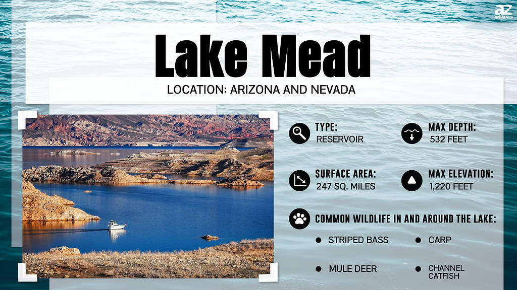
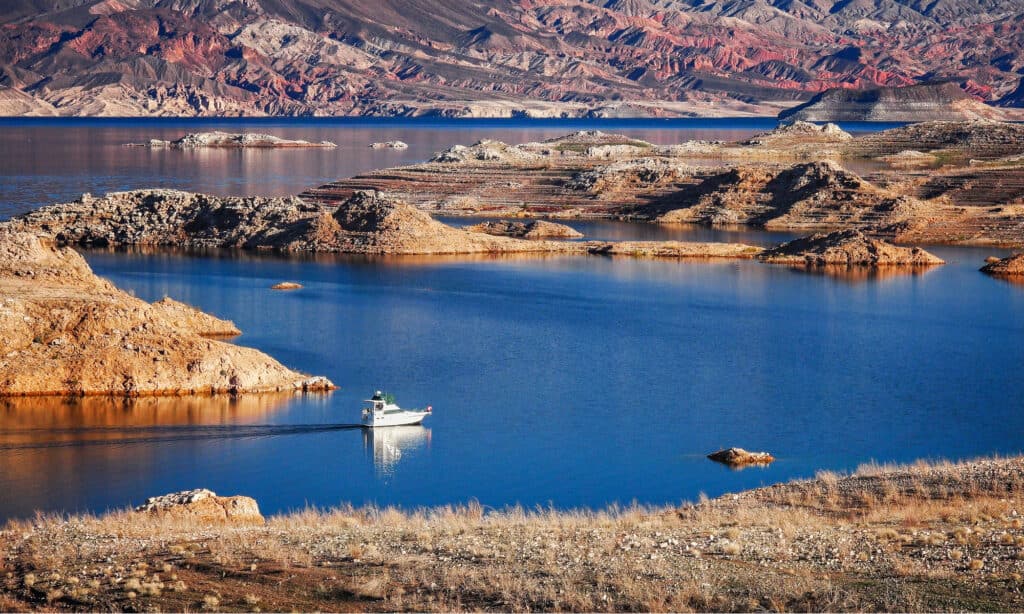
Leak Mead is the large reservoir made by the Hoover Dam on the Colorado River. It borders Arizona and Nevada and is one of the two largest reservoirs in the United States. Lake Mead is around 25 miles east of Las Vegas and 130 miles west of the Grand Canyon.
How Big is Lake Mead?
Lake Mead is the largest reservoir in the United States by volume with a volume of 2 million acre-feet of water when full. It covers 247 square miles…or it used to. Lake Mead has not been at full capacity since 1997.
What do These Shocking Images of Lake Mead Show?
The two images below come compliments of NASA. The first picture is from 2000 while the second picture was taken earlier this month. Take a moment to study the vanishing water levels across this massive reservoir.
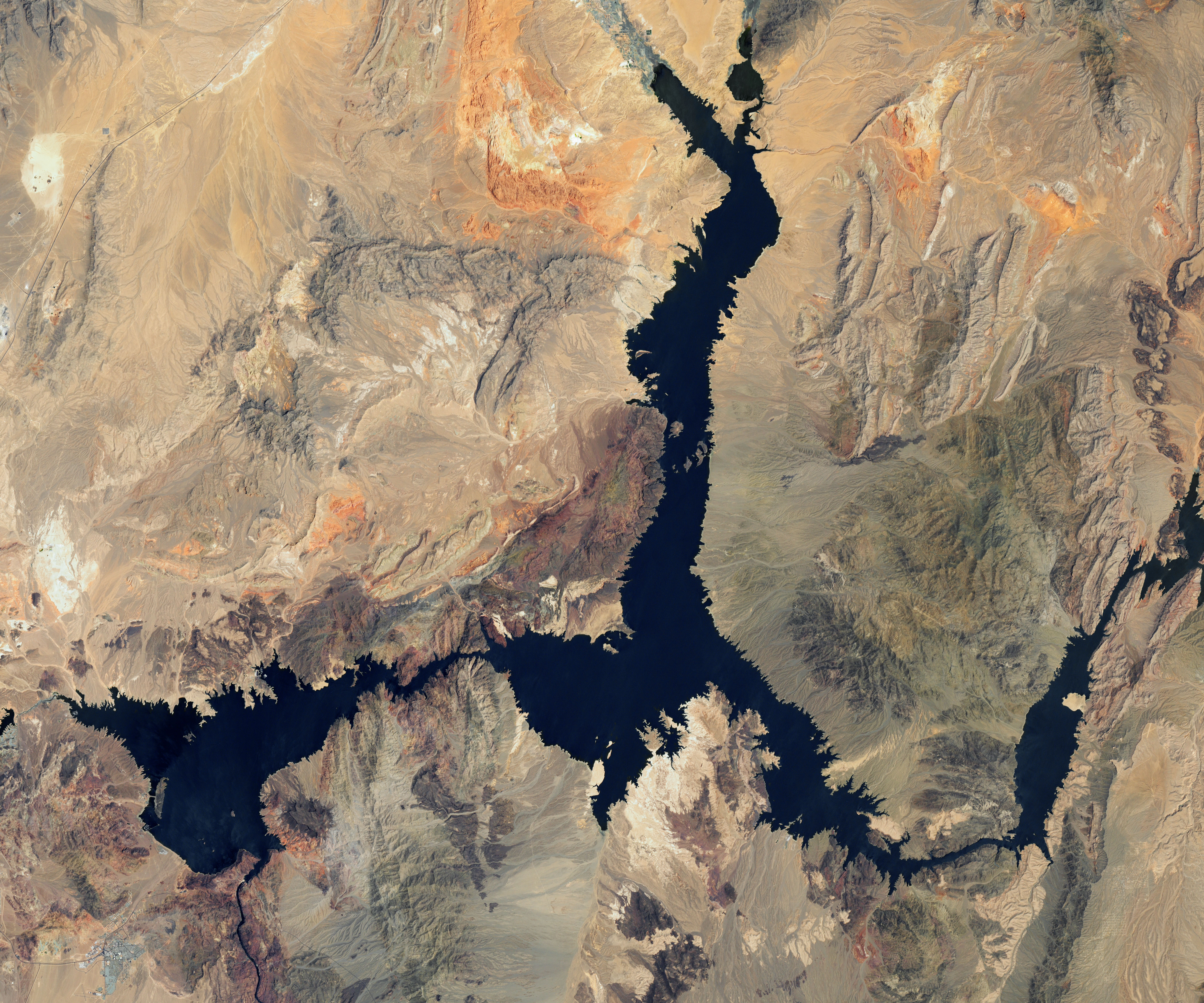
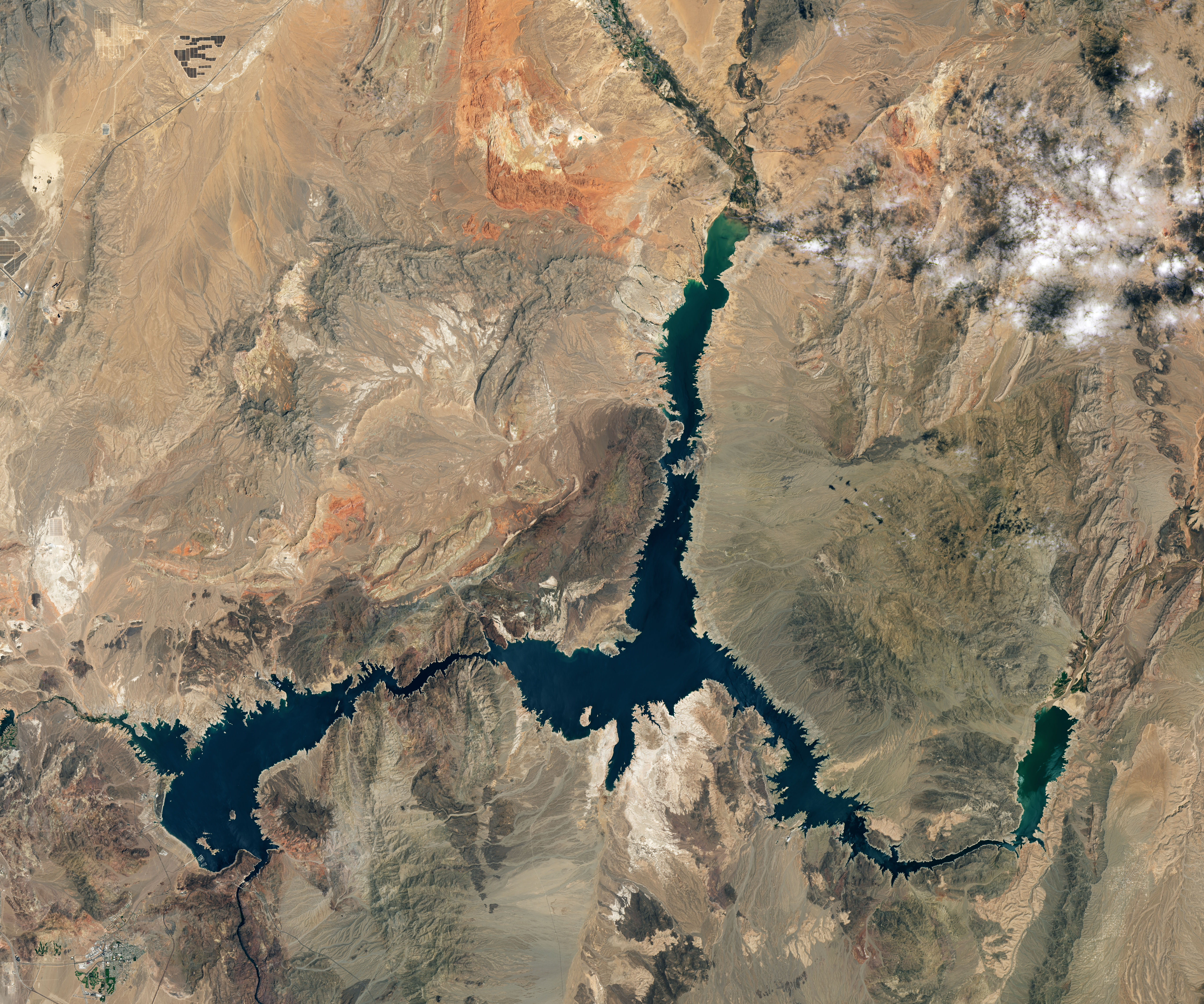
These images are from Landsat 7 and 8, satellites in the Landsat program run by NASA. More specifically, the first photo was taken on July 6, 2000, and the second one was taken on July 3, 2022.
These shocking images from space show how much Lake Mead is vanishing. Look around the edges and see the striped-colored rock that shows where the water levels used to be. At the top of the picture, you can see how the river beds are nearly dry. On the right you can see where the Colorado River flows into Lake Mead and how low the river is.
NASA also released a second picture that focuses on the Overton Arm of Lake Mead, which stretches to its northern limits. With a more zoomed-in perspective, you can clearly see how what was once a lake has now completely dried aside from a small section of riverbed.
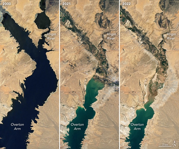
Another image released by NASA showed declining water levels in more detail.
©Public Domain – License
Just How Bad is it? What is the Water Level at?
The water level in Lake Mead is at its lowest since before it was created in 1937. The water level was 1041.30 feet (317.4 meters) above sea level on July 18, 2022. In July of 2000, when the first photo was taken, the water level was 1199.97 feet (341 meters) a difference of 158.67 feet! That is like standing on a 15-story building, looking down 150 feet, that is how much water is now gone! You can imagine how this affects the wildlife in the area. Lake Mead is home to striped bass, crappie, catfish and rainbow trout. Fewer fish means less food for the bald eagles and peregrine falcons. You can see the trickle effect of the importance of the lake.
How Full Should the Lake Be?
At full capacity, Lake Mead is 1,220 feet at the dam.
©CrackerClips Stock Media/Shutterstock.com
Lake Mead’a full capacity is 1,220 feet (372 meters). According to the U.S. Bureau of Reclamation’s Lower Colorado Basin Region, the water level has to stay above 895 feet or the Hoover Dam will have to be shut down and no water could travel past the dam. This is called the “dead pool” level. There has been concern for years about Lake Mead and Lake Powell reaching the dead pool level.
Has Lake Mead Ever Been This low Before?
Lake Mead is at its lowest level now since 1937 when it was created. In 1983 and 1999 it was near full capacity as measured at the Hoover Dam. In August of 2010, Lake Mead was at its lowest 1,087 feet (331 meters) since 1956. NASA showed similar image comparisons to August 1985 when the lake was at a near high of 1,213 feet (370 meters). So you can see there has been some fluctuation in the past, but there has been a steady decrease in the water level of Lake Mead since 1999.
Who Relies on the Water From Lake Mead and the Colorado River?
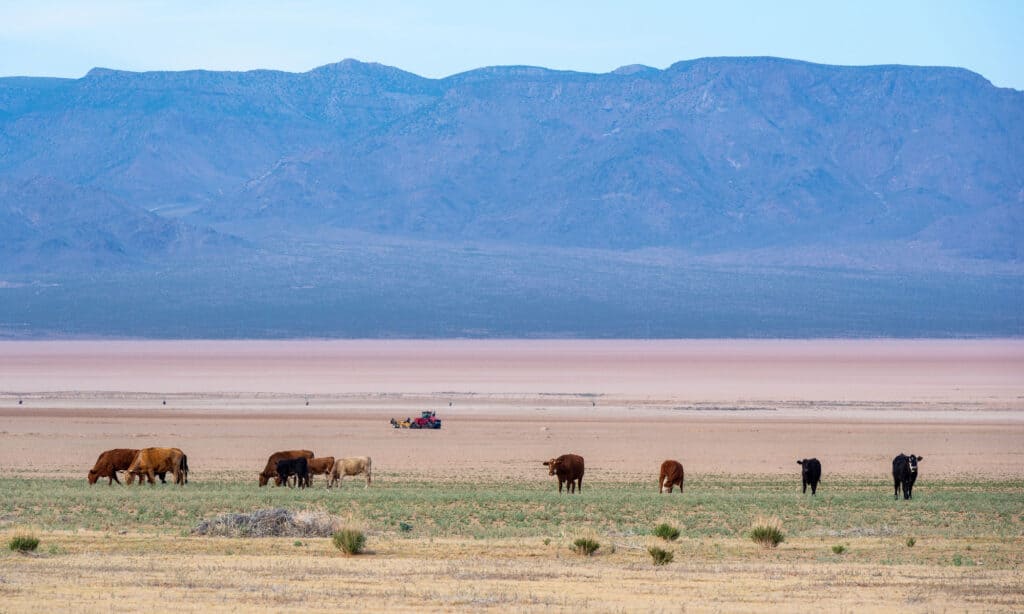
Farms rely on the water from the Colorado River Basin.
©iStock.com/Gregory Clifford
Around 40 million people in the Colorado River Basin area rely on the electricity and water provided by the Colorado River. The states that are part of the Colorado River Basin are Arizona, California, Colorado, New Mexico, Nevada, Utah, and Wyoming. Major cities that are most affected include Las Vegas, Los Angeles, San Diego, and Phoenix. The water is not just used for homes and businesses but for millions of acres of farmland. According to the Bureau of Reclamation, “Hoover Dam generates, on average, about 4 billion kilowatt-hours of hydroelectric power each year for use in Nevada, Arizona, and California – enough to serve 1.3 million people.”
What are Authorities Doing to Help the Water Levels?
Although this is the closest we have gotten to dead pool, there are many agencies working together to prevent that from happening.
1. The United States Bureau of Reclamation manages the Colorado River Basin. In June they issued a water reduction program for the states in the River Basin to cut their water use by 2-4 million acre-feet over the next year and a half.
2. The California Water Board has issued its second Water Conservation Emergency Regulation of 2022. Their requirements include:
- “Urban water suppliers must submit preliminary supply and demand assessments to the Department of Water Resources by June 1, 2022.
- Urban water suppliers must implement all conservation actions in their locally adopted plans meant to address at least a water shortage level of 10 to 20 percent (Level 2) by June 10, 2022.
- Owners and managers of commercial, industrial, and institutional properties must not use potable water for irrigating non-functional turf.”
3. On April 25, 2022, the government approved the release of 500,000 acre-feet from Flaming Gorge Reservoir to help the lake levels and they reduced the flow of water from the Glen Canyon Dam.
4. Regional Water Management Plans set the level of 1,075 feet (328 meters) to activate the water restrictions. This level has already been hit and restrictions are in place.
5. The EPA Continues its Climate Change programs aimed at addressing the issue of the drought, as a solution for the future.
What Level is Lake Powell at?
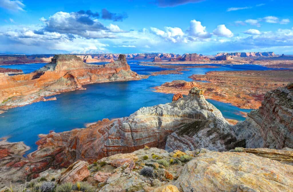
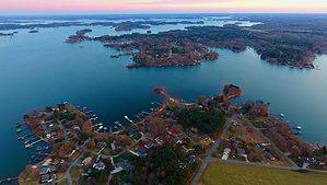
Lake Powell is a popular recreational lake. It is also vanishing due to drought and climate change.
©worldswildlifewonders/Shutterstock.com
Lake Powell is upstream from Lake Mead and experiencing the same issues. It is located at the Glen Canyon Dam right before the Grand Canyon begins. Lake Powell is 405.47 feet at the dam and 162 feet below full pool. It is at an elevation of 3,537 feet as of July 21, 2022. The dead pool level for Lake Powell is an elevation of 3,370 feet. Read here to find out what happens if the Lake Powell drought gets worse. Lake Mead has the same fate. Images like these help people understand how much Lake Mead is vanishing. Hopefully, all of the Southwest will come together to prevent this.
The photo featured at the top of this post is © NASA Earth Observatory images by Joshua Stevens, using Landsat data from the U.S. Geological Survey / Public domain, from Wikimedia Commons, the free media repository – License / Original
How to Add Us to Google News


Thank you for reading! Have some feedback for us? Contact the AZ Animals editorial team.