
Key Points:
- The longest tunnel in Arizona is the Papago Freeway Tunnel at 2,887 feet long.
- More commonly known as the Deck Park Tunnel, it opened to traffic on August 10, 1990 after a three-day open house was attended by 100,000 people.
- It technically is not a tunnel but is a succession of 19 side-by-side bridge passageways.
In Arizona, there are plenty of tunnels to explore. Some are constructed by humans and others have been formed naturally. The longest tunnel in Arizona spans nearly 3,000 feet and when you’re driving through it, it’s an adventure of its own. You might even forget you’re commuting to or from work!
The Papago Freeway Tunnel
The Papago Freeway Tunnel in Phoenix is the longest tunnel in Arizona. It is informally known as the Deck Park Tunnel. Originally, the plan to build it was proposed in 1975. Voters weren’t into the idea, so they voted against it. It took another four years before voters caved to the tunnel idea and finally passed the proposal. It was finally opened to traffic on August 10, 1990 after an open house was held. This three-day event attracted a whopping 100,000 people, which is kind of ironic since it was struck down so powerfully initially. Despite the early opposition, now there’s even a plaque that commemorates the Papago Freeway Tunnel at Margaret T. Hance Park.
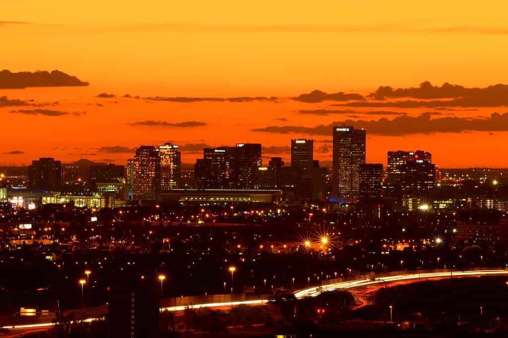
The longest tunnel in Arizona is in Phoenix.
©iStock.com/gillcouto
The Papago Freeway Tunnel’s Primary Purpose
Curiously, The Papago Freeway Tunnel isn’t exactly a tunnel. The Arizona Department of Transportation (ADOT) has a much more technical and precise description of it. It is a succession of 19 side-by-side bridge passageways. While that’s certainly more to the point, locals settled for a much easier to say (and easier to remember!) term: tunnel. Therefore, it became a part of its name. This tunnel runs from North 3rd Avenue all the way over to North 3rd Street, covering an impressively long 2,887 feet. Since it’s located just below Margaret T. Hance Park, it only makes sense that the plaque commemorating it would sit atop like icing on a cake.
The Papago Freeway Tunnel was built as an underpass on the I-10 in Phoenix. At the time of its proposal, the population in Phoenix was not anything like the bustling city it is today. It was clear that the city was growing and that a solution was required for uniting the east and west valleys. Not only that but there had to be a way for commuters to make it through the state completely uninterrupted. Perhaps residents required a bit more perspective and a greater vision to change their minds and decide to vote “yes” for its construction. Today, it still has two extra lanes in the center but that’s only because the funding didn’t cover the entirety of the vision. Those two lanes were meant as express lanes for terminal city buses but alas, only the 10 lanes (five in each direction) were completed.
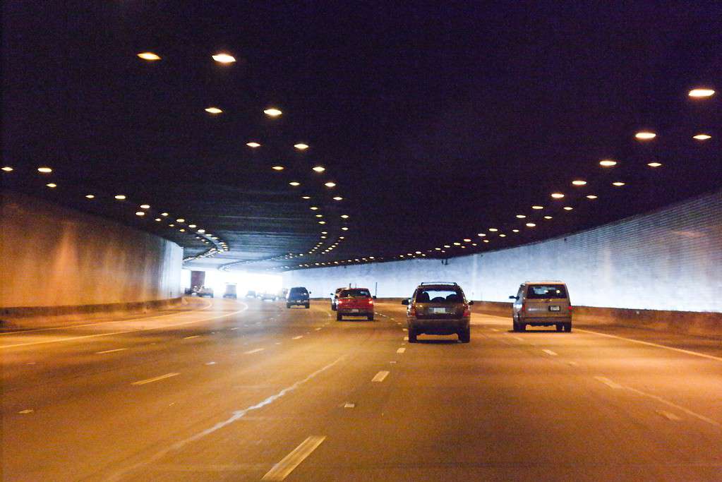
The Papago Freeway Tunnel, more commonly known as Deck Park Tunnel, was opened in 1990.
©Visitor7 / CC BY-SA 3.0, via Wikimedia Commons – License
Where Is the Papago Freeway Tunnel Located on a Map?
The Papago Freeway Tunnel is built under downtown Phoenix, which is in the south-central part of the state, halfway between Tucson to the southeast and Flagstaff to the north.
Arizona is located in the southwestern region of the United States and is part of the four corners region, the only location in the United States where four states meet: in the southwest with Utah to the north, Colorado to the northeast, and New Mexico to the east. Arizona is also bordered by California to the west, Utah to the north, New Mexico to the east, Nevada to the northwest, and the Mexican states of Sonora and Baja California to the west.
Wildlife Surrounding the Papago Freeway Tunnel
Considering the Papago Freeway Tunnel is smack dab in the center of a heavily used interstate highway, there aren’t exactly lots of wildlife sightings. However, in Phoenix as a whole, there is plenty of wildlife abounding. Some of those animals include mammals like coyotes, javelinas, deer, black bears, coatimundi, raccoons, and skunks. There are also some reptiles and amphibians, including chuckwallas, Gila monsters, and red-spotted toads. Birds in the area include greater roadrunners and great blue herons.
The photo featured at the top of this post is © iStock.com/pmphoto


How to Add Us to Google News


Thank you for reading! Have some feedback for us? Contact the AZ Animals editorial team.