
You may experience fear, disheartenment, or sadness when you learn about devastating natural disasters like tornadoes and hurricanes, but you may find it more difficult to imagine any of them happening close to home.
The truth is that the majority of the world is susceptible to natural disasters of some kind. There are tornadoes, earthquakes, wildfires, and flooding in some parts of the United States. These disasters, however, pose a greater threat to some states than others and there are varying reasons for this. States in a coastal region are vulnerable to hurricanes, while those in the midwest are geographically exposed to wind and tornadoes.
Which of these hurricanes rings a bell? Hurricane Ida, Katrina or Harvey? Beyond the personal names attached to one of the most destructive forces of nature, there are people behind the numbers you see on TV. The Centers for Disease Control and Prevention stated in an October 2021 report that the media reported 91 fatalities in 9 states as a result of Hurricane Ida. While the Northeast accounted for 56 (61.5%) of those deaths, drowning ( 37.4%), auto accidents ( 24.2%), and generator- or power outage-related deaths made up the top three causes of death (18.7%).
Ida caused damage that the National Oceanic and Atmospheric Administration (NOAA) estimated to be just under $65 billion. Only Katrina, Harvey, Maria, and Sandy have cost more money in American history.
In all, 2021 recorded the sixth consecutive year of above-average activity, and for the second straight year, every name on the list—from Tropical Storm Ana in May to Tropical Storm Wanda in November—was used.
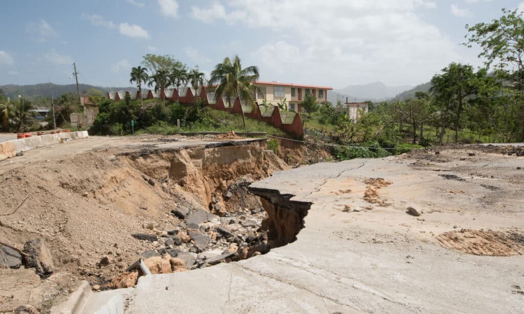
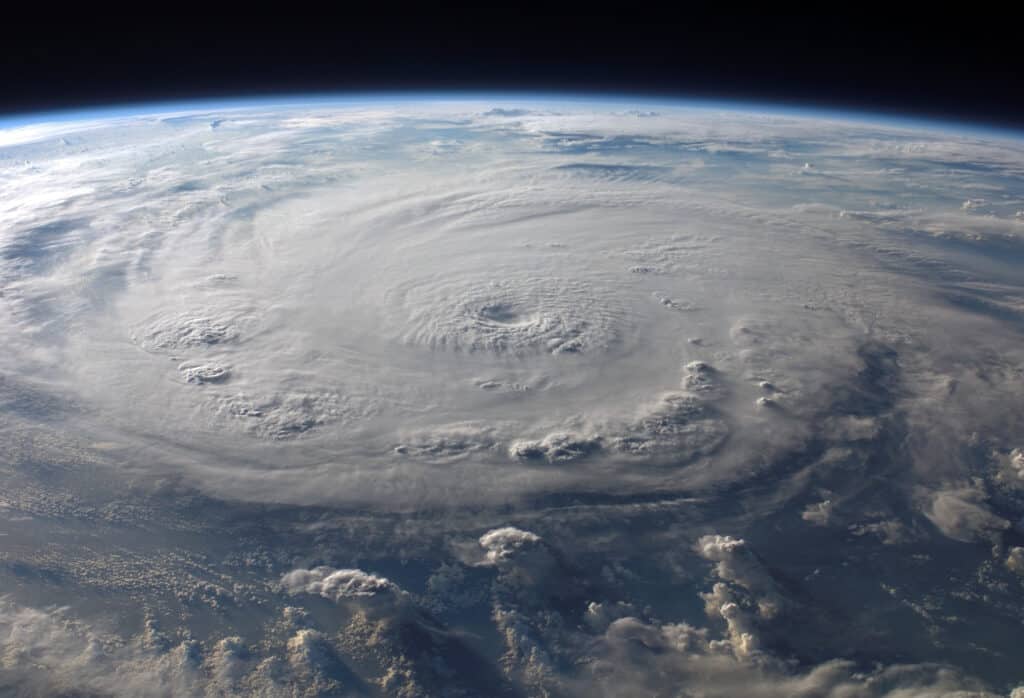
Only Hurricanes Maria, Sandy, and Katrina have cost more money than Ida (aftermath of Maria seen here).
©iStock.com/cestes001
What are Hurricanes?
Hurricanes are classified as tropical storms with maximum sustained winds of 74 miles per hour or higher. These rotating storms are known as cyclones when they form over the South Pacific and the Indian Ocean, and typhoons when they form in the Northwest Pacific. They are called hurricanes when they form over the North Atlantic, central North Pacific, and eastern North Pacific.
The Atlantic basin, which includes the Atlantic Ocean, Caribbean Sea, and the Gulf of Mexico, as well as the eastern and, less frequently, the central North Pacific Oceans, is where hurricanes develop.
The Saffir-Simpson Hurricane Wind Scale assigns a hurricane’s maximum sustained winds rating, or category, from 1 to 5. The possibility of property damage from a hurricane increases with the hurricane category.
Ever wondered how hurricanes get their names? They are identified using a list of names that change every six years and are updated and maintained by the World Meteorological Organization (WMO).
Although the official season for hurricanes runs from June 1 to November 30, these severe storms can occur before and after this time frame. It’s important to note that the Atlantic Ocean’s hurricane season, which runs from mid-August to late October, records an average of five to six hurricanes yearly. The months of May and November typically see the most storm activity in the northern Indian Ocean, where cyclones typically form between April and December.
How Do Hurricanes Form?
At least 80 degrees Fahrenheit must be existent at the surface of the ocean for tropical disturbances to develop into hurricanes. The energy from warm seas fuels those low-pressure systems.
Warm ocean air rises into the storm as it travels across the tropics in a westward direction, creating an area of low pressure beneath it. More air enters as a result of this. Clouds and thunderstorms are then created as the air rises and cools. As the water cools and condenses into droplets in the clouds, additional heat is produced, causing the storm to intensify.
A storm is deemed to be a tropical depression if its wind speeds are 38 miles per hour or less. When a storm’s sustained wind speeds reach or exceed 39 miles per hour, it is classified as a tropical storm and given a name in accordance with WMO conventions. The storm is upgraded to a hurricane once it reaches sustained wind speeds of at least 74 mph.
Stormy winds from a single hurricane can produce roughly half the energy of the entire world’s electrical generating capacity. The formation of clouds and rain from the same storm may release an astounding 400 times that amount of energy.
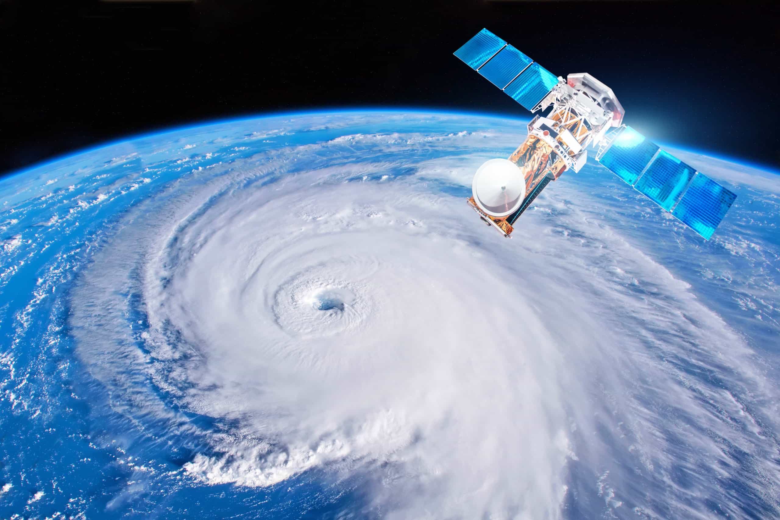
Hurricane Katrina as seen from space
©LiL SUS/Shutterstock.com
The States With The Most Hurricanes and Why
According to the National Oceanic and Atmospheric Administration, 301 hurricanes have made landfall in 19 U.S. states since 1851. Florida has had more hurricanes than any other state over that time period.
#1 Florida
Florida, the state most vulnerable to hurricanes in the nation, has been hit by 120 hurricanes since 1851. The state of Florida is susceptible to hurricanes due to its extensive coastline and geographic location. Strong winds do not dissipate quickly after a storm makes landfall because of the state’s flat terrain.
The Labour Day Hurricane of 1935, Hurricane Andrew in 1992, Irma in 2017, and Michael in 2018 are some of the most destructive hurricanes in Florida’s history.
More hurricanes have hit Monroe County in Florida’s southwest more than any other county, with Miami-Dade and Broward Counties to the east coming in second and third, respectively. The Miami-Dade county region experienced four to six feet of water as a result of Hurricane Irma in 2017.
The midwestern coast of the Sunshine State is the region with the fewest hurricanes. The risk of a direct hit from a hurricane in the areas surrounding Tampa, Jacksonville, and the Big Bend is lower, but each year, a landfall is still possible.
#2 Texas
In addition to being the second-largest state in terms of area, Texas is also the second-most hurricane-prone state in America. One of the major reasons responsible for this is its location along the Gulf of Mexico. The Gulf’s warm coastal waters are much more likely to produce hurricanes than waters in other regions.
The risks can also be attributed to higher-than-average sea surface temperatures, weaker tropical Atlantic trade winds, and decreased vertical wind shear, which would otherwise assist in breaking up tropical storms before they can intensify.
The Lone Star State has recorded 19 major hurricanes out of a total of 64. In 2017, Hurricane Harvey made landfall in Galveston. It caused $125 billion in damages, with the majority of the damage coming from flooding that followed the hurricane.
Any region along the Texas coast, from border towns like Brownsville to northern hubs like Port Arthur, is likely to be exposed to hurricanes. Compared to other Texas cities, Galveston and Houston have by far sustained the worst hurricane damage.
#3 Louisiana
The Pelican State has likely experienced more expensive and deadly storms than any other state apart from Florida. For context, the 2005 Hurricane Katrina led to about 1,600 deaths and $108 billion in damage.
It’s been 17 years since Hurricane Katrina made landfall in Louisiana. Since then, the Creole State has continued to be affected by hurricanes caused by its proximity to the Gulf Coast.
Louisiana was still recovering from the five named storms in 2020 when Hurricane Ida hit. It affected the parishes of Jefferson, Plaquemines, Terrebonne, and St. Charles in 2021. According to scientists, the global warming crisis is worsening tropical cyclones. The reason is that it gives the storms more fuel in the form of the warmer ocean and air temperatures.
The southern regions of Louisiana that are closest to the Gulf Coast tend to experience the most hurricane activity, in addition to New Orleans.
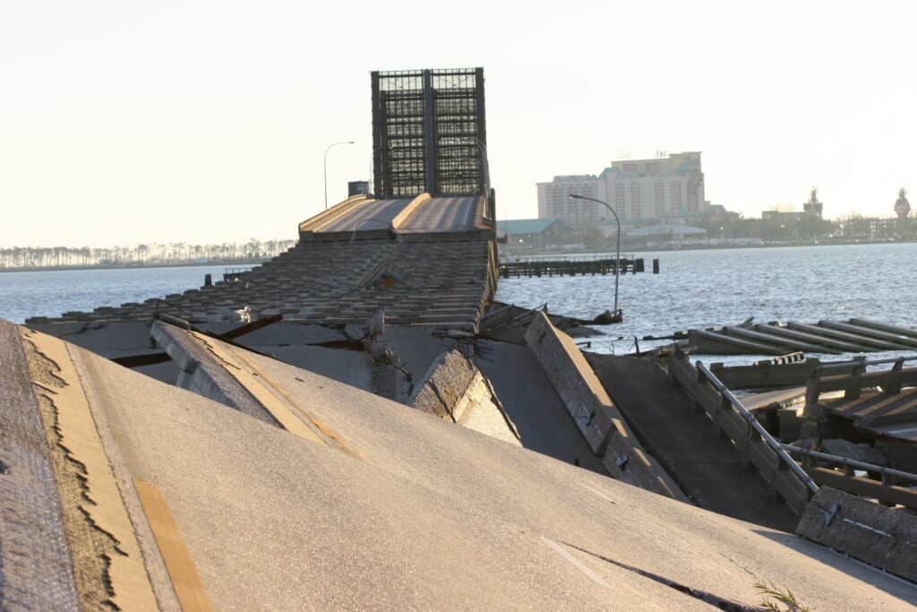
Hurricanes can cause immense damage, for instance, Hurricane Katrina destroyed the Biloxi bridge.
©Robert A. Mansker/Shutterstock.com
#4 North Carolina
With 58 landfalling hurricanes and seven major hurricanes, North Carolina earns the fourth spot on the list of hurricane-prone states. The coastline of North Carolina extends outward. This makes it one of the regions in the country most susceptible to a direct hurricane strike.
Throughout the past 20 years, hurricanes have had an effect on every region of the state, from the mountains to the coastal and sound counties.
The most recent major hurricane to hit the Tar Heel State was Hurricane Florence in September 2018. It caused an estimated $22 billion in damage. In 2016, Hurricane Matthew made landfall in the state, destroying Robeson, Edgecombe, Cumberland, and Wayne counties in its wake.
#5 South Carolina
One of the states most at risk from hurricanes and tropical storms in the country is South Carolina. The Atlantic Ocean is surrounded by six coastal counties. These counties have a combined general coastline of more than 200 miles. Another 21 inland counties may also be directly impacted. The state’s vulnerability is greatly increased by densely populated coastal areas. This is especially true during the busiest tourist seasons, and the typically low coastal elevations.
Five of South Carolina’s 31 landfalling hurricanes—including Hurricane Hugo in 1989—have been considered major. Hugo caused the highest storm tide heights ever seen along the U.S. East Coast and made landfall just north of Charleston as a Category 4 hurricane. The estimated cost of damage was nearly $7 billion.
Up Next…
Take a look at some of our other articles about the crazy forces of nature!
- 5 Deadliest Blizzards – Find out just how bad the winters have been in these places.
- Hurricane Names – Find out how they get named and how they’re even chosen.
- 6 Worst Tornadoes In The US – If hurricanes and blizzards weren’t enough, find out how much destruction these tornadoes caused!