
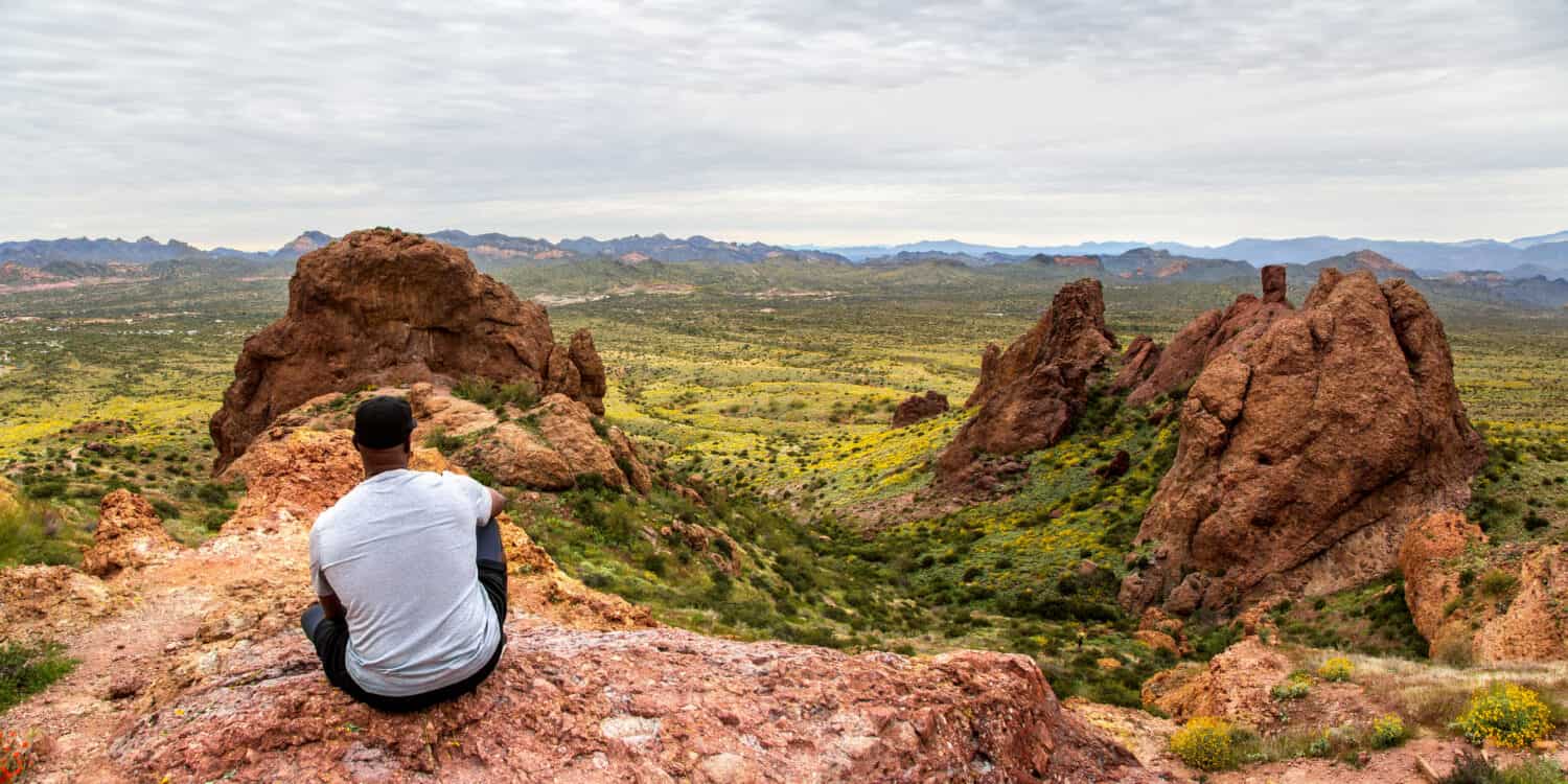
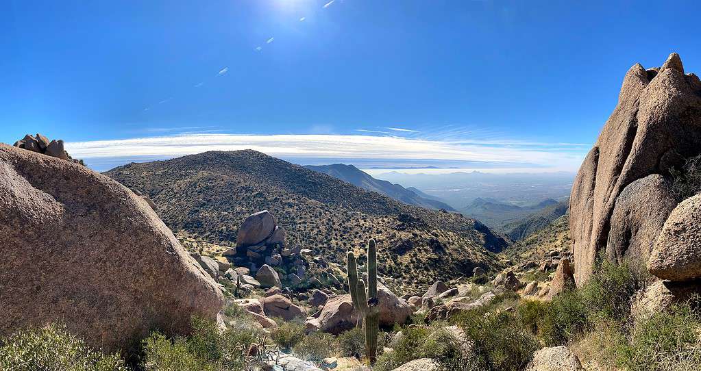
Within the stunning landscapes of Arizona, a treasure trove of iconic hiking trails awaits hikers of all ages and skill levels. From the rugged grandeur of the Grand Canyon National Park to the serene and lush beauty of Sedona, these trails offer a diverse range of experiences. Each journey presents an opportunity to connect with the unique natural wonders of the region, whether it’s gazing at the breathtaking Horseshoe Bend, descending into the depths of the Grand Canyon, or summiting one of the many peaks in the state.

Devil’s Bridge Trail via Dry Creek Road
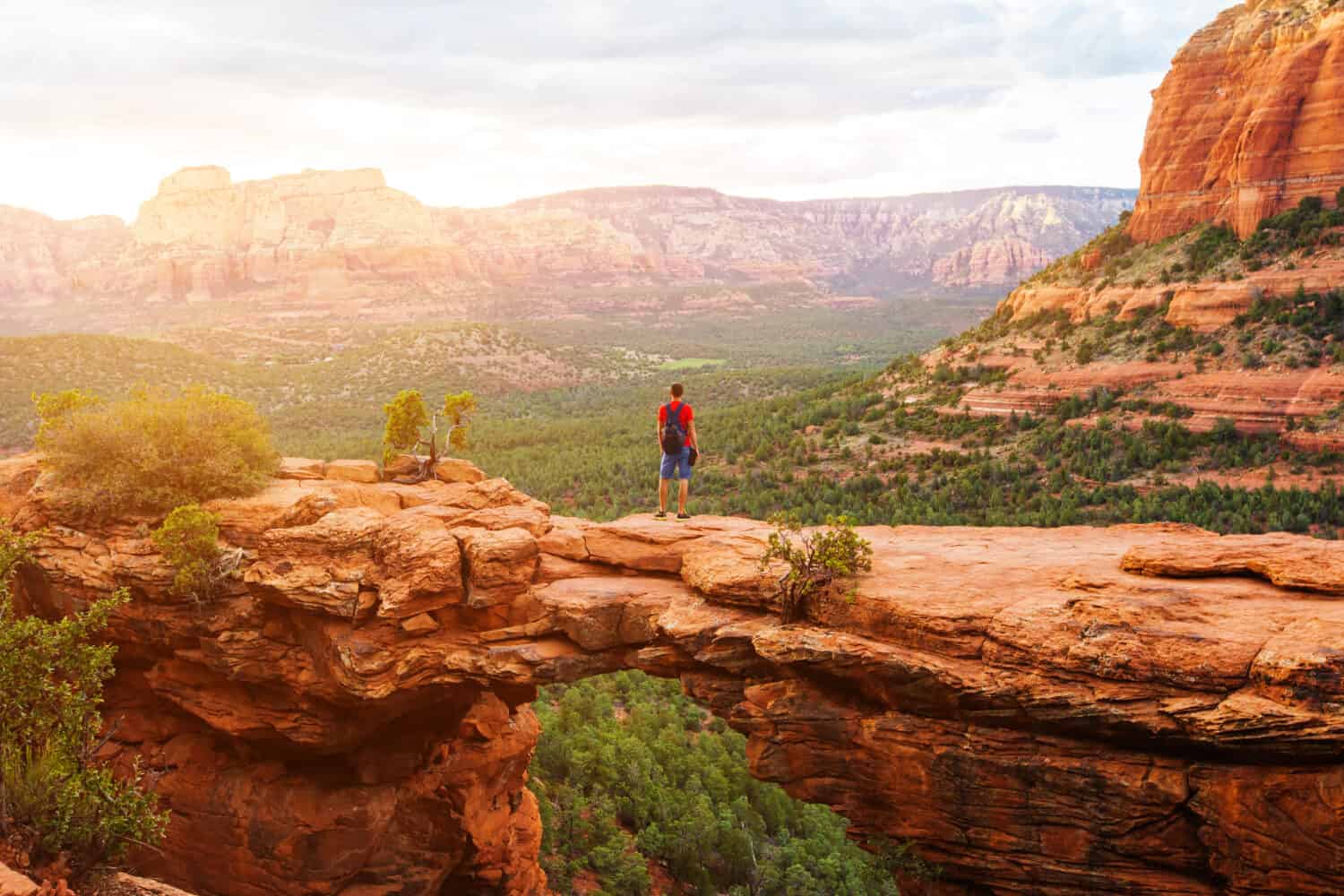
Devil’s Bridge Trail via Dry Creek Road is approximately 3.9 miles round trip.
©Nikolas_jkd/Shutterstock.com
In the red rock wonderland of Sedona, AZ, Devil’s Bridge Trail via Dry Creek Road is a captivating trail that invites hikers to explore the region’s breathtaking beauty. This out-and-back trail spans approximately 3.9 miles round trip and offers a relatively moderate elevation gain of around 521 feet. It is accessible to a wide range of hikers, including families with older children. That said, it is a popular trail, so start early in the day if you want to beat high crowds.
The prominent feature of this trail is, of course, Devil’s Bridge itself. Moreover, it is the largest sandstone arch in the Sedona region of the Coconino National Forest. As you stand upon this geological marvel, you’ll be rewarded with awe-inspiring panoramic views of Sedona’s iconic red rock formations and lush desert landscape.
While there are no bodies of water along the trail, keen-eyed hikers can spot a variety of desert wildlife, including nimble lizards, soaring hawks, and the occasional rattlesnake. Devil’s Bridge Trail provides an opportunity to immerse yourself in the unique flora and fauna of the region while experiencing the sheer natural beauty of one of Arizona’s best views. Furthermore, dogs are allowed on this trail. Bear in mind that all dogs must be leashed.
West Fork of Oak Creek Trail #108
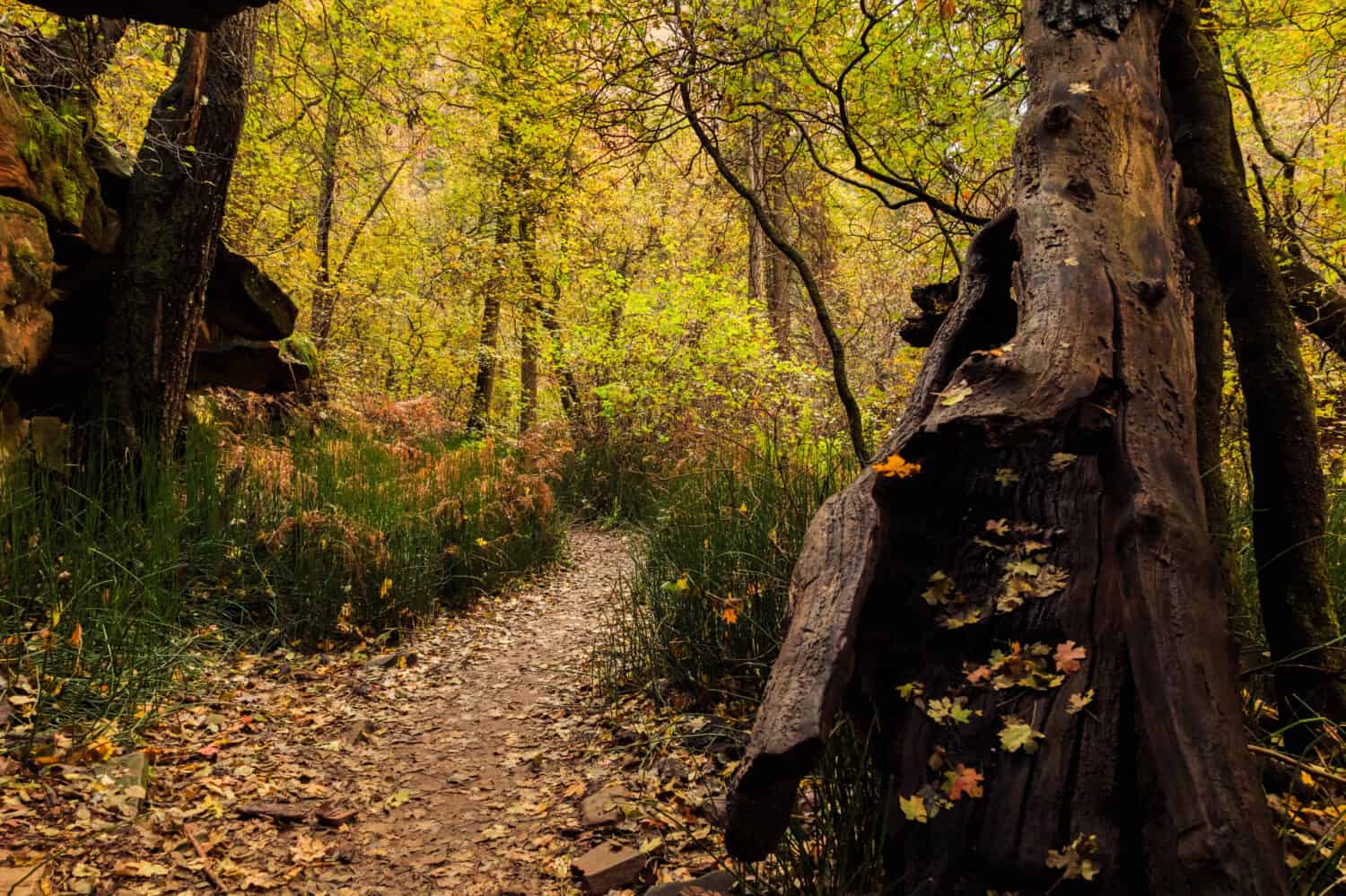
West Fork of Oak Creek Trail #108 is approximately 6.5 miles round trip.
©Pritha_EasyArts/Shutterstock.com
Next on our list of Arizona’s most beautiful and iconic hiking trails is West Fork of Oak Creek Trail #108. Near Munds Park, AZ, the West Fork of Oak Creek Trail #108 is a fun and family-friendly hiking experience. This trail winds alongside the meandering waters of Oak Creek and is renowned for its lush vegetation and scenic beauty.
The trail is approximately 6.5 miles in length, with a minimal and gradual elevation gain of 564 feet. This makes it a relatively easy hike suitable for hikers of all skill levels, including families with children. It’s a perfect escape from the desert heat into the refreshing shade of the canyon. However, the 13 separate creek crossings can become challenging or hazardous when the waters are high.
The prominent feature of this hike is the enchanting Oak Creek, which you’ll follow throughout your journey. The trail crosses the creek multiple times, requiring creek crossings and providing opportunities to dip your toes in the cool waters. Towering cliffs and vibrant foliage create a stunning backdrop.
Furthermore, as you explore this trail, you may encounter a variety of wildlife, including deer, squirrels, and a diverse range of bird species.
Seven Sacred Pools via Soldier Pass to Brins Mesa Loop
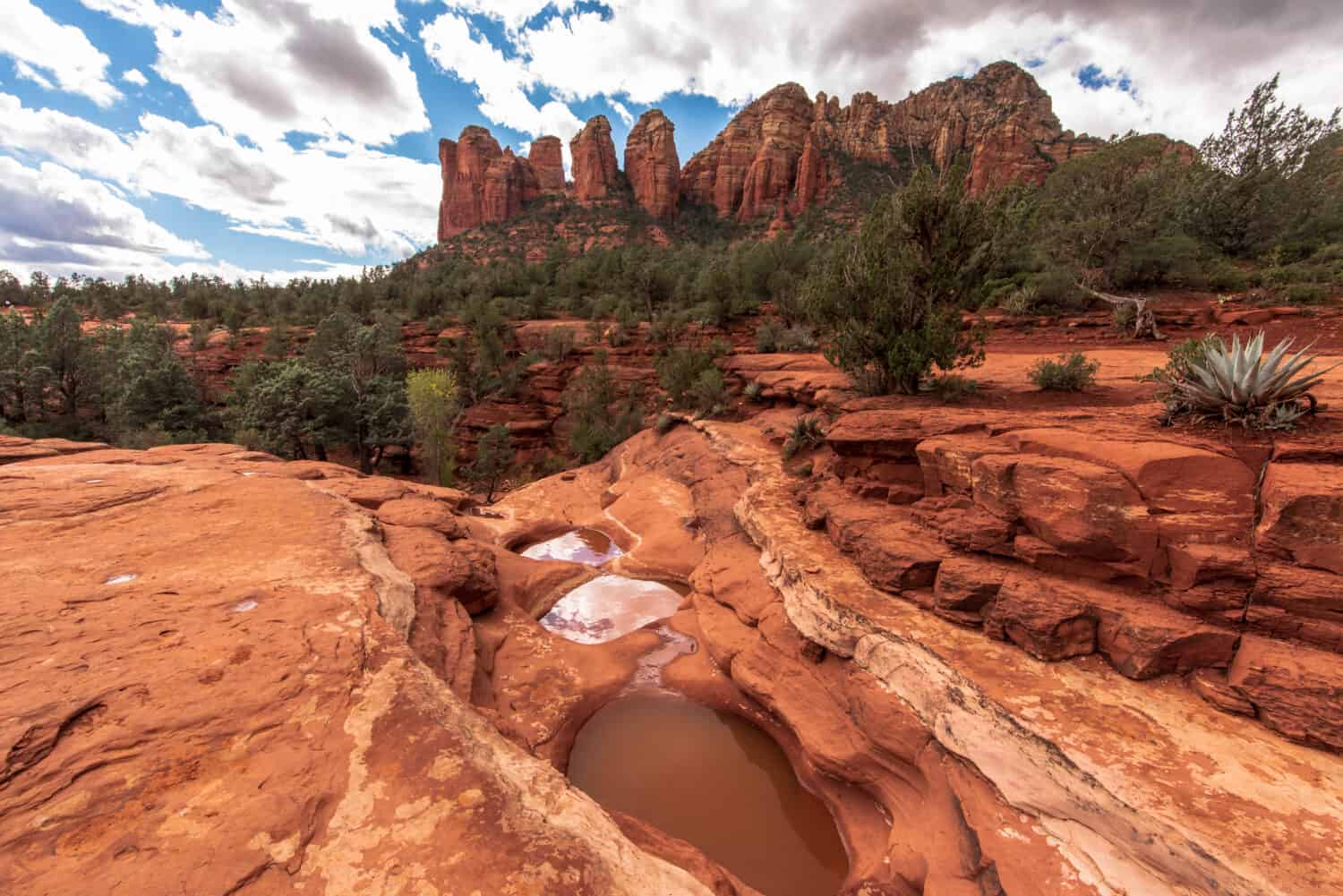
Seven Sacred Pools via Soldier Pass to Brins Mesa Loop is approximately 5 miles round trip.
©Matt Grimaldi/Shutterstock.com
Back to Sedona amongst the mesmerizing red rock landscape, the Seven Sacred Pools via Soldier Pass to Brins Mesa Loop is a unique and delightful hiking adventure that showcases beautiful bodies of water. This loop trail is approximately 5 miles in length, with a mild elevation gain of about 846 feet. It offers a moderately challenging experience suitable for families with older children and intermediate hikers. The loop takes you through diverse terrain, providing a variety of scenic views.
The prominent features of this hike are the Seven Sacred Pools, a series of natural pools formed by seasonal water flow, and the intriguing Devil’s Kitchen sinkhole. The red rock formations and lush vegetation in the area create a stunning visual contrast. Moreover, this trail is one of multiple ways to get to the Seven Sacred Pools.
Furthermore, there are plentiful secret caves to explore amongst the surrounding landscape that is teeming with desert wildlife. As you explore this picturesque trail, keep an eye out for deer, coyotes, javelina, and a variety of bird species, such as eagles, hawks, and hummingbirds.
Piestewa Peak Summit Trail #300
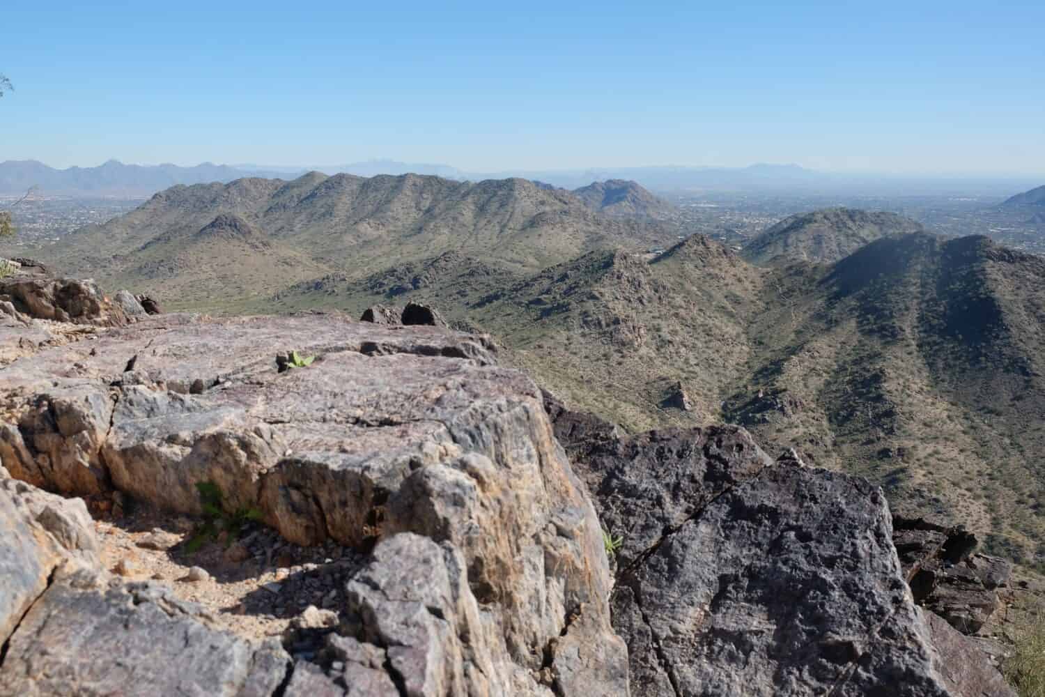
Piestewa Peak Summit Trail #300 is approximately 2.3 miles round trip.
©AdamBagindo/Shutterstock.com
Next on our list of Arizona’s most beautiful and iconic hiking trails is Piestewa Peak Summit Trail #300. Located near Phoenix, AZ, the Piestewa Peak Summit Trail #300 is a challenging but popular out-and-back hiking destination for both locals and visitors. This trail is situated within the Phoenix Mountain Preserve and is a challenging ascent to the summit of Piestewa Peak. This peak is 2,610 feet (796 meters) above sea level and is the second tallest peak in the Phoenix Mountains.
The trail is approximately 2.3 miles in length, with an elevation gain of around 1,151 feet. While relatively short, it’s considered a difficult hike due to the steep and rocky terrain. Families with older children and experienced hikers often find this trail enjoyable.
The prominent feature of this hike is undoubtedly the vista from the summit of Piestewa Peak. From this vantage point, hikers are rewarded with panoramic views of the Phoenix metropolitan area and the surrounding Sonoran desert landscape. Moreover, these features and the convenient location of Phoenix make it a great sunset hike.
While there are no bodies of water on this hike, you may encounter a variety of desert wildlife and wildflowers depending on the time of year. Furthermore, staying hydrated and prepared for the challenging terrain is essential when embarking on the Piestewa Peak Summit Trail. So be prepared and make sure you set out with ample water supplies and the ten essentials!
Flatiron via Siphon Draw Trail
Flatiron via Siphon Draw Trail is approximately 5.5 miles round trip.
©Monica Lara/Shutterstock.com
The Flatiron via Siphon Draw Trail is a seriously challenging yet rewarding out-and-back trail in the Lost Dutchman State Park. The trail is approximately 5.5 miles in length, with an elevation gain of around 2,627 feet. It’s a strenuous hike that requires endurance and sure footing, making it more suitable for experienced hikers and not for the faint of heart.
The highlight of the hike is the stunning views once you reach the plateau on top of Flatiron. The breathtaking rock formation offers panoramic views of the Superstition Mountains and the vast Arizona desert. The rugged terrain and steep sections add an element of thrill to the journey.
The surrounding desert landscape provides opportunities to spot desert wildlife, including Gila monsters, rattlesnakes, and many different bird species. Furthermore, due to recent rock slides, this trail is hard to navigate once you reach the upper part of the trail. In addition, the trail involves extensive scrambling. Proper gear, including plenty of water, suitable footwear, sun protection, a first aid kit, and the remaining ten essentials, are necessary for tackling this challenging yet awe-inspiring trail.
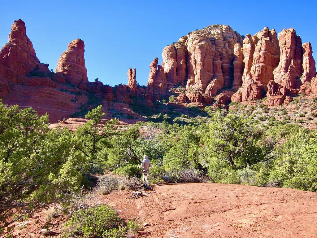
Soldier Pass Trail
Soldier Pass Trail is approximately 4.5 miles round trip.
©Dawn Minkow/Shutterstock.com
Next on our list of Arizona’s most beautiful and iconic hiking trails is the Soldier Pass Trail. Also residing in the Coconino National Forest is yet another hiking gem. Soldier Pass Trail is a moderate out-and-back trail that spans approximately 4.5 miles round trip, with an elevation gain of about 839 feet. Moreover, it is a moderately challenging hike. Though it is still regarded as family-friendly.
One of the trail’s prominent features is the Seven Sacred Pools, a series of picturesque natural pools. Another notable feature is the intriguing Devil’s Kitchen sinkhole. These geological wonders are surrounded by the stunning red rock scenery that defines Sedona’s landscape. Furthermore, as you meander through this trail, you’ll have the opportunity to spot local wildlife. Some wildlife include deer, javelina, and an array of desert birds and reptiles.
Like many of the trails in Arizona, Soldier Pass Trail exemplifies the relationship between outdoor exploration and the preservation of natural wonders. It provides a family-friendly hiking experience that showcases the diverse beauty of Arizona’s desert landscape.
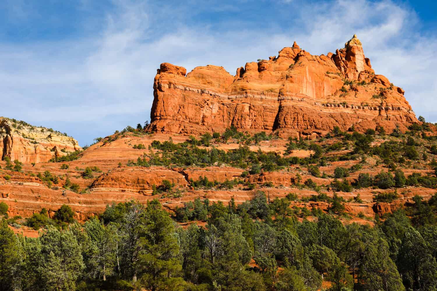
Boynton Canyon Trail
Located in Sedona, AZ, Boynton Canyon Trail is approximately 7.2 miles round trip.
©Ann Talbot/iStock via Getty Images
Boynton Canyon Trail, which also resides in the captivating landscape of Sedona, Arizona, offers a serene and immersive hiking experience. This out-and-back trail covers approximately 7.2 miles round trip, according to AllTrails. Moreover, it has a moderate elevation gain of about 964 feet. It is another incredibly popular hike amongst locals and visitors alike.
The trail’s focal point is the canyon floor and surrounding landscape. It emanates a serene and enchanting atmosphere. Additionally, the Boynton Vortex, a sought-after spot for spiritual or energy seekers, can be found along the trail. The vibrant red rock walls of the canyon create a stunning backdrop, serving as a canvas for nature’s artistry. Additionally, you are allowed to bring your dog on this trail. But they must be kept on a leash.
As you traverse Boynton Canyon, keep an eye out for the unique flora and fauna of the desert environment, including resilient yucca plants and the swift-footed jackrabbits that call this terrain home.
Cathedral Rock Trail
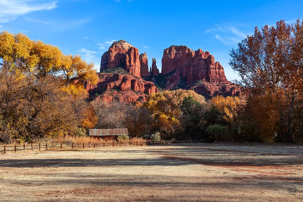
Cathedral Rock Trail is approximately 1.2 miles round trip.
©mdesigner125/iStock via Getty Images
Next on our list of Arizona’s most beautiful and iconic hiking trails is Cathedral Rock Trail. Situated amidst the enchanting red rock scenery of Sedona, Cathedral Rock Trail is a short but strenuous out-and-back hiking adventure that spans approximately 1.2 miles round trip, with an elevation gain of about 741 feet. While this trail may not be recommended for young children due to its challenge, it is still a popular trail for hikers of all ages and promises an adventurous experience in one of Arizona’s most iconic regions. There is a considerable amount of scrambling, so use your best judgment if this is the hike for you.
The focal point of the trail is Cathedral Rock. This remarkable red rock formation draws visitors from around the world. The rock’s towering spires and majestic presence create a powerful backdrop for hikers and nature enthusiasts alike. It’s another place where many people experience the Earth’s natural beauty and energetic connection converge.
As you ascend to Cathedral Rock, you’re treated to sweeping panoramic views of the Sedona area and its stunning red rock landscape. While hiking, be on the lookout for desert flora and fauna, including cacti and lizards sunning themselves on the warm rocks. Furthermore, though dogs are allowed, it is advised to leave your pups at home for this adventure, as the steep scrambling sections are not well-suited for the majority of our four-legged companions.
Camelback Mountain via Echo Canyon Trail

Camelback Mountain via Echo Canyon Trail is approximately 2.6 miles round trip.
©Jeremy Janus/iStock via Getty Images
Near Scottsdale, AZ, Camelback Mountain via Echo Canyon Trail offers a challenging hiking adventure that spans approximately 2.6 miles round trip. This out-and-back trail has a substantial elevation gain of around 1,522 feet. Moreover, it is known for its difficulty, making it unsuitable for young children. However, it rewards intrepid adventurers with an opportunity to witness one of Arizona’s most iconic natural landmarks.
The highlight of the trail is, of course, Camelback Mountain and the vista it provides. Camelback Mountain itself is an imposing rock formation that somewhat resembles the hump and head of a kneeling camel. The hike entails rock scrambling toward the summit and demands physical stamina. However, the payoff is the breathtaking panoramic view of Scottsdale and the vast desert expanse.
As you navigate the trail, keep your eyes peeled for desert wildlife, including the bighorn sheep, the enigmatic Gila monster, and a variety of bird species soaring through the clear desert skies.
Tom’s Thumb Trail
Tom’s Thumb is approximately 4 miles round trip.
©Robert Ansbach/iStock via Getty Images
Next on our list of Arizona’s most beautiful and iconic hiking trails is Tom’s Thumb Trail. Tom’s Thumb Trail is an out-and-back trail residing within the McDowell Sonoran Preserve in Rio Verde, AZ. It offers a challenging hiking experience that leads to the iconic granite spire known as Tom’s Thumb.
The trail is approximately 4 miles round trip, with an elevation gain of around 1,217 feet. It is a moderately difficult hike due to the steep and rocky terrain, making it better suited for experienced and surefooted hikers of all ages.
The highlight of this hike is Tom’s Thumb, a massive granite spire that stands at roughly 200 feet (61 meters). From the base of Tom’s Thumb, hikers are rewarded with beautiful views of the McDowell Mountains and the nearby Phoenix metropolitan area. Moreover, climbers experience even greater views from the top of Tom’s Thumb itself.
There are no bodies of water on this hike or fountains near the trailhead, so pack plenty of water for this desert hike. Along the trail, you may encounter a variety of desert wildlife, including desert bighorn sheep, Gila monsters, and red-tailed hawks. As with any hike, especially in the desert, hikers should prepare with proper gear, including sturdy footwear and ample water, to tackle this rugged and rewarding trail.
Horseshoe Bend Trail
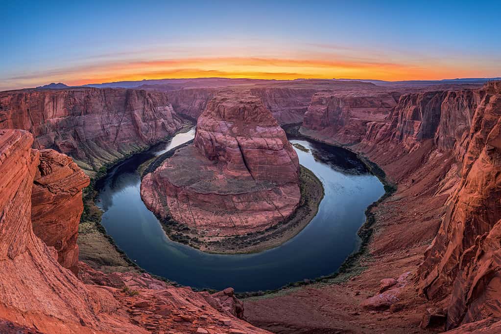
Horseshoe Bend Trail is approximately 1.5 miles round trip.
©Sean Pavone/iStock via Getty Images
Located near Page, AZ, the Horseshoe Bend Trail is a short but iconic hike that offers one of the most breathtaking and well-known vistas in the American Southwest. This relatively easy trail is approximately 1.5 miles round trip and features an easy elevation gain of around 137 feet.
The trail is family-friendly and suitable for hikers of all ages and skill levels. Its prominent feature is the awe-inspiring Horseshoe Bend overlook, where the Colorado River makes a dramatic 270-degree turn, creating a horseshoe shape within the canyon. This geological wonder presents a jaw-dropping view of the river winding through the deep sandstone canyon.
The expansive Colorado River flows below, and visitors can enjoy the spectacle from the safety of a well-protected overlook. Due to its popularity and easily accessible point, this trail is incredibly popular, and wildlife sightings may be more limited compared to other trails. Some of the most commonly sighted animals include birds, such as hawks.
Overall, Horseshoe Bend Trail is a must-visit destination for anyone in Arizona or those seeking an unforgettable view of the Colorado River’s majestic meander through the Arizona desert landscape.
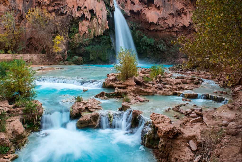
Havasu Falls, Mooney Falls, and Beaver Falls
Havasu Falls, Mooney Falls, and Beaver Falls Trail are approximately 24.4 miles round trip.
©daniloforcellini/iStock via Getty Images
Next on our list of Arizona’s most beautiful and iconic hiking trails are Havasu Falls, Mooney Falls, and Beaver Falls Trail. Residing within the Havasupai Indian Reservation near Supai, AZ, the Havasu Falls, Mooney Falls, and Beaver Falls Trail is a bucket-list out-and-back hike with stunning turquoise waterfalls and striking desert scenery.
This challenging trail spans approximately 24.4 miles round trip. It has varying elevation gains depending on the sections you explore, with an overall elevation gain of 3,664 feet. The nature of this trail is generally strenuous, with steep descents and climbs. It is best suited for experienced backpackers. Hikers and families with older children can also enjoy a more moderate portion of the trail.
The prominent features of this hike are the cascading waterfalls. These waterfalls include Havasu Falls, Mooney Falls, and Beaver Falls. With its vast size and vivid turquoise waters, Havasu Falls is particularly famous and is the trail’s primary attraction. However, Mooney Falls and Beaver Falls are equally as spectacular.
The trail follows Havasu Creek, and you’ll need to cross the creek multiple times, offering refreshing opportunities to cool off. Wildlife in this lush desert oasis includes native fish species, birds, and the occasional mule deer.
You are required to obtain a permit to access the Havasu Falls area. You must plan due to limited availability. Moreover, permits are issued by the Havasupai Indian Reservation. This trail provides a once-in-a-lifetime backpacking opportunity to witness some of the most beautiful waterfalls in the American Southwest.
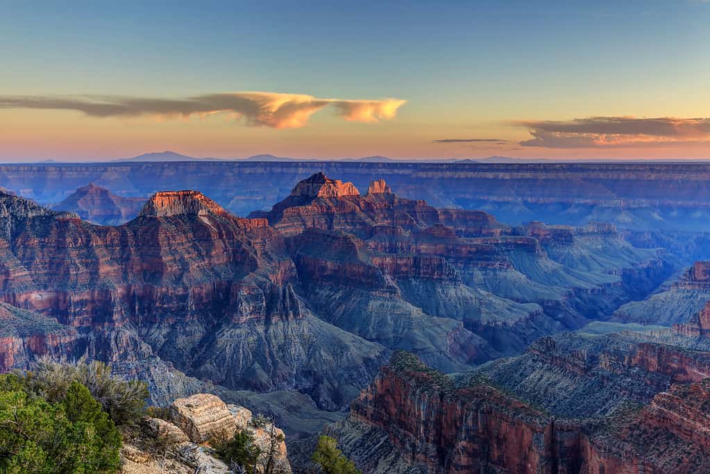
Bright Angel Trail
Bright Angel Trail is approximately 15.3 round trip.
©jamesvancouver/iStock via Getty Images
Situated in the heart of the Grand Canyon National Park, the Bright Angel Trail is a classic, challenging out-and-back trail. It is the most popular trail in the park and offers unparalleled views. This historic trail stretches approximately 15.3 miles round trip, with a significant elevation gain of around 4,478 feet. Due to its considerable length, the national park advises against day hikes unless the intent is to hike a small section of the overall trail. Moreover, backpackers are common on this trail due to its length.
Bright Angel Trail is a strenuous trail due to its steep descent and ascent. This makes it more suitable for experienced hikers. Day hikers and families with older children can enjoy shorter segments of the trail, such as the hike to the 1.5-mile Rest House and back.
The trail’s prominent feature is the stunning Grand Canyon itself. This includes its multi-layered rock formations, colorful strata, dramatic landscapes, and incredible desert flora. As you descend, you’ll encounter waypoints offering shade, water, and rest stops along the way.
The trail follows the course of Bright Angel Creek, providing access to water for hikers. Wildlife in the canyon includes bighorn sheep, mule deer, California condors, and a wide variety of other desert creatures.
Hiking the Bright Angel Trail requires careful preparation. The trail is long and strenuous, and temperatures can soar well above 100 degrees Fahrenheit (37.8 degrees Celsius) in the summer. You must obtain a backcountry permit to stay in the canyon overnight, so it’s essential to check with the National Park Service. Leave your dogs at home, though, as they aren’t allowed on this trail.
Shoshone Point
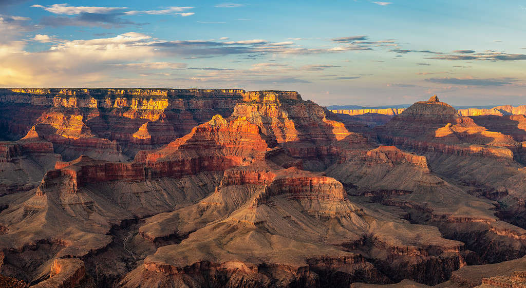
Shoshone Point Trail is approximately 2.1 miles round trip.
©Craig Zerbe/iStock via Getty Images
Last on our list of Arizona’s most beautiful and iconic hiking trails is Shoshone Point Trail. Shoshone Point is also within Grand Canyon National Park. It offers a unique and easy hiking experience with stunning panoramic views of the Grand Canyon. This short and family-friendly out-and-back trail is approximately a 2.1-mile round trip. The trail features a minimal elevation gain of roughly 154 feet and is accessible via a flat and well-maintained path. This makes it suitable for hikers of all skill levels. Moreover, it’s an ideal choice for those seeking a quick but rewarding hike with unparalleled vistas.
The prominent feature of Shoshone Point is the breathtaking overlook itself. It provides unobstructed views of the Grand Canyon’s expansive landscapes, in addition to the thriving ponderosa pine forest. It’s an excellent spot for sunrise or sunset photography and provides plenty of opportunities for birdwatchers. Furthermore, it offers a peaceful setting for contemplation and reflection amongst nature’s grandeur.
The photo featured at the top of this post is © daniloforcellini/iStock via Getty Images


How to Add Us to Google News


Thank you for reading! Have some feedback for us? Contact the AZ Animals editorial team.