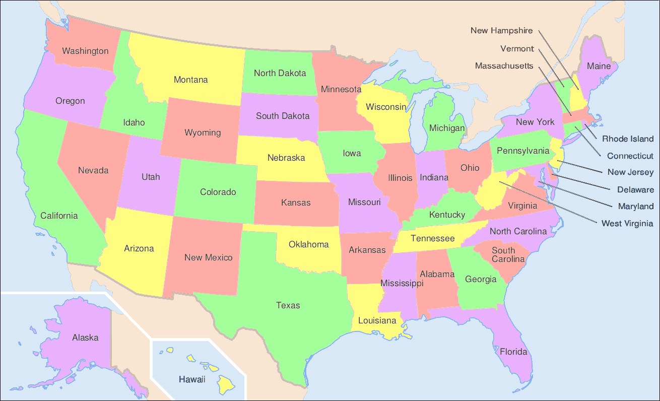

Introduction
Did you know that the largest state in America covers over 420 million acres? This massive state measures around one-fifth of the size of the contiguous United States, excluding Alaska and Hawaii. In addition, no other state rivals the size of the largest state; the second-largest state measures nearly 2.5 times smaller in total area. Discover the top six largest states in America and compare the rankings and total areas of all 50 states.
#6 Arizona
The sixth-largest state by total area is Arizona, which covers around 113,990 square miles–or 295,233 square kilometers. In addition, the acreage of this state measures some 72.954 million acres. Arizona became the 48th and final contiguous state admitted into the Union on Valentine’s Day of 1912. Furthermore, the population of Arizona numbers around 7.359 million residents, and the state capital is Phoenix.
Five Arizona Facts
- Arizona’s climate ranges from arid to semiarid to humid, depending on the region and time of year. During July, the city of Phoenix sees maximum temperatures averaging 106ºF, as Arizona records exceptionally high temperatures.
- Wildlife in Arizona includes mammals like black bears, antelopes, or javelinas, which are wild pigs. In addition, a wide variety of bird species–including quail, doves, and turkeys–call this state home.
- Arizona’s main industries include manufacturing, technology development, services, and resource extraction.
- This state features the famous Grand Canyon, which stretches a maximum of 18 miles wide and around 277 miles long.
- Arizona does not participate in daylight savings time, during which people set their clocks either an hour ahead or an hour behind according to the season.
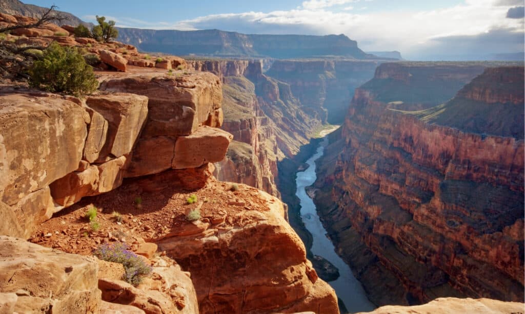
Tourism of sites like the Grand Canyon helps to support Arizona’s economy.
©sumikophoto/Shutterstock.com
#5 New Mexico
New Mexico sits at rank number five on the list of the largest states in America by total area, covering around 121,590 square miles. Furthermore, New Mexico’s area translates to approximately 314,917 square kilometers–or 77.818 million acres. Like Arizona, New Mexico became an official U.S. state in 1912, and the capital of the state is Santa Fe.
Five New Mexico Facts
- New Mexico’s climate sees average yearly temperatures in the mid-50s and varied precipitation throughout the state. However, the hottest parts of New Mexico may experience temperature extremes up to 120ºF.
- Examples of animals found in New Mexico include mule deer, rattlesnakes, minks, bobcats, and around 300 unique bird species.
- Some industries that support New Mexico’s economy include mining, oil production, tourism, manufacturing, and government spending.
- 23 different Native American tribes call New Mexico home.
- Around 50 wineries reside in New Mexico, and the state is well-known for its incredible wine.
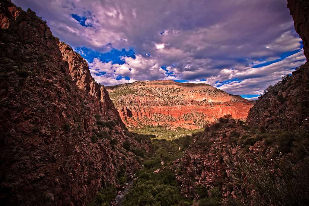
New Mexico’s climate may be extremely arid or hot in certain regions, reaching temperatures of 120ºF.
©photoBeard/Shutterstock.com
#4 Montana
With a population of 1.123 million residents, Montana is certainly not the largest state by population. However, it is the fourth-largest state by total area, covering around 147,040 square miles. In addition, the state stretches across 380,832 square kilometers–or 94.106 million acres. Montana was admitted into the Union on November 8, 1889, and the capital of Montana is Helena.
Five Montana Facts
- The climate of Montana is semiarid. Summers in this state are hot while winters can be bitterly cold. Although Montana infrequently sees heavy snowfall, freezes are common, occurring more than 200 days every year.
- Some wildlife in Montana includes moose, grizzly bears, bighorn sheep, mule deer, elk, bobcats, bald eagles, and more.
- Montana’s economy mainly relies on agriculture, mining, forestry, and tourism.
- The term “Montana” derives from the Spanish word “montaña,” meaning “mountain.”
- Nearly half of Montana’s population lives in rural areas while around one-fourth of the entire United States population lives in rural areas.
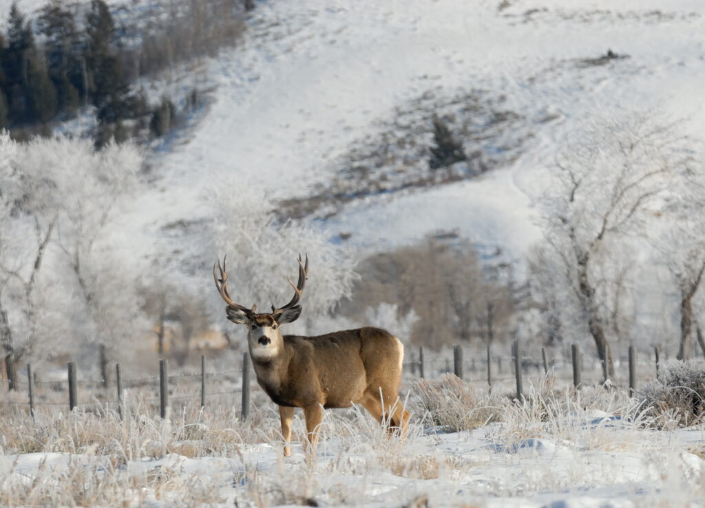
One animal found in Montana is the mule deer, which may be found in deserts with vegetation or mountain forests.
©Kirk Geisler/Shutterstock.com
#3 California
Introduced as the 31st state of the United States in 1850, California has grown substantially since its admission. In fact, California holds the title of the most populous state in the country with a population numbering 39.029 million residents. In addition, the total area of California stretches across 163,695 square miles, making it the third-largest state in America. The state also covers 423,968 square kilometers–or 104.765 million acres. Finally, the capital of California is Sacramento.
Five California Facts
- The climate of California is generally warm, but some cities experience lower average temperatures than others. For instance, while Death Valley sees temperatures well above 100ºF during summer, San Francisco experiences an average annual temperature between 50ºF and 60ºF.
- Some animals that can be encountered in California include black bears, jackrabbits, rattlesnakes, California jays, and over 400 mammal species.
- Industries like electronics manufacturing, technology development, aerospace, film, tourism, and agriculture make up the largest supporters of California’s economy.
- The population of California is larger than the population of the entire country of Canada.
- Over 100,000 earthquakes shake the state of California every year. Fortunately, though, most of these earthquakes are minor and cause no damage.

Sacramento is the capital of California, which is the third-largest state in the country.
©iStock.com/miroslav_1
#2 Texas
The population of Texas lies around 30.030 million residents, and the state covers an incredible 268,596 square miles. In addition, the total area of Texas measures approximately 695,660 square kilometers, which translates to 171.901 million acres. Texas ranks as the second-largest state in the country, and it was admitted into the Union in 1845, over a century before the admission of the largest U.S. state. Furthermore, the capital of Texas is Austin.
Five Texas Facts
- The climate of Texas is usually considered very warm or even blisteringly hot due to its geographic location. However, the climate in Texas varies by region. In addition, the state is prone to experiencing weather extremes like hurricanes or intense heat waves.
- Wildlife in Texas includes over 100 snake species, alligators, bison, livestock, and black bears.
- The primary industries in Texas are oil and natural gas production, banking, manufacturing, insurance, aerospace research and development, and medical research.
- Austin, Texas is considered the live music capital of the world.
- Many people often refer to Texas as the “battiest state” because it has more bat species than any other state in the U.S.
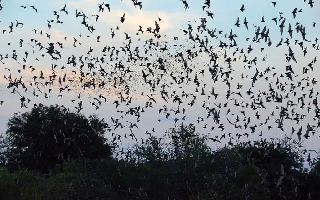
Texas is home to the greatest number of bat species in America.
©Jeff Reeves/Shutterstock.com
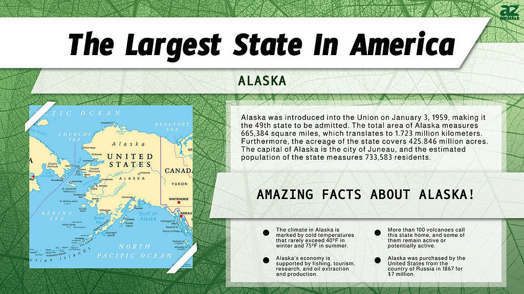
#1 Alaska
Alaska was introduced into the Union on January 3, 1959, making it the 49th state to be admitted. The total area of Alaska measures 665,384 square miles, which translates to 1.723 million kilometers. Furthermore, the acreage of the state covers 425.846 million acres. The capital of Alaska is the city of Juneau, and the estimated population of the state measures 733,583 residents.
Five Alaska Facts
- Like Texas, Alaska’s climate varies by region, as its area is so large. Overall, though, the climate in Alaska is marked by cold temperatures that rarely exceed 40ºF in winter and 75ºF in summer.
- Examples of animal life in Alaska include sea otters, musk oxen, grizzly bears, moose, and wolves.
- Alaska’s economy is supported by fishing, tourism, research, and oil extraction and production.
- More than 100 volcanoes call this state home, and some of them remain active or potentially active.
- Alaska was purchased by the United States from the country of Russia in 1867 for $7 million.

Fishing supports Alaska’s economy as a major industry.
©Krasowit/Shutterstock.com
What is the Smallest State in America by Total Area?
Rhode Island is the smallest U.S. state with a total area covering approximately 1,545 square miles. In addition, Rhode Island measures 4,001 square kilometers and 988,800 acres. The population of Rhode Island lies around 1.094 million residents, as of 2022. Furthermore, the state was admitted into the Union in 1790, and the capital of Rhode Island is Providence.
Five Rhode Island Facts
- The climate in Rhode Island is characterized by cooler temperatures year-round and weather variability. The average annual temperature in this state measures 50ºF, and some extreme weather occurrences include coastal Nor’easters and abundant snowfall.
- Some animal species found in Rhode Island include white-tailed deer, wild turkeys, beavers, rabbits, and red or gray foxes.
- The main industries in Rhode Island are tourism, medical services, education, and business services like insurance and finance.
- Rhode Island claims the shortest state motto in the country at only four letters: “Hope.”
- This state was the first to abolish the practice of slavery in 1652. In fact, the colony abolished slavery before it became an official U.S. state.
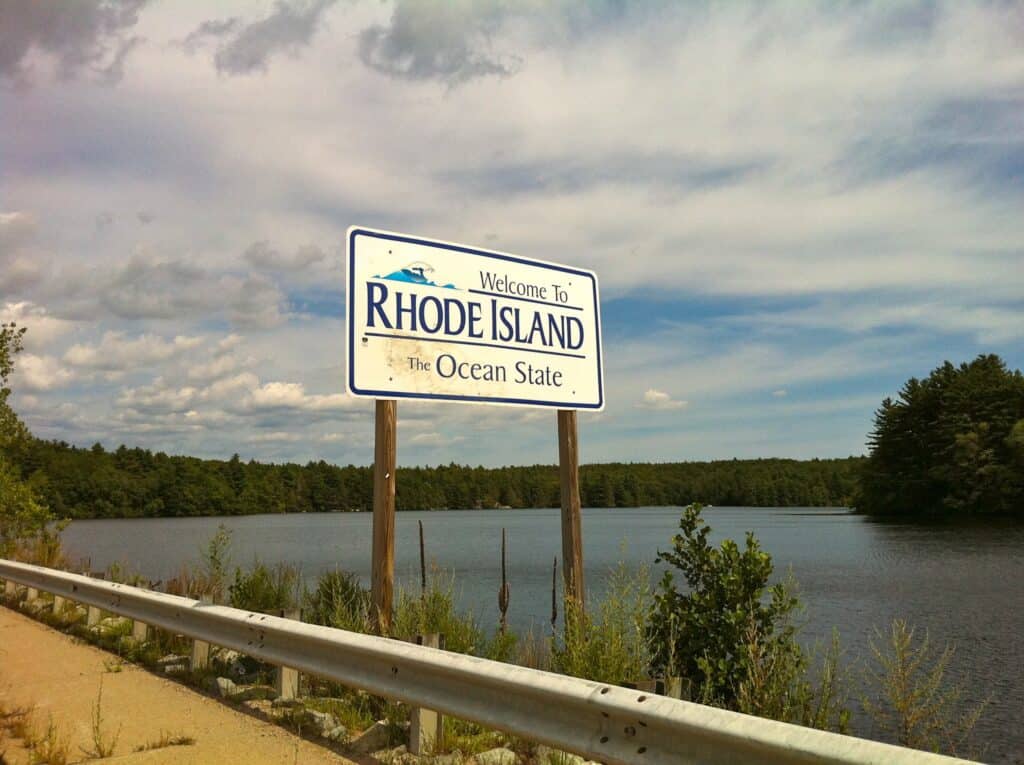
The smallest state in America by total area–Rhode Island–covers 1,545 square miles.
What About Washington D.C.?
Washington D.C. is neither a state nor a part of another state. Rather, Washington D.C. is considered a district, and it is the capital of the United States. However, the District of Columbia must abide by several federal laws applicable to states, just as other states do. Thus, while Washington D.C. is not a state, it may be treated like one, and it records the smallest total area when compared to any U.S. state.
The total area of the District of Columbia measures only 68 square miles, which translates to 176 square kilometers. In addition, the acreage of Washington D.C. measures 43,520 acres. By comparison, Rhode Island, which is the smallest state, boasts an area nearly 23 times larger than the area of Washington D.C.

Washington D.C. does not belong to any state, and its total area measures less than any other state in the U.S. at 68 square miles.
©iStock.com/Sean Pavone
Ranking of All 50 U.S. States by Total Area (Including Washington D.C.)
| Rank | State | Area (mi2) | Approximate Area (km2) | Approximate Acreage |
|---|---|---|---|---|
| #1 | Alaska | 665,384 | 1,723,337 | 425,845,760 |
| #2 | Texas | 268,596 | 695,660 | 171,901,440 |
| #3 | California | 163,695 | 423,968 | 104,764,800 |
| #4 | Montana | 147,040 | 380,832 | 94,105,600 |
| #5 | New Mexico | 121,590 | 314,917 | 77,817,600 |
| #6 | Arizona | 113,990 | 295,233 | 72,953,600 |
| #7 | Nevada | 110,572 | 286,380 | 70,766,080 |
| #8 | Colorado | 104,094 | 269,602 | 66,620,160 |
| #9 | Oregon | 98,379 | 254,800 | 62,962,560 |
| #10 | Wyoming | 97,813 | 253,335 | 62,600,320 |
| #11 | Michigan | 96,714 | 250,488 | 61,896,960 |
| #12 | Minnesota | 86,936 | 225,163 | 55,639,040 |
| #13 | Utah | 84,897 | 219,882 | 54,334,080 |
| #14 | Idaho | 83,569 | 216,443 | 53,484,160 |
| #15 | Kansas | 82,278 | 213,099 | 52,657,920 |
| #16 | Nebraska | 77,348 | 200,330 | 49,502,720 |
| #17 | South Dakota | 77,116 | 199,730 | 49,354,240 |
| #18 | Washington | 71,289 | 184,638 | 45,624,960 |
| #19 | North Dakota | 70,698 | 183,107 | 45,246,720 |
| #20 | Oklahoma | 69,899 | 181,038 | 44,735,360 |
| #21 | Missouri | 69,707 | 180,540 | 44,612,480 |
| #22 | Florida | 65,758 | 170,312 | 42,085,120 |
| #23 | Wisconsin | 65,496 | 169,634 | 41,917,440 |
| #24 | Georgia | 59,425 | 153,910 | 38,032,000 |
| #25 | Illinois | 57,914 | 149,997 | 37,064,960 |
| #26 | Iowa | 56,273 | 145,746 | 36,014,720 |
| #27 | New York | 54,555 | 141,297 | 34,915,200 |
| #28 | North Carolina | 53,819 | 139,391 | 34,444,160 |
| #29 | Arkansas | 53,179 | 137,733 | 34,034,560 |
| #30 | Alabama | 52,420 | 135,767 | 33,548,800 |
| #31 | Louisiana | 52,378 | 135,658 | 33,521,920 |
| #32 | Mississippi | 48,432 | 125,438 | 30,996,480 |
| #33 | Pennsylvania | 46,054 | 119,279 | 29,474,560 |
| #34 | Ohio | 44,826 | 116,099 | 28,688,640 |
| #35 | Virginia | 42,775 | 110,787 | 27,376,000 |
| #36 | Tennessee | 42,144 | 109,152 | 26,972,160 |
| #37 | Kentucky | 40,408 | 104,656 | 25,861,120 |
| #38 | Indiana | 36,420 | 94,327 | 23,308,800 |
| #39 | Maine | 35,380 | 91,634 | 22,643,200 |
| #40 | South Carolina | 32,020 | 82,931 | 20,492,800 |
| #41 | West Virginia | 24,230 | 62,755 | 15,507,200 |
| #42 | Maryland | 12,406 | 32,131 | 7,939,840 |
| #43 | Hawaii | 10,932 | 28,314 | 6,996,480 |
| #44 | Massachusetts | 10,554 | 27,335 | 6,754,560 |
| #45 | Vermont | 9,616 | 24,905 | 6,154,240 |
| #46 | New Hampshire | 9,349 | 24,214 | 5,983,360 |
| #47 | New Jersey | 8,723 | 22,592 | 5,582,720 |
| #48 | Connecticut | 5,543 | 14,356 | 3,547,520 |
| #49 | Delaware | 2,489 | 6,446 | 1,592,960 |
| #50 | Rhode Island | 1,545 | 4,001 | 988,800 |
| #51 | District of Columbia | 68 | 176 | 43,520 |


How to Add Us to Google News


Thank you for reading! Have some feedback for us? Contact the AZ Animals editorial team.