
Introduction
New York is a state that includes several lakes, rivers, and streams. Some of these bodies of water have been dammed to provide flood control, hydroelectric power, and drinking water. What is the largest dam in New York State?
The Largest Dam in New York State
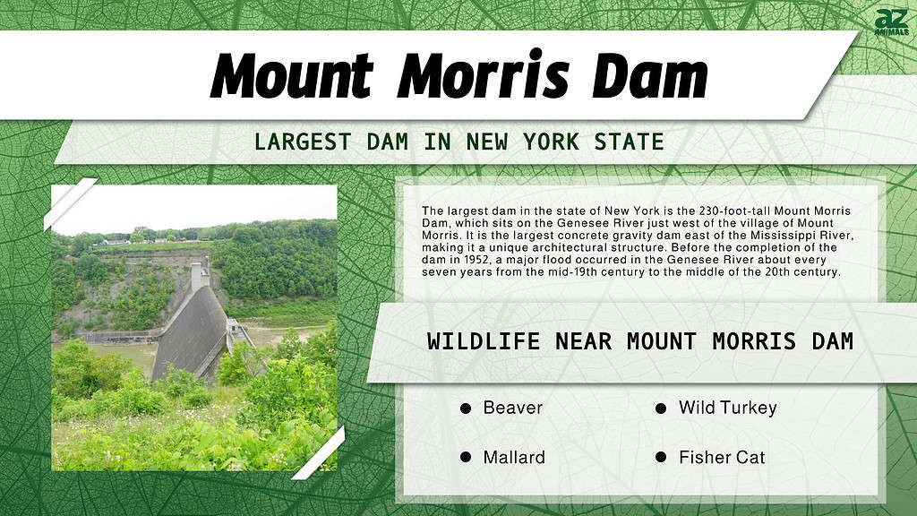
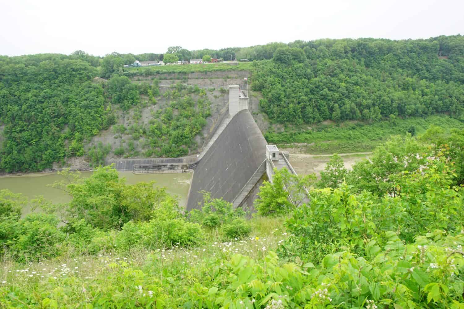
The largest dam in the state of New York is the 230-foot-tall Mount Morris Dam, which sits on the Genesee River just to the west of the village of Mount Morris. The purpose of this dam is flood control for farms, residences, businesses, and manufacturing. This includes the Genesee Valley from Mount Morris to Lake Ontario, which includes the area of Rochester, NY.
The Mount Morris Dam is the largest dam in New York State.
©quiggyt4/Shutterstock.com
The Largest Dam in New York State: Where It Is on a Map
The largest dam in the state of New York is the 230-foot-tall Mount Morris Dam, which sits on the Genesee River just to the west of the village of Mount Morris. The village is only 42 miles south of the city of Rochester, New York. Syracruse is 112 miles northeast of Mount Morris.
The Largest Dam in New York State: Design and Construction
Congress authorized the project in the 1940s under the Flood Control Act of 1944. Construction began in 1948, and the dam was completed in 1952. During the construction period, over 400 people worked on the dam. Work-related incidents cost the lives of two men. The cost for the entire project was $25 million. It is the largest concrete gravity dam east of the Mississippi River, making it a unique architectural structure. A series of rectangular conduits are built into the base of the spillway. These control the flow of water down the river.
| About the Mount Morris Dam | |
|---|---|
| Type | Concrete Gravity / Dry |
| Height | 230 feet (70 meters) |
| Total Length | 1,028 feet (313 meters) |
| Top width | 20 feet (6.1 meters) |
| Maximum height above the riverbed | 230 feet (70 meters) |
| Top elevation | 790 feet (240 meters) above sea level |
What Body of Water Does the Mount Morris Dam Control?
The Mount Morris Dam was built to provide flood control for the Genesee River, a Lake Ontario tributary. The river has several waterfalls in Rochester and Letchworth State Park. Rochester has historically received power for industry from the river—for its mills in the 19th century and through hydroelectric power today.
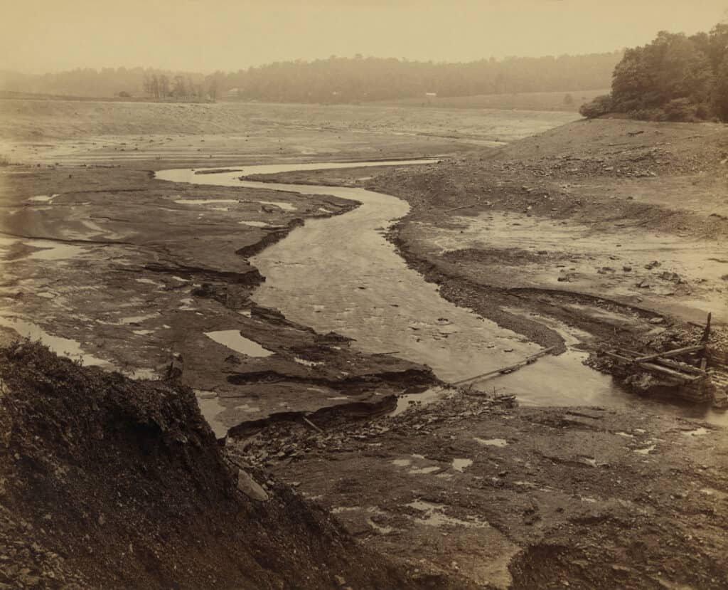
Flooding has been a problem with the river as far back as records go. Some of the floods have been incredibly destructive. The flood of 1865 released the equivalent of half the flow of Niagara Falls onto the unsuspecting villages downstream. A major flood occurred in the river about every seven years from the mid-19th century to the middle of the 20th century.
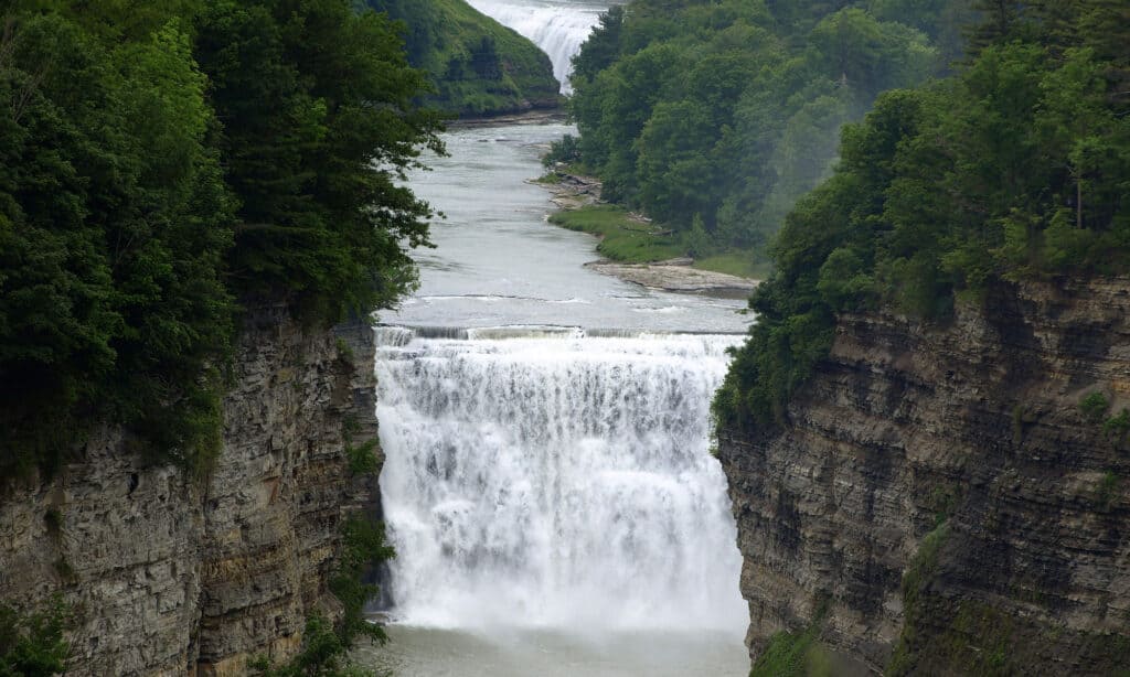
The mighty Genesee River was a flood risk until the completion of the Mount Morris Dam—the largest dam in New York.
©iStock.com/Ravi Natarajan
Wildlife Near Mount Morris Dam
The area near the Mount Morris Dam includes some diverse wildlife habitats due to the presence of the Genesee River. The region includes brushland, forests, wetlands, and open fields. The Genesee River Wildlife Management Area monitors and manages such wildlife as the wild turkey, ruffed grouse, white-tail deer, black bear, beaver, muskrat, mallard, wood duck, raccoon, fisher cat, and red and gray fox, as well as migratory songbirds.
What Would Happen if the Mount Morris Dam Ever Failed?
If the Mount Morris Dam ever failed completely, the sudden release of water could overwhelm the villages of Mount Morris, Avon, and Scottsville. Rochester, and the towns of Brighton, Geneseo, and Irondequoit, would also be at risk. Mount Morris’s proximity to the dam would allow for minimal warning before flood waters arrive. A flood would destroy bridges across the Genesee River, including those over I-90, I-390, I-490, and I-590. A breach of the dam at maximum high water levels could endanger the lives of over 40,000 people and have an economic cost of nearly $4.5 million.
A dam collapse can be devastating.
©Everett Collection/Shutterstock.com
Conclusion
The Mount Morris Dam is the largest dam in the state of New York. The control it provides for the floodwaters of the Genesee River ensures that the people in the region below the dam can live their lives and conduct their business without fear of catastrophic flooding.
The photo featured at the top of this post is © Alyssa Cerny/Shutterstock.com


How to Add Us to Google News


Thank you for reading! Have some feedback for us? Contact the AZ Animals editorial team.