You might think that true north and magnetic north are the same thing, but, to the surprise of many, they are actually different.
So, what is true north vs. magnetic north? The simple explanation is that true north is a fixed point that people can easily mark on a globe or a map. Another name for true north is the geographic north pole.
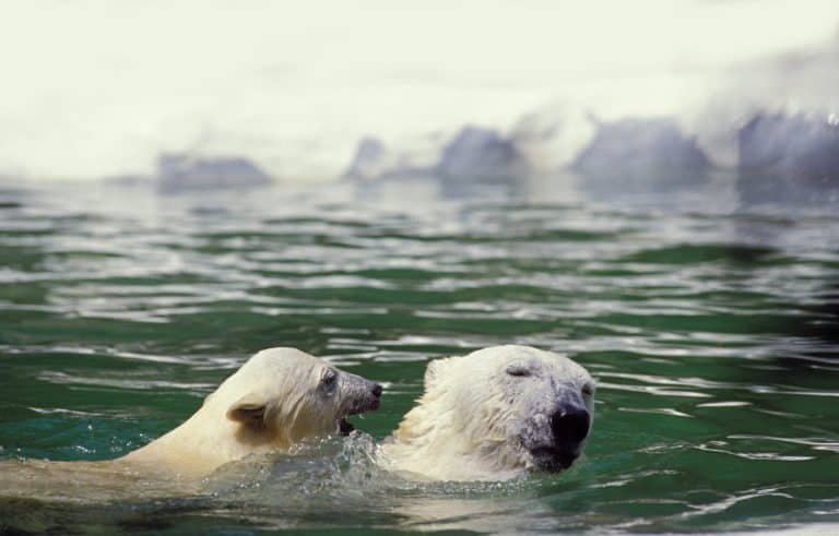
Compasses point towards magnetic north which is different than true north.
©Triff/Shutterstock.com
Magnetic north is where a compass’s needle points. Compasses work because they align with the earth’s magnetic field. The magnetic north is constantly shifting. Its current location is between Canada and Russia, near Ellesmere Island. This is actually about 310 miles away from the geographic north pole.
Magnetic north moves about 34 miles per year and has been shifting in this direction since people started tracking its movement, around the year 1900. Another name for magnetic north is the geomagnetic north pole or the north magnetic pole.
Understanding Earth’s Magnetic Field and How It Affects Navigation
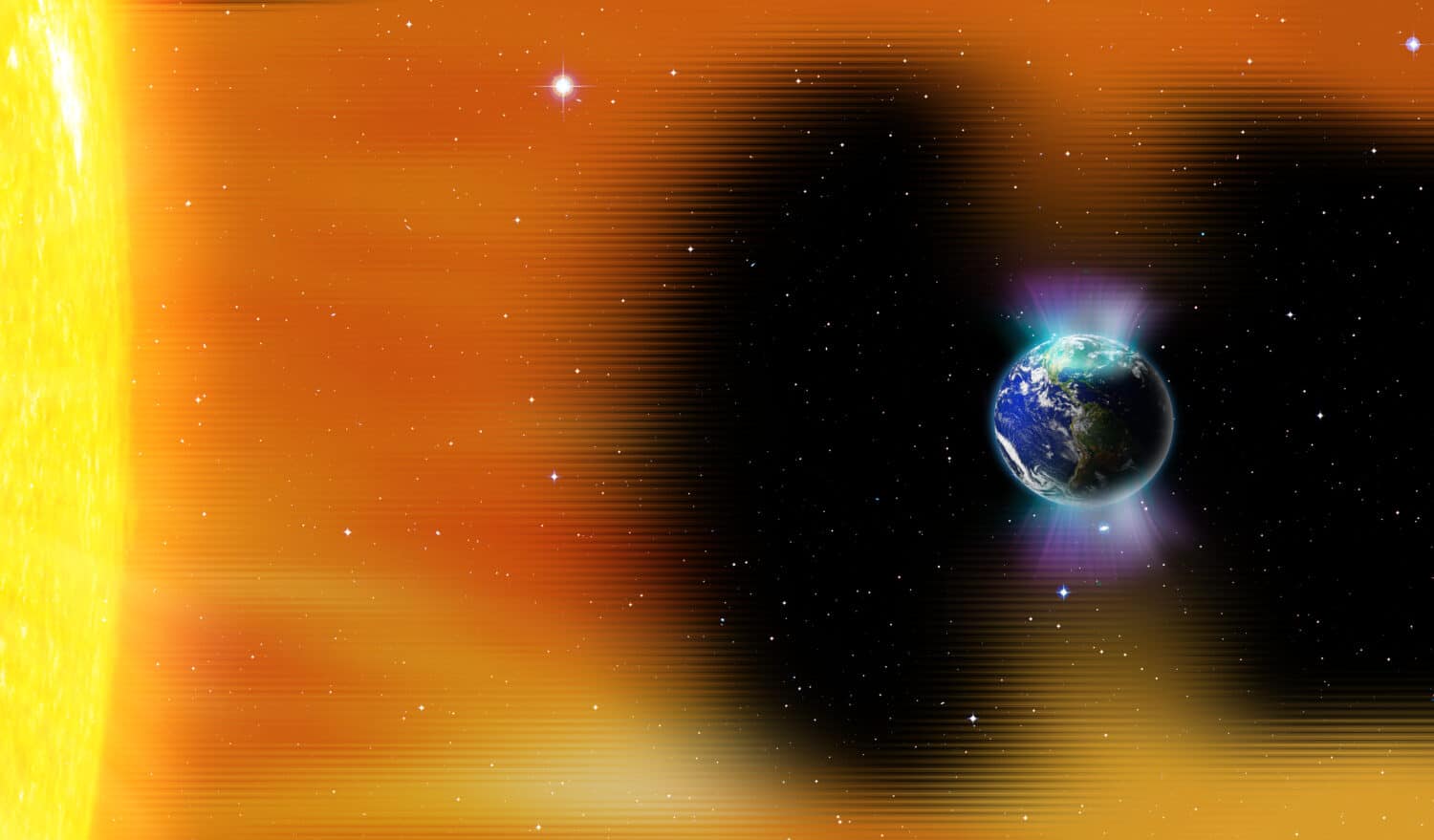
Earth has a magnetic field that makes life on Earth possible. Without it, life would look quite different. Our magnetic field protects the planet from harmful solar wind particles. Without our magnetic field, our atmosphere would not be possible, and we’d have no air to breathe. It also protects us from a lot of the radiation found in space. Examples of planets that do not have magnetic fields include Mars and Venus.
The Earth’s magnetic field is created by several things that are unique to our planet. First, our planet’s core consists of liquid molten iron. As the Earth rotates, the liquid iron moves slowly creating electric and magnetic energy. This process creates a loop that makes more electric and magnetic energy, resulting in our magnetic field.
This magnetic field also serves an important purpose in helping people navigate around the globe. Before GPS technology, this was essential for travel.
The First Compasses
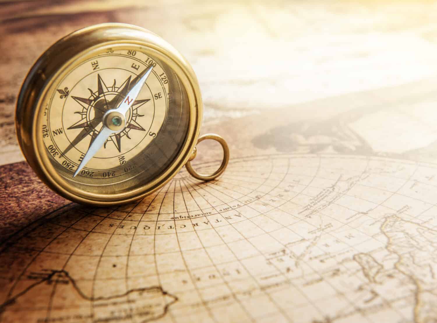
Before our modern era, people used the stars for navigation. However, they are not always visible during storms or during the day, so another method was needed. Compasses became a useful tool. They consist of a magnetized stone mounted in a way that allows it to spin freely.
Historians are not exactly sure when the first compass was developed, but they believe it was in China sometime around the 11th century CE. They were first seen in European navigation at the end of the 12th century CE. Experts believe that the Chinese were the first to discover that a magnetized stone would point to the north as early as 2,000 years ago. If you know which direction is north, you can easily determine which direction is east, west, or south.
The earliest compasses were magnetized needles attached to a piece of wood or cork that could float. This device was then placed in a dish of water. The magnetized needle would then point north. As compasses developed, the needle was placed onto a card that had the names of the directions on it. The direction north was often denoted by a T, which stands for Tramontana. This is the Latin name of the north wind. Today, many compasses still have a fleur de lis design that resembles a T for this reason.
Today’s compasses have all four directions plus 28 other points of direction indicated for better navigation.
How Magnetic North Affects Navigation
Close to the equator, the slight difference in the location of magnetic north from true north does not make much of a difference for navigation. However, closer to the poles, it can set you off course by several miles. So, scientists and engineers have developed adjustments for compasses for this variation.
Additionally, in our modern world, many vehicles that use compasses like ships and aircraft are made of metal that can affect the magnetic point of a compass. When the magnetism of a ship or plane affects a compass, it is called deviation. Some of these compasses have other magnetic components called Kelvin spheres and Flinders bars to help account for this deviation.
How to Use a Compass to Navigate
Navigating with a compass is a great skill to have. We have many modern tools to help us but batteries die, reception goes away, and electronics malfunction. Most individuals use a compass in connection with a map. Many consumer compasses have a clear background so you can hold it up to a map and see through it.
They may also have other tools to help you navigate with a map like:
- Small rulers to help you judge distance
- A static arrow called a direction-of-travel arrow. This arrow helps you see which direction you need to go in relation to the magnetic arrow pointing north
- An outer ring called a bezel. The bezel rotates and has 360 degree markings, this rotates the entire compass plate that also has orienting lines to help you align the compass with the north/south direction on a map. At the top of the bezel is an index line that helps you reference the results you get from your compass.
- An orienting arrow that is used in conjunction with the bezel and fits the needle inside of it exactly.
Before you use a compass, you will need to know how to not only use a map to get around but also how to use it to recognize your surroundings. In the wilderness map cues like contour lines that show elevation, peaks of mountains, and bodies of water can help you to figure out where you are.
Taking a Bearing
Follow these steps to use a compass to do what is called “taking a bearing” with a map:
- Once you are oriented to your map, mark your current location.
- Mark the location where you want to go.
- Draw a straight line between the two.
- Place the straight edge of your compass along the line with the direction-of-travel arrow pointed in the direction you need to go.
- Turn the bezel until the north-south orienting lines on the compass align with the north-south direction on your map.
- Check where the index line is on the bezel.
- Hold the compass with the direction-of-travel arrow pointed away from you and move until the magnetic arrow is inside of the orienting arrow. Make sure the index line is still at the same point on the bezel. Once the magnetic arrow is aligned with the orienting arrow, you will be traveling in the right direction.
Orienting Yourself
You can also do these steps sort of in the opposite order to orient yourself to a map and find out where you are. Follow these steps to orient yourself and find your approximate location using a map:
- Find a recognizable landmark around you like a body of water or mountain.
- Point your direction-of-travel arrow toward the landmark.
- Rotate the compass bezel until the needle is in the orienting arrow and take note of the bezel reading at the index line.
- Put a corner of the straight side of your compass on the landmark, while keeping the compass pointed at the landmark, and rotate the baseplate (not the bezel; keep the bezel reading the same) until the north-south lines align with the north-south lines on your map and the north marker on the compass is pointing north.
- Draw a line from the landmark to your current location.
- Repeat this step with at least two other landmarks.
- Where the three lines intersect is your location.
Celestial Navigation for Finding True North
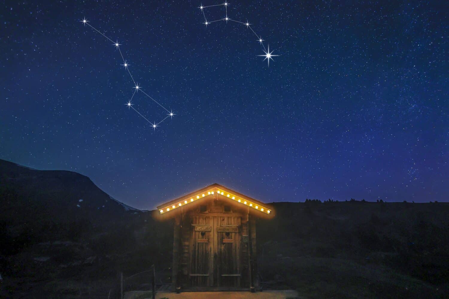
At night, you can use the stars for navigation. Polaris, also known as The North Star, remains very close to true north at all times. It is visible in the Northern Hemisphere. In order to find this, you will have to know a few constellations. These other constellations give you a map in the sky for how to find Polaris.
The Little Dipper, also known as Ursa Minor, is perhaps the most important constellation for finding Polaris. The last star on the “handle” of the dipper is Polaris.
However, because it is brighter, some people find it is easier to use the Big Dipper, also known as Ursa Major, to find Polaris. Once you find the Big Dipper, look at the two stars on the front of the dipper part of the shape. These stars are called Merak and Dubhe. Follow the line from Merak, the lower star, to Dubhe, and keep going. Polaris is located about five times the distance between Merak and Dubhe in that direction.
When the Little Dipper is too low in the sky, some people also use Cassiopeia to find Polaris. This is a “W” shaped constellation on the other side of the Little Dipper from the Big Dipper. Make a line that bisects the shallower dip of the W over the star that bisects that section. Follow that line towards the big dipper and you will find Polaris.
In the Southern Hemisphere, people can use another constellation, the Southern Cross, for navigation.
Tools for Accurate Navigation
You can make a simple compass as they did in ancient times with a piece of magnetized metal fixed to something that floats. However, in our modern times, there are many more accurate tools to help with navigation.
If you’re heading off into the wilderness there are some other navigation tools you should bring in addition to your magnetic compass:
- Topographical map of the area you are in
- Pencil & paper
- Whistle (you can use it to signal to other members of your party or signal for help if lost)
- Watch – Tracking the time helps you determine how far you have gone.
- Altimeter – This can help you pinpoint your location on a map by the elevation.
Handheld compasses are most often used by people doing outdoor sports such as hiking, backpacking, and camping. A compass can help you navigate the wilderness successfully. However, there are other tools that can be used for navigation that don’t rely on our earth’s magnetic field.
1. Gyrocompass
This device is often found on ships. It uses the rotation of the earth to find true north and help ships navigate properly. They are popular for large ships because they are not affected by any magnetic materials that can disrupt magnetic compasses.
2. GPS
Most people are familiar with consumer Global Positioning Systems, also known as GPS. Apps like Google Maps, Apple Maps, and Waze help people get around efficiently on foot, by bike, in cars, and via public transit. Commercial vehicles like ships and planes also use GPS to help navigate and to make delicate maneuvers more accurate.
The downside of GPS for consumers in the wilderness is that batteries can easily die, and devices can malfunction. While GPS does not require data transmission, it does require the user to have an unobstructed sightline to four or more GPS satellites.
3. Radar
Radar is another tool that is primarily used in navigation for planes and ships. It uses radio waves to locate objects, obstructions, and landmarks to help the user identify where they are. While radar is now considered a standalone word, it was originally an acronym that stood for Radio Detection and Ranging.
4. Sonar
Similar to radar, sonar uses sound waves to help with navigation. It is mostly used for underwater navigation. It stands for sound navigation and ranging.