
Today, we’ll be learning about the map location of the 10th-largest state in the United States. Wyoming is a beautiful state that holds a plethora of wonders. Whether you live there, are just traveling through, or are specifically visiting, it’s good to know a few things about it. One of the first things we need to know is exactly where it is. Once we have this information, we can start to explore its interior. Wyoming is home to several incredible wonders of the United States. From the Grand Teton National Park to Devils Tower to Yellowstone, there is no shortage of fun to be had. So, where is Wyoming? What states does it border? We’re about to find out.
Where Is Wyoming on a Map?
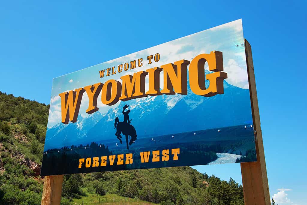
Wyoming is a state in the western portion of the United States.
©Ingo70/Shutterstock.com
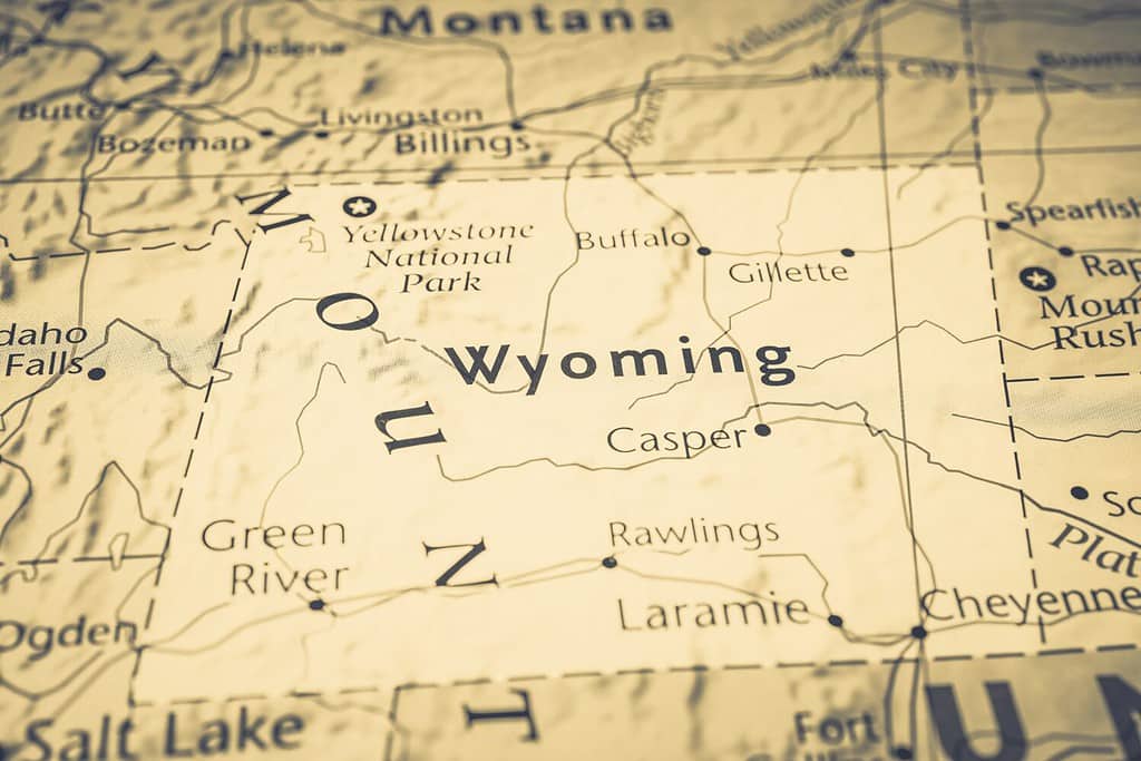
Wyoming is one of the eight states that comprise the Rocky Mountain Region. This region describes the set of states that contain the United States Rocky Mountains. Here’s a great interactive map showing its exact location.
As you can see, this perfectly rectangular state is bordered by several other states. Montana makes up the entire northern border of Wyoming, while South Dakota and Nebraska sit to the east. In the south and southwest, Colorado and Utah border Wyoming. Finally, the western side is boxed in by Idaho and a little bit of Montana. To make this information more comprehensive, we’ve put it in this helpful table below.
States That Border Wyoming
| State | Direction of Border |
|---|---|
| Montana | North and Northwest |
| South Dakota | East |
| Nebraska | East |
| Colorado | South |
| Utah | South and Southwest |
| Idaho | West |
Major Cities in Wyoming
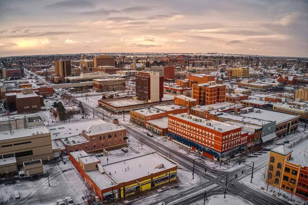
Cheyenne is the most-populated city in Wyoming.
©Jacob Boomsma/Shutterstock.com
Wyoming is the least-populated state in the United States. It has a population of 578,803 people. This population is mostly divided between 203 places – 99 incorporated and 104 census-designated. Of these places, 19 are cities and 80 are towns. The smallest city in Wyoming is Buffalo, Wyoming, with a population of 4,469. The largest city is the state capital, Cheyenne, which has a population of 65,051. All of our population data is sourced from the 2021 Census. We’re going to check out a quick table of the ten most-populated cities in Wyoming.
| City | Population |
|---|---|
| Cheyenne | 65,051 |
| Casper | 58,656 |
| Gilette | 32,884 |
| Laramie | 31,659 |
| Rock Springs | 23,196 |
| Sheridan | 19,095 |
| Evanston | 11,814 |
| Green River | 11,609 |
| Jackson | 10,849 |
| Riverton | 10,587 |
When Did Wyoming Become a State?
Wyoming became a state on July, 10th, 1890.
©Alexander Lukatskiy/Shutterstock.com
Wyoming was the 44th state to join the United States. A low population in the Wyoming Territory prevented the state from joining earlier. The Wyoming Territory was established in 1869. During that time, Congress followed a general rule that a territory needed to have at least 60,000 documented residents to enter the Union. By December 1888, the Wyoming Territory only had 55,500 residents. Joseph M. Carey, a Territorial Delegate to Congress, worked to fight against this rule in order to establish statehood. He argued several points, including stating that the true population of Wyoming was much greater than the population estimate. He also argued that several other states had been admitted to the Union with numbers lower than 60,000 residents.
Eventually, Congress agreed to admit Wyoming to the Union. President Harrison signed Wyoming’s Statehood Bill on July 10th, 1890.
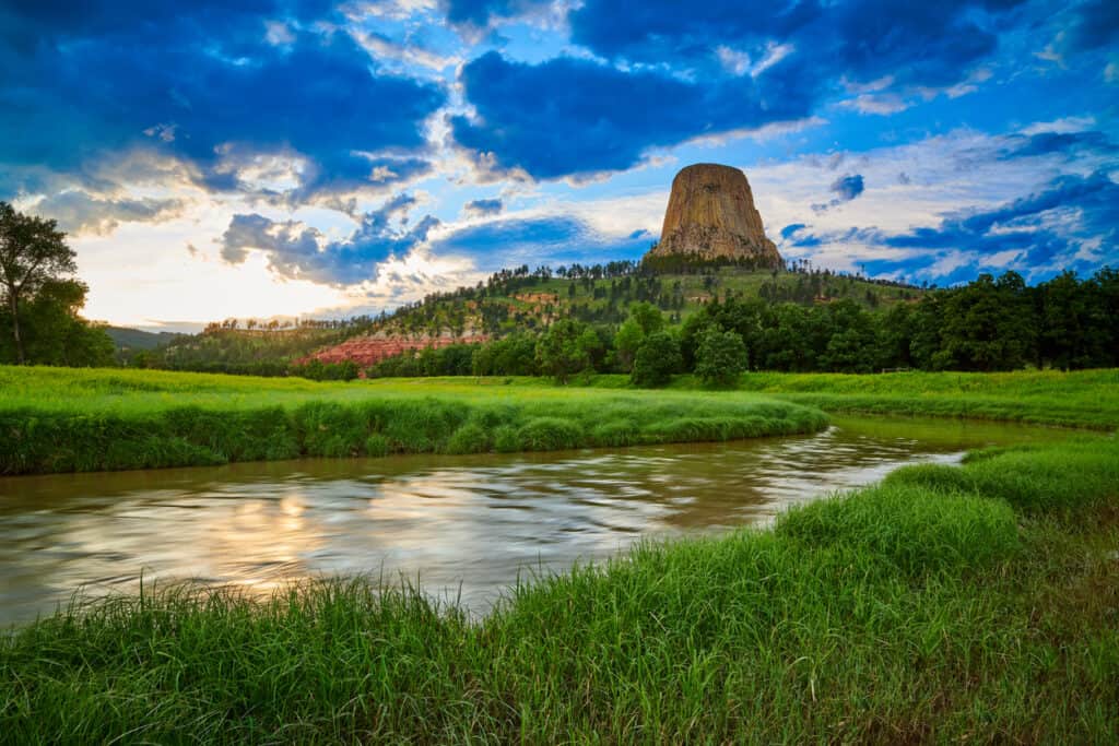
What Is Wyoming Known For?
Devils Tower National Monument is one of the most famous attractions in Wyoming.
©Sulae/Shutterstock.com
Wyoming is probably the most famous for its large array of beautiful National Parks. We’re going to look at a few of the most-visited attractions in this large and beautiful state.
Yellowstone National Park
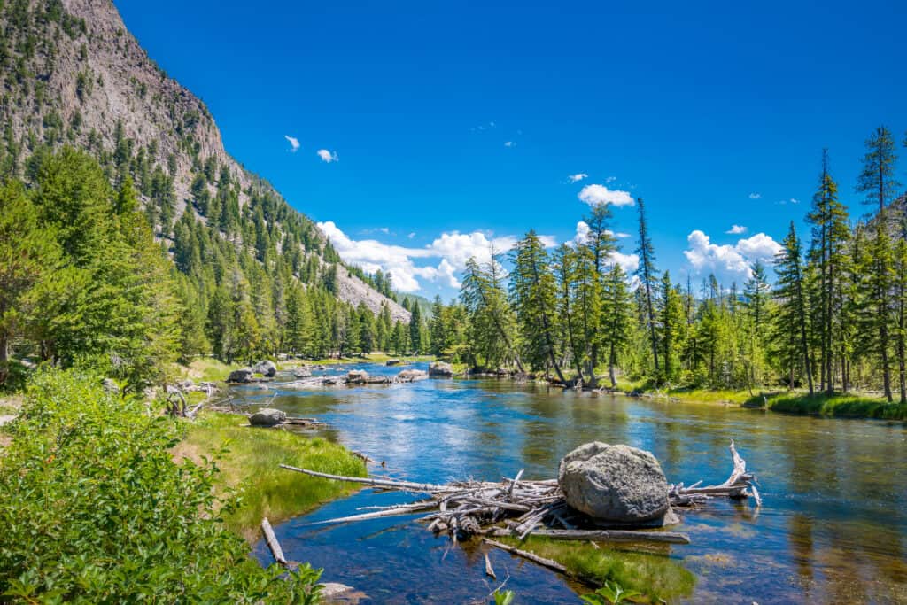
One of the most well-known places in Wyoming is Yellowstone National Park which attracts more than 3 million visitors each year.
©NaughtyNut/Shutterstock.com
Yellowstone National Park is, perhaps, the most famous attraction in Wyoming. It actually spans three states – Idaho, Montana, and Wyoming – but most of the park is contained within Wyoming. This 2.2 million acre national park contains an insane amount of incredible features, including a diverse ecosystem and about half of the world’s active geysers. The park sees over three million visitors every year.
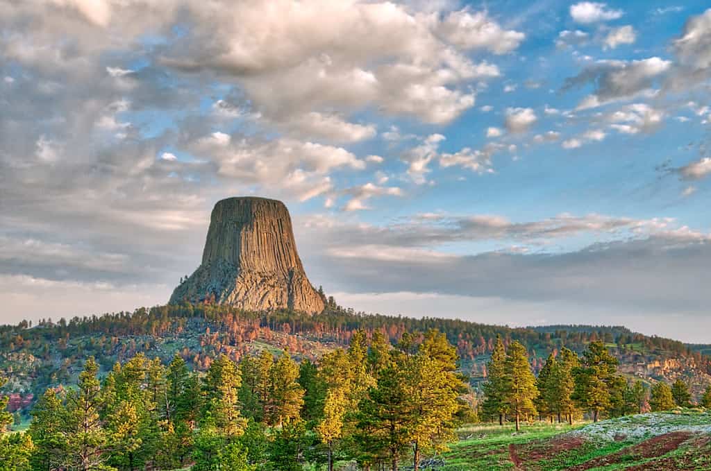
Devils Tower National Monument
America’s first national monument is Wyoming’s Devils Tower National Monument.
©iStock.com/Patrick Jennings
Devils Tower is an absolutely incredible geological feature that is sacred to over 20 Native American tribes. This incredible monument was designated as America’s first national monument in 1906. The tower reaches a base-to-summit height of 867 feet! It towers 1,267 feet above the Belle Fourche River and has an overall elevation of 5,112 feet above sea level. Over 500,000 people visit every year to hike, camp, climb, and explore.
Grand Teton National Park
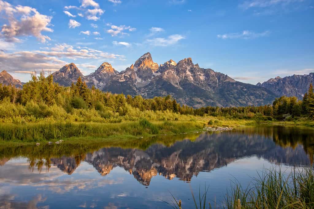
The Grand Teton has an elevation of 13,775 feet.
©R K Sewell Photography/Shutterstock.com
Grand Teton National Park is a huge park that contains and protects the Grand Teton Mountain Range. This range contains 134 named mountains, some of which are the oldest rocks in North America. The highest peak in the national park is Grand Teton, which stands at an elevation of 13,775 feet. This incredible peak has a prominence of 6,530 feet. Every year, around three million people visit the Grand Teton National Park for astounding views, hikes, wildlife, and climbing opportunities.


How to Add Us to Google News


Thank you for reading! Have some feedback for us? Contact the AZ Animals editorial team.