

Orange County is situated in Los Angeles, in Southern California, U.S. It’s often referred to by its initials O.C. Home to world-famous tourist destinations, Orange County contains 40 miles of golden coastline and several well-regarded universities, but does it contain much wildlife, and what about hiking? This article will discover the epic path to the highest point in Orange County, where it is, and what you can see.
Orange County’s Highest Point
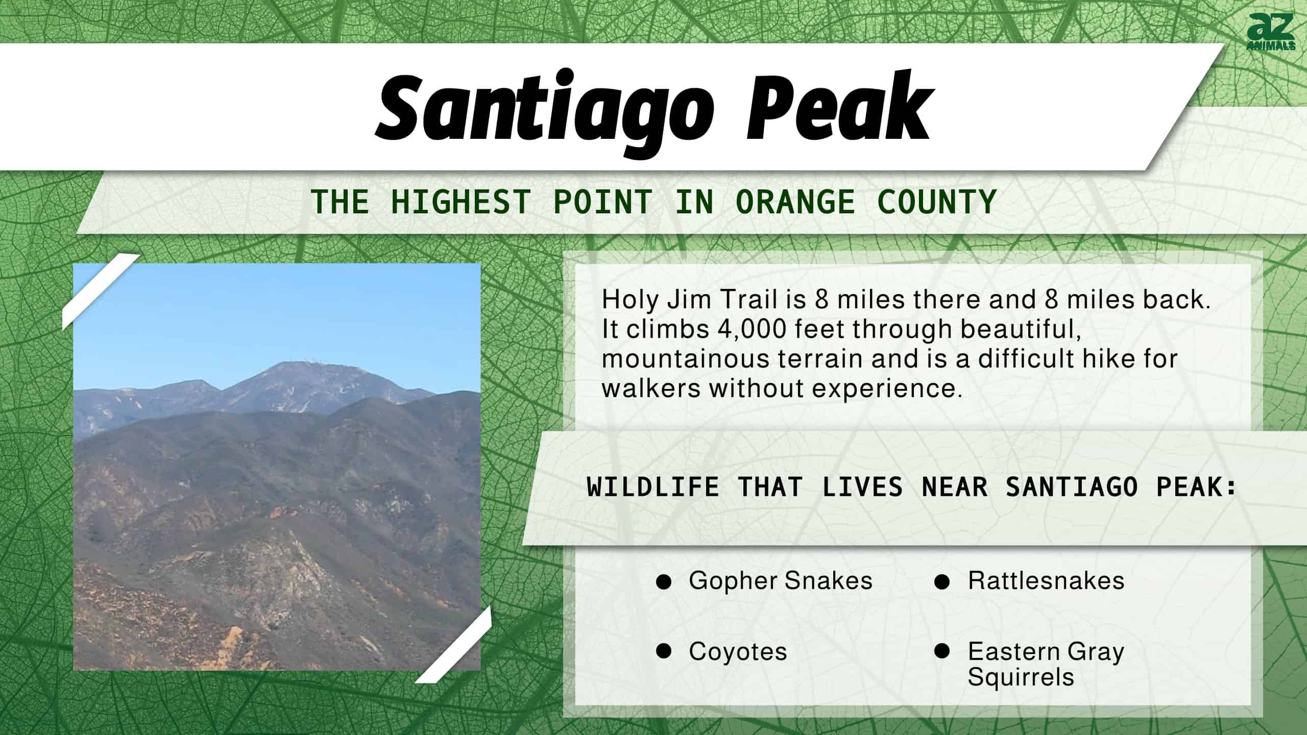
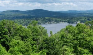
Orange County’s highest point is Santiago Peak, often called “Saddleback Mountain” by locals. It’s 5,689 feet tall and accessed by the Holy Jim trail from Trabuco Canyon.
Several trails take hikers to the top, but the Holy Jim trail is the most popular and scenic.
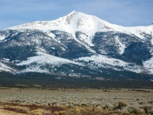
If you’re wondering what the highest point in the whole of California is, well, that’s the epic 14,505 feet Mt. Whitney in the Sierra Nevada that totally dwarfs Santiago Peak!
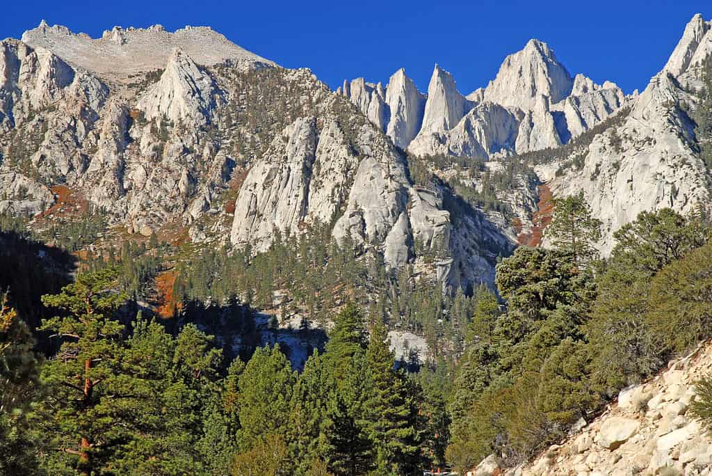
Mount Whitney is the highest point in California.
©nyker/Shutterstock.com
Where is Santiago Peak Located on a Map?
Santiago Peak is the southern mountain of the Saddleback landform located in Orange County and marks a border point of Orange and Riverside counties. It lies along the crest of the Santa Ana Mountains.
The Path to Santiago Peak
Holy Jim trail is 8 miles there and 8 miles back. It climbs 4,000 feet through really beautiful mountainous terrain, quite unlike the overall impression of sunny, beach-side southern California.
It’s a difficult hike for walkers without experience. Although maintained, it’s often overgrown, poison ivy abounds, and bugs by the billion descend on hikers, but that does not put hikers off. The view is just too good.
At the peak, you can see most of Orange County and east towards Mount San Antonio, San Gorgonio, and San Jacinto.
The Trek: Overview
On the trail, you’ll cross Holy Jim Canyon Creek many times. In hot seasons, it dries up in places, but rainy seasons turn it into a crashing cascade. Hiking boots are most definitely required at all times. As is bug spray. Bugs thrive around Santiago Peak, and whilst ladybugs are fun to watch, mosquitoes are not.
Holy Jim trail is open year-round to hikers, bikers, and dog walkers, but dogs must always be leashed. Before setting off, check for wildfire reports. On occasion, wildfires close the Holy Jim trail. The results of ravaging fires are frequently seen on the climb. In fact, hikers report that several signs are currently burnt away, making it a little difficult to navigate.
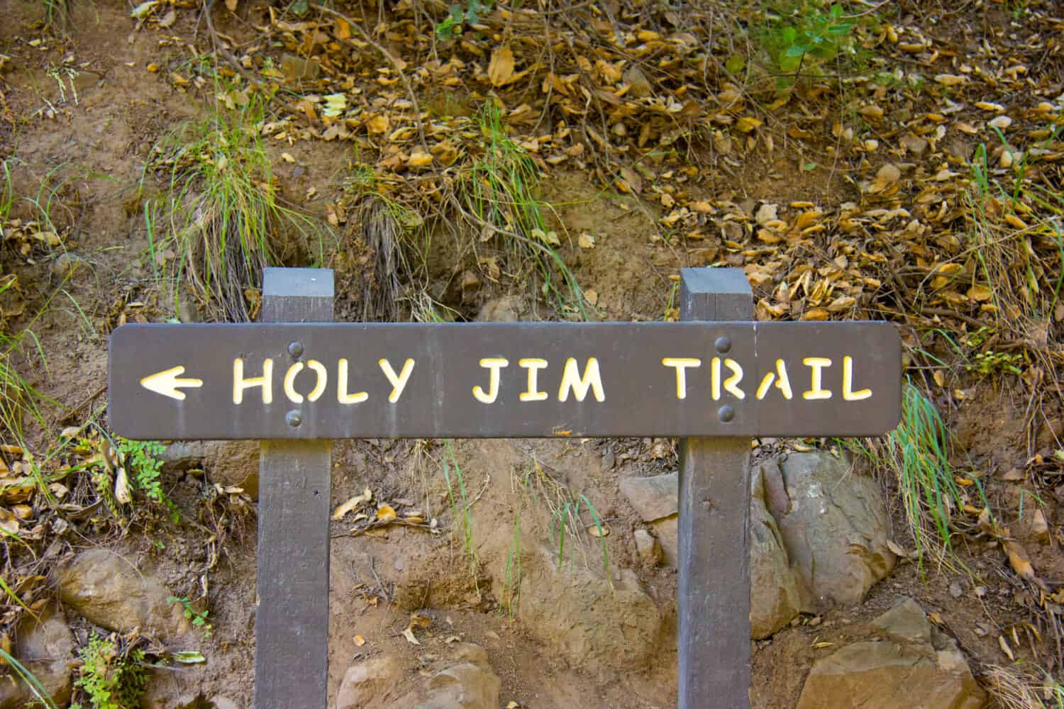
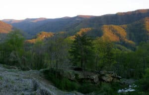
Holy Jim trail is the most epic route to the highest point in Orange County.
©KK Stock/Shutterstock.com
Parking
Start at the trailhead, but even this isn’t simple!
Holy Jim trail begins at Trabuco Creek Road, and there’s a seven-mile journey over five miles of gravel and rough ground to reach it. Hikers recommended a high clearance 4×4, but passenger cars have been spotted there too. Once you’ve made it, a large parking area with toilets awaits.
Note that parking requires an adventure pass which can be bought in advance online.
Starting Out
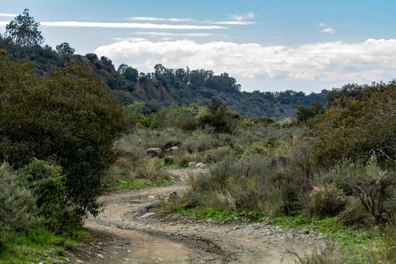
Head towards the canyon via a dirt road that passes several cabins. After one flat mile, pass through the gate (with the trailhead sign) and into the cool, lush forest.
Holy Jim Falls vs. Santiago Peak
Next is the trail junction. Holy Jim Falls lies straight ahead, and the summit is to the left via Main Divide Road (a fire road). If you have time, take a trip to the pretty waterfall. We’ll find out more about the falls below.
If not, walk onto Main Divide Road. You can continue on Main Divide road to the summit, and you’ll have to share it with cars, or turn right and take the Holy Jim trail after around ¼ a mile. It’s easy to miss the single-track trail on your left, so keep your eyes peeled and prepare for a lush, steep track through forest and open mountainside.
The trail requires effort, particularly once you hit the final three miles to the summit.
Antennae and lookout scopes dominate Orange County’s highest point, and it’s pretty windy up there, so take layers. There aren’t any facilities either, so take food and drink with you too.
Holy Jim trail takes a good eight hours there and back, so hikers recommend starting early, especially in fall because the light vanishes fast after 3 pm. If you begin at 7.30 am and don’t stay hours at the peak, you should return to the trailhead by 3.30 pm, but this doesn’t account for splashing in the falls, taking photos, or numerous rest breaks.
Holy Jim Falls
18-foot Holy Jim Falls is a pretty waterfall on the Holy Jim trail. It’s in a tranquil canyon in front of a fern-lined grotto. Hikers say it’s magical, and you’ll often have the place to yourself because it’s not well known.
It’s a trickle in summer, but in fall and winter, it gushes and cascades its way down.
On the trail to the falls, keep a lookout for a sign that marks the final place a grizzly bear was ever spotted in California. In 1907 “The Honey Thief” was shot at the mouth of Trabuco Canyon.
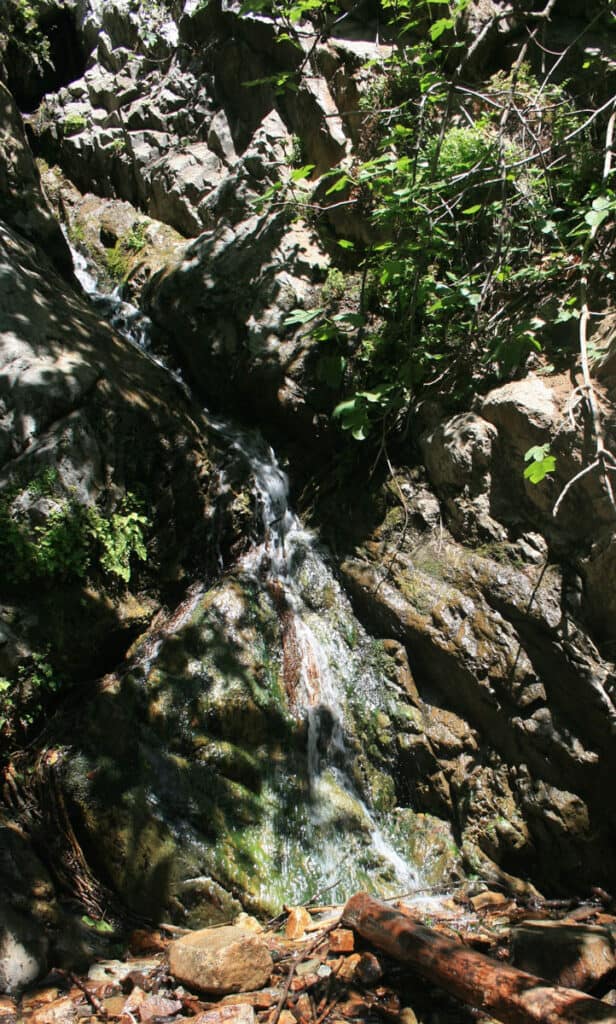
Holy Jim Falls is surrounded by overhanging moss and ferns.
©1801067623/Shutterstock.com
Why Is it Called ‘Holy Jim Trail’?
In 1888, a union veteran called James T. Smith bought a canyon between Trabuco Creek and Santiago Peak. He raised bees and wore a large hat with an upturned brim. With his walrus mustache and habit of leaving his shirt off but wearing a tobacco-filled jacket, Jim was a real character, but what gave him the name Holy Jim?
It started off as Cussin’ Jim due to his creative, long-winded swearing. Cartographers named the area after him, but bureaucrats changed Cussin’ Jim to Holy Jim. Others think it’s sarcasm, built on the rumor that his neighbors called him Salvation Smith.
Where Is it on a Map?
USDA Forest Service provides a map of the Holy Jim trailhead.
The trailhead is located on Holy Jim Road fork on Trabuco Canyon Road, six miles up the creek from O’Neil Park. Its exact spot is latitude 33.67611 and longitude -117.51694.
Can You Drive There?
Yes, you can drive to the highest point in Orange County on Main Divide Road. It’s 15.5 miles on an unpaved narrow road with loose surfaces. A 4×4 drive or SUV is needed. The last three-mile stretch is very steep. It hits a 22 % incline in place.
The drive to Santiago Peak takes several hours, and it’s sometimes closed due to wildfire or bad weather.
Holy Jim trail is for hikers, and cars can reach Santiago Peak on the Main Divide road.
©Arne Beruldsen/Shutterstock.com
What Is There to Do on Holy Jim Trail?
There are no facilities on Holy Jim trail or Santiago Peak other than the trailhead’s parking area.
Take photos, eat your packed lunch, and admire the view. To take in a 360-degree view, you have to walk around the peak’s antennae farm, which is approximately a 1/4 mile round trip.
Then descend before it gets dark. If you do find yourself there as night falls, stick to the road.
What Animals Live Near Orange County’s Highest Point?
Saddleback Mountain range is packed with exciting animals. Here are just a few that prowl Orange County’s highest point:
Mountain Lion
Mountain lions, also called cougars or pumas, live in California’s wild spaces. Because they regulate an ecosystem through their diet of rodents, snakes, sheep, and deer, ecologists believe they are one of the most important carnivores in the U.S.
Most often seen in forests, mountain lions hunt their unfortunate prey from the shadows, but they also enjoy sun soaking on rocky outcrops. It’s rare to see one, but if you do, it’ll appear tan-colored and up to 5.5 feet long with a three-foot tail.
This epic cat can run at 55 mph, leap 20 feet into a tree or across a gorge, and hunt down whatever it feels like eating.
Human attacks are rare, but they sometimes stalk domestic dogs. If you’re faced with a mountain lion, wave your arms and make lots of noise. Do not run because this triggers their chase instinct. That said, it’s incredibly rare, especially with the number of people on the Holy Jim trail. The most likely time to spot a mountain lion is dawn or dusk.
Gopher Snake
Up to 9-foot-long gopher snakes prey on, you’ve guessed it, gophers. But that’s not all. These long snakes also eat birds, bird eggs, lizards, insects, and sometimes bats.
They’re often spotted by hikers basking on open trails. Yellow, red, tan, brown, and cream, they’re attractive constrictor snakes without venom, but if you frighten one, it’ll play rattlesnake, flatten its head, hiss, and make a rattling noise.
Gopher snakes sunbathe in summer, but during the winter months, they hibernate in dens alongside rattlesnakes.
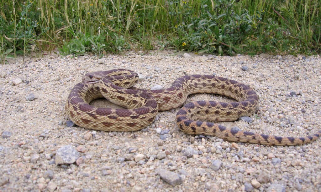
A gopher snake acts like a rattlesnake when threatened, but it’s not venomous.
©rawaccess/Shutterstock.com
And speaking of rattlers…
Rattlesnakes
Rattlesnakes also live on Orange County’s highest point. These four feet long-pit vipers live in forests and rocky outcrops.
They’re more dangerous to humans than gopher snakes, because their venomous bite is painful and requires urgent medical treatment, but rattlesnakes don’t hunt humans. They are more likely to quickly move away and only strike out if they’re trod on or threatened. In the first instance, rattlesnakes make a loud rattling noise to warn predators off.
Rattlers appear in a mixture of brown, red, yellow, and deep rust, with off-white and dark brown diamond-shaped patterns running the length of their back. A triangular head and sharp fangs inject venom into its rodent and bird prey. If you come across one, slowly walk back. Rattlesnakes are the chief reason why it’s best to keep dogs on a leash in wild spaces.
Coyotes
Coyotes live and hunt in packs in Orange County’s wild spaces, including the highest point. Santiago Peak in Saddleback Mountains is a vast open space with plenty of forested cover for coyote packs.
They’re nocturnal, so it’s very unlikely you’ll spot them on the Holy Jim trail. Coyotes primarily prey on rabbits, mice, and small deer but eat reptiles and carrion too.
These golden-eyed small wolf look-a-likes run at 40 mph, and they call at night with a totally spine-chilling howl.
Eastern Gray Squirrels
Experts think up to 20 Eastern gray squirrels live in every acre of the Eastern United States’ forests, so it’s no surprise that Santiago Peak’s forests are packed with them.
These tree-top dwellers spend their days gathering nuts and seeds in a cache ready for the bare winter months. They are small gray and white animals with bushy tails the same length as their 9-12 inch body length. Their whippy tails aid balance as they pelt through tree branches. Do you know a squirrel’s feet can turn 180 degrees? It helps them descend vertically. Amazing.
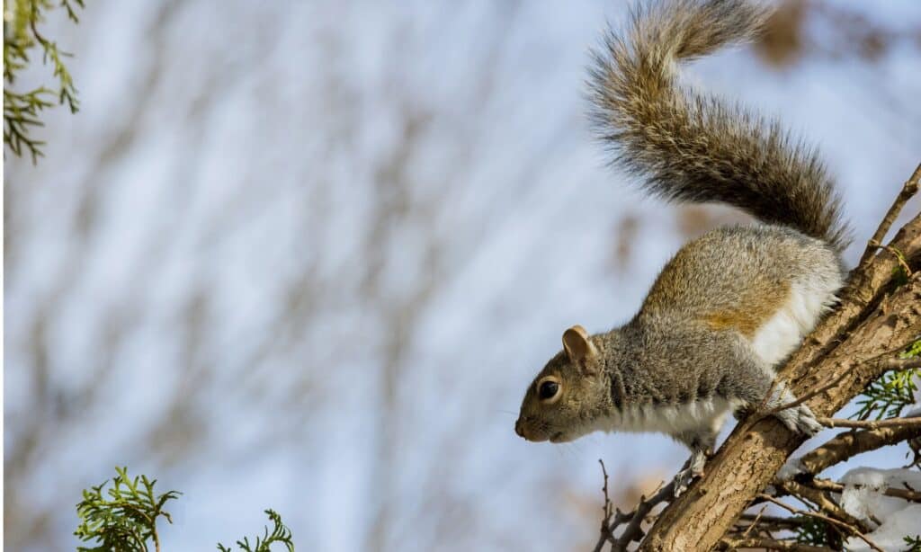
Eastern gray squirrels have feet that turn 180 degrees so they can descend vertically.
©iStock.com/photovs
Red-tailed hawk
Red-tailed hawks circle Orange County’s highest peak, opportunistically scanning the ground for lizards, rodents, snakes, rabbits, or anything it can pin down for a meal. Once locked on, this hawk descends at 120 mph!
Unlike peregrine falcons, red-tailed hawks pin their prey to the ground rather than catching it mid-flight. The red-fanned tail gives them away from 100 feet in the air; they’re one of the most common hawks in the U.S. but beautiful every time.
Plants Near Orange County’s Highest Point
Holy Jim trail is a beautiful walk during spring and summer. Expect to admire ferns, mosses around the creeks, falls, and fig trees (yes, really) along the pathways. Years ago, settlers grew figs here on the mountainside, along with honeybee farms, and their fig trees have gone wild.
On the more exposed areas of the mountain, an abundance of wildflowers bloom brightly. Some of the most vibrant include verbena, mallow, yarrow, angle trumpet, rock pea, numerous agave, and wild onions.
Holy Jim trail is awash with beautiful plant life, but keep your eyes peeled for poison oak. Trekkers report a good deal of it near the track to Orange County’s highest point.
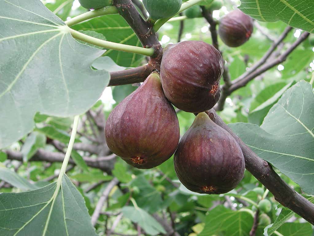
Wild fig trees line the lower regions of the Holy Jim trail.
©simona pavan/Shutterstock.com

How to Add Us to Google News


Thank you for reading! Have some feedback for us? Contact the AZ Animals editorial team.