The UV Index was designed to help people know when it’s time to get out of the sun. Ultraviolet radiation (UV) from the sun can cause sunburns and skin damage.
The index ranges from 0 to 11+, with levels in the United States typically averaging about 9 to 10 during the summer when UV rays are at their peak.
Anything 11 or higher is considered an extreme level. However, levels at high elevations recorded during peak months can range in the 20s. Yet, there is one level on record that looms above all the rest.
What Was the Highest UV Index Ever Recorded on Earth?
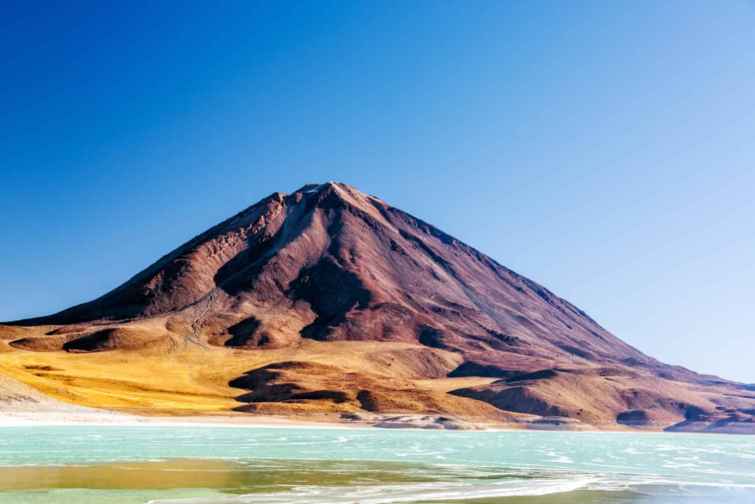
The Highest UV Index ever recorded on Earth was 43.3, detected on December 29, 2003, at the top of the Licancabur Volcano in the Andes mountain range.
.
©Structured Vision/Shutterstock.com
Scientists placed a radiation detector on a 19,423-foot-tall peak of the volcano. The detector picked up the extreme spike in UV rays during the Southern Hemisphere’s summer.
UV Index ratings tend to be high in the Andes, often reaching into the mid-20s due to the tropical location, high elevation, and naturally low ozone levels. But this record spike surprised scientists with its intensity.
About the UV Index
Anything 11 or higher on the UV Index is considered to be a high risk of harm from sun damage.
©Leestudio/Shutterstock.com
The UV Index was created in 1994 by the National Weather Service (NWS) and the U.S. Environmental Protection Agency (EPA) to raise public awareness about the dangers of sun exposure. Ratings are determined using current ozone levels, cloud cover, and elevation.
A Combination of Factors Reduced Ozone Levels
The Ozone Layer is an invisible layer of gases high in the Earth’s atmosphere that absorbs harmful radiation from the sun. Scientists believe on December 29, 2003, there was a storm of events that caused the ozone levels to plunge on the Licanbur volcano, letting in the sun’s harmful UV rays.
Some of the factors that may have contributed to the high UV index include:
- Fires burning in the Amazon.
- Seasonal thunderstorms over the Andes.
- Two weeks before the spike, a large solar flare occurred.
- An atmospheric train of ozone-depleting chemicals blowing in from Antarctica.
Scientists believe this convergence of events caused the ozone level to deplete above the Andes volcano, which let in radiation from the sun and sent UV levels soaring to record levels.
Where is the Licancabur Volcano on a Map?
The Licancabur Volcano is part of the Andes in South America. It’s located on the border between northern Chile and Bolivia, just 25 miles from the town of San Pedro de Atacama. The volcano is located in the Atacama Desert, considered the driest place on Earth, other than the North and South Poles.
Studying Mars on Earth
Remarkably, since it’s located in a desert, the volcano is known for containing one of the world’s highest lakes inside its wide summit crater. The lake is only accessible to tourists by a challenging hike up the mountain.
The surface of the lake is frozen most of the year, while the water at the bottom remains liquid. Scientists use these conditions to mimic the environment of Mars lakes and to find strategies for searching for life in the Solar System.
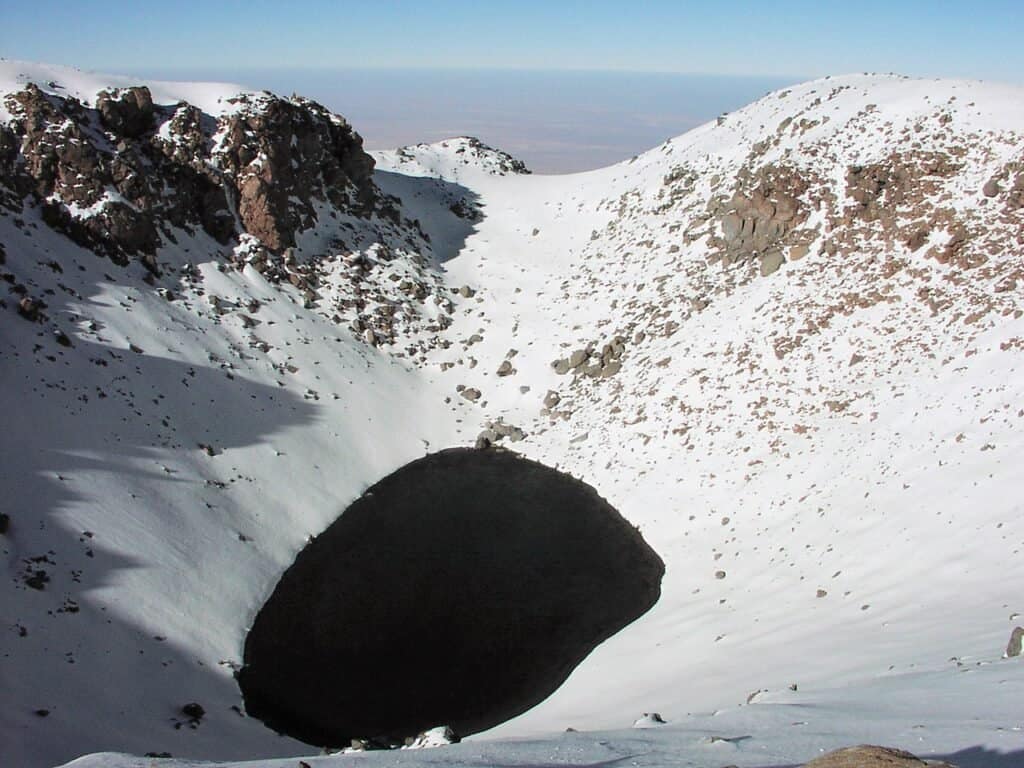
The volcano contains one of the world’s highest-elevation lakes inside its wide summit crater.
©Albert Backer (talk) 22:55, 5 July 2009 (UTC) / Creative Commons – Original / License
It’s surprising to find a lake in a desert region, and the Licanbur Volcano Lake is extraordinary. The water is a combination of low oxygen, low atmospheric pressure, and high UV radiation. However, life is still present in the lake. Scientists have detected the presence of microbes. Studying these microbes has helped researchers to understand how life can adapt to extreme settings.
Wildlife Around the Area
The Licancabur Volcano hasn’t erupted in recorded history, and scientists believe the last eruption occurred at some point after the Ice Age. The area around the volcano is a cold desert climate situated at a high altitude.
The environment around the volcano is so harsh that scientists use it as a replica of Mars to test devices and conduct studies. Besides the volcano, the land contains lagoons, vast dunes, salt flats, and geysers.
The average rainfall in the desert is about .6 inches per year, and some areas get even less. Despite these inhabitable conditions, there are a few animals that make the desert their home.
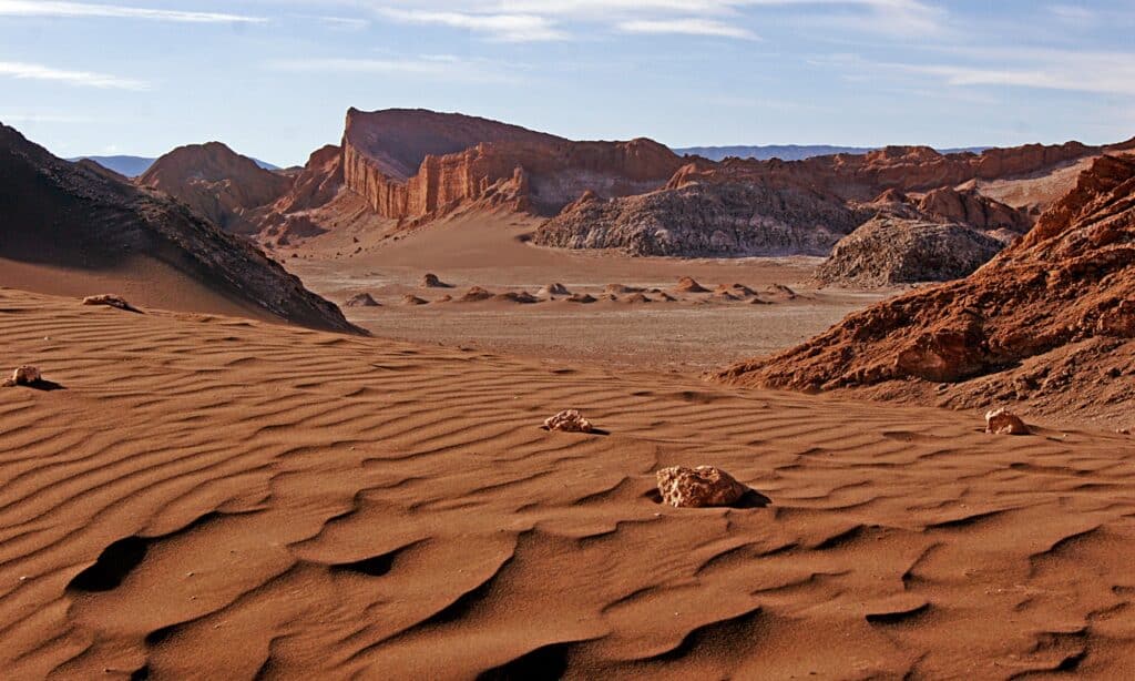
The Valley of the Moon is located in the Atacama Desert, near the Licancabur Volcano.
©iStock.com/Eduardo Cabanas
There are two national reserves nearby which are home to several species, the Eduardo Avaroa Andean Fauna National Reserve and the Los Flamencos National Reserve.
Some of the animals you can find in the area include:
- Flamingos
- Pumas
- Culpeo (Andean foxes)
- Vizcacha
- Guanacos
- Vicuña
- Darwin’s leaf-eared mouse
- South American Gray Fox
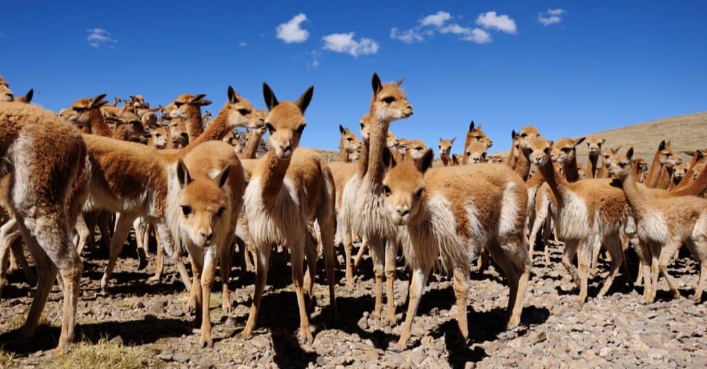
Wild vicuñas are similar to domesticated alpacas. Their thick wool helps them survive frigid temperatures in the Andean Mountains.
©Carlos Sala Fotografia/Shutterstock.com
To the west, Humboldt penguins live in desert cliffs along the coastline. As for reptiles, surprisingly few species live in the area. Some you may find include iguanas, lava lizards, and salt flat lizards.

Humboldt penguins live in the Atacama Desert in northern Chile.
©Tom Meaker/Shutterstock.com
The photo featured at the top of this post is © Structured Vision/Shutterstock.com
Thank you for reading! Have some feedback for us? Contact the AZ Animals editorial team.


