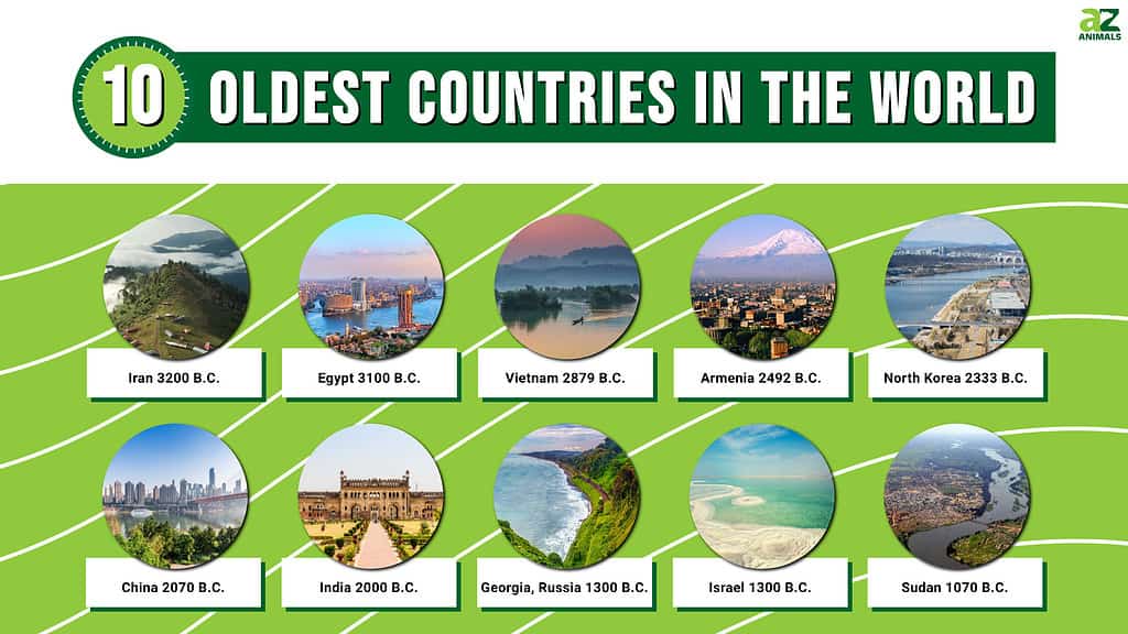
While some might believe that the oldest countries in the world are immense global powers that remain prominent today, this assumption is false. In fact, it is likely that most people would be surprised to learn which countries were founded first. Although some still hold influential political and world power, others have been diminished by other global powers and colonialism. Find out which countries are the oldest in the world.
1. Iran
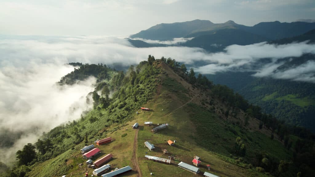
Iran is the oldest country in the world founded in 3200 B.C. and has a topography characterized by numerous mountains and mountain ranges.
©Amir Pirasteh/Shutterstock.com
Iran was established as a country in 3200 B.C. It lies between the Middle East and Asia, bordering prominent countries like Iraq, Turkey, Afghanistan, and Pakistan. Its capital is Tehrān, and the country has a population that numbers over 86 million. Iran’s topography is characterized by numerous mountains and mountain ranges.
The climate in Iran varies across the region in both precipitation and temperature. For instance, while the annual rainfall in the southeastern portion of Iran measures approximately two inches, the portion bordering the Caspian Sea receives around 78 inches of annual precipitation. Overall, though, temperatures remain warm while humidity fluctuates.
Plant life in Iran depends on region, precipitation, topography, and other factors. Brush and shrubs exist in desert areas, but forests can be found within 10% of Iran’s area. The region bordering the Caspian Sea includes the most amount of plant life in Iran. Trees like oak, walnut, elm, and others blanket the area. On the other hand, bears, hyenas, and leopards can be found in mountainous regions that include forested areas. Foxes and rodents reside in semi-arid areas, and several different types of birds and fish inhabit the Caspian Sea.
2. Egypt
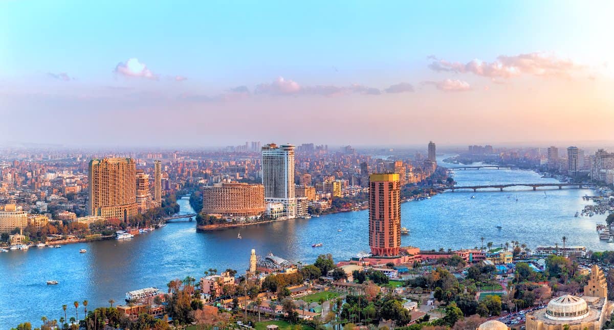
Capital city Cairo, with an approximate population of 104 million.
©AlexAnton/Shutterstock.com
Egypt’s first form of government was created around 3100 B.C. Egypt is a country that lies in the northeast corner of the African continent. It borders the Mediterranean Sea, Israel, Libya, and Sudan. The capital of Egypt is Cairo, and the country has an approximate population of 104 million citizens. Society in Ancient Egypt was extremely advanced in technology and literacy for its time. While pharaohs originally ruled Egypt for thousands of years, Greece, Rome, and Arab empires conquered the country within a 900-year span of time.
The Nile River flows through Egypt, allowing for agricultural opportunities along its fertile riverbanks. Around the Nile River lies miles upon miles of the Egyptian desert. The two main deserts in Egypt include the Western Desert and the Eastern Desert. The minor Sinai Peninsula is smaller than the former two deserts but remains notable. Egypt’s climate is dry with mild winters and very hot summers. Tropical air currents can cause sandstorms that occur approximately 50 days out of every passing year. The northern portion of Egypt experiences more humidity than the south, as it borders the Mediterranean Sea.
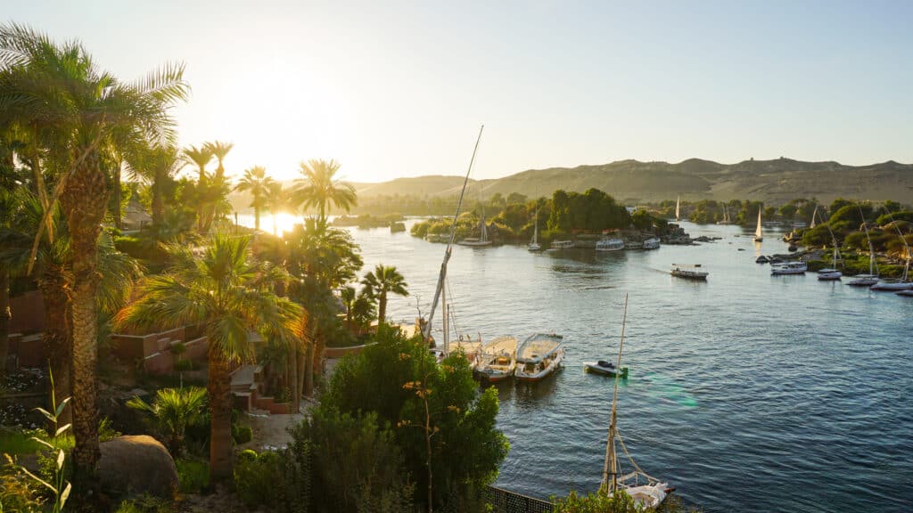
The Nile River flows through Egypt, allowing for agricultural opportunities along its fertile riverbanks.
©iStock.com/glowonconcept
The Western Desert of Egypt has very little plant life to boast about, but the Eastern Desert includes plants like acacia, tamarisk, and succulents. Around the Nile, however, more abundant plant life can be encountered. Over 100 species of grass border or reside within Nile waters. Although the papyrus plant used to be prominent in Ancient Egypt, its prevalence has diminished greatly.
Animals that live in the Egyptian countryside include camels, goats, and buffalo. Crocodiles exist in Egypt but only in certain areas. Meanwhile, animals typically associated with the country’s climate and habitat, like hippopotamuses and giraffes, cannot be found in Egypt anymore. On the other hand, hundreds of species of fish and birds reside throughout the Egyptian waters and skies. Some include the hooded crow, the black kite, and the Nile perch.
3. Vietnam
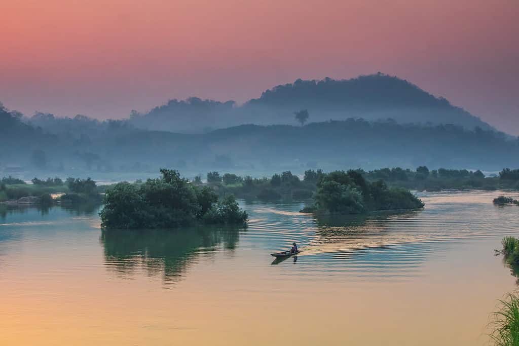
Beautiful sunrise on the Mekong river.
©Nakornthai/Shutterstock.com
Vietnam, founded in 2879 B.C., hugs the eastern part of southeastern Asia. The capital is Hanoi, and Vietnam’s population measures over 99 million. The country is bordered by Cambodia, Laos, and China. China had a large influence on Vietnamese culture, as China ruled over Vietnam for several years. China and Vietnam engaged in the trade of goods and literature amongst other items, which helped shape Vietnam’s regime structure and economy.
Vietnam’s topography consists of the Annamese Cordillera mountains, two deltas, and a coastal plain. The highest point of elevation in Vietnam measures 10,312 feet on Fan Si Peak. Notable rivers in Vietnam include the Red River, the Mekong River, and the Black River. Vietnam’s climate is mainly warm and tropical. The average yearly temperature in Vietnam reaches 74ºF. Monsoons bring heavy precipitation and typhoons to Vietnam during the summer and fall months.
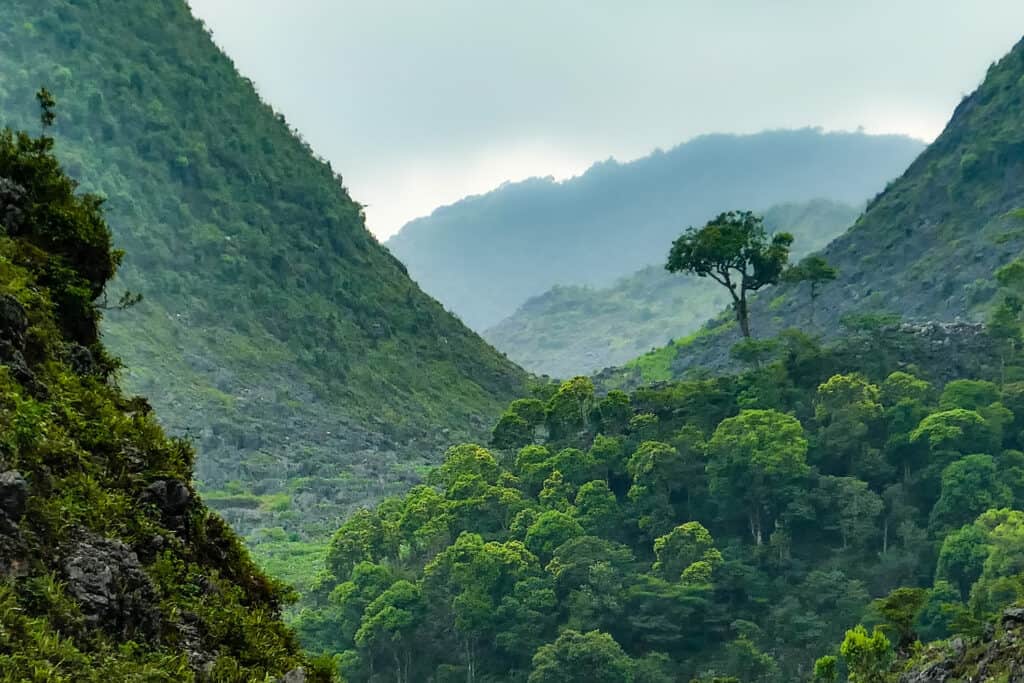
Vietnam’s plant life is characterized by abundant biodiversity due to differences in climate and topography across the region.
©iStock.com/Jaroslav Sugarek
Vietnam’s plant life is characterized by abundant biodiversity due to differences in climate and topography across the region. Evergreen forests and deciduous forests make up the woods within Vietnam. Over 1,500 species of trees and similar plants exist in Vietnam, including mangroves and ebony. Some rainforest areas can be found in Vietnam, but these are few and far between. Elephants, tapirs, tigers, and snow leopards are exotic animals that reside in Vietnam. On the other hand, cattle, pigs, fowl, and goats have been domesticated in Vietnam.
4. Armenia
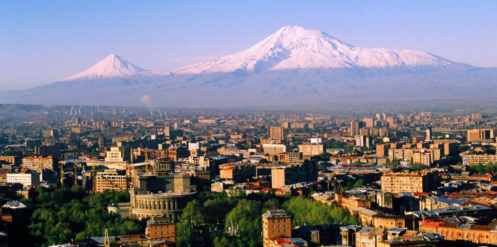
Armenia’s land is characterized by high elevations with only 10% of the country’s land sitting below 3,300 feet.
©iStock.com/marlenka
The country of Armenia began in 2492 B.C. and is bordered by Georgia, Azerbaijan, Turkey, and Iran. Armenia has about three million citizens residing within the country with more than 35% of the population found in the capital city of Yerevan. While Armenia occupies a small area today, Ancient Armenia was much larger. Unfortunately, Armenia lost much of its territory after Persian and Ottoman conquests threatened the country’s population. In fact, Ottoman rule during the 19th and 20th centuries oppressed the Armenian people through slaughter and deportation.
Armenia’s land is characterized by high elevations. For instance, the average elevation in Armenia measures 5,900 feet, and only 10% of the country’s land sits below 3,300 feet. Between plateaus and mountains lie river valleys. Notable topographic features include the Sevan Basin, the Ararat Plain, and Mount Aragats. Earthquakes can plague Armenia, damaging cities and killing civilians.
Due to a plethora of mountain ranges and the country’s small area, Armenia’s climate remains dry and hot. The average summer temperatures reside around 77ºF with winter temperatures averaging 23ºF during the coldest months. Elevation within Armenia can cause climate and temperature fluctuations.
Over 3,000 individual plant species exist within Armenia, which are organized into five main categories of plant life. For instance, semidesert portions of Armenia include vegetation like sagebrush and juniper. Animal life varies according to these categories as well. While jackals and scorpions reside in semidesert areas, lynxes and woodpeckers can be found in forest areas.
5. North Korea
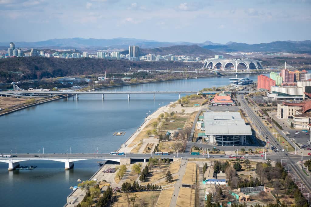
The capital of North Korea is P’yongyang, and the country has a population of over 25 million.
©iStock.com/Rihui Huang
North Korea’s first form of government was recognized in 2333 B.C. The capital of North Korea is P’yongyang, and the country has a population of over 25 million. North Korea sits above South Korea on the Korean Peninsula in eastern Asia. Russia and China border North Korea from above. Most of North Korea’s topography is made up of mountains such as the Kaema Highlands and Mount Peaktu. River valleys lie between the mountains, complementing the ranges and adding to the beautiful scenery.
Winter in North Korea is cold with average temperatures ranging between -10ºF and 20ºF. Summer months experience temperatures in the 60s, making North Korea’s climate relatively cold year-round. On the East Coast, though, topography and ocean currents cause temperatures to average between 5ºF and 7ºF higher than temperatures recorded on the West Coast.
Coniferous trees cover the highlands of North Korea. The lowlands have been used for agriculture and are characterized by plant types like oak and maple trees. Within the western lowlands lie very few forested areas due to deforestation, which has, in turn, affected animal populations, too. For example, deer, goat, tiger, and leopard populations in North Korea are threatened by habitat loss amidst an ever-growing demand for lumber.
6. China
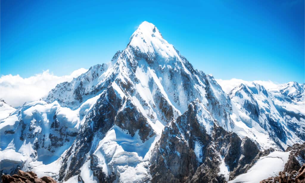
Mount Everest lies on the China-Nepal border with an elevation of 29,035 feet.
©Vixit/Shutterstock.com
China appeared as a legitimate regime in 2070 B.C. and occupies an impressively large area. It has the third-largest landmass in the world and takes up around 7.14% of the world’s land. China borders a host of Asian countries, including Russia, Mongolia, India, and Vietnam. Its capital is Beijing, and it has the largest population of any country, numbering over 1.4 billion people.
The great Mount Everest lies on the China-Nepal border with an elevation of 29,035 feet. On the other hand, the Turfan Depression sits 508 feet below sea level, making it the lowest point in the country. While the northern coast is mainly flat, the southern coast of China is characterized by rocky terrain. Unfortunately, millions have been killed in China due to the prevalence of earthquakes in the region.

China dates back to 2070 B.C. and currently has the largest population of any country numbering over 1.4 billion people.
©MyCreative/Shutterstock.com
The climate across China can differ greatly due to its massive size and variation in topography. China’s average annual temperature ranges between 32ºF and 68ºF according to the region. Likewise, precipitation varies immensely throughout China. For instance, the southeastern coast of China averages more than 80 inches of rainfall per year while Huang He only experiences between 20 and 35 inches of annual precipitation.
China’s biodiversity concerning both plant and animal species is impressive. Over 30,000 individual plants exist within the country, which are dispersed throughout climates ranging from tropical to temperate to arid and much more. Animals like the giant salamander and the giant panda are native to China. These fascinating creatures add to the immense biodiversity that remains a staple of the country. The most diversity in animal life can be encountered in the Tibet and Sichuan regions.
7. India
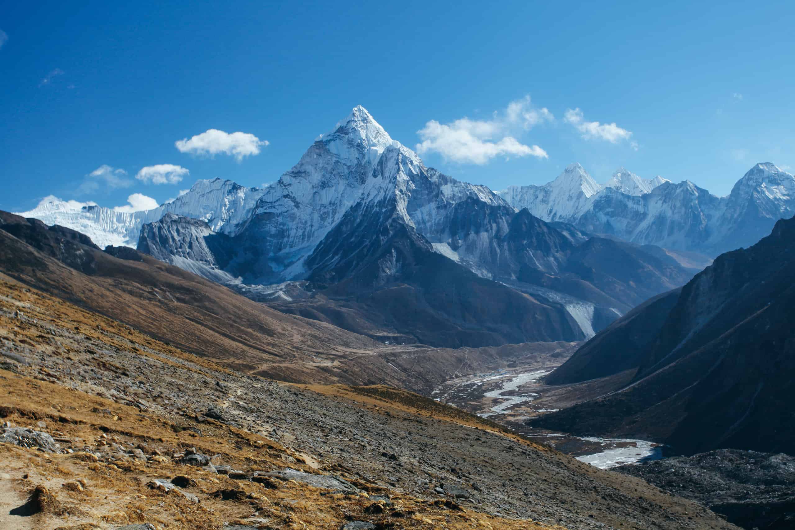
The Great Himalayas, Himalayan mountains.
©bodrumsurf/Shutterstock.com
India was ruled by the British Empire until its independence was recognized in 1947. Prior to British rule, India was comprised of a collection of different nations. In fact, settlement on the Indian subcontinent occurred for approximately 5,000 years before legitimate civilizations had been established. People settled lands of present-day India until the rise of civilizations like the Vedic Civilization, which began around 1,500 B.C. While India was not an official country until the mid-1900s, its roots are some of the oldest in the world. Similar to China, India’s population is over one billion, and its population is ever-growing. The capital of India is New Delhi, and the country is bordered by Pakistan, Nepal, China, and some other East Asian countries. Within India lies an extremely diverse population that includes a wide variety of ethnicities, languages, and indigenous people groups. The Indus civilization controlled India’s region before it became a country. Hinduism is the most prominent religion in India, but its influence reaches beyond South Asia, too.
The Himalayan Mountains, likely one of the most well-known mountain chains throughout the world, run right above India. As a peninsula, India’s most notable geographic features are the Arabian Sea to the west and the Bay of Bengal to the east. Due to unique interactions between tectonic plates beneath India, the country experiences natural disasters like landslides and earthquakes with frequency.
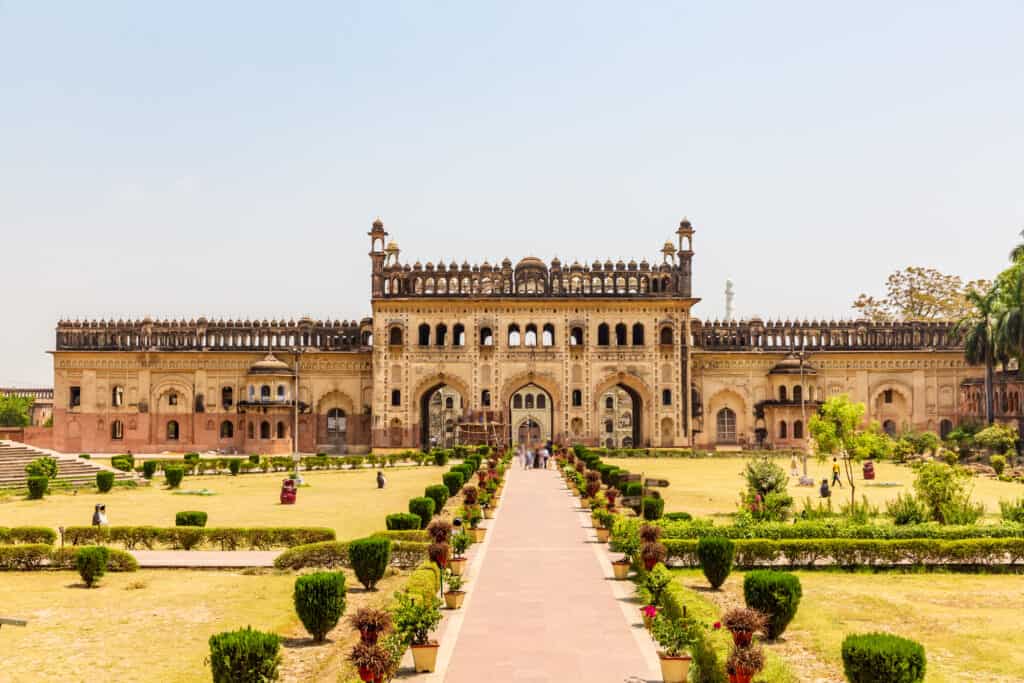
India was recognized as a country in 2000 B.C. and has a population of more than 1 billion people and growing.
©iStock.com/Subodh Agnihotri
India’s climate is famous for monsoon activity, which determines the overall temperature patterns throughout the year. For instance, monsoon sequences create three climate distinctions. These include a hot and dry climate ranging from March to June, a hot and wet climate between June and September, and a cool and dry climate from October to February. Precipitation falls heaviest between June and October when the southwest monsoon season takes place.
The prominence of vegetation in India follows rainfall patterns across the region. Nevertheless, India’s diversity of plant life is impressive, including tropical, evergreen, deciduous, and coniferous forests. Likewise, animal life in India is diverse. Some remarkable species include Indian elephants, tigers, Asiatic lions, and over 1,200 bird species. However, these forests and the animals that inhabit them have been threatened by increased deforestation and poaching. Approximately 1,300 plant species are believed to be endangered species, and animal species like the rare lion-tailed macaque have been targeted by hunters.
8. Georgia
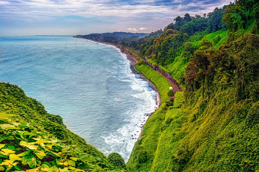
Georgia dates back to 1300 B.C. and has a warm and humid climate due to incoming air from the Black Sea.
©Ruslan Harutyunov/Shutterstock.com
Georgia, whose population numbers around 3.7 million, was established in 1300 B.C. Its capital is Tbilisi, and the country borders Russia, Azerbaijan, Armenia, and Turkey. Georgia thrived during the medieval period, but it was later absorbed by the Soviet Union. Georgia’s self-sovereignty did not return until 1989, nearly 3,300 years after it was founded.
To the west of Georgia lies the Black Sea. Mountains blanket Georgia’s landscape, which is accompanied by many forested areas. The highest point in Georgia measures 16,627 feet on Mount Shkhara. Following close behind are Mount Rustaveli, Mount Tetnuld, and Mount Ushba, which all sit at elevations above 15,000 feet.
Georgia’s climate is warm and humid due to incoming air from the Black Sea. By contrast, the Caucasus mountains bar cold air from blowing into the country. Western and eastern Georgia’s climates differ with west Georgia being more humid and east Georgia having a drier climate. As a result, western Georgia receives between 40 and 100 inches of annual precipitation. Temperatures in the winter months in Georgia never reach below freezing, and summer temperatures average 71ºF in most regions.
Forested areas take up over one-third of Georgia’s terrain. Trees like oak, chestnut, and fruit trees bearing apples and pears can be found predominately in the western portion of the country. By comparison, east Georgia includes less vegetation with brush and grasses making up the majority of plant life. Areas dominated by forests and heavy vegetation include diverse animal species such as lynx, brown bears, and foxes. The Black Sea sees many unique types of fish, and birds like hawks and bearded eagles can be seen flying overhead.
9. Israel
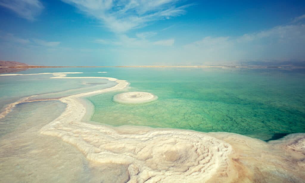
The Dead Sea is likely the most famous body of water found in Israel due to its high salt content.
©iStock.com/vvvita
Like Georgia, the country of Israel was also founded in 1300 B.C. Its capital is Jerusalem, and the country has a population of 8.9 million residents. Israel borders Lebanon, Syria, Jordan, and Egypt, and its coast runs along the Mediterranean Sea. Israel is the only Jewish country today; it was promised to the Hebrews, who preceded the Jews, as the “promised land” according to the Bible.
The area that Israel occupies is small, but it has four distinct regions, including the coastal plain, hill regions, the Great Rift Valley, and the Negev, which all differ in topography and climate. The Dead Sea is likely the most famous body of water found in Israel due to its high salt content. The Dead Sea is also the lowest point on Earth at 1,312 feet below sea level. The Jordan River, which existed during biblical times, separates Israel from Jordan.
Winter in Israel is cool and wet, ranging from the months of October to April. On the other hand, summer occurs between May and September and is characterized by a hot and dry climate. Precipitation fluctuates greatly between the southern and northern portions of Israel. While the north may see up to 44 inches of rainfall annually, the south may only receive a single inch throughout the entire year.
Israel includes over 2,800 different identified plant species. While oak and conifers can be found in forested regions, these trees are but replacements for the original evergreens that dominated Israel. Deforestation for agriculture and manufacturing led to the disappearance of these trees, but efforts have been made to replenish the forests and protect habitats. Over 400 kinds of birds exist in Israel, from the partridge to the desert lark. Animals like wildcats, geckos, and badgers also reside in the country.
10. Sudan
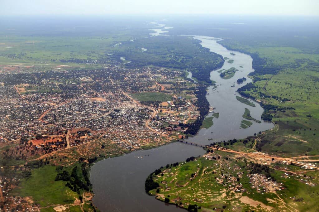
Sudan was established in 1070 B.C. and most of its area is covered by plains, plateaus, and the Nile River.
©iStock.com/Phototreat
Sudan was established in 1070 B.C. It lies in the African continent, bordered by Egypt, Libya, Chad, and other Northeast African countries. It has a population of 45 million people, and its capital is Khartoum. Before the succession of South Sudan, Sudan was the largest country on the African continent. While Sudan was originally a colony, it later gained independence.
Most of Sudan’s area is covered by plains, plateaus, and the Nile River. Deserts make up most of North Sudan, but topography increases in south-central Sudan with the inclusion of hills and mountains. The Red Sea Hills are a notable topographic feature of the country. These hills include streams and border a plain on the coast.
Weather in Sudan is dependent on the season and region. Precipitation is rare in North Sudan, but rainfall picks up in the central and southern areas of the country. Temperatures in Sudan average between 80ºF and 100ºF during the warmest time of the year. By contrast, temperatures during the cooler months range between 50ºF and 70ºF.
Plant life in Sudan ranges from brush and shrubs to acacia trees and grasses, depending on the region and its climate. Grassfires and agriculture have greatly depleted the abundance of vegetation. Furthermore, soil erosion and desert expansion have threatened these plant species, too. Lions, cheetahs, and rhinoceroses are native to Sudan. Crocodiles can be found in the Nile River alongside various insects and other reptiles.
Summary of the 10 Oldest Countries in the World
Let’s take a glance back at the cities that make our top 10 list as being the oldest on the planet.
| Rank | Location | Age |
|---|---|---|
| 1 | Iran | 3200 B.C. |
| 2 | Egypt | 3100 B.C. |
| 3 | Vietnam | 2879 B.C. |
| 4 | Armenia | 2492 B.C. |
| 5 | North Korea | 2333 B.C. |
| 6 | China | 2070 B.C. |
| 7 | India | 2000 B.C. |
| 8 | Georgia, Russia | 1300 B.C. |
| 9 | Israel | 1300 B.C. |
| 10 | Sudan | 1070 B.C. |
Ancient Cities That Didn’t Make the List

The God Apollo was born on the sacred island of Delos, Greece, where ancient monuments and ruins can be found.
©Dimitris Panas/Shutterstock.com
While there are many ancient countries that can make the list for oldest, they can’t all make the top 10. Impressive in their own right, the countries of Greece, Ethiopia, and San Marino all have a storied past and have stood the test of time. They have overcome conflicts, whether from occupation by outside forces to invasions and liberations, and today remain strong.
- Greece (1000 BC) – often called the cradle of Western civilization, it has ancient landmarks dating back to the 5th century BC and was the site of the first Olympic Games in 776 BC. Located on the southern tip of the Balkan Peninsula, it is known for its landmarks and Philosophers, like Aristotle, Plato, Socrates, and Pythagoras, for whom the Pythagorean Theorem is named.
- Ethiopia – this landlocked country located in the Horn of Africa region was once known as Abyssinia. The Ethiopian Empire was founded in the 10th century BC and has even been documented in the King James Version of the Bible. The first known kingdom to have existed in this country is from 980 BC. It is the second most populous nation, with Nigeria being the first, and is one of the poorest, with a per-capita GDP of $1020 per person.
- San Marino – founded in 301 AD, this small country is a mountainous European microstate that is completely surrounded by Italy. Located on the northeastern side of the Apennine Mountains, sitting upon Monte Titano, it is the fifth-smallest country in the world and the third-smallest in Europe (the Vatican and Monaco are smaller). It is also one of the wealthiest nations, with a per-capita GDP of $48,000 per person.
Thank you for reading! Have some feedback for us? Contact the AZ Animals editorial team.


