
Rivers have always been a source of food, transport, and recreation for Mexico. Their historical impact has been small, however, as Mexico lacks proper natural harbors and the country’s rivers are famously ill-suited for navigational purposes. Though there are roughly 1800 miles of accessible rivers and canals to the coastline, they tend to be used primarily for hydroelectric power generation or to produce water for irrigation.
Read on to learn more about some of Mexico’s most notable rivers and what you can do when you visit!
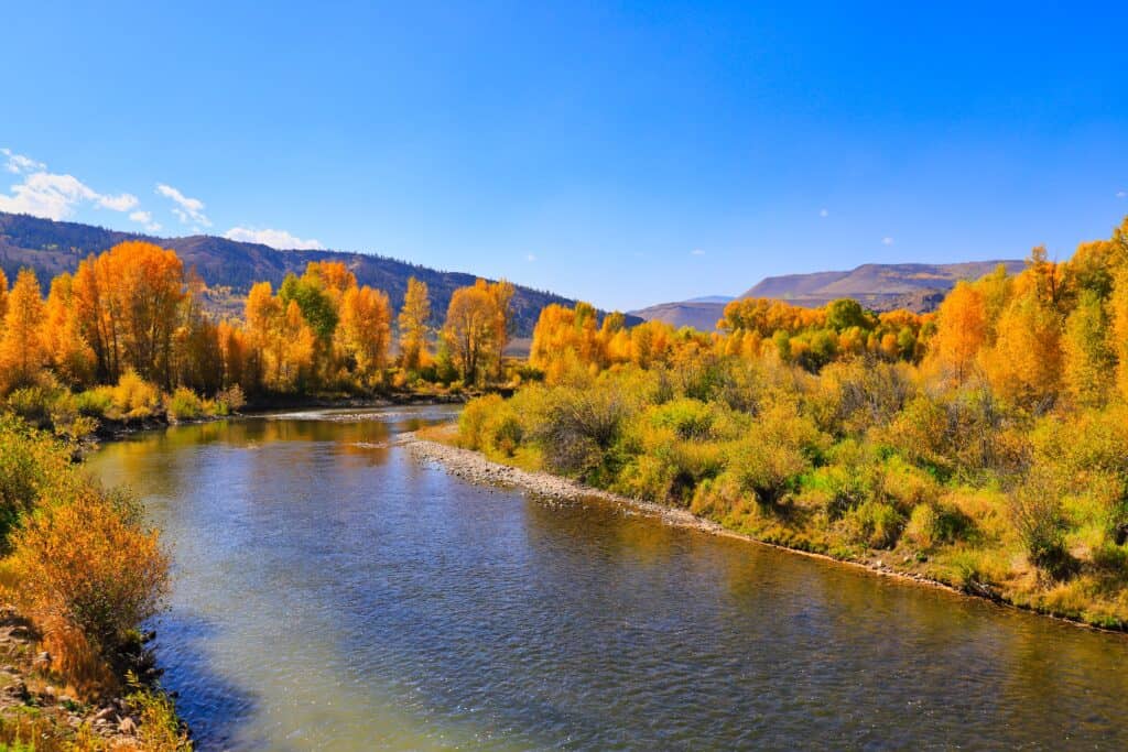
Rio Grande
Rio Grande is a famous crossing between the U.S. and Mexico.
©iStock.com/Greg Meland
The Rio Grande is perhaps the most famous river in Mexico, where it is also known as the Río Bravo (“Furious River”) or the Río Bravo del Norte (“Great River of the North”). It is the fifth-longest river in America, and the 20th-longest river worldwide.
It is approximately 1,896 miles long and flows from southern Colorado through New Mexico, Texas (in the United States), Coahuila, Nuevo León, Chihuahua, and Tamaulipas (in Mexico) before ending in the Gulf of Mexico.
It forms a natural border between Mexico and Texas and has historically been a major source of water for the states it passes through. The Rio Grande has a maximum depth of 60 feet, making it inopportune for cargo transport or even recreational riverboating. There are small navigable pockets near the river’s mouth and parts near Laredo, Texas, but the Rio Grande has not seen much use by boat since the steamboats of the 1800s.
Like many rivers, the Rio Grande has seemingly always been a source of human interest. Petroglyphs (chiseled rock carvings) attributed to predecessors of the Pueblo Indian people have been discovered that date back to the 1300s. Ancestors of New Mexico’s Puebloans first showed up in the Rio Grande Valley pre-500 AD, and findings show that the river has been used for irrigation since its discovery.
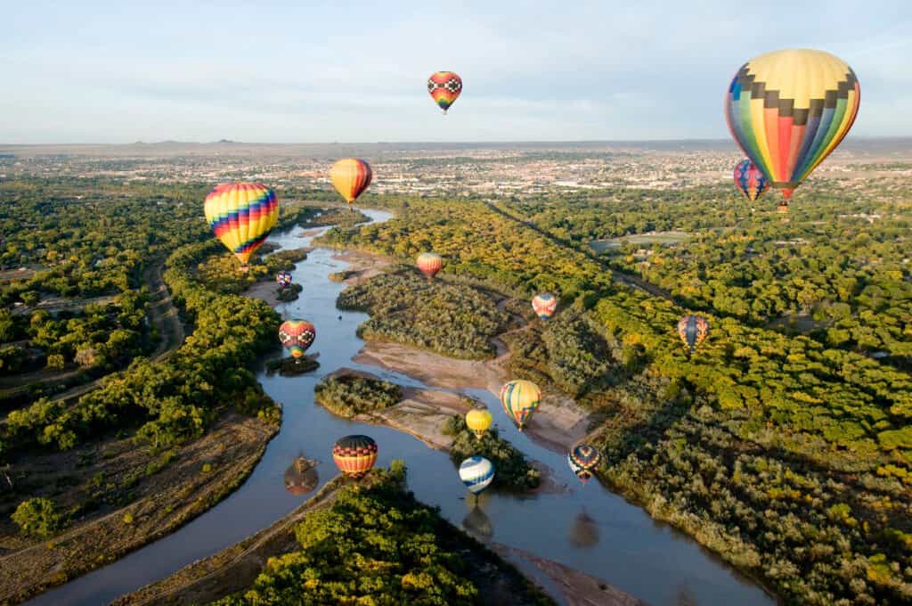
There are two major recreational attractions alongside the Rio Grande in New Mexico – Wild Rivers Recreational Area and the Orilla Verde Recreation Area.
Wild Rivers Recreational Area is part of the Rio Grande del Norte National Monument in Taos County, New Mexico. There is a visitor center and byway into the backcountry, as well as plenty of opportunities for camping, hiking, and picnicking.
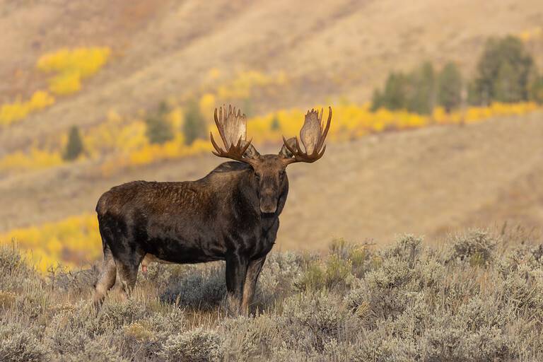
The view from La Junta Point of the 800-foot-deep canyon (formed by the junction of the Rio Grande and the Red River) is a popular attraction for visitors. Plenty of wildlife and nature is observable in the area too – everything from big horn sheep, red-tailed hawk, mule deer, elk, and mountain blue-bird to 500-year-old pinon and juniper forests.
The Orilla Verde Recreation Area is also a part of the National Monument area, located more specifically within the walls of the Rio Grande Gorge, along the banks of the Rio Grande itself.
The campgrounds of Orilla Verde are close to the river, which provides an optimal environment for whitewater rafting, canoeing, and kayaking, as well as swimming, fishing, and camping. Trails here are steep and demanding, but committed hikers should find plenty to enjoy when visiting the area.
Petroglyphs and archeological artifacts are commonly found throughout the canyon floor and walls, and animals ranging from hawks and eagles all the way to beavers, deer, and cougars are endemic to the region.
The Colorado River
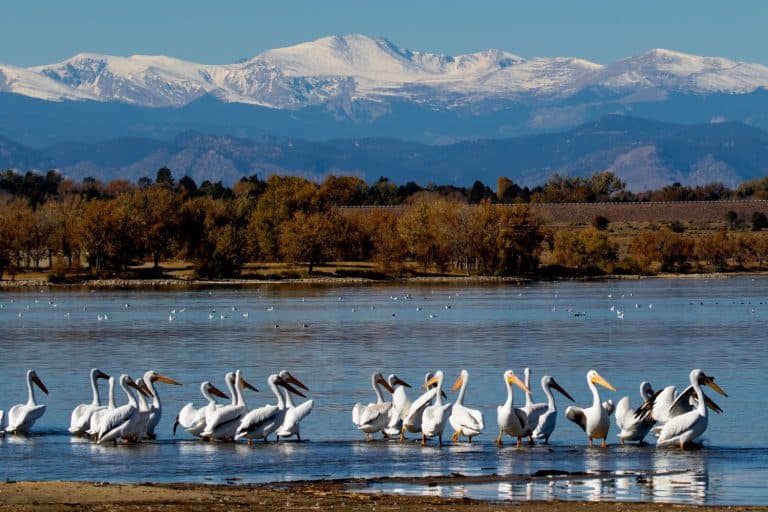
The Gulf of California is fed by the Colorado River from the North and by the Fuerte, Mayo, Sinaloa, Yaqui, and Sonora Rivers from the east.
The Colorado River flows for 1,450 miles from Colorado in the United States all the way to the Sonoran Desert of Mexico. It also serves as the border between these two nations for 17 miles, before ending where the Golfo de California (the Gulf of California) empties out into the Pacific Ocean.
The Gulf of California is fed by the Colorado River from the North and by the Fuerte, Mayo, Sinaloa, Yaqui, and Sonora Rivers from the east. This area is the most important fishery location in Mexico and is full of anchovies, giant squid, sardines, shrimp, billfish, and tuna. It is also a common tourist attraction due to its beautiful coastline beaches and reefs. They provide the perfect environment for snorkeling, scuba diving, swimming, sunbathing, and relaxing at the water’s edge.
The Colorado River is the 6th largest river in America and the 47th largest in the world. It provides drinking water for approximately 40 million people and creates 1.4 trillion dollars of economic value in the process. It flows across 11 national monuments/parks, the most famous of which is the Grand Canyon.
The Grand Canyon draws roughly 6.5 million visitors a year, from all over the country and the world. It is a majestic 278-mile-long canyon (home to 11 Native American Tribes) that provides plenty of opportunities for camping, day treks, and long backpacking trips. Despite its modern-day popularity and obvious attraction as a tourist destination, the Grand Canyon wasn’t officially a national park until 1919.
During that time, the Colorado River found itself in the midst of an engineering renaissance, and hydraulics experts began modifying the basin to create reservoirs, dams, and potable drinking water for much of America and Mexico. Around 227 miles of the Colorado River pass through the Grand Canyon, and it is diverted on either side to form Lake Powell and Lake Mead – the two largest reservoirs in America.
Along the way, the Colorado River provides a much-needed source of water for numerous city municipalities, agricultural industries, and tourist economies. Recreational opportunities abound, from hiking, sightseeing, and backpacking to fishing, boating, and whitewater rafting – all of which generate $26 billion in revenue.
Lerma River
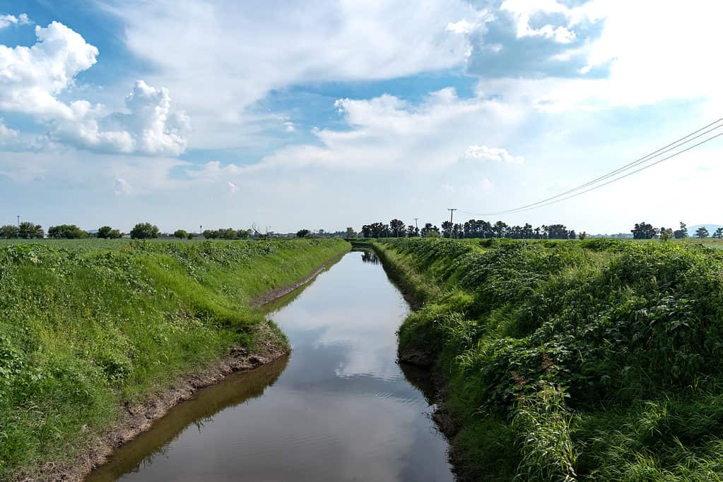
The basin formed by the Lerma River at Lake Chapala is Mexico’s most important watershed.
©PICSEAH/Shutterstock.com
The Lerma River (Río Lerma) is the second longest river in Mexico, running for 470 miles from the Mexican Plateau to Lake Chapala, near Guadalajara, Jalisco.
The basin formed by the Lerma River at Lake Chapala is Mexico’s most important watershed. Several tributaries feed into the basin, including the Apaseo, the Turbio, and the Laja Rivers. This makes the Lerma River the largest river system in the country, albeit one made infamous for its pollution. The Santiago River travels out from this basin, and some consider it to be a continuation of the Lerma River.
Only recently has the Mexican government begun to address the problem, updating the conditions of sanitation buildings and installing environmental programs designed to clean up the Lerma River.
Similar to the Rio Grande, you cannot travel on the Lerma River by boat. Instead, it is a primary source of irrigation for the region’s agricultural systems. More than half of the farmers in the Lerma/Chapala/Santiago river basin are small farmers in charge of 820,000 hectares in need of irrigation. Roughly three million hectares are currently being developed for food production.
The population of the river basin hovers somewhere around 15 million people, and Guadalajara and Toluca’s metropolitan areas source their municipal water from the Lerma River. It is the outskirts of these regions that suffer the most from a lack of clean drinking water.
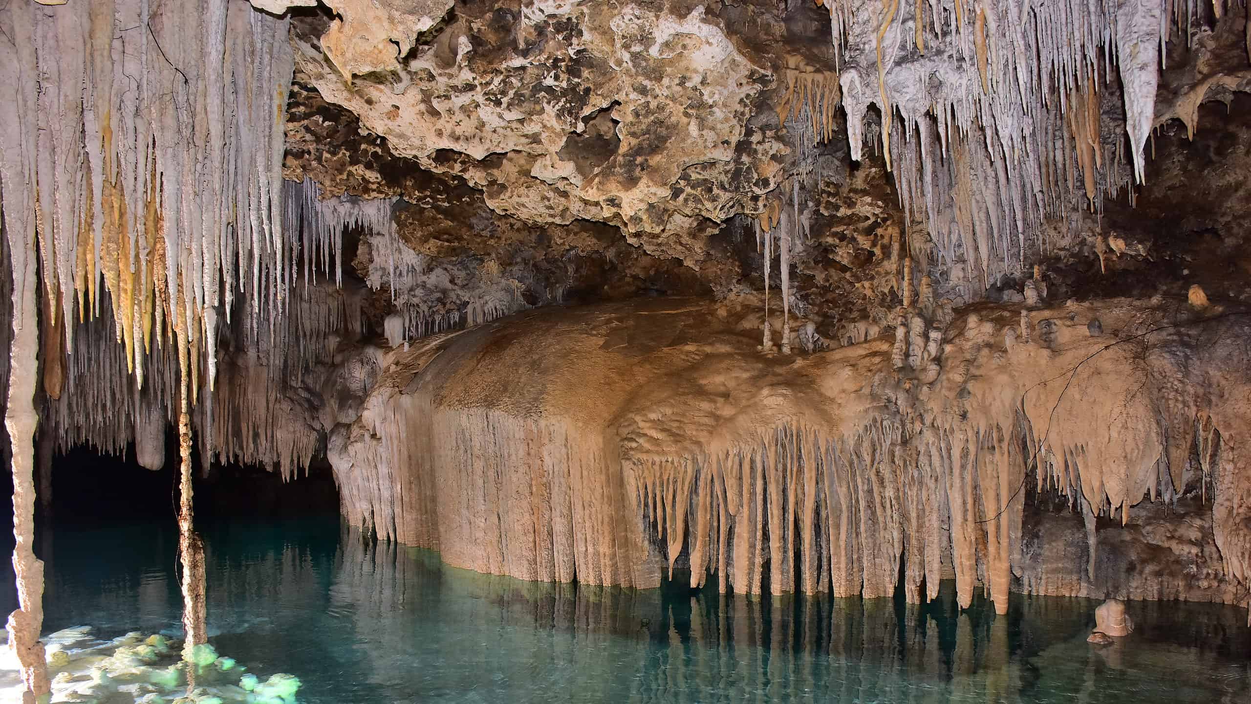
Rio Secreto
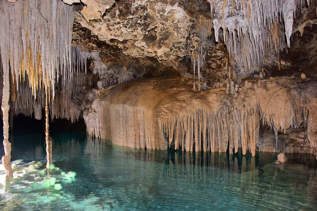
The Mexican government classifies the Rio Secreto as a nature reserve, and as such only 10% of the 38 kilometers of limestone caves are used for tourism.
©nikitich viktoriya/Shutterstock.com
The Rio Secreto (or Secret River) was discovered in 2004 by Don Cleo, a local landowner who was hunting an iguana into a hole in the ground and, in the process, chanced upon an entire system of caves that developed along a subterranean river running 24 miles.
The Rio Secreto runs for eight miles (with fifteen outlets) underneath the Riviera Maya, a coastline in the Yucatán Peninsula. The cave system has been the source of numerous archeological discoveries, including human skeletons and artifacts that are nearly 13,000 years old. Paintings, altars, and carvings of faces called Caritas made by the Maya people have been found in the cave as well.
A ship that dates back to roughly 1000-1697 AD was discovered at one cave entrance (thought to be an ancient reservoir) and is currently held at the Mexican National Institute of Anthropology and History.
The Rio Secreto is classified by the Mexican government as a nature reserve, and as such only 10% of the 38 kilometers of limestone caves are used for tourism. Speleologists explored and mapped the cave system from December 2006 to September 2007, and by April 2008 it was open for public guided tours. Rio Secreto had 104,000 tourists in 2016 alone.
Those visiting Playa Del Carmen should look for the Rio Secreto Underground River Tour, a guided tour that will allow you to explore fully the beauty and mystery of the Crystal Caves and Tulum Ruins.
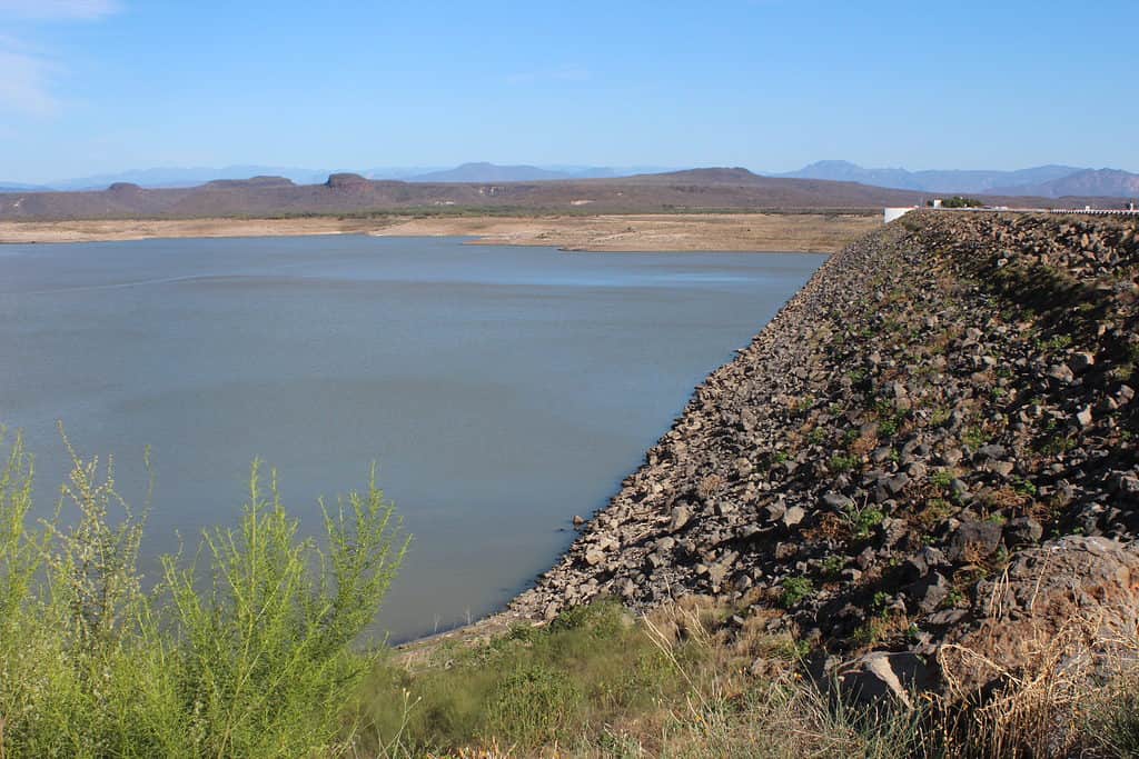
Grijalva River
About 60 miles of the Grijalva are travelable by boat, and its drainage basin is 51,900 square miles.
©iStock.com/KathiieMR
The Grijalva River (also known as the Tabasco River or the Mezcalapa River) is an offshoot of the Rio Grande that runs for 400 miles in southeastern Mexico. It was named for the man who discovered it, Juan de Grijalva, a conquistador from Spain who came to Mexico in 1518.
The Grijalva River starts in Chiapas from Nezahualcoyotl Lake. It continues through the state of Tabasco, across the Sumidero Canyon and the Bay of Campeche, and into the Angostura Dam – Mexico’s biggest reservoir. From there, the Grijalva River intersects with the Usumacinta River and eventually empties out into the Gulf of Mexico.
There are about 60 miles of the Grijalva that are travelable by boat, and its drainage basin is 51,900 square miles. Visitors to Chiapa de Corzo should travel north to visit the Sumidero Canyon, created 35 million years ago in concurrence with the Grand Canyon in Arizona by erosion from the Grijalva River. This canyon is also a national park and the second-largest tourist attraction in Chiapas, providing riverboat tours of its walls along the Grijalva.
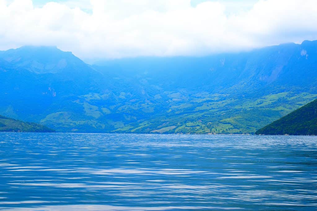
Balsas River
The Balsas River is one of Mexico’s largest rivers and helps separate the states of Guerrero and Michoacán.
©Baltstories/Shutterstock.com
The Balsas River (also known as the Mezcala River or the Atoyac River) is a 479-mile-long river in southern Mexico that runs from the plateaus of the Mesa Central region to the Pacific Ocean. It passes through the Mexican states of Puebla, Morelos, and Guerrero and México and joins the Pacific Ocean at Mangrove Point by Lázaro Cárdenas in Michoacán.
It is one of Mexico’s largest rivers and helps separate the states of Guerrero and Michoacán. Most of the Balsas is not navigable by boat, so it is primarily used for irrigation, flood control, and hydroelectricity. The Balsas River Basin is a fertile area that provides viable growing conditions for everything from cotton, sugarcane, and coffee, to fruits, vegetables, and corn.
Modern research has identified the Balsas River Valley as the birthplace of corn domestication roughly 9000 years ago. In fact, Mexico was one of the world’s first agricultural centers, and corn was one of the primary crops of the Americas. The Balsas River Basin is also one of Middle America’s biggest basins and is kept in arid conditions by winds from both the Gulf of Mexico and the Pacific Ocean.
The biggest project created along the Balsas was the En Infiernillo dam, a 65-mile-long lake created in 1964 to bring irrigation and 1 million kilowatts of electricity to central Mexico.
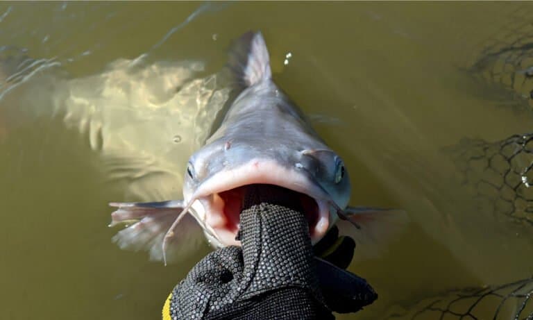
Rio Conchos
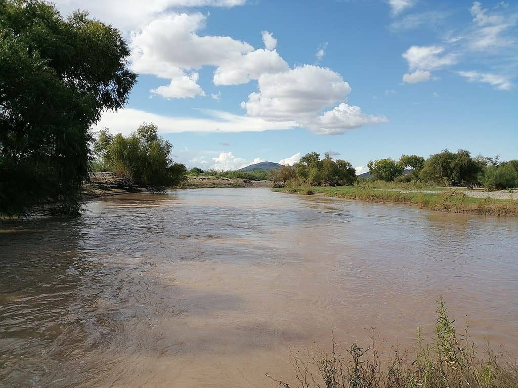
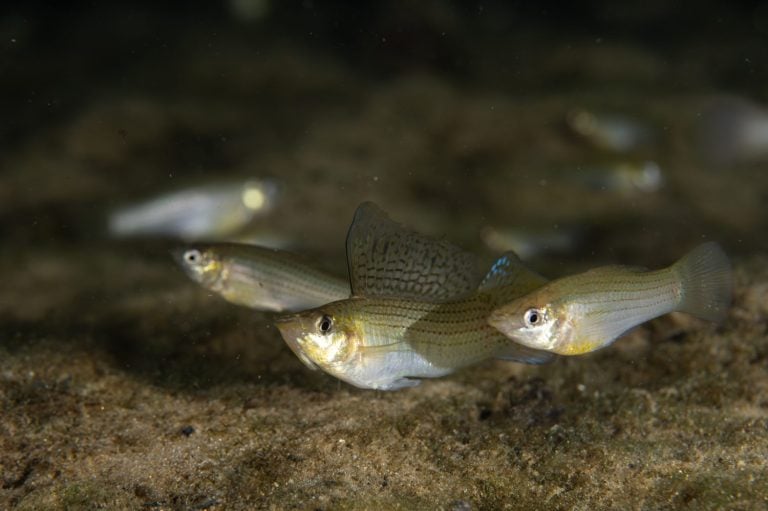
Of the 47 species of fish in the Rio Conchos, 12 are natural to the environment.
At 350 miles long, the Rio Conchos is one of the largest tributaries of the Rio Grande. It starts in the Sierra Madre Occidental mountain range, flows through to the La Boquilla Dam at Toronto Lake, and into a series of lakes and tributaries before finally joining the Rio Grand near Ojinaga.
It is the biggest river in Chihuahua and one of the most essential river systems in northern Mexico due to its multiplicity of reservoirs for hydroelectric and agricultural use. The Rio Conchos is included in the Global 200 Freshwater Ecoregions list, noted as an area of international importance for its distinct biodiversity.
The World Wide Fund for Nature is in charge of creating this list to keep track of conservation efforts around the globe. Unfortunately, the Rio Conchos is a “priority 1” river, which means it is currently in danger of disappearing. Of the 47 species of fish in the Rio Conchos, 12 are natural to the environment. There are also a number of amphibians and reptiles endemic to the region.
Such biodiversity has flourished because the river is not easily traversable by boat. This means that the usual dams and structures that disrupt river ecosystems are not present here. However, the Rio Conchos is currently threatened with contamination due to sewage, pollution, overgrazing, and waste from agricultural/land management operations in the area, such as clear-cutting.
Important dams and tributaries along the Rio Conchos include the Boquilla Dam, Río Satevó, Río Santa Isabel, Río Florido, and the Río San Pedro.
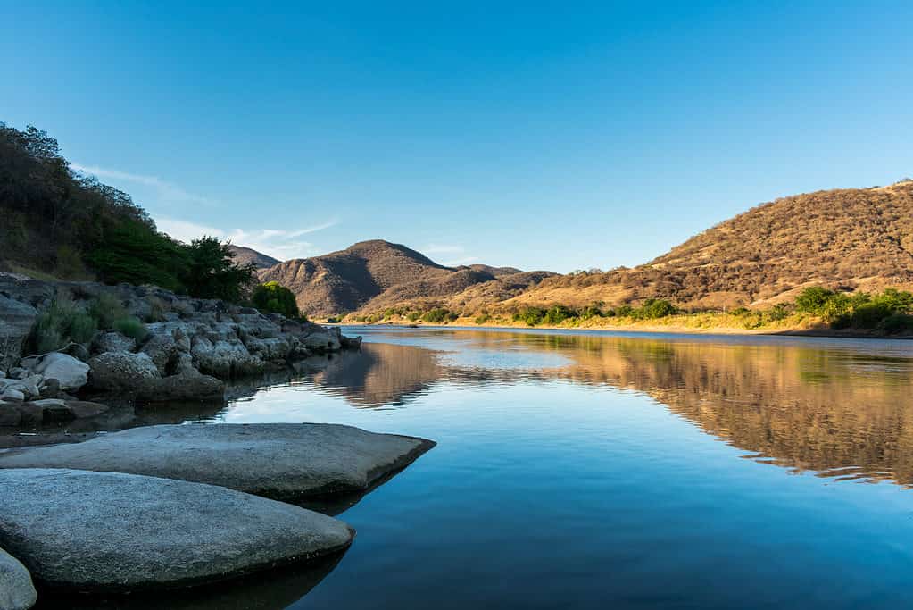
Fuerte River
The main use for the Fuerte River’s waters is irrigation, aided by the construction of the Miguel Hidalgo Dam near the city of El Fuerte.
©FVinas/Shutterstock.com
The Fuerte River starts in the Sierra Madre Occidental mountain range, where the Rio Verde/Rio San Miguel meets the Urique River, near the Mexican state of Sinaloa. From there, it flows 180 miles (350 if you include the Rio Verde) to the Gulf of California, where it meets the Pacific Ocean.
The main use for the Fuerte River’s waters is irrigation, aided by the construction of the Miguel Hidalgo Dam near the city of El Fuerte. With the help of this dam, the various farms and land plots in the Los Mochis lowlands are able to flourish.
The combination of the Fuerte River and the Miguel Hidalgo Dam also creates the Embalse de Gustavo Diaz Ordaz reservoir – the largest reservoir in the state of Tamaulipas. The water it collects is used to fulfill the varied agricultural needs of two Mexican states, the northern parts of Sinaloa and the southern parts of Sonora. Another use of the Fuerte River’s waters comes in the form of irrigating mango plantations that occur along its path.
Rafting along the Fuerte River is a common past-time, and hiking alongside it allows visitors to explore the region’s deciduous tropical forests. Local wildlife includes raccoons, white-tailed deer, rabbits, ducks, and doves.