
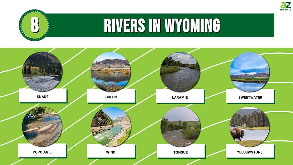
The state of Wyoming is filled with a plethora of breathtaking sights to see. There are dusty deserts, towering mountains, and raging rivers. Some of the rivers in Wyoming are special because they had a significant historical impact. Here’s a preview of the rivers we will discuss:
The United States’ westward expansion used a number of these rivers as a route. Along with serving as a source of hydroelectric power and irrigation, rivers have been a source for leisure activities over the years. Check out some of the magnificent rivers that flow across Wyoming.
Snake River
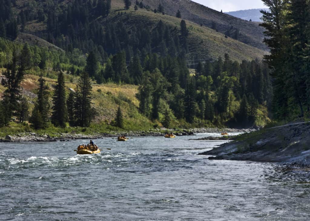
Drawing up to 300,000 tourists annually, Snake River is a popular attraction.
©Tucker James/Shutterstock.com
Wyoming’s Snake River, one of the country’s most stunning and unspoiled rivers, draws 300,000 tourists yearly. The Snake River offers a wide range of chances for water activity. These include “laid back” to “action and adventure,” much like the seemingly endless amount of paths in Jackson Hole.
Everyone can benefit from the river, regardless of their degree of expertise. When the river reaches the Snake River Canyon, it changes completely. For nearly 10 miles, the river is directed into a fury of whitewater punctuated by Class II and III rapids by sheer cliffs. The frothy waves and screaming splash of the Snake River Canyon make it a popular location for paddlers wanting an exciting trip. This has earned it names like Lunch Counter, Rope, and the Big Kahuna.
Located in Moose, Wyoming is the Snake River monitoring station. The Snake River is the Columbia River’s biggest tributary. Prior to joining the Columbia River in Washington, it travels from its source in western Wyoming via Idaho and Oregon.
Green River
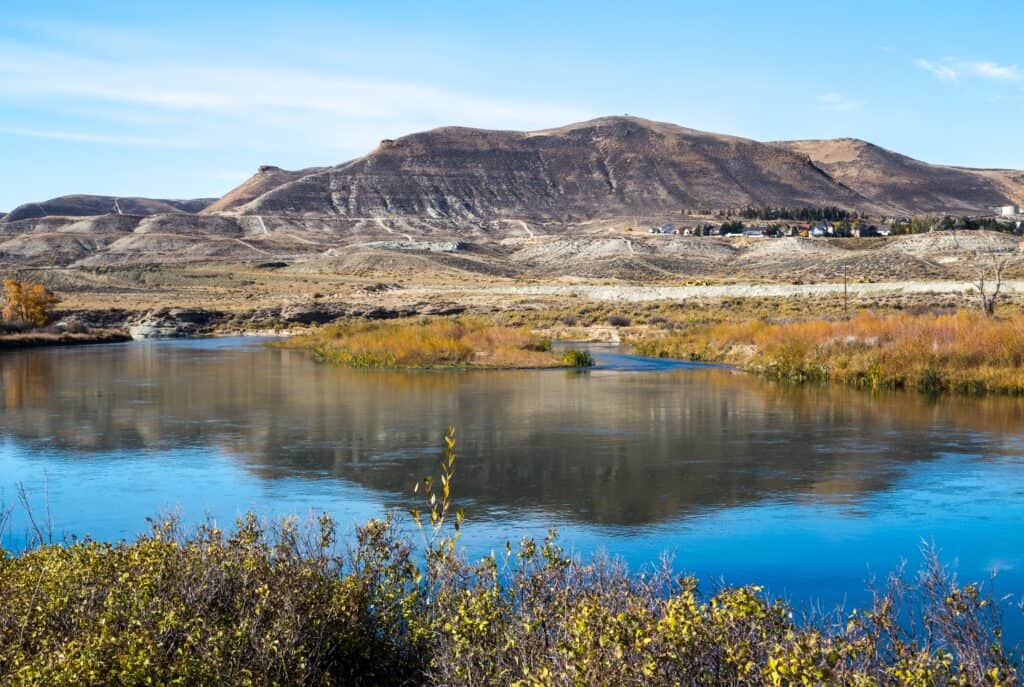
Serving as the main tributary of the Colorado River is the Green River.
©Victoria Ditkovsky/Shutterstock.com
The main tributary of the Colorado River is the Green River, situated in the western United States. The Green River Basin, the river’s basin, includes portions of the American states of Wyoming, Utah, and Colorado.
The Wind River Mountains in Wyoming are the starting point of the 730-mile-long Green River. The river spends most of its journey across Wyoming and Utah. The exception is a brief 40-mile section in western Colorado.
The Green River is the ideal location in Sweetwater County for serious relaxation. This huge torrent provides something exciting for kayakers, rafters, canoers, and water sport enthusiasts at every bend as it meanders through the breathtaking Southwest Wyoming countryside. It has a depth between three and 50 feet, depending on where you are in the river.
The Green River Whitewater Park and Tubing Channel, located in the center of the city of Green River, has something for everyone. Visitors to the river can meander, swim, float, or jump off of waterfalls that reach four feet high, as well as navigate challenging rapids and calm wading pools. The southern channel, where Castle Falls churns, is a popular destination for experienced paddlers.
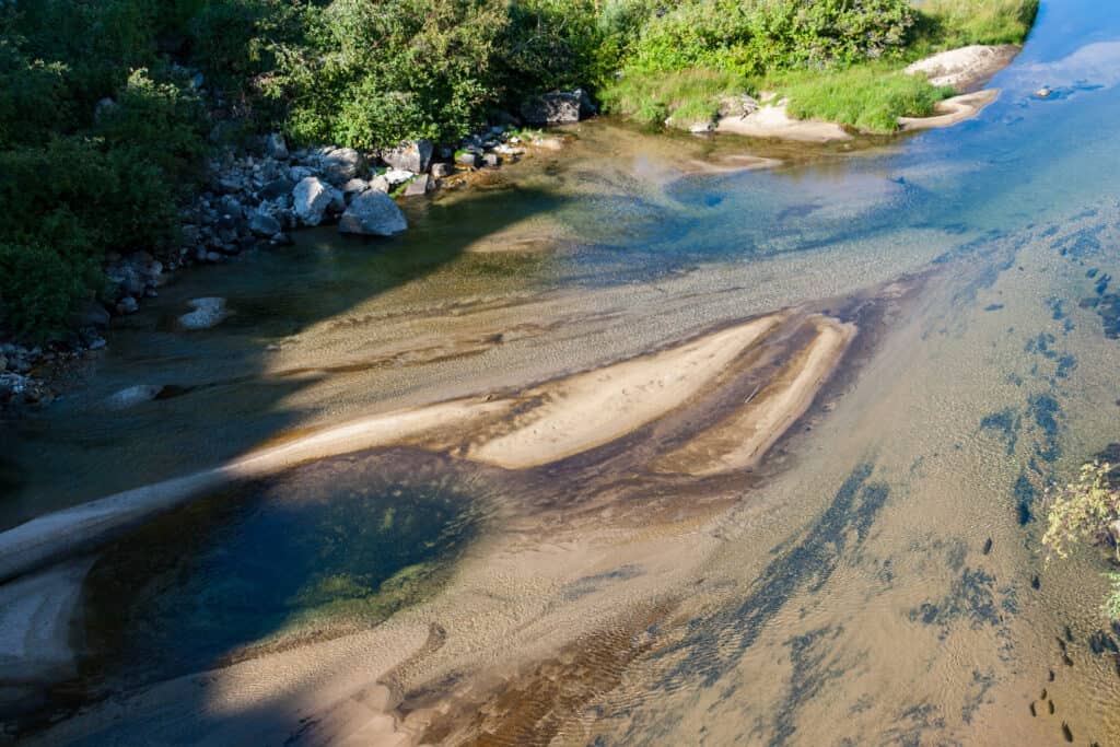
Laramie River
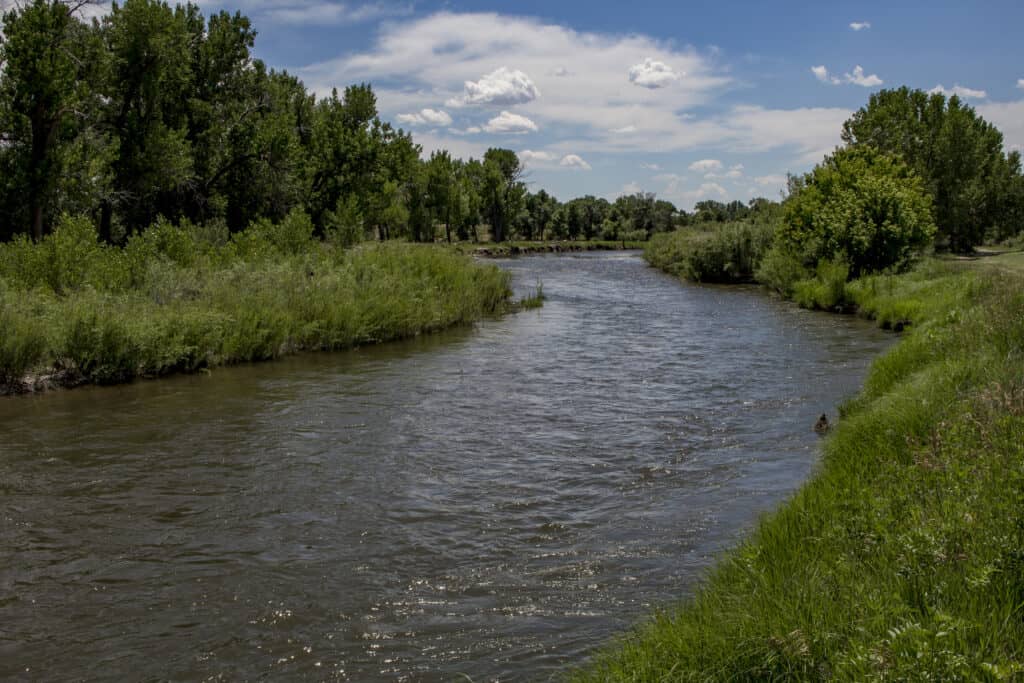
The name of the Laramie River is meant to honor Jacques La Ramée, a trapper who frequented the region.
©K. Bradley Washburn/Shutterstock.com
In the states of Colorado and Wyoming, the Laramie River is a tributary of the North Platte River and is about 280 miles long. The river’s name honors the fur trapper, Jacques La Ramée, who frequented the region at the beginning of the 19th century.
The word “Laramie” appears in the names of several geographic entities in the area, including Laramie County, Wyoming, the city of Laramie, and others. This place is a true freestone river, and because irrigation needs are so great, flows change considerably.
Springtime and late autumn are the ideal times to go fishing. Focus on riffles, deep crevices, and undercut edges rather than open flats. Wild browns between 10 and 16 inches in length are typical, although a few fish in the Big Laramie can weigh more than 10 pounds.
Sweetwater River
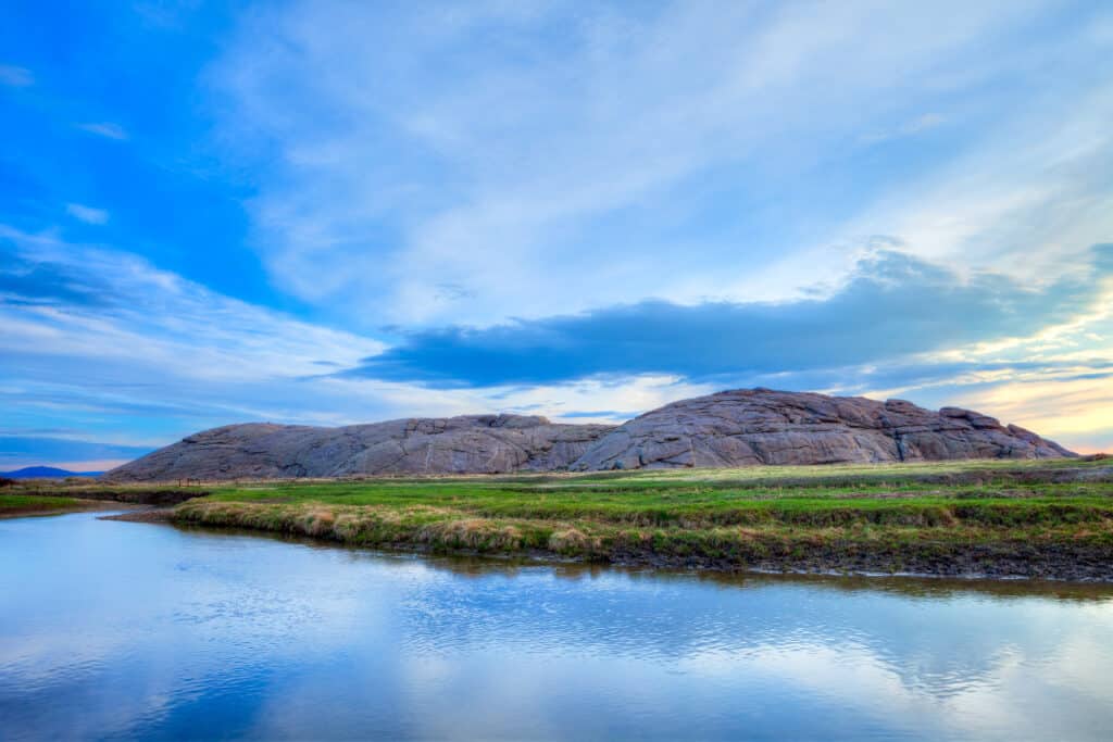
Independence Rock is a major path marker of Sweetwater River.
©LHBLLC/Shutterstock.com
In the American state of Wyoming, the Sweetwater River is a 238-mile-long tributary of the North Platte River. Its waters eventually flow into the Gulf of Mexico as a component of the Mississippi River system. From the neighborhood of Casper to South Pass, the Oregon Trail traveled along the Sweetwater in a westward direction.
A path marker was Independence Rock, a granite pillar standing 193 feet above the river’s north bank not far from the lake. Legend says General William Ashley gave the river its name in 1823, because the poachers thought the water tasted delicious.
From Sweetwater’s headwaters to Sweetwater Station, great brown and rainbow trout fishing are available in a natural setting. Its underappreciated fishery status is a result of its challenging access, yet fishermen looking for a wild, undeveloped experience will prioritize it.
Popo Agie River
Another name for Popo Agie River is Middle Fork.
©Wirestock Creators/Shutterstock.com
Fork in the Road American state of Wyoming is home to the Popo Agie River. There are 54 miles in the river. Occasionally, the river is simply referred to as the “Middle Fork.” This body of water and its tributaries feed approximately 11,503 acres out of its headwaters in the Wind River Range till it reaches the North Fork of the Popo Agie River. The river is a member of the Popo Agie Watershed.
The majority of people think the Crow Indian phrase Popo Agie means “gurgling river.” The river was known as the Crow River by the local Crow population when the initial white trappers came to the region. The pronunciation is “Puh – Po Shuh.”
In the Wind River Range, close to the Wyoming town of Lander, Popo Agie Falls is a swimming hole and play waterfall. This cascade includes a series of irregular falls on the Middle Popo Agie River, providing a very stunning picturesque area as well.
Wind River
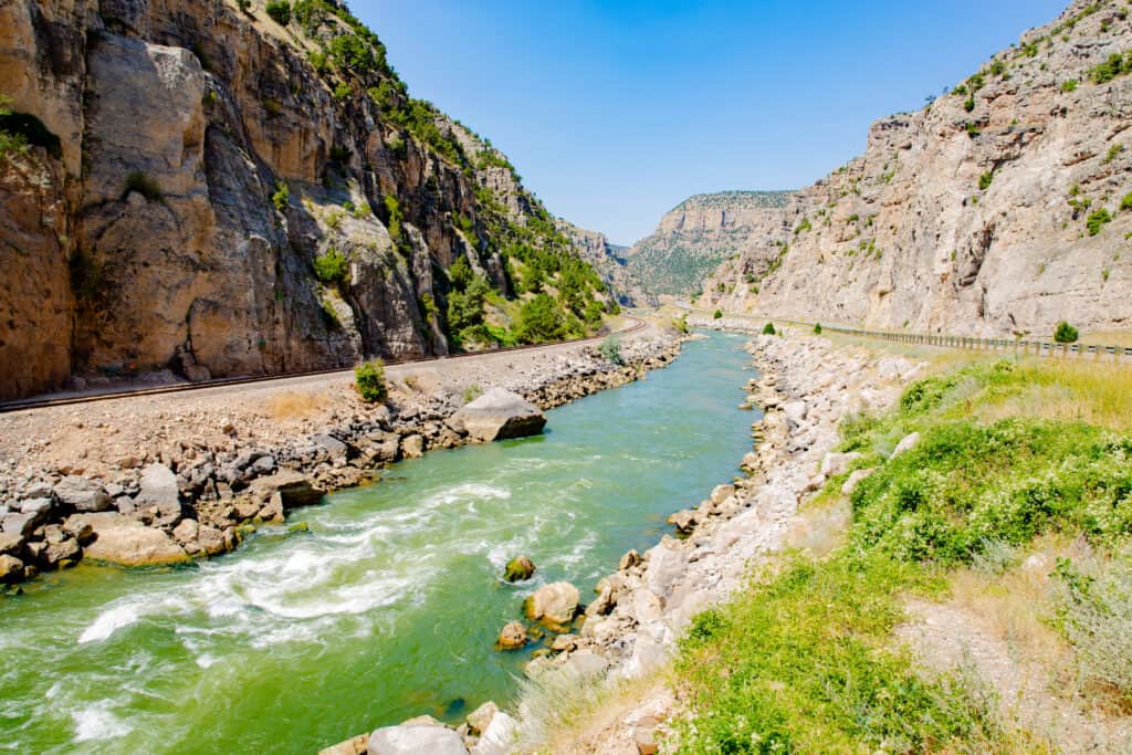
The 185-mile Wind River comprises the higher sections of Bighorn River.
©Traveller70/Shutterstock.com
The Bighorn River’s higher sections in Wyoming make up the Wind River. There are 185 miles in the Wind River. The renowned trout fishing area close to Fort Smith, Montana, comes to mind when you picture the Bighorn River. You might not be aware that there is another exceptional tailwater fishing upwards of 100 miles upstream, close to the quaint Wyoming town of Thermopolis.
Thermopolis’ natural hot springs, which were frequented by Butch Cassidy and his Wild Bunch, make the hamlet a comfortable rest stop for travelers en route to neighboring Yellowstone National Park. The few fishermen who are aware of the fishing adore it for its seclusion, abundant huge brown, rainbow, and cutthroat trout, and superb dry-fly fishing in the spring and fall.
Tongue River
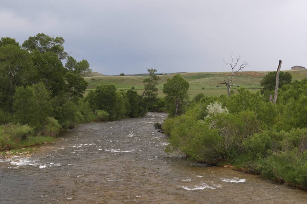
The Tongue River is a tributary of the Yellowstone River.
©vagabond54/Shutterstock.com
In the American states of Wyoming and Montana, the Tongue River is a tributary of the Yellowstone River. It’s about 265 miles long. The Tongue River originates in Wyoming’s north-central Bighorn Mountains and travels east and north. It eventually leaves the state and enters Montana.
The north and south forks of the river flow across lower slope fields at the mountain’s summit before combining and forming a steep canyon that leads to the border of the Forest Service near Dayton. The Tongue’s chilly, crystal-clear water has long provided people with refuge, food, and recreation.
Yellowstone River
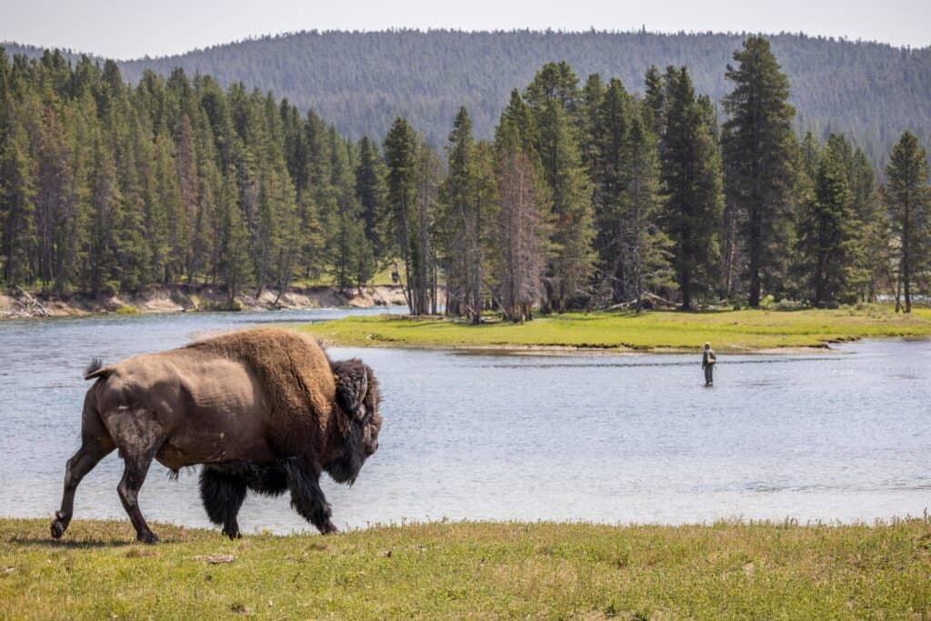
At around 692 miles long, the Yellowstone River is a massive tributary of the Missouri River.
©Cavan-Images/Shutterstock.com
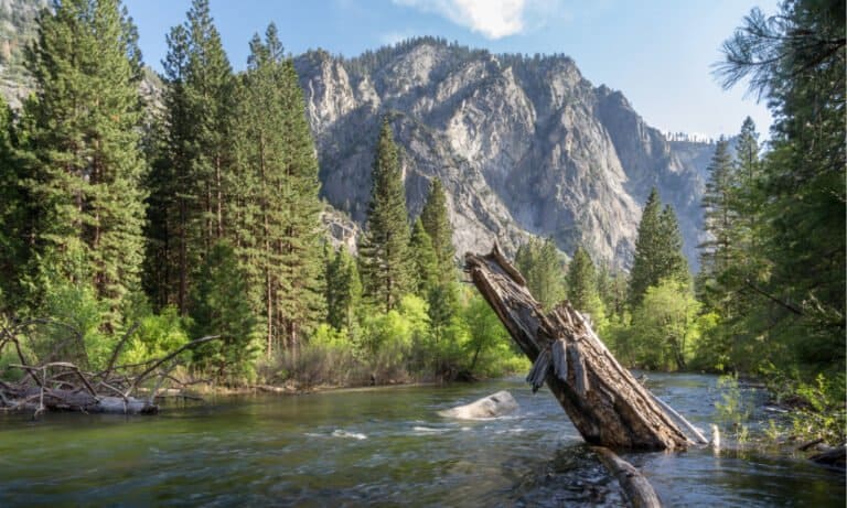
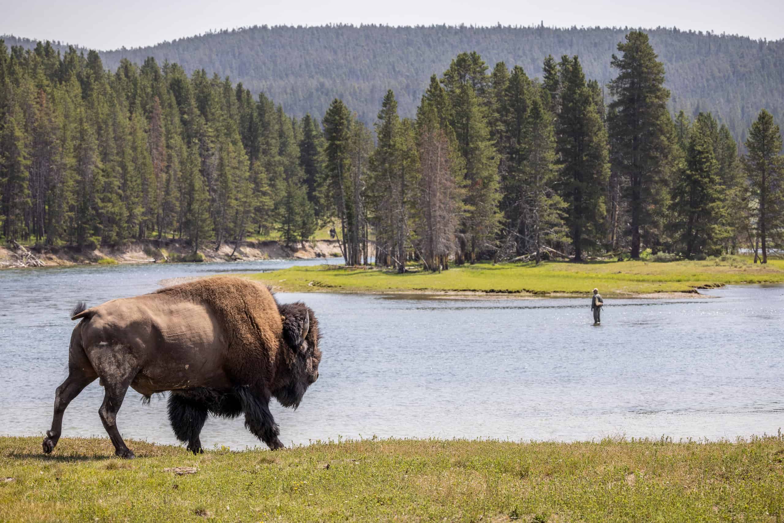
Around 692 miles long and located in the western United States, the Yellowstone River is a tributary of the Missouri River. Thought to be upper Missouri’s main tributary, it draws water from the Rocky Highlands near Yellowstone National Park to empty an area with headwaters in the Rockies and high plains of southern Montana and northern Wyoming.
About 25 miles west of the present-day Williston, it runs northeast to its merger with the Missouri River on the North Dakota side of the frontier. Yellowstone cutthroat trout are abounding in the river inside Yellowstone National Park, which offers convenient flat-water fishing.
The part of the river that flows through the Hayden Valley is permanently closed. The remainder is open and wadable, though. Floating is prohibited. After the river opens on July 15, there are various insect hatches that provide anglers the chance to try a variety of synthetic flies, such as Pale Morning Duns, Green Drakes, Gray Drakes, Caddis, and salmon flies.
Summary of 8 Rivers in Wyoming
| Name of River | Connections | Length in Miles |
|---|---|---|
| Snake | Columbia River’s biggest tributary | 1078 |
| Green | Colorado River’s main tributary | 730 |
| Laramie | North Platte River tributary | 280 |
| Sweetwater | North Platte River tributary | 238 |
| Popo Agie (Middle Fork) | Part of the Popo Agie Watershed; joins the North Fork | 54 |
| Wind | Comprises the higher sections of the Bighorn River | 185 |
| Tongue | Yellowstone River tributary | 265 |
| Yellowstone | Missouri River tributary | 692 |