
The United States has several recreational lakes, like Lake Lanier, created by damming rivers. Many of these artificial lakes have hundreds of miles of shoreline and thousands of acres of surface area. However, lake width is not as commonly recorded: it can be difficult to accurately find the widest point of a body of water that winds through river channels like a dragon. So, with that in mind, how wide is Lake Lanier?
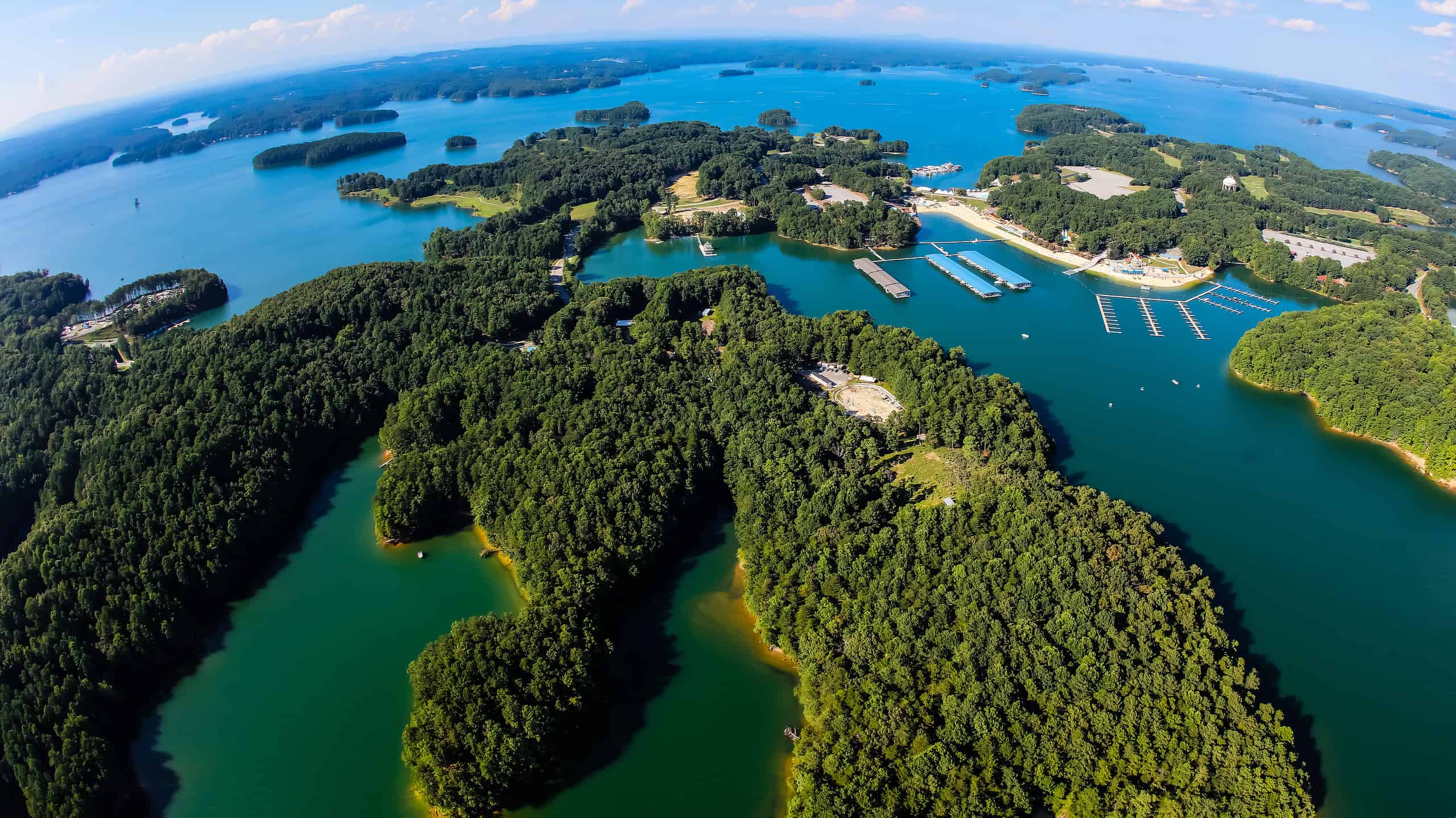
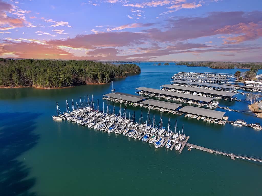
Lake Lanier has a very complex shoreline.
©Brett Barnhill/Shutterstock.com
The History of Lake Lanier
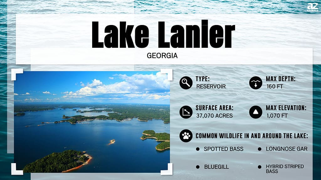
The U.S. state of Georgia is the home of Lake Lanier, the namesake of poet Sidney Lanier. The U.S. Army Corps of Engineers built Lake Lanier when they dammed the Chattahoochee River in 1956 for flood control, recreation, power generation, and creating a regional water supply. The Chestatee River also feeds the reservoir, which has a surface area of about 59 square miles and about 692 miles of shoreline. However, its construction was not without some negative impacts, as it covered tens of thousands of acres of farmland, and displaced families, businesses, and even cemeteries.
Interesting Lake Lanier Facts
- The United States Army Corps of Engineers created the lake in the state of Georgia in 1956 through the construction of the Buford Dam.
- Lake Lanier is one of the most popular recreational lakes in the nation. It tops the list of those in the Southeast, with millions of visitors yearly.
- Lake Lanier has an area of 59 square miles and is about 1,071 feet above sea level.
- The lake can fluctuate seasonally due to drought, flood control, power generation, and heavy rain.
- The Chestatee and Chattahoochee Rivers carry water from the Blue Ridge Mountains of Georgia to the lake.
- Lake Lanier is about 60 miles northeast of Atlanta, GA.
- The construction of Buford Dam and the creation of Lake Lanier cost about 45 million dollars.
Lake Lanier on a Map
Ways of Measuring Lake Lanier
There is a lack of information about the width of Lake Lanier, though there is information about the length, area, depth, and shoreline. The surface area of Lake Lanier is about 59 square miles, with about 692 miles of shoreline. Lake Lanier is approximately 27 miles long and has an average depth of 156 feet. We will find its width using its length as a starting point.
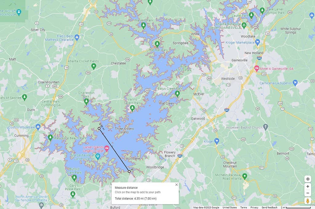
Lakes are measured through ground surveys, GPS data, aerial reconnaissance, and the analysis of satellite imagery. Without direct access to these methods, we can use the mapping data and measuring tools in Google Maps. The width of a lake is measured perpendicular to its length, which has been given as 27 miles. This can be more difficult with reservoirs due to their irregular shape, so measurements are approximate.
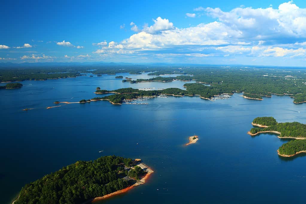
Given its irregular shape, it can be challenging to determine how wide Lake Lanier is.
©Marcus E Jones/Shutterstock.com
How Wide is Lake Lanier?
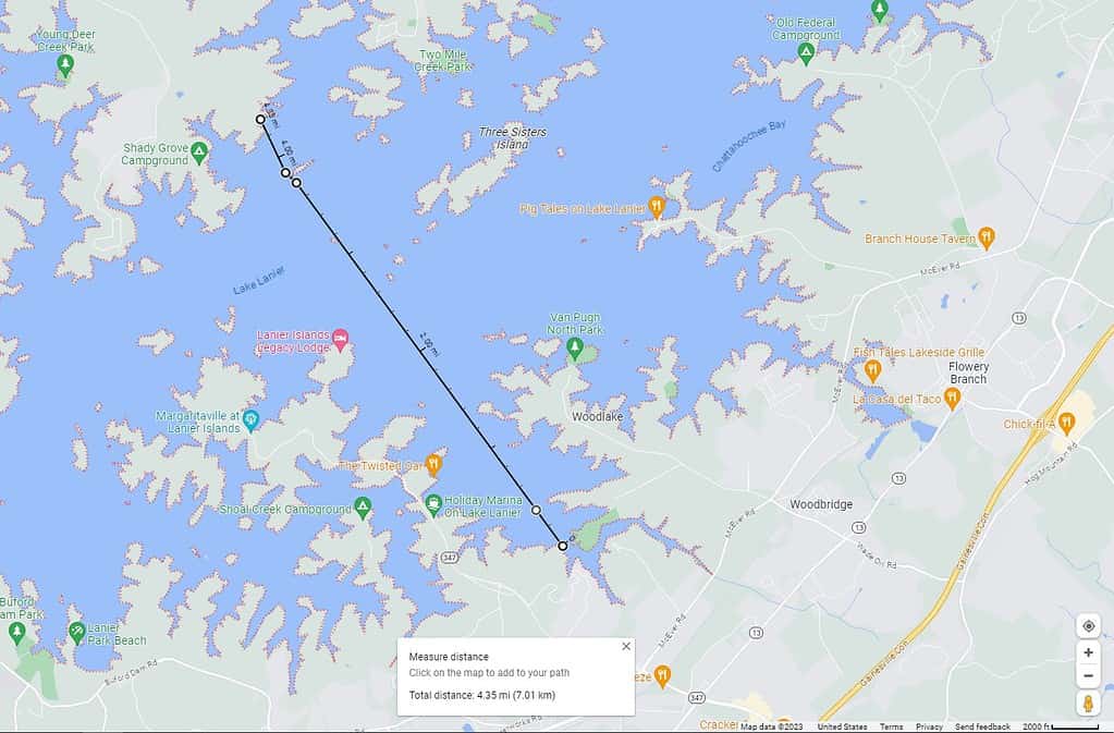
A square can be used to find the broadest open water stretch of the lake perpendicular to its length. The widest point of the lake perpendicular to this length is 4.35 miles.
How wide is Lake Lanier? A-ZAnimals.com/Rob Amend
©A-Z-Animals.com/Rob Amend
How Long Would It Take an Average Swimmer to Swim the Width of Lake Lanier?
If an average swimmer jumped into the lake from a home off Breezy Bay Road, 2 hours and 10 minutes later, they would have covered 4.35 miles, climbing out of the lake across from Burton Mill Park.
A-ZAnimals.com/Rob Amend
Comparable Lakes in The United States
Lake Lanier is a reservoir lake with recreational uses. Some of the country’s top recreational lakes (with their widths) are:
- Lake Tahoe: Straddling the border of U.S. states California and Nevada, Lake Tahoe is one of the world’s most popular recreational lakes. Millions of years ago, the earth’s crust fractured and formed the lake’s basin. The lake is 22 miles long by 12 miles wide, with a shoreline that’s 72 miles long and a surface area of 191 square miles.
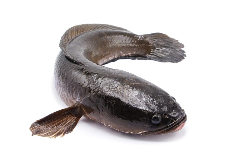
- Lake of the Ozarks: This artificial lake in the U.S. state of Missouri is over 93 miles long and over 130 feet deep. It has over 1,000 miles of shoreline and winds around so much that it resembles a dragon.
- Lake Winnipesaukee: Lake Winnipesaukee is the state of New Hampshire’s largest lake. It is a natural lake with an outflow regulated by Lakeport Dam. Damming the lake allowed the water to rise, incorporating other bodies of water into its own. The lake is home to over 260 small islands and several peninsulas, contributing to its 288-mile shoreline. It is around 20 miles long and measures 9 miles at its maximum width. At its deepest, it is 180 feet deep.
- Lake Placid: Lake Placid is a natural lake In the U.S. state of New York, in the Adirondacks, known for having hosted the Olympics twice. It is divided into two basins, or “lobes,” with different depths and temperatures: East Lake and West Lake. At its greatest depth, the lake is over 150 feet deep. Its width measures 1.5 miles.
So, how wide is Lake Lanier? Although it is difficult to measure such an irregularly shaped lake, at 4.35 miles wide, Lake Lanier is a beautiful recreational area and the crown jewel of lakes in the Southeast.