
Pennsylvania is aptly known as the Keystone State due to its pivotal role in the nation’s history and its status as a pioneer in building national trails. With 188 rail trails and more than 2,100 miles, There are several wonderful rail paths to discover in Pennsylvania, including the longest biking trail in Pennsylvania, if you enjoy riding a bicycle.
Pennsylvania has the third-highest concentration of rail trails in the nation, just behind Michigan and Minnesota. Because they were once railroad lines, rail trails are convenient for cycling and usually have beautiful scenery. Thanks to their flat terrain and lovely surroundings, they’re a fantastic option for anyone searching for a simple route to run or walk on.
Which of the 200 biking trails in Pennsylvania is the longest? Let’s dive into everything you need to know about the longest biking trail in Pennsylvania, plus some more interesting facts.
What Is The Longest Biking Trail In Pennsylvania?
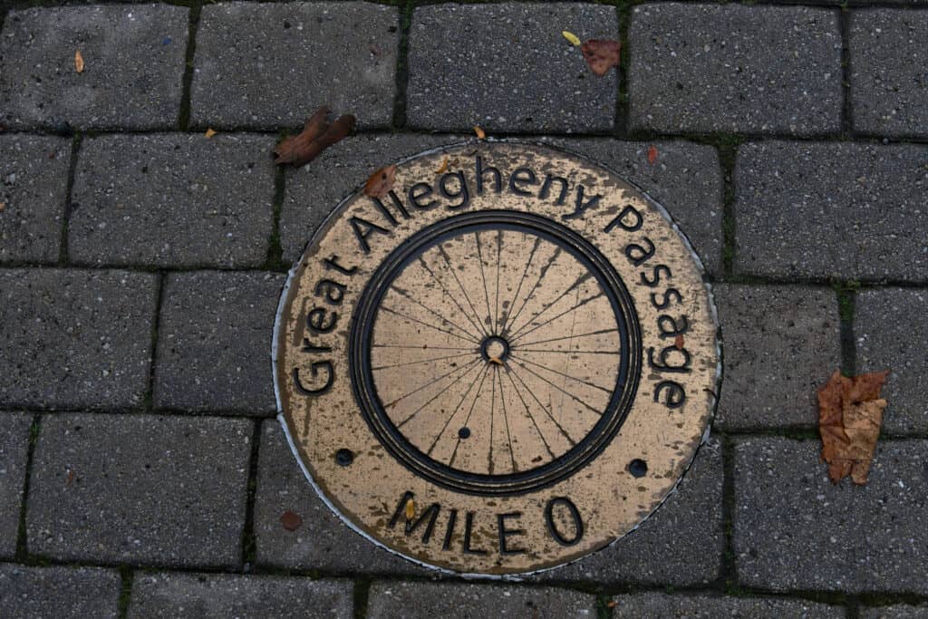
The Great Allegheny Passage trail is the longest biking trail in Pennsylvania.
©Steve Guldeman/Shutterstock.com
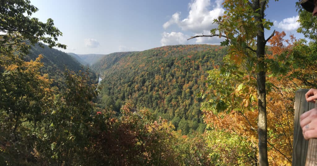
Running a 150-mile trail, the Great Allegheny Passage is unquestionably the longest biking trail in Pennsylvania. Between Homestead, PA (near Pittsburgh), and Cumberland, MD, more than 150 miles of converted rail lines make up the Great Allegheny Passage. A relatively flat rail trail connects to the C&O Canal Towpath for a total of 334.5 miles before reaching Washington, D.C.
You can traverse valleys and navigate around mountains on this trail. You can cross the Mason-Dixon line, visit several state parks, explore several trail towns, and much more if you ride the trail’s full length.
Unexpectedly, the trail parallels the Allegheny River, but make sure your bike can handle any terrain as you will be riding on gravel, crushed limestone, and in certain locations, dirt, in addition to asphalt and concrete.
The Great Allegheny Passage Route
In general, this route between Cumberland and Pittsburgh follows former rail lines, and Cumberland is the location of the mile 0 marker. The highest point on the Great Allegheny Passage is the Eastern Continental Divide at 2392 feet above sea level. You can reach Pittsburgh by continuing west, where you will notice that the incline is mild but constant. Many historical locations along this path can inform you about Western exploration and even the French and Indian War.
The Allegheny Highlands Trail in Pennsylvania, the Allegheny Highlands Trail in Maryland, the Steel Valley Trail, the Youghiogheny River Trail, and the Three Rivers Heritage Trail make up the route of the Allegheny Passage. The route also incorporates the 52-mile Montour Trail, which serves as Pittsburgh International Airport.
The Potomac Heritage National Scenic Trail, one of eight national scenic trails, encompasses the section of the trail between Ohiopyle and Cumberland.
Where Is Pennsylvania Located On A Map?
The Great Allegheny Passage starts in Cumberland, Maryland, and ends in downtown Pittsburgh Pennsylvania at Point State Park. Pennsylvania is located in the northeast region of the United States and is classified as a mid-Atlantic state. It is bordered by Lake Erie to the north, New York to the north and east, New Jersey to the east, Delaware and Maryland to the south, West Virginia to the southwest, and Ohio to the west.
Wildlife At The Schuylkill River Trail

During your exploration of the Allegheny Passage Trail, you might get lucky and see Pennsylvania’s beautiful wildlife.
©iStock.com/juefraphoto
While biking this trail, some individuals may be concerned about bears. Bears, however, pose little danger along the Great Allegheny Passage. Raccoons, squirrels, and mice are more likely to become a problem in wooded locations.
While on the route, you will likely witness many of Pennsylvania’s native wildlife. There are a lot of local species throughout this fairly long trip, and there are more than 400 bird species, several fish species, 90 different animal species, and many more.
You’re likely to spot many birds when biking along the path. These include the red-tailed hawk, the wild turkey, the black vulture, and others. There are also many moles, bats, rabbits, and squirrels. You might even observe a beaver building a dam if you approach a river.
Other Biking Trails In Pennsylvania
1. Schuykill River Trail
Schuylkill River Trail is a multipurpose path that runs beside the river’s banks. The path, partially finished as of 2018, is intended to stretch 140 miles from the river’s source in Schuylkill County to Fort Mifflin in Philadelphia.
2. Pine Creek Rail Trail
The Pennsylvania Grand Canyon.
©iStock.com/Kaytlin King
The Pine Creek Rail Trail is an excellent destination in north-central Pennsylvania. This is actually one of Pennsylvania’s most picturesque rail trails. It travels along a disused railroad bed through the PA Grand Canyon’s forested hillsides, which can rise to 1,000 feet above the trail. Longer stays are possible thanks to the abundance of trailheads, comfort stations, campgrounds, and hotels in small towns along the route.
3. Ghost Town Trail
This 36-mile rail track called the Ghost Town Trail runs through the Pennsylvania counties of Indiana and Cambria. Indeed, the Ebensburg and Blacklick Railroad hauled coal using this rail route until the early 1990s. On the Ghost Town Trail, you’ll be biking beside several streams, typical of Pennsylvania’s rail trails, and an opportunity to appreciate the area’s unobstructed beauty.
4. Oil Creek Bike Trail
The Oil Creek Bike Trail crosses one of Pennsylvania’s most famous regions. This picturesque 9.7-mile asphalt track is constructed on a former railroad slope that winds through parkland and woods and is parallel to Oil Creek. The world’s oil business began in this valley, where the route starts in the north at the Drake Well Museum, the site of the first intentionally-dug oil well. Ghost towns, old oil equipment, and the lovely brook may all be seen along the way.
5. Armstrong Trail
The Allegheny River is followed by the 35.5-mile Armstrong Trail, a rail trail in Armstrong County, Pennsylvania. This trail offers breathtaking views of the Allegheny River and some rather unique railroad artifacts, particularly in the trail’s northern miles.
The photo featured at the top of this post is © Brian Yarvin/Shutterstock.com


Sources
- Uncovering PA, Available here: https://uncoveringpa.com/rail-trails-in-pennsylvania#:~:text=Schuylkill%20River%20Trail&text=The%20longest%20completed%20portion%20of,the%20heart%20of%20the%20city
- Wikipedia, Available here: https://en.wikipedia.org/wiki/Schuylkill_River_Trail
- Visit Philadelphia, Available here: https://www.visitphilly.com/things-to-do/attractions/schuylkill-river-trail/

How to Add Us to Google News


Thank you for reading! Have some feedback for us? Contact the AZ Animals editorial team.