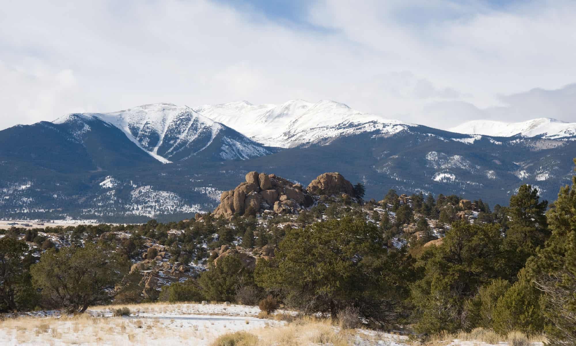

The Rocky Mountains are one of the many mountain chains that stretch across portions of the United States. They are also sometimes called the Rockies. The Rocky Mountains are the longest main chain in the United States and they stretch for 3,000 miles across six different states. There are also many subranges of the Rockies that include smaller peaks.
According to geologists the Rocky Mountains are between 80-50 million years old. Many of the mountains in the Rockies are considered sacred by various indigenous tribes that have lived on the land that is now the United States for thousands of years. These mountains draw millions of hikers and visitors to the states where they are located.
What States The Rocky Mountains Are In
The Rocky Mountains can be found in six states: Colorado, Wyoming, Montana, Idaho, New Mexico, and Utah. Most of the mountains are in Colorado, including the 10 highest peaks in the entire mountain chain. Mount Elbert, which is the highest point in the Rocky Mountains, is also one of the tallest peaks in the United States.
Learn more about where the Rocky Mountains start and end.
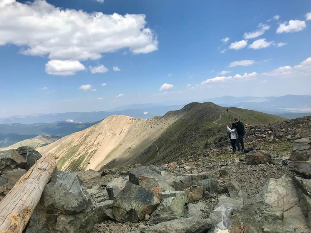
Colorado
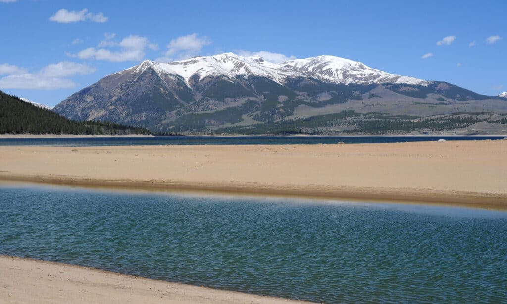
Mount Elbert
©iStock.com/SeanXu
Highest Peak: Mount Elbert -14,439 feet
Nearby City: Leadville
Known For: Mount Elbert is the highest point in the Rocky Mountains and the second highest peak in the contiguous United States. It’s just 16 miles from Leadville so that’s where many hikers stay before they set off to hike Mount Elbert. There are five trails that lead to the summit of Mount Elbert and all of them are relatively easy. You don’t need to be an experienced hiker or trail runner to get to the summit of Mount Elbert. Once you get up there you will get breathtaking views.
If you’re going to be dayhiking up Mount Elbert make sure that you start off early in the morning. Storms can come up fast on the mountain and snow and ice are always possible even if you’re hiking in the summer. If you are on the mountain and the weather starts to turn get down the mountain as quickly as you can. Better to have to hike to the summit another day than get caught in some of the epic storms that occur at that elevation.
Wyoming
Gannett Peak, Wyoming’s high point, and the headwaters of the Green River.
©Jeff Bernhard/Shutterstock.com
Highest Peak: Gannett Peak – 13,810 feet
Nearby City: Pinedale
Known For: Gannett Peak is part of the Continental Divide Scenic Trail and it’s one of the toughest hikes in the contiguous United States. It is the highest summit within the Yellowstone Ecosystem in Wyoming and it’s the second highest peak in the entire stretch of the Rocky Mountains. There is an 896 acre glacier that sits on the northern slopes of the mountain. Hikers face the possibility of severe weather and run-ins with Black bears, but that doesn’t stop many of them.
However, you do need to be an experienced climber, hiker, and mountaineer to take on Gannett Peak. This mountain is quite remote and the incline is steep. At points you will need to climb narrow peaks and rock scramble while dealing with extreme cold, snow, and ice. Getting to the summit can take up to five days depending on weather conditions so you will need to be prepared for cold weather backcountry camping. It’s highly recommended that anyone who wants to climb Gannett Peak climbs with a friend or a guide. Hikers and climbers who are up for the challenge of Gannett Peak can pick up the Elkhart Trail in Pinedale. That will take you past several lakes and into Titcomb Basin. From the Basin you can pick up one of several other trails that will take you to the base of the mountain.
Montana
A view towards the summit of Granite Peak, Montana
©Jason Maehl/Shutterstock.com
Highest Peak: Granite Peak – 12,799 feet
Granite Peak is part of the Beartooth Range of south-central Montana. At 12,799 feet, it stands out as the highest peak in the state. It’s one of seven of a closely grouped chain of peaks over 12,000 feet in elevation, along with Hidden Glacier, Glacier Peak, Mount Villared, Tempest Mountain, Mystic Mountain and Mount Peal. This area of climbing is for the adventurous. The high altitude, weather and rugged terrain make this a challenge, requiring careful preparation and intense physical effort.
The peak can be approached from several sites. The south side is accessed from Cooke City to the Sky Top Lakes. The most popular route is from Fishtail to Mystic Lake and the hauntingly-named Froze-to-Death Plateau to the east face of Granite Peak. All pitches are steep and Granite Peak should not be tackled as a first mountain by beginners, unless they’re accompanied by an experienced guide. Route-finding techniques, belaying and rappelling knowledge and the understanding of the use of an ice axe will be necessary to ensure a great experience on this mighty mountain.
Idaho
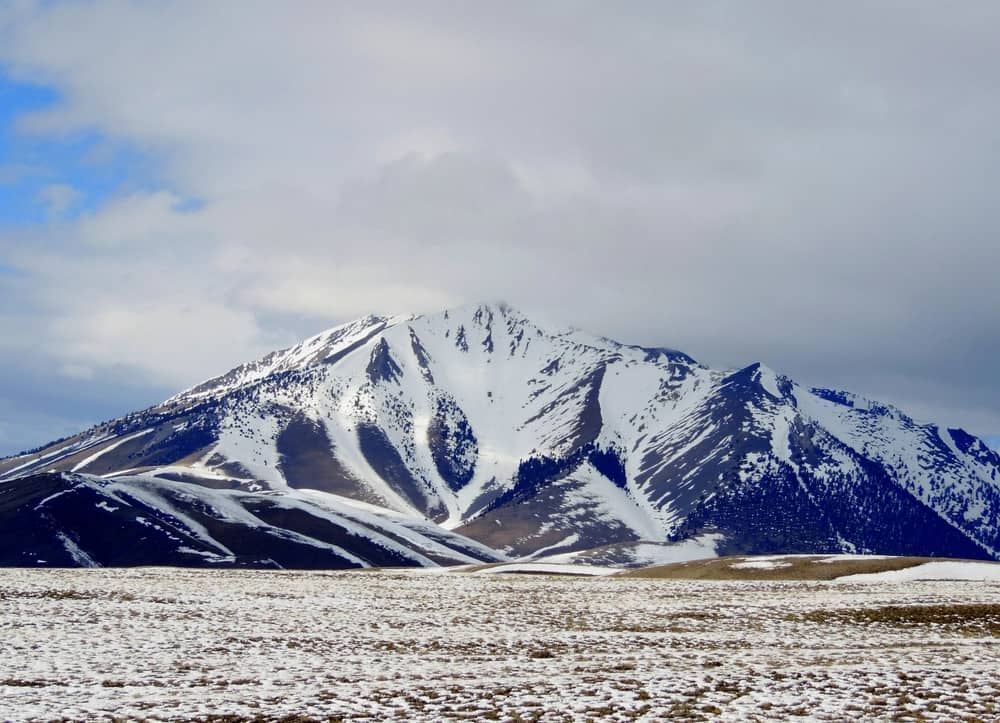
Snowy Borah Peak in Idaho.
©Debby Ford/Shutterstock.com
Highest Peak: Borah Peak -12,662 feet
Nearby City: Arco
Known For: Borah Peak is Idaho’s only glacial mountain and it’s really impressive to see. If you can make it to the summit the views are stunning. But like many of the other Rocky Mountain peaks this isn’t a climb for beginners. Hikers on Borah Peak will be navigating trails that can gain 5,000 feet of elevation in just a five mile section of trail. The trails to the top of the mountain are steep and long.
In good weather hikers who are trying to get to the summit in one day may put in 12 hours or more of climbing. Hikers who are using Borah Peak to hone their mountaineering skills should practice mountain climbing, rock climbing, and rock scrambling skills before they attempt to make it to the summit of Borah Peak.
You can set up camp at the Borah Peak Trailhead, which is also recommended. The trail guides for Borah Peak suggesting starting your hike as early as 4.30 A.M. so that you are off the mountain by 1 P.M. If storms are going to hit on the mountain they usually hit in the afternoon and evening. Hikers should try to plan their hike accordingly and be back down at base camp by the afternoon.
New Mexico
View from atop Wheeler Peak, the tallest mountain in New Mexico.
©Elijah Beck/Shutterstock.com
Highest Peak: Wheeler Peak – 13,167 feet
Nearby City: Taos
Known For: Wheeler Peak has a relatively moderate incline for a peak in the Rocky Mountains which makes it a little easier than some of the other Rocky Mountain peaks to hike. You will still be hiking in snow near the summit though so always be prepared with cold weather gear and snow poles or spikes. Wheeler Peak is a gorgeous hike that will give you views of the best that the stunning landscape of New Mexico has to offer.
To get to the summit of this mountain you will need to take two different trails. The Bull-of-the-Woods Trail and the Williams Lake Trail are the only two trails that will go all the way to the summit. There is a parking lot for RVs and campers at the Bull-of-the-Woods trailhead. If you take the Williams Lake Trail you will be hiking through the Taos ski area on your way to the wilderness. Some of the trail lies on private property so be respectful and stay on the trail.
Utah
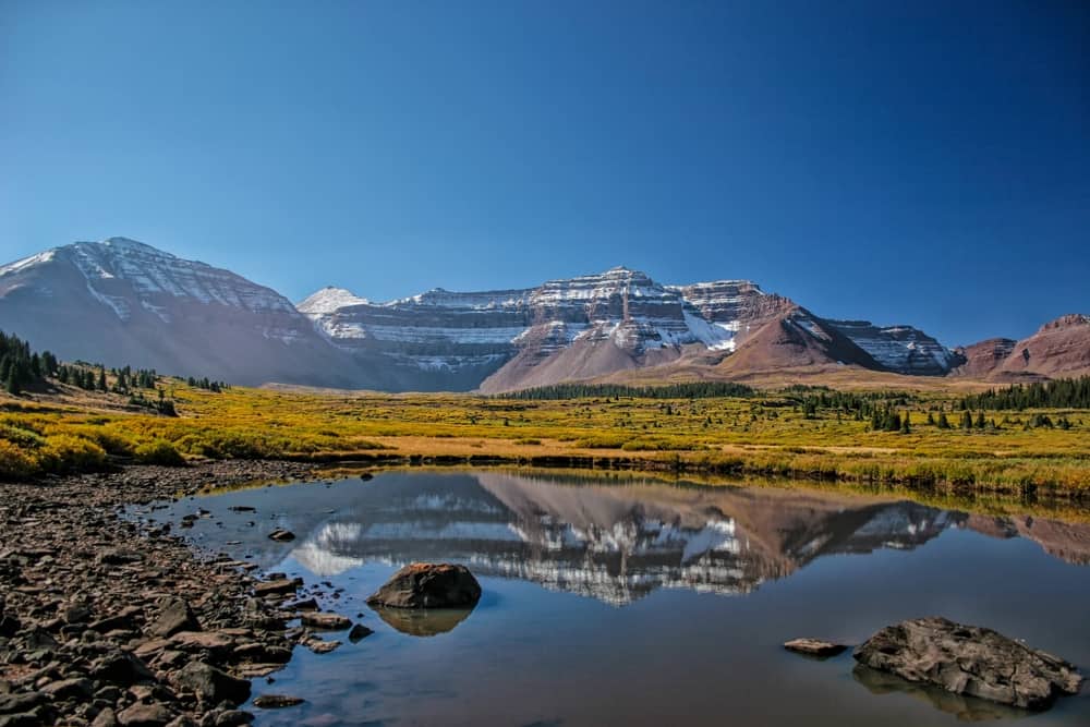
Reflections in a high mountain pond of Kings Peak highest mountain in Utah in late autumn.
©Mitch Johanson/Shutterstock.com
Highest Peak: King’s Peak – 13,534 feet
Nearby City: Duchesne
Known For: King’s Peak is one of only 57 peaks in the contiguous United States that are considered “ultra” peaks. “Ultra” peaks are mountain peaks with more than 5,000 feet of prominence. Hiking King’s Peak is a challenging 29 miles so it takes most hikers a few days to climb it. Even though this mountain climb can be a challenge because of the incline it’s a very popular spot for hikers, climbers, trail runners, and cyclists.
There are several different trails that will lead hikers to the summit. Henry’s Fork Trail is the most popular trail. Hikers can gather at the campground that sits at the Henry’s Fork Trailhead and set up camp. Other trails that will lead to the summit are the Uinta River Trail and the Yellowstone Creek Trail. If you don’t mind lots of company take the Henry’s Fork Trail. But, if you’re a solo hiker and you prefer to be alone with nature the Uinta River Trail is going to be a better choice for you. This trail is much less crowded than the other two summit trails.
10 Tallest Mountains In The Rocky Mountains
All 10 of the highest peaks in the Rocky Mountains are in one state – Colorado. They are:
- Mount Elbert
- Mount Massive
- Mount Harvard
- Blanca Peak
- La Plata Peak
- Uncompahgre Peak
- Crestone Peak
- Mount Lincoln
- Castle Peak
- Grays Peak
Highest Point In The Rocky Mountains
Mount Elbert- 14,439 feet