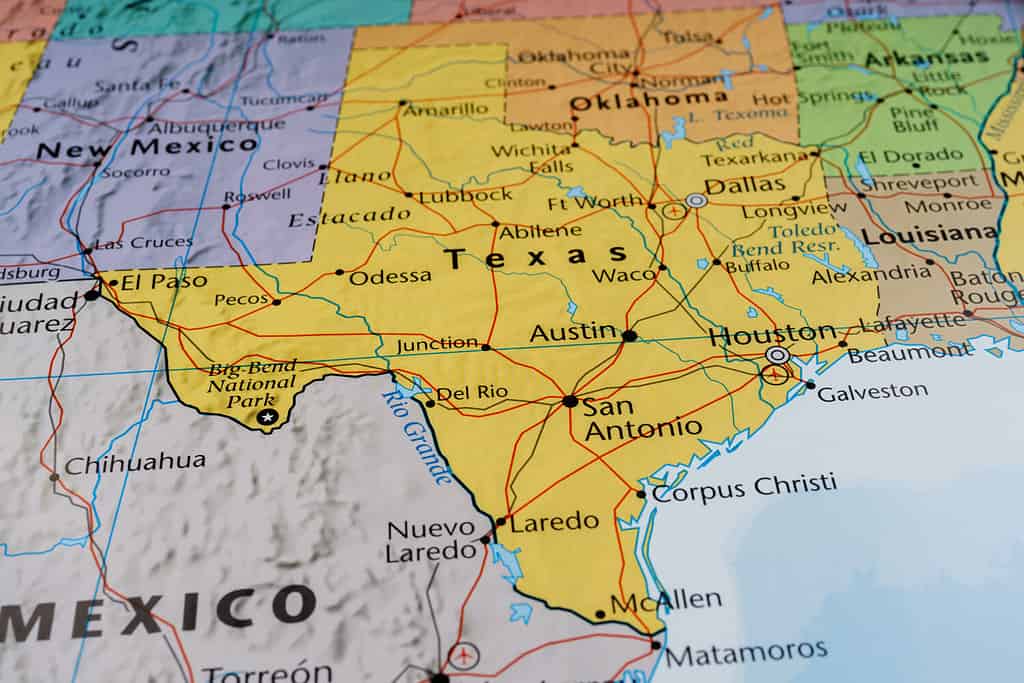
The Lone Star State looks enormous on a traditional map, but how long is Texas compared to some of the other, sizeable states in the US? It still doesn’t hold a candle to Alaska but the state of Texas is quite long.
Measured from its extreme northern and southern points, Texas is 801 miles long. It’s nearly as wide, at 773 miles from east to west. West Virginia, Virginia, North Carolina, and South Carolina could all fit inside Texas with enough elbow room to move around.
Now that we’ve established how wide Texas is and that it’s a vast state, how tall is Texas metaphorically speaking? Residents of the Lone Star State are very proud to be Texans, and rightly so. Texas stands out in many areas that have nothing to do with a map.
There are Ten Eco-Regions in Texas

The state of Texas on a traditional map.
©Alexander Lukatskiy/Shutterstock.com
As an enormous state, covering so many square miles, it stands to reason that Texas has a lot of eco-regions. As a matter of fact, it has ten. If you spend a lot of time moving throughout the state, you’ll experience just about every natural environment you can imagine.
- Pineywoods
- Gulf Prairies and Marshes
- Post Oak Savannah
- Blackland Prairie
- Crosstimbers
- High Plains
- Rolling Plains
- South Texas Plains
- Trans-Pecos
- Edwards Plateau
There are three plains on the list but each one is distinctly different from the others. Some eco-region maps have different names for the eco-regions and some even have an extra eco-region or two. But the above ten covers Texas pretty well, including all of the environment and geography types within the state.
Pineywoods
The Pineywoods ecoregion is situated at the eastern edge of the state. It’s large but by no means the largest eco-region in Texas. Pineywoods extends farther to the east and down into Louisiana and Arkansas.
This region features an annual rainfall of between 35″ and 50″ and it’s mostly what the name indicates—a generally flat area between 200′ and 500′ elevation that’s covered in pine trees.
Gulf Prairies and Marshes
This area of Texas is most like southern Louisiana and just about anywhere along the Gulf Coast in Florida. The average rainfall is the same as Pineywoods but with a much higher overall humidity throughout the year.
Saltgrass marshlands are prevalent and the area is mostly flatland, with a lower elevation than pinewoods and less disparity between its lowest and highest points.
Post Oak Savannah
When you’re looking at an eco-region map of Texas, you’ll notice a couple of things. The first is how tall Texas is and the second is that the Post Oak Savannah area is nearly as tall.
This region features strips of forest that are heavily populated with oak trees, juxtaposed against wide open grass prairies. The region receives about 30″ to 40″ of rainfall each year and its an outstanding region for agriculture.
Blackland Prairie
The Blackland Prairie runs parallel to Post Oak Savannah, in a north and south direction and is nearly as tall. As the name of the eco-region suggests, it’s mostly wide open prairie, as if it shed the oak tree strips from the post-oak savannah the farther east we travel across the map.
Crosstimbers
No matter how tall Texas is, geographically or metaphorically, it will never escape the imagery of the cross timbers, which is quintessentially Texas. In the northern, central section of Texas, near the crook of the L to the west, the Crosstimbers runs south, ending almost perfectly center in the state.
This area features 30″ to 40″ of rainfall per year and is generally open, with tall grasses and long, lonely roads. It does have some woodland here and there, with a scattering of the savannah vibe as well.
High Plains
The high plains eco-region is located in the northernmost section of Texas, encompassing the West and Central sections of the rectangle. Elevations here are more extreme, ranging from 3,000′ to nearly 5,000′.
Humidity is much lower here and the rainfall is less than half of the previous eco-regions, typically between 15″ and 20″ per year.
Rolling Plains
The rolling plains eco-region is east and south of the high plains area. This is mostly wide open country and, in some areas, there isn’t a tree in sight as far as you can see in any direction.
As the name implies, the land features a rolling elevation to it, with winding rivers and streams and short grass interspersed with patches of bluestem.
South Texas Plains
The South Texas plains are situated to the far south of the state. While this eco-region is full of extensive plains, just like the rolling and high plains, this one is characterized by shrubs.
The area features between 20″ and 35″ of rain per year. It’s a highly agricultural part of the state, especially for livestock.
Trans-Pecos
The Trans-Pecos section of Texas is situated to the far west of the state, taking up the entire pointed corner of Texas. There’s a lot of desert and desert-like terrain in the Trans-Pecos region, with a wild disparity in elevation—from 2,500′ to nearly 9,000′.
Desert shrubs and desert grasslands are the primary plants throughout the region. Of course, the mountainous areas feature more variety in their topography.
Edwards Plateau
This place is known as Texas hill country and that’s exactly what you get. The elevation runs from purely flatland to nearly 3,000′ and the region features a fair disparity in rain levels, from 15″ to 35″.
This is where all of Texas’ most beautiful and abundant springs are located. Also, if you love exploring caves, this is the part of Texas you want to be, directly in the middle.
Wildlife Throughout Texas

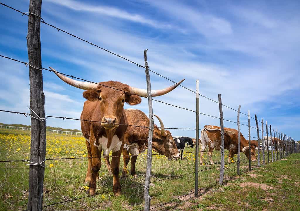
A Texas Longhorn looks up in time to take a picture while grazing on the grass behind a barbed wire fence.
©Leena Robinson/Shutterstock.com
Texas has a wide variety of animal wildlife, with plenty of abundance for wildlife aficionados, hunters, bird-watchers, and more. Because of how tall Texas is and thanks to wide-ranging and extensive eco-regions, a variety of wildlife can call this state home.
Some of the more exotic varieties of animals found in Texas include wildebeest, scimitar-horned oryx, nyala, Addax, blackbuck, and sable. If you’re wandering the wilderness of Texas, there’s a chance you may run into feral pigs, black bears, coyotes, and gophers.
Some of the more traditional animals such as eastern squirrels, beavers, whitetail, skunks, rats, armadillos, possums, moles, and nutria. If you head to the 367 miles of Texas coastline and find dolphins, cobia, striped bass, flounder, black drum, redfish, and speckled trout.
The thousands of other reptiles, birds, mammals, fish, and invertebrates that call Texas home will fill the pages from tip to bottom in a lengthy book. Suffice it to say, Texas is brimming with wildlife.
Final Thoughts on How Tall Texas Is
From north to south (or south to north if you prefer to look at it that way), Texas is 801 miles of every kind of environment you can imagine. From huge cities, packed with people to rural farms, well beyond the reach of a cell phone signal, Texas has it all.
It’s truly a massive state and abundantly wealthy in life and vitality. Though it’s not the biggest state in the US, standing in the middle of Texas, you wouldn’t know any different.
The photo featured at the top of this post is © Roschetzky Photography/Shutterstock.com
Thank you for reading! Have some feedback for us? Contact the AZ Animals editorial team.


