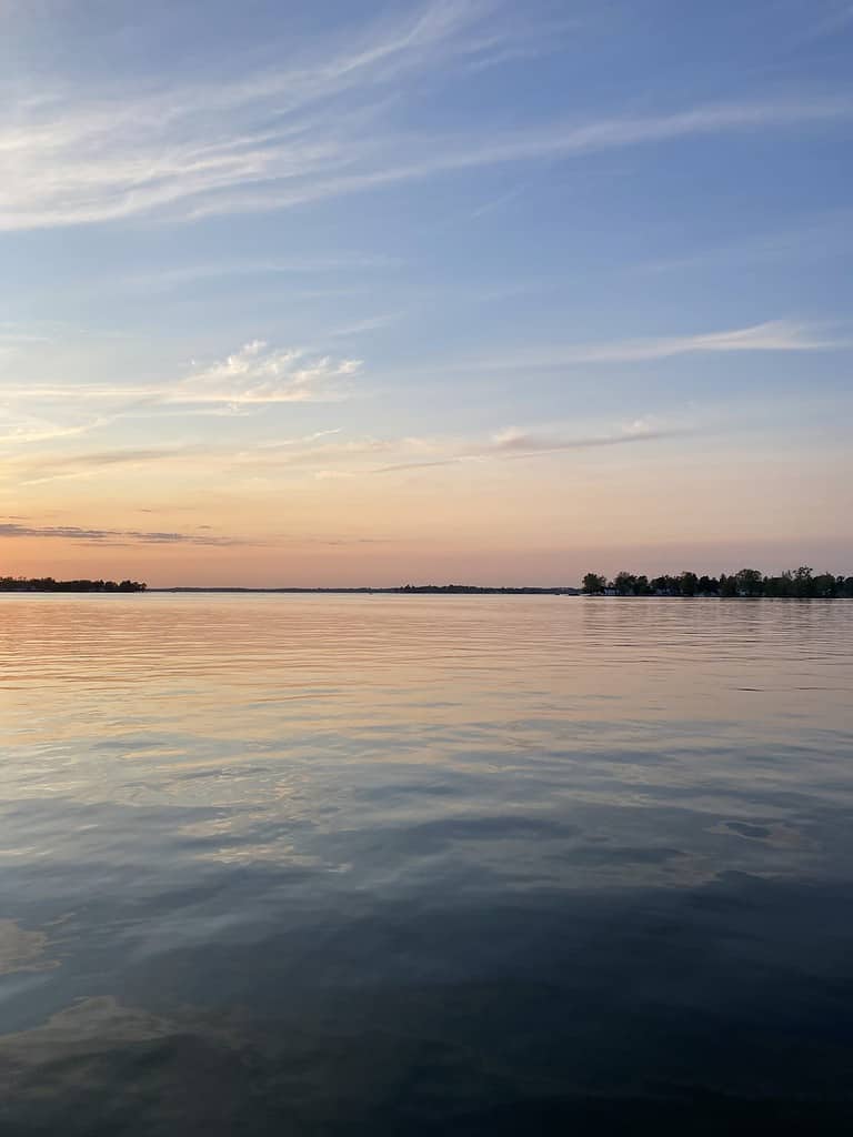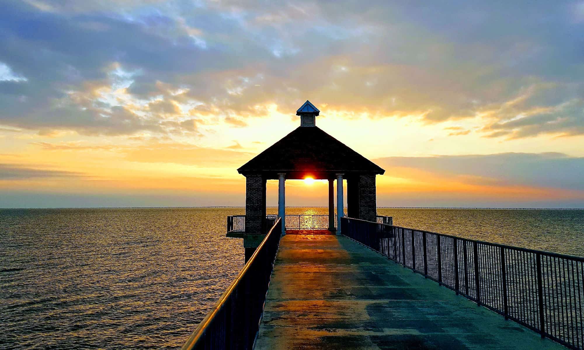

Within Louisiana’s Pontchartrain Basin lies Lake Pontchartrain, an essential estuary flowing into the Gulf of Mexico. Six cities lie on its shores: New Orleans, Slidell, Madisonville, Mandeville, Kenner, and Metairie. The lake hosts a teeming array of wildlife including – but certainly not limited to – bull sharks and crocodiles. Given its rich ecology and the size of some of its inhabitants, how deep is Lake Pontchartrain?
How Deep Is Lake Pontchartrain?
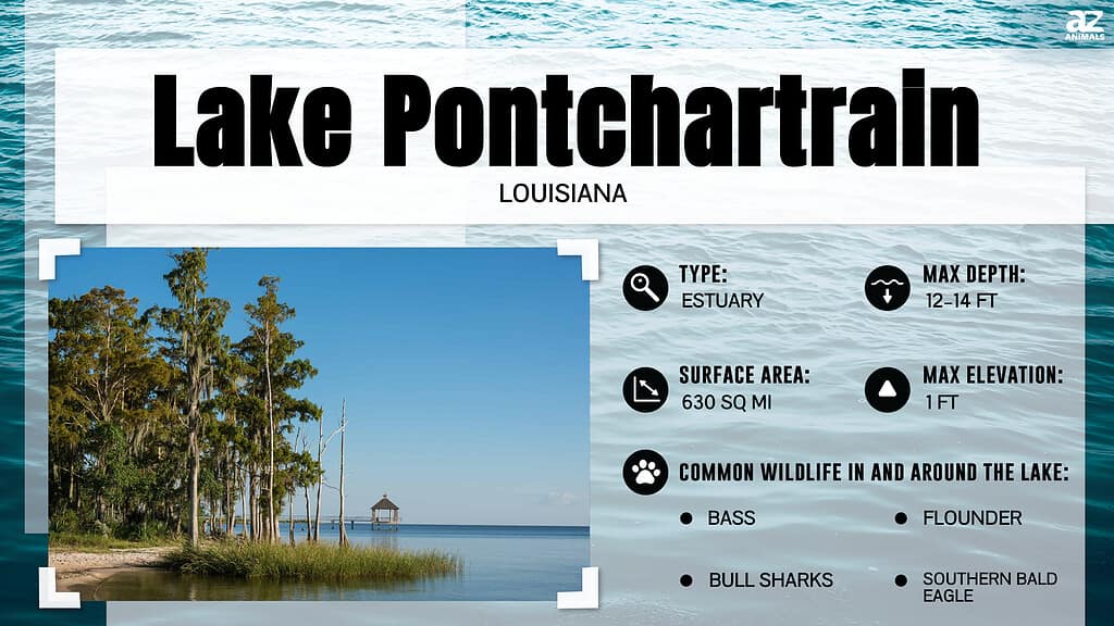
Lake Pontchartrain averages 12-14 feet deep with a maximum depth of 65 feet. Despite its sizable surface area (630 square miles), most of it is very shallow. In shape, it forms an approximate oval. The Lake Pontchartrain Causeway crosses it, connecting the respective northern and southern Louisiana communities of Mandeville and Metairie.
The table below lists several other measurements for Lake Pontchartrain:
| Measurement Type | Size |
|---|---|
| Area | 630 square miles (1,600 km2) |
| Length | 40 miles (64 km) |
| Width | 24 miles (39 km) |
| Maximum Depth | 65 feet |
| Average Depth | 12-14 feet |
| Height Above Sea Level | 1 foot |
How Deep Is Lake Pontchartrain Compared to Other Well-Known American Lakes?
Below is a table comparing the depth of Lake Pontchartrain to the depths of several other well-known or sizeable American lakes. All measurements are in feet and indicate the depths of the lakes at their deepest points.
| Lake | Depth |
|---|---|
| Lake Pontchartrain | 65 feet |
| Crater Lake | 1,949 feet |
| Lake Tahoe | 1,645 feet |
| Lake Superior | 1,332 feet |
| Lake Michigan | 922 feet |
| Lake Ontario | 802 feet |
| Lake Huron | 750 feet |
| Yellowstone Lake | 394 feet |
| Flathead Lake | 371 feet |
| Lake Winnipesaukee | 212 feet |
| Lake of the Woods | 210 feet |
| Lake Erie | 210 feet |
| Great Salt Lake | 33 feet |
Where Is Lake Pontchartrain?
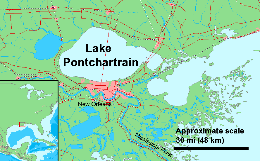
Lake Pontchartrain is in Louisiana near the city of New Orleans.
©Derived from Demi Public Domain Map Server, Public Domain data sources used / Duk (User) / CC BY-SA 3.0 – Original / License
Lake Pontchartrain is located within the Pontchartrain Basin in southeastern Louisiana near New Orleans. The lake connects to the Gulf of Mexico via the Rigolets Strait and to Lake Borgne via Chef Menteur Pass. It is fed by the Amite, Bogue Falaya, Tangipahoa, Tchefuncte, and Tickfaw rivers as well as Bayou Chinchuba and Bayou Lacombe.
The lake forms part of six Louisiana parishes: Jefferson, Orleans, St. Charles, St. John the Baptist, St. Tammany, and Tangipahoa.
The Pontchartrain Basin
The Pontchartrain Basin is one of the Gulf Coast’s largest and most significant wetlands, covering over 10,000 square miles. It includes habitats like rivers, bayous, swamps, and hardwood forests, which encourage a vast range of wildlife. Unfortunately, logging and oil drilling have compromised many of its hardwoods, swamps, and bayous.
The Pontchartrain Basin contains about 2.1 million people and includes the following parishes: Ascension, East Baton Rouge, East Feliciana, Iberville, Jefferson, Livingston, Orleans, Plaquemines, St. Bernard, St. Charles, St. Helena, St. James, St. John the Baptist, St. Tammany, Tangipahoa, and Washington.
The boundaries of the Pontchartrain Basin are as follows:
- North: Louisiana-Mississippi border
- West: Thompson Creek and the Mississippi River
- South: Breton and Chandeleur Sounds and Chandeleur Islands
- East: Pearl River
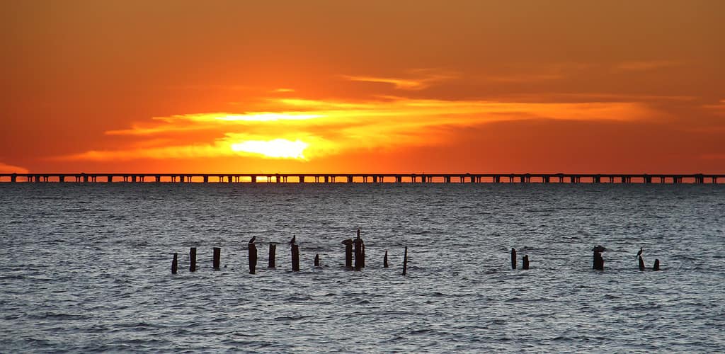
The Lake Pontchartrain Causeway
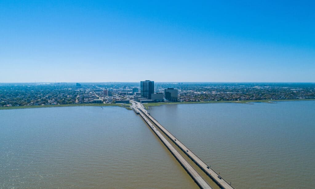
The Lake Pontchartrain Causeway is 23.83 miles long.
©Mark Runde/Shutterstock.com
Also known as the Causeway or (in French) Chaussée du lac Pontchartrain, the Lake Pontchartrain Causeway was completed in 1969 and comprises twin parallel bridges. The northern end of the causeway lies in Mandeville, Louisiana while the southern end lies in Metairie, Louisiana.
Guinness World Records lists the Causeway as the world’s longest bridge over water (continuous). The length of the two bridges spans 23.83 miles (38.35 km). Before 2011, it listed the Causeway as the longest bridge over water in the world without conditions. However, China’s Jiaozhou Bay Bridge opened in 2011, exceeding the length of the Causeway. As a result, Guinness divided the original category into continuous and aggregate bridges, awarding the former category to the Causeway and the latter to the Jiaozhou.
Animals in Lake Pontchartrain
A wide variety of animals call Lake Pontchartrain home. This includes several fish species:
- Alligator gar (Atractosteus spatula)
- Atlantic croaker (Micropogonias undulatus)
- Atlantic stingray (Dasyatis sabina)
- Black bullhead (Ameiurus melas)
- Black drum (Pogonias cromis)
- Blacktip shark (Carcharhinus limbatus)
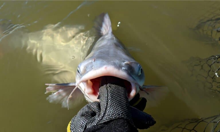
- Blue catfish (Ictalurus furcatus)
- Bull shark (Carcharhinus leucas)
- Channel catfish (Ictalurus punctatus)
- Crevalle jack (Caranx hippos)
- Flounder (Paralichthys dentatus)
- Gafftopsail catfish (Bagre marinus)
- Gulf sheepshead (Archosargus probatocephalus)
- Gulf sturgeon (Acipenser oxyrinchus desotoi)
- Hardhead catfish (Ariopsis felis)
- Ladyfish (Elops saurus)
- Largemouth bass (Micropterus salmoides)
- Paddlefish (Polyodontidae)
- Red drum (Sciaenops ocellatus)
- Sand seatrout (Cynoscion arenarius)
- Southern flounder (Paralichthys lethostigma)
- Spotted gar (Lepisosteus oculatus)
- Spotted seatrout (Cynoscion nebulosus)
- Striped bass (Morone saxatilis)
Certain notable reptiles also live in the lake:
- Alligator snapping turtle (Macrochelys temminckii)
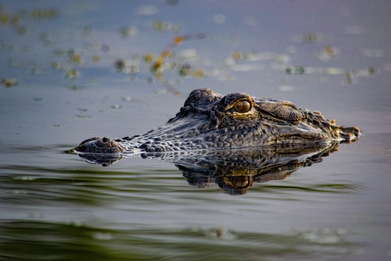
- American alligator (Alligator mississippiensis)
The area around Lake Pontchartrain hosts other animals like frogs, toads, and salamanders as well as birds like bald eagles, pelicans, and ospreys. It also offers manatees, otters, and several other mammals.
History of Lake Pontchartrain
Lake Pontchartrain began forming approximately 5,000 years ago.
©iStock.com/XKarDoc
Lake Pontchartrain first began forming approximately 5,000 years ago. At this time, glacier melts in North America caused the Mississippi River to swell eastward. As the Mississippi dumped sediment into the Gulf of Mexico, it formed a wide delta. This delta included the modern parishes of Orleans, St. Bernard, and Plaquemines. Over the next 2,000 years, the delta expanded greatly, eventually forming the shores of the lake. Today, the Pontchartrain Basin includes 16 Louisiana parishes and four Mississippi counties.
Before the arrival of Europeans, Native American tribes lived on the shores of the lake for centuries. These tribes included the Bayougoula, Chitimacha, Colapissa, Mougoulacha, Oumas, Quinipissalive, and Tangipahoa. They called it Okwata, which means “wide water.”
In 1699, the local Native Americans led the French settler Pierre La Moyne, Sieur d’Iberville, through the region. He renamed the body of water Lake Pontchartrain after the French Minister of the Marine, Comte de Pontchartrain. The name stuck. After this, habitation increased greatly in the area.