
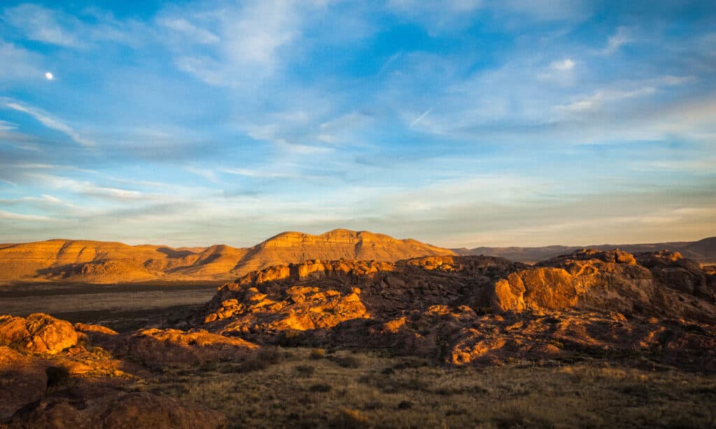
Though typically far from snow-peaked, Texas does have mountains! When people think of mountains, they typically picture the imposing Rockies in Colorado or perhaps the Appalachian Mountains in the east. Texas, which accounts for nearly 7% of the nation’s total area, is the second-largest state in the United States after Alaska. Texas has more than 2,000 mountains, peaks, and hills.
The Franklin Mountains, Davis Mountains, and the Guadalupe Mountains are three significant mountain ranges in this state that are home to various plants, animals, pathways, and lookouts. Although a couple of these West Texas mountain ranges are within a short drive from cities, the majority need extensive planning to visit due to their remoteness. This article enumerates the 13 mountain ranges found in Texas and other interesting facts!
Mountain Ranges in Texas
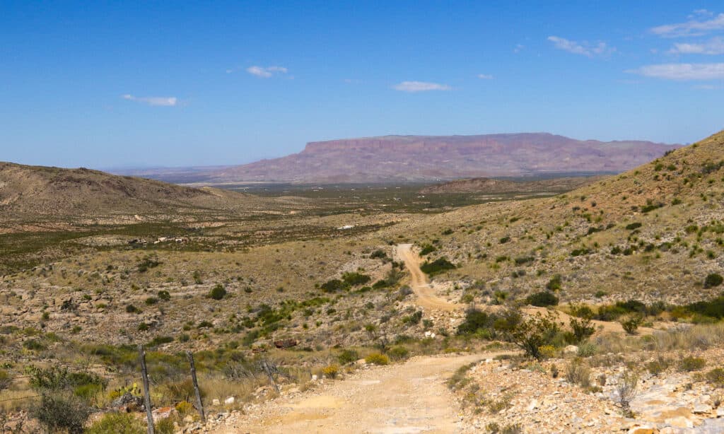
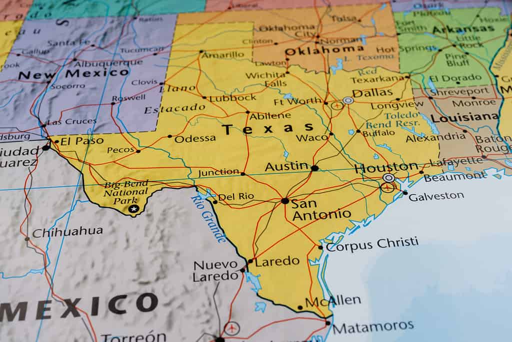
For non-Texans, images of Texas typically include symbols like chili con carne, Texas Hill Country, and the Dallas Cowboys. It can be surprising that Texas has at least a dozen mountain ranges since most residents live in cities on the coast or the plains. A great approach to experiencing the state’s untamed beauty is to venture outside and hike through the Texas highlands. For Texas residents and visitors alike, here are 13 mountain ranges in the Lone Star State:
1. Beach Mountains
The highest point of Beach Mountains is 5,827 feet above sea level.
In the southwest of Culberson County, Texas, three miles north of Van Horn, lie the Beach Mountains, whose highest point is 5,827 feet above sea level. Trans-Pecos, Texas, is home to several solitary mountain ranges, including the Beach mountain range. The Baylor, Apache, Sierra Diablo, Wylie, Carrizo, Eagle, and Van Horn mountains are some other ranges in the area. The Baylor Mountains to the north and the considerably larger Sierra Diablo range to the northwest are separated from the Beach Mountains by narrow passes.
Yucca, mesquite, creosote, and different species of cacti are among the plants that make up the vegetation of the Beach Mountains, which is typical of the Chihuahuan Desert. Unusual herds of desert bighorn sheep, typically confined to the hilly regions of Trans-Pecos Texas and southeastern New Mexico, can be found in the Beach Mountains.
2. Chinati Mountains
The Texas Chinati Mountains are a minor range in the remote West Texas high desert not far from Presidio.
Even while the Chihuahuan Desert conjures images of a lifeless wasteland, it also offers nature enthusiasts a wealth of natural riches. The Texas Chinati Mountains are a minor range in the remote West Texas high desert not far from Presidio, and they are one of the high desert’s most beautiful destinations. These mountains are renowned for their long grasses, desert vegetation like several varieties of cacti, and vistas of the rolling lands beyond. The Chinati area is distinct since it was the site of the largest volcanic eruption in the region millions of years ago, despite being adjacent to other areas like Big Bend. This produces a setting distinct from most of the arid areas around.
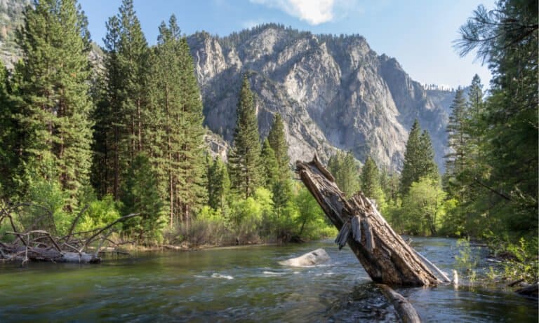
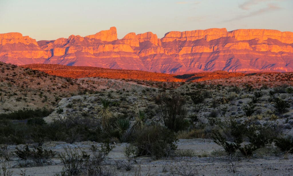
3. Chisos Mountains
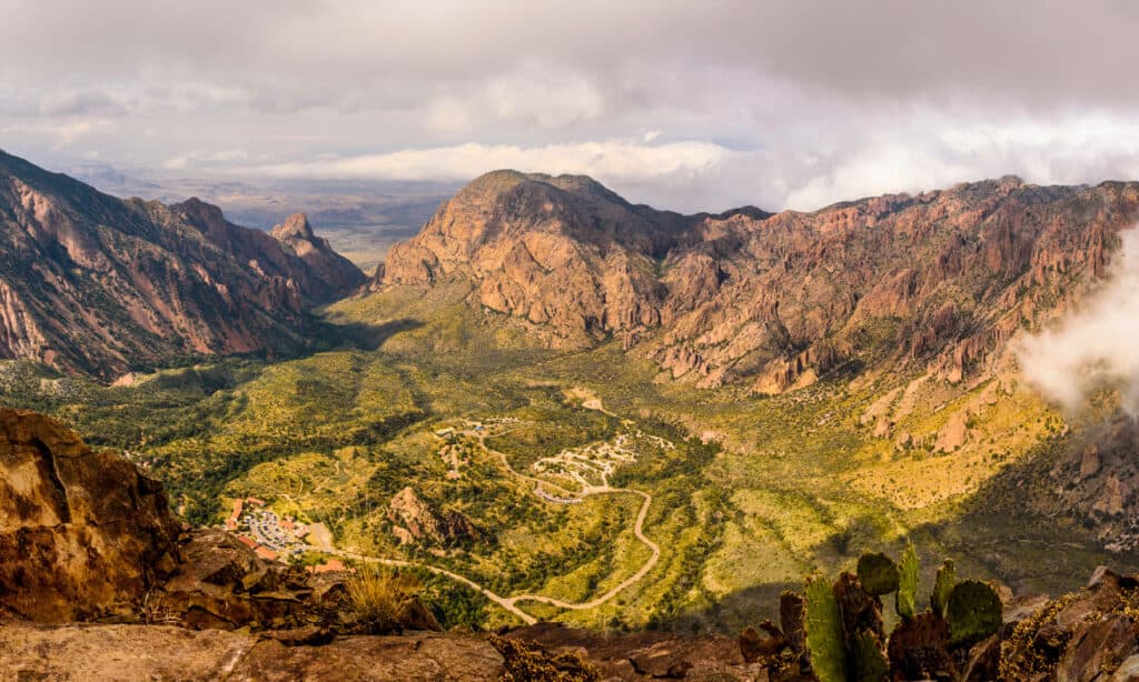
The Chisos Mountains is the only mountain range with a national park.
©iStock.com/Tim Speer
The Trans-Pecos region of Texas’ Big Bend is home to the Chisos Mountains, also referred to as the Chisos, and is the only mountain range within a national park. It offers some of the state’s best hiking trails and has one of the most amazing mountain peaks in Texas. The 40-square-mile mountain chain is contained inside the borders of Big Bend National Park. The Chisos is the southernmost mountain range in the United States, and it runs along southern Texas’ border with Mexico. Hikers who opt to travel the Chisos routes are treated to vistas of the renowned Rio Grande, craggy mountains, and narrow canyons.
4. Christmas Mountains
The Christmas Mountains are one of the newest mountain ranges in Texas.
©vagabond54/Shutterstock.com
In Brewster County, Texas, there is a small group of mountains called the Christmas Mountains that are close to Big Bend National Park. The Christmas Mountains is one of the newest mountain ranges in the state that is accessible to the public. The Texas State University System owns the 9,270-acre land, which is accessible to members of the public and academic scholars looking into the region’s natural resources. Oak, mesquite, juniper, cacti, chaparral, and grasses grow in the region’s shallow, rocky soils.
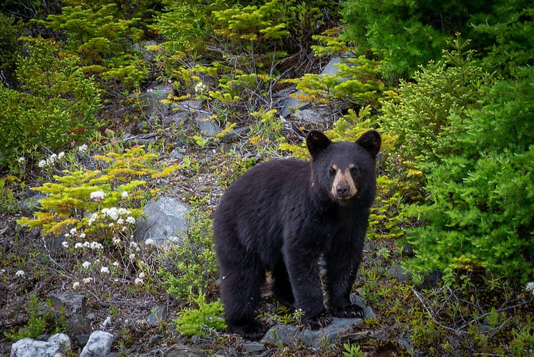
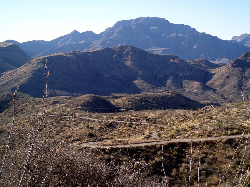
5. Davis Mountains
The Davis Mountains are home to the McDonald Observatory, Texas’ most renowned astronomical location.
©Chance Horner/Shutterstock.com
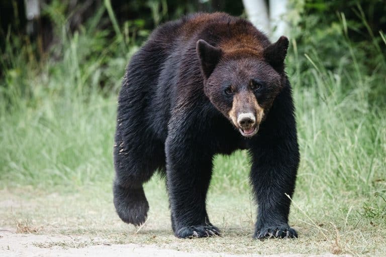
The second-biggest desert on the North American continent encircles Texas’ largest mountain range. The Davis Mountains are a group of West Texas mountains close to Fort Davis. The Davis Mountains serve as an oasis of desert life and are home to the McDonald Observatory, Texas’ most renowned astronomical location. They are a well-liked location for camping and trekking, and the area is home to Davis Mountains State Park and Fort Davis National Historic Site. At Davis Mountains State Park, more than 277 bird species, including 10 hummingbird species, have been spotted. Black bears, mule deer, whitetail deer, elk, cougar, and other large creatures can be found in this area.
6. Delaware Mountains
The Delaware Mountains are a mountain range in the state of Texas, spanning part of Culberson County.
A portion of Culberson County is covered by the Delaware Mountains, a mountain range in Texas. The Lenape, known as the Delaware Indians, gave the region its name. At the southernmost point of the Guadalupe Mountains and Guadalupe Mountains National Park, and Guadalupe Pass, the range extends to the south-southeast. The Delaware Mountain Formation was composed from horizontal strata of limestone, sandstone, and shale that were laid down 250 million years ago.
7. Franklin Mountains
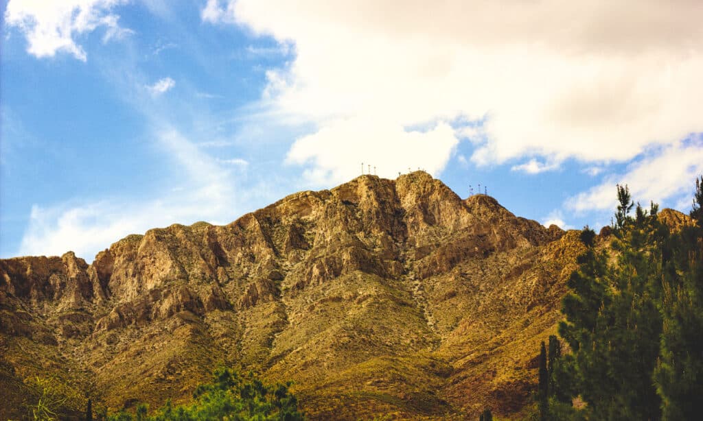
The Franklin Mountains contain the earliest rock formations in Texas.
©iStock.com/OneKnight
The Franklin Mountains are a narrow range in Texas that stretches from El Paso north into New Mexico, and it is only 23 miles long and 3 miles wide. The Franklin Mountains contain the earliest rock formations in Texas and have undergone geological upheaval for more than a billion years. The Texas portion of the range, shared between Texas and New Mexico, can be regarded as the state’s biggest urban mountain range. The Franklin Mountains State Park includes a significant portion of the range. The mountains are a short drive from El Paso, unlike other mountain ranges in Texas that are surrounded by small towns or are located in an open desert.
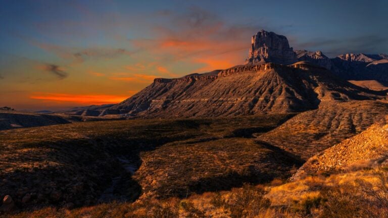
8. Guadalupe Mountains
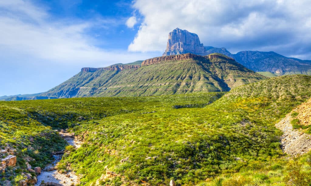
The Guadalupe Mountains didn’t have any infrastructure until the 20th century when tourists from outside the area started coming.
©LHBLLC/Shutterstock.com
A mountain range called the Guadalupe Mountains can be found in west Texas and southeast New Mexico. The Guadalupe Mountains, located in Texas and New Mexico, have been a source of life for many years. El Capitan in the Guadalupe Mountains, the highest point in Texas, is a difficult trek at about 9,000 feet. The Guadalupe Mountains didn’t have any infrastructure until the 20th century when tourists from outside the area started coming. Hikers of all ages can visit several well-known trails in the area, with difficulty levels ranging from easy to challenging. The Guadalupe Mountains, nevertheless, allow visitors to experience nature despite being a well-kept park in its untamed state.
9. Hueco Mountains
The Hueco Mountains are accessible for hiking and rock climbing.
©Rosemary Woller/Shutterstock.com
A mountain range known as the Hueco Mountains rises in southern Otero County, New Mexico, and stretches 27 miles south into Texas. These Texas mountains, part of another mountain range shared with New Mexico, are well-known for their historical significance and are accessible for hiking and rock climbing. The name, which translates from Spanish to mean “gap or hole,” makes sense given that a pass exists between the Hueco and Franklin Mountain ranges outside El Paso. Native Americans lived in the low mountains for thousands of years, and several of Texas’ most important rock paintings are in this region.
10. Palo Pinto Mountains
©Alexander Lukatskiy/Shutterstock.com
A unique cuesta-like range of hills in western Palo Pinto County, Texas, is what is meant by the phrase “Palo Pinto Mountains.” Sugarloaf Mountain, Crawford Mountain, and Antelope Mountain make up the range of three famous mountains in Palo Pinto. The Palo Pinto range undoubtedly satisfies Texas’ definition of a mountain at about 1,500 feet in elevation.
11. Sierra del Carmen
The Sierra del Carmen is also known as the Sierra Maderas del Carmen.
©William Silver/Shutterstock.com
In the Mexican state of Coahuila, the Sierra del Carmen, also known as the Sierra Maderas del Carmen, is the northern tip of the Sierra Madre Oriental. As part of a bi-national initiative to conserve a significant area of the Chihuahuan Desert in Mexico and Texas, a section of the Sierra del Carmen is preserved in the Maderas del Carmen Biosphere Reserve. The Sierra Mountains start near the Rio Grande in Big Bend National Park and go for roughly 45 miles to the southeast.
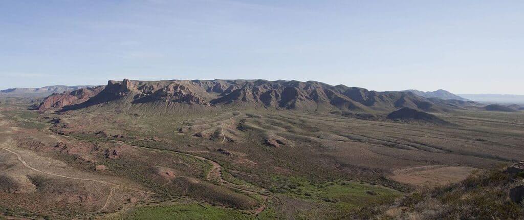
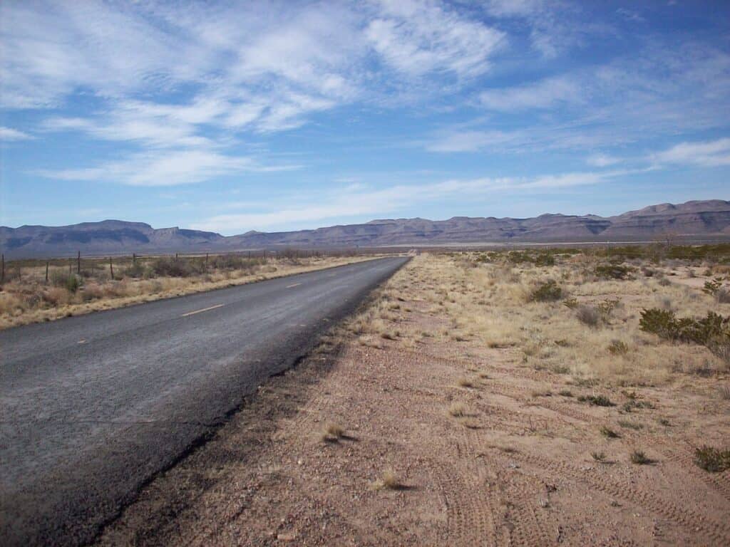
12. Sierra Diablo
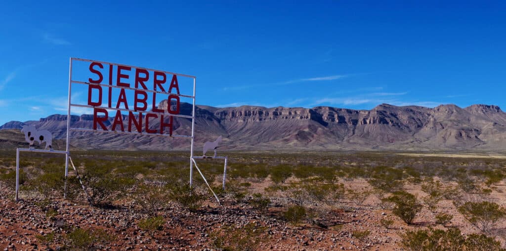
The Sierra Diablo is located between the counties of Hudspeth and Culberson.
©Bennekom/Shutterstock.com
In the state of Texas, between the counties of Hudspeth and Culberson, there lies a minor mountain range known as the Sierra Diablo. West Texas’ Sierra Diablo is a high mountain plateau, and the elevation of the range’s tallest peak is 6,610 feet. The Sierra Diablo Wildlife Management Area, established in 1945 to protect the last Texas desert bighorn sheep population, is located inside the range.
13. Sierra Vieja
The Sierra Vieja, often referred to as Candelaria Rim Rock, is where the Southern Rocky Mountains of North America end.
In the far western Jeff Davis County and northern Presidio County of West Texas, 42 miles northwest of the city of Marfa, is a small mountain range known as the Sierra Vieja. The Sierra Vieja, often referred to as Candelaria Rim Rock, is where the Southern Rocky Mountains of North America end. The range’s highest point, Capote Peak, is approximately 14 miles northwest of Farm Road 2810. In the Sierra Vieja, juniper, pion pine, live oak, cacti, conifer, and grasses grow in shallow, stony terrain.
Summary of 13 Mountain Ranges in Texas
| Name of Mountains | Location in Texas | Flora and Fauna, and Terrain | Notable Features |
|---|---|---|---|
| Beach | SW Culberson Co., near Van Horn | Yucca, mesquite, creosote, and cacti. | Highest point = 5827 ft. Herds of bighorn sheep |
| Chinati | Near Presidio | Long grasses, desert vegetation like cacti. | Large volcanic eruption millions of year ago. |
| Chisas | Inside Big Bend National Park, on Rio Grand River. | Craggy mountains and narrow canyons; black bears. | Only mountain range within a national park. Southernmost mountain range in the US. |
| Christmas | Brewster Co., near Big Bend National Park. | Oak, mesquite, juniper, cacti, chaparral, and grasses. | Owned by the Texas State University System |
| Davis | Near Ft. Davis National Historical Sie | Over 277 bird species; black bears, mule deer, whitetail deer, elk, cougar, and others. | Home to McDonald’s Observatory and Ft. Davis St. Park. |
| Delaware | Culberson Co., adjacent to Guadalupe Mts. | Composed of limestone, sandstone, and shale laid down 250 million years ago. | Named for the Lenape tribe, known also as the Delaware. |
| Franklin | From El Paso north 23 miles into New Mexico | Earliest rock formations in Texas, experiencing geological upheaval for a billion years. | Franklin Mountain State Park; near a major city, unlike most other Texas mountains. |
| Guadalupe | In West Texas and SE New Mexico. | El Capitan is the highest peak in Texas at 9000 ft. | Didn’t have any infrastructure until the 20th century. |
| Hueco | From southern Otero Co., New Mexico, 27 miles south into Texas. | Hueco means “gap or hole,” for the pass between the Hueco and Franklin Mts. | Texas’ most important rock paintings come from the natives of ancient times. |
| Palo Pinto | W. Palo Pinto Co. | 1500 ft. elevation | Sugarloaf Mt., Crawford Mt., and Antelope Mt. are in this range. |
| Sierra del Carmen | From the Rio Grande in Big Bend National Park and go 45 miles SE. | Part of N. Sierra Madre Oriental and Chihuahuan Desert. | A MX-TX initiative is the Maderas del Carmen Biosphere Reserve. |
| Sierra Diablo | Hudspeth and Culberson Cos. | A high mountain plateau; range’s tallest peak is 6610 ft. | The Sierra Diablo Wildlife Mgt. Area for the Texas desert bighorn sheep. |
| Sierra Vieja | W. Jeff Davis Co. and N. Presidio Co., 42 miles from Marfa. | Juniper, pinyon pine, live oak, cacti, conifer, and grasses. | Where the Southern. Rocky Mts. end; highest peak is Capote Peak at 6212 ft. |