
“I’ll take, ‘U.S. Geography’ for $200, Alex.”
Answer: These two states that border one another also share the record for the most states along their individual borders.
Could you ring in with the correct answer? (Well, actually, the correct question. It is Jeopardy, after all.) After reading this article, you could buzz in with confidence!
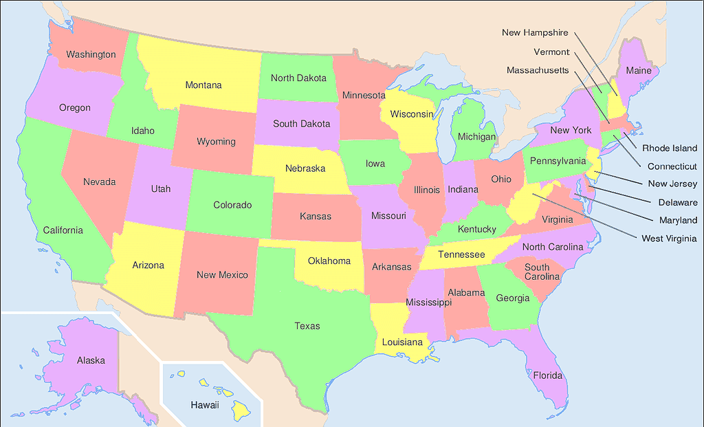
Which state in the U.S. borders the most other states? If you don’t feel like counting on this map, just keep reading!
©User:Wapcaplet in Inkscape / CC BY-SA 3.0 – Original / License
States That Border the Most Other States
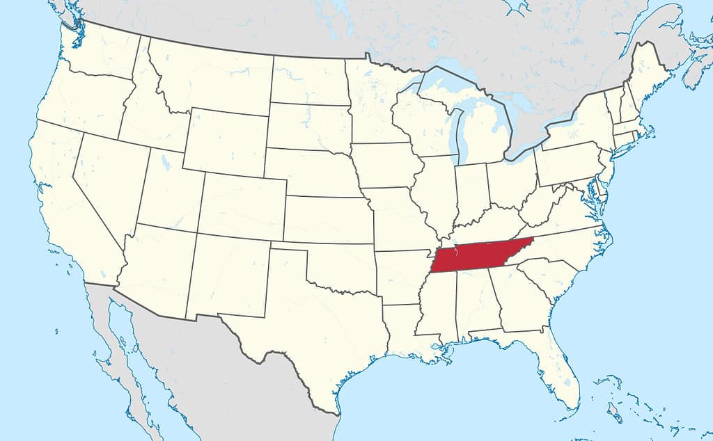
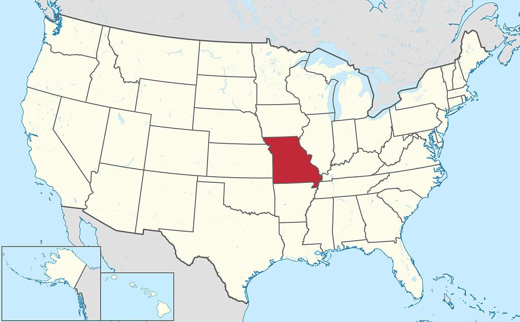
Missouri and Tennessee, which border one another, also share borders with eight states, more than any other state in the nation.
Tennessee shares borders with Kentucky and Virginia to the north, North Carolina to the east, Georgia, Mississippi, and Alabama to the south, and Arkansas and Missouri to the west.
Missouri shares its borders with Iowa to the north, Kentucky, Tennessee, and Illinois to the east, Arkansas to the south, and Oklahoma, Nebraska, and Kansas to the west.
As you can see, not only do Missouri and Tennessee share a border, but they both also border Kentucky and Arkansas.
The Kentucky Bend
The area where Kentucky, Tennessee, and Missouri meet is an anomaly. There is a small portion of Kentucky territory that is completely encircled by Missouri and Tennessee. If that sounds confusing, that’s because it is!
The area is known as the Kentucky Bend. It is also known as New Madrid Bend, Madrid Bend, Bessie Bend, or Bubbleland. Some say it looks a like a bubble on a map. You can judge for yourself.
The entire area of the Kentucky Bend is about 27 square miles of land and water. It lies in an oxbow loop of the Mississippi River. An oxbow is a U-shaped meander of a river. The Mississippi flows south until it reaches close to State Route 22 in extreme western Tennessee. That is where it takes a rather sudden curve northward. It flows north to New Madrid, Missouri, where it curves southward again to continue its journey to the Gulf of Mexico.
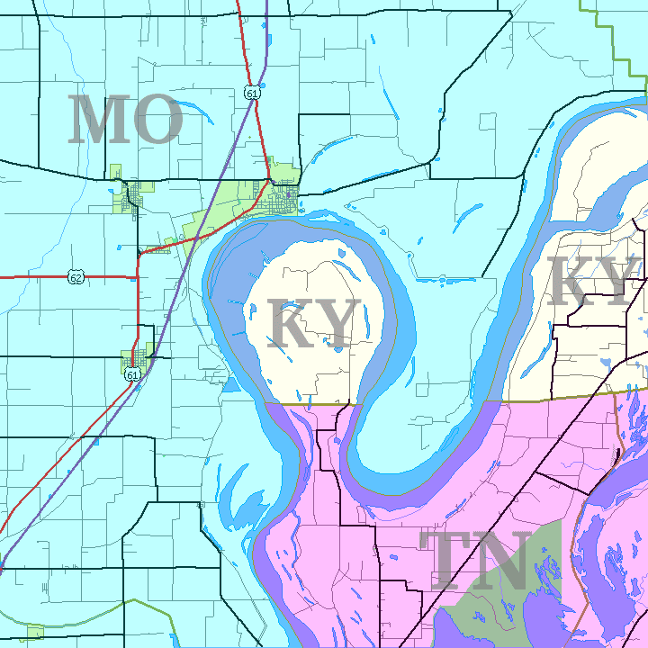
The Kentucky Bend (or Bubbleland) is one of the oddest state boundaries in the United States.
©Jim Efaw, author of this work / CC BY-SA 2.5 – Original / License
A State Border Oddity
River oxbows are not uncommon, but here’s where things become strange for this particular meander. The land that lies in the middle of the oxbow is Kentucky territory. The Mississippi River that surrounds it to the east, north, and west represents a border with Missouri. The land border to the south is with Tennessee. This small patch of Kentucky land is an exclave. It does not touch the rest of Kentucky at any point.
The small handful of residents that live in the Kentucky Bend are Kentucky citizens, but they actually have a Tipton, Tennessee address. And the closest populated area is New Madrid in Missouri, although there are no roads or ferries that connect the Kentucky Bend with New Madrid.
This territorial oddity was possibly the result of mistakes made by nineteenth-century surveyors. Tennessee protested the way the borders were drawn because the land in “The Bend” was rich and fertile, perfect for growing cotton. Tennessee gave up its claims to Kentucky Bend shortly before the Civil War.
Other Tennessee/Missouri Similarities
Along with the strange border situation with Kentucky, Tennessee, and Missouri also share some other similarities.
Both are mountain states. Missouri features the Ozark Mountains in the southern half of the state, while the Great Smoky Mountains dominate the eastern Tennessee landscape.

Tennessee, along with North Carolina, is home to the Great Smoky Mountains National Park.
©Mihai_Andritoiu/Shutterstock.com
Both states are home to one national park. The Great Smoky Mountains National Park in Tennessee (and North Carolina) is the most visited national park each year.
Missouri is home to the smallest national park. At 91 acres, Gateway Arch National Park in St. Louis is less than two percent of the size of the next smallest national park, Hot Springs National Park in Arkansas.
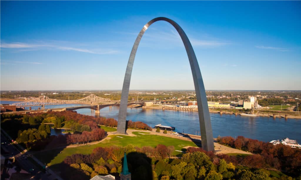
Missouri houses the Gateway Arch National Park.
©amolson7/Shutterstock.com
Both states also have cities famous for country music. Nashville, Tennessee, is the undisputed home of country music, but Branson, Missouri, has become quite an entertainment destination itself.
The populations of the two states are comparable. Missouri is home to nearly 6.8 million people, while Tennessee has just over 7 million residents.
Tennessee’s largest university is the University of Tennessee-Knoxville, with over 31,000 students. Missouri’s biggest school is the University of Missouri-Columbia, with an almost identical enrollment.
Both states have professional sports franchises in the National Football League (NFL), National Hockey League (NHL), and Major League Soccer (MLS).
| League | Missouri | Tennessee |
|---|---|---|
| NFL | Kansas City Chiefs | Tennessee Titans |
| NHL | St. Louis Blues | Nashville Predators |
| MLS | St. Louis SC *Sporting Kansas City (the team offices are in Missouri, but their stadium is in Kansas) | Nashville SC |
Both states include horses in their official state symbols, something only twelve states have done.

The Tennessee Walking
Horse
is the state horse of Tennessee.
©aleigha blakley/Shutterstock.com
Tennessee’s list of official state animals includes the Tennessee Walking Horse, while Missouri counts the Missouri Fox Trotter among its state animals.

Other Tennessee/Missouri Comparisons
Missouri is significantly larger than Tennessee. It is the 18th largest state, with a land area of 68,741 square miles. Tennessee is the 34th largest state, with a land mass of 41,234 square miles.
Tennessee became the sixteenth state admitted to the Union on June 1, 1796. Missouri’s statehood came 25 years later when it became the twenty-fourth state on August 10, 1821.

Kansas City is Missouri’s most populous city.
©Sean Pavone/Shutterstock.com
Kansas City is Missouri’s most populous city, with a metro population of nearly 2.4 million (although some of those residents live across the state line in Kansas). Nashville is Tennessee’s capital and its most populous city, with a metro population of 2 million.

Nashville is Tennessee’s capital and its largest city.
©Kevin Ruck/Shutterstock.com
Missouri has two Major League Baseball teams, the St. Louis Cardinals and Kansas City Royals, while Tennessee has none. Tennessee has a team in the National Basketball Association, the Memphis Grizzlies, while Missouri does not have an NBA franchise.
Second Place for the Most States Bordered
After Tennessee and Missouri, which each border eight states, there is a tie for second place: Colorado and Kentucky both share borders with seven states.
Colorado borders New Mexico, Oklahoma, Utah, Wyoming, Arizona, Kansas, and Nebraska. Kentucky borders Tennessee, Virginia, West Virginia, Illinois, Indiana, Missouri, and Ohio.
States that Border the Fewest Other States
So those are the states that border the most other states, but what about the other end of the spectrum? Which state borders the fewest states? Once again, there is a tie for first place in the category.
Neither Alaska nor Hawaii shares a border with another state. They are the only states that can make such a claim.
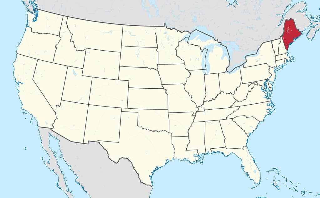
In the contiguous 48 states, Maine shares its border with the fewest number of states. Maine only borders one state: New Hampshire. The rest of Maine’s border is found on the Atlantic coastline or the international boundary with Canada.
The next states in line are South Carolina, Florida, and Washington, all of which only border two states. South Carolina borders North Carolina and Georgia. Florida borders Georgia and Alabama. Washington borders Oregon and Idaho.
Not surprisingly, the states that border the fewest other states are all coastal states (with Hawaii being the only state comprised entirely of islands), while the ones that border the most states are all inland.
The photo featured at the top of this post is © Traselu / CC BY-SA 4.0 – License / Original


How to Add Us to Google News


Thank you for reading! Have some feedback for us? Contact the AZ Animals editorial team.