
Mexico is the fifth-largest country in the Americas and the fourteenth-largest nation in the world in terms of total area (fifteenth if you count Antarctica, which is not a nation). Here are the dimensions of this North American country, how it compares to other nations, and much more.
Square Kilometers and Square Miles
Various sources report different figures regarding the exact size of Mexico’s territory, although most of the numbers only vary slightly. The Mexican government officially lists the area of Mexico at 1,964,375 square kilometers. That equates to just over 758,449 square miles.
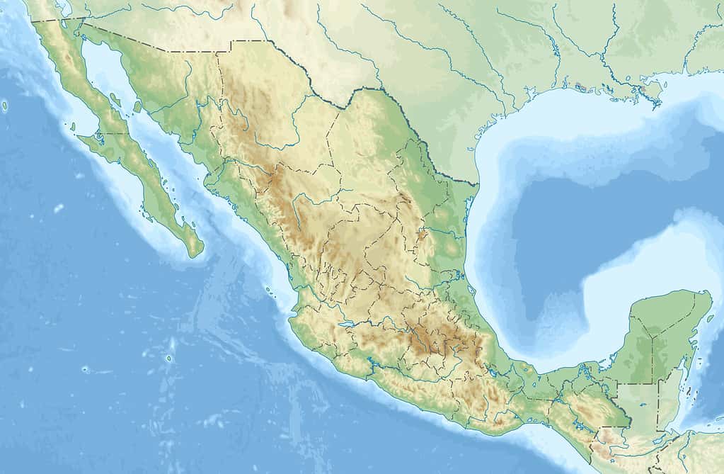
Mexico spans over 750,000 square miles.
©Addicted04 / CC BY-SA 3.0 – License
Acres
Mexico’s total area covers 485,407,634 acres. If you are unsure of the size of an acre, here are a couple of examples for perspective. An American football field (minus the ends zones) is just over one acre in size. A FIFA-regulation soccer field (which many people worldwide, including most citizens of Mexico, recognize as true football) covers nearly 1.8 acres.
Length and Width of Mexico
Mexico measures nearly 2,000 miles (3,200 kilometers) from its furthest land points from north to south.
The width of Mexico from east to west varies significantly depending on the location. The distance from Tijuana to Matamoros in northern Mexico is over 1,260 miles. That measurement is a diagonal line from northwest to southeast.
In southern Mexico, the nation only measures around 135 miles (217 kilometers) wide at its narrowest point. That is just slightly wider than the width of the U.S. state of Connecticut.
Mexico has four time zones, mirroring the time zones in the conterminous United States. Much of the nation does not observe Daylight Saving Time, though, meaning the time will differ from U.S. locations in the same zones for much of the year.
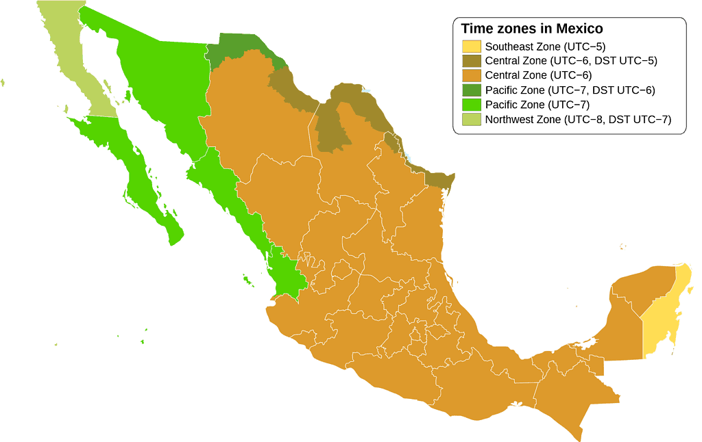
The Central Time Zone covers most of Mexico.
©RicHard-59 / CC BY-SA 4.0 – License
Other Nations
As noted earlier, Mexico is the fifth-largest country in the Americas. The only North and South American nations with greater land areas are Canada, the United States, Brazil, and Argentina.
As the fourteenth-largest nation in the world, Mexico falls between Saudi Arabia and Indonesia. Saudi Arabia covers 830,000 square miles (2,149,690 square kilometers). Indonesia is slightly smaller than Mexico. The archipelagic state encompasses 735,358 square miles (1,904,569 square kilometers).
At nearly 3.8 million square miles, the United States is more than five times the size of Mexico. The state of Alaska alone would cover 88% of Mexico’s territory.
Russia is the world’s largest country in total area, with an expanse of over 6.1 million square miles. You could fit almost nine Mexicos inside Russia.
It would take more than five Mexicos to cover the land mass of the 50 U.S. states.
©User:Wapcaplet in Inkscape / CC BY-SA 3.0 – License
Mexico’s Population
Mexico has a population of 129,875,529 (2023 estimate), making it the most populous Spanish-speaking country in the world. The highest population numbers are found in the country’s center between the states of Jalisco and Veracruz. The arid desert regions in northern Mexico and the tropical rainforests in the south are much more sparsely populated.
Cities
The urbanization rate in Mexico has increased significantly in the last six decades. In the 1960s, only about half of the Mexican population lived in cities. Today, that figure has risen to around 80%.
Mexico City (known as Ciudad de México in Spanish, or simply CDMX) is the nation’s capital and also its largest city. The current population is estimated to be nearly 8.6 million people. It is the largest Spanish-speaking city in the world.
The Greater Mexico City area, officially known as the Metropolitan Area of the Valley of Mexico, is home to nearly 22 million people. It is the largest metropolitan area in North America and the fifth-largest in the world. Tokyo, Delhi, Shanghai, and São Paulo.
Mexico City is the oldest continuously inhabited city in the Americas. It was founded in the 1320s as Tenochtitlan. Though control of the city would change throughout the centuries, the city has had inhabitants for the last 700 years.
Along with the capital city, Mexico has a dozen other municipalities with populations of over one million. Those cities include Tijuana, León, Puebla, Ecatepec, Juárez, Zapopan, Guadalajara, Monterrey, Nezahualcóyotl, Mexicali, Querétaro City, and Culiacán.
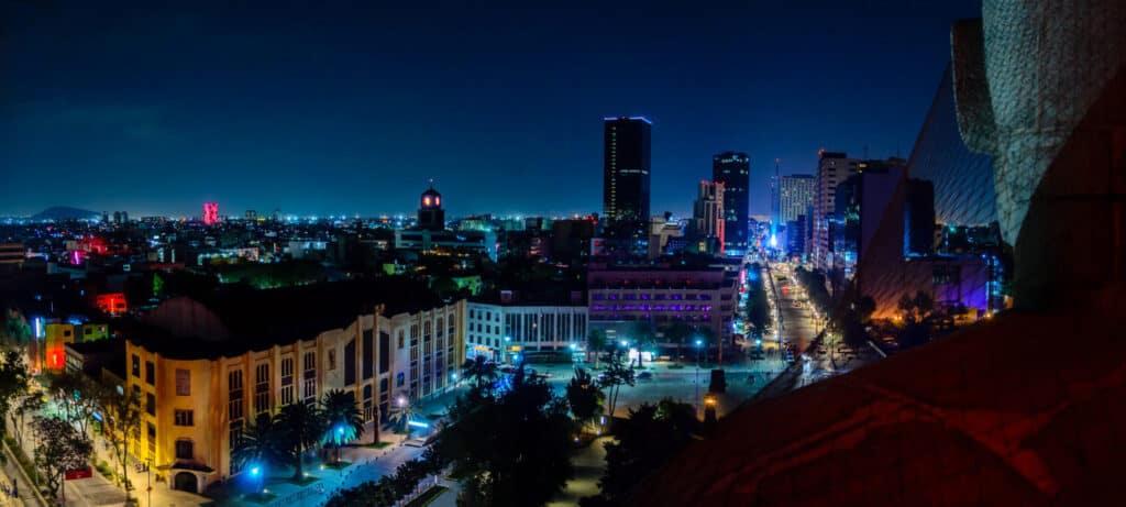
Mexico City is the capital and the largest city in Mexico.
©AGCuesta/Shutterstock.com
States
The nation’s official name is Estados Unidos Mexicanos or the United Mexican States. Mexico is divided into 31 states. The capital of Mexico City is a separate entity, similar to how Washington, D.C., is not part of a U.S. state.
Chihuahua in northern Mexico is the largest state in terms of land area. The state stretches over 95,526 square miles (247,411 square kilometers).
The smallest Meixcan state is Tlaxcala, at 1,543 square miles (3,996 square kilometers).
Jalisco is the most populous state in Mexico, with around 8.4 million people. Note that the population of Mexico City is greater than that of the most populous state in the nation.
The least populous state is Baja California Sur, with 759,000 residents.
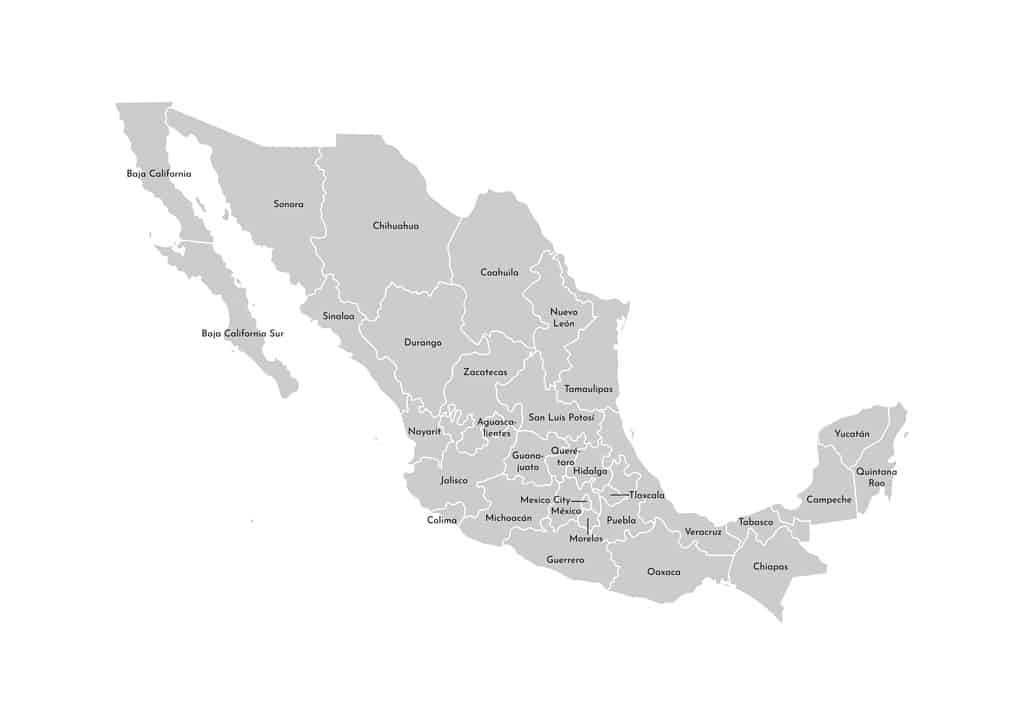
Mexico is divided into 32 federal entities (31 states and the capital of Mexico City).
©Olli Turho/ via Getty Images
Mexico’s Borders and Coastline
Mexico’s entire northern border is shared with the United States. The border stretches 1,933 miles as it meanders from northwest to southeast. It is the busiest international boundary globally, with around 350 million documented crossings each year.
Four U.S. states border Mexico. The Texas/Mexico border is the longest at approximately 1,241 miles. Arizona’s border with Mexico stretches 373 miles. New Mexico shares a 180-mile border with Mexico, while the California/Mexico border runs for 140 miles.
Mexico borders the Pacific Ocean to the south and west. It shares borders with Guatemala and Belize to the southeast and the Caribbean Sea. The Gulf of Mexico borders the nation to the east.
Mexico features 5,800 miles (9,330 kilometers) of coastline. It has the thirteenth-longest coastline of any nation in the world.
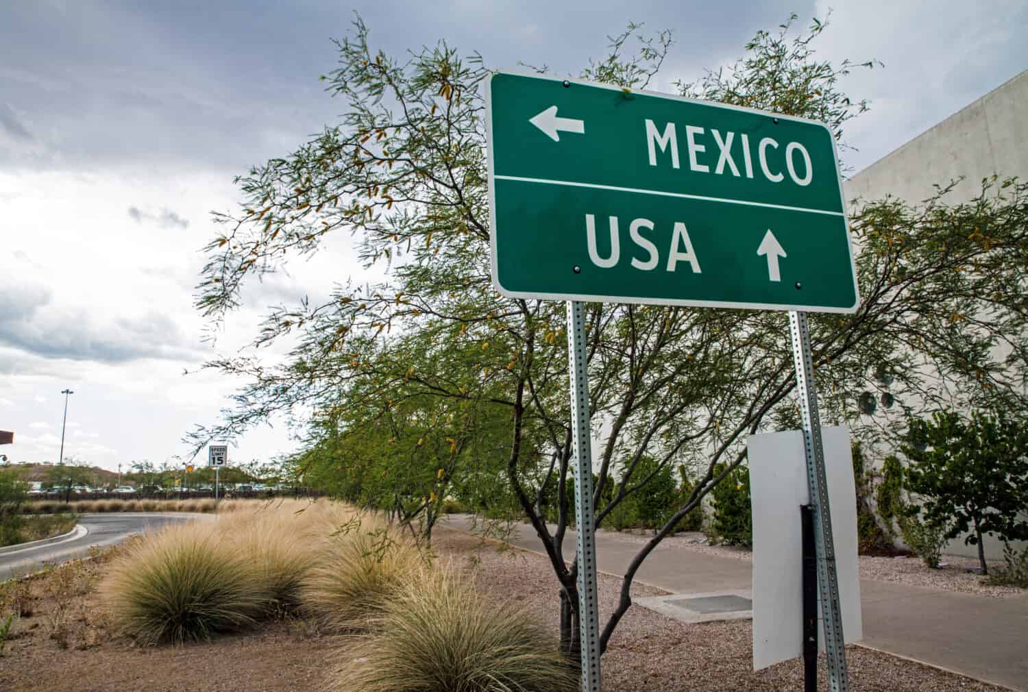
The U.S./Mexico border is the busiest international boundary in the world.
©Chess Ocampo/Shutterstock.com
The Mexican-American War
While Mexico’s territory covers 758,449 square miles today, it could have been much larger were it not for a nineteenth-century war with the United States
In 1819, U.S. Secretary of State John Quincy Adams and Spanish Envoy Lord Don Luis de Onís signed the Adams-Onís Treaty. The treaty established the boundaries between American and Spanish territories in North America. It defined the northern borders of present-day U.S. states such as California, Nevada, and Utah.
Two years later, Mexico declared its independence from Spain. Mexico claimed much of what is now the western United States as its sovereign territory.
In 1829, U.S. President Andrew Jackson attempted to buy the land of Texas from Mexico for five million dollars. Mexico wanted nothing to do with the offer.
In 1836, Texas declared itself to be a sovereign nation. The Republic of Texas used the Adams-Onís Treaty to define its border with the United States, but it also claimed territory extending to the Rio Grande in the south.
The U.S. annexed Texas in 1845 and continued the claim that Texas’ land extended to the Rio Grande in the south. This was a primary factor in launching the Mexican-American War, which lasted from 1846-1848.
The United States prevailed in the conflict. Hostilities ended with the signing of the Treaty of Guadalupe Hidalgo. By signing the treaty, Mexico ceded a staggering 55% of its territory to the United States. That territory included the modern states of California, Nevada, Utah, New Mexico, most of Arizona and Colorado, and parts of Oklahoma, Kansas, and Wyoming. Mexico also released all claims to Texas and officially recognized the Rio Grande as its new northern boundary.
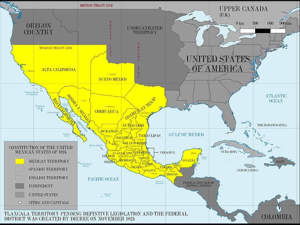
Mexico’s territory, seen in yellow, was far greater before the Mexican-American War.
©Giggette / CC BY-SA 3.0 – License
The photo featured at the top of this post is © Photitos2016/ via Getty Images


How to Add Us to Google News


Thank you for reading! Have some feedback for us? Contact the AZ Animals editorial team.