
The United States is a vast country with landscapes that range from deserts to old-growth forests, and this variety is reflected in each state’s tallest summit. Some are easily accessible by car, while others are at the end of long and challenging hikes. Keep reading to discover the highest point in each of the 50 U.S. states.
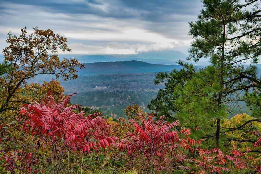
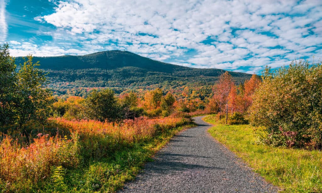
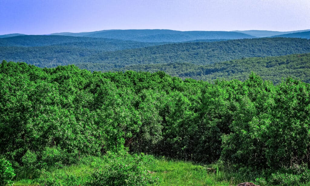
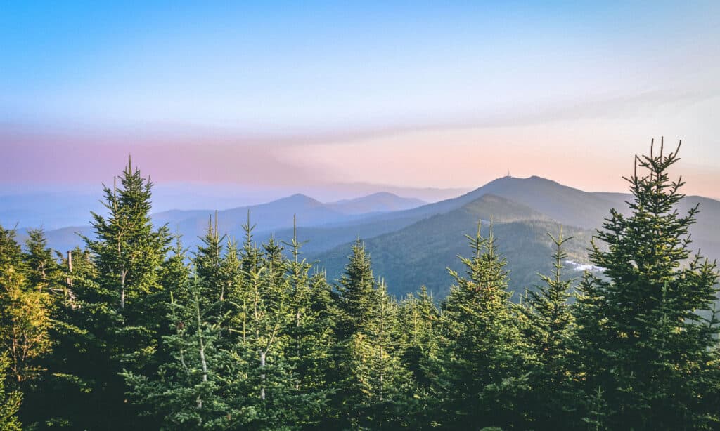
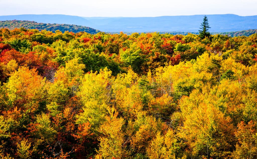
1. Alabama
Cheaha Mountain’s name comes from the Choctaw word for “high.”
©Sharon Davies Photography/Shutterstock.com
Located in the state’s northeastern corner, Cheaha Mountain is the highest point in Alabama, with 2,405 feet of elevation. You can find the mountain within Cheaha State Park, in the foothills of the Appalachian Mountains. The summit features Bunker Tower, built in the 1930s, and is an observation tower that is open for hikers looking to take in the views.
2. Alaska
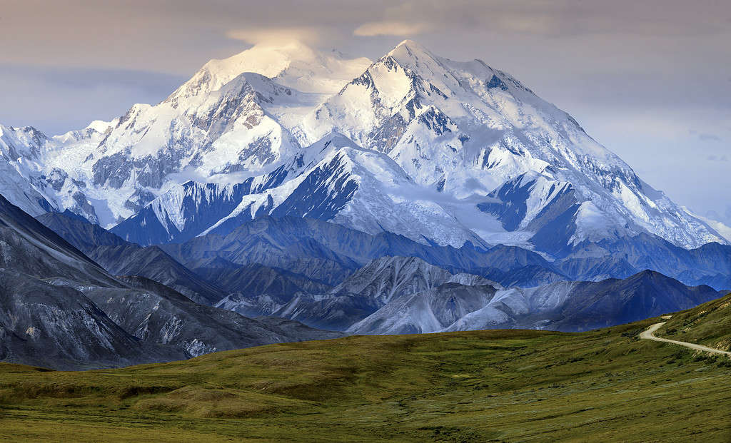
Denali National Park stretches for over six million acres in south-central Alaska.
©SteveAllenPhoto/iStock via Getty Images
Formerly known as Mount McKinley, Denali is Alaska’s highest point. It reaches a staggering height of 20,310 feet above sea level. The mountain is blanketed in snow from late September through early May. Nearly 400,000 people visit Denali National Park each year, but few people successfully make it to the summit. Climbing Denali requires hikers to navigate steep inclines and severe weather conditions, including temperatures that plunge as low as -76 degrees Fahrenheit.
3. Arizona
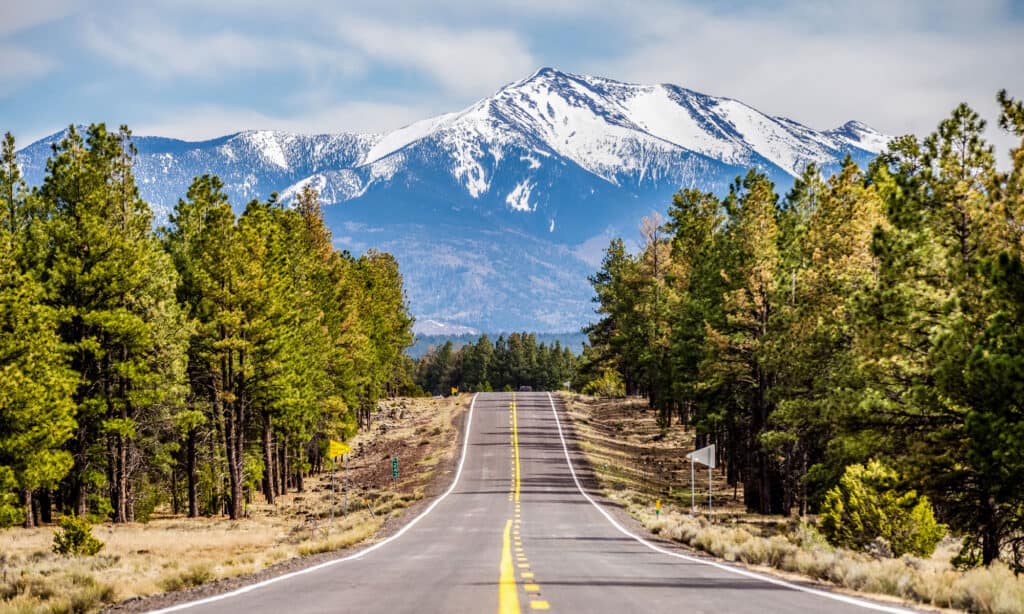
The summit of Humphrey’s Peak is only accessible by hiking.
©iStock.com/digidreamgrafix
Located about 20 miles north of Flagstaff, Humphreys Peak is the highest point in Arizona at 12,633 feet. Humphreys Peak is located among the San Francisco Peaks, which were created by volcanic eruptions more than 500,000 years ago.
The trail to the summit of Humphreys Peak is over five miles long and gains more than 3,000 feet in elevation. There are also shorter, less intense hikes around Humphrey’s Peak, including the 2.5-mile Aspen Loop.
4. Arkansas
The views from Mount Magazine include the surrounding Mount Magazine State Park and the Ouachita Mountains.
©Bonnie Taylor Barry/Shutterstock.com
The highest point in Arkansas is Mount Magazine, which stands at 2,753 feet of elevation. Mount Magazine is part of the Ouachita Mountains range, which runs from the east to the west.
This peak is located within Mount Magazine State Park, offering plenty of hiking, camping, and rock climbing opportunities. You can reach the summit of Mount Magazine by taking the Signal Hill Trail. The trail passes through a forest, but you’ll know you’ve reached the peak when you see a 400-square-foot stone map of Arkansas.
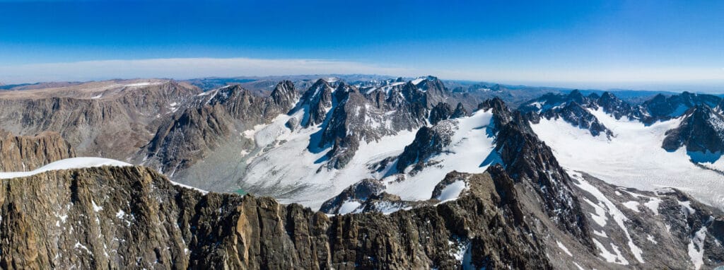
5. California
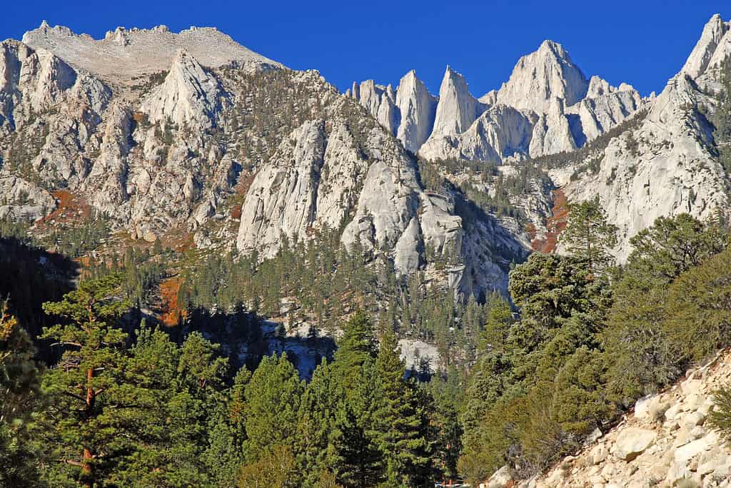
Mount Whitney is the highest point in the contiguous U.S. and is located just 84 miles from Badwater Basin, the lowest point in the country.
©nyker/Shutterstock.com
The highest point in California is also the highest point in the contiguous U.S. States. Mount Whitney, situated in the Sierra Nevada mountain range, reaches an elevation of 14,505 feet. Mount Whitney is notable for being a relatively young mountain, and the scars from the glaciers that carved the mountain’s peak are still visible today.
The trailhead to Mt. Whitney’s summit starts at an elevation of 8,360 feet, increasing the risk of altitude sickness for hikers. The trail’s rough terrain, numerous switchbacks, and unpredictable weather conditions make the hike to Mount Whitney’s summit a challenging feat.
6. Colorado
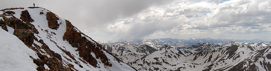
Mt. Elbert is the second-highest peak in the contiguous U.S. States.
©Robertbody at English Wikipedia, CC BY 3.0 – Original / License
With 58 mountain peaks over 14,000 feet in elevation, Colorado has the highest average elevation in the United States. The tallest of its peaks is Mount Elbert, which is also the highest peak in the Rocky Mountains.
Despite its elevation, the hike to the summit of Mount Elbert is relatively easy. Hikers have three main trails to choose from to reach the top, and two of the trails are class 1, which designates they are well-marked and lower intensity. The third option to summit Mount Elbert is a class 2 trail, which is accessible to intermediate-level hikers.
7. Connecticut
The hike to the top of Bear Mountain takes you on part of the Appalachian Trail.
©Shanshan0312/Shutterstock.com
Located in the northwestern corner of the state within the Appalachian Mountain Range, Bear Mountain is the highest peak in Connecticut at 2,323 feet in elevation. The highest point in Connecticut is actually located on the side of nearby Mount Frissell, but that mountain’s peak is located in Massachusetts.
All of the trail options to reach the top of Bear Mountain are moderately strenuous, with occasional rock scrambling and steep climbs. At the top, look for a stone marker from 1885 designating Bear Mountain as the “highest ground in Connecticut.”
8. Delaware
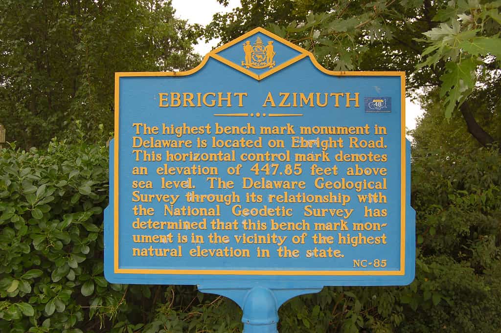
Delaware’s highest point is in a residential area with trees, fields, and rolling hills.
©Photo by and (c)2006 Derek Ramsey (Ram-Man), CC BY-SA 2.5 – Original / License
This state has an average elevation of 60 feet with a landscape of mostly rolling hills and coastal plains. However, the northern part of Delaware is much hillier, and that’s where Ebright Azimuth, the highest point in the state, is located.
Ebright Azimuth gets its name from the original owners of the property, and it stands at 447.85 feet above sea level. Its determination as the state’s highest point was contentious, and the Delaware Geological Survey worked with the National Geodetic Survey to assess multiple areas to finally agree that Ebright Azimuth could claim the title.
9. Florida
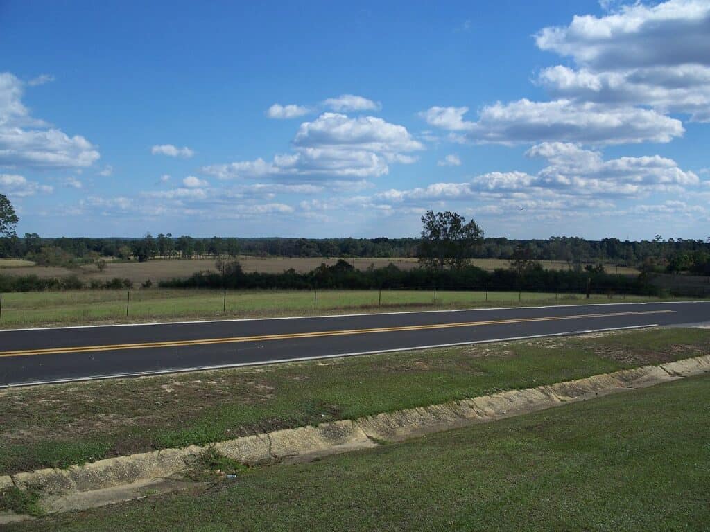
The highest point in Florida, Britton Hill, is located close to the Florida-Alabama state line.
The highest point in Florida sits at a modest 345 feet above sea level. Despite its small stature, Britton Hill is a popular destination for tourists and hikers. Located in the Florida panhandle, Britton Hill is situated within the community of Lakewood.
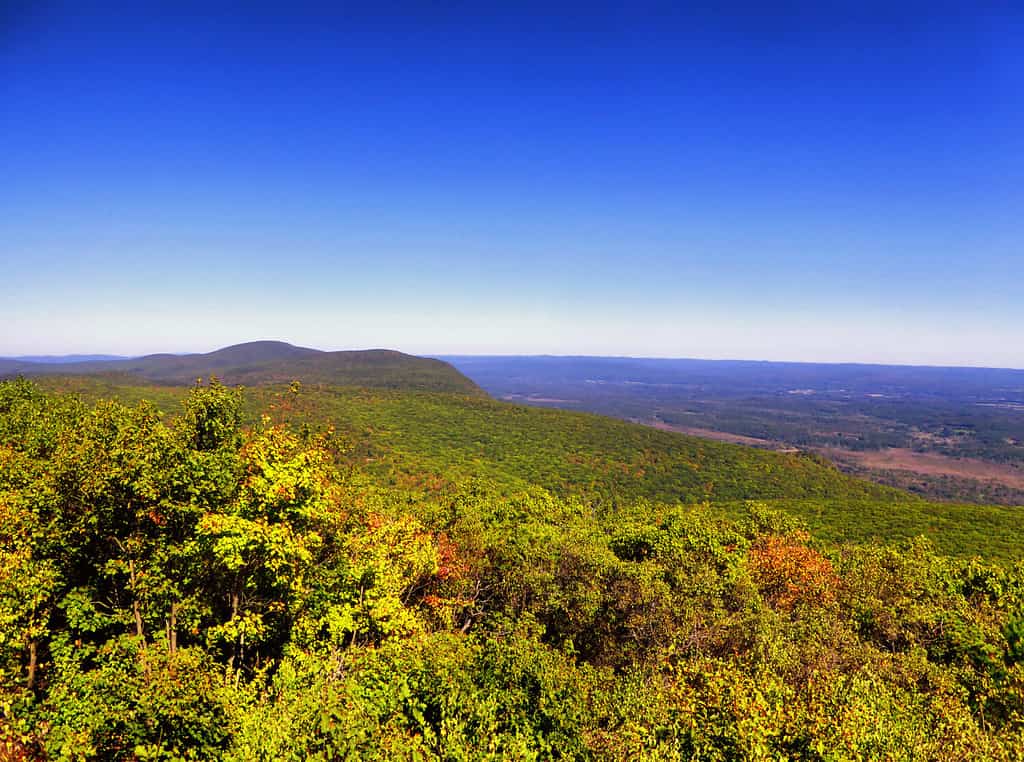
10. Georgia
On clear days, hikers at the summit of Brasstown Bald can see Atlanta 80 miles to the south.
©RodClementPhotography/Shutterstock.com
The highest point in Georgia is located within the Chattahoochee-Oconee National Forest. Brasstown Bald sits at 4,784 feet above sea level. Its name refers to the clear mountaintop meadow that provides beautiful views of Georgia, Tennessee, and South Carolina.
There are several trails you can take to reach the summit of Brasstown Bald, ranging from 11.5 miles to a steep 0.6-mile trail. Once you’ve reached the top, you can rest at a picnic area, take in the views from the observation deck, or explore the Museum of Natural Science and History.
11. Hawaii
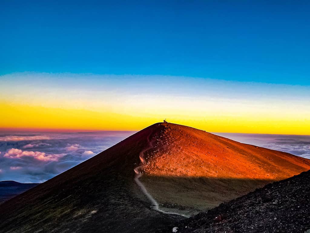
Mauna Kea is a dormant volcano that last erupted around 4,500 years ago.
©Chris Finch Photography/Shutterstock.com
Hawaii is an island chain in the Pacific Ocean formed by volcanic activity. Hawaii’s highest point, Mauna Kea, is located on the Big Island and is 13,796 feet above sea level.
Mauna Kea has one of the most varied climates in North America, ranging from tropical heat near sea level to below-freezing temps and snow at the summit. The mountain is sacred in Hawaiian culture and carries deep spiritual significance.
12. Idaho
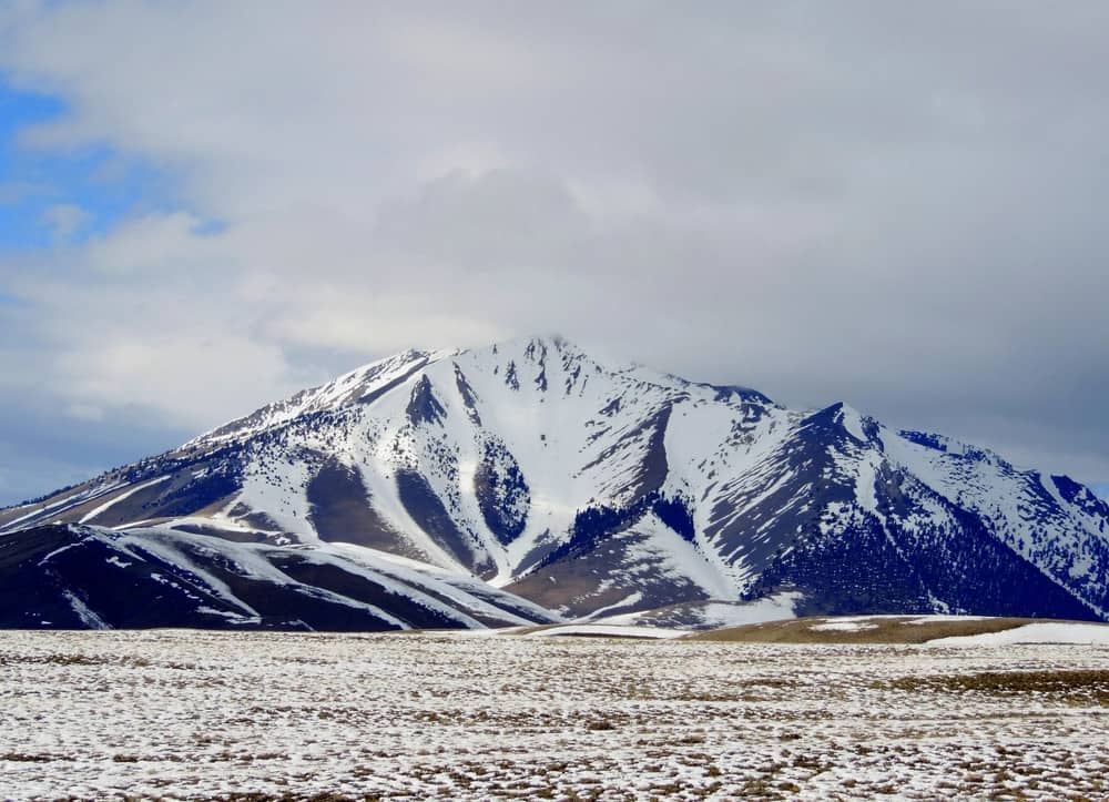
Borah Peak is part of the Rocky Mountains, spanning New Mexico to Canada.
©Debby Ford/Shutterstock.com
The highest point in Idaho is located within the Salmon-Challis National Forest. Borah Peak has an elevation of 12,668 feet and is among the Lost River Range, which is part of the larger Rocky Mountains. The hike to the summit is challenging, with many rock formations to scramble over. Many hikers choose to turn around at the aptly named Chickenout Ridge.
13. Illinois
The highest point in Illinois, Charles Mound, is on private land and is open to visitors a few times a year.
Reaching a height of 1,235 feet, Charles Mound is the highest point in Illinois. It is located in the northwestern corner of the state near the Illinois-Wisconsin state line. Charles Mound was named after Charles Wuebbels, one of the region’s early settlers whose descendants still own the land today.
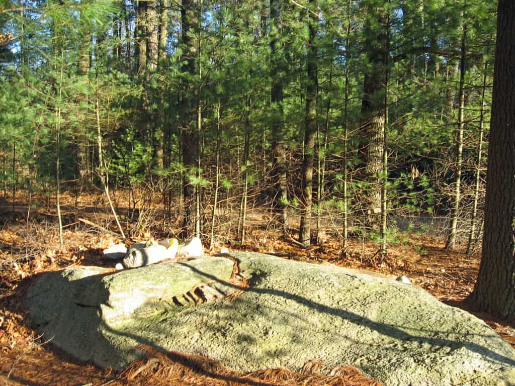
14. Indiana
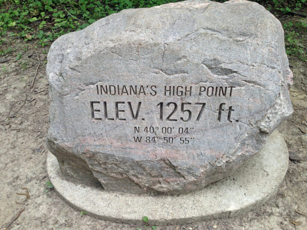
Hoosier Hill is located on the geological formation known as the Cincinnati Arch.
©Fredlyfish4 / CC BY-SA 3.0, via Wikimedia Commons – Original / License
In Indiana, Hoosier Hill is the highest point, with an elevation of 1,257 feet. Although it is the place with the highest elevation, it is a relatively flat stretch of land, marked by an engraved boulder noting the elevation and coordinates.
Hoosier Hill is located on private property in the eastern part of the state near the Indiana-Ohio state line. The property owner has created a site for visitors with picnic tables, a fire pit, a visitor log, and a mailbox for souvenir cards.
15. Iowa
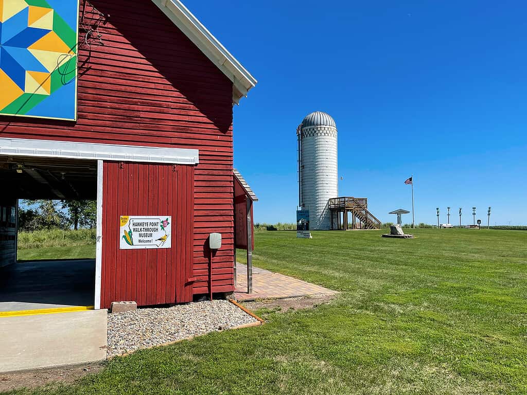
Hawkeye Point boasts a collection of antique farm equipment and historical items.
©Gabe Shakour/Shutterstock.com
The highest point in Iowa used to be a local secret, covered by rows of corn. These days, Hawkeye Point — with an elevation of 1,670 feet — welcomes visitors.
Hawkeye Point is located in the northwestern corner of Iowa, and it offers beautiful, panoramic views of the surrounding farmlands. Visitors can stay at the nearby campground and check out the license plates left by previous tourists.
16. Kansas
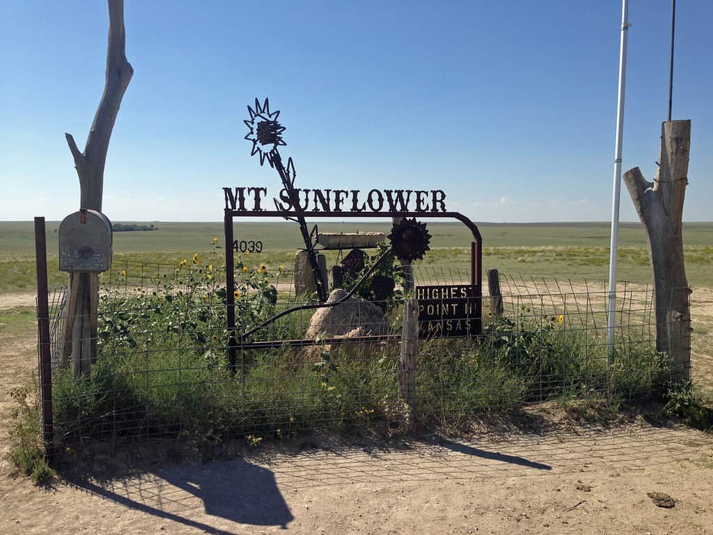
Mount Sunflower is located in northwestern Kansas near the Colorado state line.
©Fredlyfish4/Shutterstock.com
Instead of a dramatic mountain, the highest point in Kansas is at the climax of a long incline. Mount Sunflower sits at 4,039 feet above sea level, but it is relatively unassuming in the high plains of Kansas. Mount Sunflower is marked by a sculpture of a sunflower crafted from railroad spikes. The site includes a picnic area, a free little library, and a registration book.
17. Kentucky

Black Mountain is known to locals as Katahrin’s Mountain.
©Photo by Matt Wasson, Appalachian Voices. April 18th, 2010, iLoveMountains.org, CC BY 2.0, via Wikimedia Commons – Original / License
Located in Harlan County, an area rich with coal deposits, Black Mountain is Kentucky’s highest point, with an elevation of 4,145 feet. The area has multiple hiking trails, a nearby campground, and a recreation area with ziplining and offroading.
18. Louisiana
Although it is located on private property, visitors are welcome to hike Driskill Mountain.
Known for its low elevation and areas that sit below sea level, Louisiana’s highest spot rises to a mere 535 feet. Driskill Mountain is located in north-central Louisiana, and visitors can hike to the summit using the well-marked trail.
19. Maine
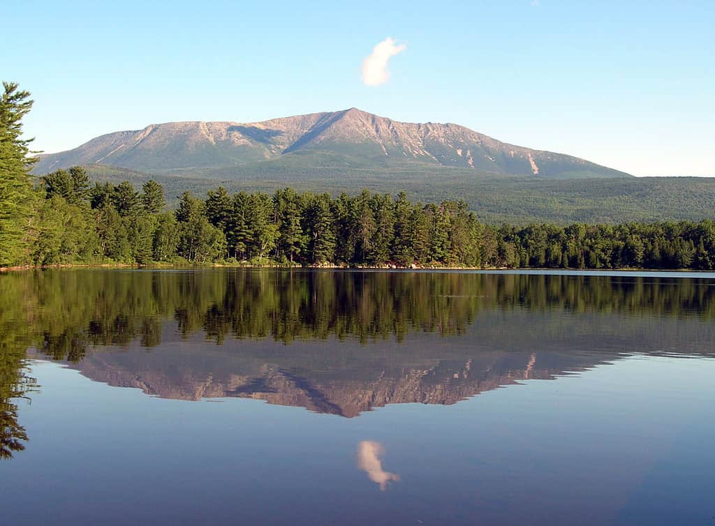
The name “Katahdin” is derived from the Abenaki word for “main mountain.”
©Sandra S Newman/Shutterstock.com
Mount Katahdin is the highest point in Maine, and it is also the northern terminus of the Appalachian Trail. With an elevation of 5,268 feet, reaching the summit is a challenge for even experienced hikers. Situated within Baxter State Park, the area around Mount Katahdin has hundreds of trails and nearly a dozen established campgrounds.
20. Maryland
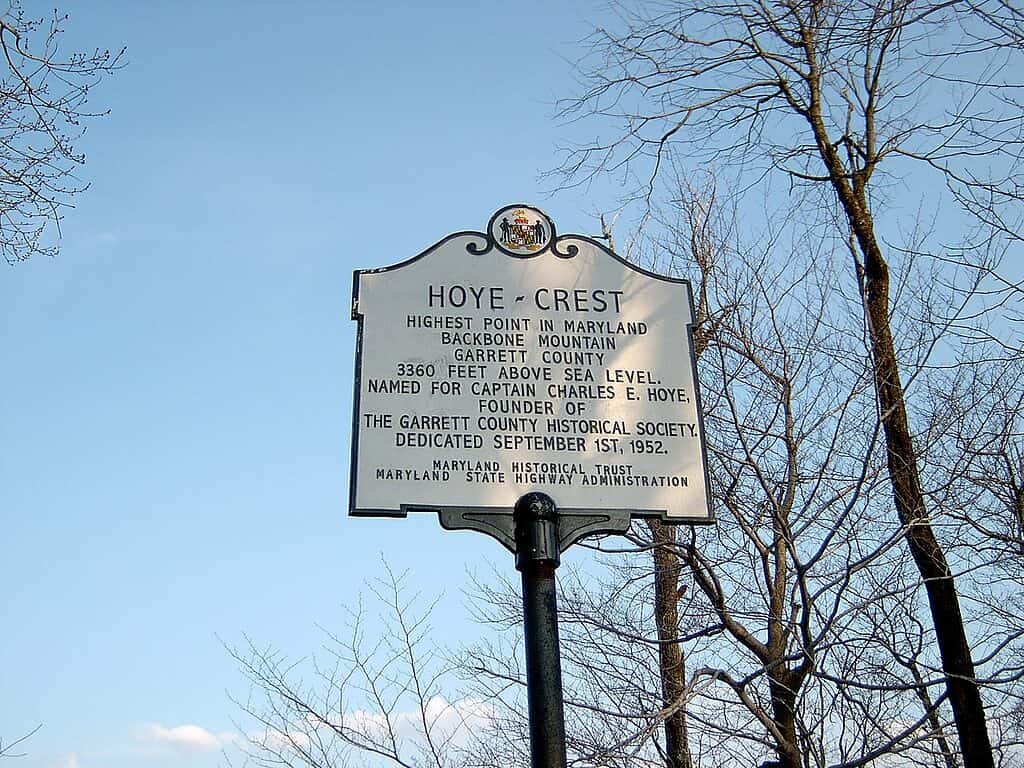
Hoye Crest is named after the founder of the Garrett County Historical Society, Captain Charles E. Hoye.
©Brian M. Powell (user Bitmapped on en.wikipedia) / CC BY-SA 3.0 – Original / License
Located on Backbone Mountain near the Maryland-West Virginia state border, Hoye Crest is Maryland’s highest point, with an elevation of 3,360 feet. Hoye Crest is privately owned, but visitors can reach the summit by taking the Maryland High Point Trail. The hike is just over a mile, and at the top, visitors will find a picnic area, a stone cairn, an obelisk, and a plaque.
21. Massachusetts
Mount Greylock is located in northwestern Massachusetts, near the New York state line.
©Romiana Lee/Shutterstock.com
Sitting at 3,491 feet of elevation, Mount Greylock is the highest point in Massachusetts. Visitors can either drive directly to the summit or take a moderately strenuous hike to the top.
The area around Mount Greylock has dozens of trails and camping options at Mount Greylock State Reservation. Mount Greylock also features the War Memorial Tower, a 100-foot-tall lighthouse built in 1932.
22. Michigan
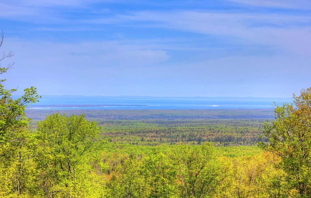
The summit of Mount Arvon offers views of Michigan’s Upper Peninsula.
Situated among the Huron Mountains in Michigan’s Upper Peninsula, Michigan’s highest point is Mount Arvon, with 1,979 feet of elevation. Mount Arvon is on private property, but visitors are able to access the summit. This mountain is the highest naturally occurring peak in the state, but a man-made pile at Tilden Mine technically has a higher elevation.
23. Minnesota
Mount Eagle is located just 20 miles from the state’s lowest point, which is on the shore of Lake Superior.
©Marina Hannus/Shutterstock.com
Sitting at 2,301 feet above sea level, Eagle Mountain is the highest point in Minnesota. The mountain is located within the Superior National Forest in the northeastern corner of the state.
The Eagle Mountain Trailhead marks the start of the hike to the mountain’s summit. It is a moderately strenuous seven-mile roundtrip that passes by Whale Lake on the route to the top.
24. Mississippi
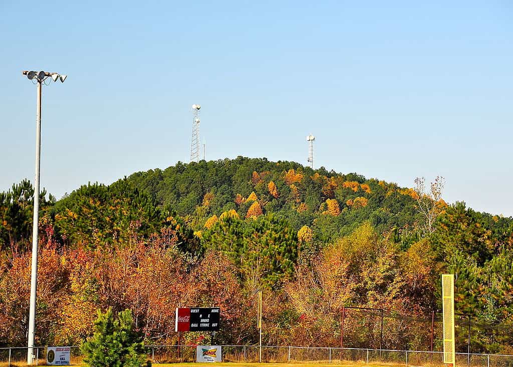
Woodall Mountain was previously known as Yow Mountain.
Standing at 806 feet above sea level, Woodall Mountain is a large outcrop of sandstone and iron that marks Mississippi’s highest point. The mountain played an important role in the Civil War as the site of the Battle of Iuka.
Woodall Mountain is located in the northwestern corner of the state and is open to the public. Visitors can take Woodall Mountain Road to the summit, which is marked by a commemorative boulder.
25. Missouri
Taum Sauk Mountain is located in the Ozarks among the St. Francois Mountains.
©Steven Schremp/Shutterstock.com
Taum Sauk Mountain stands at 1,772 feet of elevation, making it Missouri’s highest point. The mountain is part of Taum Sauk Mountain State Park, which encompasses almost 8,000 acres of forest.
The summit of Taum Saulk is marked by a plaque and includes an overlook tower to take in the views. There is a campground near the summit and a trailhead leading to a waterfall three miles away.
26. Montana
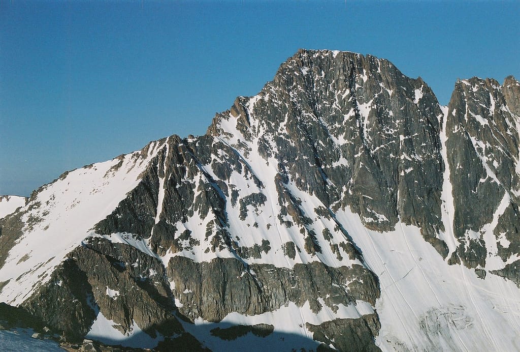
The first official ascent of Granite Peak was recorded in 1923.
Located in the south-central region of the state within the Absaroka Beartooth Wilderness, Granite Peak is Montana’s highest point at 12,799 feet of elevation. Although it is possible to hike to the summit, it is a highly strenuous trail that makes steep elevation gains through dense forests and snow-packed tundra.
27. Nebraska
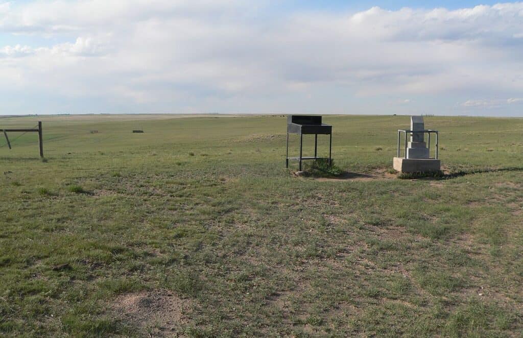
Be sure to sign the guest book after you take in the views at Panorama Point.
Located near the tri-state border of Nebraska, Colorado, and Wyoming, Panorama Point reaches an elevation of 5,424 feet above sea level. While this high point is not a mountain, it offers unparalleled views of the state’s vast open plains. Panorama Point is located on private property, but the public can access the site, which is designated by a stone marker.
28. Nevada
Boundary Peak is located at the northern end of the White Mountains.
©Kris Wiktor/Shutterstock.com
Although it is known as Boundary Peak, Nevada’s highest point is actually a ridge of Montgomery Peak, which is located across the state line in California. Boundary Peak has an elevation of 13,147 feet, and its name reflects its proximity to the state border, less than a mile away. The hike to the summit of Boundary Peak is highly strenuous due to steep elevation gains, rock scrambling, and desert conditions.
29. New Hampshire
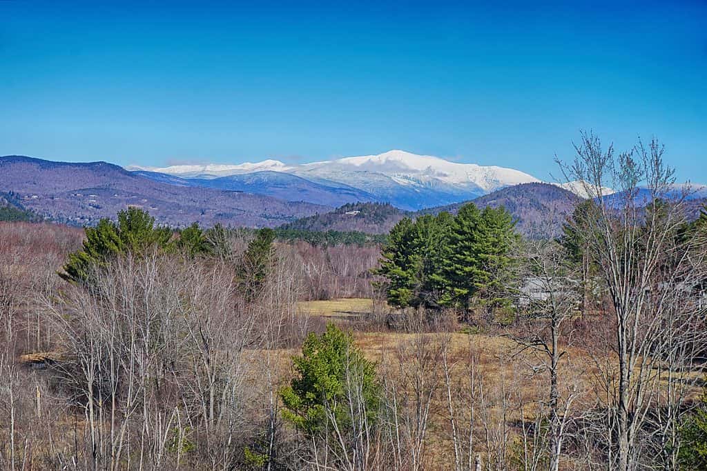
Mount Washington is part of the Presidential Range, which is known to locals as the White Mountains.
©Jonathan Lingel/Shutterstock.com
Standing at 6,288 feet above sea level, Mount Washington is the highest point in New Hampshire and the entire Northeast region. The Mount Washington Cog Railway has been carrying visitors to the summit since 1869.
Although Mount Washington can experience quickly shifting and severe weather, it remains a popular spot to visit. The surrounding area has hundreds of hiking trails and campgrounds.
30. New Jersey
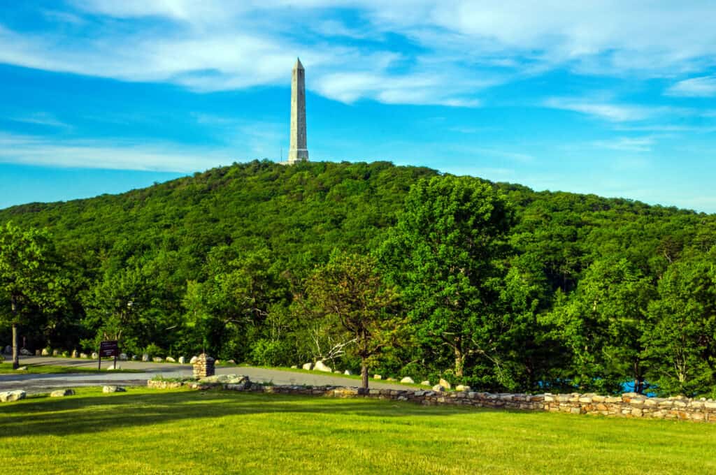
High Point is situated on the Kittatinny Ridge in High Point State Park.
©Bruce Goerlitz Photo/Shutterstock.com
Located in the northwestern corner of the state, High Point is New Jersey’s highest point, with 1,803 feet of elevation. Additionally, it features a 220-foot stone monument that was erected to honor the state’s veterans. Visitors can reach the summit by either driving directly to the upper parking lot or by taking one of the several trails that lead to the top.
31. New Mexico
Wheeler Peak gets its name from Major George M. Wheeler, who was the first to officially survey the mountain in the 1870s.
©Elijah Beck/Shutterstock.com
Previously known as Taos Peak, Wheeler Peak is the highest point in New Mexico, with an elevation of 13,161 feet. It is located in Carson National Forest and is part of the Sangre de Cristo Mountain range. The hike to the summit of Wheeler Peek is a strenuous 4-mile trek that gains almost 3,000 feet in elevation.
32. New York
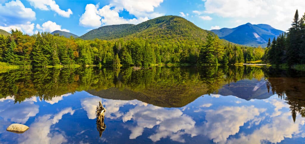
Mount Marcy is located within the Adirondack High Peaks Wilderness Area.
©Colin D. Young/Shutterstock.com
Located in northeastern New York, Mount Marcy is the state’s highest point at 5,344 feet tall. Additionally, it is the highest point of the Adirondack Mountains. About 1,000 feet below the summit is Lake Tear of the Clouds, which is a source for the Hudson River.
A trip to Mount Marcy’s summit is a strenuous 7.4-mile hike that gains over 3,000 feet in elevation. The trail sets off from the Adirondack Mountain Club’s High Peaks Information Center, which has information about other nearby trails and activities.
33. North Carolina
Mount Mitchell State Park was established in 1915.
©iStock.com/Frederik Flagstad
Located in the Appalachian Mountains with an elevation of 6,684 feet, Mount Mitchell is North Carolina’s highest point. It is also the highest peak east of the Mississippi River. Visitors can reach the summit of Mount Mitchell by taking a quarter-mile trail from the parking lot to an observation deck, while the Old Mitchell Trail offers a more challenging hike from the state park office two miles downslope.
34. North Dakota
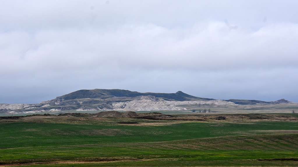
White Butte is about 30 miles south of the Theodore Roosevelt National Park.
Located in the southwestern corner of North Dakota, White Butte reaches an elevation of 3,506 feet, making it the state’s highest point. White Butte is part of the North Dakota badlands, known for its distinctive rocky formations, including buttes, cones, and pyramids.
An easy four-mile hike leads to the summit of White Butte, which offers excellent views of the surrounding area. However, the weather can quickly shift, especially in the summer.
35. Ohio
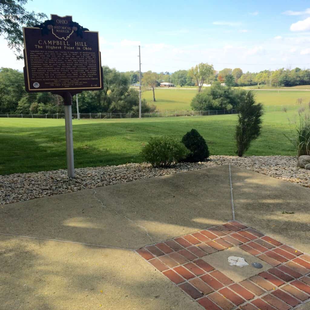
Campbell Hill was formerly part of the Bellefontaine Air Force Station.
©Jeffrey M. Frank/Shutterstock.com
While the Appalachian Mountains run through Ohio’s southern region, the state’s highest point is located to the north in the city of Bellefontaine. Campbell Hill reaches an elevation of 1,549 feet and is considered one of the best-maintained state high points. Campbell Hill is located within the campus of a community college, and the summit is marked by a paved area, benches, a flag pole, and a large plaque.
36. Oklahoma

Black Mesa is in the area where the eastern plains region transitions into the Rocky Mountains.
©John A Davis/Shutterstock.com
Situated in Oklahoma’s panhandle region, Black Mesa is the state’s highest point, with an elevation of 4,973 feet. Black Mesa is named for the black volcanic rock from which it was formed.
The hike to the summit is an 8.4-mile roundtrip with an elevation gain of about 600 feet. The desert landscape around Black Mesa is one of the darkest areas in the country, making it an especially popular destination for star gazing.
37. Oregon
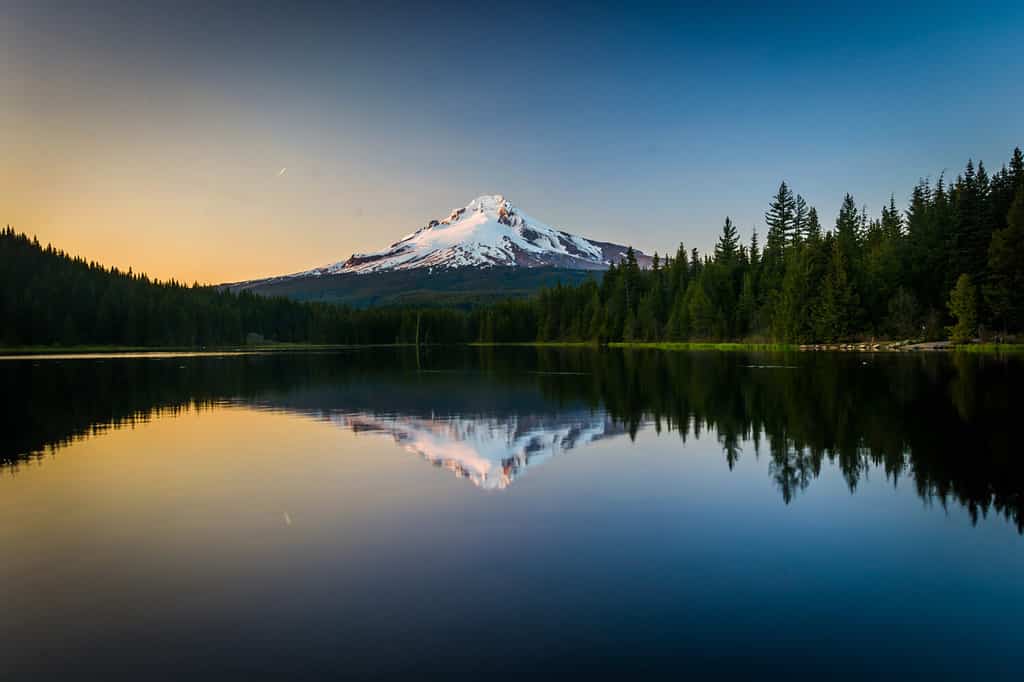
Mount Hood National Forest offers an abundance of campgrounds and hiking trails.
©ESB Professional/Shutterstock.com
With its most recent eruption in 1907, Oregon’s highest point is a stratovolcano, Mount Hood. This peak has an elevation of 11,239 feet and is a popular destination for mountain climbers.
Situated among the Cascade Range, summiting Mount Hood requires the use of crampons and an ice axe. Although the trail to the summit is only three miles, it is quite strenuous, especially given the possibility of shifting changing weather conditions.
38. Pennsylvania
The summit of Mount Davis is at the end of a 0.8-mile hike.
©Zack Frank/Shutterstock.com
Located in Forbes State Forest, Mount Davis is Pennsylvania’s highest point, with an elevation of 3,213 feet. Mount Davis features an observation tower at its summit that provides views of the surrounding Allegheny Mountains. Additionally, there are multiple opportunities for hiking, cross-country skiing, and horseback riding in the area.
39. Rhode Island
The highest point in Rhode Island is Jerimoth Hill, which sits at a height of 811 feet. Jerimoth Hill is located on land that is owned by the Rhode Island Department of Environmental Management. Accordingly, visitors can access the summit by taking a well-marked, quarter-mile trail.
40. South Carolina
Sassafras Mountain is located in northwestern South Carolina near the North Carolina state border.
©Wirestock Creators/Shutterstock.com
While part of Sassafrass Mountain sits in North Carolina, its peak is in South Carolina, the highest point in the state with an elevation of 3,553 feet. This area is part of the Blue Ridge and Appalachian mountains.
In 2019, the summit was improved for visitors and now boasts an observation tower and bathrooms. There is a short path from the parking lot to reach the summit, or you can take the longer Foothills Trail to the top.
41. South Dakota
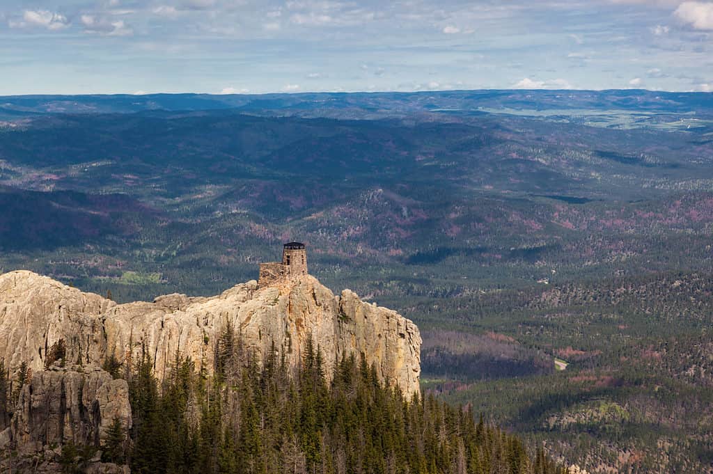
Black Elk Peak’s previous name was Harney Peak.
©Tami Freed/Shutterstock.com
Located in the Black Hills National Forest, Black Elk Peak is South Dakota’s highest point, with an elevation of 7,242 feet. At the summit, the historic Harney Fire Lookout provides outstanding views. There are several trails that lead to the top of Black Elk Peak, and most of them are moderately difficult, with steep switchbacks and some significant gains in elevation.
42. Tennessee
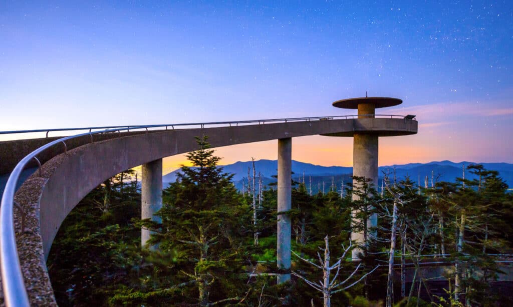
The observation tower at Clingmans Dome offers panoramic views.
©iStock.com/SeanPavonePhoto
Situated near the Tennessee-North Carolina border, Clingmans Dome reaches a height of 6,643 feet, making it Tennesee’s highest point. Clingmans Dome is part of the Great Smoky Mountains National Park, which is the country’s most-visited national park. The road to Clingmans Dome ends a half mile from the summit, and a steep, gravel walking path leads the rest of the way to the top.
43. Texas
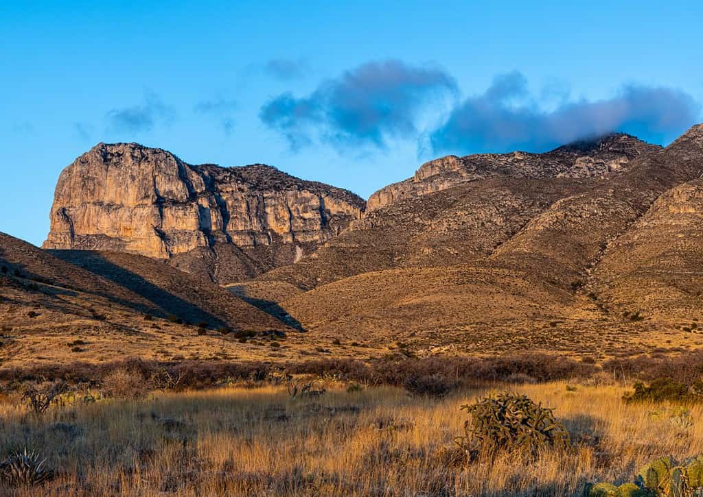
Guadalupe Peak’s other name is Signal Peak.
©Billy McDonald/Shutterstock.com
Located in the high desert of western Texas, Guadalupe Peak sits at 8,751 feet of elevation, making it the state’s highest point. The hike to the summit of Guadalupe Peak is a strenuous 8.4-mile roundtrip.
The hike begins in a cactus and sagebrush-filled desert and ascends to a forest of juniper and pinyon trees. A steel pyramid marks the summit of Guadalupe Peak.
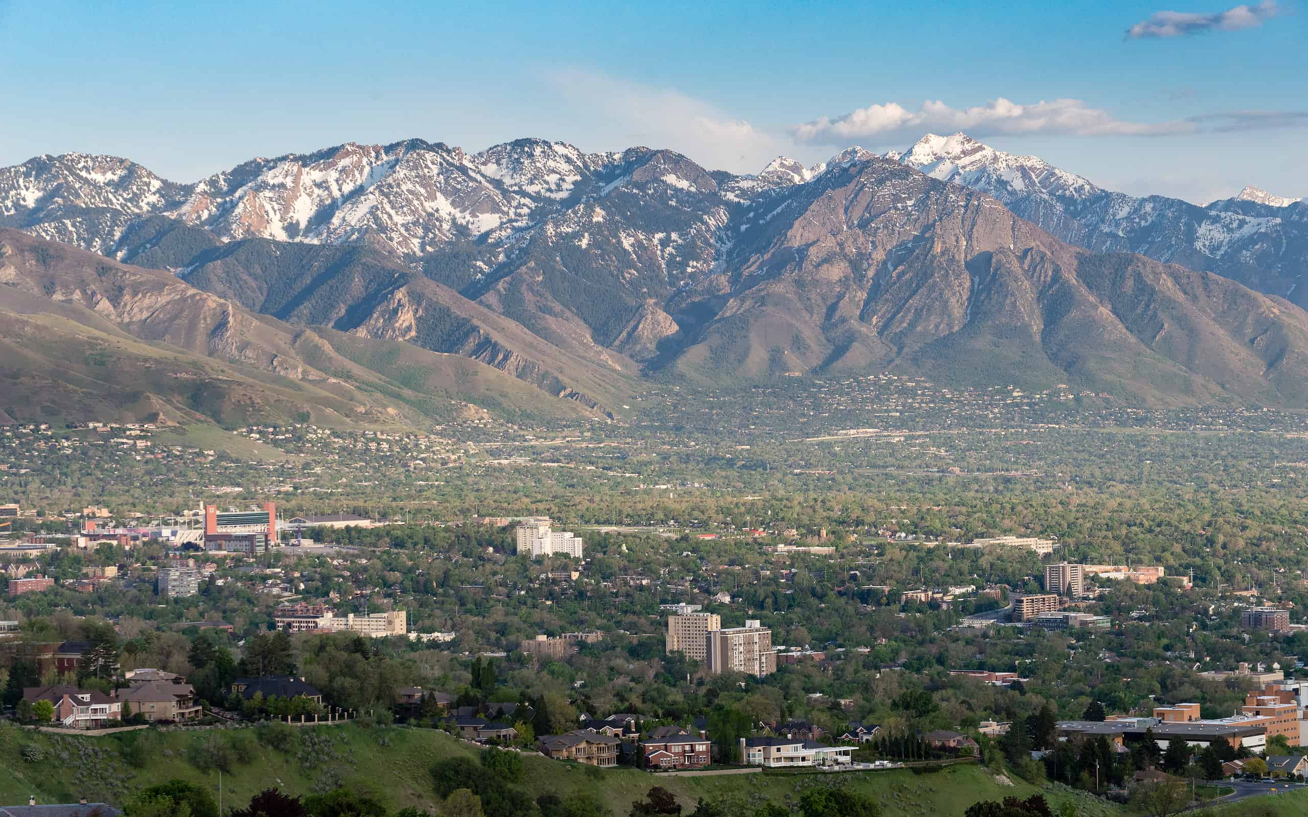
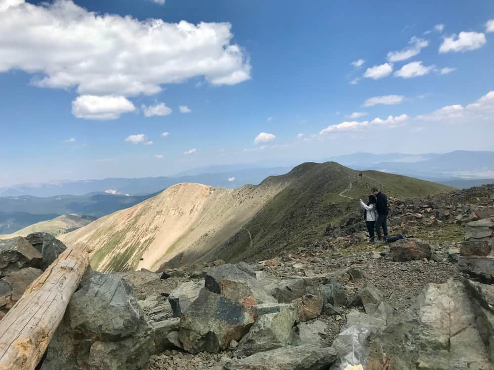
44. Utah
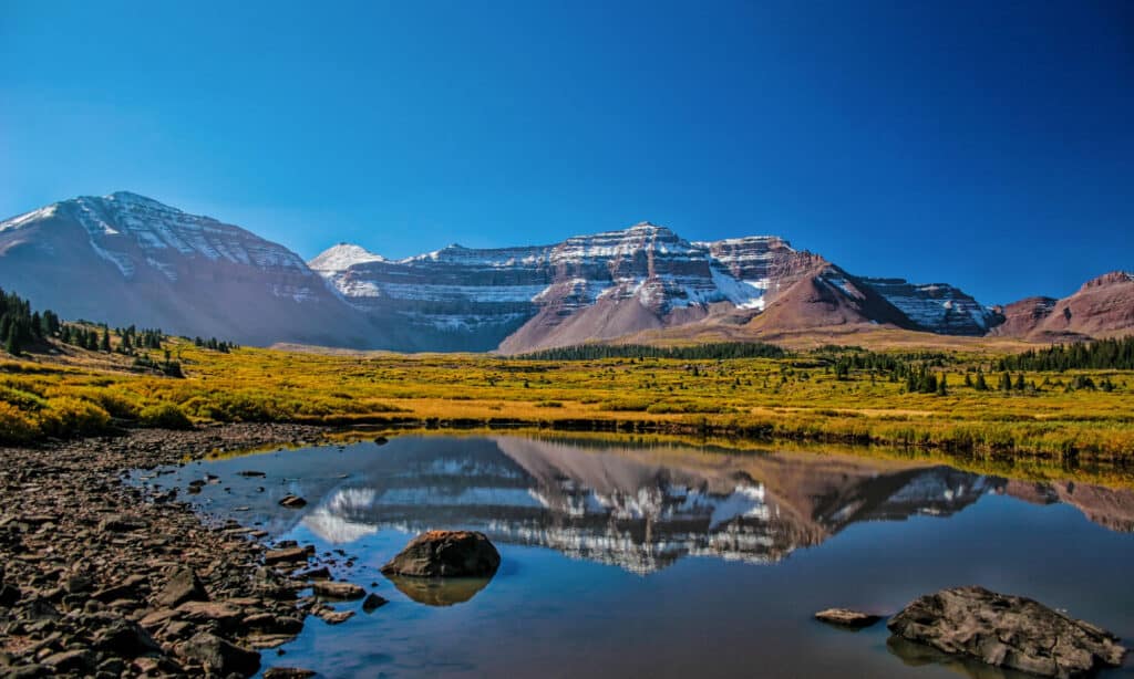
Kings Peak gets its name from Clarence King, the U.S. Geological Survey’s first director.
©Mitch Johanson/Shutterstock.com
In the High Uintas of Utah, Kings Peak is the state’s highest point, with a height of 13,528 feet. Kings Peak is an “ultra prominence” since its peak rises 6,348 feet from the valley floor where the base of the mountain stands. Reaching the summit of Kings Peak requires a roundtrip hike of at least 30 miles through the Ashley National Forest.
45. Vermont
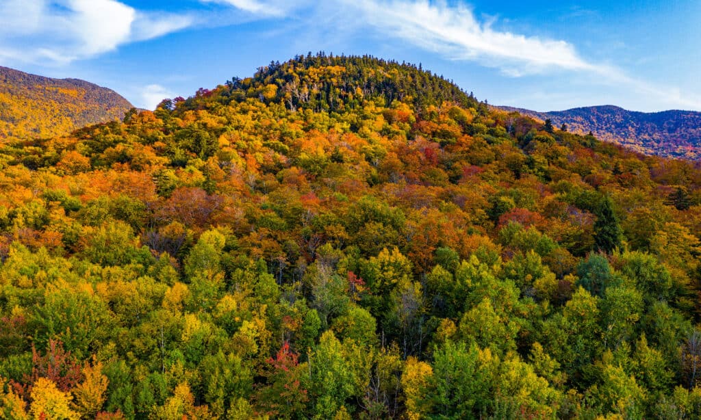
From some angles, Mount Mansfield is said to resemble a human face.
©Felix Lipov/Shutterstock.com
Located in northern Vermont, Mount Mansfield is the state’s highest point, with an elevation of 4,393 feet. Its summit ridge contains some of the state’s last remaining alpine tundras.
While it is possible to reach the summit of Mount Mansfield, a popular activity is to hike the “face” of the mountain. Its highest point is called The Chin, where hikers can explore the Upper and Lower Lips, Forehead, and Nose.
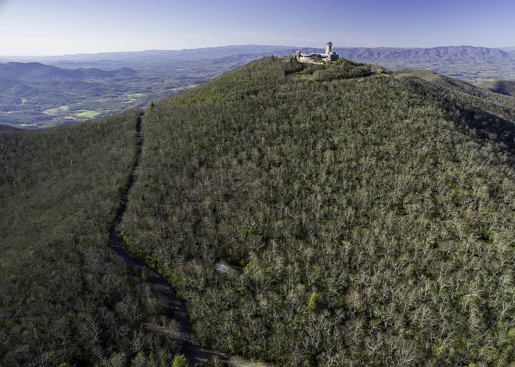
46. Virginia
The Mount Rogers National Recreation Area has several trails for hiking and biking, including the Virginia Creeper Trail.
©Gabriel Quiles/Shutterstock.com
The highest point in Virginia is Mount Rogers, located within the George Washington and Jefferson National Forests. With an elevation of 5,729 feet, the area around Mount Rogers is known as the “rooftop of Virginia.” The trip to the summit includes a nine-mile out-and-back hike, which overlaps with a portion of the Appalachian Trail.
47. Washington
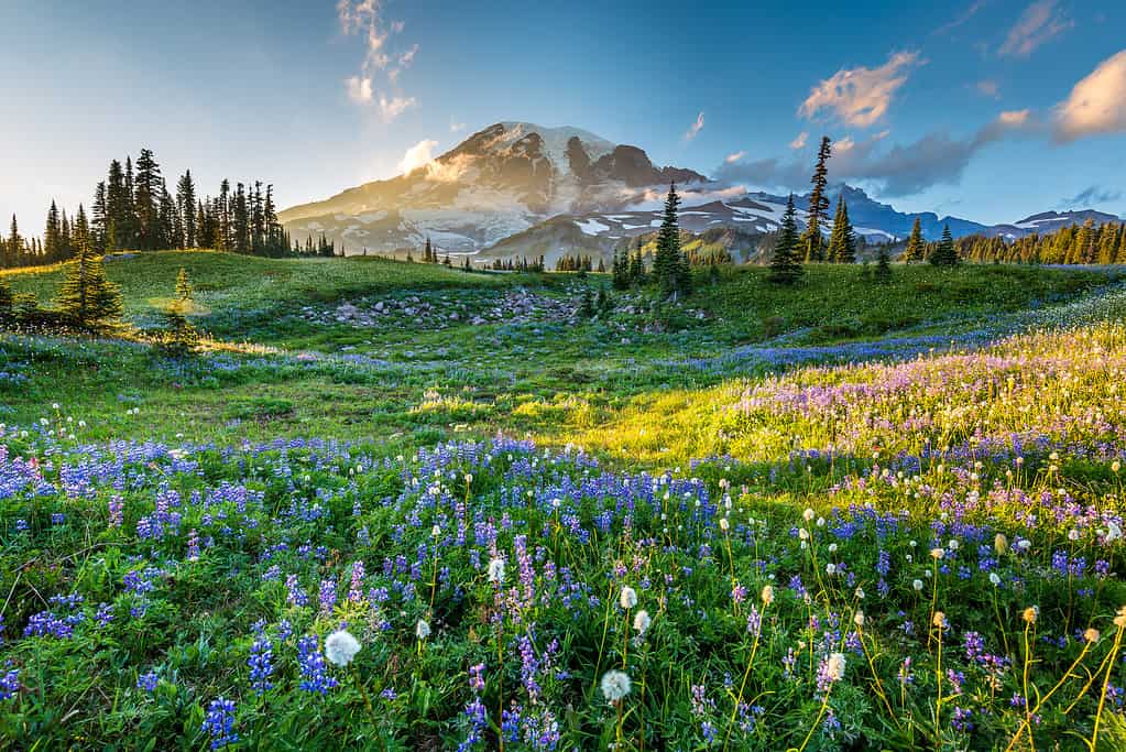
Mount Rainier has more glaciers than any other mountain in the contiguous United States.
©RomanKhomlyak/iStock via Getty Images
Situated in the Cascade Mountains, Mount Rainier is Washington’s highest point, with an elevation of 14,410 feet. The mountain is a dormant volcano with three separate peaks: Liberty Cap, Point Success, and Columbia Crest.
Hiking to the summit of Mount Rainier depends on advanced hiking skills and preparation. With over 9,000 feet of elevation gain, the journey requires the use of ice axes, crampons, and ropes.
48. West Virginia
Spruce Knob has an observation tower that offers views of the surrounding Allegheny Mountains.
©Jon Bilous/Shutterstock.com
Known as the Mountain State, West Virginia is the only state that is situated entirely within the Appalachian Mountain range. The state’s highest point is Spruce Knob, which has an elevation of 4,863 feet. The summit of Spruce Knob is easily accessible via the quarter-mile Whispering Spruce Trail.
49. Wisconsin
Timm’s Hill County Park features hiking trails, fishing, and cross-country ski trails.
©Maarten Daams/Shutterstock.com
With a height of 1,951 feet, Timm’s Hill is the highest point in Wisconsin. Timm’s Hill is located in the north-central region of the state within Timm’s Hill County Park. An easy quarter-mile trail leads to the summit, which features an observation tower for the best possible views.
50. Wyoming
Gannett Peak is located in the Bridger Wilderness.
©Jeff Bernhard/Shutterstock.com
Wyoming is home to five peaks that exceed 13,000 feet, but its highest point is Gannett Peak, which reaches 13,804 feet of elevation. This mountain is part of the Rocky Mountains and the Wind River Range.
Due to its remote location, sheer cliff faces, and extreme elevation, the summit of Gannett Peak is only accessible to highly experienced mountain climbers. However, there are multiple trails and opportunities for outdoor recreation in the surrounding area.
| State | Highest Point |
|---|---|
| Alabama | Cheaha Mountain |
| Alaska | Denali |
| Arizona | Humphreys Peak |
| Arkansas | Mount Magazine |
| California | Mount Whitney |
| Colorado | Mount Elbert |
| Connecticut | Bear Mountain |
| Delaware | Ebright Azimuth |
| Florida | Britton Hill |
| Georgia | Brasstown Bald |
| Hawaii | Mauna Kea |
| Idaho | Borah Peak |
| Illinois | Charles Mound |
| Indiana | Hoosier Hill |
| Iowa | Hawkeye Point |
| Kansas | Mount Sunflower |
| Kentucky | Black Mountain |
| Louisiana | Driskill Mountain |
| Maine | Mount Katahdin |
| Maryland | Hoye Crest |
| Massachusetts | Mount Greylock |
| Michigan | Mount Arvon |
| Minnesota | Eagle Mountain |
| Mississippi | Woodall Mountain |
| Missouri | Taum Sauk Mountain |
| Montana | Granite Peak |
| Nebraska | Panorama Point |
| Nevada | Boundary Peak |
| New Hampshire | Mount Washington |
| New Jersey | High Point |
| New Mexico | Wheeler Peak |
| New York | Mount Marcy |
| North Carolina | Mount Mitchell |
| North Dakota | White Butte |
| Ohio | Campbell Hill |
| Oklahoma | Black Mesa |
| Oregon | Mount Hood |
| Pennsylvania | Mount Davis |
| Rhode Island | Jerimoth Hill |
| South Carolina | Sassafras Mountain |
| South Dakota | Black Elk Peak |
| Tennessee | Clingmans Dome |
| Texas | Guadalupe Peak |
| Utah | Kings Peak |
| Vermont | Mount Mansfield |
| Virginia | Mount Rogers |
| Washington | Mount Rainier |
| West Virginia | Spruce Knob |
| Wisconsin | Timm’s Hill |
| Wyoming | Gannett Peak |

How to Add Us to Google News


Thank you for reading! Have some feedback for us? Contact the AZ Animals editorial team.