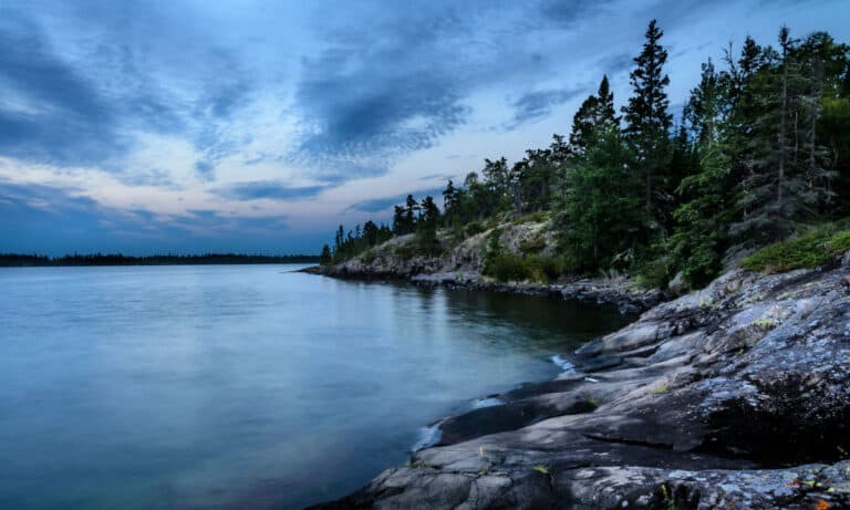
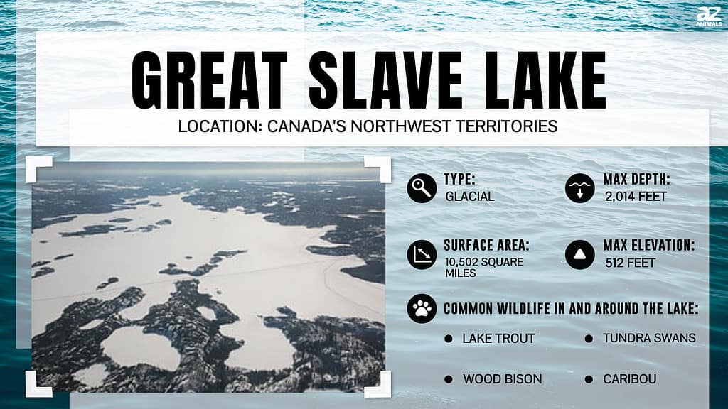
Great Slave Lake in Canada’s Northwest Territories is the deepest lake in North America and the ninth-deepest lake in the world. Let’s explore the details of this seemingly bottomless freshwater lake.
Depth of Great Slave Lake
Great Slave Lake features a staggering depth of 2,014 feet. The bottom of the lake is the lowest natural point on the continent, dropping a quarter of a mile below sea level.
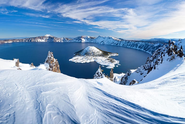
The lake is over 150 feet deeper than Crater Lake, the deepest lake in the United States and the second-deepest in North America.
Great Slave Lake could swallow all but three of the world’s tallest buildings. The only towers taller than the depths of Great Slave Lake are the Burj Khalifa in the United Arab Emirates, Merdeka 118 in Malaysia, and Shanghai Tower in China. Every other skyscraper on Earth, including the CN Tower in Toronto and One World Trade Center in New York City, would be completely covered by the deep waters of this Canadian lake.
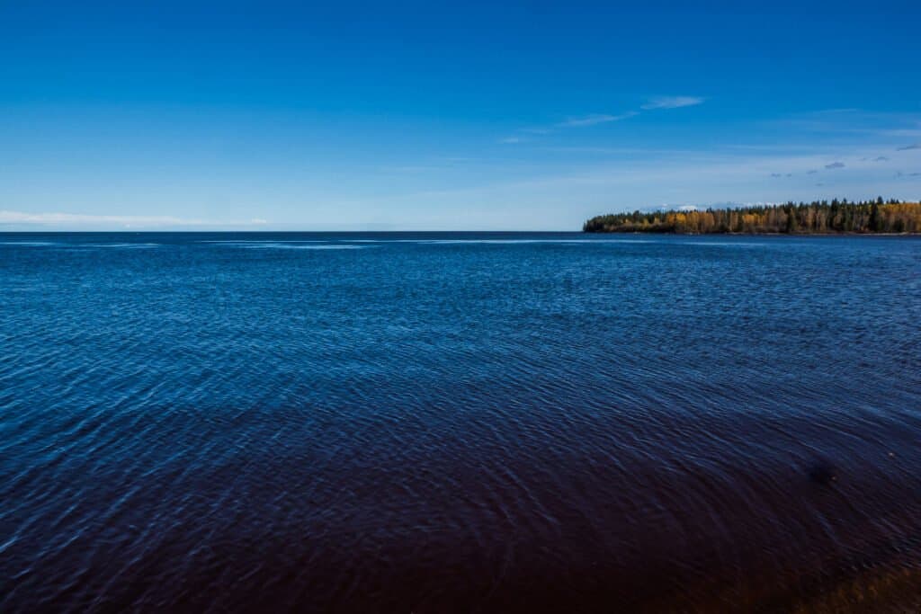
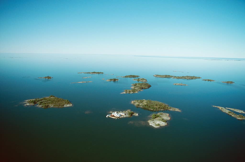
Canada’s Great Slave Lake is easily the deepest lake in North America.
©norikko/Shutterstock.com
Size of Great Slave Lake
Great Slave Lake covers an area of 10,502 square miles, making it the fifth-largest lake in North America and the tenth-largest lake in the world. It is the second-largest lake in the Northwest Territories behind Great Bear Lake, which sits about 200 miles to the northwest.
Great Slave Lake has a surface area larger than two of the Great Lakes. It is nearly 600 square miles larger than Lake Erie and well over 3,100 square miles larger than Lake Ontario.
The footprint of Great Slave Lake is larger than that of six U.S. states. Vermont, New Hampshire, New Jersey, Connecticut, Delaware, and Rhode Island are all smaller than Great Slave Lake. In fact, the lake is larger than the latter three states combined.
The lake is roughly the size of the nation of Haiti.
Great Slave Lake is larger than two of the Great Lakes.
©© Getty Images/PHOTOS.com>> via Getty Images
Formation of Great Slave Lake
Approximately 13,000 years ago, a huge portion of the Northwest Territories buckled under the immense weight of a glacier. As the glacier retreated some 10,000 years ago, meltwater from the Laurentide Ice Sheet filled the region and formed Lake McConnell. This glacial lake stretched for over 620 miles, covering the area where Great Bear Lake, Great Slave Lake, and Lake Athabasca are now found. The land slowly bounced back with the removal of the glacial weight. Great Slave Lake was separated from Lake McConnell during this post-glacial uplift. Today, the lake has a surface elevation of 512 feet above sea level.
The glacial meltwater also filled the Slave River, the main river that feeds Great Slave Lake today. The lake is also fed by the Hay, Lockhart, and Taltson Rivers. The lake drains into the Mackenzie River, the largest and longest river in Canada. This river has the second-largest drainage basin of any river in North America, trailing only the Mississippi River.
History of Great Slave Lake
The earliest indigenous peoples arrived at the lake some 8,000 years ago. British fur trader Samuel Hearne was purportedly the first European to explore the lake. He crossed the frozen lake (which he called Lake Athapuscow) in 1771. Trading posts were established near the mouth of the Slave River beginning in the 1780s.
The lake’s name came from the Slavey People, a First Nations people of the Dene group. They are indigenous to the Great Slave Lake region.
When the fur traders arrived, they dealt primarily with the Cree, another First Nations people. When the traders asked their Cree guides about the Dene people, their guides told them that these people were sometimes taken as slaves by the Cree. The traders began to refer to the Dene people as “Slavey” or simply “Slave.” That name then was applied to the lake itself. French fur traders called the lake “Grand Lac des Esclaves,” which translates to “Great Slave Lake.”
It must be noted that the Cree and Dene peoples made peace long ago, but the historical references to slavery continue in the names of Great Slave Lake, Slave River, Lesser Slave River, and Lesser Slave Lake.
Renaming efforts have suggested the Slave names of the lake and its surrounding waters should be removed and replaced with indigenous names. One example that has been put forth is the Dene name of the lake. They refer to the lake as Tucho, which means “Big Water.” It is also known as Tu Nedhe, meaning “Big Lake.”
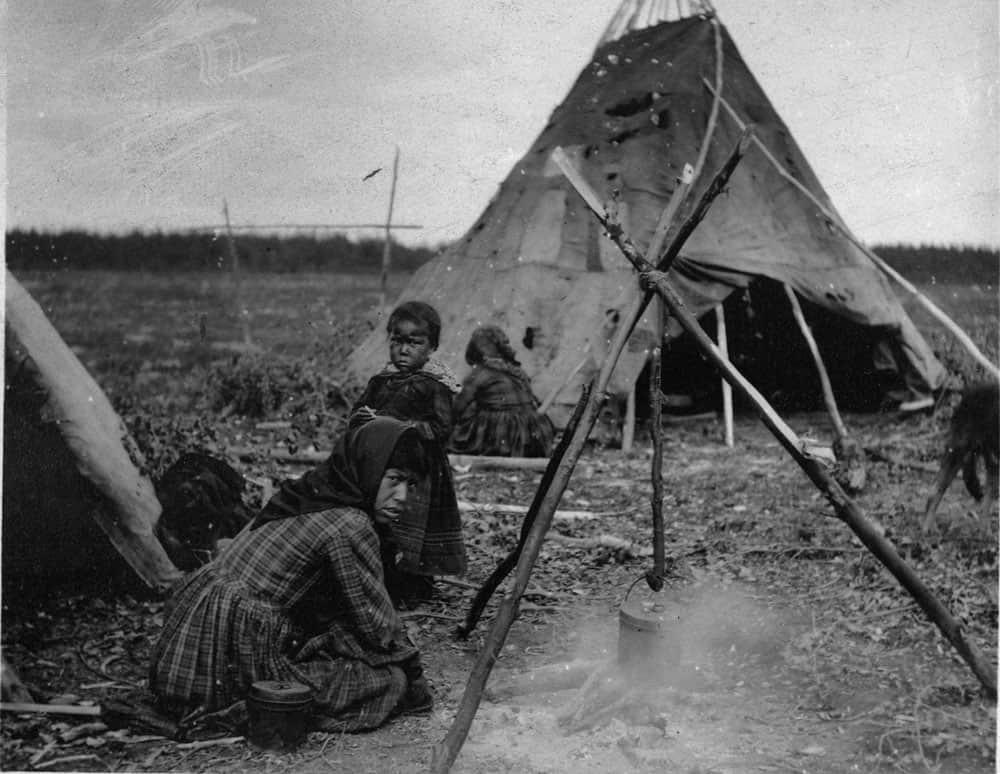
The Slavey people often lived in impoverished camps, such as this one pictured between 1870 and 1920.
©Geological Survey of Canada / Public domain – Original / License
Climate of Great Slave Lake
Great Slave Lake is large enough to impact the climate of the surrounding area. It has a moderating effect, extending the growing season near the lake as opposed to areas further from its waters.
The lake typically begins to freeze over in late November. The ice does not melt until mid to late May. The lake’s waters are fully open by mid-June.
Summer generally features calm waters and weather. Storms become more common in the fall, some of which can be strong and can appear with little warning.
The Towns of Great Slave Lake
Gold was discovered on the North Arm of Great Slave Lake in the 1930s. A prospector named Johnny Baker was reportedly the first to discover the precious metal. The ensuing gold rush birthed the town of Yellowknife, which became the capital of the Northwest Territories in 1967.
Other communities on the lake’s shores include Hay River, Fort Resolution, Łutsel K’e, and Behchokǫ̀. Over half of the entire population of the Northwest Territories live in these five communities around Great Slave Lake.
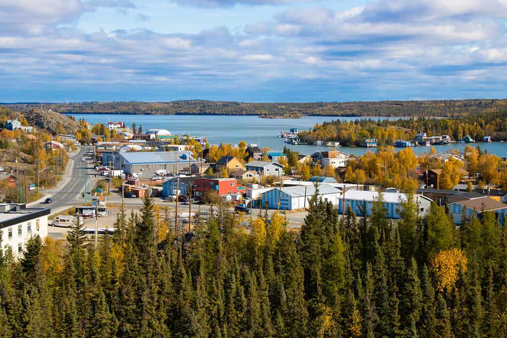
Yellowknife is the largest city in the Northwest Territories.
©ti1993/Shutterstock.com
Fishing in Great Slave Lake
Great Slave Lake is a world-renowned fishery. Trophy lake trout weighing 60 pounds or more swim in these waters. Huge northern pike are also caught routinely. The lake is also brimming with lake whitefish, Arctic grayling, and walleye.
Wildlife of Great Slave Lake
The lake’s remote location makes it a haven for a wide variety of animals. Birds proliferate in the region, including bald eagles, tundra swans, gulls, arctic terns, geese, ducks, and many others. Wood bison, the largest terrestrial animals in North America, are common sightings. Caribou and even the occasional muskox can also be spotted around the lake.
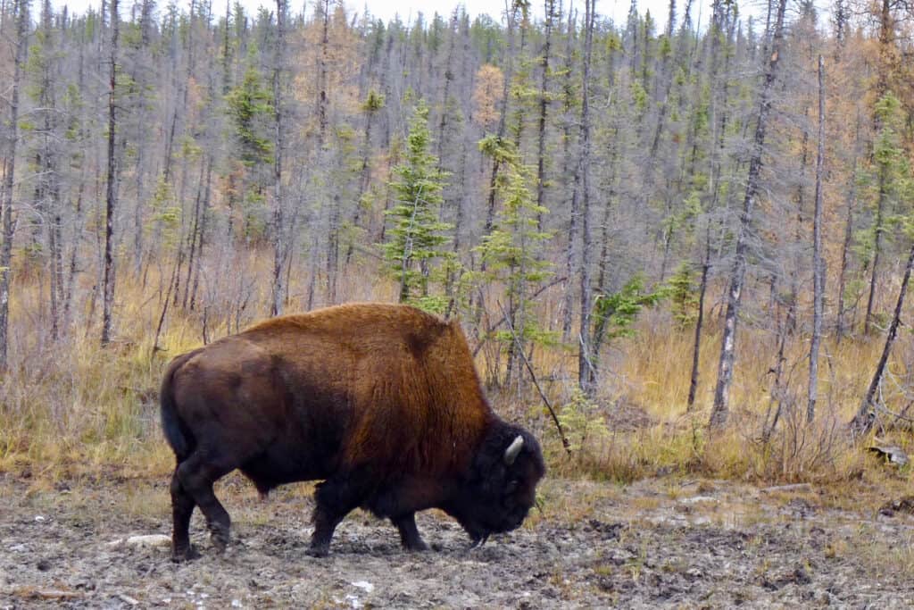
Wood bison are larger than the plains bison of the American West.
©iStock.com/Peter Loring
Midnight Sun
The sun doesn’t set in Yellowknife on the summer solstice, which occurs on June 21 or 22. During this time, Yellowknife experiences about 20 hours of sunlight. But, even when the sun does slip below the horizon for a very brief period, the sky never becomes truly dark.
Aurora Borealis
When the sun does set at Great Slave Lake, it is a wonderful place to view the aurora borealis or the northern lights. Yellowknife is known as the “Aurora Capital of North America.” The celestial lights are visible some 200 nights per year in the region.
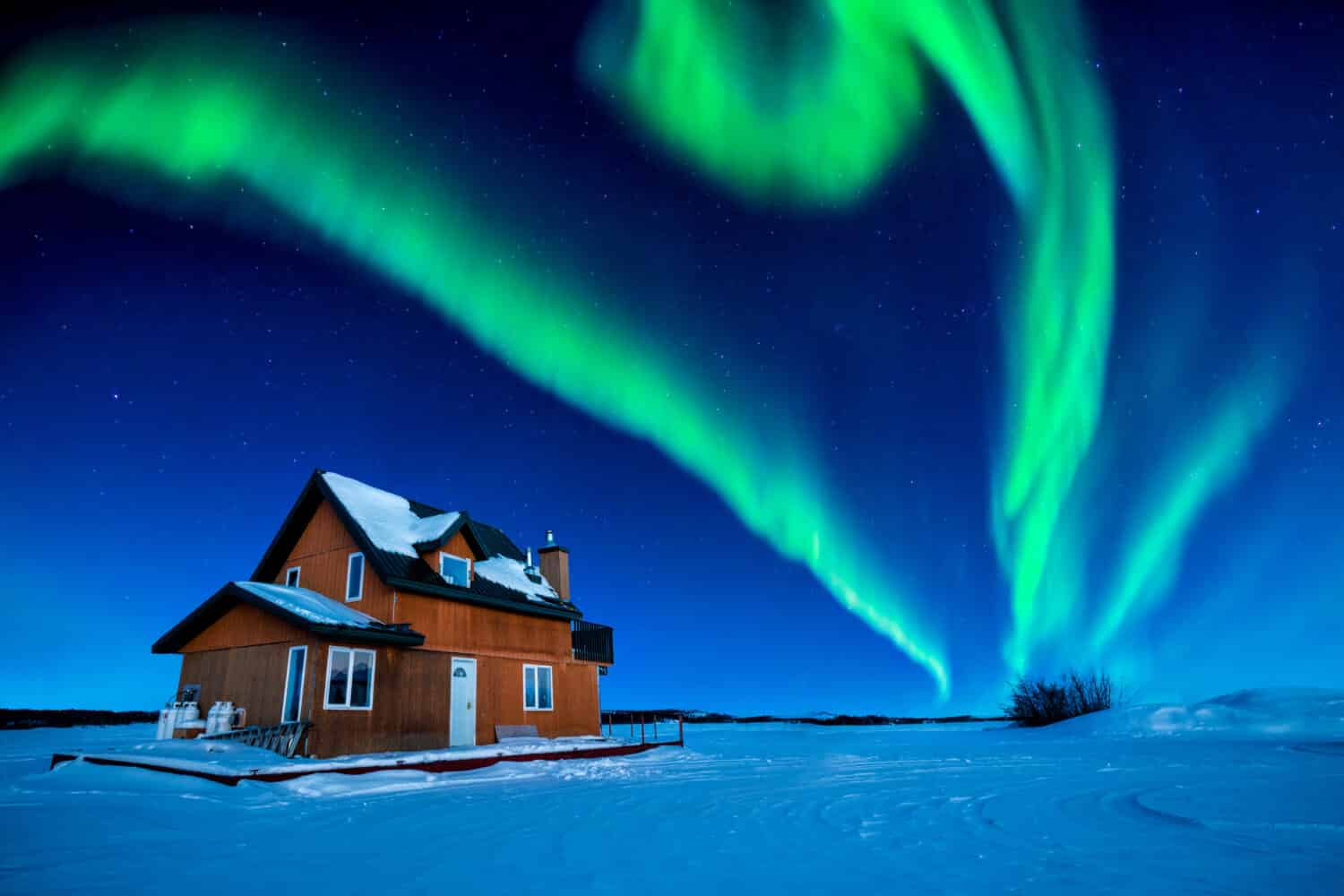
Great Slave Lake is a spectacular place to view the aurora borealis.
©Ken Phung/Shutterstock.com
Ice Road
There is one ice road over Great Slave Lake during the winter. The Dettah Ice Road is a four-mile-long road over the frozen lake that connects Yellowknife with the small community of Dettah. During the summer, the drive between these two towns is 17 miles along a trail around the lake.
Television Shows
The Great Slave Lake region gained wider notoriety in the 2010s through two cable TV shows that featured the area. Ice Lake Rebels, which aired on Animal Planet, detailed the lives of houseboaters on the lake. Ice Road Truckers on the History Channel documented the journeys of truck drivers as they hauled large and heavy loads across the ice roads created by frozen lakes and rivers in the region.