
South Dakota is located in the north-central United States. It is the seventeenth largest state in the nation in terms of land area. Here is a look at how the state’s size breaks down into different measurements, along with comparisons to the total areas of other states.
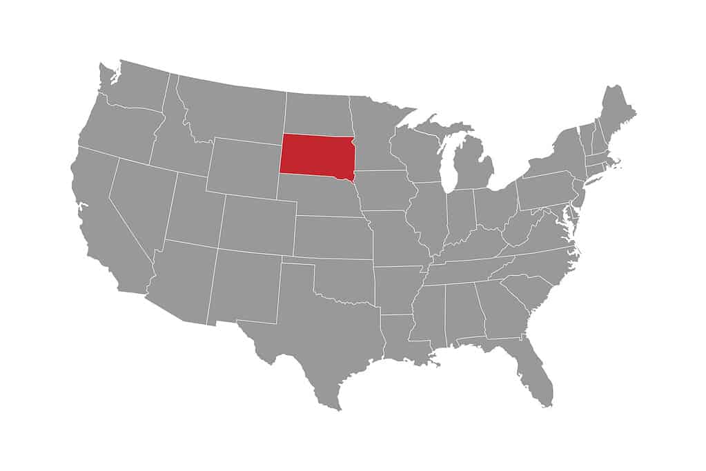
South Dakota is generally regarded as the far western edge of the U.S. Midwest.
©Ruslan Maiborodin/iStock via Getty Images
Length and Width of South Dakota
Unlike the many irregularly shaped states in the U.S., South Dakota’s borders form a fairly uniform rectangle. In general, the state measures 370 miles (595 kilometers) from east to west. This is quite similar to the length of North Dakota, which stretches 340 miles (547 kilometers) from east to west.
While the horizontal measurements of North and South Dakota are close, the vertical measurements are essentially identical. South Dakota measures 210 miles (338 kilometers), while North Dakota stretches 211 miles (340 kilometers) from north to south.
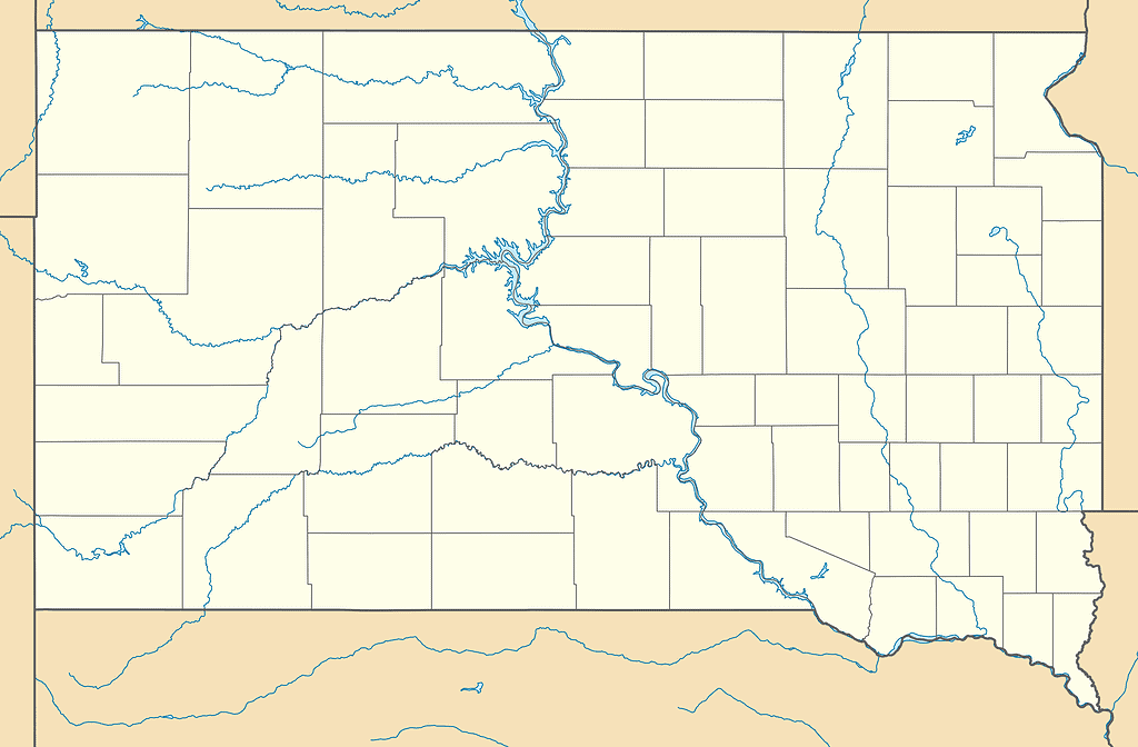
Aside from the northeast and southeast corners, South Dakota is a near-perfect rectangle.
©Alexrk / CC BY 3.0 – License
Square Miles and Kilometers
The South Dakota Secretary of State reports that South Dakota covers an area of 77,047 square miles. That equates to 199,551 square kilometers.
The state is very similar to Nebraska in terms of total area. Nebraska’s borders encompass 77,347 square miles (200,328 square kilometers).
Acres
An acre is roughly the size of a football field (minus the end zones). There are 640 acres in one square mile. South Dakota’s territory covers 49,310,080 acres.
Other States
As noted above, South Dakota is the seventeenth largest state in the U.S. It is sandwiched between Nebraska and Washington State.
Rhode Island is the smallest state in the nation at just 1,214 square miles. You could fit 63 ½ Rhode Islands inside of South Dakota.
South Dakota is bigger than the nine smallest U.S. states combined. If the states of Maryland, Hawaii, Massachusetts, Vermont, New Hampshire, New Jersey, Connecticut, Delaware, and Rhode Island were combined, South Dakota would cover that entire land area. In fact, you could throw in another Delaware and three more Rhode Islands, and South Dakota would still completely cover the area.
Alaska is the largest state in the U.S. at 665,384 square miles (1,723,337 square kilometers). That is more than 8 ½ times the size of South Dakota. Texas is nearly 3 ½ times larger than South Dakota, while California is a little more than twice the size of Mount Rushmore State. Neighboring Montana is just under two times the size of South Dakota.
South Dakota occupies just over two percent of the United States’ total land area. For comparison, Rhode Island only accounts for 0.04% of U.S. land, while a staggering 17.48% of the nation’s land is in Alaska.
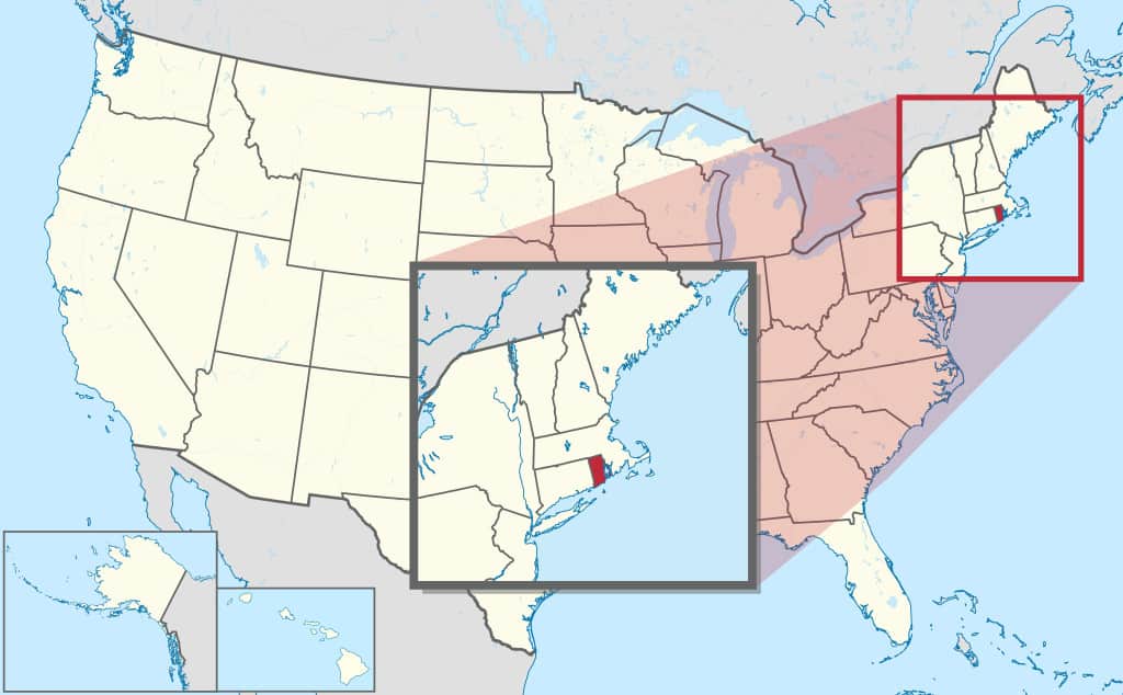
South Dakota is more than 63 times larger than Rhode Island.
©TUBS / CC BY-SA 3.0 – License
State Borders
South Dakota’s entire northern border is shared with North Dakota. Minnesota and Iowa border South Dakota to the east, Nebraska to the south, and Wyoming and Montana to the west.
Six states border South Dakota.
©PeterHermesFurian/iStock via Getty Images
Population
While South Dakota is a large state, it is one of the least populated states in the nation. The state’s 2022 population estimate was 909,824, per the U.S. Census Bureau. Only four states have fewer residents than South Dakota: North Dakota, Alaska, Vermont, and Wyoming.
Given the state’s expansive size and the small number of residents, this also gives South Dakota one of the lowest population densities in the U.S. Population density is calculated by the number of people per square mile. South Dakota has a population density of just under twelve people per square mile. Four states have a lower population density than South Dakota: North Dakota, Montana, Wyoming, and Alaska.
Largest Cities
South Dakota has one city with more than 100,000 residents. Sioux Falls has a population of 202,078 (2022 estimate). The Greater Sioux Falls metro area has nearly 282,000 residents.
The next largest South Dakotan city is Rapid City, with 78,824 residents. All other cities in the state have populations below 30,000.
Pierre is the capital of South Dakota. It is the nation’s second least populous state capital, with 13,969 residents. Only Vermont has a smaller state capital. Montpelier has just 8,023 residents.
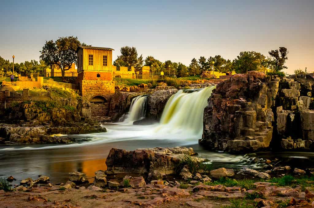
Sioux Falls is named after the waterfalls at Falls Park.
©photo.eccles/Shutterstock.com
Counties
There are 66 counties in South Dakota, which is close to the average for a U.S. state (62).
The state’s largest county by area is Meade County which stretches for 3,471 square miles (8,990 square kilometers). The smallest county is Aurora County, at 708 square miles (1,834 square kilometers).
The most populous county is Minnehaha County, with an estimated population of 203,971. Most of Sioux Falls is located in Minnehaha County. The city’s southernmost location extends into Lincoln County.
The least populous county in South Dakota is also the smallest: Aurora County. An estimated 2,755 people live in the county.
Geographic Center
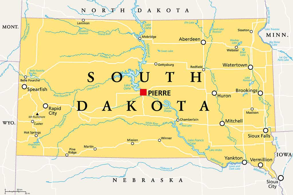
The exact center point of the United States is in South Dakota. The Geographic Center of the Nation Monument is located in Belle Fourche (pronounced “Bell Foosh”) in western South Dakota. While the monument symbolically marks the nation’s center, the exact center point is on private property about twenty miles north of Belle Fourche.
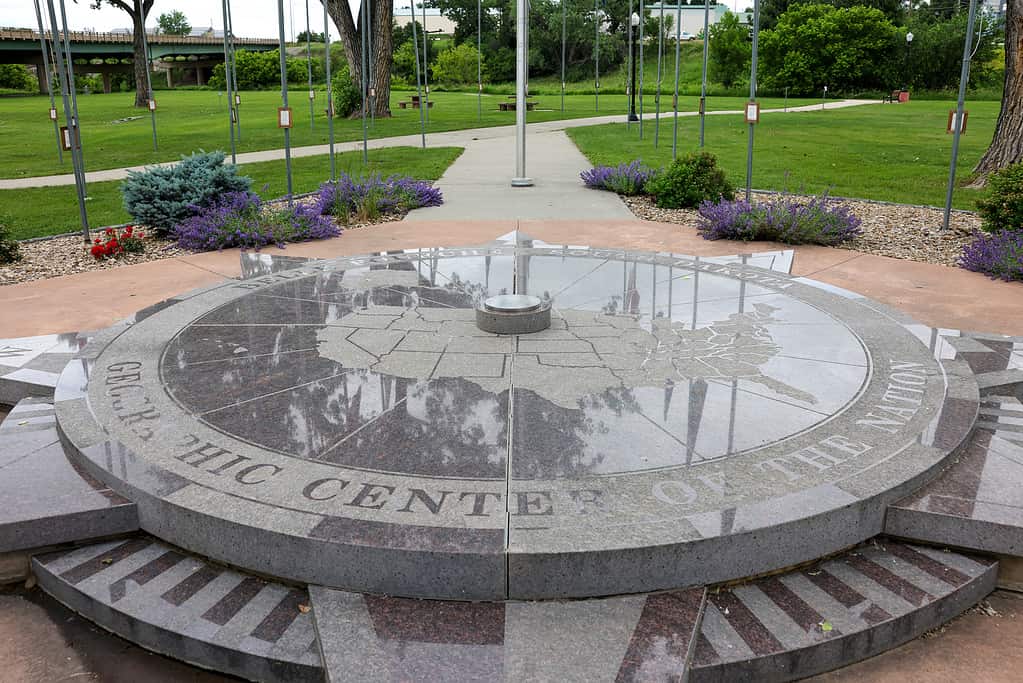
The Geographic Center of the Nation Monument can be found in Belle Fourche, South Dakota.
©Bo Shen/iStock via Getty Images
Origin of South Dakota
The United States acquired the land that would become the state of South Dakota in the Louisiana Purchase in 1803. President Thomas Jefferson purchased the land from France for fifteen million dollars. This purchase doubled the size of the United States. Other future states in the land purchase included Louisiana, Arkansas, Missouri, Iowa, Oklahoma, Kansas, Nebraska, North Dakota, and parts of Minnesota, New Mexico, Montana, Wyoming, and Colorado.
South Dakota’s journey to statehood would take 86 years from the United States’ initial land acquisition. During this time, parts or all of South Dakota’s land were included in various territories. The borders and names of the territories constantly changed as the westward expansion of the United States moved forward.
President James Buchanan signed the Organic Act in 1861, which created the Dakota Territory. Initially, along with South Dakota, the territory included the present states of North Dakota, Montana, Wyoming, and a small portion of Nebraska. By 1868, the territory only included the present states of North and South Dakota.
The Enabling Act was adopted on February 22, 1889. This act paved the way for the entrance of Montana and Washington into the U.S., along with dividing the Dakota Territory into two parts: North and South Dakota.
North and South Dakota were simultaneously admitted into the Union on November 2, 1889, as the 39th and 40th states. Technically, North Dakota was number 39, and South Dakota was number 40. President Benjamin Harrison didn’t want to show favoritism to one state over another, so he shuffled the bills for the two states and randomly drew North Dakota as the first bill he would sign.
Montana and Washington State also joined the Union in November 1889.
Parks and More
South Dakota is home to two national parks.
Badlands National Park covers some 244,000 acres. The park is a mix of rugged and foreboding geologic formations and the largest protected mixed-grass prairie in the nation. It is also home to one of the richest fossil beds on the planet. A large herd of around 1,200 bison roam the vast expanse of the Badlands.
Wind Cave National Park marks the first cave to receive national park status. The cave is famous for its honeycomb-like formations. Bison, elk, pronghorn, and prairie dogs all inhabit the 33,847 acres of this park.
Along with its two national parks, South Dakota is also home to Jewel Cave National Monument, Minuteman Missile National Historic Site, Missouri National Recreational River, and Mount Rushmore National Memorial.
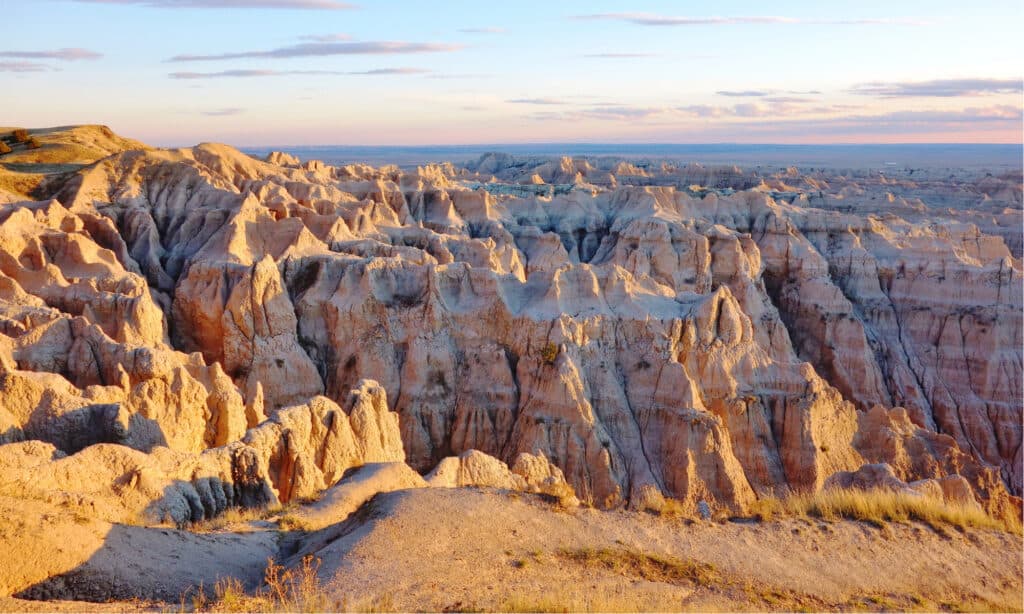
The geologic formations of Badlands National Park feels like another world.
©EQRoy/Shutterstock.com
State Animals
The coyote was named the official state animal of South Dakota in 1949.
Other official animal representatives of the state include the ring-necked pheasant (state bird), walleye (state fish), and honey bee (state insect). The Triceratops is also recognized as the state fossil.
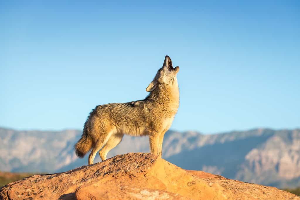
The coyote is South Dakota’s official state animal.
©Warren Metcalf/Shutterstock.com
The photo featured at the top of this post is © Alexrk / CC BY 3.0 – License / Original


How to Add Us to Google News


Thank you for reading! Have some feedback for us? Contact the AZ Animals editorial team.