
North Dakota lies in the upper Midwest of the United States. The Peace Garden State is the nineteenth-largest state in the nation. Here is an in-depth look at North Dakota’s size, comparisons to the total areas of other states, and much more.
Square Miles and Kilometers
North Dakota’s total area covers 70,704 square miles or 183,123 square kilometers. Depending on weather conditions, water covers between two and four percent of the state’s total area.
Acres
There are 640 acres in a square mile. To help further visualize this unit of land measurement, an acre is roughly equivalent to an American football field without the end zones. A professional soccer field is 1.8 acres in size.
North Dakota is 45,250,560 acres in size.
Length and Width of North Dakota
North Dakota is rectangular in shape. The state stretches 211 miles (340 kilometers) from north to south. This is virtually identical to the north-to-south measurement of neighboring South Dakota, which spans 210 miles (338 kilometers).
North Dakota extends 340 miles (547 kilometers) from east to west. That is just a bit shorter than the width of South Dakota, which spans 370 miles (595 kilometers) from east to west.
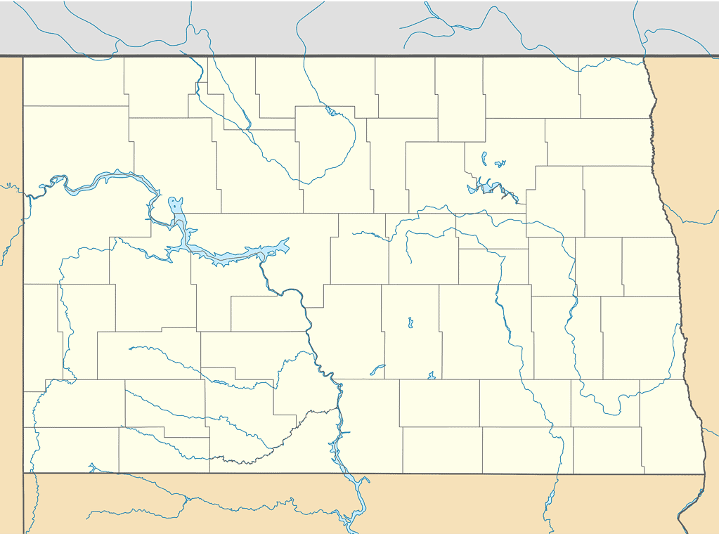
North Dakota is rectangular, measuring 129 miles further from east to west than its distance from north to south.
©Alexrk2 / CC BY 3.0 – License
State Borders
North Dakota borders three U.S. states and two Canadian provinces. The Saskatchewan and Manitoba provinces make up the northern border of North Dakota. The state borders Minnesota to the east, South Dakota to the south, and Montana to the west.
The U.S./Canada border is the longest international border in the world, stretching 5,525 miles (8,891 kilometers). North Dakota’s border with Canada spans 310 miles, accounting for about 5.6% of the total span of the border between the two nations.
Along with North Dakota, twelve other U.S. states share borders with Canada: Maine, New Hampshire, Vermont, New York, Pennsylvania, Ohio, Michigan, Minnesota, Montana, Idaho, Washington, and Alaska.
North Dakota has the eighth-longest border with Canada among these states. The state with the shortest Canadian border is Pennsylvania at 42 miles (68 kilometers). Alaska has the longest border with Canada by far, stretching 1,538 miles (2,475 kilometers)
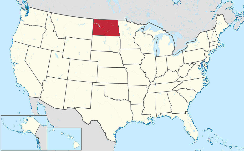
North Dakota borders three U.S. states and two Canadian provinces.
©TUBS / CC BY-SA 3.0 – License
Other States
Washington State is the most similar to North Dakota in terms of size. The Evergreen State is only 594 square miles (1,538 square kilometers), bigger than North Dakota.
Oklahoma is 805 square miles (2,083 square kilometers) smaller than North Dakota. Missouri is also a similar size, measuring just 997 square miles (2,582 square miles) smaller than North Dakota.
As for North Dakota’s size compared to its three neighboring states, Minnesota is 16,232 square miles (42,041 square kilometers) larger than North Dakota. South Dakota outsizes its northern neighbor by 6,343 square miles (16,428 square kilometers). Montana, the fourth-largest state in the U.S., is 76,336 square miles (197,709 square kilometers) larger than North Dakota. It is more than twice the size of the Peace Garden State.
Alaska is the biggest state in the U.S. by an incredible margin. At 665,384 square miles (1,723,337 square kilometers), you could fit almost nine and a half North Dakotas inside Alaska’s borders.
The largest of the Lower 48 states is Texas at 268,597 square miles (695,663 square kilometers). It is nearly 3.8 times the size of North Dakota.
California, the third largest state, outsizes North Dakota by 2.3 times.
Looking to the other extreme, Rhode Island is the smallest U.S. state at 1,214 square miles (3,144 square kilometers). Around 58 Rhode Islands could fit inside North Dakota!
The smallest nine U.S. states would come very close to fitting within North Dakota’s borders. Those states are Maryland, Hawaii, Massachusetts, Vermont, New Hampshire, New Jersey, Connecticut, Delaware, and Rhode Island.
Percentage of U.S. Area
North Dakota accounts for 1.86% of the total area of the United States. Washington State contains 1.88% of the U.S., while Oklahoma accounts for 1.84% of the nation’s area.
Rhode Island contains a meager 0.04% of the United States area, while an astounding 17.48% of the United States is found in Alaska.
Geographical Center of North America
The geographical center of North America lies in North Dakota. There is a stone cairn in Rugby, North Dakota, claiming to mark the center point of the continent.
However, Rugby’s claim as the continent’s geographical center has been challenged. Peter Rogerson, a professor of geography at the University at Buffalo in New York, took into account the distortions caused by cartographic projections and found that the actual geographic center of North America is 145 miles southwest of Rugby. It lies in the aptly named town of Center, North Dakota. The town’s fortuitous name was chosen long before it was discovered to be the geographical center of North America. However, whether you choose Rugby or Center, the geographical center of the continent does lie in North Dakota.
North Dakota is roughly equidistant from all the water borders of the United States. It sits about 1,500 miles from the Atlantic Ocean, the Gulf of Mexico, and the Pacific Ocean.
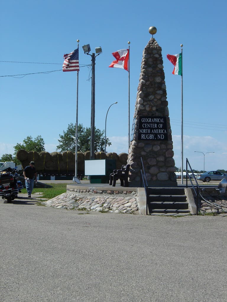
A stone monument, along with the flags of the United States, Canada, and Mexico, marks the geographical center of North America in Rugby, North Dakota.
©Scottserkin at English Wikipedia / Public domain – License
Population
With 779,261 residents (U.S. Census Bureau 2022 estimate), North Dakota is the fourth least populated state in the United States. The only states with fewer residents are Alaska (733,583 residents), Vermont (647,064 residents), and Wyoming (581,381 residents). South Dakota has 909,824 residents, a population that is 16.75% higher than North Dakota. These five states are the only U.S. states with populations under one million.
California boasts the largest population of any U.S. state, with 39,029,342 residents. The Golden State’s population is more than fifty times that of North Dakota. In fact, there are fifteen counties in California with populations that are larger than the entire state of North Dakota. The population of Los Angeles County alone is twelve and a half times larger than that of the Peace Garden State.
Wyoming is the least populous U.S. state. North Dakota has 197,880 more residents than Wyoming.
Population Growth
While North Dakota is one of the least populated states, it is also one of the fastest growing. The Peace Garden State has seen a 16% increase in population since 2010. Only Idaho, Utah, Texas, Florida, Nevada, and Colorado have grown by higher percentages since the 2010 census.
Population Density
Along with being the fourth least populated state, North Dakota also has the fourth-lowest population density of any state. Population density is the calculation of the number of people per square mile of land area. North Dakota has a population density of 11.3 people per square mile. South Dakota has a very similar population density of 11.7 people per square mile.
Only Montana (7.5), Wyoming (5.9), and Alaska (1.3) have lower population densities than North Dakota. The combination of Alaska’s huge area and its small population easily gives it the lowest population density in the nation.
New Jersey is the most densely populated state in the U.S., with 1,263 people per square mile.
North Dakota is a large, but sparsely populated state.
©TobyG/Shutterstock.com
Largest Cities
North Dakota has one major city (population over 100,000). Fargo has 131,444 residents (2022 estimate). The Fargo metro area is home to 258,663 residents, although the metropolitan area extends across state lines into Minnesota.
The capital city of Bismarck (74,445 residents) and Grand Forks (58,692 residents) are the only other cities in North Dakota with populations over 50,000. Minot is close, with 47,759 residents.
Fargo is the largest city in North Dakota.
©Jacob Boomsma/Shutterstock.com
Counties
There are 53 counties in North Dakota, which is a bit less than the average number of counties in a U.S. state (62).
McKenzie County, in the western part of the state, is the largest county in terms of total area. This county spans 2,742 square miles (7,102 square kilometers). McKenzie County is larger than the state of Delaware.
The smallest county by area is Eddy County in central North Dakota, covering 632 square miles (1,637 square kilometers).
Cass County, in the eastern part of the state, is the most populous county by far, with 192,734 residents (2022 estimate). This county is where Fargo, the state’s largest city, is located. The next most populated county is Burleigh County, with 99,280 residents (2022 estimate).
Slope County in southwest North Dakota is the least populous county in the state, with only 672 residents (2022 estimate). It is the only county in the state with a population under 1,000. Slope County is the twentieth least populated county in the United States as a whole.
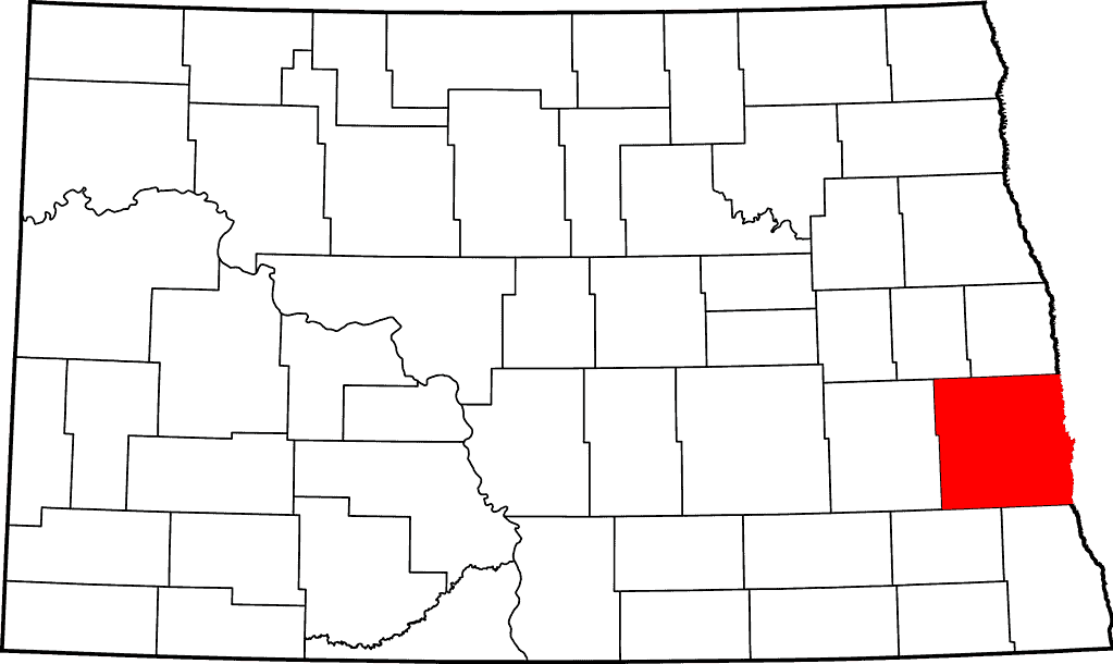
Cass County is the most populous county in North Dakota.
©David Benbennick / Public domain – License
Federal Lands
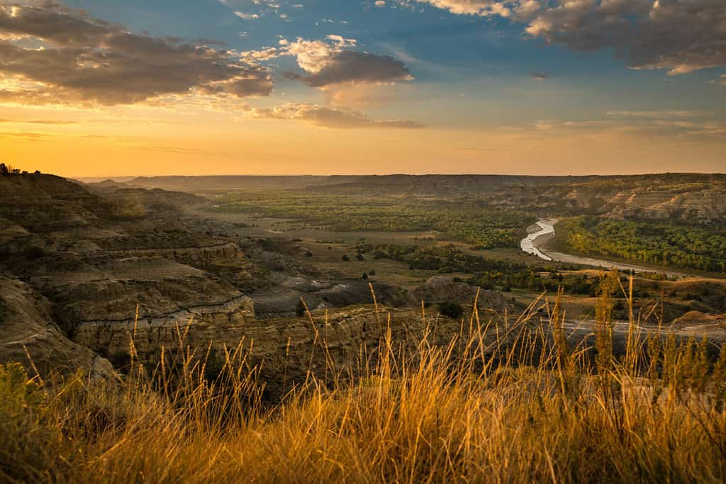
Theodore Roosevelt National Park is located in North Dakota. It is the only national park named after an individual person. Roosevelt hunted bison in the Dakota territory as a young man. He became an avid conservationist. During his presidency from 1901-1909, Roosevelt established approximately 230 million acres of public lands, including 150 national forests, 55 federal bird reservation and game preserves, five national parks, and 18 national monuments. The national park that bears his name was established in 1978 when President Jimmy Carter signed it into law.
The 70,448-acre park is located in the badlands of western North Dakota. Bison, elk, mule deer, and pronghorns all proliferate in the park. Visitors can enjoy many hiking trails within this national park. The hikes vary from just one-tenth of a mile to 18 miles in length. The park also offers opportunities for backcountry camping, bicycling, fishing, and horseback riding. In the winter, it is a marvelous location for snowshoeing and cross-country skiing.
Along with this national park, North Dakota is also home to other federal lands, including the Fort Union Trading Post and Knife River Indian Villages National Historic Sites.
The state also houses 63 wildlife refuges, more than any other state.
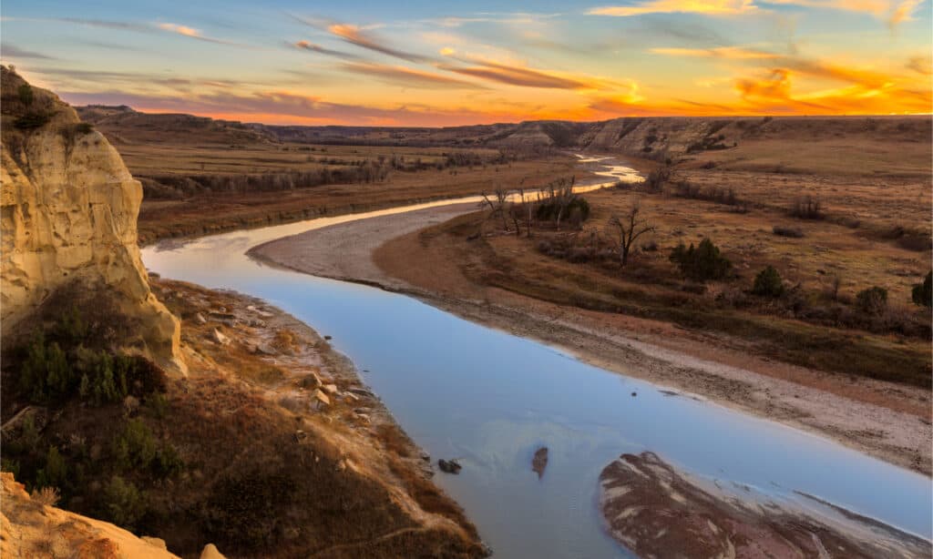
The Little Missouri River winds through Theodore Roosevelt National Park.
©ZakZeinert/Shutterstock.com
Farmland
Farms and ranches cover about 39.3 million acres of North Dakota. That is nearly 87% of the state’s total area. The soybean is the top crop in the state. There are around 8,400 soybean farms, producing around $2.1 billion worth of soybeans each year.
North Dakota is also the leading producer of flaxseed, canola, spring wheat, durum wheat, field peas, dry edible beans, oats, and sunflowers in the United States. In addition to these crops, the state is the top honey producer in the U.S. North Dakota is one of the most agriculturally diverse states in the nation.
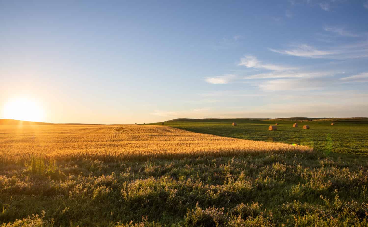
North Dakota fields, such as this one, produce more soybeans than anywhere else in the U.S.
©Cavan-Images/Shutterstock.com
State Animals
North Dakota lawmakers have designated four official animals that represent their state. The first state animal was the western meadowlark, which was named the official state bird in 1947.
The other official state animals of North Dakota include the northern pike (named the state fish in 1969), Nokota horse (named the state’s honorary equine in 1993), and convergent lady beetle (named the state insect in 2011).

The western meadowlark is North Dakota’s official state bird since 1947.
©Kerry Hargrove/Shutterstock.com
The photo featured at the top of this post is © Alexrk2 / CC BY 3.0 – License / Original


How to Add Us to Google News


Thank you for reading! Have some feedback for us? Contact the AZ Animals editorial team.