Bonefish
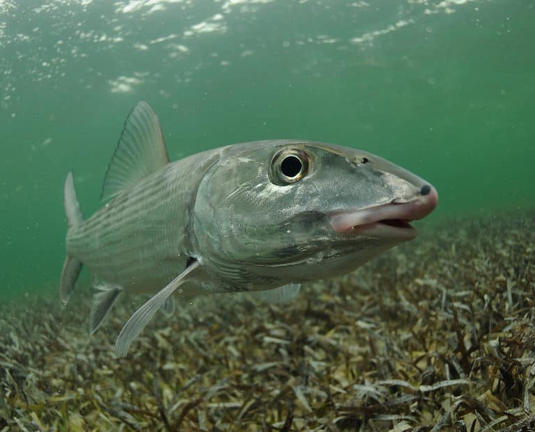
Grey ghost of the tidal flats

Spread across dozens of islands and cays, the British Virgin Islands (BVI) are defined by a marine-first natural heritage: clear, warm waters over coral reefs, seagrass meadows, and mangrove-fringed bays that function as nurseries for fish, lobsters, conch, rays, and juvenile reef species. On land, coastal dry forest and rocky hills (notably on Tortola and Virgin Gorda) support a distinct assemblage of Caribbean birds, lizards, and invertebrates, while offshore islets provide relatively predator-free nesting habitat for seabirds. The result is a compact archipelago where a short boat ride can shift your wildlife encounter from reef fish and turtles to cliff-nesting tropicbirds.
Key ecosystems include fringing and barrier reefs (with famed sites like Anegada's Horseshoe Reef), mangroves and lagoon systems that stabilize shorelines and shelter young marine life, and seagrass beds that are critical feeding grounds for sea turtles. The BVI's conservation significance is global in the Caribbean context: as a UK Overseas Territory, it contributes to regional efforts to protect threatened corals, rebuild depleted fisheries, and safeguard migratory species that traverse the Wider Caribbean. The wildlife experience is uniquely intimate and water-based-think snorkeling with schooling reef fish minutes from shore, spotting nesting seabirds from a kayak or sailboat, and visiting Anegada to learn about the recovery of one of the Caribbean's rarest iguanas.
The British Virgin Islands' wildlife is shaped by a small, highly fragmented landmass spread across many steep, hilly islands and low-lying cays. Short watersheds and thin soils limit freshwater habitats, so most terrestrial species concentrate in coastal dry forests, scrub, and seasonal wetlands (salt ponds). In contrast, the extensive shallow marine shelf around the islands-coral reefs, seagrass beds, and mangroves-creates highly productive habitats that dominate biodiversity patterns, supporting reef fish, sea turtles, sharks/rays, and major seabird rookeries on offshore islets. Exposure to trade winds, hurricanes, and strong coastal gradients (rocky headlands to sheltered bays) further partitions habitats and influences where species breed, feed, and shelter.
The British Virgin Islands (BVI) protected-area system is centered on a network of National Parks and Marine Parks managed by the BVI National Parks Trust, complemented by site-based protections led by the Conservation & Fisheries Department (e.g., fisheries/marine regulations, turtle and coral protections) and a Ramsar-designated wetland on Anegada. Protected areas focus on safeguarding coral reefs, seagrass and mangroves (critical for turtles, fish nurseries, and invertebrates), offshore seabird cays, and remaining tracts of coastal dry forest and upland woodland on the larger islands.
Approximate land under formal protection: ~10-15% of total land area (order-of-magnitude estimate; protection is also significant in nearshore marine areas through marine parks and fisheries measures, which are not reflected in the land-only percentage).
Protects the highest elevation forest on Tortola, a refuge for native plants, migratory songbirds, and island reptiles. Its cooler, moister upland habitat is a biodiversity stronghold compared with surrounding dry coastal zones.
An important block of upland woodland and dry forest that supports native birds and reptiles and helps protect watersheds that drain to surrounding reefs. The ridge trails also pass through relatively intact native vegetation.
Internationally important wetland complex of salt ponds, mangroves, and coastal habitats supporting waterbirds and the critically endangered Anegada rock iguana. The surrounding flats and shores are also key foraging/nesting areas for seabirds and marine turtles.
A premier marine and seabird site with clear-water reefs, seagrass beds, and small cays used by nesting/roosting seabirds. The surrounding habitats are important for juvenile fish, lobsters, and foraging turtles.
One of the BVI's best-known snorkel/dive parks, protecting shallow coral reefs and reef fish communities close to Tortola. The islets also provide resting habitat for seabirds.
Protects reef habitats around one of the Caribbean's most famous wreck sites, where corals and sponges attract diverse reef fish and turtles. The park helps conserve both underwater cultural heritage and surrounding marine biodiversity.
The British Virgin Islands (BVI) are a small-island Caribbean biodiversity hotspot where the wildlife "signature" is strongly coastal and marine: coral reefs, seagrass beds, mangroves, salt ponds, and rocky shorelines support sea turtles, reef fish, rays, sharks, seabirds, and shorebirds. Terrestrial wildlife is comparatively limited (few native land mammals, mostly bats), but the islands hold notable reptile diversity-including globally important endemics-alongside dry coastal scrub/forest birds and large seasonal pulses of migratory birds moving through the northeastern Caribbean.
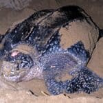
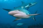
Wildlife tourism in the British Virgin Islands (BVI) is primarily a marine- and seabird-focused experience built around coral reefs, seagrass beds, mangroves, and rocky offshore cays. It's economically important because it overlaps strongly with the territory's core visitor economy-sailing/charter yachting, diving, snorkeling, and beach travel-so wildlife viewing is often part of a trip even when it isn't the main purpose. Historically, nature-based travel grew alongside the BVI's rise as a premier Caribbean sailing destination, with marine parks and protected areas helping to sustain reef-based recreation. Accessibility is straightforward: most visitors arrive via Beef Island (EIS) near Tortola or by ferry from the U.S. Virgin Islands, then reach wildlife sites by boat (day cruises, private charters, dive boats), with some easy coastal trails for birding and dry-forest habitat on the larger islands.
Dec-Apr (dry season): clearest water and calmer conditions for snorkeling/diving; best visibility for reef fish, turtles over seagrass, and general seabird watching from boats. May-Jun (shoulder): warm water, generally good seas, fewer crowds; excellent for snorkeling and mangrove paddles; seabirds active around offshore cays. Jul-Oct (hotter + hurricane season): marine life remains abundant but weather can disrupt boating; choose flexible plans and prioritize sheltered bays/mangroves; late summer often has very warm water for long snorkel sessions. Nov (transition): improving weather and water clarity returning-great value month for reef time and birding.
Anegada looks "wrong" for the Virgin Islands: it's a flat, coral-limestone island (not a steep volcanic peak), and that geology is exactly why it can support both salt-pond wetlands for waterbirds and the islands' flagship endemic iguana.
To hedge against hurricanes wiping out a single-island species, conservationists have created additional "insurance" populations of Anegada rock iguanas on other predator-managed islands-so some of the best places to see this BVI native are now outside its original range.
Some of the BVI's richest wildlife habitat is only a few feet deep: seagrass beds and mangrove edges act as nurseries where juvenile fish and invertebrates concentrate-meaning snorkel-depth water can be biologically busier than the open blue just offshore.
The same reefs that protect marine biodiversity also created a long history of shipwrecks; today, famous wreck sites (such as the RMS Rhone marine park) function as artificial reefs covered in sponges and corals and packed with reef fish-turning a maritime disaster into a wildlife hotspot.
The Anegada rock iguana (Cyclura pinguis) is the British Virgin Islands' signature endemic land vertebrate-its only native wild population is on Anegada, and it's listed as Critically Endangered (IUCN).
Horseshoe Reef off Anegada forms an approximately 18-mile (≈29 km) arc, making it the largest coral reef system in the British Virgin Islands and one of the largest barrier-reef structures in the Caribbean.
Anegada's Salt Ponds are the British Virgin Islands' largest wetland complex and are recognized internationally as a Ramsar Wetland of International Importance-an outsized "bird-and-nursery habitat" for such a small territory.
Mount Sage (on Tortola) tops out at about 521 m (1,709 ft), the highest point in the British Virgin Islands; the surrounding Sage Mountain National Park protects some of the territory's most intact high-elevation moist forest habitat for native birds, reptiles, and invertebrates.
6 species documented in our encyclopedia
Thank you for reading! Have some feedback for us?
We appreciate your help in improving our content.
Our editorial team will review your suggestions and make any necessary updates.
There was an error submitting your feedback. Please try again.