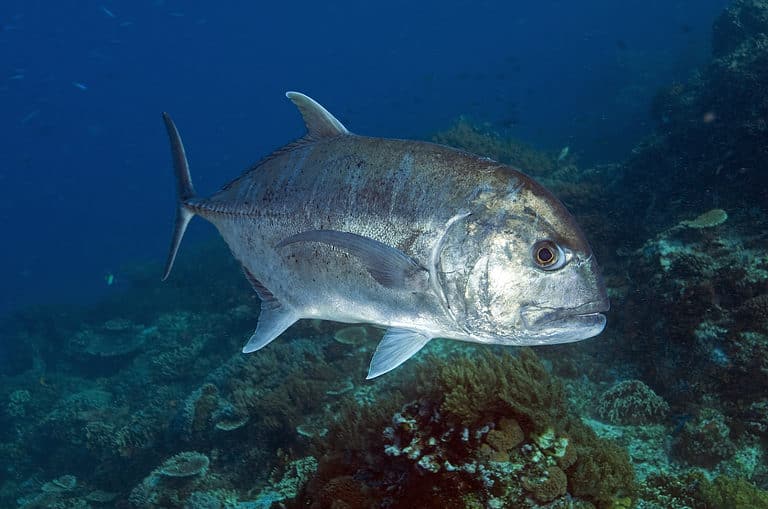
Grey Reef Shark
Guardian of the reef drop-off
Guam sits at the western edge of Micronesia, with tropical sea life and limestone forests. The island was long known for its unique native birds and bats. Today it is also known for conservation: habitat protection and species recovery help people see and learn about Guam’s nature. Main habitats include coral reefs and seagrass beds that support reef fish, sea turtles, and many invertebrates; mangrove-lined bays and estuaries that act as nurseries; and coastal cliffs and limestone (karst) forests that hold special plants and remaining native animals. Wetlands and coastal flats give resting and feeding sites to migratory shorebirds on the Pacific flyways, making seasonal birding important. Guam’s reefs and forests are easy to reach, and visitors can often see active restoration and biosecurity work. Because invasive species have changed much of the land life, wildlife encounters often show both loss and recovery.
Guam's north and south have different land types that make distinct wildlife homes: a northern uplifted limestone plateau with karst forests, caves, and cliffs, and southern volcanic uplands with more rain, ravines, and streams. Surrounding coral reefs, lagoons, and seagrass beds support rich marine life. Guam is a stopover for migratory and pelagic birds.
Sea level to 406 m (Mount Lamlam)
Entirely coastal island in the western Pacific (Philippine Sea); ~125.5 km of shoreline with extensive fringing reefs, lagoons, sandy beaches, and embayments (e.g., Apra Harbor).
Guam's protected areas include federal sites (a National Park Service unit and U.S. military lands), a small National Wildlife Refuge, and territorial marine preserves and coastal parks managed by Guam. Protection focuses on coral reefs, seagrass beds, small limestone-forest patches, seabird nesting areas, and cultural coasts. Because of the brown tree snake, work also includes habitat protection, biosecurity, and restoration.
~15-25% of Guam's land area is under some form of formal protection or conservation-oriented management (federal/territorial parks, refuge, and designated conservation areas). Marine protected areas cover additional nearshore reef and lagoon habitats in multiple reserves; the protected share of coastal waters is significant but varies by definition and boundary source.
A coastal, multi-unit NPS park protecting shoreline habitats, coastal strand, and adjacent waters that support seabirds, migratory shorebirds, and sea turtles, alongside historically significant WWII sites. Several units provide accessible wildlife viewing on reefs and beaches.
A territorial park system protecting beaches, coastal vegetation, and adjacent nearshore waters-important for seabirds, migrating shorebirds, and turtle use of coastal habitats. Some units overlap with or sit near marine preserves, improving habitat continuity along the coast.
A small offshore island/lagoon setting valued for seabird viewing and as a safer (predator-reduced) site used for conservation and species recovery efforts. Surrounding lagoon and reef habitat support diverse reef fish and invertebrates.
One of Guam's best-known nearshore snorkel/diving areas, protecting patch reefs, seagrass, and coral communities that support high fish biomass and nursery habitat. Excellent for wildlife viewing of reef fish and occasional turtles.
A unit of the U.S. National Wildlife Refuge System on northern Guam that protects limestone forest, coastal cliffs, and beach habitat. It provides important habitat for Guam's remaining native wildlife and for migratory birds.
A second unit of the Guam National Wildlife Refuge System located within Andersen Air Force Base that protects large areas of northern Guam habitat managed for wildlife conservation in coordination with the Department of Defense.
Guam has very rich tropical marine life — coral reefs, seagrass, and pelagic visitors — but its land animals are much changed. Native limestone forests once had many endemic birds, but the invasive brown tree snake caused big losses and local extinctions, leaving quieter forests. Conservation focuses on marine protection and reef health and on strong invasive species control, fenced refuges, and reintroductions for native birds and bats. Guam is on major western Pacific flyways, so seasonal migrants and shorebirds add to birding.
Guam has varied wildlife in coral reefs, seagrass beds, limestone forests, wetlands, and coastal cliffs. Best for visitors are snorkeling and diving with reef fish, turtles, rays and sometimes dolphins, plus coastal and wetland birding when they migrate. On land, native wildlife is limited by invasive species, but Micronesian forest birds can still be found in protected areas.
Best overall conditions for snorkeling and diving: clearer water and calmer seas on many leeward shores (conditions vary by coastline). Great time for shore-based turtle and reef-fish viewing, and comfortable hiking in limestone forest. Winter is also a strong window for migratory shorebirds and seabirds using Guam as a stopover.
Warm, generally good water visibility with fewer crowds. Productive time for reef life activity and comfortable conditions for combining boat trips (dolphin/reef cruises) with birding at wetlands. Afternoon heat rises-plan land wildlife walks early/late.
Lush landscapes and active marine life, but expect heavier rain, rougher seas at times, and occasional storm closures. Visibility can drop after runoff; choose sheltered coves or days with calmer conditions. This period can still be rewarding for turtles, reef fish, and pelagic bird sightings from cliff lookouts between weather systems.
Sea turtle encounters are possible year-round while snorkeling/diving (always observe from a respectful distance). Birding is year-round, with added diversity during migration; time your outings around cooler early mornings and tides for shorebirds.
Guam is a small volcanic-and-limestone island ringed by coral reefs and deep ocean. On land, limestone forests, ravine (riparian) forests, and fire-influenced savanna and grasslands form a patchwork shaped by soils, karst, typhoons, and human use. Coastal mangroves and estuaries are small but vital. Offshore are fringing reefs, seagrass areas, and deep pelagic waters.
Moist evergreen forests persist mainly in sheltered ravines and wetter uplands, with dense canopy and high humidity; much is secondary or fragmented due to historical land use and invasive species.
Patchy and localized-most common in wetter ravines/valleys and upland pockets rather than continuous island-wide cover.
Limestone (karst) forests and coastal strand-associated woodlands on the northern plateau and some leeward sites, with drought-tolerant native trees and thin soils over limestone.
Historically widespread on limestone areas; today fragmented remnants, especially across northern Guam and some coastal/leeward zones.
Fire- and disturbance-maintained savanna/grassland and scrubby vegetation (often swordgrass/fern-dominated) on nutrient-poor or lateritic soils, especially in southern Guam; can represent degraded forest landscapes.
Notable across parts of southern Guam and other disturbed landscapes; extent varies with fire regime and land management.
Short streams and small watersheds with riparian corridors; lentic freshwater is largely represented by reservoirs (e.g., Fena Valley Reservoir) and small impoundments rather than natural lakes.
Limited area but distributed across drainage networks; most surface water features are small and seasonal/flashy.
Mangroves, estuaries, freshwater marshy areas, and lowland wet depressions that provide nursery habitat and bird stopover resources; wetlands are scarce but highly valuable.
Very limited, mainly in a few coastal embayments/estuaries and low-lying floodplains.
Fringing coral reefs, reef flats, lagoons/reef-associated soft bottoms, and steep fore-reef slopes that quickly transition to deep pelagic waters around the island.
Extensive around the entire coastline and into surrounding waters; reef development varies with exposure and coastal geomorphology.
Mixed native forest remnants and secondary forests, including limestone forest on the north plateau and mixed forest in the south; many stands are affected by invasive plants and altered disturbance regimes.
Moist evergreen/ravine forest pockets with dense understory and higher moisture availability, often along protected drainages.
Open-canopy limestone woodland and coastal strand woodland elements on thin karst soils and wind-exposed sites.
Open grass-dominated areas, including managed/abandoned fields and fire-influenced grasslands, especially in southern Guam.
Swordgrass/fern savanna and scrubby savanna mosaics maintained by frequent fires and poor soils; important for certain bird and invertebrate assemblages but often represents anthropogenic conversion.
Coastal and disturbed shrub communities, including early-successional thickets and scrub on dry/exposed sites.
Southern volcanic uplands and ridgelines (e.g., Mount Lamlam area) with steep slopes, thin soils, and strong typhoon exposure shaping vegetation structure.
Limestone and volcanic sea cliffs and interior karst bluffs that provide nesting/roosting sites and specialized plant niches.
Limestone (karst) caves and rock shelters in the north; important microhabitats for bats/invertebrates and groundwater interactions where present.
Short, steep streams and riparian corridors (e.g., Ugum River system) that respond rapidly to heavy rain and typhoons.
Reservoir habitat (notably Fena Valley Reservoir) supporting freshwater communities and serving as a key water source.
Small freshwater wet areas and riparian wetlands that expand/contract with rainfall; important for water quality and migratory birds.
Localized freshwater marshy patches and wet grassy depressions, often near low-gradient reaches or impounded areas.
Small but ecologically significant mangrove stands in sheltered bays/estuaries (e.g., Apra Harbor-associated and other protected inlets), functioning as nurseries and shoreline buffers.
Stream mouths and sheltered embayments with brackish mixing, supporting juvenile fishes and invertebrates and providing bird foraging habitat.
Coastal strand, dune/berm vegetation, and nearshore habitats influenced by salt spray, storm surge, and typhoons.
Sandy beaches and pocket beaches used by shorebirds and as human recreation areas; dynamics strongly influenced by storms and coastal development.
Wave-exposed limestone benches and volcanic rock shorelines with intertidal communities and surge channels.
Fringing reefs and patchy reef development around Guam; includes reef flats, spur-and-groove zones, and fore-reef slopes supporting high fish and coral diversity (variable condition by site).
Nearshore sand/rubble bottoms and deeper benthic substrates surrounding the island, including reef-associated sediments and slope habitats.
Pelagic waters immediately offshore with a rapid transition to deep water; important for migratory species and regional connectivity.
Steep island slopes and adjacent deep pelagic/benthic environments in the Mariana region beyond the reef edge, influenced by oceanic currents and upwelling variability.
Dense built environments (notably around Hagatna (Agana) and Tumon/Tamuning) with highly modified coastlines and altered runoff regimes.
Residential and mixed-use areas expanding into former agricultural and secondary forest lands, fragmenting terrestrial habitats.
Mixed small-scale agriculture and cleared lands, contributing to a patchwork of open habitats and secondary succession.
Localized managed tree crops and planted stands (historically and presently), contributing to simplified habitat structure compared to native forest.
Guam's "extinct-in-the-wild" birds aren't all gone: the Guam rail (Hypotaenidia owstoni) disappeared from the wild on Guam by the late 1980s, but survived through captive breeding and has been reintroduced on nearby Cocos Island (off Guam) and other sites.
With many insect-eating birds gone, Guam's forests show dramatic ripple effects: research comparing Guam to nearby islands has found forest spider abundance up to ~40× higher on Guam-an ecological cascade from losing birds.
The brown tree snake doesn't just hunt wildlife-it also causes blackouts: snakes climbing power poles and bridging electrical equipment have been a well-documented source of power interruptions on Guam.
Guam's Mariana fruit bat (Pteropus mariannus) is one of the island's few native mammals and a key seed disperser; when bat numbers drop, native limestone-forest tree regeneration can suffer.
Guam's beaches and nearshore waters are part of a Pacific "rest stop" for threatened reptiles: green turtles (Chelonia mydas) and hawksbill turtles (Eretmochelys imbricata) use Guam for nesting and foraging, linking the island to wider Micronesian migratory pathways.
Guam is home (though now rare) to the coconut crab (Birgus latro), the world's largest land-dwelling arthropod-adults can reach ~4 kg and span close to 1 m from leg to leg.
In some Guam habitats, brown tree snake (Boiga irregularis) densities have been estimated at roughly 10,000-13,000 snakes per square mile (~4,000-5,000 per km²), among the highest snake densities ever recorded.
Guam is the nearest big island to the Mariana Trench’s Challenger Deep, the ocean’s deepest point (~10.9 km). Very deep animals, like the hadal snailfish (Pseudoliparis swirei), live below about 8 km.
By the late 1980s, Guam lost about 10 of its 12 native forest birds across most of the island. The collapse, blamed on the introduced brown tree snake, is among the most severe invasive predator losses.
2 species documented in our encyclopedia
Thank you for reading! Have some feedback for us?
We appreciate your help in improving our content.
Our editorial team will review your suggestions and make any necessary updates.
There was an error submitting your feedback. Please try again.