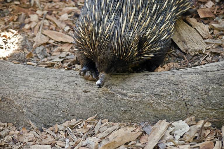
Echidna
Spines, eggs, and ant-eating mastery
Spines, eggs, and ant-eating mastery
One species, many ecotypes.

Bony rays, endless ways.
Build wetlands, shape worlds.
Built to dig. Born to endure.

Built to soar, born to strike
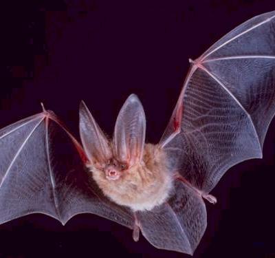
Night pilots of the mammal world

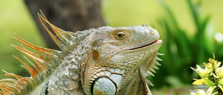
From geckos to dragons-lizard power
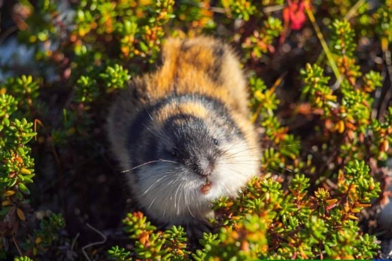
Small rodents, huge tundra impact

Webbed feet, sky roads, wetland lives
Wetlands are ecosystems in which water inundates or saturates the soil at or near the surface for long enough to create hydric (oxygen-poor) soils and to support plant and microbial communities adapted to saturated conditions. They occur along the continuum between terrestrial and fully aquatic environments, driven by distinctive hydrology, soils, and wetland-adapted vegetation.
Wetlands form where water stays, seasonally or year-round, changing soil, plants, and animals. Low oxygen in wet soil slows decay and makes hydric soils, favoring plants like sedges, rushes, reeds, mangroves, and water-tolerant trees, creating marshes, swamps, bogs, and fens. Wetlands slow floods, hold and release water, filter sediments and excess nutrients, and improve downstream water. They are wildlife hubs and store lots of carbon in peat, so they are fragile to drainage, fire, and warming.
Wetlands are places where soils stay wet from frequent rain, high water tables, river overflow, coastal flooding, or underground water. They occur from tropical to subarctic regions and often have high humidity, fog, and small temperature swings near the ground. In cold areas, yearly freeze-thaw controls water and plant life; in the tropics, warm, wet seasons keep growth going.
Highly variable by latitude: ~5-15°C (tropical coastal/riverine wetlands) to ~25-45°C (temperate/continental wetlands); subarctic peatlands often ~30-50°C annual swing between winter lows and summer highs.
Broad range depending on wetland type and setting: ~500-1,500 mm/yr common for many temperate marshes/swamps; ~1,500-3,500+ mm/yr for humid tropical wetlands; peat-forming bogs often ~700-2,000 mm/yr with precipitation exceeding evapotranspiration for much of the year. Some wetlands persist with lower rainfall (~250-600 mm/yr) if sustained by groundwater, snowmelt, rivers, or tides.
Seasonal change in wetlands is mainly hydroperiod (how deep, long, and when water floods). In temperate/subarctic wetlands, winter ice slows decay and spring snowmelt floods trigger spawning and bird migration; summer droughts lower water, expose mudflats, and raise peatland fire risk. In tropical wetlands, wet seasons widen flooding and fish movement; dry seasons shrink pools and favor drier-edge plants.
Growing season varies by latitude and flooding. Tropical wetlands 10–12 months; temperate 5–8 months (150–240 days); subarctic peatlands 2–4 months (60–120 days). In cold regions it goes from post‑thaw to late summer/fall; in monsoonal tropics peak growth is early‑mid wet season when water is plentiful but not deeply flooding vegetation.
Rising temperatures; ice-out where applicable; high water from snowmelt and seasonal rains; widespread inundation of floodplains and marsh platforms; increased turbidity and nutrient inputs; rapidly warming shallow water in sunlit areas.
Major hydrologic reset: floodwater reconnects channels, backwaters, and floodplains; transports sediments/organic matter and redistributes nutrients; triggers primary production as light and temperature increase; replenishes groundwater; expands spawning and nursery habitat; can also flush accumulated pollutants downstream.
Warm water and air; high plant growth (emergent reeds/sedges, floating-leaved plants, swamp canopy); water levels may remain high in rain-fed wetlands or gradually decline in seasonal wetlands; potential stratification in deeper ponds; increased decomposition; occasional droughts and heat waves can reduce surface water.
Maximum primary productivity; strong nutrient uptake and filtration by vegetation and microbial communities; high carbon fixation (especially in peat-forming systems where anoxia slows decay); oxygen can fluctuate strongly (daytime supersaturation from photosynthesis, nighttime hypoxia); risk of algal blooms increases with nutrient loading and warmth.
Lower sun angle; cooling water; increased storms in many regions; water levels often drop in seasonal wetlands as evapotranspiration declines and inflows change; leaf fall in forested swamps adds detritus; first frosts begin; clearer water may occur as algal production declines.
Shift from production to detrital food webs: large inputs of leaf litter and senescing macrophytes fuel microbial decomposition; nutrient release can increase late-season; reduced plant uptake; fall turnover in deeper waters can redistribute oxygen and nutrients; exposure of mudflats creates feeding habitat for migrants.
Cold temperatures; short days; ice cover and snow in colder climates; reduced inflow; low light; vegetation dormant; water may persist under ice in deeper areas while shallow seasonal wetlands may freeze solid or dry if autumn drawdown was strong.
Greatly reduced primary production; slowed decomposition; anoxic conditions can develop under ice (winterkill risk) due to continued respiration and limited gas exchange; peatlands can store carbon as decay slows; physical disturbance from ice can shear vegetation and reshape channels.
Day Length: Day length varies strongly with latitude: in temperate/boreal wetlands, long summer days drive peak photosynthesis, rapid plant growth, and high food availability; shortening days in autumn cue migration, diapause, and plant senescence; minimal winter daylight limits primary production and can exacerbate low-oxygen conditions under ice. In tropical wetlands, photoperiod changes are modest and seasonality is often driven more by rainfall than day length, though day length still helps time breeding and migration for some species.
Wetlands are found on every continent, even in polar areas, where water stays near the soil long enough to make wet soils and water-loving plants. They are common in flat floodplains, deltas, coasts (estuaries, mangroves, tidal marshes), glacial hollows, and northern peatlands. Big areas are in tropical river basins, the boreal/Arctic peat belt, and large temperate floodplains and lake edges.
Globally threatened and in widespread decline; many wetland types (especially peatlands, coastal marshes, and floodplain wetlands) have been heavily reduced, fragmented, and degraded, with strong biodiversity and carbon-storage consequences.
A wetland doesn't have to be "wet" all the time: Some wetlands are seasonal-dry for part of the year-yet still have hydric soils and water-adapted plants.
Some wetlands are fueled by rain, not rivers: Bogs can be "ombrotrophic," meaning they get most of their water and nutrients from rainfall, making them acidic and nutrient-poor.
Wetlands can clean water like a living filter: Microbes, plants, and sediments can trap particles, transform nitrogen compounds, and bind some pollutants-one reason wetlands can improve downstream water quality.
Wetlands can be both carbon sinks and methane sources: They often lock away carbon in peat, but low-oxygen soils also produce methane-so their climate role depends on water level, temperature, and disturbance.
Peat is basically time stored in mud: In waterlogged, low-oxygen conditions, dead plant material decomposes extremely slowly, building layers that can preserve pollen, seeds, and even human artifacts.
Trees can "breathe" in flooded soil: Mangroves and swamp trees often use specialized roots (like pneumatophores) that pull oxygen from the air when the ground is waterlogged.
Peat growth is slow-motion geology: A common rule of thumb is ~1 millimeter of peat accumulation per year-so 1 meter of peat can represent around 1,000 years of ecosystem history.
Pantanal scale check: At roughly ~150,000+ km² (varying by flood extent and definitions), the Pantanal is comparable in area to England and can look like an inland sea during peak floods.
Sundarbans scale check: Around ~10,000 km², the Sundarbans is about the size of Jamaica-except it's a labyrinth of tidal channels and salt-tolerant forests.
Okavango Delta scale check: The Okavango's seasonal wetland footprint can reach ~15,000 km²-similar to the size of Connecticut-despite being in a semi-arid region.
Small footprint, big influence: Although wetlands occupy only a single-digit percent of Earth's land area, they can strongly regulate floods and water quality across entire river basins.
Mangrove nurseries as "apartment complexes": A mangrove shoreline can function like stacked habitat-roots, trunks, and canopy each providing different living space for fish, crabs, insects, birds, and reptiles.
Largest tropical wetland: The Pantanal (Brazil/Bolivia/Paraguay) is widely cited as the world's largest tropical wetland, swelling dramatically in the rainy season.
Largest contiguous mangrove forest: The Sundarbans (India/Bangladesh) is the biggest continuous mangrove ecosystem on Earth.
Biggest peatland system: The Western Siberian Lowland contains the largest peatland complex on the planet, storing vast amounts of carbon in deep peat.
Largest tropical peatland complex (known): The Congo Basin's Central Basin peatlands form the largest mapped tropical peatland complex, a major carbon store discovered and measured only recently (2010s).
Among the most productive ecosystems: Many wetlands rival (and can exceed) rainforests and coral reefs in primary productivity-especially marshes and mangroves-because shallow water and nutrients power rapid growth.
Carbon "heavyweights": Peatlands cover only a small fraction of Earth's land (~3%), yet store an outsized share of global soil carbon-often summarized as roughly twice the carbon contained in the world's forests' biomass.
The rainforest's master gardener
Built for blizzards, born for tundra
Built to dig. Born to endure.
Night pilots of the mammal world
Build wetlands, shape worlds.

Small hunter, big household legend
One cat. Two continents.

Webbed feet, world travelers.
Built to soar, born to strike
Spines, eggs, and ant-eating mastery
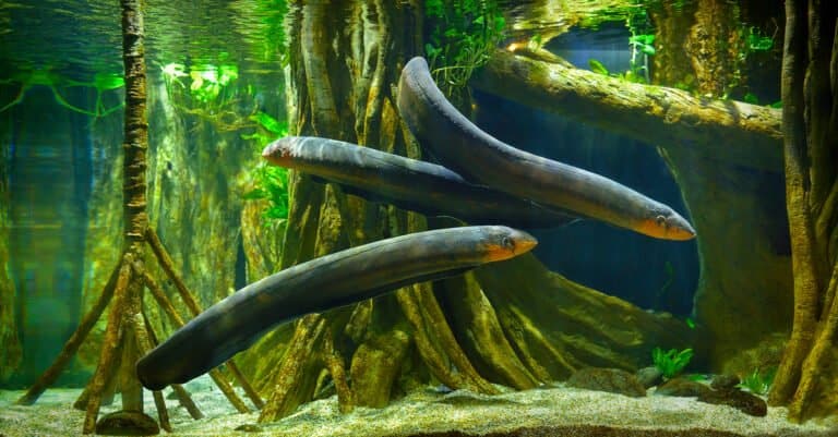
Lightning hunter of the Amazon
Bony rays, endless ways.
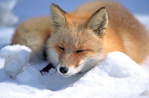
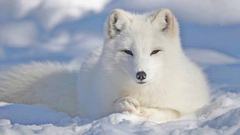
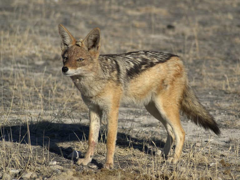
From dunes to tundra-fox smart.
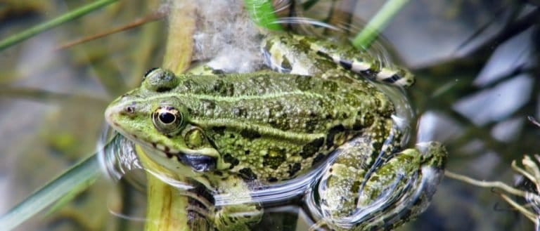
Tailless jumpers, masters of change
Webbed feet, sky roads, wetland lives

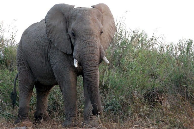
Gentle giants of the African forests

Pouches, burrows, and big impacts
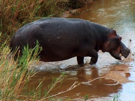
Big river grazer, bigger attitude
Sun-powered lizards of the Americas
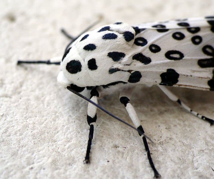
Six legs, endless lives.
Small canids, big survival skills
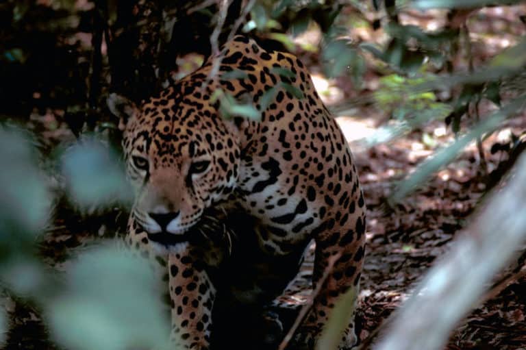
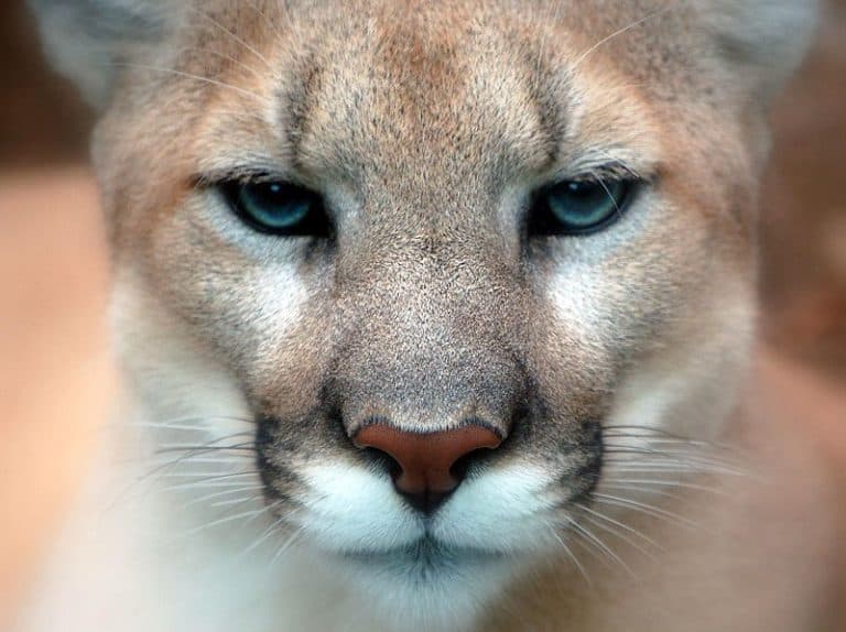
Power of the Americas' apex cat

Sting-powered drifters of the sea

Big hops, big pouches, big variety
Thank you for reading! Have some feedback for us?
We appreciate your help in improving our content.
Our editorial team will review your suggestions and make any necessary updates.
There was an error submitting your feedback. Please try again.