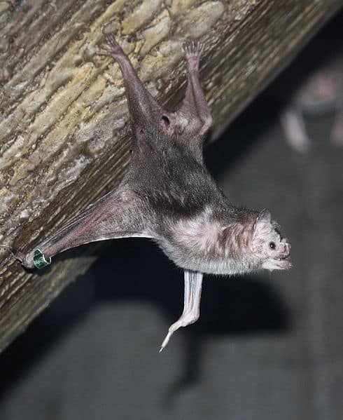
Vampire Bat
Small bite, big biology.

Piauí is a transition zone where the dry Caatinga of Northeast Brazil meets the savanna Cerrado and a small but important Atlantic coast. This mix of habitats supports dry-land specialists plus savanna and wetland species, making wildlife varied over short distances. Serra da Capivara's plateaus and sandstone canyons protect key animals and some of the Americas' most important rock art. Main habitats include the Caatinga (thorn scrub, dry forest, rocky outcrops) for reptiles, dry-area birds, and hardy mammals; the Cerrado (open grasslands, shrublands, gallery forests) which adds birds and medium to large mammals; and the coast (dunes, mangroves, estuaries, beaches) that attracts migratory shorebirds and coastal specialists. Rivers and seasonal wetlands give refuge in the dry season. The tri-biome mix and canyon scenery make a "desert-to-dunes" wildlife visit special.
Piauí has a west–east rain and vegetation gradient: wetter savanna/woodland in the west, drier semi-arid thorn scrub and rocky uplands inland, and a short Atlantic coast with mangrove, dune and estuary habitats. Parnaíba rivers form gallery forests, wetlands and riparian corridors. Plateaus, cliffs and caves (Serra da Capivara) hold dry-forest animals, roosting bats and endemic rocky-habitat species.
Near sea level on the Atlantic coast/Parnaíba Delta to roughly ~800-900 m on interior plateaus and serras (higher, cooler uplands and canyon/valley topography increase habitat diversity)
Atlantic Ocean; a short coastline centered on the Parnaíba Delta with extensive estuaries and mangrove-fringed tidal waterways
Piauí's protected areas include large federal units run by the Chico Mendes Institute across the semi-arid dry-forest and the savanna–dry-forest transition in the south and center, plus coastal and mangrove areas in the Parnaíba River delta. Key parks include Capivara Range and Confusions Range. Other units protect headwaters, sandstone plateaus, canyons, coastal wetlands and migratory waterbirds.
About 13% of Piauí is covered by officially designated protected areas (conservation units). Strictly protected units (national parks and the Uruçuí-Una Ecological Station) account for about 4.3% of the state; the remainder is in sustainable-use categories (for example, environmental protection areas and extractive reserves).
A globally important Caatinga stronghold combining rugged mesas, canyons, and seasonal watercourses that sustain dry-forest wildlife; also famous for rock art and archaeological sites, and valuable for conserving Caatinga fauna and supporting habitat connectivity with nearby protected areas.
One of Brazil's largest Caatinga national parks, protecting vast, relatively roadless tracts of seasonally dry forest, limestone and sandstone formations, and caves-important for large mammals and for maintaining ecological processes across a big Caatinga landscape.
A small but high-visibility park protecting Cerrado-Caatinga transition habitats with striking sandstone formations and gallery forests; good for wildlife viewing of savanna species and birds in a compact area with established visitation infrastructure.
A large Cerrado headwaters park (multi-state, including southern and southwestern Piauí) that protects springs, palm swamps, and plateaus critical for water security and for Cerrado mammals and birds; important for landscape-scale conservation in an increasingly converted agricultural frontier.
A state-level protected area in Piauí that conserves the Poti River canyon landscape and associated riparian habitats, supporting wildlife linked to cliffs, dry forest and scrub, and river corridors.
A state park in Piauí centered on sandstone outcrops and caves, with habitat important for cave fauna (especially roosting bats) and other wildlife associated with rocky landscapes and seasonal dry vegetation.
A strict-protection Cerrado reserve safeguarding plateaus, savanna woodlands, and headwater systems; important for conserving threatened Cerrado wildlife in a region under pressure from agricultural expansion.
A sustainable-use marine and coastal reserve protecting mangroves, tidal channels, and estuarine productivity while supporting traditional communities; important nursery habitat for fish and crustaceans and for coastal wildlife including migratory birds.
A large multi-use protected landscape spanning the Parnaíba Delta (across state boundaries) that buffers mangroves, dunes, coastal sandplain habitats, and estuarine waters; especially important for shorebird concentrations and broader coastal habitat integrity.
A broad escarpment and plateau environmental protection area (shared with neighboring states) that helps protect springs, forest enclaves, and transition habitats; important as a connectivity and buffer landscape for wildlife moving between drier lowlands and wetter uplands.
Piauí sits in Northeast Brazil at a place where many habitats meet: semi-arid Caatinga scrub, Cerrado savanna and woodlands, gallery forests, rivers, and a rich coast with the Parnaíba Delta's mangroves and sandbars. This mix gives wildlife like drought-tolerant mammals and reptiles inland, many birds in savannas and rocky canyons, and coastal and estuary animals such as mangrove birds, caimans, and sea turtles. Protected areas like Serra da Capivara and Serra das Confusões protect large Caatinga areas and endemic species, while the Parnaíba Delta draws waterbirds and marine-linked life.
Piauí has wildlife-viewing in semi-arid thorn scrub, dry forest, inland tropical savanna, rivers and wetlands along the Parnaíba River, and a short Atlantic coast with mangroves and estuaries that draw birds and other animals. Key protected areas are Capybara Range National Park and Parnaíba River Delta Environmental Protection Area with sandstone cliffs, caves and rock art.
Best overall for comfortable hiking and reliable access on unpaved roads in the interior. Wildlife concentrates around water sources, improving chances to spot thorn-scrub and savanna species. Clear skies favor sunrise/sunset viewing at lookouts in Serra da Capivara and night drives in surrounding areas.
Landscapes are greener after rains, with increased insect activity and more vocal birds. Good balance of access and biodiversity; excellent for photographers who want vibrant vegetation without peak rain disruption.
Burst of plant growth, flowering, and breeding activity-great for bird song/behavior and amphibians/reptiles after showers. Some remote tracks can become difficult; plan extra time and favor areas with better infrastructure (coastal/Delta and main park sectors).
Mangroves, tidal channels, and sandbars attract resident and migratory birds; boat-based wildlife viewing works in most months, though tides and wind can affect outings. Dry months generally give smoother logistics and better visibility.
Piauí in Northeast Brazil is a crossroads of ecosystems. Its interior is semi‑arid Caatinga that transitions into Cerrado savanna with gallery forests along rivers. A short Atlantic coast at the Parnaíba River has mangroves, estuaries, dunes, and rich nearshore waters. This mix supports many habitats, including Serra da Capivara's sandstone cliffs and rock shelters, known for wildlife and ancient sites.
Expressed mainly as Caatinga: drought-deciduous thorn woodlands and scrub with cacti, bromeliads, and seasonal leaf drop; locally includes denser seasonally dry forests on more fertile or sheltered sites (e.g., around Serra da Capivara/Serra das Confusões).
Largest share of the state, especially central and eastern Piauí; broadly predominant inland.
Savanna formations ranging from open grassland to typical savanna woodland, with fire-adapted grasses, shrubs, and scattered twisted trees; includes patches of woodland savanna and riparian/gallery forests threading through savanna matrices.
Mainly southern and western Piauí, forming a wide transition zone with Caatinga and other dry forests.
Major river networks and seasonal drainages (notably the Parnaíba River basin) with riparian forests, sandbars, oxbows, and reservoirs; strong wet-dry seasonality shapes aquatic habitats and connectivity.
Statewide along rivers and reservoirs; strongest presence along the Parnaíba and its tributaries.
Coastal and river-associated wetlands, including floodplains, marshes, and the Parnaíba Delta complex with seasonally inundated areas and brackish wetlands behind dunes.
Localized but important-most extensive at the Parnaíba Delta and lower Parnaíba floodplain; scattered interior marshy depressions during rainy season.
Shallow Atlantic nearshore waters off a short coastline, influenced by estuarine inputs from the Parnaíba Delta; supports coastal fisheries and marine-connected food webs.
Very limited in area relative to the state-restricted to the narrow coastal strip and adjacent shelf waters.
Caatinga thorn scrub with cacti and drought-resistant shrubs; common on rocky soils and lowlands, including large areas around Serra da Capivara.
Open thorn woodland and denser dry-forest patches in Caatinga-Cerrado transitions; includes areas with taller trees on deeper soils.
Cerrado savanna mosaics (grass-dominated to tree-dotted) in the south/west; fire and seasonal drought are key ecological drivers.
Open grassy areas within the Cerrado mosaic and on plateaus; often intergrades with shrub savanna.
Seasonally dry deciduous forest patches, especially on better soils or sheltered slopes/valleys, with pronounced leaf loss during the dry season.
Gallery and riparian forests lining rivers and perennial/seasonal streams, forming biodiversity corridors through otherwise dry or savanna-dominated landscapes.
Sandstone escarpments and cliff faces (e.g., Serra da Capivara region) with specialized rock-dwelling flora/fauna and nesting sites.
Rock shelters and cave-like sandstone overhang systems associated with the Serra da Capivara landscape, important for bats, invertebrates, and microclimate refuges (and renowned archaeological sites).
Dissected plateaus and ranges (e.g., Serra da Capivara/Serra das Confusões areas) creating elevational and topographic microhabitats in an otherwise dry matrix.
Parnaíba River and tributaries with rapids to slow-flowing reaches, sandbanks, and riparian corridors; central to freshwater biodiversity and human water use.
Floodplain wetlands and seasonal ponds/depressions during the rainy season; coastal wetland complexes at the Parnaíba Delta.
Fresh to brackish marshes around the lower Parnaíba and deltaic plains, with emergent vegetation and strong seasonal water-level fluctuation.
Mangrove forests concentrated in the Parnaíba Delta estuary, providing nurseries for fish/crustaceans and coastal protection.
Parnaíba Delta estuarine channels mixing fresh and salt water, with mudflats, tidal creeks, and high productivity.
Short coastal zone with dunes, coastal sandy scrub vegetation mosaics, lagoons/backslope wetlands, and human settlements.
Sandy beaches near the Parnaíba Delta and coastal municipalities, influenced by tides, winds, and sediment delivery from the delta.
Extensive land-use in parts of the state, including rainfed crops and expanding mechanized agriculture in Cerrado areas; habitat fragmentation is a key pressure.
Urban centers (e.g., Teresina and coastal towns) creating heat-island effects, altered drainage, and concentrated demand on river resources.
The Caatinga in Piauí can look desert-like for months, but after rains it can transform fast: many plants leaf-out and flower almost simultaneously, and wildlife timing (breeding, feeding, movement) is tightly synced to these short wet windows.
Piauí is a major refuge for one of Brazil's most unusual mammals: the Brazilian three-banded armadillo (Tolypeutes tricinctus), the only armadillo that can roll completely into a tight ball-an extreme defense strategy in open, dry habitats.
In the Parnaíba Delta, a few kilometers can take you from freshwater to brackish mangroves to full marine sands and reefs-so it's possible to find river, mangrove, and ocean species living in a compact "habitat mosaic."
At dusk in parts of the Parnaíba Delta, flocks of scarlet ibis (Eudocimus ruber) can return to roost, turning mangrove treetops visibly red-an effect caused by the birds' carotenoid-rich diet (especially crustaceans).
Some Caatinga amphibians found in Northeast Brazil (including Piauí) are built for drought survival: casque-headed treefrogs (genus Corythomantis) can use their bony head like a plug to seal themselves into rock crevices, reducing water loss during dry spells.
Serra das Confusões National Park (Piauí) is the largest national park in Brazil created to protect Caatinga (semi-arid) ecosystems-an 800,000+ hectare stronghold for dry-forest wildlife.
The Parnaíba River Delta (shared with Maranhão) has many channels and islands on Piauí's side. It's often called the only "open-sea" delta in the Americas and one of few in the world, a big biodiversity hotspot.
Piauí's Serra da Capivara-Serra das Confusões protected-area complex forms one of the largest continuous blocks of legally protected Caatinga anywhere, giving wide-ranging species (like big cats and large anteaters) room to persist in a biome that is heavily fragmented elsewhere.
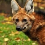
Piauí's Cerrado (tropical savanna) in the south of the state overlaps the range of the maned wolf (Chrysocyon brachyurus), the tallest wild canid in South America-an animal whose long legs are an adaptation to moving through tall, open savanna vegetation.
Within Piauí's Caatinga, researchers record the presence of the giant armadillo (Priodontes maximus), the world's largest armadillo species-an ecosystem engineer that digs deep burrows later used by many other animals.
5 species documented in our encyclopedia
Thank you for reading! Have some feedback for us?
We appreciate your help in improving our content.
Our editorial team will review your suggestions and make any necessary updates.
There was an error submitting your feedback. Please try again.