N S W E
Wildlife Expeditions

Wildlife of
Tocantins

Tocantins is Brazil's wildlife crossroads-where Cerrado savannas meet Amazonian forests along the Tocantins-Araguaia rivers.
18 Species
277,720 km² Land Area
Overview

About Tocantins

Tocantins sits in a transition zone where the open grasslands, gallery forests, and shrublands shaped by fire of the Cerrado blend into wetter Amazon forests. This creates many habitats close together, supporting savanna mammals, raptors, river specialists, and forest-edge birds. The Tocantins-Araguaia river system shapes much of the wildlife, with wide floodplains, oxbow lakes, sandbars, and wetlands that gather animals and birds, especially in the dry season. Away from the rivers, mosaic Cerrado landscapes—open grassland, typical cerrado woodland, and denser woods—are threaded by gallery forests that let forest species move through. This patchwork supports both typical Cerrado animals and species that track wetter forest habitats. The close mix of big-water systems and classic Cerrado plateaus gives a "two biomes in one" feel: savanna views and termite mounds one day, river dolphins, flooded forest, and sandbar birdlife the next.

Physical Features

Geography

Tocantins is a large transition zone between the Cerrado savanna and the southern Amazon basin. Wildlife is shaped by changes in rain, fire, and plants across plateaus, grasslands, and river corridors. The Tocantins–Araguaia rivers create riparian/gallery forests, wetlands, and flooded plains that act as movement corridors and dry-season refuges; sandy uplands and palm swamps support special Cerrado species.

277,720 km² Land Area
10th largest state in Brazil Size Rank
Brazil Country
State Type
Elevation Range

~100 m to ~1,340 m (low river floodplains up to upland plateaus and serras)

Key Landscapes

Cerrado plateaus and interfluves (savanna mosaics with grasslands, shrublands, and woodland Cerrado) Tocantins River system (major north-flowing river; riparian forests, islands, and reservoirs influencing aquatic and shoreline habitats) Araguaia River and Bananal/Cantão floodplain complex (seasonally flooded forests and wetlands important for waterbirds, fish, and semi-aquatic fauna) Gallery forests and palm swamps along streams-cooler, wetter linear habitats that concentrate biodiversity and enable dispersal Jalapão region (sandy plains, dunes, quartzitic outcrops, and spring-fed rivers-high habitat heterogeneity and endemism within Cerrado landscapes) Serra Geral do Tocantins and other escarpments/ridges (topographic gradients creating localized microclimates and distinct plant communities)
Parks & Reserves

Protected Areas

Tocantins lies in the Cerrado-Amazon transition. Protected areas focus on three zones: Jalapão (savanna plateaus, sand dunes, palm-swamp springs), the Araguaia and Tocantins river corridors and floodplains including Bananal Island, and Cantão (a wetland-forest mosaic of rivers, oxbow lakes, and seasonally flooded forest). Protection includes federal national parks, ecological stations, state parks, and Environmental Protection Areas with zoning.

Protected Coverage

About 25%

National Parks & Preserves

Araguaia National Park (Bananal Island)

~555,500 ha (park area; approx.)

Protects a large portion of Bananal Island and the Araguaia River floodplain, an important inland wetland and seasonal flood ecosystem that supports abundant aquatic wildlife and large predators.

Jaguar Giant otter Lowland tapir (Brazilian tapir) Black caiman Jabiru stork

General Mountain Range of Tocantins National Park (Serra Geral do Tocantins)

~716,300 ha (park area; approx.)

A very large protected Cerrado (savanna) landscape of plateaus, cliffs, and river headwaters spanning Tocantins and Bahia, important for wide-ranging mammals and intact savanna habitats.

Maned wolf Giant anteater Puma (cougar) Pampas deer Greater rhea

Parnaiba River Headwaters National Park (Nascentes do Rio Parnaiba)

~729,800 ha (park total; multi-state; approx.)

Protects extensive Cerrado headwaters, gallery forests, and plateaus in a remote multi-state region (including Tocantins), important for watershed protection and habitat for large mammals and savanna birds.

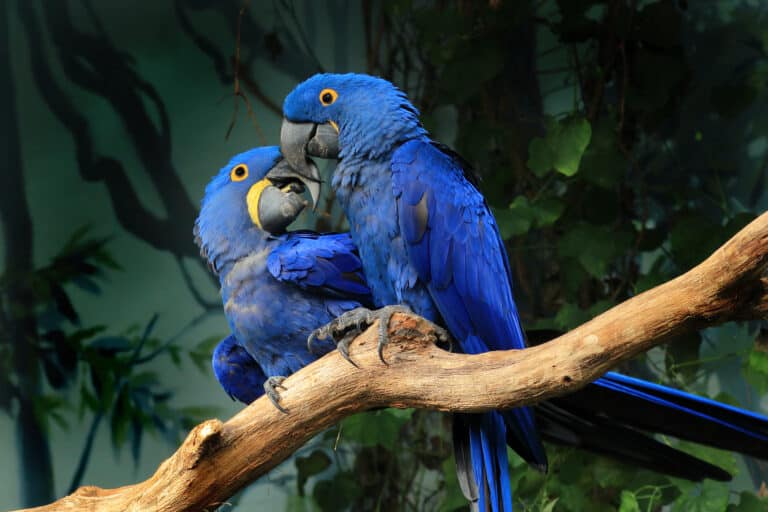
Jaguar White-lipped peccary Giant anteater Lowland tapir (Brazilian tapir) Blue-and-yellow macaw

State & Provincial Parks

Jalapão State Park

158,970 ha (Protected Planet/IUCN-WCMC listing)

A large protected area in Tocantins within the Jalapão region, known for Cerrado habitats including sand dunes, springs, and palm wetlands. Important for Cerrado wildlife and part of a broader regional conservation mosaic.

Maned wolf Giant anteater Jaguar Pampas deer Greater rhea

Cantão State Park

90,018 ha (Protected Planet/IUCN-WCMC listing)

A major wetland-forest mosaic in western Tocantins with many lakes and river channels, supporting rich aquatic fauna and large mammals.

Giant otter Jaguar Brazilian tapir Black caiman Jabiru stork

Serra do Lajeado State Park

9,931 ha (Protected Planet/IUCN-WCMC listing)

Cerrado ridges and gallery forests near Palmas that help protect water sources and provide habitat for a variety of mammals and birds in a heavily pressured landscape.

Giant anteater Maned wolf Ocelot Brazilian tapir Toucans (toucan species)

Wilderness Areas

  • Jalapao backcountry (sand dunes, palm swamps, and remote headwaters of the Sono River and Novo River systems) forming a broad roadless mosaic with Jalapao Ecological Station, Jalapao State Park, and Serra Geral of Tocantins National Park
  • Bananal Island and the Araguaia River floodplain (seasonally inundated forests, oxbow lakes, and river channels), including extensive low-road-density areas associated with Araguaia National Park
  • Cantao wetland labyrinth (networks of lakes and channels with extensive flooded forests) around Cantao State Park near the Araguaia River and Coco River confluence, where access is often primarily by boat
  • Serra Geral plateaus and escarpments (remote sandstone tablelands and canyon country) along the Tocantins-Bahia border, including large protected blocks within Serra Geral of Tocantins National Park
Animals

Wildlife

Tocantins sits at a major ecological crossroads where Brazilian savanna and woodland biomes blend into the southern Amazon, and where the Tocantins-Araguaia river system creates extensive gallery forests, seasonally flooded wetlands, oxbow lakes, and sandbar beaches. This transition-zone geography produces high species turnover (savanna + Amazon elements together), with especially strong wildlife viewing along rivers (dolphins, otters, caimans, turtles, waterbirds) and in protected mosaics such as Cantao State Park/Bananal Island landscapes (large mammals, wetland birds, and intact riparian forests).
~180-220 species (savanna-Amazon transition; strong riverine mammal diversity) Mammals
~550-650 species (mix of open-country savanna, gallery-forest, and Amazonian species) Birds
~160-220 species (notably river turtles/crocodilians plus savanna lizards and snakes) Reptiles
~90-140 species (many savanna and gallery-forest frogs; seasonal breeders) Amphibians
~400-700 species in the Tocantins-Araguaia basin (very diverse, with many riverine specialists) Fish
Examples

Iconic Species

Jaguar
Jaguar Flagship top predator of Tocantins' river-forest mosaic; most reliably encountered (as tracks/camera-trap records and occasional sightings) near large wetlands and intact riparian forests such as the Araguaia/Javaés region.
Giant Anteater One of the Brazilian savanna biome's signature mammals; often associated with open savannas and grasslands across Tocantins, making it a defining species for the state's savanna experience.
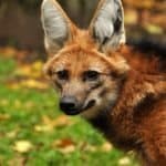
Maned Wolf
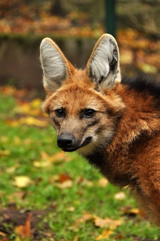
Maned Wolf Iconic long-legged canid of the Brazilian savanna biome; Tocantins' open habitats and agricultural frontiers still hold populations, though it is more often detected by tracks/camera traps than direct observation.
Lowland Tapir Largest terrestrial mammal in Brazil; strongly tied to rivers, floodplains, and forest edges in Tocantins, where it shapes vegetation through seed dispersal.
Giant Otter
Giant Otter A charismatic river specialist; family groups use oxbow lakes and calm channels in the Araguaia-Javaes/Cantao wetland systems, offering some of the best aquatic-wildlife viewing in the state.
Araguaia River Dolphin A distinctive freshwater dolphin restricted to the Araguaia-Tocantins drainage; it is one of Tocantins' most emblematic river species and a focal point for ecotourism and conservation attention.
Jabiru
Jabiru Huge wetland stork commonly associated with seasonal floodplains; a highly visible 'wetlands icon' in the Araguaia/Javaés landscapes during lower-water periods.
Black Caiman A top aquatic predator of calm waters and lagoons; where wetlands remain intact, it underlines Tocantins' Amazon-influenced aquatic fauna.

Endemic & Rare Species

Araguaia River Dolphin

Inia araguaiaensis

Range-restricted; often treated as conservation-priority due to limited distribution and escalating river impacts (formal status varies by listing authority)

Endemic to the Araguaia-Tocantins system; vulnerable to dam-driven habitat change, fisheries interactions, boat traffic, and water-quality degradation.

Giant Otter

Pteronura brasiliensis

Endangered (IUCN)

Tocantins' wetland-lake networks can support breeding groups; sensitive to disturbance, prey depletion, and riparian habitat loss, making it a strong indicator of river health.

Giant Armadillo

Priodontes maximus

Vulnerable (IUCN)

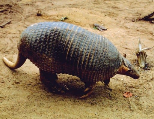
A low-density, wide-ranging savanna-forest ecotone species; threatened by habitat conversion and hunting, and important as an ecosystem engineer through its burrows.

White-lipped Peccary

Tayassu pecari

Vulnerable (IUCN)

Herd-forming forest/edge ungulate that is especially prone to fragmentation; where it persists in Tocantins it supports large predators and reflects landscape connectivity.

Giant South American River Turtle

Podocnemis expansa

Conservation-dependent in many regions; heavily impacted historically by harvest (IUCN status varies by assessment)

Nests on exposed sandbars in major rivers; Tocantins' large river beaches can be nationally important for reproduction where nesting areas are protected from harvest and disturbance.

Maned Wolf

Chrysocyon brachyurus

Near Threatened (IUCN)

A savanna flagship affected by roadkill, persecution, and habitat conversion; Tocantins is within a key portion of its savanna-range continuity.

Harpy Eagle

Harpia harpyja

Near Threatened (IUCN)

Occurs where large tracts of mature forest remain (especially along Amazon-influenced riparian/forest blocks); highly sensitive to forest loss and human disturbance.

Notable Populations

  • Range-restricted population of the Araguaia River Dolphin (Inia araguaiaensis) within the Araguaia-Tocantins drainage, a globally significant endemic river-cetacean population.
  • Wetland-rich Araguaia-Javaes/Cantao landscapes supporting strong assemblages of aquatic predators and indicators (giant otters, caimans) and large concentrations of waterbirds during seasonal low-water periods.
  • Major river sandbar nesting areas (where protected) for large river turtles (notably Podocnemis expansa) along the Araguaia/Tocantins system.
  • Brazilian tropical savanna megafauna remnants (giant anteater, maned wolf, giant armadillo) persisting in a heavily pressured biome, making intact savanna-gallery forest mosaics in Tocantins nationally relevant for tropical savanna conservation.

Recent Changes

  • Hydropower development and river regulation in the Tocantins basin have altered flow seasonality and connectivity, contributing to declines/instability of some long-distance migratory and commercially important fishes and changing aquatic food webs.
  • Expansion of mechanized agriculture and pasture, plus more frequent/severe dry-season fires, has increased fragmentation of savanna habitats, elevating roadkill and conflict risk for wide-ranging mammals (e.g., maned wolf, giant anteater) and reducing connectivity for forest-edge species.
  • In several river stretches, strengthened protection and community-led nest guarding/head-starting efforts for river turtles have improved local nesting success, though outcomes remain uneven and site-dependent.
  • Growing research attention and monitoring of the Araguaia River Dolphin since its recognition as a distinct species has increased documented occurrence records, while simultaneously highlighting threats from fisheries interactions, boat traffic, and habitat change.
Visit

Wildlife Viewing

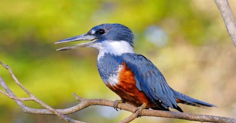
Tocantins is a rich transition zone where Cerrado savanna, gallery forests, wetlands and Tocantins–Araguaia rivers mix. It has many kinds of birds and good chances to see maned wolf, giant anteater and capybara, plus otters, caimans, herons and kingfishers. Highlights: Jalapão savannas and veredas, Araguaia River, Cantão and Lago de Palmas—great for boat trips and dawn or dusk drives.

Best Seasons

Dry season (May-September)

Best overall for wildlife viewing and logistics. Clearer roads in Jalapão, fewer mosquitoes, and easier spotting as animals concentrate near water. Peak birding and mammal viewing at dawn/dusk; excellent boat outings on the Araguaia/Cantão with calmer conditions and better visibility along sandbars and river edges.

Shoulder dry-to-wet transition (October-November)

Hotter days but dramatic skies and active wildlife as rains begin. Early storms freshen the landscape and can trigger bursts of insect life-great for night walks and frog/reptile encounters. Good time for photography: dust settles, greens return, and birds become more vocal.

Wet season (December-April)

Lush landscapes and peak wetland dynamics-especially around Cantão and floodplain areas. Expect more challenging access on dirt roads (Jalapão in particular), but rewarding boat and lodge-based viewing: breeding bird activity, amphibians calling, and increased aquatic life. Plan around rain and use local operators with appropriate vehicles/boats.

Top Wildlife Experiences

  • Boat safari in Parque Estadual do Cantão (near Caseara): explore igapó-like flooded forests and channels for caimans, river turtles, capybaras, kingfishers, and the chance of giant otters; best at sunrise and late afternoon.
  • Araguaia River sandbar birding (seasonal beaches, especially in the drier months): scan for terns, skimmers, herons/egrets, raptors, and river-edge specialists; combine with sunset boat rides for caiman spotting.
  • Jalapão sunrise wildlife drive + vereda (palm wetland) walk: base around Mateiros/São Félix do Tocantins; look for maned wolf tracks, giant anteater, armadillos, seriema, macaws/parakeets, and Cerrado endemics in open savannas.
  • Cerrado night spotlighting near Jalapão (with a local guide): search for nocturnal mammals (foxes, anteaters, armadillos) and nightjars/owls; excellent for learning animal calls and track identification.
  • Hike and wildlife photography at Serra do Espírito Santo (Jalapão): early-morning hike for raptors, swifts, and panoramic habitat viewing; combine with quiet time near streams for butterflies and mixed bird flocks.
  • Lago de Palmas / UHE Lajeado reservoir shoreline birding (near Palmas): easy-access day trips for waterbirds, raptors, and riverine species; great for travelers with limited time who want reliable sightings.
  • Natural pools and gallery forest edges in Jalapão (around fervedouros and river corridors): while the main draw is scenery, early/late hours can produce toucans, trogons, woodpeckers, and primate/bird activity in riparian forest strips.

Wildlife Watching Types

Birding hotspots (Cerrado specialists, riparian/gallery forest birds, wetland and river birds) Boat-based wildlife viewing (rivers, channels, flooded forests, reservoir edges) Mammal tracking and dawn/dusk safari-style drives (maned wolf, giant anteater, capybara, armadillos; sightings vary seasonally) Reptile and amphibian watching (caimans, turtles; frogs peak in wet season-best on guided night walks) Night spotlighting and nocturnal birding (owls, nightjars, nocturnal mammals) Wildlife photography trips (sunrise/sunset river light, sandbar birds, Cerrado landscapes)

Guided Options

  • Parque Estadual do Cantão local boat guides (Caseara area): guided canoe/boat routes through channels and seasonally flooded forest; ideal for wildlife-first itineraries and dawn departures.
  • Jalapão-based 4x4 operators (Mateiros / São Félix do Tocantins): multi-day expeditions that can be tailored to include sunrise drives, night spotlighting, and guided walks in veredas and gallery forests.
  • Araguaia River community boat pilots (seasonal beach areas): guided sandbar circuits for birding and caiman-spotting at dusk; ask for routes focused on quieter channels and wildlife viewing rather than speedboat sightseeing.
  • Birding-focused private guides based in Palmas: customized day trips to Lago de Palmas/reservoir margins and nearby Cerrado fragments, with early starts and scope/fieldcraft support.
  • Lodge or pousada-linked nature guides in western Tocantins (Cantão/Caseara): package options combining boat safaris, forest walks, and night outings; useful in wet season when local access knowledge matters most.
Habitats

Ecosystems

Tocantins sits in a large transition between the Brazilian savanna and the southern and eastern edge of the Amazon rainforest. Its plants and animals are shaped by a strong wet–dry season, fires in savanna-woodlands, and the Tocantins-Araguaia river basin, which supports riverside forests, floodplain wetlands (around Cantao State Park and Bananal Island), and large reservoirs.

Biomes

Savanna

Dominant Cerrado tropical savanna mosaic, including open grasslands, shrub-dominated savannas, and wooded savannas, shaped by strong wet-dry seasonality and recurrent fire.

Covers the vast majority of Tocantins (approximately about nine-tenths of the state); the remainder is mainly Amazon rainforest in the north/northwest transition zone.

Tropical Dry Forest

Seasonal semi-deciduous to deciduous forests occurring as patches on more fertile soils and along some valleys/slopes; many areas are highly fragmented due to agriculture and pasture.

Patchy, mainly in transition zones within the Cerrado matrix; ~10-15%.

Tropical Rainforest

Moist evergreen forests at the state's northern fringe and as humid forest enclaves and gallery forests along major rivers and tributaries, reflecting Amazon influence.

Limited and discontinuous; ~5-10% (including river-linked forest belts).

Freshwater

Major river corridors (Tocantins, Araguaia and tributaries), oxbow lakes, and large impoundments/reservoir systems that support aquatic and riparian biodiversity.

Linear but pervasive along drainage networks; ~2-3% of area as open water (variable seasonally/with reservoirs).

Wetland

Seasonally inundated floodplains, marshy depressions, and palm-lined wet grasslands (palm-swamp wet grasslands), especially associated with the Araguaia floodplain and the Cantao and Bananal Island region.

Concentrated along the Araguaia and lowlands; ~3-6% (expands during rainy-season flooding).

Habitats

Savanna

Cerrado sensu stricto mosaics with twisted trees, thick bark, and a diverse grassy understory; fire is a key ecological driver.

Grassland

Open grasslands and scrubby grasslands, often on poorer or seasonally waterlogged soils, important for ground-nesting fauna and endemic Cerrado plants.

Woodland

Dense wooded savannas and transitional dense woodland formations that grade into more forested habitats.

Shrubland

Shrubby Cerrado patches on sandy/rocky substrates, often with high fire tolerance and strong dry-season stress.

Forest

Gallery and riparian forests forming continuous strips along rivers/streams, acting as biodiversity corridors across the savanna matrix.

Rainforest

More humid evergreen/semievergreen forest pockets near the northern transition toward Amazon-influenced vegetation and along wetter river sectors.

Deciduous Forest

Seasonal deciduous or semi-deciduous forests on more fertile sites; many remnants persist as fragments amid agricultural landscapes.

River/Stream

Large, dynamic river channels (Araguaia, Tocantins) with sandbars, side channels, and strong seasonal discharge shaping aquatic communities.

Lake

Oxbow and floodplain lakes associated with meandering systems, plus reservoir lakes created by hydroelectric dams on the Tocantins system.

Wetland

Floodplain wetlands and seasonally inundated savannas, including extensive wetland complexes near Cantao and the Araguaia floodplain.

Marsh

Shallow, vegetated floodplain margins and depressions that fill during rains, providing nursery habitat for fish and waterbirds.

Swamp

Palm-dominated wet areas (palm swamps) and permanently or semi-permanently saturated pockets along lowlands and tributaries.

Agricultural/Farmland

Expanding mechanized croplands (notably soy and other commodities) and extensive cattle pasture replacing Cerrado mosaics in many areas.

Plantation

Localized commercial tree plantations (e.g., eucalyptus) and other managed perennial plantings in suitable zones.

Urban

Urban and peri-urban habitats centered around Palmas and regional hubs, with riparian corridors often serving as key green infrastructure.

Ecoregions

Cerrado Babassu forests Tocantins/Pindare moist forests Tocantins-Araguaia freshwater ecoregion (FEOW)
Protection

Conservation

Primary Threats

  • Widespread turning of native Cerrado and northern transitional forests into soy, corn, and cattle pasture is the main pressure in Tocantins, especially along roads like BR-153 and on flat plateaus. This removes habitat, breaks up gallery forests, and raises pesticide and fertilizer runoff into Tocantins-Araguaia tributaries.
  • Beyond direct clearing for farms and pasture, habitat loss occurs through degradation of riparian buffers, draining or alteration of palm swamps and seasonally flooded areas, and progressive fragmentation of Cerrado mosaics that many wide-ranging species (for example, large carnivores and anteaters) need to persist.
  • Hydropower dams and transmission lines on the Tocantins River system (and associated roads, worker settlements, and borrow pits) alter flow seasonality, block aquatic connectivity, and change sediment/nutrient dynamics. Road expansion increases wildlife roadkill and facilitates land grabbing, illegal clearing, and access for hunting/fishing in remote areas.
  • River regulation from dams changes flood pulses that sustain downstream wetlands and floodplain forests (notably affecting fish spawning cues and turtle nesting beaches). In uplands, altered fire regimes (too-frequent late dry-season fires) simplify vegetation structure, reduce seed banks, and can convert diverse typical cerrado savanna into more homogenized grass-dominated systems.
  • Projected warming and increased drought/heat extremes in the Cerrado intensify fire weather, stress water availability in headwaters feeding the Tocantins-Araguaia basin, and can shrink seasonal wetlands. This compounds land-use pressures by increasing the probability of large, high-intensity fires and reducing ecosystem recovery between fire events.
  • Agrochemical runoff and sedimentation from clearing/poorly managed pasture and cropland affect water quality in tributaries feeding the Tocantins and Araguaia. In localized areas, small-scale mining and informal dredging can add turbidity and (where mercury is used) toxic contamination, impacting fish and riverine wildlife.
  • Mining (including artisanal gold in some riverine contexts and larger licensed operations where present) can drive deforestation for access roads and camps, increase sediment loads, and create contamination risks. Even when spatially localized, impacts can propagate downstream through the Tocantins-Araguaia aquatic network.
  • While Tocantins is not Brazil's main logging hotspot, selective/illegal logging and timber extraction can occur in the northern transition forests and along river corridors, degrading habitat quality and opening access routes that accelerate subsequent clearing and hunting.
  • Subsistence and opportunistic hunting (e.g., of peccaries, deer, and large birds) persists in rural areas and along new access roads. In fragmented landscapes, even moderate offtake can reduce populations of slow-reproducing species and disrupt ecological functions like seed dispersal.
  • Fishing pressure in the Tocantins-Araguaia system-especially near towns and accessible river stretches-reduces stocks of large-bodied, slow-growing fish and can affect food webs. Altered flows from dams can also concentrate fish and increase catchability during certain seasons.
  • Capture and illegal trade of songbirds and parrots, and occasional trafficking of reptiles, is facilitated by road networks connecting Tocantins to major markets. Removal of breeding adults can depress local populations even where habitat remains.
  • As cattle ranching expands and fragments habitat, conflicts increase with large carnivores (notably jaguars) through predation on livestock, leading to retaliatory killing and reduced tolerance for wildlife on private lands.
  • Tourism growth in Jalapão and increased recreation/boating on rivers can disturb nesting sites (e.g., river turtles on sandbanks), increase litter, and create off-road impacts on fragile sandy soils and riparian vegetation when not well managed.
  • Exotic pasture grasses (e.g., widespread African grasses used in ranching) can invade adjacent native Cerrado, increasing fuel loads and promoting hotter, more frequent fires. Feral/domestic animals (e.g., free-ranging dogs near settlements) can also harass wildlife and spread disease.
  • Disease risks are amplified where wildlife, livestock, and domestic animals overlap-particularly for wild canids and carnivores exposed to pathogens from dogs, and for aquatic fauna stressed by warmer waters and degraded habitats that can increase susceptibility to infections.
  • Rapid growth around Palmas and other urban centers increases demand for water, sand/aggregate extraction, and peri-urban expansion into Cerrado remnants, adding fragmentation, pollution, and pressure on nearby protected areas and river margins.
  • Depletion pressures include unsustainable extraction of riparian timber for local use, overharvest of certain wild resources in unregulated areas, and cumulative water withdrawals/impoundments that reduce dry-season flows in smaller tributaries.
Fun Facts

Did You Know?

Tocantins has its own river dolphin: the Araguaian river dolphin (Inia araguaiaensis), formally described in 2014, is endemic to the Tocantins-Araguaia basin and is genetically distinct from the better-known Amazon river dolphin.

In Tocantins you can encounter Amazon icons in a savanna state: giant otters (Pteronura brasiliensis) use the flooded lakes and channels of Cantao/Araguaia-Javaes, even though the surrounding uplands are classic Brazilian savanna.

The Araguaia's famous sand beaches are seasonal habitats: they appear during low water, become major turtle nesting sites, and then disappear completely under floodwater a few months later-so the 'beach ecosystem' literally migrates with the river level.

Plants in Jalapao's savanna depend on regular fires. Traditional or managed burning tells when key species, like golden grass (Syngonanthus nitens), flower and make seed, affecting food and shelter for insects and birds.

Because Tocantins is an ecotone, one boat trip in the Araguaia-Javaes-Cantao area can mix savanna animals (like the maned wolf, Chrysocyon brachyurus) with wetland/forest species (giant otter, river dolphins).

Bananal Island (between the Araguaia and Javaes rivers, in western Tocantins) is widely cited as the world's largest river island-about 20,000 km²-making it one of South America's biggest continuous wetland wildlife refuges.

The Araguaia-Javaés system in Tocantins is a key nesting stronghold for the South American river turtle (Podocnemis expansa), the largest freshwater turtle in South America; on protected sandbanks, nesting can involve large aggregations of females in the dry season.

The Jalapao Mosaic, including Jalapao State Park and nearby protected Indigenous areas, protects about 34,000 km², making it one of Brazil's largest protected savanna areas.

Cantao State Park is where the Brazilian savanna meets Amazon wetlands and becomes a water maze in floods, with about 800 connected lagoons and channels—one of Brazil's most lake-dense protected areas in an inland savanna-forest transition.

Thank you for reading! Have some feedback for us?