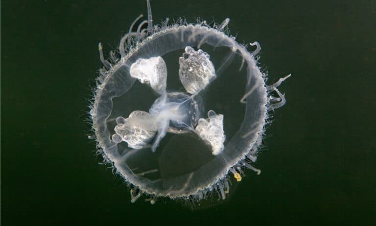
Freshwater Jellyfish
A jellyfish... in your pond.

A jellyfish... in your pond.
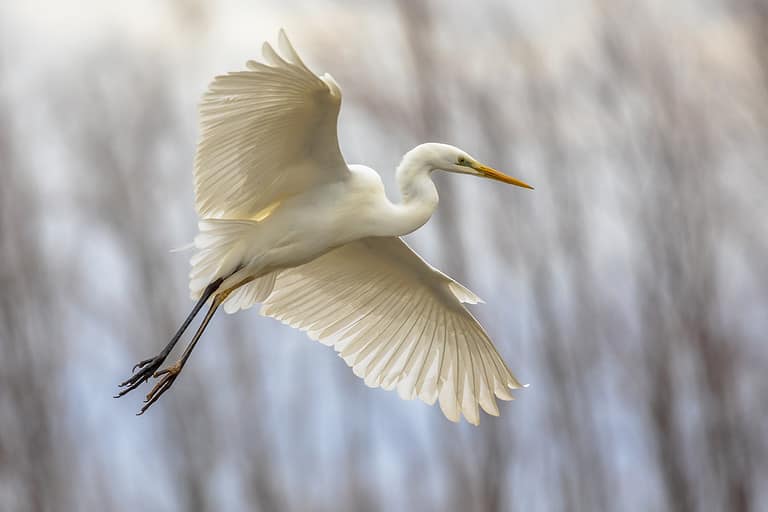
Big white hunter of the wetlands
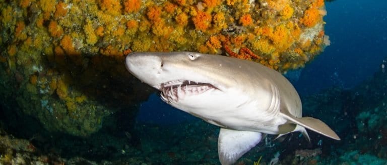
Protruding teeth, gentle glide.
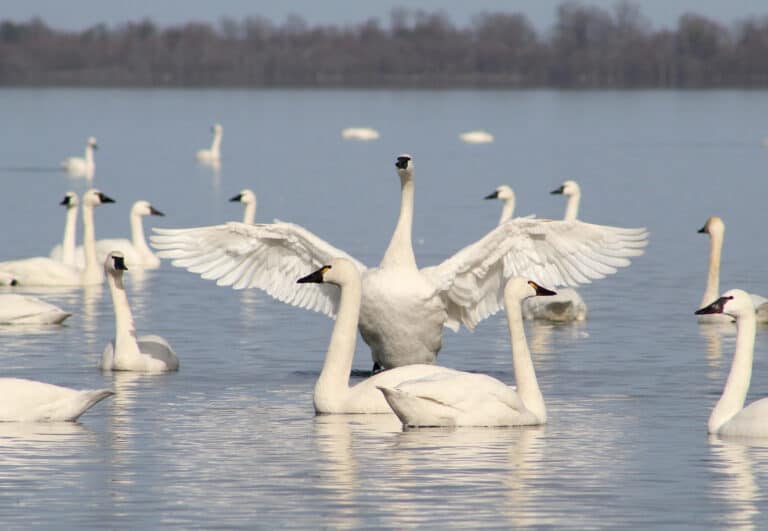
Whistling wings, tundra to tidewater
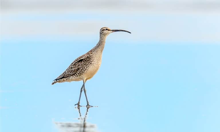
Curved bill, epic journeys
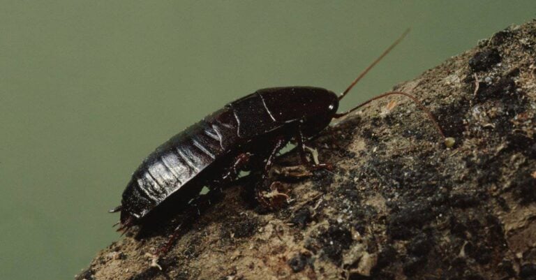
The basement-dwelling "black beetle"
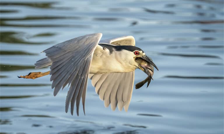
Night hunter with a black-crowned cap
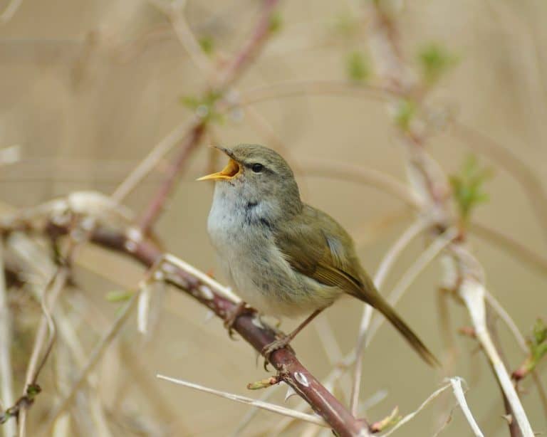
The voice of Japan's early spring
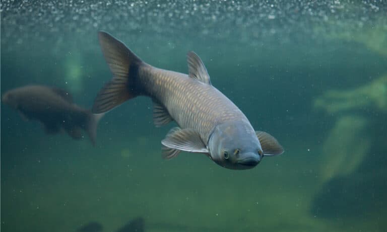
The underwater lawnmower-handle with care
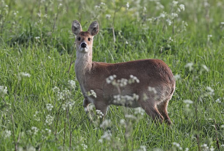
No antlers. All tusks.
Shanghai's wildlife is full of contrast. A very built city sits beside the Yangtze River estuary, where tides, silt, and sea meet to make vital bird habitat. The estuary is a large feeding and resting stop for migrants traveling between Arctic breeding grounds and Australasian wintering sites. Key habitats include intertidal mudflats, saltmarshes, reedbeds, and brackish-water channels around Chongming and other wetland complexes. Urban rivers, parks, and small woodlots act as stepping-stones for passing migrants. The mudflats are especially important: mud full of small animals feeds long-distance shorebirds, while nearby marshes shelter herons, egrets, and wintering waterfowl. Protecting these areas depends on shoreline management, sediment flows, and a balance between development and habitat protection.
Shanghai sits on a low delta at the mouth of the Yangtze River, an estuary where fresh, brackish, and marine waters meet. Its tidal flats, reed marshes, and nearshore waters support fish, invertebrates, and migratory waterbirds on the East Asian-Australasian Flyway. Wildlife uses coastal wetlands, river corridors (Huangpu, Yangtze), Chongming island, canals, ponds, and farm polders.
Sea level to ~100 m (low deltaic plain with small hills such as the Sheshan/Tianma area)
East China Sea coastline at the Yangtze River mouth (including the northern shore of Hangzhou Bay), characterized by estuarine shores, tidal flats, and wetland-lined margins
Designated 1986
Designated 1986
Shanghai, at the Yangtze River estuary, is a very urban city with important coastal wetlands, tidal flats, and nearshore sandbars that are stopover and wintering habitat for migratory waterbirds on the East Asian-Australasian Flyway. Most protection is on Chongming Island (especially Dongtan) and Jiuduansha sandbars, with small forest parks and city-edge green spaces for resident birds, amphibians, and pollinators.
≈8-12% of Shanghai's land area is under some form of formal ecological protection/park designation (the effective share is higher if intertidal flats and managed nearshore waters are included).
One of the most important tidal-flat and reedbed wetland complexes in the Yangtze estuary, globally significant for staging and wintering migratory shorebirds and waterfowl; extensive mudflats and saltmarsh provide key feeding habitat.
A protected sandbar/islet and marsh system in the Yangtze estuary with restricted access; highly productive tidal channels and mudflats support large numbers of migrating shorebirds and waterbirds, making it a cornerstone site for flyway conservation.
Low-elevation hill forest and mixed woodland habitat in western Shanghai that functions as an urban biodiversity refuge and migration "green island" for passerines and raptors, with understory habitat for amphibians and reptiles.
A national forest park on Chongming Island in Shanghai, characterized by plantation and mixed forest with nearby wetland habitats that can support a variety of birds and other wildlife.
Coastal shelterbelt forest and lagoons/ponds in southern Shanghai that provide stopover habitat for waterbirds and a corridor of woody cover in a coastal landscape dominated by development and agriculture.
A managed wetland park on Chongming with reedbeds, tidal creeks, and shallow-water habitats that can concentrate herons, egrets, and migratory waterbirds during spring and autumn movements.
Riverside woodland and wetlands in Pudong, Shanghai, near the Huangpu River/Yangtze estuary area that provide habitat for waterbirds and other common urban-edge wildlife.
Coastal mudflats, seawall-front habitats, and adjacent managed ponds/green space that are well-known locally for concentrating migratory shorebirds-especially during fall migration-making it one of Shanghai's best wildlife-viewing coastlines.
Internationally recognized wetland for migratory waterbirds; Ramsar status underscores global significance for flyway conservation and supports stronger monitoring and habitat management priorities.
Internationally important estuarine sandbar and marsh wetland; crucial feeding and roosting habitat for shorebirds and colonial waterbirds, with limited access that helps reduce disturbance.
A set of tightly controlled land/shoreline management zones used in China to limit incompatible development and maintain ecological function; in Shanghai these buffers often prioritize estuarine wetlands, shoreline habitats, and bird migration stopovers.
Shanghai's wildlife comes more from its river mouth and coast than from big land mammals. Tidal mudflats, saltmarsh, reedbeds, river channels and nearshore waters at the Yangtze mouth support life. Despite a big urban core, Chongming Dongtan, Jiuduansha, Nanhui coast and nearby wetlands have birds, especially during spring and autumn migration and in winter. On the East Asian-Australasian Flyway, Shanghai is a key stopover and winter area for shorebirds, cranes, storks and waterfowl. Its waters hold brackish and freshwater fish, migratory sturgeon, and sometimes estuarine dolphins.
Shanghai's wildlife comes from the Yangtze River mouth: tidal flats, reedbeds, brackish marshes and coastal islands, key stopover and wintering habitat on the East Asian-Australasian Flyway. Chongming and Pudong coastal wetlands are good for migrating shorebirds and waterbirds (spring/fall), ducks, geese and raptors in winter. Marine life is limited, but estuary life and wetland restoration help.
Peak northbound migration. Look for shorebirds using tidal flats and impoundments, herons/egrets in reedbeds, and songbirds moving through parks and green corridors. Best for variety and photography in softer light; plan around tides if targeting shorebirds.
Breeding season for some wetland birds and active amphibians/insects, but heat/humidity and haze can reduce comfort and visibility. Early mornings are best; focus on reedbed birds, urban park biodiversity, and night nature walks (frogs/insects) after rain.
Peak southbound migration with strong shorebird passage and mixed flocks of waders, terns, and gulls along the coast and estuary. Often excellent for close views at managed wetlands and for raptor movement on clear days.
Best time for wintering waterfowl: ducks, geese, swans (in suitable areas), and occasional raptors over open wetlands. Crisp air can mean better visibility; bring warm layers and plan mid-day sessions for comfort.
Shanghai, at the Yangtze River mouth, is an urban river–estuary–coast mix, not big wild land. It still has tidal flats, saltmarshes, reedbeds and waters around Chongming Island, Jiuduansha and the Yangtze estuary. These support fisheries, water cleaning, flood protection and migratory bird stopovers on the East Asian‑Australasian Flyway. Inland vegetation is broken into riparian strips, parks, woods, canals and farms.
Extensive estuarine and coastal wetlands (tidal flats, saltmarsh, reedbeds) at the Yangtze estuary and around Chongming/Changxing/Hengsha islands and Jiuduansha shoals; critical for migratory shorebirds and waterfowl.
Patchy but regionally significant along the estuary and outer-coast margins; among the most ecologically important non-urban areas in the municipality.
Large river and canal network dominated by the Huangpu River and Yangtze distributaries, plus urban waterways, reservoirs, and numerous ponds; supports freshwater fish, riparian birds, and provides major ecosystem services (water supply, drainage).
Widespread as linear corridors and waterbodies throughout the municipality, though highly engineered/managed.
Shallow, turbid nearshore waters of the East China Sea influenced by the Yangtze plume; productive for fisheries and estuarine-dependent species, with strong salinity gradients and soft-sediment seabeds.
Along the municipality's eastern coastline and offshore waters; functionally important despite heavy shipping/industrial use.
Greatly reduced natural forest cover; remaining tree cover is mostly secondary woodland fragments, riparian plantings, shelterbelts, and urban/peri-urban forested parks with mixed broadleaf species.
Limited and fragmented; mostly in parks, greenbelts, and peri-urban plantings rather than continuous forest.
Yangtze River estuary with strong freshwater-saltwater mixing, sediment dynamics, and shifting shoals (e.g., around Chongming and Jiuduansha); core habitat for migratory birds and estuarine fisheries.
Saltmarsh and reed marsh communities (often including large reedbeds) behind tidal flats; important for roosting/nesting waterbirds and shoreline stabilization.
Protected and restored wetland complexes such as Chongming Dongtan and Jiuduansha (noting ongoing management challenges like invasive cordgrass and hydrological alteration).
Major rivers and distributaries (Huangpu River, Yangtze channels) plus dense canalized waterways; key movement corridors for aquatic biota but affected by pollution, hard banks, and vessel traffic.
Urban and peri-urban ponds in parks, campuses, and agricultural landscapes; provide habitat for amphibians, fish, and common waterbirds, often with managed shorelines.
Small to moderate-sized lakes and impoundments within the metro/peri-urban matrix (typically managed for water storage, recreation, and stormwater control).
Low-lying coast with engineered seawalls and remaining natural shore segments; includes mudflat-forming zones and coastal protection infrastructure.
Limited sandy shoreline compared with mudflat habitat; where present, often highly managed and influenced by coastal engineering.
Naturally scarce due to the region's low-relief sedimentary coast; mainly localized hardened shorelines and engineered revetments rather than true rocky intertidal habitat.
Nearshore-offshore transition waters used by pelagic fish and seabirds, heavily intersected by shipping lanes and influenced by the Yangtze freshwater plume.
Soft-sediment (mud/silt) benthic habitats offshore and within estuarine channels, supporting invertebrate communities fundamental to shorebird prey and fisheries.
Peri-urban cropland and aquaculture-influenced landscapes (notably on Chongming and outer districts), interwoven with drainage canals and shelterbelts; important for some generalist birds but highly modified.
Managed tree plantings/shelterbelts and greening projects in peri-urban areas (e.g., roadside and agricultural windbreak plantings) that provide limited but widespread arboreal habitat.
Mosaic of housing, small waterbodies, canals, and remnant greenspace that can support adaptable wildlife (e.g., herons, egrets, passerines) but is fragmented.
Dense built environment with parks, street trees, and waterfront promenades; urban biodiversity concentrated in managed greenspaces and along riparian corridors.
You can birdwatch globally threatened migratory shorebirds in Pudong's Nanhui coastal wetlands within the same municipality as Lujiazui's skyline-one of the rare places where a megacity and an East Asian-Australasian Flyway stopover site directly overlap.
Chinese mitten crabs are "catadromous": they spend much of their lives in freshwater upstream, but mature adults migrate down toward brackish estuarine waters around the Shanghai region to reproduce-so their life cycle literally depends on the city's estuary mixing zone.
Jiuduansha ("Nine Shoals") is effectively "new land" in ecological terms: it formed from shifting Yangtze sediments and then rapidly developed reedbeds and tidal flats that wildlife colonized-an example of habitat appearing and maturing on human timescales in an ultra-developed region.
Shanghai's coastal wetlands host both saltwater and freshwater species side-by-side because the estuary's salinity can swing sharply with tides and river flow-so brackish specialists (estuary fish and invertebrates) overlap with inland wetland birds in the same viewing areas.
In winter and migration, big waterbirds—storks, cranes, geese, and raptors that hunt wetland prey—visit Chongming and the estuary reserves, with wingspans of several meters on the edge of a huge city.
Shanghai sits at the mouth of the Yangtze- the world's 3rd-longest river-so its coastal waters are influenced by one of Earth's largest river-plume ecosystems, a nutrient-rich zone that underpins major fisheries and estuary food webs.
Chongming Island (Shanghai) is widely cited as China's largest alluvial island (built from Yangtze sediments), and its scale helps explain why a megacity can still contain extensive marsh-and-mudflat wildlife habitat.
Shanghai Jiuduansha Wetland National Nature Reserve protects a little over 400 km² of estuarine shoals and marsh-Shanghai's largest protected wetland area-created by sediment deposition at the river mouth and now crucial for waterbirds.
Chongming Dongtan National Nature Reserve (≈326 km²) is one of the largest tidal saltmarsh-mudflat protected areas in the Yangtze estuary, internationally recognized for supporting migration "bottlenecks" of shorebirds and other waterbirds.
The Yangtze estuary around Shanghai is the native home of the Chinese mitten crab (Eriocheir sinensis). Few cities sit beside the crab's original area; it has spread to Europe and North America.
16 species documented in our encyclopedia
Thank you for reading! Have some feedback for us?
We appreciate your help in improving our content.
Our editorial team will review your suggestions and make any necessary updates.
There was an error submitting your feedback. Please try again.