N S W E
Wildlife Expeditions

Wildlife of
Xinjiang Uygur Zizhiqu

China's biggest region compresses deserts and sky-high ranges into one realm-home to snow leopards, wild camels, and migratory wetlands on Central Asian corridors.
55 Species
1,664,900 km² Land Area
Overview

About Xinjiang Uygur Zizhiqu

Xinjiang's wildlife is shaped by strong contrasts: huge dry basins and gravel deserts next to big mountain systems—the Tian Shan, Kunlun, and Pamirs. The region links East and Central Asia, so its animals have a Central Asian feel, with wide-ranging ungulates and predators of steppe, stony desert, and high alpine areas. Isolation, a harsh climate, and long movements make many species specialists for cold, scarcity, and long travel. Key habitats are the Tarim Basin deserts with oases and river corridors, the Junggar Basin's steppe-desert mix, and the alpine zones of the Tian Shan and Kunlun with cliffs, scree, and high meadows. Rivers and closed (endorheic) lakes form rare wetland islands that are vital for migratory birds on Central Asian flyways. Xinjiang contains an unusually full range of elevation and aridity, and its wildlife connects strongly to Kazakhstan, Kyrgyzstan, Tajikistan, Mongolia, and China.

Physical Features

Geography

Xinjiang's wildlife is shaped by contrasts between arid basins (deserts and semi-desert steppes) and high mountains make cooler, wetter alpine habitats. Mountains trap moisture to form sky-island refuges for forest, meadow, and tundra. Basins hold drought-adapted animals and oasis riparian corridors. Its position between Central and East Asian biogeographic zones, with transboundary river valleys and passes, supports migratory routes.

1,664,900 km² Land Area
Largest provincial-level region in China Size Rank
China Country
Autonomous region Type
Elevation Range

-154 m (Turpan Depression) to 8,611 m (K2/Chogori on the border), spanning deep basins to extreme alpine and glaciated peaks

Coastline

No ocean coastline (landlocked); major inland waters include Bosten Lake, Ebinur Lake, and Kanas Lake, plus large river corridors such as the Tarim, Ili, and Irtysh.

Key Landscapes

Tarim Basin (endorheic basin supporting desert, oasis, and riparian habitats) Taklamakan Desert (one of the world's largest shifting-sand deserts) Junggar Basin (semi-arid steppe and desert-steppe mosaics) Tian Shan Mountains (major alpine and montane habitat belt; glaciated headwaters) Kunlun Mountains (high-elevation cold deserts and alpine zones along the south) Pamir Plateau and ranges (very high, rugged terrain forming a Central Asian corridor)
Parks & Reserves

Protected Areas

Xinjiang's protected areas are mostly large National Nature Reserves that protect desert basins (Taklamakan/Tarim, Junggar), endorheic lakes and wetlands used by migratory waterbirds, and high-alpine zones in the Tian Shan, Kunlun and Pamir ranges. Scenic, forest and wetland parks add protection and allow visits. Many sites form corridors for steppe/desert and mountain species (snow leopard, ibex), swans, geese and cranes.

Protected Coverage

~18-20% of land area under some form of protection (approximate; depends on whether scenic areas, wetland parks and other designations are counted alongside nature reserves).

National Parks & Preserves

Altun Shan National Nature Reserve

≈45,000 km²

One of China's largest and most remote protected areas, spanning high, cold deserts and alpine plateaus along the northern Tibetan Plateau margin; crucial for wide-ranging mammals and intact predator-prey systems.

Snow leopard Tibetan antelope Tibetan wild ass Wild yak Tibetan gazelle

Lop Nur Wild Camel National Nature Reserve

≈60,000-65,000 km² (commonly cited range)

Hyper-arid desert and salt-lake landscapes safeguarding one of the world's last populations of wild Bactrian camels; important for desert-adapted wildlife and long-distance movements between water sources.

Wild Bactrian camel Goitered gazelle Asiatic wild ass Corsac fox Houbara bustard

Kalamaili Mountain Ungulate National Nature Reserve

≈18,000 km²

Steppe-desert and low mountain habitats in the Junggar Basin supporting large herds of Central Asian ungulates; one of the best places in Xinjiang for viewing open-country wildlife.

Asiatic wild ass Goitered gazelle Argali Saker falcon Eurasian wolf

Taxkorgan National Nature Reserve (Pamir Plateau)

≈14,000 km² (order-of-magnitude commonly cited)

High-elevation Pamir landscapes of broad valleys and rugged peaks; a flagship area for mountain ungulates and large carnivores along the China-Central Asia frontier.

Snow leopard Marco Polo sheep (argali) Siberian ibex Brown bear Golden eagle

Kanas National Nature Reserve (Altai Mountains)

≈2,200-2,500 km²

Boreal forests, alpine meadows and mountain lakes in the Altai; notable for forest mammals and raptors, plus strong habitat continuity with transboundary Altai ecosystems.

Eurasian lynx Brown bear Moose Red deer Black stork

Bayinbuluk Swan Lake National Nature Reserve

≈1,300-1,400 km²

High-elevation grasslands and wetlands in the Tian Shan; one of the most important breeding and staging areas in inland Asia for swans, geese and cranes.

Whooper swan Bar-headed goose Demoiselle crane Common crane Cinereous vulture

State & Provincial Parks

Sayram Lake Scenic Area / Regional Protected Landscape

≈500-700 km² (lake + surrounding protected landscape; varies by boundary definition)

Montane lake and surrounding steppe-meadow mosaics in the Ili region; strong for spring-autumn bird migration and open-country mammals in a relatively accessible setting.

Whooper swan Greylag goose Common crane Corsac fox Golden eagle

Tomur Peak National Nature Reserve (Tian Shan, Xinjiang)

2,371 km² (237,100 ha)

Extensive glaciers, cliffs, and alpine basins around Xinjiang's highest Tian Shan massif; important habitat for snow leopard and Siberian ibex and nesting territory for high-mountain raptors.

Snow leopard Siberian ibex Argali (Marco Polo sheep) Bearded vulture Himalayan snowcock

Heavenly Lake Area Protected Landscape (Tian Shan)

≈500-1,000 km² (park/management area scale varies by designation)

Forest-alpine ecotones around an iconic mountain lake; valuable for forest birds and mammals and as a compact example of Tian Shan biodiversity near Urumqi.

Eurasian red squirrel Siberian roe deer Eurasian lynx Black grouse Golden eagle

Wildlife Refuges

Ebinur Lake Wetland National Nature Reserve

≈2,000 km² (order-of-magnitude commonly cited)

Critical saline lake and marsh complex in northwest Xinjiang, supporting large congregations of migratory waterbirds and providing wetland habitat in an otherwise arid landscape.

Whooper swan Common crane Eurasian spoonbill Pallas's gull Great cormorant

Tarim River Euphrates poplar (Populus euphratica) Forest Nature Reserve (riparian corridor reserves along the Tarim)

≈1,000-3,000 km² (varies by the specific Tarim corridor reserve segment)

Fragmented but vital riparian forests and reedbeds that act as biodiversity 'lifelines' across the Tarim Basin; important for endemic/regionally distinctive deer and desert-edge fauna.

Bactrian deer (Tarim red deer) Wild boar Goitered gazelle Eurasian otter Steppe eagle

Bosten Lake Wetland Protected Area (Bayingolin area)

≈1,000 km² (wetland/lake complex scale; protection boundaries vary)

Large inland lake with reedbeds and deltas that support breeding and stopover waterbirds; a key wetland node on migratory routes across interior Asia.

Great crested grebe Common pochard Whooper swan Common crane Great cormorant

Ulungur Lake Wetland Protected Area (Altay region)

≈1,000 km² (wetland/lake complex scale; varies by designation)

Northern Xinjiang lake and marsh system known for waterfowl staging and breeding; important for diving ducks and other wetland specialists in the Altai foothills.

White-headed duck Dalmatian pelican Whooper swan Ferruginous duck Black-necked grebe

Wilderness Areas

  • Taklamakan Desert interior (vast roadless dune seas and gravel deserts away from the desert highways)
  • Kunlun Mountains-Arjin Shan frontier (high, cold deserts and plateaus with extremely low human footprint)
  • Eastern Pamirs roadless uplands (around Kongur-Muztagh Ata and high valleys near the China-Tajikistan/Pakistan borders)
  • Central and western Tian Shan high-alpine backcountry (glaciated basins and cliff systems used by ibex and snow leopard)
  • Altai Mountains transboundary backcountry (remote taiga-alpine transitions toward Kazakhstan, Russia and Mongolia)
  • Lop Nur-Kumtag desert margins (remote gravel plains and salt flats supporting wild camel movements)
Animals

Wildlife

Xinjiang's wildlife is defined by huge environmental contrasts: hyper-arid deserts and gravel plains of the Tarim and Junggar basins, broad steppes, and very high mountains (Tian Shan, Kunlun, Pamir, Altai) with alpine meadows, scree, glaciers, and riverine poplar riparian forests. This setting creates one of China's strongest Central Asian faunas-snow leopard-ibex-argali systems in the mountains, wild camel-gazelle-ground-jay communities in deserts, and major wetland stopovers for migratory waterbirds along Inner Asian flyways.
~140-160 species (diverse carnivores and mountain ungulates; several Central Asian endemics/near-endemics) Mammals
~450-500 species (very high due to migration corridors and desert/wetland contrasts) Birds
~55-70 species (desert-adapted lizards and snakes prominent) Reptiles
~10-15 species (limited by aridity; concentrated in mountain valleys and wetlands) Amphibians
~120-160 species (strongly split between endorheic desert basins and cold mountain rivers; many localized forms) Fish
Examples

Iconic Species

Snow Leopard
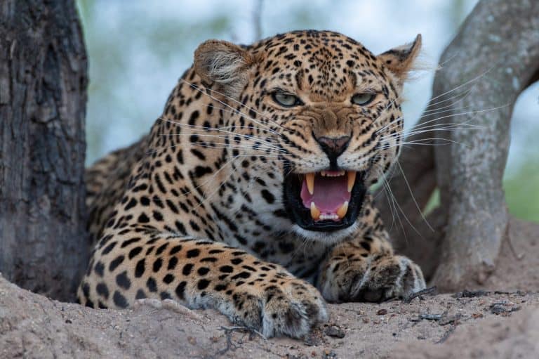
Snow Leopard Flagship predator of the Tian Shan, Kunlun and Pamir; a defining high-altitude wildlife experience tied to ibex and argali landscapes.
Wild Bactrian Camel One of the world's rarest large mammals, surviving in the remote desert reserves of eastern Xinjiang (Gobi-Lop Nur region).
Przewalski's Horse Globally famous conservation success; reintroduced populations roam parts of the Junggar Basin/Kalamaili area.
Asiatic Ibex Signature cliff-dwelling ungulate of the Tian Shan and Altai; commonly encountered relative to other large mammals and a key snow-leopard prey.
Argali (including Marco Polo sheep in the Pamirs) Iconic giant wild sheep of high basins and ridges; the Pamir form ('Marco Polo sheep') is especially sought by wildlife watchers.
Goitered Gazelle Characteristic antelope of Xinjiang's deserts and semi-deserts, often seen in open basins where few large mammals persist.
Eurasian Brown Bear A notable large carnivore of forested and alpine parts of the Altai and Tian Shan, representing Xinjiang's northern, boreal influence.
Bearded Vulture
Bearded Vulture Emblematic high-mountain scavenger frequently associated with dramatic Tian Shan/Kunlun terrain and ungulate carcasses.
Demoiselle Crane A striking migrant and breeder in steppe/wetland mosaics; large seasonal gatherings occur at key lakes and marshes.

Endemic & Rare Species

Xinjiang Salamander (Semirechensk Salamander)

Ranodon sibiricus

Critically Endangered (IUCN); extremely restricted range in western Tian Shan headwaters

One of China's most range-restricted amphibians, dependent on cold, clean mountain streams and vulnerable to habitat disturbance and water changes.

Wild Bactrian Camel

Camelus ferus

Critically Endangered (IUCN); tiny, fragmented global population

Xinjiang holds a core share of the remaining wild population; threatened by habitat fragmentation, disturbance, and competition/ hybridization risks with domestic camels.

Przewalski's Horse

Equus ferus przewalskii

Endangered (IUCN); conservation-dependent reintroduced populations

Xinjiang is one of the primary landscapes in China for free-ranging herds after captive-breeding and releases.

Ili Pika

Ochotona iliensis

Endangered (IUCN); endemic to the Tian Shan of Xinjiang

A Xinjiang endemic mammal of talus slopes; climate warming and habitat shifts are widely considered key threats.

Tarim Red Deer (Yarkand deer)

Cervus hanglu yarkandensis

Regionally rare and conservation-dependent; restricted to Tarim Basin riparian poplar forests

A flagship of the Tarim's riverine poplar forests, tightly linked to floodplain habitat quality and water availability.

Saiga Antelope

Saiga tatarica

Critically Endangered (IUCN); in China largely extirpated with only occasional cross-border occurrences

Historically part of Xinjiang's steppe fauna; any modern records are notable and typically tied to movements from Kazakhstan.

Pallas's Cat

Otocolobus manul

Near Threatened (IUCN) and locally scarce

A quintessential Central Asian small cat of steppe and rocky desert margins; elusive but strongly associated with Xinjiang's open country.

Notable Populations

  • One of the world's only remaining wild populations of Wild Bactrian Camel persists in the eastern Xinjiang desert reserve network (Gobi-Lop Nur region).
  • Reintroduced Przewalski's horse herds in the Junggar Basin (notably around Kalamaili) represent a nationally significant restoration program.
  • Pamir and Tian Shan ranges support nationally important high-mountain ungulate assemblages (ibex and argali/Marco Polo sheep) that underpin snow leopard conservation.
  • Key lakes and wetlands (e.g., Ebinur, Bosten and other basin wetlands) host regionally significant concentrations of migratory waterbirds on Inner Asian flyways.
  • Tarim Basin riparian poplar-and-willow corridors support one of China's most distinctive desert riparian wildlife communities, including Tarim red deer strongholds.

Recent Changes

  • Przewalski's horse reintroduction and population reinforcement in the Junggar Basin (Kalamaili area) has created expanding free-ranging herds, though drought and pasture pressure remain constraints.
  • Asiatic wild ass (kulan) and some desert ungulate populations have shown localized recoveries in parts of northern Xinjiang where protection and enforcement improved, but trends vary by site.
  • Wetland extent and quality in several basins has fluctuated with water diversion, reservoir operations, and drought, affecting waterbird stopover numbers and breeding success year-to-year.
  • Tarim riparian habitats have faced long-term pressure from altered river flows and land use; restoration/"ecological water" deliveries in some reaches have aimed to improve riparian forests and associated wildlife.
  • Occasional reports of saiga near the Xinjiang-Kazakhstan border reflect sporadic cross-border movements rather than a re-established Chinese population.
  • Large carnivores (wolf, snow leopard) experience ongoing conflict risk where livestock grazing expands into mountain and basin-edge habitats, influencing local occupancy patterns.
Visit

Wildlife Viewing

Xinjiang offers dramatic wildlife viewing where deserts, high mountains, and vast wetlands meet on migration routes. See alpine and plateau species (ibex, argali, snow leopards, bearded vulture), desert species (goitered gazelle, corsac fox), and wetlands with migratory waterfowl, cranes, swans. Best late spring to early autumn; winter suits raptors and some mountain mammals. Travel is remote; plan with local guides.

Best Seasons

Spring (Apr-May)

Raptor and waterbird migration ramps up at wetlands and river corridors; steppe/desert mammals become more active after winter; wildflowers can peak in parts of Ili Valley/Tian Shan foothills. Conditions can be windy with variable road access at higher elevations.

Summer (Jun-Aug)

Best overall access to high-altitude areas (Tian Shan, Pamir, Kunlun) for ibex/argali habitat, alpine birds (lammergeier/bearded vulture, golden eagle), and marmots/pikas; wetlands hold breeding and staging waterbirds. Bring sun protection; afternoons can bring storms in mountains.

Autumn (Sep-Oct)

Excellent clarity and comfortable temperatures for desert-edge safaris; strong fall bird migration at lakes and marshes (geese, ducks, cranes, waders); rutting season for some mountain ungulates can increase sightings. Nights turn cold quickly; early snow possible on passes.

Winter (Nov-Mar)

Specialist season for raptors and scavengers (eagles, vultures) and tracking mammals in snow in select mountain valleys; some wetlands host overwintering swans/ducks where water stays open. Access can be challenging due to snow/ice and road closures-best with local operators.

Top Wildlife Experiences

  • Birding the wetlands and reedbeds of Bosten Lake (Bohu County, Bayingolin): scan shorelines and marshy inlets for swans, geese, ducks, grebes, herons, and migrating waders in spring/fall; combine with early-morning boat/shore hides where allowed.
  • Altai Mountains & Kanas-Hemu region (near Burqin): forest-edge and alpine birding (woodpeckers, thrushes, raptors) plus chances for red fox and other montane mammals; prime in summer/early autumn when trails and viewpoints are accessible.
  • Tian Shan alpine wildlife day hikes around the Urumqi area (e.g., Tianshan Tianchi / Bogda vicinity and surrounding valleys where permitted): look for lammergeier (bearded vulture), golden eagle, choughs, and pika/marmot colonies; best June-September.
  • Pamir Plateau wildlife drives on the Karakoram Highway corridor (Kashgar-Tashkurgan): scan open slopes and ridgelines for Siberian ibex and Marco Polo sheep (argali) habitat; pair with sunrise/sunset glassing from high viewpoints (permits/seasonal rules apply).
  • Ili Valley grasslands and wetlands (Yining and surrounding counties): spring-summer is strong for steppe birds and wetland waterfowl; combine open-country scanning with riverine thickets for passerines and raptors.
  • Desert-edge mammal tracking near the Tarim Basin oases (e.g., around Hotan/Korla access points to desert-steppe): dawn/dusk drives to look for goitered gazelle, corsac fox, and other desert-adapted fauna; best in cooler months (spring/autumn) with minimal heat haze.
  • Raptor watching in open country and mountain foothills (Tian Shan/Altai approaches): winter and shoulder seasons can be excellent for eagles and other birds of prey; combine roadside scanning with dedicated vantage points for soaring activity.

Wildlife Watching Types

High-mountain mammal watching (ibex/argali habitat viewing via ridge-and-slope glassing) Snow leopard habitat exploration (ethical, track-and-sign focused trips in suitable mountain ranges; sightings are rare) Wetland birding (lakes, reedbeds, river deltas-migratory waterfowl and waders) Raptor watching (eagles, vultures/lammergeier, falcons-especially along foothills and passes) Desert and steppe mammal safaris (gazelles, foxes; best at dawn/dusk) Forest and taiga-edge birding (Altai/Kanas region-passerines, woodpeckers, owls) Wildlife photography trips (landscape + wildlife with hides/vantage points) Citizen-science style bird counts/seasonal migration watching at key lakes and reservoirs

Guided Options

  • Pamir Plateau (Kashgar-Tashkurgan) multi-day wildlife & scenery drives with local licensed guides (permit-dependent); focus on high-elevation ungulates, raptors, and plateau birdlife.
  • Altai/Kanas-Hemu nature-focused itineraries run by Xinjiang-based eco-tour operators (summer-early autumn): forest-edge birding walks, sunrise viewpoint sessions, and optional photography guidance.
  • Tian Shan day-trip or 2-3 day guided hikes from Urumqi (Tianchi/Bogda area where access is permitted): raptor-focused outings with early starts and dedicated glassing stops.
  • Ili Valley birding circuits (spring-early summer, fall migration) guided by regional birding leaders: wetlands + steppe transects with flexible routing based on recent sightings.
  • Bosten Lake wetlands birding days with local guides/park staff coordination: timed for migration peaks and best light; combine shore-based scopes with permitted boat sections where applicable.
  • Specialist wildlife photography tours (custom/private) that combine desert-edge dawn drives, wetland mornings, and mountain raptor sessions; best booked with operators experienced in Xinjiang logistics and regulations.
Habitats

Ecosystems

Xinjiang Uyghur Autonomous Region has big environmental differences: vast endorheic basins (Tarim, Junggar) that are very dry, belts of steppe and semi-desert, and high mountains (Tian Shan, Kunlun, Pamir, Altai) with zones from dry foothills to montane forests, meadows, alpine tundra and ice. Glacier- and snowmelt-fed rivers, oases and terminal lakes form riparian corridors and migration links to Central Asia.

Biomes

Cold Desert

The dominant basin biome: cold-winter deserts and semi-deserts of the Tarim and Junggar basins, with extensive sand seas (e.g., Taklamakan), gravel plains, and saline flats; vegetation sparse and often restricted to interdunes and ephemeral washes.

Largest share of the region; widespread across the Tarim Basin and much of the Junggar Basin.

Hot Desert

Warmer, hyper-arid desert conditions occur in the lowest, most sheltered basin interiors during summer, intensifying evapotranspiration and supporting classic oasis-desert contrasts; biologically expressed through heat-tolerant desert shrubs and ephemeral annuals after rare rains.

Patchy within the hottest low-elevation basin interiors and dune fields; locally prominent but smaller than cold-desert extent.

Temperate Grassland

Steppe and dry grassland (often transitioning to semi-desert) occupy basin margins, piedmonts, and intermontane valleys, supporting grazing systems and wildlife adapted to open landscapes.

Broad belts around mountain foothills and across parts of northern Xinjiang (notably around the Tian Shan and in the Junggar periphery).

Temperate Forest

Montane temperate forests occur where orographic precipitation is sufficient, especially on wetter mountain slopes; includes mixed and conifer-dominated forests in moister Tian Shan and Altai zones.

Discontinuous, mainly on mid-elevation mountain slopes; relatively limited areal extent compared with deserts and steppe.

Boreal Forest (Taiga)

Cold, high-latitude/continental montane conifer forests and forest-steppe (taiga-like) are best developed in the Altai and some high, cool ranges, with larch/spruce/fir assemblages where moisture allows.

Localized in northern high mountains (especially Altai); small regional share.

Alpine

Above treeline, alpine meadows, scree, and cold desert/alpine steppe dominate; supports snowbed communities and high-elevation fauna across the Tian Shan, Kunlun, and Pamir.

Extensive across all major mountain systems at high elevation; large in vertical extent though less in planar area than basins.

Tundra

On the highest plateaus and peaks (notably Pamir and parts of Kunlun/Tian Shan), vegetation becomes sparse and tundra-like with cushion plants, cold deserts, and periglacial environments.

Patchy at the highest elevations; limited but ecologically distinctive.

Freshwater

Glacier- and snowmelt-fed rivers (e.g., Ili, Tarim tributaries), high mountain lakes (e.g., Kanas, Bosten), and endorheic lake systems provide critical aquatic habitat in an arid matrix.

Linear and localized-concentrated in mountain catchments, oases, and terminal basins.

Wetland

Riparian forests, reedbeds, floodplain marshes, and terminal-lake wetlands occur along rivers and in oases (e.g., Tarim corridor) and around lakes (e.g., Ebinur and other endorheic basins), often highly dynamic with water diversion and salinization.

Scattered but vital; concentrated along river corridors and lake margins in basins.

Habitats

Desert

Taklamakan sand sea, gravel/gobi surfaces, yardangs, and saline playas; biological hotspots occur at desert margins and around groundwater-fed shrub zones.

Steppe

Temperate steppe and semi-desert steppe on piedmonts and intermontane basins, important for migratory ungulates and raptors; heavily used for grazing in many areas.

Grassland

Open grasslands in cooler/moister valleys and foothills, including meadow-like pastures where meltwater and summer storms increase productivity.

Shrubland

Xeric shrublands on alluvial fans and basin edges (e.g., saxaul and other drought/salt-tolerant shrubs), stabilizing dunes and supporting desert food webs.

Forest

Discontinuous mountain forests forming biodiversity refugia and watershed protection zones, especially in wetter parts of the Tian Shan and Altai.

Coniferous Forest

Spruce- and fir-dominated montane forests (iconically Tian Shan spruce) on cooler, moister slopes and ravines; key habitat for montane birds and mammals.

Deciduous Forest

Riparian poplar (Euphrates poplar) forests and willow stands along desert rivers and floodplains, forming linear "green corridors" through the Tarim system.

Alpine Meadow

High-elevation summer pastures and flower-rich meadows above or near treeline in the Tian Shan, Kunlun, and Pamir; sensitive to climate and grazing pressure.

Mountain

Major ranges (Tian Shan, Kunlun, Pamir, Altai) with strong elevational zonation, glaciers, talus slopes, and deep valleys creating many microhabitats.

Cliff/Rocky Outcrop

Rock walls, canyon escarpments, and mountain crags used by nesting raptors and cliff-dwelling ungulates; common in Tian Shan and Pamir landscapes.

Cave

Karst and erosional caves occur locally in mountainous terrain, providing roosting and specialized microhabitats, though less extensive than in China's humid karst regions.

River/Stream

Snowmelt-fed rivers and braided channels (e.g., Ili system; Tarim tributaries) underpin oasis agriculture and sustain riparian ecosystems in arid basins.

Lake

Large and small lakes ranging from alpine clearwater (e.g., Kanas) to endorheic saline/alkaline basins (e.g., Ebinur), important for waterbirds and regional hydrology.

Pond

Small irrigation and natural ponds in oases and floodplains that provide amphibian and bird habitat in otherwise dry lowlands.

Wetland

Reedbeds, floodplain wetlands, and delta-like terminal wetlands in endorheic basins; productivity hotspots but vulnerable to water abstraction and salinity changes.

Marsh

Fresh to brackish marshes around lake margins and in river deltas (notably in terminal basins), supporting migratory and breeding birds.

Swamp

Localized floodplain swampy areas and backwaters along desert rivers where groundwater remains high; often intergrades with riparian forest and reedbeds.

Agricultural/Farmland

Irrigated oasis agriculture (cotton, fruit orchards, grains) concentrated along river corridors and alluvial fans; creates novel edge habitats but increases water demand.

Urban

Urban/industrial nodes (e.g., Urumqi and other oasis cities) concentrated along transport corridors and foothill basins, with heat-island and fragmentation effects.

Suburban

Expanding peri-urban belts around oasis cities with mixed land use, shelterbelts, and semi-managed greenspaces.

Ecoregions

Taklamakan Desert (WWF) Junggar Basin semi-desert (WWF) Tian Shan montane steppe and meadows (WWF) Tian Shan montane conifer forests (WWF) Altai montane forest and forest steppe (WWF) Pamir alpine desert and tundra (WWF) Kunlun Mountains alpine desert (WWF) Tarim Basin deciduous forest and steppe / riparian poplar corridor (WWF)
Protection

Conservation

Primary Threats

  • Water scarcity and competition among irrigation, cities/industry, and ecosystems in endorheic basins (especially the Tarim) reduces environmental flows, stresses desert oases, and fragments/degenerates riparian poplar forests (Populus euphratica) critical for Tarim wildlife (e.g., Tarim red deer) and migratory birds.
  • River regulation, groundwater extraction, and engineered water transfers in the Tarim system alter seasonal flooding and riparian regeneration; desert stabilization/afforestation projects can also change native dune dynamics and shrub-steppe structure when not aligned with local ecology.
  • Oasis expansion, settlement growth, and conversion of alluvial fans and low-elevation foothills reduce and fragment desert-steppe habitats used by goitered gazelle and other ungulates, and compress wildlife into remaining corridors between basins and mountains.
  • Irrigated agriculture (notably cotton and fruit orchards) around oases increases water withdrawals and salinization risks; fencing, canals, and night lighting around fields create movement barriers for ungulates and increase conflict/retaliation.
  • Major highways/railways, pipelines, transmission lines, and border/security roads intersect migration and dispersal routes (e.g., across Kalamaili and basin-mountain interfaces), increasing vehicle collisions, barrier effects, and human access to previously remote habitats.
  • Coal, oil/gas, and metal mining in basins and foothills causes direct habitat loss, road proliferation, dust/noise disturbance, and localized water contamination; exploration footprints in deserts can degrade fragile biological soil crusts that recover slowly.
  • Salinization and agrochemical runoff from irrigated oases, plus industrial effluents and windblown dust from disturbed soils, degrade wetlands (e.g., Ebinur Lake basin) and shallow groundwater relied upon by desert flora/fauna.
  • Warming and changing precipitation alter glacier and snowpack melt regimes in the Tian Shan/Kunlun/Pamir, shifting timing/volume of river inflows to oases and riparian forests; increasing heat and drought intensify desertification risk and can reduce high-altitude forage for wild sheep/ibex.
  • Illegal take persists in remote mountains and deserts for meat and trophies (notably wild sheep/ibex), and opportunistic hunting pressure can increase with new roads and extractive camps.
  • Cross-border trade risks (given long international borders) include demand for pelts and body parts of carnivores and birds, and occasional trafficking of live animals; enforcement is challenged by remoteness and porous informal routes.
  • Snow leopards and wolves may prey on livestock in high pasture systems (Tian Shan, Kunlun, Pamir), prompting retaliatory killing; expanding herding infrastructure and guard dogs also displace wild ungulates that are key prey.
  • Rising tourism and recreation in mountain scenic areas and lakes, plus off-road vehicle use in deserts, increase den disturbance for carnivores, disrupt breeding birds, and can damage dunes and desert crusts.
  • Disease spillover risks increase where domestic sheep/goats overlap with argali/ibex on shared pastures; outbreaks can cause rapid declines in small, isolated wild populations.
Fun Facts

Did You Know?

Wild Bactrian camels in the Lop Nur-Tarim region are documented drinking highly brackish to saline water sources that most mammals cannot tolerate-an adaptation to a desert where "fresh" water can be rare or seasonal.

Xinjiang's Tian Shan can host desert and glacier ecosystems within the same regional wildlife corridor: snow leopards and ibex occupy high rocky slopes above basins where goitered gazelles and jerboas live in arid steppe and desert edges.

Ebinur Lake (a hypersaline lake in northern Xinjiang) still functions as an important wetland stopover: even very salty lakes can support huge invertebrate blooms that fuel migratory waterbirds during passage seasons.

The Pamirs and western Tian Shan make Xinjiang a crossroads where Central Asian animals (Marco Polo argali, ibex, snow leopard) live beside East Asian desert-steppe animals, helped by mountain barriers and basin corridors.

Lop Nur Wild Camel National Nature Reserve (Xinjiang) spans roughly 65,000 km²-widely cited as the world's largest protected area created specifically to conserve the critically endangered wild Bactrian camel (Camelus ferus).

Xinjiang's Pamir Plateau (notably around Taxkorgan) is home to the Marco Polo argali (Ovis ammon polii), famous for having the largest horns of any wild sheep-record rams can exceed ~1.8 m (about 6 ft) along the horn curl.

Kalamaili Mountain Ungulate National Nature Reserve in the Junggar Basin is China's key stronghold for the Asiatic wild ass/kulan (Equus hemionus) and one of the country's most important landscapes for large steppe ungulates (also including goitered gazelle).

Arjin Shan (Altun) Nature Reserve on Xinjiang's southeastern edge covers about 45,000 km²-among China's largest nature reserves-protecting high-altitude wildlife such as Tibetan antelope and snow leopard across an enormous alpine-desert mosaic.

Thank you for reading! Have some feedback for us?