N S W E
Wildlife Expeditions

Wildlife of
Shandong Sheng

Shandong's peninsula wetlands and offshore islands are a frontline stopover on the East Asian-Australasian Flyway, where sea, mudflats, and Mount Tai meet migratory spectacle.
19 Species
157,100 km² Land Area
Overview

About Shandong Sheng

Shandong's wildlife is shaped by a long coastline, broad river plains, and low mountains that rise quickly from farms to forested ridges. This mix makes a place where marine life, shorebirds, and woodland species live close together, centered on the Shandong Peninsula and the Yellow Sea. Its best features are coastal wetlands, tidal flats, and bays—especially Laizhou Bay and Jiaozhou Bay—which feed and rest huge numbers of migratory waterbirds moving between Siberian breeding areas and Australasian wintering sites. Offshore islands and rocky headlands form seabird and raptor migration routes, while inland plains and reservoirs support geese, swans, cranes, and wintering ducks. Mount Tai and nearby ranges hold forest patches and mountain refuges. The peninsula effect brings migrants into places where they stop to rest and feed, letting visitors see shorebirds, seabirds, and forest birds in one trip during spring and autumn flyway migrations.

Physical Features

Geography

Shandong's long Yellow Sea-Bohai Sea coast, river deltas like the Yellow River Delta, and mix of wetlands, plains, and low mountains shape wildlife. Mudflats, salt marshes, estuaries, and offshore islands are key stopover and winter sites for migratory waterbirds on the East Asian-Australasian Flyway. Inland farms, lakes, and forested hills (Mount Tai, Yimeng) support wetland, grass edges, and woodland species.

157,100 km² Land Area
Mid-sized within China; about the 17th largest provincial-level division by land area Size Rank
China Country
Province Type
Elevation Range

Sea level to ~1,545 m (Mount Tai / Taishan, Yuhuangding/Jade Emperor Peak)

Coastline

Coastal province on the Yellow Sea with additional frontage on the Bohai Sea; deeply indented shoreline around the Shandong Peninsula including Laizhou Bay and Jiaozhou Bay, plus numerous nearshore islands and intertidal flats that strongly structure marine, shorebird, and wetland habitats

Key Landscapes

Shandong Peninsula projecting into the Yellow Sea (strong marine/coastal influence on habitats) Yellow Sea and Bohai Sea coasts with extensive sandy shores, rocky headlands, and intertidal mudflats Major bays and embayments: Laizhou Bay and Jiaozhou Bay (important shallow-water and tidal-flat ecosystems) Yellow River (Huang He) lower reaches and the Yellow River Delta (estuaries, reedbeds, saline wetlands, coastal lagoons) Coastal wetlands and salt pans/salt marsh complexes (critical for shorebirds and waterfowl) Offshore islands and archipelagos (e.g., Changdao/Long Island area) used by seabirds and migratory passerines as stepping-stones/landfall sites
Parks & Reserves

Protected Areas

Shandong's protected areas are mostly wetlands and coasts on the Yellow Sea — a key stopover and wintering area on the East Asian-Australasian Flyway — plus smaller forested mountain parks (e.g., Tai, Laoshan, Kunyu, Yimeng). National Nature Reserves, National Forest Parks/Scenic Areas, wetland parks and marine zones protect migratory waterbirds (cranes, storks, swans, shorebirds, gulls/terns), estuarine marshes, and temperate broadleaf forest.

Protected Coverage

~12-15% of provincial land area under some form of protected-area designation (estimate varies by definition and whether scenic/forest parks are counted).

National Parks & Preserves

Yellow River Delta National Nature Reserve (Dongying)

~1,530 km² (approx.; reserve boundary and functional zones vary by source/year)

One of northern China's most important coastal wetland complexes, with vast reedbeds, tidal flats, and newly formed deltaic habitats that support major concentrations of migratory and breeding waterbirds; flagship site for coastal wetland restoration and birdwatching.

Red-crowned crane Oriental stork Saunders's gull Common crane Great egret

Rongcheng Swan Lake National Nature Reserve (Weihai/Rongcheng)

~50 km² (order-of-magnitude; commonly cited as a relatively small, focused wetland reserve)

A premier wintering site for swans and other waterfowl on the Shandong Peninsula, combining lagoon-like waters, seagrass/shallow bays, and adjacent coastal habitats; one of the best places in the province for close-range waterbird viewing in winter.

Whooper swan Tundra swan Eurasian wigeon Common goldeneye Black-tailed gull

Changdao National Nature Reserve (Changshan/Changdao Islands, Yantai)

~50-60 km² land plus a much larger surrounding marine area (often cited in the high hundreds of km²)

Island and surrounding marine habitats that form an important migration corridor and stopover for raptors and passerines, with sea-cliff nesting birds and rich nearshore marine biodiversity; valued for both bird migration monitoring and marine conservation.

Peregrine falcon Japanese sparrowhawk Black-tailed gull Chinese egret Little tern

Laoshan National Scenic Area / Laoshan National Forest Park (Qingdao)

~400-450 km² (scenic-area scale; core forest park is smaller)

Coastal granite mountains with mixed forests, streams, and ravines adjacent to the Yellow Sea; notable as a forest refuge near a major city and for woodland bird diversity during migration.

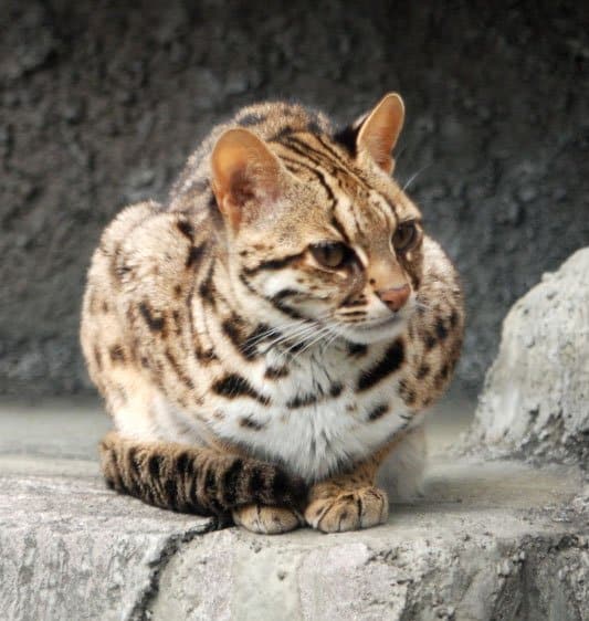
Mandarin duck Chinese goshawk Ring-necked pheasant Siberian weasel Leopard cat

Mount Tai (Taishan) National Scenic Area / Taishan National Forest Park (Tai'an)

~250 km² (scenic-area scale; management units vary)

Large, forested mountain massif rising from the plains, supporting remnant temperate forest communities and serving as a regional stepping-stone for forest birds; high visitation but with substantial habitat in less-developed slopes and valleys.

Northern goshawk Eurasian jay Ring-necked pheasant Wild boar Siberian roe deer

State & Provincial Parks

Kunyu Mountain (Kunyu Shan) Provincial Nature Reserve / Forest Park (Yantai-Weihai)

~100-200 km² (varies by designated unit/boundary)

One of Shandong's best remaining blocks of low-mountain forest and headwater streams, important for woodland breeding birds, amphibians, and mammals; comparatively quieter backcountry than major scenic sites.

Leopard cat Eurasian badger Wild boar Mandarin duck Northern goshawk

Yimeng Mountains (Yimengshan) Provincial Nature Reserves & Forest Parks (Linyi area)

Several hundred km² across multiple protected units (distributed complex rather than one single park)

A mosaic of forested ridges, rocky outcrops, and valleys that holds some of the province's most continuous inland habitat; valuable for forest birds and medium-sized mammals in an otherwise heavily settled region.

Siberian roe deer Wild boar Eurasian sparrowhawk Ring-necked pheasant Red fox

Wulian Mountain-Jiuxian Mountain Provincial Forest Park cluster (Rizhao)

~50-150 km² (combined park landscapes; varies by counted components)

Forested low mountains and granite landscapes that support woodland bird communities and provide a relatively intact upland corridor near the coast; good for spring/autumn migration viewing from ridgelines.

Chinese bamboo partridge Eurasian jay Great spotted woodpecker Siberian weasel Wild boar

Wildlife Refuges

Nansi Lake / Weishan Lake wetland protection complex (Jining-Zaozhuang)

~1,000+ km² of lake/wetland landscape (multiple management units; exact protected footprint varies)

Shallow lakes, reed marshes, and extensive lotus/reed zones that support herons, egrets, migratory ducks, and breeding marsh birds; a key inland wetland complement to the Yellow Sea coastal sites.

Grey heron Great egret Eurasian spoonbill Common pochard Eurasian bittern

Jiaozhou Bay coastal wetland & mudflat protection areas (Qingdao)

Patchwork of protected sites around the bay (tens of km² in total; boundaries vary by unit)

Intertidal mudflats and estuarine wetlands that can host migratory shorebirds and waterfowl; conservation focus includes habitat retention amid intense coastal development pressures.

Bar-tailed godwit Dunlin Kentish plover Eurasian curlew Black-headed gull

Shandong coastal/island marine protection zones (various nearshore MPAs, incl. around Changdao)

Typically tens to hundreds of km² per unit (varies widely by site)

Nearshore reefs, seagrass/shallow bays, and island waters important for fish nurseries and seabirds; complements terrestrial reserves by protecting feeding habitat for coastal birds and maintaining marine biodiversity.

Little tern Black-tailed gull Chinese egret Japanese sea bass (coastal fish) Swimming crab (Portunus spp.)

Wilderness Areas

  • Kunyu Mountain interior valleys and ridge forests (least-developed upland block on the eastern peninsula)
  • Backcountry ravines and upper slopes of Laoshan away from main scenic corridors (woodland habitat + migrant traps)
  • Yimeng mountain ridgelines and forest belts between major scenic nodes (remaining semi-contiguous upland habitat)
  • Outer Changdao/Changshan island cliffs and adjacent marine waters (comparatively low road density, strong seabird/migrant value)
  • Remote reedbed cores and closed zones within the Yellow River Delta marshes (best for sensitive waterbirds during breeding and migration)
Animals

Wildlife

Shandong's wildlife is defined by the Shandong Peninsula's long Yellow Sea coastline, broad intertidal mudflats, estuaries (notably the Yellow River Delta), island chains, and a warmer-temperate interior of plains and low mountains (including Mount Tai). The province sits on the East Asian-Australasian Flyway, making spring and autumn migration the headline natural event: shorebirds, waterfowl, and seabirds concentrate at coastal wetlands and bays (Laizhou, Jiaozhou, and adjacent mudflats). Inland, mixed woodland and agricultural mosaics support typical North China mammals and forest birds, while nearshore waters host marine mammals and productive fisheries.

≈80-100 species (terrestrial + coastal/marine visitors) Mammals
≈450-520 species (very high due to migration and coastal stopovers) Birds
≈35-50 species Reptiles
≈15-25 species Amphibians
≈600-900+ species (marine-dominated; fewer in freshwaters) Fish
Examples

Iconic Species

Whooper Swan Large wintering flocks are a signature of Shandong's coast, especially at well-known swan wintering sites (e.g., Rongcheng/Swan Lake area), drawing visitors for close viewing.
Oriental Stork An East Asian flagship species that uses Shandong's estuaries and marshes as key feeding and staging habitat; sightings in the Yellow River Delta are a major birding highlight.
Saunders's Gull A coastal wetland specialist strongly associated with Bohai-Yellow Sea saltmarshes; Shandong's deltaic marshes are among its most important habitats.
Black-faced Spoonbill Globally threatened and highly sought-after; Shandong's coastal wetlands and tidal flats are regular stopover/wintering areas where flocks may gather.
Spotted Seal The most iconic marine mammal of the Bohai/Yellow Sea region; individuals occur along Shandong's coast in the cold season, linking the province to regional seal conservation.
Narrow-ridged Finless Porpoise A small, finless cetacean of shallow coastal waters; Shandong's nearshore seas are part of its range and a key place to understand Yellow Sea marine biodiversity.
Eurasian Spoonbill A conspicuous wetland bird often seen in estuaries and coastal lagoons; mixed flocks with other waders can occur during migration and in winter.
Common Crane A charismatic migrant/winter visitor to open wetlands and agricultural landscapes; Shandong can host important seasonal concentrations during passage.

Endemic & Rare Species

Spoon-billed Sandpiper

Calidris pygmaea

Critically Endangered (globally); extremely rare passage migrant

A flagship of Yellow Sea mudflat conservation; any records in Shandong's coastal stopover sites underscore the province's role in preventing global extinction.

Great Knot

Calidris tenuirostris

Endangered (globally); declining due to loss of intertidal habitat

A migration-dependent shorebird that relies on rich Yellow Sea tidal flats; Shandong mudflats can be vital refuelling habitat during peak passage.

Chinese Crested Tern

Thalasseus bernsteini

Critically Endangered (globally); very rare coastal seabird

One of the world's rarest terns; any occurrence along Shandong's islands/coast is conservation-significant and draws high attention from birders and researchers.

Relict Gull

Ichthyaetus relictus

Vulnerable (globally); localized and sensitive to disturbance

Primarily an inland breeder but uses Bohai-Yellow Sea coastal areas seasonally; Shandong records highlight the connectivity between inland and coastal habitats.

Japanese Eel

Anguilla japonica

Endangered (globally); declining across range

A migratory fish using estuaries and rivers; Shandong's river mouths and coastal waters are part of its lifecycle corridor and reflect broader East Asian aquatic pressures.

Notable Populations

  • East Asian-Australasian Flyway migratory shorebird stopover concentrations on Shandong's intertidal mudflats (notably around the Yellow River Delta and major bays).
  • Regionally important wintering swan concentrations along the northeastern Shandong Peninsula coast (Rongcheng area).
  • Key Bohai-Yellow Sea habitat for threatened waterbirds such as Oriental Stork and Saunders's Gull, supported by estuaries, saltmarsh, and aquaculture-wetland mosaics.
  • Seasonal use of Shandong nearshore waters by marine mammals (e.g., spotted seals and finless porpoises), reflecting the productivity and conservation challenges of the Yellow Sea shelf.

Recent Changes

  • Ongoing declines in many Yellow Sea-dependent shorebirds (e.g., Great Knot, Spoon-billed Sandpiper) linked to intertidal habitat loss and degradation across the region, including pressures from coastal development and disturbance.
  • Wetland protection and restoration efforts in parts of the Yellow River Delta and other coastal reserves have supported improved breeding/foraging conditions for some waterbirds (including storks and gulls) where disturbance is controlled.
  • Expansion and subsequent management of invasive smooth cordgrass (Spartina alterniflora) in coastal wetlands has altered mudflat availability and benthic prey communities; removals/restoration in some areas aim to recover open tidal flats used by shorebirds.
  • Reintroduction/management of Père David's deer (Milu, Elaphurus davidianus) in the Yellow River Delta area has created a notable conservation-and-ecotourism feature in some coastal reserve landscapes (where established).
  • Shifts in coastal fish and invertebrate communities associated with warming waters, intense fishing pressure, and aquaculture expansion have affected food webs that support seabirds and marine mammals.
Visit

Wildlife Viewing

Shandong's peninsula and bays (Laizhou Bay, Jiaozhou Bay) lie on the East Asian–Australasian Flyway, making it a top birding spot. Coastal mudflats, saltmarshes and deltas host large numbers of shorebirds, waterfowl and raptors in migration. Winters bring swan and duck gatherings. Inland Mount Tai and Laoshan add woodland birds and hiking near Qingdao, Yantai, Weihai and Jinan.

Best Seasons

Spring (Mar-May)

Northbound migration ramps up: shorebirds refuel on tidal flats (sandpipers, plovers), mixed flocks of ducks and geese linger in bays, and passerines move through coastal scrub and mountain valleys. April-May is often the most productive window for "variety days" combining wetlands + headlands for seabirds/raptors.

Summer (Jun-Aug)

Breeding season for herons/egrets and other wetland birds; coastal islands can host terns and other seabirds. Early mornings are best for heat and haze. Great time for nature walks in Mount Tai/Laoshan for woodland birds, butterflies and dragonflies; also good for wetland photography with breeding plumage behavior.

Autumn (Sep-Nov)

Peak southbound migration: shorebird diversity and numbers can be excellent on mudflats, and coastal headlands become raptor watchpoints (eagles, harriers, falcons passing through). Weather is comfortable, visibility can be crisp after cold fronts-prime for seawatching and long-lens photography.

Winter (Dec-Feb)

Signature season for waterfowl: Whooper Swans and other swans gather at select coastal lagoons; bays and reservoirs hold large rafts of ducks, geese and grebes. It's also the best time for close-range swan photography and quiet, uncrowded wildlife viewing in coastal villages and wetlands.

Top Wildlife Experiences

  • Photograph wintering Whooper Swans at Rongcheng Swan Lake (Yandunjiao area, Weihai): go at sunrise for soft light and active feeding/flight behavior; combine with a coastal walk for sea ducks and gulls.
  • Spend a full tide cycle shorebirding at the Yellow River Delta National Nature Reserve (Dongying): plan around low tide to scan exposed mudflats for migrating sandpipers and plovers, then watch them lift to roost as the tide returns.
  • Do a raptor-and-seawatch session at Chengshantou (Weihai, eastern tip of the peninsula): in peak migration, set up on headland viewpoints to track raptors riding the wind and seabirds moving along the coastline.
  • Explore Jiaozhou Bay wetland edges (Qingdao) for close-to-city birding: target sunrise/sunset for feeding waterbirds, and use elevated viewpoints/boardwalk areas where available to avoid disturbing roosting flocks.
  • Take a day trip to the Changdao (Miaodao) Islands (Yantai) for seabird watching and coastal nature hikes: combine cliffside viewpoints, sheltered coves, and boat crossings where you can scan for seabirds and occasional marine mammals.
  • Hike Mount Tai (Tai'an) for woodland birding and "edge habitat" species: start early on quieter trails to listen for forest birds, then check ridgelines for passing raptors on clear days-especially during migration.
  • Plan a coastal 'wetlands loop' on the Laizhou Bay side (around estuaries and saltmarshes) to look for mixed flocks of waders, gulls and wintering ducks-best with a local guide who knows current access points and tide-safe viewing spots.

Wildlife Watching Types

Migratory birding on the East Asian-Australasian Flyway (spring and autumn) Shorebird and mudflat watching (tide-timed scanning from levees/boardwalks) Waterfowl concentrations in winter (swans, geese, ducks, grebes) Raptor migration watchpoints on coastal headlands (seawatching + skywatching) Seabird watching from islands, headlands, and ferry/boat routes Woodland and mountain birding (Mount Tai, coastal mountains/parks) Wetland wildlife photography (behavior, flight shots, roost fly-ins)

Guided Options

  • Yellow River Delta National Nature Reserve (Dongying) - check the reserve/visitor center for seasonal access, approved viewing areas, and guided interpretation programs (often tied to migration peaks).
  • Rongcheng Swan Lake area (Weihai) - local eco-guides and community-run viewing routes can help you time swan movements and find respectful, photo-friendly vantage points without disturbing birds.
  • Chengshantou (Weihai) - hire a local bird guide during migration to cover multiple lookouts in a day and to identify raptor streams and seawatching highlights after weather changes.
  • Qingdao/Jiaozhou Bay - local birdwatching groups and city nature education centers periodically run coastal wetland outings; ask in advance for tide planning and access guidance.
  • Changdao (Miaodao) Islands - local boat operators and nature guides can arrange island-to-island seawatching routes and coastal walks; best booked around calmer sea conditions.
  • Mount Tai scenic area - park staff/ranger-led interpretation (where offered) plus local naturalists can tailor early-morning birding walks and seasonal nature education focused on birds and insects.
Habitats

Ecosystems

Shandong spans the peninsula, low mountains (including Mount Tai), and coastal plains by the Bohai and Yellow seas. Ecosystems include warm-temperate forests, North China Plain farmland, and coastal wetlands like the Yellow River Delta that support migratory waterbirds on the East Asian-Australasian Flyway. Nearshore marine areas in Laizhou and Jiaozhou bays and offshore islands add diversity despite heavy human impact.

Biomes

Temperate Forest

Warm-temperate broadleaf deciduous and mixed forests on hills and mountains (e.g., Mount Tai and other uplands), with secondary woodland and planted stands where historical clearing occurred.

Patchy; concentrated in uplands of central/eastern Shandong and protected mountain areas, with extensive fragmentation outside reserves.

Temperate Grassland

Grassland-like vegetation occurs mostly as meadow/steppe-like patches on dry slopes, field margins, coastal dunes, and restoration areas; much of the original open habitat has been converted to cropland.

Limited and discontinuous; small remnants across plains, coastal dunes, and upland edges.

Freshwater

River corridors (including the lower Yellow River system and regional rivers) and large lakes/reservoirs support reedbeds, aquatic vegetation, and fish/amphibian communities, often influenced by water diversion and eutrophication.

Widespread but linear/patchy; concentrated along major rivers and around large lakes/reservoirs.

Wetland

Coastal salt marshes, mudflats, reed marshes, and deltaic wetlands (especially the Yellow River Delta) provide critical staging/wintering habitat for shorebirds, cranes, and waterfowl; inland marshes occur around lakes and floodplains.

Regionally concentrated; largest blocks in the Yellow River Delta and other estuaries/bays, with smaller inland wetland patches.

Marine

Temperate shallow seas of the Bohai and Yellow Sea include bays, island coasts, subtidal soft-bottom habitats, seaweed beds, and major aquaculture areas; productivity is high but sensitive to coastal development and pollution.

Extensive along the entire coastline and surrounding nearshore waters of the peninsula.

Habitats

Deciduous Forest

Warm-temperate oak and mixed broadleaf forests on Mount Tai and other hills; many stands are secondary/regenerating due to long settlement history.

Coniferous Forest

Planted and mixed conifer stands (e.g., pine plantations and shelterbelts) on hills, coastal zones, and reforested areas; also occurs as mixed conifer-broadleaf patches in uplands.

Woodland

Open canopy woodland and scrubby forest edges on dry hills and around villages, often intergrading with orchards and planted shelterbelts.

Grassland

Small meadow/grass-dominated patches on upland slopes, coastal dunes, and along infrastructure corridors; often heavily managed or fragmented.

Mountain

Low mountain and hill systems (notably Mount Tai) with elevational vegetation zoning, rocky outcrops, and refugia for native flora.

Cliff/Rocky Outcrop

Rocky sea cliffs and headlands along parts of the peninsula and island shorelines, supporting seabird roosting sites and specialized cliff vegetation.

Cave

Local limestone/rock caves and fissure systems in hilly areas (where present), used by bats and cave-adapted invertebrates; generally scattered and small.

River/Stream

Lower Yellow River reaches and other rivers (e.g., Xiaoqing and coastal-draining rivers) with engineered banks, floodplain remnants, and migratory fish constraints from regulation.

Lake

Large freshwater bodies and lake complexes (e.g., portions of Nansi Lake system) with reedbeds and open-water habitat supporting waterbirds and fisheries.

Pond

Aquaculture and irrigation ponds are widespread on coastal plains, forming artificial wetlands used by some waterbirds but with variable water quality.

Wetland

Coastal and inland wetlands, including extensive reed marshes and tidal flats critical to migratory shorebirds and cranes along the flyway.

Marsh

Reed-dominated freshwater and brackish marshes around deltas, lake margins, and lowland floodplains; key breeding/roosting habitat for waterbirds.

Estuary

Major estuarine systems including the Yellow River Delta and bay estuaries (e.g., around Laizhou and Jiaozhou bays) with salinity gradients, mudflats, and high bird use.

Coastal

Peninsula coastline with a mix of sandy shores, engineered ports, tidal flats, and island coasts; strong interaction of natural habitats and dense human use.

Beach

Sandy beaches and dune-backed shores occur in segments along the Yellow Sea side, supporting coastal dune vegetation where not heavily developed.

Rocky Shore

Rocky intertidal zones and boulder shores around headlands and islands, with diverse intertidal invertebrates and seaweed communities.

Kelp Forest

Subtidal macroalgal/kelp-dominated seaweed beds and extensive kelp/seaweed aquaculture areas, especially near major coastal cities (e.g., around Qingdao).

Open Ocean

Offshore waters of the Bohai/Yellow Sea supporting pelagic fish, plankton productivity, and seasonal migrations; influenced by fishing pressure and eutrophication.

Seabed/Benthic

Predominantly soft-sediment seabed in bays and shelf waters, important for benthic invertebrates that underpin shorebird food webs in adjacent tidal flats.

Urban

Large coastal and inland cities (e.g., Qingdao, Jinan, Yantai) with highly modified habitats; some urban wetlands and parks provide limited biodiversity value.

Suburban

Expanding peri-urban mosaics with fragmented woodland, ponds, and canals; strong edge effects and high disturbance.

Agricultural/Farmland

Extensive cropland on plains (wheat-maize and other systems), with remnant shelterbelts, drainage canals, and field-margin habitats.

Plantation

Orchards and planted tree belts (including coastal shelter forests and hill reforestation plantings) that replace or simplify native vegetation structure.

Ecoregions

Yellow Sea saline meadow Yellow River Plain mixed forests Shandong Peninsula deciduous forests Yellow Sea (Marine Ecoregion of the World)
Protection

Conservation

Primary Threats

  • Coastal wetland and tidal-flat loss from land reclamation for ports, petrochemical/industrial parks, urban expansion around Qingdao-Yantai-Weihai corridors, and conversion to aquaculture ponds and salt pans. This directly reduces intertidal foraging areas critical to flyway shorebirds in bays such as Laizhou and Jiaozhou and along the Yellow River Delta coast.
  • Seawalls, shoreline hardening, and channelization alter sediment dynamics and reduce natural wetland migration/retreat. Yellow River flow/sediment regulation influences delta formation and wetland salinity patterns, affecting reed marshes and shallow-water habitats used by breeding and staging birds.
  • High nutrient and chemical inputs from intensive agriculture on the North China Plain and dense coastal industry lead to eutrophication and harmful algal blooms in semi-enclosed waters (e.g., Jiaozhou Bay). Petrochemical risks and shipping increase spill exposure, while plastic and ghost gear accumulate along beaches and mudflats used by birds.
  • Intensive nearshore fishing in the Bohai/Yellow Sea reduces forage fish and alters food webs, affecting seabirds and marine mammals. Bottom-contact gear and dense set nets increase bycatch risk for species like finless porpoise and reduce benthic prey availability for demersal fish and shorebirds.
  • High recreation and tourism pressure at beaches, islands, and coastal parks (plus vehicle access onto flats in some areas) can flush roosting and feeding flocks repeatedly, reducing energy reserves during migration. Disturbance near breeding colonies on islands also lowers nesting success.
  • Expansion of ports, coastal highways, seawalls, and energy infrastructure (including coastal wind and transmission corridors) fragments habitat and increases collision/lighting hazards for nocturnally migrating birds. Offshore/nearshore construction increases underwater noise and turbidity.
  • Rapid growth of coastal metropolitan areas (especially around Qingdao and the Shandong Peninsula) increases land take, light pollution (disorienting migrants), wastewater loads, and demand for shoreline development, squeezing remaining natural coastline.
  • Intensive crop production and aquaculture expansion increase pesticide and fertilizer runoff into rivers and bays, degrading water quality and invertebrate communities that shorebirds depend on. Field consolidation and drainage reduce small wetland remnants on the inland plain.
  • Invasion of smooth cordgrass (Spartina alterniflora) in coastal wetlands can convert open mudflat into dense vegetated marsh, reducing feeding habitat for migratory shorebirds; management is complex where shorebirds require mudflat while some native marsh birds use vegetation.
  • Large congregations of migratory waterbirds in stopover and wintering wetlands elevate risks of avian influenza and other pathogens; outbreaks can cause episodic mortality and trigger management actions that may restrict access or disturb birds if not carefully handled.
  • Although enforcement has improved, illegal trapping of songbirds and opportunistic hunting of waterbirds can persist in rural/coastal areas, particularly along migration routes where birds concentrate.
  • Demand for cage birds and wild-caught wildlife products can drive continued trapping pressure; online marketplaces and informal trade networks complicate enforcement across multiple municipalities.
  • Sea-level rise and stronger storm surges threaten low-lying tidal flats and reed marshes, especially where seawalls prevent inland wetland migration ("coastal squeeze"). Warming also shifts timing of prey emergence and migration phenology, increasing mismatch risk for long-distance migrants.
  • Localized quarrying and mining (and associated haul roads) in low mountain areas can fragment habitat and increase erosion/sedimentation in downstream rivers, affecting freshwater wetlands and reservoirs used by birds.
  • Groundwater over-extraction and competing water demands reduce environmental flows to some wetlands and increase salinization risk in coastal plains, undermining freshwater and brackish marsh habitat quality.
Fun Facts

Did You Know?

Saunders's gull doesn't breed on sandy beaches: in Shandong it nests deep in saltmarsh, often in stands of seepweed (Suaeda salsa)-the same plant that turns entire coastal flats crimson in autumn ("red beach" landscapes).

The Yellow River Delta keeps making "new land" as the river shifts and drops sediment. New mudflats and marsh appear fast, and migratory shorebirds can use them in just a few seasons.

Rongcheng's wintering Whooper Swans often forage in very shallow nearshore waters and sheltered bays along the Yellow Sea-behavior that surprises many people who associate swans strictly with inland lakes and rivers.

Changdao's islands act like a rest stop: small songbirds (warblers, thrushes, flycatchers) cross the Bohai Strait and land in the first trees, making the islands ideal for banding and migration monitoring.

Jiaozhou Bay (Qingdao) shows that even a very built-up coast can still help wildlife: its remaining intertidal flats and estuarine corners host migratory shorebirds and waterfowl during spring and autumn.

Weishan Lake in southwestern Shandong is widely cited as the largest freshwater lake in northern China-its vast reedbeds and open water make it one of the biggest inland waterbird habitats on the North China Plain.

The Yellow River Delta National Nature Reserve (Dongying) is one of China's youngest, fastest-forming coastal wetland systems; bird checklists from the reserve report 300+ species recorded, making it a top-tier hotspot on the East Asian-Australasian Flyway.

The Yellow River Delta is one of the most important known breeding areas for the Endangered Saunders's gull (Larus saundersi); conservation reports repeatedly identify the delta's saltmarsh colonies as a global stronghold for the species.

Rongcheng's Swan Lake (Weihai) is among the best-known-and among the largest-wintering sites for wild Whooper Swans (Cygnus cygnus) in eastern China, with wintering counts commonly in the thousands.

Changdao in the Bohai Strait is a major "migration bottleneck" where large numbers of passerines and raptors concentrate to cross open water; the long-running Changdao bird-ringing operation is frequently described as one of China's earliest and most influential bird-banding stations.

Thank you for reading! Have some feedback for us?