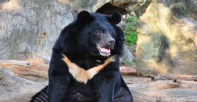
Asiatic Black Bear
Moon-marked climber of Asian forests

Moon-marked climber of Asian forests
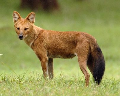
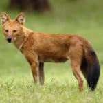
The Whistling Pack Hunter of Asia
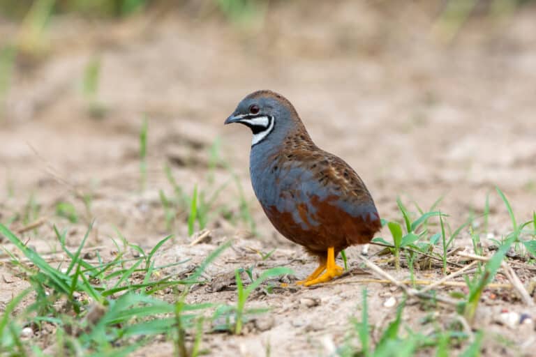
Small quail, big color.
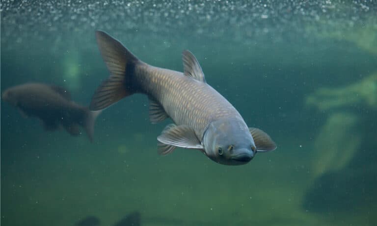
The underwater lawnmower-handle with care

Small moth, giant crop threat.
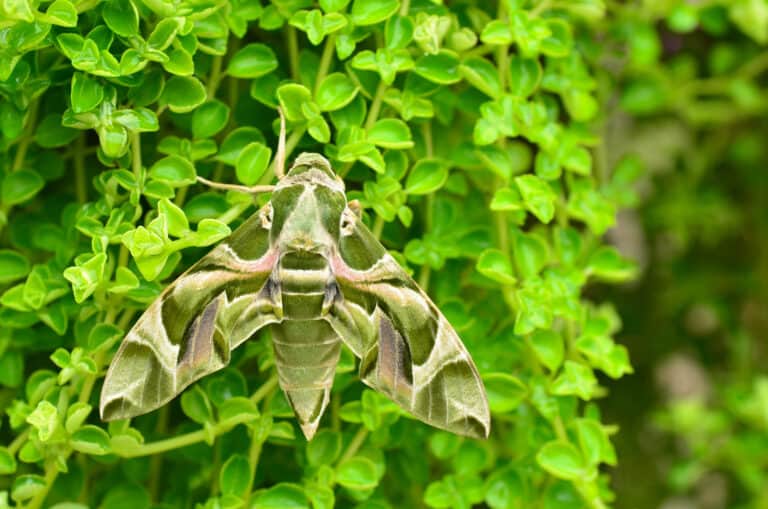
The leaf that flies at dusk

Spotted survivor, aphid devourer
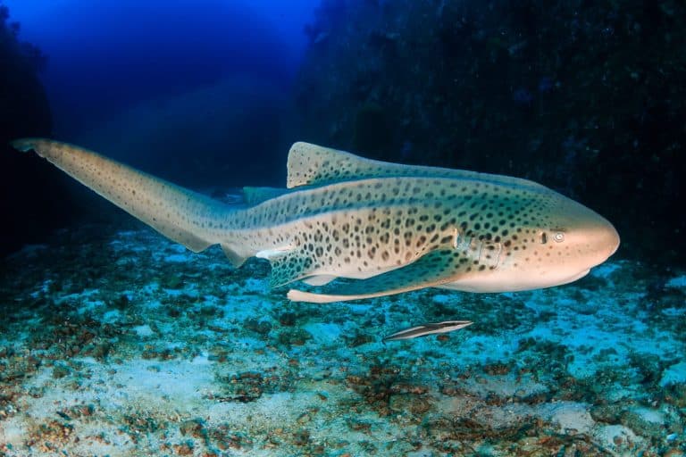
Striped youth, spotted adulthood
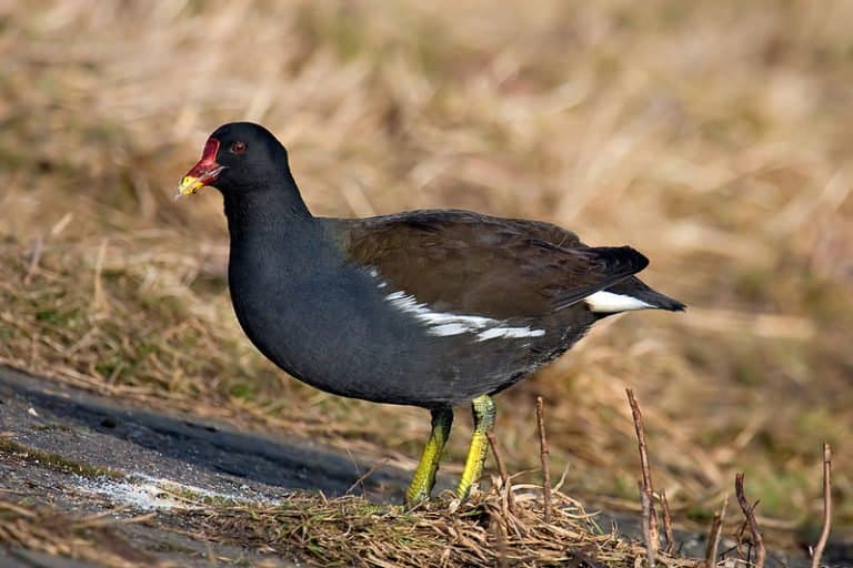
The reed-bed runner on lily pads
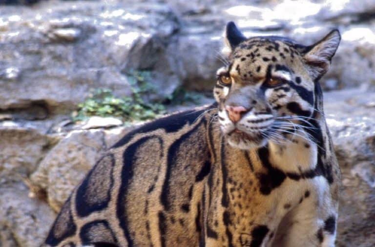
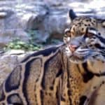
Built for the treetops, cloaked in clouds
Guangxi Zhuang Autonomous Region is wildlife-rich. Its limestone karst towers, deep river valleys, caves, and humid subtropical forests make many kinds of homes close together. Lying between southern China and northern Vietnam, Guangxi acts as an important bridge that helps wildlife move across borders and supports a high mix of temperate and tropical species.
Karst landscapes with rocky peaks, sinkholes, and caves shelter special plants and cave animals, while forested slopes hide mammals and many birds. Rivers, floodplains, and reservoirs add wetland homes for waterbirds, frogs, and reptiles and form travel routes through the mountains. Along the Gulf of Tonkin, coastal wetlands, mudflats, and mangroves feed migratory birds on the East Asian-Australasian Flyway. The close mix of karst, rivers, forests, and coastlines, and being on the border, gives Guangxi a distinct wildlife character.
Guangxi's wildlife is shaped by its humid subtropical climate and varied landforms. Karst limestone hills and caves make broken forest patches and microclimates. River valleys and floodplains give wetlands and riparian corridors. Mountains in the north and west hold intact forests. The Beibu Gulf (Gulf of Tonkin) adds mangroves, estuaries, mudflats and nearshore seas, forming biodiversity refuges and movement corridors.
Sea level (Beibu Gulf coast) to ~2,100 m in northern Guangxi (upland peaks), creating strong habitat and climate gradients
Beibu Gulf (Gulf of Tonkin) coastline with bays, estuaries, tidal flats, and mangrove wetlands; important interface between inland river systems and nearshore marine habitats
Guangxi's protected areas center on China's multi-level nature reserve system and include forest parks and scenic/geoparks plus growing coastal and wetland protections. Main priorities are limestone karst forests on the Vietnam border with key primates, interior subtropical evergreen forests, and Beibu Gulf mangroves, seagrass, estuaries and coral reefs. Many reserves have strict core and buffer zones; parks emphasize recreation.
≈18% of land area under some form of protected designation (estimate varies by definition; strictly protected nature-reserve core zones are a smaller fraction)
One of South China's most important limestone-karst forest reserves, noted for dense primate populations and high karst-adapted biodiversity. Excellent for conservation of cliff/karst forest ecosystems and associated wildlife.
A border-region limestone karst and subtropical forest reserve in Jingxi, Guangxi, best known as the key Chinese site for the Critically Endangered Cao Vit (Tonkin) gibbon, with habitat contiguous with northern Vietnam.
Large, rugged subtropical mountain forest complex near the coast and Vietnam border; valued for relatively continuous evergreen broadleaf forest and wide-ranging mammals and birds.
High-elevation headwater forests and montane streams in northern Guangxi; important for watershed protection and cold, clear habitats that support stream amphibians and forest wildlife.
Karst landscape and subtropical forest protected primarily for its exceptional orchid diversity in western Guangxi.
A major interior mountain block with subtropical forests and elevational gradients; supports regionally important biodiversity and provides connectivity among forested uplands.
Montane forests and stream valleys in northeastern Guangxi; valued for intact evergreen broadleaf habitat and forest bird communities.
A protected montane forest area in Guangxi near Nanning, covering subtropical evergreen broadleaf and cloud-forest habitats and managed for conservation of native forest biodiversity.
Iconic karst-river landscape that doubles as a riparian biodiversity corridor; notable for waterbirds, kingfishers, and otter habitat along quieter stretches and tributaries.
A major mangrove protected area in Guangxi that provides important habitat for migratory waterbirds and serves as a coastal nursery for fish and invertebrates.
Border estuary and mangrove system on the China-Vietnam frontier; important for wintering and passage waterbirds and for protecting estuarine habitat complexity.
Large marine protected area in the Beibu Gulf established to safeguard seagrass ecosystems and historically important dugong habitat; also relevant for coastal cetaceans and sea turtles.
Coral-reef and volcanic-island marine park supporting reef biodiversity and coastal-marine conservation in the northern Beibu Gulf; important for reef fish and occasional sea turtle use.
Guangxi Zhuang Autonomous Region lies where South China meets northern Indochina. Its wildlife comes from big limestone karst (Guilin-Chongzuo), subtropical evergreen forests, major rivers like the Xijiang system, and a rich coast on the Gulf of Tonkin (Beibu Gulf) with mangroves, mudflats, and nearshore waters. This mix supports many kinds of life, including karst specialists (cavefish, limestone-forest primates), forest carnivores, migratory waterbirds, and coastal marine mammals. Conservation value is especially high in the southwestern karst belt near the Vietnam border and in coastal mangrove-mudflat areas.

Guangxi has karst forests, subtropical reserves, wetlands and the Beibu Gulf coast. Bird-rich karst around Guilin–Yangshuo, key wetlands, and the rare Beibu Gulf marine mammals (including the Vulnerable Indo‑Pacific humpback dolphin, Sousa chinensis) are notable. Inland reserves hold primates, deer, civets, reptiles, amphibians and butterflies. Trips mix early birding, forest walks, wetland hides and boat outings.
Peak bird activity: migratory passage and breeding begins; excellent dawn birding in karst forests and wetlands. Amphibians become active after rains (good for herping at night with a guide). Comfortable temperatures, but frequent showers-pack rain gear and leech protection for forest trails.
Lush forests and high insect/butterfly diversity; strong dawn/dusk activity in shaded reserves. Hot and humid with heavier rain; some trails can be slippery and rivers can swell. Coastal conditions can be choppy at times-boat-based dolphin trips are more weather-dependent.
One of the best all-around seasons: clearer skies, cooler hikes, and strong bird migration again (raptors and passerines). Good visibility for coastal wildlife watching on calm days. Forest mammals are more active in cooler evenings; comfortable for multi-day reserve stays.
Best for wintering waterbirds in wetlands and reservoirs; crisp mornings suit long birding sessions. Fewer insects and less rain make forest walks easier, though wildlife can be more dispersed. Coastal trips can still be productive in fair weather, but winds may limit boating days.
Guangxi Zhuang Autonomous Region lies where South China’s subtropical interior meets the Gulf of Tonkin (Beibu Gulf) coast. It has many ecosystems: limestone karst mountains with forests, scrub, cliffs, sinkholes, and caves; evergreen broadleaf forests; river valleys and floodplains fed by the Xijiang (West River); and coastal estuaries, mudflats, and mangroves.
Subtropical evergreen broadleaf and mixed broadleaf forests dominate much of Guangxi's hills and karst mountains; these forests occur as continuous tracts in less-disturbed uplands and as fragmented patches amid agriculture in basins and valleys.
Widespread across most of the interior uplands and karst landscapes; generally the dominant biome by area.
Tropical/subtropical moist broadleaf forests with more tropical floristic influence occur in the far south and southwest (near the Vietnam border and warmer lowlands), including dense evergreen forests and monsoon-influenced stands.
Localized to the warmest southern lowlands and border areas; patchy compared with subtropical forests.
Major river systems (notably the Hongshui, Liu, Yong, and Yu rivers within the Xijiang/West River basin), tributary networks, reservoirs, and karst springs support riverine habitats, riparian corridors, and floodplain waterbodies.
Region-wide along river valleys and basins; concentrated in major watersheds and reservoir zones.
River floodplain wetlands, lakes/reservoir margins, karst depressions with seasonal inundation, and especially coastal/estuarine wetlands (mudflats and mangrove-fringed zones) provide critical habitat for waterbirds and fisheries nurseries.
Scattered inland (floodplains/karst basins) but extensive and ecologically prominent along the coast and estuaries.
Nearshore marine ecosystems of the Beibu Gulf/Gulf of Tonkin include bays, coastal waters, soft-bottom seabeds, and estuarine-influenced marine zones supporting important fisheries and migratory corridors.
Confined to the southern coastline and adjacent nearshore waters.
Evergreen broadleaf and mixed forests across karst hills and mountain ranges; many areas form biodiversity-rich subtropical forest mosaics.
More tropical, dense evergreen forests in the far south/southwest, especially in warm, humid lowlands and protected reserves near the Vietnam border.
Deciduous elements occur mixed within subtropical forests and in secondary stands, often associated with disturbance gradients and seasonal karst slopes.
Higher-elevation conifer stands and conifer-dominated plantations (e.g., pine/fir mixes) occur on some ridges and managed forest lands.
Open-canopy karst woodlands on thin soils over limestone, transitioning into shrub and grass patches on exposed slopes.
Karst shrublands and secondary scrub on rocky hillsides and degraded limestone areas, often forming a patchwork with woodland and cliff vegetation.
Small grassland openings and managed hill grasslands occur on karst plateaus, ridge tops, and around agricultural margins rather than as broad natural plains.
Karst mountain complexes and non-karst uplands create strong elevation/temperature gradients and isolated habitat 'islands' important for endemism.
Extensive limestone cave systems, sinkholes, and underground rivers (notably around Guilin and other karst areas) support specialized cave biota and bat roosts.
Limestone cliffs and tower karst support cliff-adapted plants and nesting/roosting sites; cliffs create sharp microclimates and refugia from land conversion.
Large rivers and tributaries in the Xijiang system provide riparian forests, sand/gravel bars, and migration routes; heavily influences settlement and agriculture corridors.
Natural lakes are limited, but reservoir and lake-like impoundments are common, creating still-water habitats and wetland margins.
Floodplain wetlands, karst basin wetlands with seasonal water levels, and wetland complexes around reservoirs; important for waterbirds and nutrient cycling.
Marshes occur along slow river reaches, reservoir edges, and lowland basins, with emergent vegetation and seasonal inundation.
Mangrove forests in protected coastal bays and estuaries along the Beibu Gulf function as fish nurseries and buffers against storm surges.
Estuarine zones where rivers meet the Beibu Gulf include brackish channels, mudflats, and mangrove fringes with high productivity.
Coastal plains, bays, and tidal flats along the southern margin include mixed shoreline types and intensive human use alongside key wetland habitats.
Sandy beach segments occur in parts of the Beibu Gulf coastline, interspersed with mudflats and engineered shorelines.
Rocky headlands and mixed sediment shores occur locally, providing intertidal habitats distinct from mangrove/mudflat systems.
Predominantly soft-bottom nearshore seabeds in the Beibu Gulf support benthic invertebrates and demersal fish communities.
River valleys and basins support intensive agriculture (including rice and other crops), creating a matrix that fragments lowland forests but also supports some wetland-associated biodiversity.
Commercial forestry plantations (often conifers and fast-growing broadleaf species) are common in managed landscapes, replacing or buffering natural forest patches.
Urban centers (e.g., Nanning, Guilin, Liuzhou, Beihai) concentrate development along river corridors and basins, influencing adjacent riparian and karst habitats.
White-headed langurs are cliff specialists: they routinely climb near-vertical karst walls and use caves as sleeping sites. It's a monkey that behaves more like a mountain goat-because in Guangxi's karst, caves are safe refuges from weather and predators.
Guangxi's karst underground rivers host cavefish with dramatic "darkness adaptations" (reduced eyes, loss of pigment), and in the broader South China karst region some relatives even develop odd cranial bumps/horns-evolution's response to life in perpetual night.
Indo-Pacific humpback dolphins ("Chinese white dolphins," Sousa chinensis) use Guangxi's turbid estuaries and nearshore waters; their famous pink color comes largely from blood vessels near the skin (thermoregulation), not from a pink pigment.
Beibu Gulf mangroves and tidal flats in Guangxi double as nurseries for marine life and as spawning habitat for ancient horseshoe crabs (e.g., Tachypleus tridentatus). These animals are closer to spiders than to crabs-and their lineage predates dinosaurs.
Guangxi's giant sinkhole landscapes (notably in the Leye-Fengshan karst) create deep, sheltered cold-air basins that can trap moisture and maintain relict forest microclimates-so you can find pockets of subtropical biodiversity tucked inside sheer-walled limestone pits.
Guangxi contains essentially the entire wild range of the white-headed langur (Trachypithecus leucocephalus)-a primate found naturally only in the limestone karst around Chongzuo (notably the Chongzuo White-headed Langur National Nature Reserve). In global terms, Guangxi is the species' whole "map."
Guangxi has China's only wild Cao Vit (eastern black-crested) gibbon (Nomascus nasutus), one of the world's rarest apes. It lives in one karst forest around Jingxi and northern Vietnam; Guangxi is one of two places you can hear its song.
The Beibu Gulf coast of Guangxi lay near the northern edge of the dugong's historical range in China. Globally in the western Pacific/Asia, dugongs historically ranged farther north (for example, to the Ryukyu Islands of Japan).
Weizhou Island (off Beihai, Guangxi) supports reef-building corals at the northern end of typical South China Sea coral distribution-making it one of China's most northerly coral-reef ecosystems and a high-latitude stronghold for tropical reef wildlife.
Guangxi's limestone-karst cave systems produce "micro-endemism" at an extreme: some cave-adapted animals (notably cavefish and cave invertebrates) are restricted to single caves or single underground river systems-so one cave can represent an entire global range for a vertebrate population.
47 species documented in our encyclopedia
Thank you for reading! Have some feedback for us?
We appreciate your help in improving our content.
Our editorial team will review your suggestions and make any necessary updates.
There was an error submitting your feedback. Please try again.