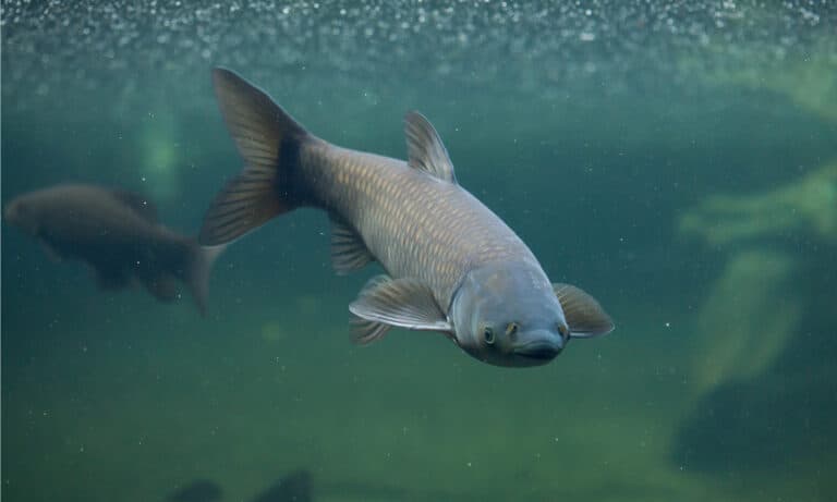
Grass Carp
The underwater lawnmower-handle with care

The underwater lawnmower-handle with care
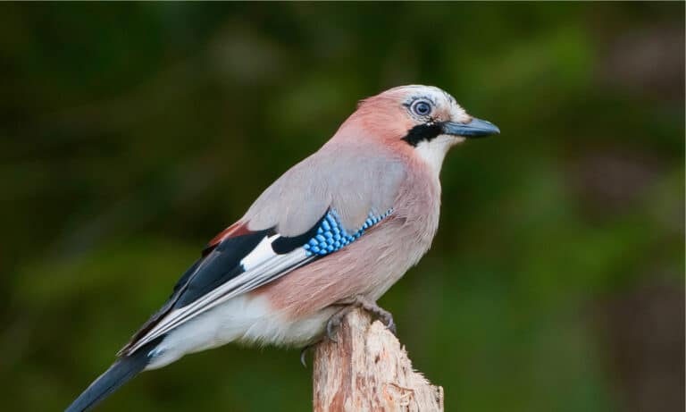
Oak Forest Planter with a Blue Flash
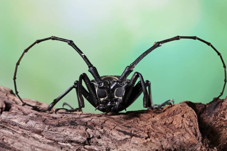
Spot it early. Save the hardwoods.
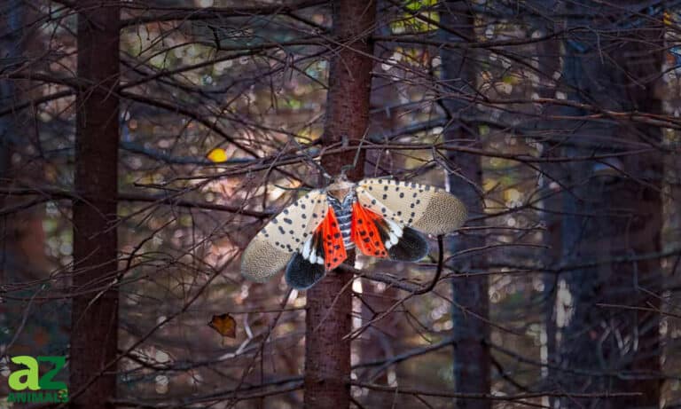
Not a fly-spot the planthopper
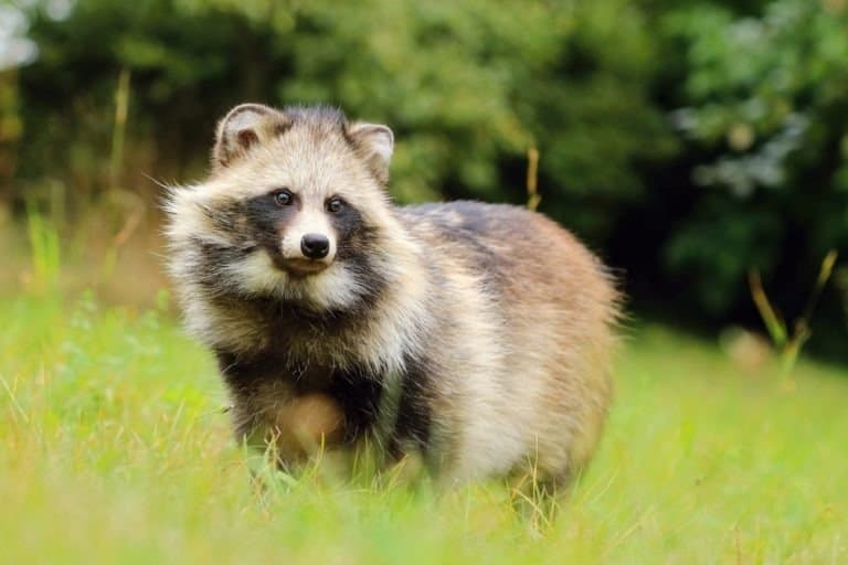
Masked canid, master of winter torpor
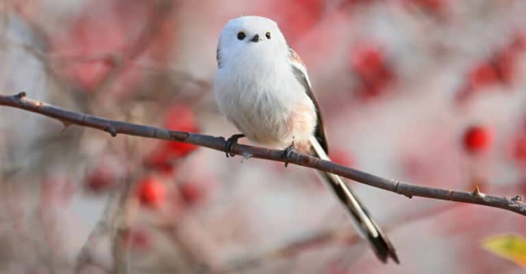
Long tail, tight flock, big personality
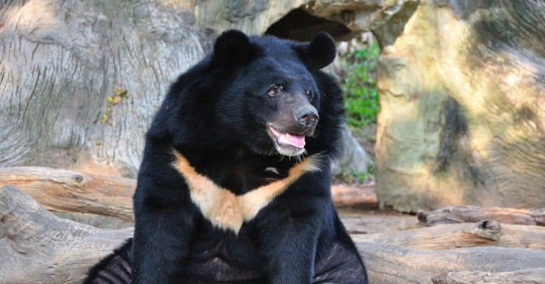
Moon-marked climber of Asian forests
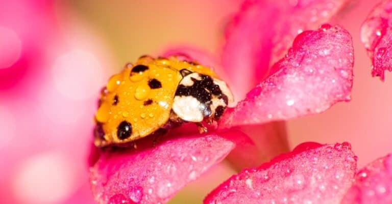
Spotted survivor, aphid devourer
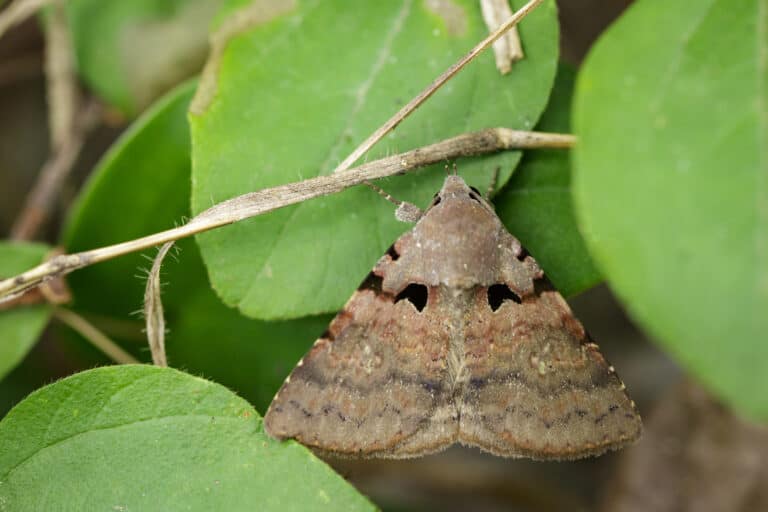
Big appetite. Big forest impact.
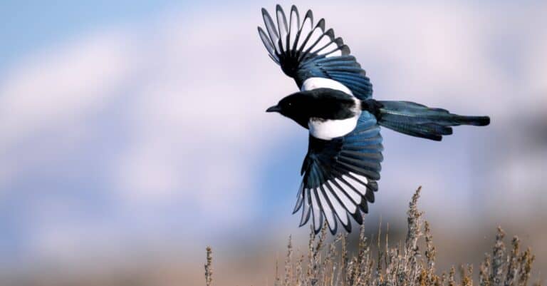
Brains, boldness, and a brilliant tail
Tianjin's wildlife is shaped by water: the Hai River system spreads across a low coastal plain and meets the Bohai Sea in reedbeds, ponds, saltmarsh, and tidal mudflats. Even as an industrial and shipping center, Tianjin keeps strong wetland areas where seasonal changes in fresh and brackish water gather fish, invertebrates, and birds. Key habitats are the Hai River delta and estuary, coastal reed marshes and fish farms, and wide intertidal flats on Bohai Bay. These places are important feeding and resting stops on the East Asian-Australasian Flyway: shorebirds probe mud for worms and shellfish, while cranes, storks, and geese use reed-lined lagoons and managed wetlands to refuel during migration. River corridors and city green spaces form blue-green networks that support rich birdlife near built-up areas. You can move quickly from city to major wetland bird concentrations, where nature mixes with ports, seawalls, fishponds, and restored marshes.
Tianjin's wildlife shows a strong north–south split. Low delta and coastal wetlands along the Bohai Sea and Hai River support migratory waterbirds, fish, and amphibians. The northern Yanshan foothills provide upland forest and shrub for land and mountain species. Cities, ports, industry, and intense farming break up habitats, so remaining wetlands, rivers, reservoirs, and protected areas are vital.
Sea level to ~1,078 m (Yanshan foothills in northern Tianjin, around Jiuding Peak area)
Bohai Sea (Bohai Bay) coastline with extensive tidal flats and coastal wetlands; roughly ~150 km of shoreline (commonly cited ~153 km) around the Binhai coastal zone
Tianjin's protected areas are mainly coastal estuarine wetlands on the Bohai Sea, vital for East Asian-Australasian Flyway migrants, plus a smaller forest block in the Yanshan foothills near Jizhou (Ji County). Protection uses national/provincial nature reserves, wetland and forest parks, scenic areas, and “ecological redline” zones restricting reedbeds, mudflats, reservoirs, and mountain forests.
≈6-10% of Tianjin's land area (rough estimate; depends on whether ecological redline zones and overlapping designations are counted).
The municipality's flagship coastal wetland reserve protecting reed marshes, saltmarsh, shallow lagoons/reservoir wetlands, and remaining natural shoreline features-an important stopover and wintering area for migratory waterbirds on the Bohai Rim.
Open-water, mudflat, and reedbed wetland habitats that support large concentrations of migratory waterbirds (ducks, geese, grebes, and shorebirds) and are a well-known birdwatching and conservation site in Tianjin.
A reed-marsh and shallow-water wetland on the Hai River delta plain that supports breeding reedland birds and serves as a migration staging site for swans, geese, and shorebirds; notable for reedbed biodiversity close to the city's agricultural landscape.
Forested mountainous reserve in northern Tianjin (Jizhou) protecting North China temperate broadleaf/mixed forests and headwater habitats; important for woodland mammals and raptors, and a key "green core" in an otherwise heavily urban/industrial municipality.
Forested mountain and scenic area around Mount Pan in Jizhou District, Tianjin. It protects warm-temperate forest habitat and associated wildlife typical of northern China's wooded hills.
A lake-and-marsh complex used by migratory waterfowl and herons; provides feeding and roosting habitat in the central-southern part of Tianjin where natural wetlands are otherwise fragmented.
Mountain scenic area centered on Jiushan Peak (Jiushanding), which is the highest point in Tianjin (about 1,078.5 m). The area is characterized by upland forests and ridge terrain in the Yanshan foothills.
While best known culturally, the surrounding valleys and mixed forests can hold notable woodland birdlife and act as a corridor between northern Tianjin forest patches, especially where development is limited on steep terrain.
A protected wetland in Tianjin (Binhai New Area) recognized internationally for supporting large numbers of migratory waterbirds on the East Asian-Australasian Flyway, including threatened species.
A protected coastal wetland complex in Tianjin that provides key habitat for migratory and wintering waterbirds along the East Asian-Australasian Flyway, with reedbeds, open water, and shallow marshes supporting large bird concentrations.
A large coastal wetland complex (reedbeds, open water, saltmarsh, and tidal-flat habitats) in Tianjin that supports major concentrations of migratory waterbirds along the East Asian-Australasian Flyway and is managed to conserve wetland habitats and reduce disturbance to birds.
Tianjin's wildlife experience is defined by the Bohai Sea coast, the Hai River delta, and large complexes of reedbeds, saltmarsh, mudflats, reservoirs, and aquaculture ponds. As a key stop on the East Asian-Australasian Flyway, it is especially rich in migratory and wintering waterbirds (cranes, storks, swans, shorebirds, gulls). Terrestrial biodiversity is more modest on the heavily urbanized plain, but increases in the low Yanshan foothills of Jizhou District. Coastal/estuarine waters add marine mammals and a mix of marine and freshwater fishes.
Tianjin’s best wildlife viewing is at coastal wetlands and mudflats on the Bohai Sea (especially Binhai New Area), the Hai River corridor, reedbeds, reservoirs, and nearby farmland. On the East Asian-Australasian Flyway, migration in spring and autumn brings shorebirds, waterfowl, and raptors. Visit at dawn/dusk and tide changes for birding, river walks, wetland photography, and seasonal raptor watching.
Peak northbound migration. Look for large movements of shorebirds on mudflats, mixed flocks of egrets and herons in reedbeds, and passage raptors overhead. Early spring can still be windy and cool; plan layered clothing and target calm mornings.
Breeding season for some local wetland birds (reedbed specialists and common waterbirds), plus dragonflies and other wetland insects. Heat/humidity can be high; haze may reduce long-distance visibility. Best for short dawn outings, boardwalk walks, and photography in softer light.
Peak southbound migration-often the most reliable season for diverse shorebirds and large waterbird gatherings. Cooler, clearer days improve viewing. Time visits to tidal cycles to watch feeding on exposed flats and concentrated roosts when the tide rises.
Overwintering waterfowl and coastal birds, plus occasional raptor action in open country. Conditions can be cold and windy; some water edges may freeze. Great for scanning sheltered bays, river stretches, and reservoirs for ducks, geese, and gulls.
Tianjin sits on the low North China Plain at the Hai River delta on Bohai Bay. River-delta processes (sediment, salinity gradients, tides) and heavy human land change shape ecosystems. Most wildlife is in coastal saltmarshes, lagoons, river corridors, reservoirs/ponds and nearshore Bohai Sea waters. Inland areas are mostly urban/industrial or farm land with small woodland patches.
Historically a temperate plain mosaic of grassland/steppe-like communities and open woodlands on the North China Plain; today largely converted to cropland and built-up land with grassland elements persisting in field margins, embankments, and managed greenspaces.
Historically widespread across the interior plain; now mostly replaced-natural/semi-natural patches are limited and fragmented.
Temperate broadleaf and mixed forest elements persist mainly as small remnant stands, planted shelterbelts, riparian groves, and managed urban/peri-urban woodlands rather than large continuous forests.
Low; scattered and highly fragmented, most common in peri-urban parks, shelterbelts, and riparian strips.
Hai River system channels, regulated waterways, reservoirs, and extensive ponds/aquaculture create a dense freshwater-brackish network important for fish, amphibians, and migratory birds (especially where water quality and reedbeds persist).
Common as a network across the municipality (rivers/canals/ponds), but natural freshwater habitat quality varies widely.
Coastal and delta wetlands (saltmarsh, reedbeds, brackish lagoons, tidal flats) at Bohai Bay and the Hai River mouth support migratory birds on the East Asian-Australasian Flyway, including protected Beidagang and Qilihai.
Regionally significant but spatially limited; concentrated in Binhai New Area coast and deltaic lowlands.
Shallow, turbid nearshore marine environment of Bohai Bay with soft-sediment seabed, estuarine mixing, and productive coastal fisheries; influenced by heavy shipping/port activity and coastal engineering.
Along Tianjin's Bohai Bay coastline and adjacent nearshore waters; marine area is limited to the coastal fringe of the municipality.
Dense urban and industrial landscapes (central Tianjin and port/industrial zones) with engineered waterways, parks, and brownfield mosaics; strong heat-island and pollution pressures.
Expanding peri-urban belt with mixed residential, light industry, canals, and planted greenbelts; often transitional with agriculture and aquaculture.
Intensive cropland on the North China Plain (wheat-maize rotation common) with drainage/irrigation canals; biodiversity mainly in margins, shelterbelts, and drainage ditches.
Mostly planted or managed tree cover (shelterbelts, parks, roadside plantings) rather than extensive natural forest.
Remnant temperate broadleaf stands and riparian groves; often secondary or planted and fragmented.
Scattered small woodlots, windbreaks, and mixed tree belts across agricultural/urban matrices.
Limited semi-natural grass cover on embankments, fallow patches, and coastal levees; more commonly managed turf/green space.
Hai River and associated regulated channels/canals; important corridors but often engineered with variable habitat complexity and water quality.
Primarily reservoirs and managed lakes used for water storage, recreation, and flood control; natural lakes are limited.
Widespread aquaculture ponds and small impoundments in lowlands; key for some waterbirds but highly managed.
Reedbeds, brackish lagoons, and deltaic wetland mosaics (notably in coastal lowlands and protected wetland areas).
Coastal saltmarsh and freshwater/brackish marshes with reeds and sedges; critical bird habitat where hydrology is maintained.
Hai River estuarine zone with strong salinity gradients and sediment dynamics; influenced by dredging and port infrastructure.
Bohai Bay shoreline including engineered seawalls, reclaimed land edges, and remaining natural coastal wetland fringes.
Limited natural sandy stretches; many shore segments are modified or armored.
Nearshore Bohai Bay waters (shallow, semi-enclosed, high turbidity) rather than true open-ocean conditions.
Soft-sediment (mud/silt) benthic habitats in Bohai Bay supporting invertebrate communities and demersal fish; impacted by trawling, eutrophication, and contaminants.
Tianjin's busiest industrial coastline can still function like a migration "gas station": shorebirds often feed not only on natural mudflats but also in human-made habitats (salt pans, aquaculture ponds, and drainage lagoons) that concentrate small prey.
Birdwatching season in Tianjin can peak in winter: the Bohai Sea's coastal edge may ice up, but ice-free channels, reservoirs, and managed ponds in places like Beidagang can pack in swans, geese, and ducks when inland waters elsewhere freeze solid.
For many long-distance migrants, Tianjin is not a destination-it's a timed pit stop. Some sandpipers and knots arrive underweight from the south, then rapidly add fat on Bohai Bay's mudflat buffet before making the next nonstop flight north.
Reedbeds around the Hai River delta aren't just scenery: they create "invisible architecture" for wildlife-dense cover for roosting birds and nesting waterfowl-while also buffering storm surges along a low-lying coast.
Tianjin's coastal wetlands sit on a working delta: the same sediment dynamics that built the Hai River-Bohai shoreline also continually reshape feeding areas, so a productive bird flat in one year can shift noticeably after storms, dredging, or river-flow changes.
Beidagang Wetland Nature Reserve in Tianjin's Binhai New Area is Tianjin's largest protected wetland-about 35,000 hectares (~350 km²) of reed marsh, open water, and ponds-making it the municipality's biggest refuge for migratory birds on the Hai River delta.
The Bohai Bay intertidal flats on Tianjin's Binhai coast are a key spring refueling stop on the East Asian-Australasian Flyway, with tens of thousands of Red Knot and other Arctic-breeding sandpipers passing in a short time.
Beidagang is documented as a major wintering site for the endangered Oriental Stork (Ciconia boyciana); winter counts reported by local monitoring have exceeded 1,000 individuals in some years-one of the largest single-site gatherings in northern China.
Qilihai Wetland (Ninghe District) is the largest freshwater marsh/wetland complex in Tianjin, a key "inland" complement to the coastal mudflats by supporting large flocks of swans, geese, and ducks during migration and winter.
11 species documented in our encyclopedia
Thank you for reading! Have some feedback for us?
We appreciate your help in improving our content.
Our editorial team will review your suggestions and make any necessary updates.
There was an error submitting your feedback. Please try again.