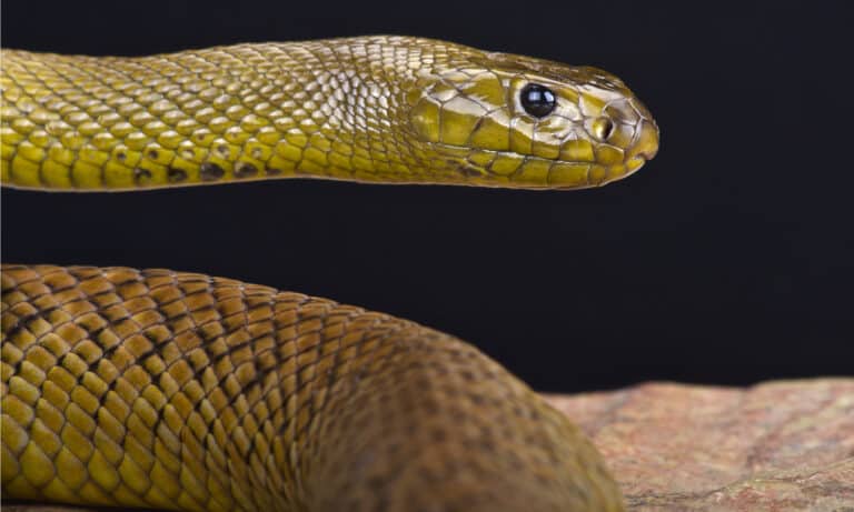
Fierce Snake
Fierce snake: desert taipan legend

Fierce snake: desert taipan legend
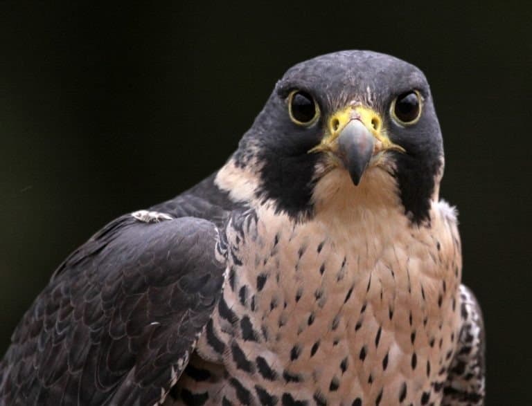
Built for the stoop.
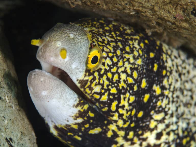
Spotted night hunter of the reef cracks
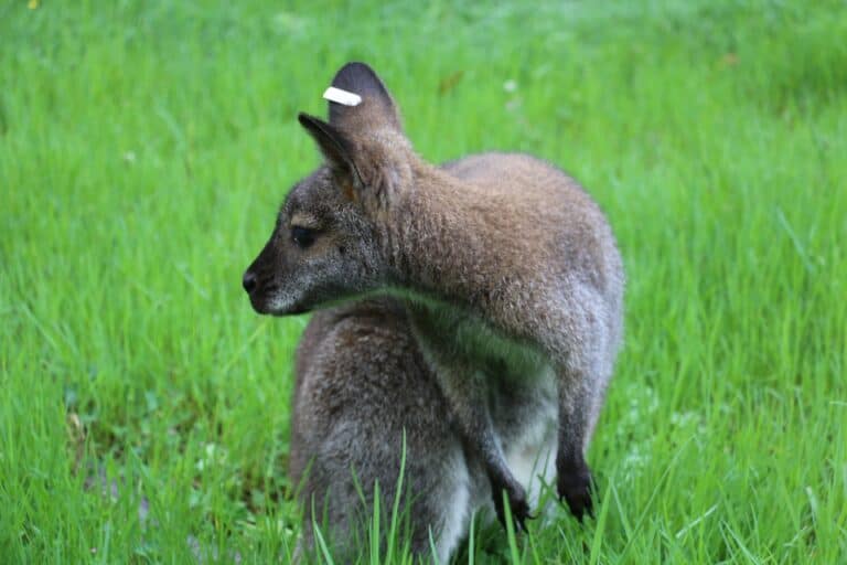
Small wallaby, big cliff skills.
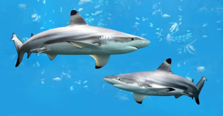
Black-tipped fins, built for speed.
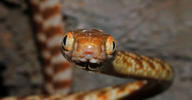
Guam's unwelcome night hunter
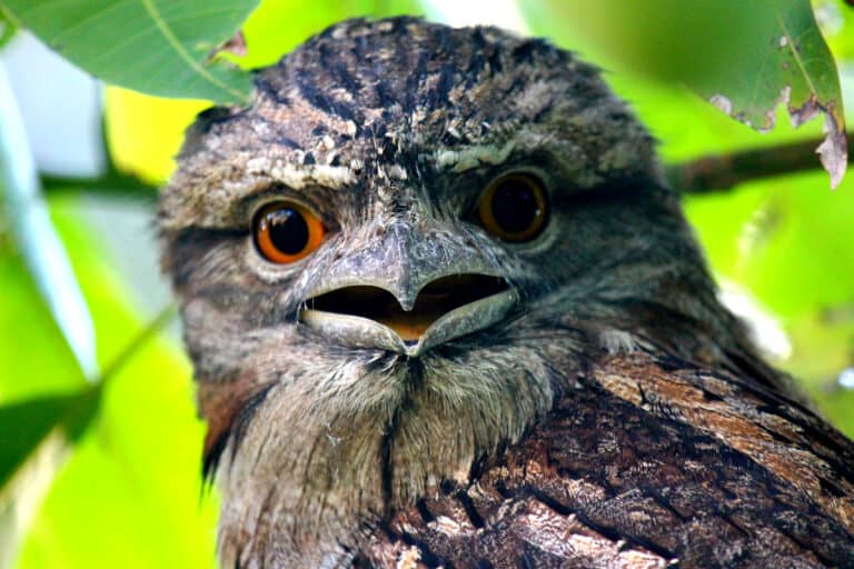
The broken-branch bird of the night
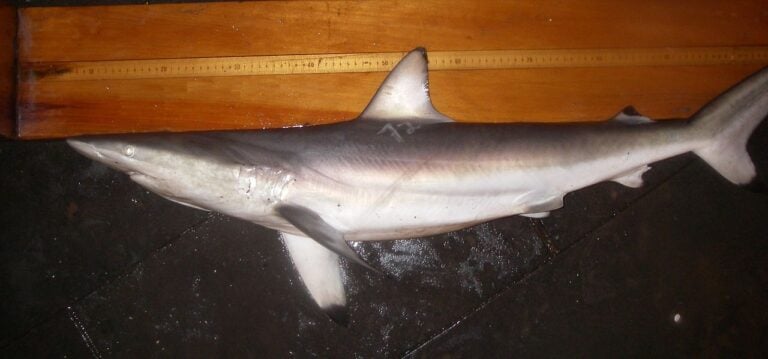
Spin, surge, strike-coastal hunter
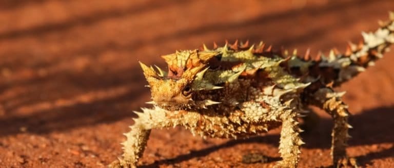
The ant-eating, water-wicking lizard
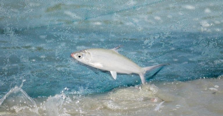
Milkfish: silver strength of the tropics
Australia's Northern Territory is a wildlife super-region with two very different parts: the tropical Top End in the north and the arid Red Centre in the south. Much of the Territory is sparsely populated and protected by national parks and large Indigenous-managed lands, which help keep key natural cycles: seasonal flooding, fire-driven savanna renewal, and desert boom-and-bust cycles. In the Top End, monsoonal savannas, paperbark swamps, floodplains and big rivers (like those around Kakadu) support many birds, large reptiles and rich freshwater life. Saltwater crocodiles rule estuaries and tidal rivers, and wetlands become fish nurseries that attract waterbirds in the wet season. Farther south, spinifex grasslands, mulga woodlands and rugged ranges near Alice Springs host desert specialists, iconic macropods and nocturnal reptiles. Indigenous stewardship and traditional burning create a distinctive ecological mosaic and up-close wildlife encounters.
Northern Territory has two main zones: the tropical Top End in the north and the arid, semi-arid interior in the south. Large shifts in rain and temperature, from monsoon coasts and floodplains to desert dunes and rocky ranges, create habitats like mangroves, wetlands, savanna woodlands and spinifex grasslands, shaping where species live, move, and find water.
Sea level to ~1,531 m (Mt Zeil, West MacDonnell Ranges)
Coastline on the Timor Sea (north) and Gulf of Carpentaria (east), with extensive estuaries, mangroves, tidal flats, and nearshore islands/reefs influencing coastal and marine-linked wildlife
Designated 1961
Northern Territory’s protected areas cover tropical wetlands and savannas in the Top End to the arid MacDonnell Ranges and central deserts. It includes Territory parks and reserves, Commonwealth national parks (Kakadu, Uluru-Kata Tjuta), large Indigenous Protected Areas (IPAs) managed by Traditional Owners, and Ramsar wetlands. Joint Aboriginal ranger management focuses on waterbirds, threatened mammals and savanna fire control.
Approximately ~20-25% of the Northern Territory's land area is under some form of protected-area management (Territory reserves + Commonwealth parks + Indigenous Protected Areas; figures vary by definition and tenure).
Australia's premier tropical wetland-and-escarpment landscape, globally important for waterbirds and floodplain ecology, with exceptional crocodile habitat and one of the richest concentrations of biodiversity in the Top End.
Iconic arid-zone ecosystems where spinifex plains, dune fields, and rocky refuges support desert-adapted reptiles and mammals; also a key landscape for threatened species reintroductions and predator management.
Top End woodland, sandstone outcrops, and spring-fed creek systems near Darwin-excellent for accessible wildlife viewing (birds, bats, and reptiles) and seasonal wet-season ecology.
A major river-gorge system with rugged sandstone escarpments and monsoon forest pockets, important for raptors, rock-wallabies, and freshwater river fauna; strong Aboriginal co-management and fire management.
Central Australian range country with waterhole refuges that concentrate wildlife; notable for arid-zone birds, macropods, and rock-dependent species.
One of the Territory's largest savanna parks, spanning the Victoria River system and rugged ranges-important for tropical savanna mammals, finches, and riverine biodiversity, with large intact habitats supporting broad-scale conservation.
A classic Top End wetland famed for dry-season wildlife concentrations and close-range viewing of large waterbirds and crocodiles along floodplain edges.
Urban-proximate wetland complex in Darwin that supports significant waterbird assemblages, especially in the late dry season as water contracts.
Coastal dunes, mangroves, and nearshore waters used by migratory shorebirds and marine fauna; also important for coastal habitat protection adjacent to Darwin.
Small but biodiverse spring-fed rainforest/monsoon-forest pocket that attracts birds and flying-foxes; valuable as a freshwater refuge in the Top End landscape.
Vast sandstone plateau and escarpment country with globally significant rock-art landscapes and high conservation value; supports threatened mammals and specialised escarpment birds, managed through Indigenous ranger programs and strategic fire regimes.
Coastal and island habitats (beaches, reefs, monsoon vine thickets) important for marine turtles, dugongs, and shorebirds; strong focus on coastal stewardship and visitor management.
Large coastal floodplains, rivers, and savannas supporting crocodiles, threatened fish and freshwater fauna, and important raptor populations; ranger-led monitoring and invasive-species control are key management tools.
Arid desert ecosystems and dune fields managed for threatened desert mammals and large-scale feral predator control; important refuge habitat for species sensitive to altered fire regimes and introduced predators.
Northern Territory wildlife covers two very different areas: the tropical "Top End" — savannas, monsoon forests, floodplains, mangroves and big rivers (Daly, Alligator) — and the dry Red Centre — spinifex deserts, rocky ranges and river red gum corridors. This north–south span gives many reptiles, wetlands important worldwide full of waterbirds, desert megafauna like kangaroos and dingoes, and ancient lineages such as crocodiles, sawfish and pig-nosed turtles. Large parks (Kakadu, Nitmiluk, Uluru-Kata Tjuta, West MacDonnell) and Indigenous-managed lands protect this wildlife.

Northern Territory wildlife ranges from the Top End's floodplains, mangroves, monsoon forests and coastal waters near Darwin and Kakadu to the Red Centre desert by Alice Springs. Expect big reptiles (saltwater crocodiles, goannas), many waterbirds in the wet season, wallabies, dingoes and night animals (possums, gliders, owls). Plan by season, road access and guided trips.
Easier travel on unsealed roads; clear days and cooler nights. Reliable wildlife in water refuges: crocodiles basking, large congregations of waterbirds at shrinking wetlands, and excellent walking conditions for spotting rock-wallabies, dingoes (rare but possible), and birds. Best time for Kakadu, Litchfield, Nitmiluk walking and 4WD touring; also strong for desert wildlife around Alice Springs due to crisp mornings/evenings.
Humidity rises; thunderstorms begin. Wildlife activity can lift just before storms (bird movement, raptors). Crocodiles still active; photography can be spectacular with storm light. Some tours reduce frequency due to heat-prioritize dawn/dusk cruises and shaded habitats.
Lush landscapes, breeding season for many birds and amphibians; huge numbers of waterbirds spread across flooded plains. Some roads/tracks close and certain areas become boat/air-access only. This is prime time for scenic flights over Kakadu's inundated wetlands and for experiencing waterfalls in full flow (where accessible). Expect more insects; plan for rain and flexible itineraries.
Around Alice Springs/West MacDonnell ranges, these months balance temperature and activity: dawn/dusk drives and walks can yield euros (wallaroos), red kangaroos, perentie goannas, thorny devils (seasonal/variable), and a rich array of arid-zone birds. After rain, wildflowers and reptile activity can increase (conditions-dependent).
Northern Territory has a big north-to-south climate difference. The Top End is monsoonal tropical with savannas, floodplains, mangroves and nearshore seas. Inland around Alice Springs are vast arid and semi-arid deserts and shrublands. Wildlife and plants depend on large rivers, seasonally flooded wetlands like Kakadu, Indigenous-managed lands, protected areas, and cycles of fire and monsoon.
Dominant Top End biome of eucalypt open forests and grassy understoreys (notably speargrass), strongly influenced by monsoonal wet/dry seasons and frequent fire; includes savanna woodlands across Arnhem Land, Kakadu surrounds, Daly/Victoria basins and Gulf country.
Widespread across the northern portion (Top End and Gulf regions); one of the major biomes, but most of the territory by area is arid and semi-arid.
Monsoon forests/woodlands and vine thickets occurring as patches within the savanna matrix (e.g., fire-sheltered sites, coastal fringes, and along rivers), plus denser eucalypt woodlands on more fertile or moister substrates.
Patchy and localized in the Top End, especially in fire-protected pockets, riparian corridors, and some coastal/near-coastal areas.
Small, species-rich monsoon rainforest pockets (often called 'monsoon vine forests') in sheltered gullies, sandstone escarpments, islands (e.g., Tiwi), and perennial riparian zones; not extensive but ecologically important refugia.
Very limited and fragmented, mostly in the far north and in protected microclimates (escarpments, gorges, islands).
Arid interior deserts and semi-deserts with dune fields, stony plains, spinifex grasslands, mulga and other acacia shrublands/woodlands; productivity is episodic following rainfall pulses.
Extensive across the central and southern NT (Tanami and Simpson deserts and adjacent arid zones).
Tropical rivers with big wet season flows and dry season refuges like waterholes and springs, including Daly, Victoria, Roper, McArthur and Katherine catchments, plus inland lakes (Lake Woods) and desert waterholes.
Occurs as linear networks and scattered waterbodies territory-wide; densest in the Top End river catchments.
Monsoonal floodplains, billabongs, paperbark swamps, and seasonally inundated grass/sedge plains (iconic in Kakadu and along the Mary/Adelaide/Alligator rivers), plus coastal saline wetlands and tidal flats; highly dynamic with wet-dry cycles.
Concentrated in the Top End lowlands and major floodplains; smaller but important occurrences around inland drainage lines and claypans.
Nearshore tropical seas and coastal waters of the Timor and Arafura seas and the Gulf of Carpentaria, supporting seagrass meadows, soft-sediment seabeds, reefs/shoals, and productive estuaries; strong tidal regimes and riverine inputs shape coastal ecology.
Along the entire northern coastline (Darwin/Van Diemen Gulf, Arnhem coast, and Gulf of Carpentaria shores).
Eucalypt savanna landscapes with seasonal grasses and frequent fire regimes across the Top End (e.g., Kakadu surrounds, Arnhem Land, Daly Basin).
Open eucalypt and acacia woodlands, including tropical eucalypt woodlands in the north and mulga-dominated woodlands in arid interior areas.
Northern floodplain grass/sedge communities in the wet season and inland pastoral grasslands (e.g., Barkly Tableland/'Mitchell grass' areas) where soils are suitable.
Arid and semi-arid shrublands (often acacia and other drought-adapted shrubs) across central NT, frequently intergrading with spinifex communities.
Dune fields, stony deserts, and sandplains (notably Tanami and Simpson) with spinifex and sparse shrubs; water availability is highly episodic.
Denser tropical eucalypt forests/woodlands and monsoon forest patches on moister or more fertile sites, including parts of the Tiwi Islands and sheltered mainland pockets.
Small monsoon rainforest (vine forest) refuges in fire-protected gullies, gorges, and coastal/island sites; high local plant diversity despite tiny extent.
Large tropical rivers (Daly, Victoria, Roper, Katherine, McArthur) with riparian corridors, deep dry-season pools, and important fish and waterbird habitats.
Seasonal and semi-permanent inland lakes and basins such as Lake Woods and other claypan systems that boom after rains and contract to refuges in the dry.
Extensive floodplains, billabongs, paperbark wetlands, and seasonally inundated plains-globally significant in areas like Kakadu.
Paperbark (Melaleuca) swamps and freshwater swamp forests in low-lying Top End areas that retain water longer into the dry season.
Sedge- and grass-dominated marshes on floodplains and around billabongs, with strong seasonal expansion/contraction.
Mangrove forests fringing estuaries and sheltered coasts (e.g., around Darwin Harbour/Van Diemen Gulf and Gulf of Carpentaria inlets), key nursery habitat for fish and crustaceans.
Highly tidal estuaries and river mouths supporting mangroves, mudflats, and seagrass; ecologically important transition zones along the northern coast.
Northern coastline with tidal flats, coastal floodplains, headlands, and offshore islands (including Tiwi and parts of Arnhem Land coast).
Sandy shorelines along the Timor/Arafura/Gulf coasts, important for coastal processes and fauna (including nesting in some areas).
Rocky headlands, sandstone and lateritic coastal outcrops, and island shorelines, especially around parts of Arnhem Land and offshore islands.
Localized reef and reef-associated communities on offshore banks/shoals and some island areas in NT waters (less continuous than the Great Barrier Reef but still significant).
Predominantly soft-sediment tropical shelf habitats in the Arafura/Timor seas and Gulf of Carpentaria, influenced by tides and river sediment inputs.
Offshore waters beyond the immediate coast used by migratory megafauna and pelagic fisheries, especially north of Arnhem Land and across the Timor/Arafura seas.
Karst and limestone cave systems (notably in parts of the Katherine region) providing roosts and specialized subterranean habitats.
Sandstone escarpments and gorge walls (e.g., Arnhem Land Plateau/Kakadu escarpments and central ranges) with cliff-line refugia and endemic-rich niches.
Rugged uplands and ranges (e.g., MacDonnell Ranges, Arnhem Land Plateau) creating cooler, wetter microhabitats and complex topography.
Urban ecosystems around Darwin/Palmerston and Alice Springs, including modified coastlines, urban wetlands, and heat/drought-adapted urban biota.
Pastoral rangelands dominate much of the NT; smaller areas of irrigated and horticultural agriculture occur mainly in the Top End and along riverine/alluvial soils.
Saltwater crocodiles aren't just coastal: in the NT they regularly turn up far inland in freshwater reaches (including popular swimming-country upstream), because they can move between river systems during floods and tolerate long periods in fresh water.
Australia's only truly carnivorous bat-the ghost bat-hunts in parts of the Top End (including sandstone country). It can take prey as large as small birds and other bats, not just insects.
Central Australia's "water-holding" desert frogs (Cyclorana spp.) can survive drought by burrowing and sealing themselves in a cocoon, dramatically slowing their metabolism; individuals have been reported emerging after years underground when rains return.
The thorny devil (common in the NT's arid interior) can "drink through its skin": rain or dew is wicked along microscopic grooves between its scales and funneled to the mouth by capillary action.
Some of the Territory's most conspicuous wildlife is seasonal: the dramatic "build-up" and wet season can switch landscapes from dusty savanna to mosquito-rich wetlands almost overnight-triggering sudden booms of frogs, insects, and the predators that follow (from herons to reptiles).
The Northern Territory is Australia's main stronghold for saltwater crocodiles: after full legal protection in 1971, the Top End now holds the country's largest wild population, with major rivers like the Adelaide and Mary among the best-known crocodile hotspots.
Kakadu National Park is one of Australia's richest single landscapes for birds, with more than 280 recorded species-an exceptionally high total for one protected area.
The Top End's floodplains (notably Kakadu and the Mary River system) host some of Australia's largest seasonal waterbird gatherings; in good wet seasons, magpie geese and other waterbirds can build into flocks of hundreds of thousands on the same wetlands.
Litchfield National Park's "cathedral" termite mounds can reach around 4 metres tall-among the tallest termite-built structures you can reliably see from a walking track anywhere in Australia.
The Northern Territory supports Australia's largest wild population of water buffalo (a feral species), concentrated in the Top End's floodplains and paperbark swamps.
79 species documented in our encyclopedia
Thank you for reading! Have some feedback for us?
We appreciate your help in improving our content.
Our editorial team will review your suggestions and make any necessary updates.
There was an error submitting your feedback. Please try again.