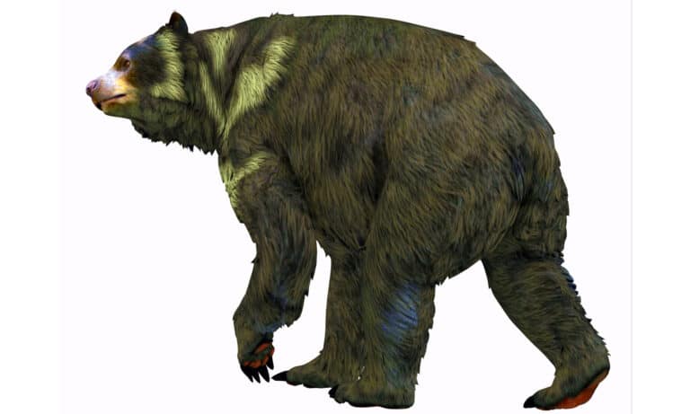
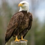
Short-Faced Bear
Big legs. Short face. Ice Age titan.
Big legs. Short face. Ice Age titan.
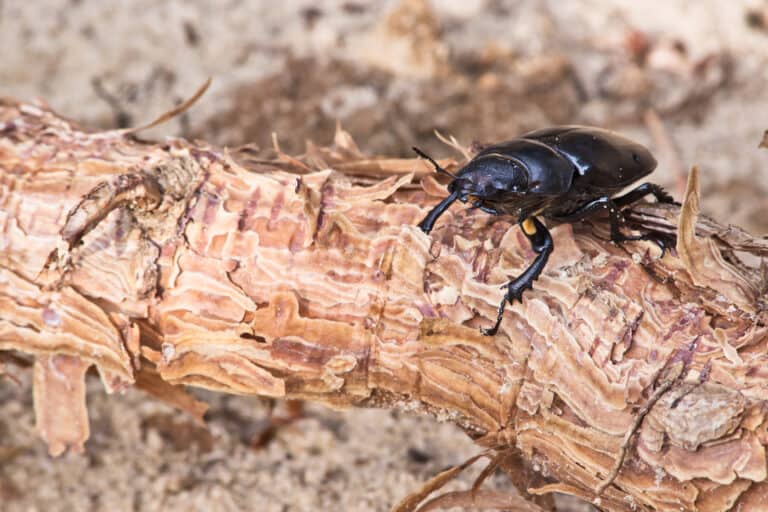
Small beetle, big forest change
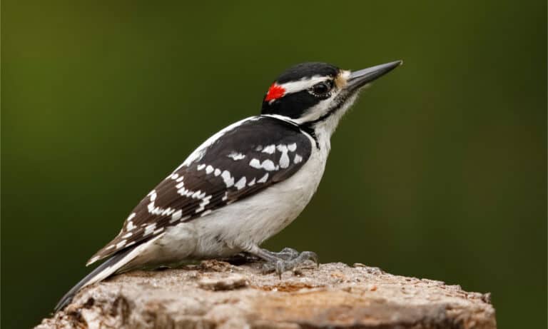
Bigger bill, louder drill!
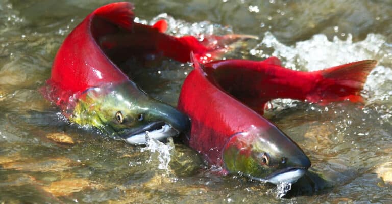
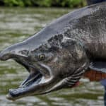
Silver at sea, scarlet to spawn
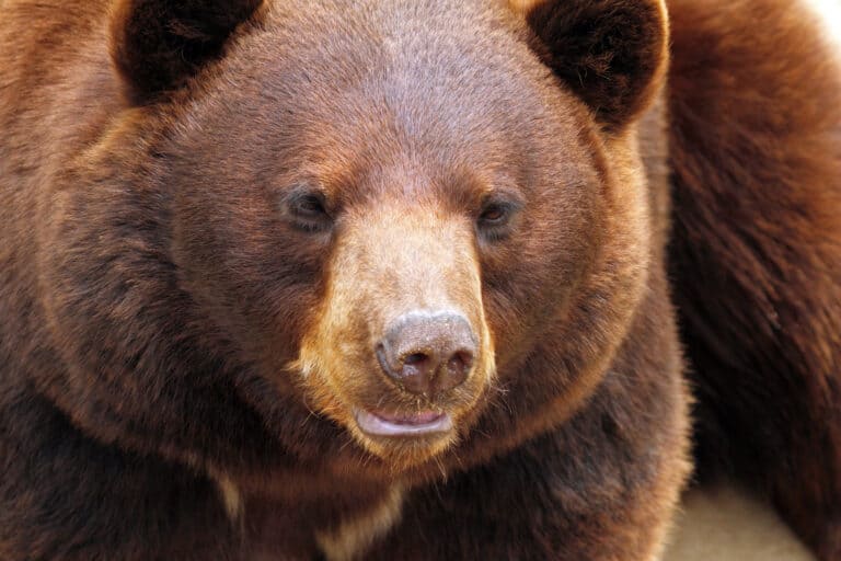
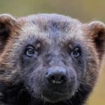
Cinnamon coat, black-bear heart

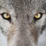
Crown of the Arctic pack ice
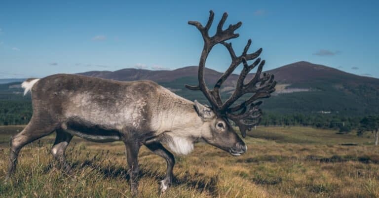
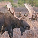
Antlers, Arctic, and endless miles.
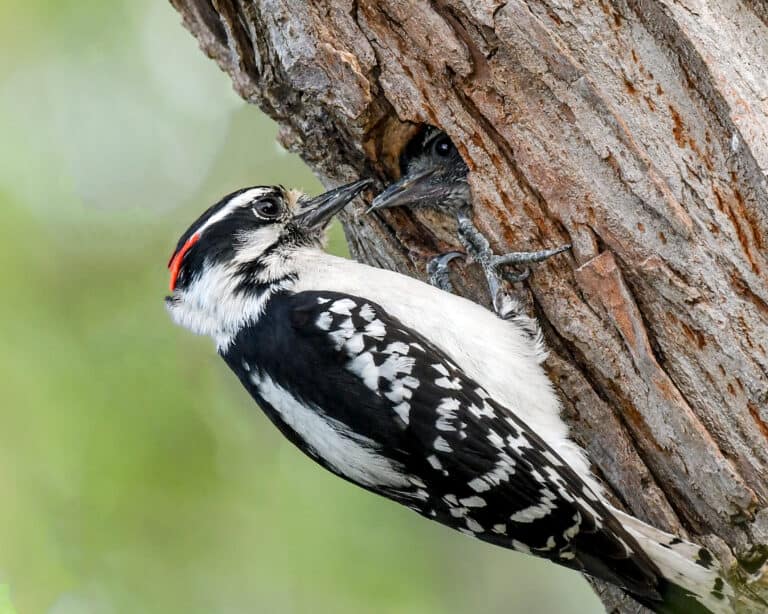
Big woodpecker energy-mini size.
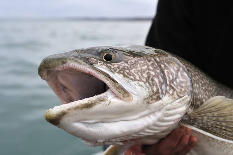
Deep-lake char, built for the cold

Wedge tail. Deep croak. Big brain.
Yukon's wildlife is shaped by long winters, bright summers, and very large, mostly connected landscapes. Few people and many protected areas help keep healthy populations of caribou, moose, grizzly and black bears, wolves, Dall sheep, and many smaller mammals and hardy birds. The territory feels like a living museum of the North, where tracks, calls, and rivers tell stories across long distances. Main ecosystems are boreal forest and wetlands in the lowlands, alpine and subalpine on the mountains, and tundra on high plateaus. Rivers, led by the Yukon River and its branches, bring life: salmon runs feed bears and eagles; cottonwood river forests shelter songbirds and beaver; oxbows and marshes are key for waterfowl. These connected valleys let animals move far, giving rare chances to see wildlife in wide, quiet places.
Yukon's wildlife follows a north–south and height gradient: Arctic coastal plain and tundra in the far north shift to boreal forest across the interior, with alpine and glaciated areas in the southwest. Major rivers, especially the Yukon River, focus riparian forests, wetlands, and migration routes. Permafrost and seasonal water keep wetlands that support waterfowl, small mammals, and predators.
Sea level (Arctic coast) to 5,959 m (Mount Logan)
Short Arctic Ocean coastline on the Beaufort Sea (with coastal tundra and lagoons); numerous large inland lakes (e.g., Kluane Lake, Teslin Lake, Tagish Lake) provide important freshwater shore and wetland habitats.
Designated 1987
Designated 1957
Yukon's protected areas include Parks Canada national parks, Yukon territorial parks, and co‑managed Special Management Areas and wildlife sanctuaries from Yukon First Nations Final Agreements. They protect intact boreal forest–tundra, river corridors, and key Arctic/subarctic habitat, especially the Porcupine Caribou range and Old Crow Flats wetlands. Many areas are remote and roadless, so protection comes from laws and low industry.
Approximately 14-16% of Yukon's land area is in formally protected areas (varies by what designations are counted).
One of Canada's flagship mountain ecosystems with vast icefields, alpine tundra, and intact predator-prey dynamics; outstanding for viewing Dall sheep and large carnivores along the Alaska Highway corridor and adjacent backcountry.
Canada's first national park created through an Indigenous land claim (Inuvialuit); protects the northern Yukon's Brooks Range and Arctic coastal plain, a core calving and migration landscape for the Porcupine Caribou Herd and denning habitat for large Arctic predators.
Anchored by the Old Crow Flats-one of North America's most important northern wetland complexes-supporting immense seasonal concentrations of breeding and migrating birds as well as boreal and tundra megafauna.
Dramatic Ogilvie Mountains tundra and alpine valleys with excellent roadside-to-backcountry wildlife viewing; important habitat for mountain ungulates and wide-ranging carnivores.
Arctic island/coastal ecosystem in the Beaufort Sea with rich nearshore marine productivity and tundra habitats; notable for polar bear activity, muskox, and huge bird migrations.
A co-managed watershed known for its salmon run and high density of grizzly bears during late summer/fall; a premier area for observing predator-salmon interactions in an intact northern river system.
Remote southeast Yukon landscape of karst springs, river corridors, and boreal valleys supporting a full complement of northern mammals and important seasonal habitat for ungulates and predators.
A major wetland complex at the south end of Teslin Lake that supports high densities of nesting and staging waterfowl and shorebirds; one of Yukon's most important bird areas with relatively accessible viewing opportunities.
Internationally significant northern wetlands (thousands of shallow lakes and ponds) that drive waterfowl productivity and migration across the Arctic; also supports muskrat-rich ecosystems and large mammals on surrounding uplands.
Large protected landscape adjacent to Kluane National Park that helps maintain connectivity for wide-ranging species (especially mountain ungulates and carnivores) across the St. Elias ecosystem.
Yukon's wildlife is shaped by vast, intact northern landscapes-boreal forest and wetlands in the south and central territory, alpine and icefield country in the St. Elias Mountains, and tundra in the far north. Low human density, large protected areas (notably Kluane), and big river systems (Yukon, Peel, Porcupine) support a classic subarctic fauna: wide-ranging carnivores (grizzly, wolf, wolverine), abundant ungulates (moose, caribou, Dall sheep), spectacular migrations (caribou and waterfowl), and strong ties to salmon-bearing watersheds.

Yukon is one of Canada’s best places to see northern wildlife in big open landscapes: boreal forest, alpine tundra, rivers, and protected areas. Low road traffic and long summer days make it easier to spot moose, caribou, Dall sheep, grizzly and black bears, rare wolves, beavers, and many birds along roads, river valleys, and in Kluane and Tombstone parks.
Shoulder season with fewer visitors and animals becoming more active as snow recedes. Excellent for bird migration along wetlands and river edges, early bear sightings at lower elevations, and moose frequenting roadside willows. Conditions can be variable (snowmelt, muddy roads), but it's a rewarding time for photographers and birders.
Peak access and the easiest time to cover long distances-many areas have 18-20+ hours of daylight. Strong all-around viewing: Dall sheep on alpine slopes (notably along the Alaska Highway), bears and moose near rivers and berry patches later in summer, and outstanding birding. Expect mosquitoes in wetter areas and plan dawn/dusk drives for the best mammal activity.
Often the best "big mammal" season: crisp temperatures, fewer insects, and dramatic colors. Rut activity increases wildlife movement (moose in particular), bears feed heavily before denning, and caribou are more likely to be seen moving between seasonal ranges. It's also prime northern lights season-combine aurora evenings with morning wildlife drives.
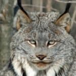
A classic Yukon experience: track wildlife in fresh snow and watch for animals concentrated along plowed roads and valley bottoms. Look for moose, foxes, snowshoe hares, lynx (rare), ptarmigan, and raptors around open water. Add aurora viewing and winter activities (dog sledding, snowshoeing). Dress for extreme cold and plan for limited daylight.
Longer days return while snow cover remains-excellent for finding tracks, photography, and combining aurora nights with brighter daytime conditions. Some tours and lodges operate specifically for this period, and wildlife sightings can be reliable along river corridors and road-accessible valleys.
Yukon has large elevation and latitude changes: mostly boreal forest valleys and plateaus, big alpine areas in mountain ranges, and Arctic tundra on the North Slope. Large cold rivers (Yukon, Porcupine) plus thousands of lakes, ponds and peatlands create freshwater wetlands supporting caribou, moose, grizzly bear, Dall sheep and migratory waterfowl. A small Beaufort Sea coast adds marine habitat.
Dominant biome across central and southern Yukon: taiga forests of spruce with mixed stands on warmer slopes and extensive post-fire mosaics.
Majority of Yukon; most lowlands/valleys and interior plateaus, especially south and central regions.
Low Arctic tundra on the North Slope and near treeline: sedge-moss meadows, dwarf shrub tundra, and wind-exposed barrens with permafrost influence.
Northern Yukon and treeline transition zones; concentrated toward the Beaufort Sea coast and Old Crow region.
Above-treeline environments in the St. Elias, Ogilvie, Pelly, Selwyn, and Mackenzie ranges: alpine tundra, talus, snowbeds, and glaciated terrain.
Widespread in mountainous areas throughout the territory; forms a large share of land area where relief is high.
Cold, oligotrophic rivers and lakes, including the Yukon River basin and major tributaries; supports salmon in connected systems and rich riparian corridors.
Statewide along river networks and lake districts; ecologically prominent though not dominant by area.
Peatlands, fens, marshes, and thermokarst wetlands (notably in Old Crow Flats) provide key breeding habitat for waterfowl and store large carbon stocks.
Patchy but extensive in northern lowlands and valley bottoms; locally dominant in Old Crow Flats and other peatland complexes.
Beaufort Sea coastal waters and nearshore ice-influenced ecosystems; supports coastal lagoons, barrier features, and marine food webs linked to sea ice seasonality.
Very limited: a short Arctic coastline and adjacent nearshore waters around the Herschel Island area.
White and black spruce stands dominate; lichen-rich understories in drier sites and muskeg-associated spruce in wetter terrain.
Aspen and birch stands are common in warmer/drier interior sites and as early succession following wildfire; extensive riparian balsam poplar.
Open, low-density spruce woodlands near treeline and in cold, dry interior zones; often interspersed with shrub and tundra patches.
Willow and dwarf birch shrublands on tundra and along floodplains; important forage and cover for wildlife.
Arctic coastal plain and upland tundra with sedges, mosses, lichens, and dwarf shrubs; strong permafrost control on drainage and soils.
Herb-rich alpine and subalpine meadows in sheltered slopes/valleys; summer foraging areas for Dall sheep and other mountain fauna.
Large mountain systems (e.g., St. Elias and Ogilvie ranges) with steep elevational zonation from forest to alpine to icefields.
Rock faces and talus slopes provide denning and nesting sites and key terrain for mountain ungulates.
Major rivers (Yukon, Porcupine, Teslin, Pelly, Stewart, Liard headwaters) with braided reaches, floodplains, and riparian forests.
Numerous cold lakes (e.g., Kluane Lake and many smaller glacial/thermokarst lakes) supporting fish and migratory birds.
Abundant small ponds, especially in permafrost lowlands; critical breeding habitat for insects and waterfowl.
Muskeg, fens, and wet sedge meadows across lowlands and valley bottoms; often associated with permafrost and poor drainage.
Shallow, vegetated wetland margins around ponds/lakes and floodplains; high productivity during the short growing season.
Peat-accumulating bogs and peat plateaus in colder/wetter landscapes; important carbon reservoirs.
Shrubby or treed wetlands in warmer valley bottoms and riparian backwaters, typically with willows and occasional spruce.
Arctic coastal habitats along the Beaufort Sea, including tundra-backed shorelines and coastal lagoons near Herschel Island.
Narrow gravel/sand beaches along the Beaufort Sea coast, seasonally affected by sea ice and storm surges.
Rocky and gravelly coastal segments and nearshore substrates in the Beaufort Sea zone; ice scour is a major disturbance.
Adjacent Beaufort Sea waters (seasonally ice-covered) influencing coastal productivity and migratory marine-linked food webs.
Shallow Arctic continental shelf benthic habitats offshore of Yukon's coastline, shaped by cold waters and ice dynamics.
Very limited footprint concentrated in Whitehorse and a few smaller communities, with localized habitat fragmentation and riparian impacts.
Small, localized agriculture primarily in the southern Yukon (e.g., near Whitehorse/Takhini valleys), constrained by climate and soils.
Yukon is one of the few places where the ranges of Dall sheep (white) and Stone sheep (darker) meet-so you can encounter "intermediate" color forms (often called Fannin sheep) in the overlap zone in southeastern Yukon.
Beavers are expanding their footprint northward in parts of Yukon, building dams and ponds in areas that were historically too cold or lacked shrubs-an ecosystem shift that can alter stream flow, wetland creation, and even permafrost stability.
Some "ocean fish" feed far inland: salmon runs up the Yukon River support wildlife hundreds to thousands of kilometres from the coast-bears and eagles can be eating marine-derived nutrients deep in the boreal forest.
The famous ~10-year boom-and-bust cycle of snowshoe hares and Canada lynx isn't just a textbook idea-long-running field experiments near Kluane (the Kluane Boreal Forest Ecosystem Project) helped pin down how predators and food limits interact to drive the cycle.
In midwinter, arctic ground squirrels don't just 'sleep'-they repeatedly warm themselves up from subzero body temperatures between torpor bouts, a high-risk strategy that lets them survive one of the harshest hibernation environments in North America.
Yukon River Chinook salmon make one of the longest salmon migrations on Earth-fish entering from the Bering Sea can swim roughly 3,000 km (and more) upriver to reach Canadian spawning tributaries in Yukon.
Arctic ground squirrels studied near Kluane can drop their core body temperature to about −2.9°C during hibernation-among the lowest body temperatures ever recorded for a mammal.
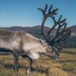
The Porcupine Caribou Herd roams northern Yukon, Alaska, and the Northwest Territories. One of North America's largest migratory caribou herds, it often numbers hundreds of thousands and migrates about 1,500 km each year.
Kluane National Park and Reserve forms part of the Kluane-Wrangell-St. Elias-Glacier Bay-Tatshenshini-Alsek UNESCO complex (~97,000 km²), widely cited as the world's largest internationally protected area-big enough to maintain intact predator-prey systems (wolves-caribou/moose, grizzlies, thinhorn sheep) at landscape scale.
89 species documented in our encyclopedia
Thank you for reading! Have some feedback for us?
We appreciate your help in improving our content.
Our editorial team will review your suggestions and make any necessary updates.
There was an error submitting your feedback. Please try again.