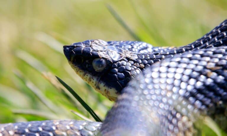
Eastern Hognose Snake
All bluff, no bite.
All bluff, no bite.
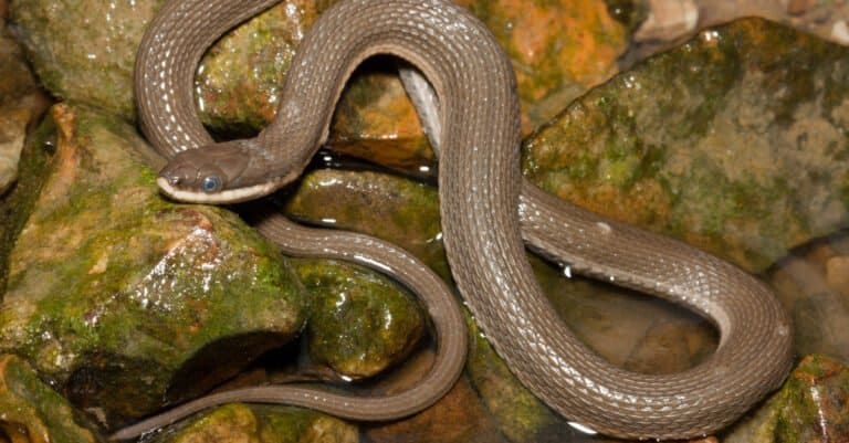
Seven stripes, one stream specialist

Bicolored tail, big-range survivor
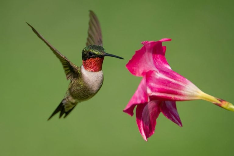
Tiny bird, huge journey
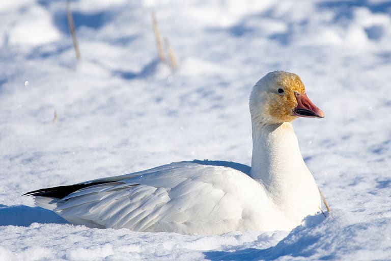
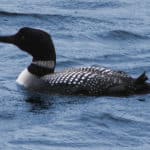
Two morphs, one Arctic traveler
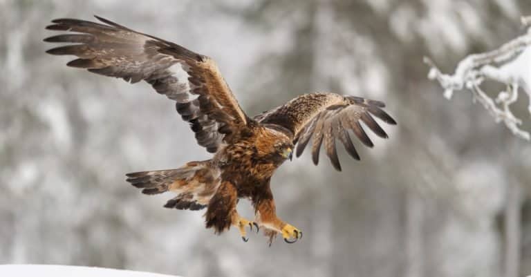
Gold-naped master of open skies
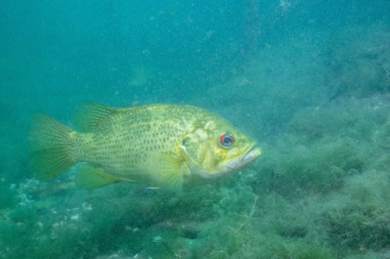
Red eyes, rock homes, sunfish attitude
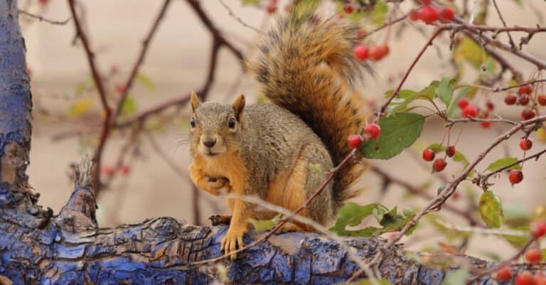
Big squirrel, bold colors, buried acorns
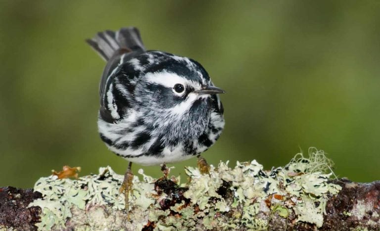
The warbler that climbs like a nuthatch
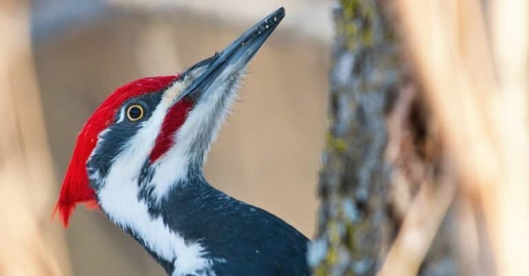
Big crest. Bigger excavations.
Ontario's wildlife is shaped by great scale and contrast: a wild north of Canadian Shield lakes, conifer forests, and peatlands, and the more fertile Great Lakes–St. Lawrence lowlands in the south. This mix of boreal and temperate zones helps many species live here—moose, wolves, and woodland caribou in the remote north, and deer, foxes, raptors, and many birds near farms, towns, and cities. Key habitats drive this diversity: boreal forest, wetlands, and rivers that feed top predators and wide-ranging mammals; Hudson Bay lowlands peatlands, inland fens and bogs for waterbirds and special plants and insects; and Great Lakes coastal marshes, dunes, alvars, and islands that are crucial stopover and nesting sites for migratory birds. Ontario is rare because it combines huge freshwater shorelines, excellent places for migrating birds, and easy shifts from wild country to urban areas.
Ontario shows a strong north-south gradient: the Canadian Shield and Hudson and James Bay lowlands in the north have boreal forest, peatlands and tundra-influenced coasts. The south is the Great Lakes-St. Lawrence lowlands with richer soils, many rivers and large wetlands. Long freshwater shores and lakes make migration stopovers, fish-spawning and nursery areas, and wetland complexes that hold many species.
Near sea level along Hudson Bay/James Bay to ~693 m (Ishpatina Ridge)
Extensive shorelines on the Great Lakes (freshwater) plus a marine/brackish coastline on Hudson Bay and James Bay, with major coastal marshes and tidal-influenced estuaries in the far north
Designated 1937
Designated 1984
Designated 1994
Ontario's protected areas include federal and provincial parks, reserves, and National Wildlife Areas/Migratory Bird Sanctuaries for wetlands and migratory birds. They run from Great Lakes coastal wetlands and Carolinian habitats in the south (many species, lots of development) through boreal forest and the Canadian Shield to Hudson Bay Lowlands peatlands; many wildlife-viewing spots are at wetlands, shorelines, and boreal areas.
~10-12% of Ontario's land and inland waters are in protected/conserved areas (approximate; varies by accounting method and inclusion of conservation reserves/Indigenous protected areas).
Ontario's largest national park protects a rugged Lake Superior shoreline and interior boreal forest, providing critical habitat connectivity for wide-ranging mammals and coastal birdlife in a relatively roadless setting.
Notable for its alvar ecosystems, limestone cliffs, forests, and clear-water nearshore habitats along Georgian Bay and Lake Huron-important for reptiles, amphibians, and migratory birds.
A globally significant migratory bird stopover on the Great Lakes; famous for spring songbird fallout, monarch migration, and wetland-dependent species in a highly biodiverse southern landscape.
Protects islands, wetlands, and mixed forests in Georgian Bay, supporting a high diversity of reptiles and amphibians and offering excellent viewing of coastal birdlife and freshwater shoreline habitats.
A mosaic of forested islands, wetlands, and shoreline along the St. Lawrence River corridor, important for raptors, turtles, and riverine wildlife at the intersection of major flyways.
One of the world's largest urban parks, protecting river valleys, wetlands, and Lake Ontario shoreline habitats; notable for species-at-risk recovery and migratory bird use within a major metropolitan region.
Iconic mixed-forest and lake country that supports strong populations of large mammals and iconic boreal birds; exceptional for canoe-route wildlife viewing and wolf howls.
A vast boreal wilderness of forests, rivers, and lakes with relatively low road density, important for wide-ranging carnivores and woodland caribou conservation.
Remote Hudson Bay Lowlands coastal and peatland ecosystems; critical for denning and seasonal use by polar bears and for huge concentrations of migratory birds in coastal wetlands.
Large, canoe-access wilderness protecting intact boreal forest and lake ecosystems; valued for predator-prey dynamics, old-growth stands, and dark-sky/low-disturbance habitat.
Great Lakes coastal marsh and sandspit habitats of international importance for migratory waterfowl, shorebirds, and marsh birds; one of Canada's most significant birding landscapes.
Key Lake Ontario shoreline stopover for migrating landbirds and raptors, with shrubland/grassland and coastal habitats that also support species at risk.
Large marsh complex important for wetland restoration, amphibians, turtles, and breeding/migrating waterbirds; a stronghold for some reptiles at risk.
Extensive coastal wetland habitat at the St. Clair River-Lake St. Clair system, supporting major waterfowl migrations and wetland-dependent birds and mammals.
Ontario's wildlife is shaped by a strong north-south gradient: vast boreal forest, muskeg, and tundra-edge habitats in the north; mixedwood forests and the Great Lakes-St. Lawrence lowlands in the south; and globally important Great Lakes shorelines, wetlands, and island systems. This creates a "big mammals + freshwater + migration" wildlife experience-moose, bears, wolves, and (in places) caribou in the north; exceptional spring/fall bird migration along Lake Erie and Lake Ontario; and a high diversity of fish, turtles, and wetland species across the Great Lakes basin.
Ontario offers varied wildlife viewing, from large boreal forest animals in the north to important Great Lakes wetlands and migration routes in the south. Visitors can see moose by Shield lakes, hear wolves, spot black bears, beavers, otters, turtles, amphibians, and raptors. Marshes, shorelines, and islands host huge seasonal flocks of waterfowl.
Peak migration and awakening wetlands: massive songbird and raptor movements along the Great Lakes; early wildflowers and amphibian choruses in southern forests; late spring brings excellent shorebird viewing on Lake Erie/Lake Ontario. Black bears begin foraging; moose can be seen feeding in roadside wetlands in northern parks. Expect variable weather and muddy trails; bring layers and waterproof footwear.
Best for remote northern experiences: canoeing and camping in Algonquin/Temagami/Quetico for loons, beavers, otters, and moose; seabird and colonial bird activity on Great Lakes islands; turtles and snakes are active in southern wetlands. Insect activity can be intense in the north-pack head nets/repellent. Warm water and long days suit paddling, photography, and family-friendly boardwalk wildlife.
A top season for big mammals and birds: moose rut (late Sept-Oct) increases sightings and vocal activity in Algonquin and other boreal-edge habitats; spectacular hawk and falcon migration along the Great Lakes (notably Lake Erie); waterfowl build into large concentrations on marshes and bays. Cooler temperatures mean fewer insects and clearer air; nights are cold in the north.
Track-and-travel season: excellent for spotting signs of wolves, lynx, fox, and marten in fresh snow, plus dependable views of deer and winter finches. Northern and east-coast owls occasionally irrupt into southern Ontario. Open-water areas of the Great Lakes host winter ducks; ice conditions can limit access-plan around safety advisories. Ideal for guided snowshoe/track programs and photography of stark landscapes.
Ontario has varied ecosystems: southern Great Lakes-St. Lawrence lowlands have mixed, deciduous forests and heavy human use; the central Canadian Shield is boreal forest with rocky areas and thousands of lakes; the far north near Hudson and James Bays has peatlands, muskeg and tundra-like coast. Freshwater areas—Great Lakes shores, large inland lakes and wetlands—support migrating birds and many fish.
Mixed and deciduous-dominant forests in southern Ontario (Great Lakes-St. Lawrence zone), including maple-beech-birch forests and Carolinian-affinity pockets in the southwest.
Primarily southern Ontario; fragmented by agriculture and urbanization but still regionally important.
Coniferous and mixed boreal forests across the Canadian Shield and much of northern Ontario, with extensive fire-driven mosaics, black spruce/jack pine stands, and lake-rich landscapes.
Dominant across most of Ontario by area, especially central and northern regions.
Tallgrass prairie and savanna-like openings (often oak-associated) in small southern remnants, maintained historically by fire and now heavily reduced.
Very limited, mostly small remnants in southwestern Ontario and a few localized sites.
Great Lakes (Superior, Huron, Erie, Ontario) plus vast networks of inland lakes and rivers (e.g., Ottawa, Albany, Moose), supporting coldwater and warmwater fisheries and shoreline ecosystems.
Province-wide; extremely high shoreline and lake density, especially on the Shield.
Large peatland systems (bogs/fens/muskeg) in the Hudson Bay Lowlands and northern Shield, and marsh/swamp complexes along Great Lakes and major rivers (notably for waterfowl).
Extensive in the north (Hudson Bay Lowlands) and concentrated pockets along Great Lakes coasts and river floodplains.
Tundra-like coastal habitats and shrub/lichen-dominated areas near Hudson Bay/James Bay margins where exposure, peatlands, and harsh climate limit tree growth.
Small, mainly along the far northern coast and near-coastal lowlands.
Saltwater/brackish coastal environments on Hudson Bay and James Bay, including tidal influence in some areas and coastal marshes/shorelines.
Limited to the far north coastlines of Hudson Bay and James Bay.
Broad province-wide forest cover ranging from southern mixedwoods to northern boreal stands; strong disturbance dynamics (fire, wind, insects) in the north.
Southern Ontario hardwood forests (e.g., sugar maple, beech, oak) with high biodiversity and strong fragmentation/edge effects.
Boreal conifer stands (black spruce, jack pine, balsam fir) across the Shield and northern lowlands; important for woodland caribou range in parts of the north.
Open-canopy systems in the south (oak woodlands) and sparse treed muskeg transitions in the north.
Tallgrass prairie remnants and meadow complexes in the south, often conservation-managed with prescribed fire.
Shrub-dominated peatland margins and regenerating cutover/burn areas, especially in northern Ontario and along hydro corridors.
No major alpine mountain systems; rugged uplands and escarpments occur (e.g., Canadian Shield uplands, Niagara Escarpment) but remain largely forested.
Niagara Escarpment cliffs and rocky Shield outcrops provide specialized microhabitats, nesting ledges, and rare plant communities.
Small karst/cave features occur locally (notably along the Niagara Escarpment and limestone areas), supporting bats and specialized invertebrates.
Great Lakes shorelines plus countless inland Shield lakes; key habitats include nearshore reefs, embayments, and coldwater lake basins.
Major rivers (Ottawa, French, Nipigon, Albany, Moose) with rapids, floodplains, and migratory fish corridors; hydropower influences some systems.
Beaver ponds and small kettle ponds are widespread, creating early-successional wetlands and amphibian habitat.
Extensive peatlands in the north and coastal/riverine wetlands in the south; critical for carbon storage and migratory birds.
Forested wetlands in southern and central Ontario (cedar, silver maple, mixed swamp forests), often along floodplains and lowlands.
Great Lakes coastal marshes (e.g., Lake Erie and Lake Ontario bays) and inland marshes; high productivity for fish nurseries and waterfowl.
Acidic peat bogs with sphagnum, black spruce, and ericaceous shrubs; common in northern Ontario and the Hudson Bay Lowlands.
River mouths and deltas along Hudson/James Bay and the Great Lakes (freshwater estuary-like zones) with strong nutrient and sediment dynamics.
Great Lakes coasts (beaches, dunes, bluffs, rocky shores) plus Hudson/James Bay coasts with low relief and extensive wetlands.
Sand and cobble beaches along the Great Lakes (notably Lake Huron, Erie, Ontario) supporting dune and shoreline communities.
Rocky Great Lakes shorelines (especially Lake Superior and Georgian Bay) and exposed Canadian Shield bedrock coasts.
Not present (Ontario is inland), except for marine waters of Hudson/James Bay which are coastal shelf rather than open ocean.
Not present.
Marine seabed present only in Hudson Bay/James Bay coastal waters; otherwise lakebeds dominate (Great Lakes and inland lakes).
Large urban ecosystems in the south (e.g., Greater Toronto Area, Ottawa, Hamilton, London) with ravines, waterfronts, and greenbelts supporting urban-adapted wildlife.
Extensive suburban matrices around southern cities, with mixed naturalized habitats, stormwater ponds, and fragmented woodlots.
Dominant land use in much of southern Ontario (row crops, mixed farming), interspersed with hedgerows, drainage ditches, and remnant wetlands.
Ontario has a rattlesnake, but only one: the massasauga, found mainly around the Georgian Bay region and the Bruce Peninsula-and unlike most snakes people picture, it gives birth to live young (no eggs).
Some Ontario turtles can overwinter underwater for months in near-freezing ponds by taking in oxygen through specialized tissues (including the cloaca), allowing painted turtles and snapping turtles to survive under ice.
Toronto has become raptor habitat: peregrine falcons now routinely nest on skyscrapers and bridges in southern Ontario after disappearing from much of the province during the DDT era.
Tommy Thompson Park (the Leslie Street Spit) in Toronto-built largely from construction fill-has turned into a major colonial waterbird nesting area on the Canadian Great Lakes, with large, noisy mixed colonies (e.g., cormorants, herons, gulls) using a "new" man-made peninsula.
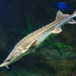
Lake sturgeon in Ontario waters can live for a century or more, meaning some individuals alive today may have hatched before the First World War-one reason recovery is slow when populations are depleted.
Ontario is home to the world-record brook trout: a 14 lb 8 oz (6.58 kg) "Nipigon strain" brook trout caught in the Nipigon River system in 1915-still recognized as the all-tackle world record for the species.
Ontario borders Lake Superior, the world's largest freshwater lake by surface area (~82,100 km²), and its cold-water fish community (notably lake trout and lake whitefish) is built around that globally unique inland "sea."
Point Pelee National Park (Ontario's Lake Erie tip) has logged 390+ bird species-one of the highest species totals recorded for any Canadian park and a globally known migration bottleneck for warblers and raptors.
Ontario's Hudson Bay Lowlands form part of one of the planet's largest wetland/peatland complexes; the province's far-north coastline supports polar bears as part of the Southern Hudson Bay subpopulation, among the world's southernmost polar bear populations.
The Great Lakes (including Ontario's Lakes Superior, Huron, Erie and Ontario shorelines) hold about 20% of the world's surface fresh water-creating an outsized amount of freshwater habitat that supports major coastal marsh wildlife (e.g., waterfowl, muskellunge, snapping turtles).
266 species documented in our encyclopedia
Thank you for reading! Have some feedback for us?
We appreciate your help in improving our content.
Our editorial team will review your suggestions and make any necessary updates.
There was an error submitting your feedback. Please try again.