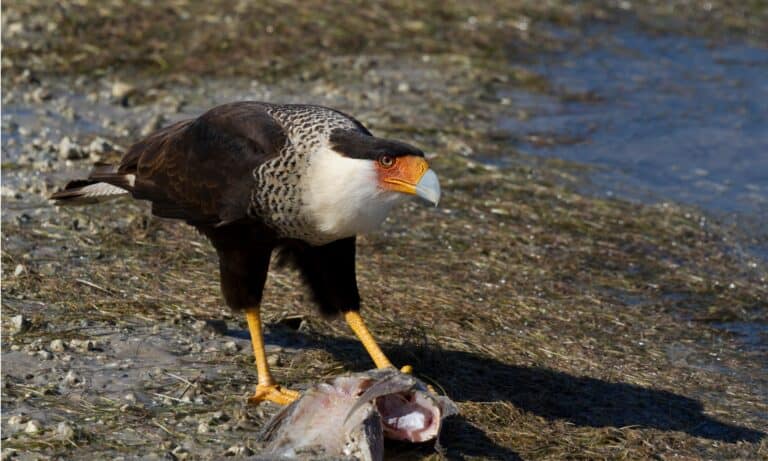
Mexican Eagle (Northern crested caracara)
Golden power on open skies

Golden power on open skies
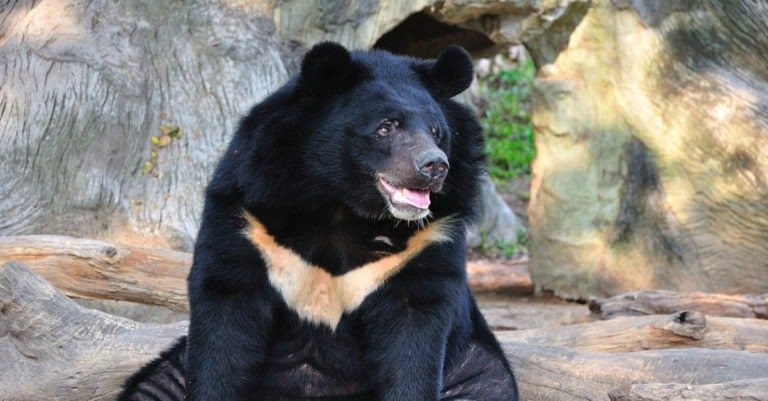
Moon-marked climber of Asian forests
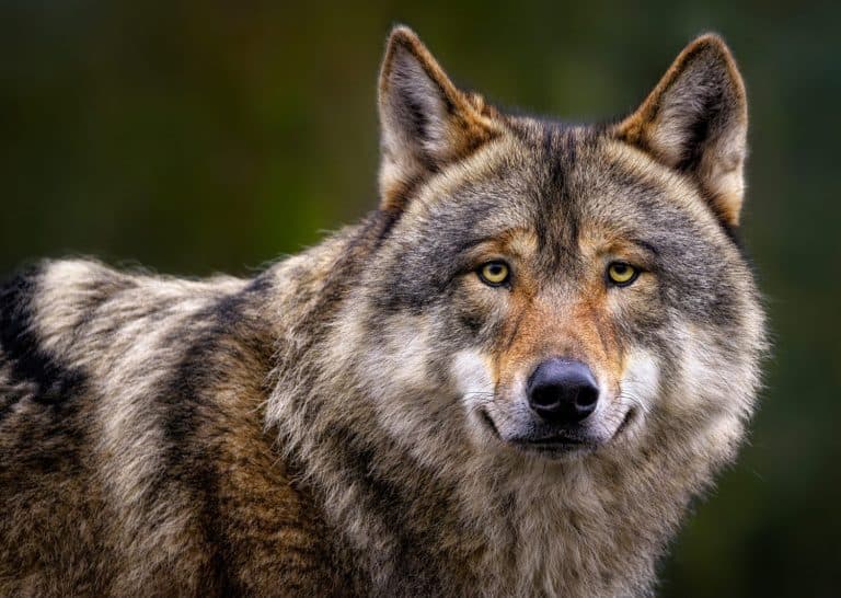
Packs, howls, and healthy wildlands
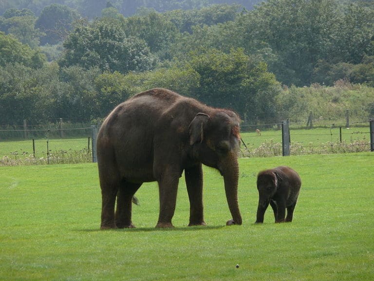
One trunk-many forests sustained

Stripes of Asia's top predator
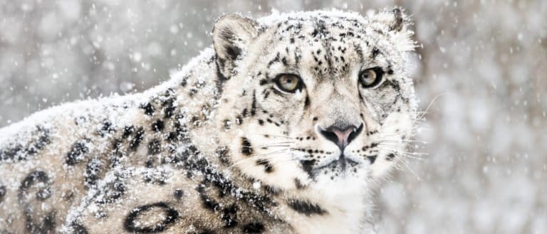
Built for cliffs. Made for cold.
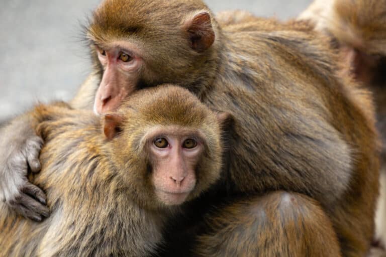
Street-smart primate, social to the core
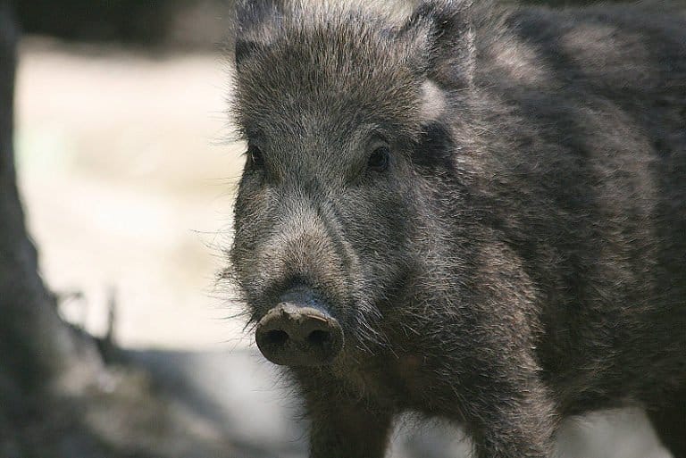
Rooting, roaming, reshaping ecosystems
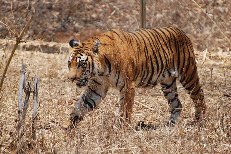
Stripes of the subcontinent
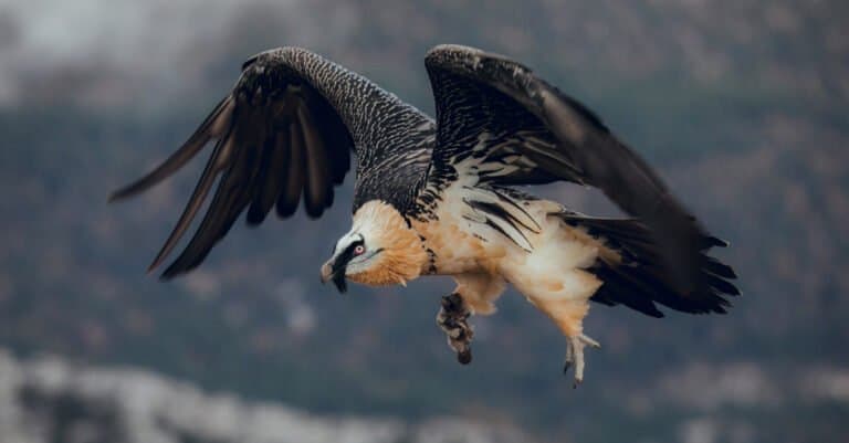
The Bone-Breaking Mountain Vulture
Uttarakhand's wildlife comes from big changes in height — from the Terai Arc's sal forests and river grasslands at the Himalayan foothills up to conifer-covered mid-mountains and alpine meadows beneath high peaks. This big height change creates rich wildlife and a “big cat to snowline” journey: tigers and elephants in lowlands, bears and leopards in temperate forests, and rare high-altitude animals above. Key places include the Terai-Bhabar belt (floodplains, tall grass, sal forest) with Corbett hosting tigers, Asian elephants, deer, and many birds. Higher up, oak, rhododendron, deodar, and pine forests hold leopard, Himalayan black bear, goral, and many pheasants. Subalpine and alpine zones and glaciated areas like Nanda Devi shelter snow leopard, Himalayan musk deer, and mountain hooved animals (goats, sheep). Rivers, headwaters, monsoon, and snowfall shape these habitats. You can see lowland safaris and high mountain wilderness in one trip.
Uttarakhand rises from the Terai-Bhabar foothills to the Greater Himalaya, causing quick changes in climate and plants and a mix of habitats—from sal forests and grasslands with large mammals (tiger, elephant) to temperate broadleaf and conifer forests, alpine meadows, and glaciers. Rivers, valleys, and wetlands act as corridors, refuges, and breeding or feeding sites.
Approx. 200 m (Terai foothills) to 7,816 m (Nanda Devi)
Uttarakhand's protected areas span the Himalayan-to-foothill range, from Shivaliks' river grasslands and sal forests to oak-rhododendron woods, alpine bugyals, glaciers, and high cold deserts. Management is by national parks and wildlife sanctuaries, plus Tiger Reserves (for tigers/elephants), Conservation Reserves (wetlands/birds), and the UNESCO Nanda Devi Biosphere Reserve. Key landscapes: Corbett-Rajaji and the Nanda Devi/Valley of Flowers and Gangotri-Govind high Himalaya.
≈15-17% of Uttarakhand's land area (rough estimate across national parks, wildlife sanctuaries, tiger-reserve buffers, and conservation reserves).
India's oldest national park and the state's premier wildlife-viewing destination, known for high tiger density, elephant herds, and rich riverine habitats along the Ramganga (with significant conservation value for grassland-forest mosaics and aquatic fauna).
A key Shivalik-Ganga foothill landscape that protects one of northwest India's most important elephant populations and maintains connectivity across the Ganga (via corridors) between forest blocks; strong for birdlife and large mammals.
A high-Himalayan wilderness of steep valleys, glaciers, and alpine meadows within the Nanda Devi massif; globally significant for alpine biodiversity and as the core of the Nanda Devi Biosphere Reserve (UNESCO World Heritage serial site with Valley of Flowers).
World-renowned alpine flower valley with exceptional seasonal blooms and high-altitude pollinator/plant diversity; also important summer habitat for Himalayan ungulates and a strong high-elevation birding area.
One of India's largest high-altitude national parks, protecting glacier-fed headwaters of the Bhagirathi (Ganga source region), extensive alpine zones, and remote valleys supporting elusive carnivores and mountain ungulates.
A high-elevation protected landscape of conifer forests, alpine meadows, and rugged ridgelines; valued for threatened Himalayan birds and carnivore habitat, and for connecting upper catchments around Har-ki-Dun and adjacent valleys.
Uttarakhand's largest sanctuary, spanning temperate forests to alpine meadows and glaciers around the Mandakini/Alaknanda headwaters; important for landscape-scale conservation of Himalayan ungulates and carnivores.
A key eastern Uttarakhand sanctuary covering steep elevational gradients and river valleys near the Indo-Nepal border; significant for high-Himalayan carnivore-prey systems and broad habitat diversity.
Compact but biodiverse mid-Himalayan oak-rhododendron and mixed conifer forests near Almora; especially good for birding and as a representative temperate forest refuge.
An important buffer and corridor landscape adjoining Corbett, with sal forests and riverine habitats that support dispersing tigers/elephants and reduce pressure on the core tourism zones.
One of India's best-known tiger conservation landscapes, integrating the Corbett core with surrounding forests and river corridors to support breeding tigers, elephants, and prey populations.
A major elephant-tiger landscape across the Shivaliks and Ganga foothills, managed to improve connectivity and reduce fragmentation across heavily used human corridors.
A globally significant high-Himalayan biosphere (including Nanda Devi and Valley of Flowers cores) designed to protect alpine ecosystems, traditional cultural landscapes, and watershed values at large scale.
A small but high-value wetland on the Yamuna system near Dehradun, important for wintering and passage migratory waterbirds and wetland conservation in the foothills.
Uttarakhand spans a steep elevation gradient from the Terai-Bhabar foothills and riverine grasslands (Corbett-Rajaji) to mid-elevation oak-rhododendron and conifer forests, and finally alpine meadows, scree, and glaciated high Himalaya (Nanda Devi landscape). This creates one of India's most species-rich wildlife mosaics: high-density megafauna and classic "jungle" wildlife in the lowlands, and specialized cold-adapted mammals and pheasants at altitude. The state is also a headwater region for major Himalayan rivers, supporting important freshwater fish (notably mahseer) alongside otters, gharial, and rich riparian birdlife.
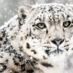
Uttarakhand offers varied wildlife: sal forests and river grasslands in the Himalayan foothills (prime tiger and elephant country), oak-rhododendron forests, alpine meadows, and high-altitude deserts with mountain species. Visitors can take jeep safaris in Corbett, watch birds along the Ganga, trek in Kedarnath and Nanda Devi, or search for bharal, Himalayan tahr and, with luck and permits, snow leopards.
Best overall for clear mountain views, comfortable safari temperatures, and concentrated wildlife around water and sunny forest edges. Excellent birding as winter migrants arrive (raptors, waterfowl). Corbett and Rajaji can be very productive; higher elevations may be snowbound, limiting access to some treks.
Blooming rhododendrons and active wildlife in mid-elevation forests; strong bird activity (courtship, calls). Great time for guided birding in Pangot/Sattal and for hikes in Kedarnath Wildlife Sanctuary. Conditions are pleasant before peak heat.
Prime big-game viewing in the foothills as animals visit rivers and pools-good odds for elephant herds, deer, and (with patience) tiger sightings in Corbett zones. Hot in the plains; higher hill stations and alpine fringes are comfortable. Ideal for early-morning/late-afternoon safaris.
Lush landscapes and dramatic rivers, but viewing can be challenging due to rain, leeches in some forests, and frequent landslides/road closures. Some parks/zones may close or run limited operations. Best for visitors focused on scenery, frogs/insects, and green-season birding in accessible lower elevations-plan conservatively and keep schedules flexible.
Crisp weather, clear skies, and stable road conditions after the rains-excellent for photography, trekking-based wildlife, and early winter bird arrivals. Good time to combine Corbett/Rajaji with mid- to high-elevation hikes before heavier winter snow.
Uttarakhand rises from Terai-Bhabar foothills to high alpine snowfields, so ecosystems change quickly. Lowlands have moist sal, deciduous forests and tall grasslands (Corbett). Mid slopes have broadleaf and mixed pine; higher areas hold conifer forests and alpine meadows (Valley of Flowers, Nanda Devi). It feeds Ganga tributaries with glacier rivers, wetlands and high lakes supporting freshwater life and migratory birds.
Terai-Bhabar and lower Shivalik foothills support tropical/subtropical deciduous forests (notably sal and mixed deciduous) with a pronounced dry season; these are key elephant-tiger habitats in the Corbett-Rajaji landscapes.
Foothills and lower elevations, especially in the southwest (Terai-Bhabar/Siwalik belt).
Mid-elevation Himalayan temperate broadleaf and mixed forests (oak-rhododendron, mixed broadleaf, and chir pine on warmer slopes) form the dominant natural vegetation belt across much of the middle Himalaya.
Widespread across mid-altitudes in Kumaon and Garhwal; one of the largest continuous biome components by area.
Upper montane to subalpine conifer-dominated forests (fir, spruce, deodar, blue pine in suitable zones) represent a cold-adapted conifer belt approaching treeline.
Higher elevations below treeline across the central and northern districts; patchy-to-continuous depending on valley aspect and elevation.
Above treeline, alpine meadows (high-altitude pastures), herb-rich flower valleys, dwarf rhododendron/juniper scrub, scree and snowbed communities occur, supporting species like Himalayan tahr and specialized pollinators.
High Himalaya zones (especially in Chamoli, Uttarkashi, Pithoragarh, Bageshwar); limited area but high ecological significance.
Near and above the highest alpine zones, very sparse vegetation on cold, wind-exposed ridges and cold deserts/scree near glaciers resembles alpine tundra conditions (mosses, lichens, cushion plants).
Small, highest-elevation pockets near glaciers and exposed ridgelines in the far north.
Glacier- and snowmelt-fed rivers (Bhagirathi, Alaknanda, Mandakini, Kali/Sharda), mountain streams, oxbow and floodplain wetlands, and high-altitude lakes support rich aquatic biodiversity and provide major downstream water services.
Statewide along river networks and headwaters; densest aquatic habitats in major valleys and foothill floodplains.
Includes Terai marshes and floodplain wetlands, riparian swamps, montane marshes, and high-altitude wet meadows and lake fringes important for waterfowl and amphibians.
Localized but ecologically important-Terai lowlands and scattered montane/high-altitude basins.
Extensive forested landscapes from Terai sal to mid-elevation oak-rhododendron and upper conifers; major protected blocks include Corbett Tiger Reserve, Rajaji NP, Kedarnath Wildlife Sanctuary and Nanda Devi Biosphere Reserve buffer forests.
Sal-dominated and mixed deciduous forests in the foothills (Terai-Bhabar), crucial for tiger, elephant, chital and rich birdlife; strong seasonal leaf-fall and grassy understories in places.
Upper montane/subalpine conifer belts (fir-spruce, deodar patches, blue pine on drier slopes) forming cold-climate forests below treeline.
Open pine woodlands (notably chir pine on warmer slopes) and degraded/open-canopy areas around villages and along drier aspects, often with grassy/shrubby ground layers.
Terai tall grasslands and riverine grasslands in lowlands (important in Corbett landscape) and smaller mid-elevation grassy openings maintained by slope, fire, or grazing.
Subalpine and alpine dwarf shrub zones (juniper, rhododendron scrub) and secondary shrublands on disturbed slopes.
High-elevation alpine meadows (high-altitude pastures) and herb-rich meadows (e.g., Valley of Flowers region) with short growing seasons, high endemism and seasonal grazing pressure in some areas.
Rugged Himalayan terrain with strong aspect/elevation gradients, landslide-prone slopes, glacial valleys and high peaks shaping microhabitats and connectivity corridors.
Steep rock faces and gorges along river valleys and high ridgelines, supporting raptors and cliff-nesting birds and specialized rock-dwelling flora.
Karst/limestone and river-cut caves occur locally (notably in parts of Kumaon), used by bats and cave-adapted invertebrates; culturally significant cave sites also occur.
Major headwater rivers and fast mountain streams (rapids, pools, braided foothill reaches) supporting otters in suitable stretches, mahseer in lower reaches, and diverse benthic fauna.
High-altitude lakes and tarns (e.g., Roopkund, Hemkund area lakes) and smaller mid-elevation lakes (notably around Nainital district) with cold-water and montane lake ecosystems.
Village ponds, small impoundments and seasonal waterbodies across foothills and mid-elevations supporting amphibians and waterbirds.
Terai marshes, floodplain wetlands, riparian backwaters, and high-altitude wet meadows/lake-edge marshes important for migratory birds and hydrological buffering.
Localized waterlogged forested/riverine patches in the Terai and along lowland riparian zones; habitat for wetland birds and amphibians where intact.
Open marshes and reedbeds in the Terai and along slow-moving foothill river sections and reservoirs; important for waterfowl and waders.
Terraced agriculture on mid-slopes (millets, pulses, horticulture) and more intensive farming in foothills/plains (rice-wheat), creating a mosaic with forest edges and human-wildlife interface.
Urban centers in valleys and foothills (e.g., Dehradun, Haridwar, Haldwani, Rudrapur) affecting river corridors, wetlands, and peri-urban forests through expansion and pollution.
Expanding peri-urban belts around major towns and along transport corridors in Doon valley and Terai, increasing fragmentation and pressure on nearby forests and riparian zones.
Uttarakhand contains a dramatic 'wildlife elevator': you can go from elephant-and-tiger habitat in the Shivalik foothills (Corbett/Rajaji) to snow leopard and bharal (blue sheep) habitat in the high Himalaya within the same state.
The Valley of Flowers is effectively 'seasonal' wilderness-snowbound and largely inaccessible for much of the year, then bursting into peak bloom during the monsoon window (roughly July-August), when the famous carpets of flowers appear.
Ganges river dolphins live in rivers, and Uttarakhand is the upstream edge of their Ganga range. Sightings near Haridwar and downstream show the river shifts quickly from Himalayan to plains ecology.
Rajaji-Corbett is not just two parks: it's a connected elephant-and-tiger landscape where animals still move through narrow forest corridors near busy towns, roads, and rail lines-real 'wildlife commute routes' in a heavily populated region.
Some high-altitude wildlife in Uttarakhand recovered after strong protection. The Nanda Devi core area was closed to trekkers in the early 1980s, helping bharal and the predators that hunt them.
Jim Corbett National Park (est. 1936 as Hailey National Park) is India's oldest national park-making Uttarakhand the birthplace of the country's national-park system.
Corbett was one of the very first tiger reserves brought under Project Tiger in 1973, placing Uttarakhand at the start of India's flagship big-cat recovery program.
Corbett has repeatedly been reported among the highest tiger-density landscapes in the world; scientific estimates in its best habitats have been roughly in the ~14-16 tigers per 100 km² range in some studies/camera-trap analyses.
Valley of Flowers National Park packs extraordinary alpine plant diversity into a small area: botanists have documented 600+ species of flowering plants in the park and its immediate surroundings, one reason it's globally famous as an alpine 'flower hotspot.'
Asan Conservation Reserve (Dehradun) became Uttarakhand's first Ramsar wetland site (designated 2020), recognized internationally for its importance to migratory and resident waterbirds.
16 species documented in our encyclopedia
Thank you for reading! Have some feedback for us?
We appreciate your help in improving our content.
Our editorial team will review your suggestions and make any necessary updates.
There was an error submitting your feedback. Please try again.