N S W E
Wildlife Expeditions

Wildlife of
Nāgāland

A rugged Indo-Burma hotspot of rain-soaked ridges and cloud forests where rare pheasants, hornbills, and big cats persist along the Myanmar frontier.
19 Species
16,579 km² Land Area
Overview

About Nāgāland

Nagaland's wildlife is shaped by steep mountains, heavy monsoon rains, and forests that change quickly with elevation, making a small but rich part of the Indo-Burma biodiversity hotspot. From subtropical broadleaf valleys to misty mid-elevation woods and cool temperate ridgelines, the state supports many birds and shy mammals that hide in remote hills and forests cared for by local people. Key habitats include evergreen and semi-evergreen forests, moist deciduous patches, bamboo brakes, and high-elevation temperate broadleaf and conifer pockets. This change with elevation is key for birds: hornbills, babblers, laughingthrushes, and other highland species occur close together, while forest corridors near the Myanmar border can still hold large predators and other sensitive animals. Rivers, streams, and ravines add places for frogs, snakes, and many small invertebrates. Strong community conservation and rough, less-visited terrain make wildlife visits feel wilder and more personal.

Physical Features

Geography

Nagaland's rugged hills (part of the Patkai‑Naga Hills) create sharp elevation and rainfall changes, so many habitats fit in a small area. River valleys, forested ridges and high plateaus form corridors and barriers shaping where species live, from subtropical evergreen and semi‑evergreen forests below to cool broadleaf‑conifer temperate zones above, driving high bird diversity in the Indo‑Burma hotspot.

16,579 km² Land Area
4th smallest state in India (by area) Size Rank
India Country
State Type
Elevation Range

≈100 m to 3,841 m (Mt. Saramati)

Coastline

None (landlocked; no ocean coastline)

Key Landscapes

Naga Hills / Patkai range (steep, forested ridgelines and valleys that drive habitat turnover) Mount Saramati massif and eastern high ranges along the Myanmar border (high-elevation refugia and temperate habitats) Barail range (western highlands; important forest block and watershed) Dzukou Valley and other high plateaus/rolling uplands (mosaic of montane grassland-shrub and surrounding forests) Major river systems and tributaries: Doyang, Dhansiri, Dikhu, Tizu, Jhanji (riparian forests, wetlands, movement corridors) Reservoirs and wetlands such as the Doyang Reservoir (notable migratory bird use, including large raptor/falcon gatherings)
State Symbols

Official Wildlife Symbols

animal

Mithun (Gayal)

bird

Blyth's tragopan

tree

Alder (Nepalese alder)

wildflower

Rhododendron

Parks & Reserves

Protected Areas

Nagaland has few official protected areas (one national park and small wildlife sanctuaries) but lies in the Indo-Burma biodiversity hotspot with diverse subtropical to temperate forests on steep elevation changes. Many forests are owned by villages, so protection often depends on community rules. Key values: hornbill-rich broadleaf forests, Blyth's tragopan, and Amur falcons at Doyang/Pangti.

Protected Coverage

≈2-3% of Nagaland is under formally notified protected areas (National Park + Wildlife Sanctuaries); community-conserved forests increase effective habitat protection beyond this figure in some landscapes.

National Parks & Preserves

Intanki (Ntangki) National Park

≈202 km²

Nagaland's only National Park and its largest formally protected forest block, important for low-to-mid elevation evergreen/semi-evergreen habitat, primates, and wide-ranging mammals in the Dhansiri-Intanki landscape.

Asian elephant Western hoolock gibbon Clouded leopard Great hornbill Sambar

State & Provincial Parks

Ghosu Bird Sanctuary

Very small (area reported in the Wildlife Institute of India protected area listing)

A notified bird sanctuary in Nagaland; a small wetland site important for conserving local waterbird habitat.

Waterbirds (ducks, herons, egrets)

Singphan Wildlife Sanctuary

About 23.6 km² (as listed by the Wildlife Institute of India)

A notified wildlife sanctuary in Nagaland (India-Myanmar border landscape) protecting intact forest habitat.

Hoolock gibbon Hornbills

Fakim Wildlife Sanctuary

About 6.4 km² (as listed by the Wildlife Institute of India)

A notified wildlife sanctuary in Nagaland protecting montane forest habitat in the eastern highlands.

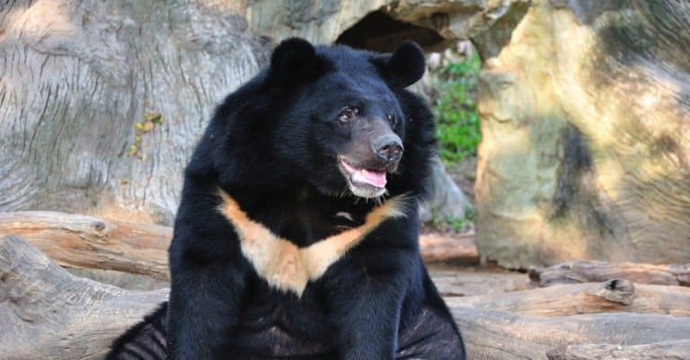
Blyth's tragopan Himalayan (Asiatic) black bear

Puliebadze Wildlife Sanctuary

About 9.2 km² (as listed by the Wildlife Institute of India)

A notified wildlife sanctuary in Nagaland (near Kohima) protecting higher-elevation forest habitat.

Blyth's tragopan Himalayan (Asiatic) black bear

Rangapahar Wildlife Sanctuary

About 4.7 km² (as listed by the Wildlife Institute of India)

A notified wildlife sanctuary in Nagaland (near Dimapur) protecting remnant low-elevation forest habitat.

Rhesus macaque Sambar

Wildlife Refuges

Khonoma Nature Conservation & Tragopan Sanctuary (community-conserved area)

≈20 km² (community-conserved forests; reported figures vary)

One of India's best-known community-led conservation areas, established to curb hunting and protect forests; notable for Blyth's tragopan conservation and strong local stewardship.

Blyth's tragopan Wreathed hornbill Rufous-necked hornbill Red serow Leopard

Doyang Reservoir-Pangti Amur Falcon Roost Landscape (community protection/IBA-type site)

Reservoir plus surrounding roost sites; roughly tens of km² (seasonal use footprint varies)

Globally significant seasonal congregation site where hundreds of thousands to over a million Amur falcons can roost during migration; a major conservation success driven by village-level protection and awareness.

Amur falcon Osprey Grey-headed fish eagle Barn swallow (migratory flocks regionally) Various wintering ducks and waders

Indo-Myanmar border forests (Mon-Tuensang-Kiphire belt; corridor-type habitats)

Large landscape corridor (extent varies by mapped corridor definition)

A broad transboundary forest belt (not one single refuge) that functions as a conservation corridor for wide-ranging mammals and hornbills, with several areas managed through local rules, reserve forests, and small sanctuaries.

Tiger (landscape presence) Clouded leopard Gaur Western hoolock gibbon Great hornbill

Wilderness Areas

  • Patkai/Naga Hills ridge forests along the India-Myanmar border (remote, highly dissected terrain)
  • Saramati massif and surrounding ridge-top forests (Kiphire district)
  • Dzükou Valley high-elevation wilderness (seasonal grassland and adjacent montane forests)
  • Japfü (Japfu)-Kohima highlands forests (important montane habitat and watersheds)
  • Tizu Valley forested catchments (noted for relatively intact stretches and connectivity)
  • Interior forests of Mon district (low road density in places; hornbill and big-mammal habitat)
Animals

Wildlife

Nagaland's wildlife is shaped by steep mountains, very high rainfall, and a mix of subtropical evergreen and semi-evergreen forests that change to temperate broadleaf and conifer zones higher up. In the Indo-Burma biodiversity hotspot and beside Myanmar, Nagaland is rich in forest birds — hornbills, pheasants, laughingthrushes, and trogons — and threatened mammals like gibbons, pangolins, and small and large cats. Community-run forests and traditional hunting affect what people see: birds can be spectacular in protected areas, while many big mammals are local and shy where hunting is heavy.

~90-120 species (state checklists vary; includes several threatened primates and small carnivores) Mammals
~450-520 species (one of Nagaland's standout groups; includes many Indo-Malayan forest specialties) Birds
~70-100 species (snakes are particularly diverse; includes king cobra) Reptiles
~35-60 species (high rainfall supports diverse frogs; taxonomy still being revised) Amphibians
~120-170+ species (hill-stream and riverine fishes; under-documented in some basins) Fish
Examples

Iconic Species

Amur Falcon Nagaland is globally famous for massive autumn roosts (notably around the Doyang area), where huge numbers gather before continuing a long migration to southern Africa.
Great Hornbill A flagship rainforest bird of mature forests; its wingbeats and large casque make it one of the most sought-after sightings in intact low- to mid-elevation forests.
Rufous-necked Hornbill A rarer, high-profile hornbill of Northeast India's forests; where it persists it signals relatively healthy, large-tree forest habitat.
Western Hoolock Gibbon India's only ape; its loud morning calls and arboreal lifestyle make it an iconic experience in well-forested tracts (e.g., parts of Intanki and adjoining community forests).
Clouded Leopard
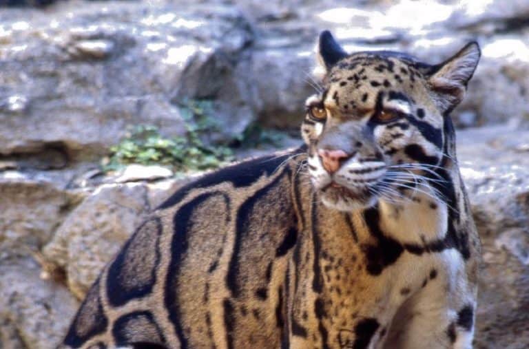
Clouded Leopard Elusive "ghost cat" of dense forests; often detected via camera traps rather than direct sightings, but it defines Nagaland's mystique for mammal enthusiasts.
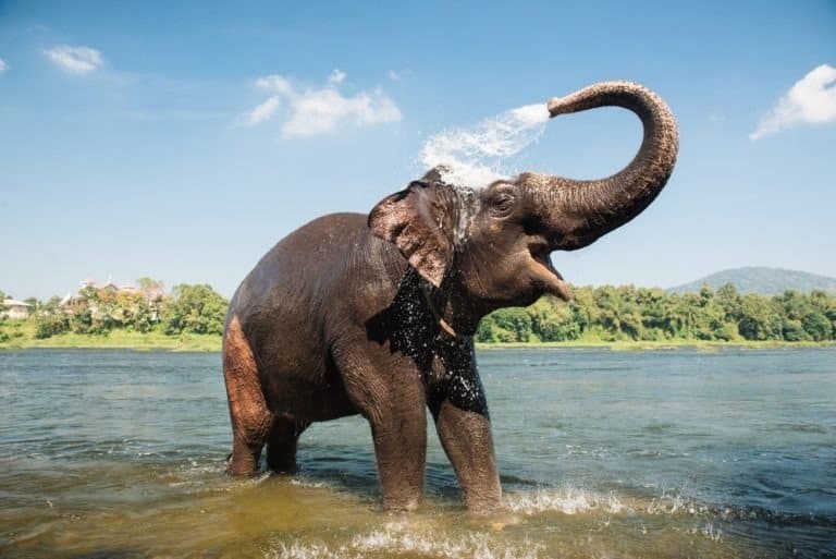
Asian Elephant
Asian Elephant Occurs in forested landscapes and corridors; more often encountered through signs and conflict-prone edges than as relaxed tourist-viewing herds.
Gaur (Indian Bison) The largest wild cattle species; a powerful symbol of intact forest ecosystems, though wary in heavily hunted areas.
Blyth's Tragopan A prized high-elevation pheasant with striking breeding plumage; a key target for birdwatchers visiting select sanctuaries and ridges.
Sclater's Monal A Northeast India specialty pheasant; highly localized and one of the region's most coveted high-mountain birds.

Endemic & Rare Species

Sclater's Monal

Lophophorus sclateri

Vulnerable (IUCN)

Endemic to Northeast India; Nagaland is part of its limited range, making protection of high-elevation forests and alpine-edge habitats important.

Blyth's Tragopan

Tragopan blythii

Vulnerable (IUCN)

A restricted-range pheasant of the eastern Himalaya/Indo-Burma interface; sensitive to hunting and forest degradation, and a conservation flagship for Nagaland's high forests.

Rufous-necked Hornbill

Aceros nipalensis

Vulnerable (IUCN)

Depends on large nesting and fruiting trees; declines quickly with logging and fragmentation, so remaining populations in Nagaland are conservation-significant.

Hume's Pheasant

Syrmaticus humiae

Near Threatened (IUCN)

A scarce pheasant of Northeast India and nearby regions; Nagaland supports habitat where it can persist, but it is vulnerable to hunting and habitat change.

Chinese Pangolin

Manis pentadactyla

Critically Endangered (IUCN)

A highly trafficked, nocturnal mammal; Nagaland lies within its South Asian range, and remaining populations are important for regional survival.

Western Hoolock Gibbon

Hoolock hoolock

Endangered (IUCN)

Forest fragmentation isolates troops; Nagaland's remaining continuous forest blocks and community protection can be pivotal for its long-term persistence.

Clouded Leopard

Neofelis nebulosa

Vulnerable (IUCN)

A forest-dependent cat threatened by habitat loss and prey depletion; camera-trap records from Northeast India (including Nagaland) highlight its conservation value.

King Cobra

Ophiophagus hannah

Vulnerable (IUCN)

An apex reptile of well-wooded landscapes; its presence indicates relatively intact ecosystems, but it faces persecution and habitat loss.

Notable Populations

  • Amur falcon mass-roosting congregation in the Doyang-Wokha region: among the largest known roosts of the species globally during autumn migration.
  • High-value hornbill habitat in remaining mature forest patches (lowland to mid-elevation), supporting regionally important populations of Great Hornbill and (more locally) Rufous-necked Hornbill.
  • High-elevation pheasant assemblages (notably Blyth's Tragopan and Sclater's Monal) in select mountain forests and sanctuaries, forming an important Northeast India stronghold where hunting pressure is controlled.

Recent Changes

  • Amur falcon conservation turnaround since the early-mid 2010s: community-led protection and enforcement greatly reduced large-scale hunting at key roost sites, improving survival during stopover and boosting eco-tourism interest.
  • Ongoing declines and increased wariness of many large mammals (e.g., elephants, gaur, large carnivores) in some landscapes due to habitat fragmentation, road expansion, and persistent hunting pressure in portions of the state.
  • Greater use of camera trapping and targeted surveys in Northeast India has improved documentation of elusive species (e.g., clouded leopard, small carnivores), revealing continued presence in forest blocks that were previously under-recorded.
  • Human-wildlife conflict (notably involving elephants and crop-raiding wildlife) has intensified in some edge areas as land use changes and corridors narrow, affecting tolerance and local distribution patterns.
Visit

Wildlife Viewing

Nagaland's steep ridges, deep valleys, and wet forests are great for seeing wildlife in subtropical broadleaf, pine, and temperate montane habitats. It has rich birds—hornbills, laughingthrushes, babblers, raptors and Blyth's tragopan—and secretive mammals (clouded leopard, leopard, Asiatic black bear, dhole, serow, sambar, barking deer). Community forests and parks like Intanki and Fakim offer trekking, dawn birding, and community-led nature travel.

Best Seasons

Oct-Nov (post-monsoon, early winter)

Clearer skies and fresh greenery; strong bird activity after rains; prime time for the Amur falcon spectacle in Wokha district (peaks typically in late Oct-Nov). Forest trails are more accessible than during monsoon, with good conditions for photography and ridge walks.

Dec-Feb (winter, dry and crisp)

Best visibility and comfortable trekking days (cold nights at higher elevations). Great for montane birding, raptors, and mixed-species flocks; easier leech-free hiking. Expect fewer insects and butterflies, and very cold conditions on high ridges/valleys.

Mar-May (spring to early summer)

Peak breeding-season birding-more singing and display behavior, increasing chances for specialties like Blyth's tragopan in suitable habitats. Forests are active with butterflies and other insects; warmer lowlands. Occasional pre-monsoon showers; haze can increase later in the season.

Jun-Sep (monsoon)

Lush forests, dramatic clouds, and excellent amphibian/reptile activity (frogs, stream life), but frequent heavy rain, slippery trails, leeches, and disruptions from landslides/road closures. Best for visitors who prioritize rainforest atmosphere and herping over long-distance travel and consistent visibility.

Top Wildlife Experiences

  • Amur falcon viewing at Pangti and nearby roost landscapes (Wokha district): dawn and dusk watchpoints for mass movements and communal roost behavior during the migration window (typically late Oct-Nov).
  • Intanki National Park (near Dimapur): early-morning forest walks with local guides to look for hornbills, barbets, broadbills, and signs of mammals (tracks, scat, scratch marks); combine with a quiet afternoon "sit-and-wait" near fruiting trees.
  • Fakim Wildlife Sanctuary (Kiphire district, near the Myanmar border): high-value, remote forest birding and mixed-flock action; go with a local guide for safe routing and best vantage points along ridges and forest edges.
  • Khonoma Nature Conservation & Tragopan Sanctuary area (near Kohima): community-conserved forests for dawn birding and patient, low-impact searching for Blyth's tragopan; excellent for photography of forest birds and village-edge species.
  • Dzükou Valley trek (from Viswema/Jakhama approaches): panoramic, high-elevation landscapes where you can combine scenic trekking with raptor watching, pipits/warblers in open habitats, and night skies; best in clear-season months.
  • Puliebadze / Kohima ridge forest walks: short-access montane birding and sunrise viewpoints; ideal if you have limited time but want a genuine highland forest experience close to town.
  • Shilloi Lake region (Phek district): lake-and-forest birding with chances for water-edge species plus ridge trails for montane specialties; good for quiet, low-crowd nature time.
  • Night spotlighting / moth-and-insect sessions around village forests (where permitted): set up a light sheet at a homestay or eco-camp for moth diversity and the chance of nocturnal frogs and geckos during warmer months.

Wildlife Watching Types

Birding hotspots (hornbills, laughingthrushes, babblers, raptors, and montane specialties like Blyth's tragopan) Raptor migration and falcon spectacle viewing (Amur falcon migration in Wokha district) Forest mammal tracking (sign-based walks for clouded leopard/leopard/bear/serow; occasional direct sightings with luck and patience) Primate and arboreal wildlife listening/watching (dawn call-based forest walks where habitat is suitable) Butterfly and insect watching (best in spring and post-monsoon; light-sheeting for moths in warm, humid periods) Herping (amphibians and reptiles along forest streams and wet trails, strongest during monsoon and immediate post-monsoon) High-altitude nature trekking with wildlife scanning (valleys/ridges for raptors and open-habitat birds) Community-conserved forest experiences (wildlife viewing linked with village conservation rules and local knowledge)

Guided Options

  • Community-based guiding and homestays in conservation-oriented villages (e.g., Khonoma and nearby Angami village areas): local guides for tragopan-focused forest walks, ridge birding, and culturally respectful access to community forests.
  • Pangti (Wokha district) community-led Amur falcon viewing: village councils/local coordinators arrange ethical watchpoints, timing for dawn/dusk, and guidance on minimizing disturbance around roost areas.
  • Nagaland Forest Department / protected-area entry with local guides (e.g., Intanki National Park, Fakim Wildlife Sanctuary): inquire about permits, approved guides, and current access conditions-especially important near border/remote zones.
  • Custom birding itineraries with Northeast India specialist naturalists (multi-day circuits linking Kohima-area forests, Wokha falcons in season, and a protected area like Intanki): best for visitors targeting endemic/rare birds and efficient logistics.
  • Village-forest night walks and insect-light sessions (where permitted) arranged through homestays: guided, low-impact nocturnal viewing focused on frogs, insects, and forest soundscapes.
  • Responsible trekking support (local trek leaders/porters) for routes like Dzükou Valley and other ridge trails: improves safety, helps with route-finding, and increases wildlife chances through early starts and quiet movement.
Habitats

Ecosystems

Nagaland in Northeast India is part of the Indo-Burma biodiversity hotspot. Steep slopes from low valleys to ridges (up to ~3,800 m), heavy monsoon rain, and complex landforms make a patchwork of tropical moist evergreen and semi-evergreen forests, moist deciduous, montane temperate broadleaf, and pine forests. Fast rivers, riparian zones, reservoirs, and shifting cultivation create freshwater and regrowing woodland‑shrub‑grassland mosaics.

Biomes

Tropical Rainforest

Moist evergreen and semi-evergreen forests in lower to mid elevations with very high monsoon rainfall; includes tall broadleaf evergreen canopies, dense understories, and rich epiphyte/liana growth in wetter belts.

Broadly distributed on windward slopes and many mid-elevation hills; a major natural vegetation type where intact (roughly ~35-55% combined with semi-evergreen in remaining forested landscapes, but fragmented by cultivation).

Tropical Dry Forest

Moist deciduous to semi-deciduous forests in relatively drier pockets, rain-shadowed slopes, or more seasonally stressed sites; often grades into secondary woodland after disturbance.

Patchy, typically in drier valleys/slopes and around settled areas; ~5-15% locally depending on district and disturbance history.

Temperate Forest

Montane temperate broadleaf and mixed forests at higher elevations (often with oak-laurel-chestnut elements), with cooler climates, frequent mist, and higher moss/epiphyte loads; includes mixed stands on upper slopes and ridges.

Upper hills and high ridges, especially toward the eastern/southeastern highlands; ~15-30% where elevation allows, generally more continuous in less-accessible terrain.

Alpine

Very high-elevation scrub and meadow-like openings near the highest peaks/ridgelines; limited true alpine conditions but small areas of cold, wind-exposed vegetation occur near summits.

Tiny, near highest peaks (e.g., around Mt. Saramati region); typically <1% of the state.

Freshwater

Fast-flowing rivers, hill streams, and reservoirs supporting riparian forests, gravel bars, and aquatic biodiversity; includes major drainages and impoundments (e.g., Doyang reservoir).

Widespread linear network across all districts; small areal extent but ecologically pervasive (generally a few percent of area).

Wetland

Riparian wetlands, marshy valley bottoms, seepage zones, and reservoir fringes; seasonally inundated patches occur along floodplains and in depressions.

Scattered and localized; generally <1-2% but important for birds and amphibians in select valleys/reservoir margins.

Habitats

Forest

Dominant natural cover across much of Nagaland, ranging from low-elevation evergreen/semi-evergreen to high-elevation montane forests; many areas are now a mosaic of intact blocks and regenerating secondary forest.

Rainforest

Wet evergreen/semi-evergreen stands with dense canopy and high structural complexity in wetter belts and sheltered slopes; strong liana/epiphyte presence in humid zones.

Deciduous Forest

Moist deciduous tracts in comparatively seasonal/drier pockets; often intergrades with secondary woodland after logging or shifting-cultivation cycles.

Coniferous Forest

Pine-dominated patches (notably Khasi pine, Pinus kesiya) on ridges and disturbed or fire-influenced slopes, sometimes forming mixed pine-broadleaf stands.

Woodland

Secondary woodland and regrowth formed after shifting cultivation and selective extraction; commonly alder-associated regrowth in managed landscapes.

Grassland

Ridge-top openings, shifting-cultivation fallows, and anthropogenic grasslands maintained by repeated disturbance and burning; important for certain birds and as grazing/foraging areas.

Shrubland

Successional scrub on fallows and degraded slopes, often transitioning to woodland/forest if left undisturbed; frequent along village peripheries and cultivation mosaics.

Mountain

Steep, dissected hill terrain with elevational zonation, landslide scars, and deep valleys; creates many microclimates and high habitat turnover over short distances.

Cliff/Rocky Outcrop

Rocky escarpments and steep outcrops along gorges and ridge faces; supports specialized plants and provides nesting/roosting sites for some birds.

River/Stream

Hill rivers and torrents with riffle-pool sequences, boulder beds, and riparian corridors; key ecological connectors across forest blocks and settlements.

Lake

Primarily reservoir/lake-like waters (e.g., Doyang reservoir) and small natural/impounded lakes in valleys; important seasonal habitat for waterbirds.

Pond

Village ponds, small impoundments, and paddy-adjacent waterbodies that support amphibians and local wetland biodiversity.

Wetland

Valley-bottom wet patches, reservoir fringes, and seepage wetlands; often small but high-value for amphibians and wetland-dependent birds.

Marsh

Localized marshy margins around reservoirs and slow-flowing reaches; seasonal expansion during monsoon and contraction in dry months.

Bog

Small, high-elevation peat-like seepage areas and persistently waterlogged patches in cool uplands (where present), supporting specialized moisture-tolerant vegetation.

Agricultural/Farmland

Terraced paddy rice in valleys and slopes, plus mixed cropping; extensive shifting cultivation landscapes create a patchwork of fields, fallows, and regrowth.

Plantation

Orchards and planted stands (e.g., fruit orchards, timber species, and other cash-crop plantings) embedded within the forest-fallow mosaic; generally localized near accessible areas.

Urban

Built-up habitats centered on towns such as Kohima and Dimapur, with fragmented green spaces and peri-urban secondary growth.

Ecoregions

Mizoram-Manipur-Kachin rain forests Northern Triangle subtropical forests
Protection

Conservation

Primary Threats

  • Widespread subsistence and commercial bushmeat hunting and bird trapping, combined with traditional hunting and easy access to guns and airguns, plus market demand, quickly lower numbers of hornbills, pheasants, primates and ungulates, especially outside protected areas and in community forests without strict rules.
  • Nagaland's border proximity to Myanmar and its position within regional trade routes increases risk of trafficking in high-value species and parts (e.g., pangolin scales, bear bile/body parts, deer antlers), with movement often occurring through informal road networks and market chains that are difficult to monitor.
  • Forest loss and fragmentation occur through shifting cultivation cycles that shorten fallow periods, expansion of settlements, and conversion to orchards/plantations in some valleys and mid-elevations; this reduces contiguous habitat needed for wide-ranging species (elephants, large carnivores) and isolates smaller forest-dependent populations.
  • Selective logging (legal/illegal) and heavy extraction for timber and fuelwood degrade mature forest structure-critical for cavity-nesting hornbills and other old-growth associates-while opening up road access that further increases hunting pressure.
  • Road widening, new hill roads, and associated slope cutting increase fragmentation and landslide risk, create edge effects, and improve access to previously remote forests-often leading to secondary increases in hunting and timber extraction; border-area infrastructure can also disturb sensitive ridge-top and river-valley habitats.
  • Localized coal mining and stone/limestone quarrying in parts of the state can cause forest clearance, siltation of streams, and chronic disturbance; poorly regulated small mines can leave unstable spoil and contaminate waterways used by downstream communities and aquatic biodiversity.
  • Crop raiding and property damage by Asian elephants (especially near forest-agriculture edges), along with occasional conflict involving Asiatic black bear and wild boar, can lead to retaliatory actions and erode community support for conservation unless compensation and prevention measures are timely.
  • Expansion of permanent agriculture and cash crops in accessible valleys and mid-slopes, plus intensification around growing towns, reduces secondary forest recovery areas and narrows wildlife movement corridors between higher-elevation forest blocks.
  • Changes in fire regimes (including burning associated with shifting cultivation preparation), local hydrological alteration around reservoirs/river works, and replacement of diverse forests with simplified plantations in some areas reduce habitat quality and affect prey availability and nesting/roosting sites.
  • Siltation from road cutting and quarrying, localized coal-related runoff, and increasing solid waste/sewage around urban centers (notably Dimapur-Chumoukedima and Kohima areas) affect stream health; pesticide use in expanding horticulture can also reduce insect prey for birds and contaminate headwater catchments.
  • Shifts in monsoon timing/intensity and rising temperatures are likely to increase landslides and alter moisture regimes across elevations, potentially pushing temperate species upslope, changing flowering/fruiting phenology important for hornbills and primates, and increasing stress on small, fragmented populations.
Fun Facts

Did You Know?

That spectacular Amur falcon gathering happens around a man-made reservoir: the Doyang hydroelectric project created open water and edge habitat that now concentrates roosting falcons in nearby forest patches-an example of wildlife exploiting a modern landscape feature.

Despite being raptors, Amur falcons are largely insect-eaters on migration; in Nagaland they gorge on termites and other flying insects to build fat reserves for the next leg of their journey.

Nagaland's wildlife protection is unusually community-driven: several villages manage "community conserved areas" and enforce local no-hunting rules-often more effectively (and faster) than formal enforcement in remote hill terrain.

Blyth's tragopan (Nagaland's state bird) is a master of "hidden showmanship": the male's bright blue facial skin and inflatable throat-lappet can stay subdued in the forest gloom and then suddenly flare into vivid color during courtship displays.

Camera-trap studies from the wider Indo-Myanmar hill forests (including protected areas around Nagaland) repeatedly show that some of the region's most elusive predators-like clouded leopards-persist surprisingly close to inhabited landscapes when forest cover and prey remain intact.

Pangti-Doyang in Wokha district hosts one of the world’s largest Amur falcon (Falco amurensis) roosts; scientists have counted hundreds of thousands, with some seasons reaching about one million birds.

The Amur falcons that stage in Nagaland are part of one of the longest migrations known for any bird of prey: breeding in northeast Asia and wintering in southern Africa, they travel roughly 20,000+ km round-trip each year.

Nagaland's forests support the king cobra (Ophiophagus hannah), the world's longest venomous snake; individuals can exceed 4 m, and the species is documented from the state's Indo-Myanmar hill forests.

Nagaland is within the range of the atlas moth (Attacus atlas), a species often cited among the world's largest moths by wing surface area-an outsized, unmistakable insect recorded from Northeast India's humid forests, including the Naga Hills region.

Thank you for reading! Have some feedback for us?