N S W E
Wildlife Expeditions

Wildlife of
Arunāchal Pradesh

India's wild eastern frontier-where Eastern Himalayan peaks and Indo-Burma forests meet, hosting rare megafauna and some of Asia's richest birdlife.
24 Species
83,743 km² Land Area
Overview

About Arunāchal Pradesh

Arunachal Pradesh is a high, forested arc of the Eastern Himalayas where steep valleys, monsoon rivers, and remote ridges protect a rare mix of Himalayan and Southeast Asian wildlife. Tall layers of height let cold mountain animals and tropical forest specialists live close by, sometimes within a day's travel. Key habitats range from low-elevation evergreen and semi-evergreen forests (important for hornbills, primates, and big cats) through temperate broadleaf and conifer forests (home to red panda, pheasants, and many songbirds) up to subalpine scrub and alpine meadows that support mountain ungulates and their predators. Heavy rain and rough land create many unique species and make each valley feel different. Its Indo-Burma influence and border position with Bhutan, Tibet, and Myanmar make it excellent for birdwatching, mammal tracking, and finding local animal groups that change with altitude.

Physical Features

Geography

Arunachal Pradesh's steep Eastern Himalayan hills make sharp climate and plant changes in short distances, creating many different habitats—from humid subtropical foothill forests to temperate broadleaf and conifer forests, alpine scrub, and high meadows. Deep river gorges and isolated valleys shape animal ranges and endemism, while large forests support Eastern Himalayan and Indo-Burma species.

83,743 km² Land Area
14th largest state in India (largest in Northeast India) Size Rank
India Country
State Type
Elevation Range

~100 m in the foothills to ~7,060 m (Kangto peak)

Key Landscapes

Eastern Himalayan mountain ranges (including high ridgelines and glaciated peaks) Foothill plains and Himalayan front along the Assam border (subtropical lowlands) Patkai-Tirap hill system toward the Myanmar border (Indo-Burma influence) Major river basins and gorges: Siang (Brahmaputra), Subansiri, Kameng (Jia Bharali), Dibang, Lohit, Noa-Dihing; plus numerous tributary valleys Altitudinal forest belts: tropical evergreen/semi-evergreen, subtropical broadleaf, temperate broadleaf and conifer forests Alpine zones: rhododendron scrub, alpine meadows, high-elevation wetlands and glacial headwaters (seasonal habitats for specialized fauna)
State Symbols

Official Wildlife Symbols

animal

Mithun (Gayal)

bird

Great hornbill

tree

Hollong

wildflower

Lady's slipper orchid

Parks & Reserves

Protected Areas

Arunachal Pradesh protects Eastern Himalayan–Indo-Burma biodiversity, from subtropical lowland forests and riverine grasslands to temperate forests and alpine meadows. Its protected areas are Wildlife Sanctuaries and Tiger Reserves, with two National Parks (Namdapha, Mouling). The state is home to tiger, elephant, clouded leopard, red panda, takin, musk deer, and hornbills. Rugged Patkai and Mishmi hills keep strong links for conservation.

Protected Coverage

Approximately ~15-20% of Arunachal Pradesh is under formally notified protected areas (National Parks, Wildlife Sanctuaries/Tiger Reserves, and allied designations), with additional large tracts managed as Reserved/Community forests that enhance landscape connectivity beyond this figure.

National Parks & Preserves

Namdapha National Park and Tiger Reserve

≈1,985 km² (National Park); ≈1,988 km² (Tiger Reserve landscape, commonly cited)

One of India's largest and wildest protected landscapes, spanning lowland tropical rainforest to high montane habitats. It is renowned for big-cat diversity and intact forest processes across the Patkai range near the Myanmar border.

Bengal tiger Clouded leopard Asiatic elephant Hoolock gibbon Red panda

Mouling National Park

≈483 km²

A high-biodiversity Eastern Himalayan park centered on steep, forested mountains and river valleys, valued for temperate-to-alpine habitats and relatively low human footprint.

Red panda Mishmi takin Himalayan black bear (Asiatic black bear) Himalayan serow Leopard

State & Provincial Parks

Pakke Tiger Reserve (Pakhui Tiger Reserve / Pakke Wildlife Sanctuary)

≈862 km²

A premier lowland forest reserve famous for exceptionally rich hornbill assemblages and strong elephant-tiger conservation value, with well-known community-linked conservation initiatives.

Bengal tiger Asiatic elephant Gaur Great hornbill Rufous-necked hornbill

Eaglenest Wildlife Sanctuary

≈217 km²

A compact but world-renowned elevational corridor (subtropical to temperate) that is outstanding for bird diversity and Eastern Himalayan endemics; a flagship site for wildlife-focused birding and research.

Bugun liocichla Blyth's tragopan Great hornbill Red panda Clouded leopard

Dibang Wildlife Sanctuary

≈4,150 km²

A vast, rugged wilderness in the Mishmi Hills featuring strong altitudinal gradients and large, relatively undisturbed catchments-important for high-elevation mammals and carnivores.

Mishmi takin Red panda Snow leopard Musk deer Himalayan black bear (Asiatic black bear)

Kamlang Wildlife Sanctuary / Kamlang Tiger Reserve

≈783 km² (Wildlife Sanctuary; Tiger Reserve notified over a larger landscape in common references)

A Patkai-range forest landscape with remote valleys and strong connectivity toward Namdapha; notable for large mammals and intact evergreen forests.

Bengal tiger Clouded leopard Asiatic elephant Hoolock gibbon Great hornbill

Wildlife Refuges

Mehao Wildlife Sanctuary

≈2,816 km²

Large, steep forested terrain around the Mehao Lake area, spanning subtropical to temperate zones; valued for primates and elusive forest carnivores.

Clouded leopard Hoolock gibbon Red panda Himalayan black bear (Asiatic black bear) Leopard

Talley Valley Wildlife Sanctuary

≈337 km²

A high-elevation valley and surrounding temperate forests noted for scenic wilderness character, rich Himalayan birdlife, and cold-climate forest specialists.

Red panda Clouded leopard Himalayan black bear (Asiatic black bear) Himalayan serow Blyth's tragopan

Itanagar Wildlife Sanctuary

≈140 km²

A key protected forest near the capital that safeguards low- to mid-elevation wildlife and functions as an important local biodiversity refuge and education/research site.

Hoolock gibbon Capped langur Clouded leopard Great hornbill Leopard cat

D'Ering (Daying Ering) Memorial Wildlife Sanctuary

≈190 km²

A riverine island/grassland sanctuary on the Siang/Brahmaputra system, important for wetland and grassland birds and as a floodplain wildlife refuge.

Asiatic elephant Hog deer Smooth-coated otter Fishing cat Bar-headed goose (winter visitor)

Wilderness Areas

  • Upper Dibang Valley and Mishmi Hills roadless tracts (adjacent to/including Dibang and Mehao landscapes)
  • Siang (Dihang) upper valley wilderness (deep gorges, largely unfragmented forest blocks)
  • Patkai range interior forests between Namdapha-Kamlang (high connectivity, low road density)
  • Tawang-West Kameng high-elevation backcountry (alpine/temperate zones with limited access outside settled valleys)
  • Remote border ridgelines and headwaters toward the Bhutan and Myanmar frontiers (large contiguous forest-alpine mosaics)
Animals

Wildlife

Arunachal Pradesh (Eastern Himalaya-Indo-Burma transition) is one of India's most wildlife-rich mountain landscapes, spanning tropical lowland forests through subtropical broadleaf and temperate conifer forests to alpine scrub and meadows. This steep elevational gradient, heavy monsoon rainfall, and relatively intact forest cover create exceptional species turnover across short distances-mixing Himalayan high-altitude fauna with Southeast Asian/Indo-Burmese lineages. The state is especially notable for rare pheasants, hornbills, cats, and high-elevation ungulates, and for being one of the best places in India to encounter elusive, range-restricted Eastern Himalayan species.

~160-200 species (statewide estimates vary by checklist and taxonomy) Mammals
~650-750 species (among the highest in India) Birds
~120-170 species (still under-documented in many districts) Reptiles
~70-110 species (rapidly expanding with new descriptions/records) Amphibians
~200-300+ species (high diversity in Brahmaputra tributaries; documentation ongoing) Fish
Examples

Iconic Species

Red Panda
Red Panda A flagship Eastern Himalayan mammal of cool temperate forests with bamboo; Arunachal hosts some of India's most important habitats for the species (e.g., West Kameng/Tawang and adjoining ranges).
Clouded Leopard
Clouded Leopard An emblematic, elusive big cat of dense evergreen and semi-evergreen forests; Arunachal's extensive forests make it one of India's better strongholds for this species.
Snow Leopard
Snow Leopard A high-altitude icon in alpine and subalpine zones of the state's far north; sightings are rare but the species defines the wilderness character of Arunachal's upper Himalaya.
Hoolock Gibbon India's only ape; occurs in Arunachal's lowland and foothill forests where continuous canopy persists, offering one of the country's best landscapes for primate watching.
Bengal Tiger
Bengal Tiger Arunachal's large forest blocks (notably Namdapha and adjoining landscapes) support tigers across unusually rugged terrain, reflecting high ecosystem integrity.
Asian Elephant
Asian Elephant A defining species of the foothills and riverine forests; seasonal movements through valleys and lowland reserves make elephant presence a key part of the wildlife experience.
Great Hornbill A charismatic canopy bird of mature forests; Arunachal remains one of India's best regions for hornbill diversity due to extensive old-growth patches.
Blyth's Tragopan A spectacular, forest-dwelling pheasant of the Eastern Himalaya; sought by birders in mid-to-high elevation broadleaf forests.
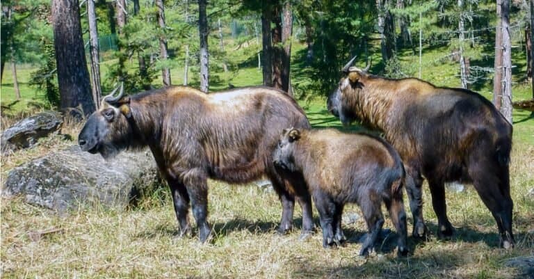
Mishmi Takin A signature large ungulate of high, steep forests and alpine edges in eastern Arunachal; culturally and ecologically emblematic of the Mishmi Hills.
White-winged Wood Duck A rare, globally threatened duck of quiet forest wetlands; Arunachal is among the most important Indian states for potential remaining populations.

Endemic & Rare Species

Mishmi Takin

Budorcas taxicolor

Vulnerable (global); regionally range-restricted in India

Arunachal (especially the Mishmi Hills region) represents the core Indian range; it is one of the state's most distinctive highland mammals.

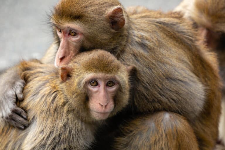
Arunachal Macaque

Macaca munzala

Endangered

A primate described from Arunachal in the 2000s; its known range is narrow in western Arunachal's high-elevation forests, making it a true state signature species.

White-bellied Heron

Ardea insignis

Critically Endangered

One of the world's rarest herons; Arunachal's large, relatively undisturbed river systems are crucial for the small remaining global population.

Bengal Florican

Houbaropsis bengalensis

Critically Endangered

A grassland specialist threatened by habitat conversion; remnant lowland grasslands in the broader northeast (including parts of Arunachal's foothills) are important for persistence.

Ward's Trogon

Harpactes wardi

Range-restricted Eastern Himalayan specialty (rare/local)

A coveted bird of cool, mossy broadleaf forests; Arunachal is one of the most reliable places in India to search for it.

Sclater's Monal

Lophophorus sclateri

Vulnerable

A rare, range-restricted pheasant of the Eastern Himalaya; Arunachal contains key habitat and is central to its Indian conservation story.

Rufous-necked Hornbill

Aceros nipalensis

Vulnerable

Declines elsewhere make Arunachal's remaining mature forests especially important; it is a hallmark of intact, tall-canopy forest.

White-winged Wood Duck

Asarcornis scutulata

Endangered

Highly sensitive to disturbance and wetland loss; any remaining Arunachal populations are conservation-priority and a major draw for specialist birders.

Chinese Pangolin

Manis pentadactyla

Critically Endangered

Poaching for illegal trade is a major threat; Arunachal's forests may still hold significant populations compared with many other parts of its range.

Himalayan Musk Deer

Moschus leucogaster

Endangered (regional/global assessments vary by taxonomy)

A high-elevation, heavily poached ungulate; Arunachal's remote upper forests and alpine zones are among the more important remaining refuges in India.

Notable Populations

  • Namdapha-Noa-Dihing landscape supports one of India's most intact large-mammal assemblages in a single protected forest block (tiger, clouded leopard, multiple smaller cats, elephant, diverse primates).
  • Eastern Arunachal (Mishmi Hills and adjoining highlands) is the core Indian stronghold for Mishmi takin and an important region for high-elevation carnivores (including snow leopard in suitable zones).
  • Arunachal's river systems (Siang, Subansiri, Kameng, Noa-Dihing and tributaries) are nationally significant for riverine biodiversity, including habitats used by the Critically Endangered white-bellied heron.
  • Statewide forests are among India's most important remaining habitats for hornbill diversity (great hornbill, wreathed hornbill, rufous-necked hornbill) where mature forest persists.

Recent Changes

  • Ongoing discovery and description of amphibians and reptiles in Arunachal has rapidly increased known species totals in the last decade, indicating under-documented diversity rather than recent colonization.
  • Local declines and increased fragmentation risk are widely reported for several large-bodied, hunted or trade-targeted species (pangolins, musk deer, some hornbills) where hunting pressure and access have risen.
  • Range-use documentation has improved for high-elevation carnivores (e.g., snow leopard) through camera trapping and sign surveys, refining where the species is confirmed within Arunachal's upper Himalaya.
  • Riverine specialists (notably white-bellied heron) remain vulnerable to hydropower development, sand/stone extraction, and disturbance-pressures that can drive local declines even where forests remain.
  • Human-elephant conflict dynamics are changing in some foothill areas with land-use change, influencing elephant movement patterns and increasing conflict incidents in certain corridors.
Visit

Wildlife Viewing

Arunachal Pradesh is one of India's best and least crowded wildlife places, from tropical river valleys to high alpine meadows in the Eastern Himalayas. At the junction of the Eastern Himalaya and Indo‑Burma regions, it offers birding, primate tracking and big‑mammal safaris. Expect hornbills, laughingthrushes, rare cats, bears, hoolock gibbons, frogs and butterflies. Plan permits, travel time and guides.

Best Seasons

Oct-Nov (post-monsoon, clear skies)

Peak visibility and comfortable temperatures across elevations; excellent birding with mixed-species flocks in Eaglenest/Sessni; good chances for primates and forest mammals in Namdapha and Pakke. Rivers run clear for scenic valley travel. Ideal for combining multiple parks in one trip.

Dec-Feb (winter)

Crisp, dry conditions at lower and mid elevations; good for photography and structured safari days in Pakke/Pakhui and Nameri-adjacent areas. Some high passes and alpine zones can be cold/snowy and occasionally inaccessible. Wintering waterbirds and raptors are a bonus in riverine habitats.

Mar-Apr (spring)

One of the best periods for bird vocal activity (breeding calls), orchids/rhododendrons in bloom, and overall forest visibility before summer rains. Excellent time for Eaglenest (Bugun Liocichla habitat), Pakke hornbills, and Mishmi Hills birding circuits; comfortable trekking conditions in mid-elevation forests.

May-Jun (early monsoon / pre-peak rains)

Lush forests and high wildlife activity, but increasing showers and leeches in some areas. This can be strong for amphibians, butterflies, and nocturnal wildlife walks where feasible. Plan extra buffer days for weather and road conditions.

Jul-Sep (monsoon)

Spectacular greenery and peak herpetofauna/insect diversity, but frequent heavy rain, landslide risk, and limited accessibility in many areas. Best only for specialists (amphibians, botany, macro photography) with flexible plans and local support; many visitors avoid this season.

Top Wildlife Experiences

  • Hornbill-focused safaris in Pakke (Pakhui) Tiger Reserve - dawn drives/forest walks around Seijosa & nearby community forests to look for Great, Wreathed, and Rufous-necked Hornbills, plus elephants, gaur, and primates.
  • Birding expedition to Eaglenest Wildlife Sanctuary (Sessni-Lama Camp corridor) - one of India's top montane birding routes; target specialty species such as Bugun Liocichla (in its known range), Himalayan cutias, trogons, and diverse laughingthrush flocks.
  • Multi-day wilderness journey in Namdapha National Park - explore one of India's largest forest wilderness areas for hornbills, pheasants, gibbons, and the chance (rare but real) of big cats in a landscape that transitions from lowland rainforest to higher ridges.
  • Mishmi Hills birding and mammal tracking (around Roing-Hunli-Anini approaches, seasonally accessible) - search for high-value Eastern Himalayan birds (including several rare laughingthrushes, wren-babblers, and raptors) and experience remote highland habitats.
  • Hoolock gibbon and primate watching in forest corridors near Pakke and other low-mid elevation forests - early-morning listening walks to locate calling gibbon families; often combined with hornbill and mixed-flock birding.
  • Riverine wildlife days along the Kameng and other major rivers (Pakke/Nameri region interface) - scan sandbanks and river edges for otters, kingfishers, riverine birds, and occasional large mammals coming to drink; great for landscape-and-wildlife photography.
  • Butterfly, orchid, and herpetofauna-focused natural history walks in spring/early monsoon in foothill forests (Pakke area, lower Eaglenest) - ideal for macro photography and naturalist-led identification days.

Wildlife Watching Types

Birding hotspots and montane birding drives (Eaglenest, Pakke, Mishmi Hills, Namdapha) Forest mammal safaris (elephant, gaur, deer; occasional rare cat sign/records) Primate watching (hoolock gibbon and other primates) Night walks / spotlighting in permitted areas (owls, flying squirrels, civets, amphibians) Riverine wildlife viewing (otters, kingfishers, sandbank birds; scenic river corridors) Butterfly and macro-naturalist trips (especially spring to early monsoon) High-elevation and alpine habitat exploration (seasonally accessible meadows/ridges for specialized birds and landscapes) Community-based wildlife and cultural-natural history experiences near protected areas (local guides, conservation villages)

Guided Options

  • Eaglenest birding circuits with local camps (Sessni/Lama Camp) led by specialist bird guides-typically 5-8 day programs focused on elevational transects and dawn-to-dusk bird activity.
  • Pakke/Pakhui hornbill and primate safaris arranged through local eco-camps and community guides (often based near Seijosa), combining park entry logistics with village conservation initiatives.
  • Namdapha wilderness programs with registered local guides and forest department coordination-multi-day itineraries emphasizing safe access, river/forest navigation, and species tracking.
  • Mishmi Hills guided expeditions (seasonal road access) run by regional birding specialists and local teams-best for photographers and serious birders seeking Eastern Himalayan specialties.
  • Naturalist-led macro and herpetofauna tours in foothill forests (spring/early monsoon), focusing on amphibians, reptiles, insects, butterflies, and night-time identification sessions.
  • Photography-focused wildlife trips (small groups) that prioritize time at known bird/mammal activity zones, hides where available, and flexible schedules for weather and light.
Habitats

Ecosystems

Arunachal Pradesh ranges from wet monsoon foothills and deep river valleys to cool temperate ridges and high alpine zones of the Eastern Himalayas. This creates layered ecosystems—evergreen forests, temperate broadleaf and conifer belts, subalpine shrublands, alpine meadows, and riverine and floodplain wetlands—that host Eastern Himalayan and Indo-Burma species like hornbills, hoolock gibbons, red panda, takin, and high altitude pheasants.

Biomes

Tropical Rainforest

Very wet, largely evergreen to semi-evergreen forests in the outer Himalayan foothills and deep valleys (notably in the southeast around Namdapha and along major river basins), with high orchid/fern diversity and dense canopy structure.

Widespread at low elevations in the south and southeast; concentrated in the wettest foothill/valley tracts (roughly low-elevation belt).

Temperate Forest

Montane broadleaf and mixed forests (oak, maple, magnolia, rhododendron, etc.) transitioning upward to conifer-dominated stands; strong east-west and slope-aspect variation driven by rainfall and elevation.

Large mid-elevation belt across much of the state; one of the dominant natural covers on mountain slopes.

Temperate Rainforest

Exceptionally moist montane/cloud-forest conditions on windward slopes with heavy monsoon influence-mossy forests, epiphyte-rich canopies, and persistent fog (often overlapping with broadleaf temperate forests).

Patchy but prominent on high-rainfall, windward mid-elevation slopes (not continuous statewide).

Alpine

Above treeline: subalpine scrub, rhododendron thickets, alpine grasslands/meadows, scree, and snow-influenced habitats supporting cold-adapted flora and fauna.

High-elevation zones in the north and along major ranges (e.g., around Tawang/West Kameng and higher ridges statewide); limited area but ecologically distinctive.

Freshwater

Large, fast-flowing Himalayan rivers and tributaries (glacial/snowmelt + monsoon-fed) with braided reaches, gravel bars, and deep gorges; crucial for aquatic biodiversity and riparian corridors.

Statewide via dense river network (Siang, Subansiri, Kameng, Dibang, Lohit, Noa-Dihing, etc.).

Wetland

Floodplain wetlands, oxbow-like features, riparian marshes, and seasonally inundated lowland areas along major valleys; includes high-altitude wet meadows/peaty patches in some alpine basins.

Localized-most extensive in lowland valley bottoms and along larger rivers; smaller scattered alpine wet patches at high elevations.

Habitats

Forest

Extensive natural forest cover across elevation bands; includes protected landscapes such as Pakke (Pakhui) Tiger Reserve, Eaglenest Wildlife Sanctuary, and large community-managed forests.

Rainforest

Evergreen/semi-evergreen lowland and foothill forests with high structural complexity; notable in and around Namdapha National Park and the Noa-Dihing basin.

Deciduous Forest

Moist deciduous elements and seasonal-leaf-drop components mixed into subtropical/temperate forests, especially in drier pockets, valley rain-shadows, and disturbed/secondary areas.

Coniferous Forest

Subalpine to upper-temperate conifer stands (e.g., fir, spruce, hemlock/pine locally) on colder slopes and higher elevations, transitioning to krummholz near treeline.

Woodland

Open-canopy forest/woodland mosaics on ridges and in human-influenced landscapes (shifting cultivation fallows and village-use forests), often intergrading with shrubland and grassland.

Grassland

Riverine grass/sandbar communities and montane openings; includes tall-grass patches in valley bottoms and grassy clearings created by landslides, floods, and traditional land use.

Shrubland

Subalpine rhododendron/juniper scrub and secondary shrublands on slopes, landslide scars, and regrowing fallows; important for mid- to high-elevation wildlife cover.

Alpine Meadow

High-elevation meadows above treeline (summer-grazed in places) with diverse herbaceous flora; prominent around high passes and plateaus (e.g., Tawang/West Kameng highlands).

Mountain

Steep Himalayan terrain with strong altitudinal zonation, frequent landslides, and diverse microclimates; major biodiversity driver and connectivity corridor between Bhutan-Tibet-Myanmar ranges.

Cliff/Rocky Outcrop

Rock faces and canyon walls along gorges and high ridges providing nesting/roosting sites (raptors) and specialized cliff flora; common in Siang, Dibang, and Kameng gorges.

Cave

Local limestone/rock shelters and small cave systems (where geology permits), used by bats and other cavern fauna; generally scattered and site-specific.

Lake

High-altitude lakes/tarns and landslide-dammed lakes (e.g., Sangetsar/Madhuri Lake area near Tawang) with cold, oligotrophic conditions.

River/Stream

Major Himalayan rivers and tributaries (Siang/Brahmaputra headwaters system, Subansiri, Kameng, Dibang, Lohit, Noa-Dihing) supporting riparian forests, gravel bars, and fisheries.

Pond

Small village ponds, rain-fed depressions, and temporary pools-important for amphibians and local water use; scattered in settled valleys.

Wetland

Seasonally inundated floodplain patches, riparian wetlands, and high-altitude wet meadows; key for waterbirds and nutrient cycling in valley bottoms.

Swamp

Riparian swampy pockets and waterlogged forested areas along low-gradient valley reaches and backwaters during monsoon peaks; localized.

Marsh

Shallow, sedge- and grass-dominated marshes along river edges and floodplain depressions; expands seasonally with monsoon flooding.

Bog

Small alpine/subalpine peat-forming wet patches (where persistent saturation occurs), uncommon but ecologically significant for carbon storage.

Urban

Compact urban centers (e.g., Itanagar-Naharlagun) with fragmented green spaces and altered hydrology; relatively small footprint compared to forested areas.

Agricultural/Farmland

Terraced fields and valley agriculture (rice, maize, millet, horticulture) plus jhum/shifting-cultivation mosaics that create successional habitat patches.

Plantation

Localized plantations (e.g., tea/horticulture and small timber/fuelwood plantings) mainly in lower elevations; not dominant statewide.

Ecoregions

Eastern Himalayan broadleaf forests Eastern Himalayan subalpine conifer forests Eastern Himalayan alpine shrub and meadows Himalayan subtropical broadleaf forests Brahmaputra Valley semi-evergreen forests
Protection

Conservation

Primary Threats

  • Forest and riverine habitat loss/fragmentation occurs through shifting cultivation (jhum) transitions, conversion to settled agriculture/horticulture in valleys, and widening linear clearings for roads, powerlines, and hydropower projects-breaking connectivity between Pakke-Nameri foothills, Kamlang-Namdapha forests, and Dibang/Siang landscapes.
  • Roads, bridges, quarries, and camps open remote forests (West Kameng/Tawang, Upper Siang, Anjaw/Changlang), causing habitat break-up, more disturbance, vehicle collisions, logging, and hunting. Hydropower on Siang, Subansiri, Dibang, Kameng brings construction damage, many workers, and long-term river changes.
  • Although large-scale commercial logging has been curtailed compared with the past, localized illegal felling and heavy extraction for construction timber and fuelwood persists near expanding road networks and towns; selective removal of large trees also reduces nesting/roosting resources for hornbills and other cavity nesters in lowland forests.
  • Traditional and opportunistic hunting (guns/snares) affects pheasants, hornbills, primates, and ungulates in several landscapes; even where culturally regulated, increased market access via roads can shift hunting from subsistence to higher offtake.
  • Cross-border proximity to Myanmar and trade routes toward Southeast Asia/Tibet can drive trafficking of high-value wildlife (e.g., pangolins, bear parts, big-cat parts) and capture of rare species; enforcement is challenging in rugged terrain with porous borders and expanding transport corridors.
  • Elephants (foothill valleys), wild pigs, and occasionally bears cause crop loss; leopards and occasionally tigers depredate livestock in forest-edge villages. Retaliatory killing and social tolerance erosion are key risks, especially where compensation is delayed or inaccessible.
  • Warming and altered precipitation are shifting treelines and alpine meadow composition, affecting high-elevation specialists (e.g., red panda habitat quality via bamboo dynamics; alpine ungulates and their predators). Glacier/snowpack changes and more extreme rainfall increase landslides and river sediment pulses, influencing both terrestrial and aquatic ecosystems.
  • Hydropower and river regulation (flow alteration, sediment trapping/release, bank stabilization) modify riparian habitats important for fish (e.g., mahseer), turtles, and riverine bird communities; altered fire regimes and increased human ignition near roads can change understorey composition in some forests.
  • Local declines in river fish are linked to destructive practices (e.g., dynamite/chemical/electrofishing in some stretches), increased access to remote streams, and habitat changes from sedimentation and flow modification; this particularly affects larger migratory/riverine fishes in the Siang/Subansiri systems.
  • Construction-related runoff, quarry silt, and landslide debris elevate turbidity in rivers; localized agrochemical use in expanding horticulture belts and improper solid waste disposal around growing towns/tourist nodes (e.g., Tawang circuit, Itanagar region) add pressure on waterways and wildlife.
  • Expansion of horticulture (orchards/plantations), terrace cultivation in valleys, and settlement growth along road corridors reduces forest edges and increases human presence in wildlife movement zones, intensifying conflict and fragmenting habitats.
  • Urban sprawl and associated infrastructure around Itanagar-Naharlagun and district headquarters increases demand for timber, sand/stone, water, and land; it also creates barrier effects and light/noise disturbance along key foothill interfaces.
  • High dependence on fuelwood and non-timber forest products (bamboo, medicinal plants, wild edible species) can cause localized depletion near villages and roadheads; extraction pressure often concentrates along accessible corridors, degrading understorey and regeneration.
  • In disturbed foothill and roadside areas, invasive plants (commonly including Lantana camara and Chromolaena odorata) can colonize openings, suppress native regeneration, and alter habitat quality for understorey-dependent fauna.
  • Interface between livestock/free-ranging dogs and wildlife can transmit pathogens (e.g., canine diseases affecting carnivores; parasites to ungulates). Increasing settlements and road-linked dog populations heighten risks near protected-area edges.
  • Pilgrimage/tourism growth (e.g., Tawang sector, Eaglenest/Pakke landscapes) increases traffic, noise, waste, and off-trail pressure. Military and border outposts can add persistent disturbance in high-elevation zones if not carefully managed.
  • Localized coal/limestone extraction and stone quarrying (often associated with road and hydropower material needs) drive forest clearing, slope instability, and sediment pollution; impacts are typically concentrated but severe in affected valleys.
  • Linear infrastructure and valley development can isolate small populations (e.g., arboreal primates, small carnivores, and some pheasants) across ridgelines and river barriers, reducing gene flow and increasing vulnerability to local extirpation.
Fun Facts

Did You Know?

In Namdapha, you can encounter classic Indo-Malayan rainforest wildlife (like hoolock gibbons and great hornbills) in the lowlands and still have confirmed records of snow leopard from the same protected area-an unusual overlap created by the reserve's extreme altitude range.

Arunachal is one of the only places where a bird can be genuinely "local to one valley": the Bugun liocichla is a micro-endemic known from a very small area around Eaglenest/Singchung, not broadly across the Himalaya.

A primate new to science was described here in the 21st century: the Arunachal macaque (Macaca munzala) was formally described in 2005 from Tawang-West Kameng, showing that large mammals in the Eastern Himalaya are still being discovered/reclassified recently.

Eaglenest Wildlife Sanctuary is extraordinarily species-dense for birds: more than 450 bird species have been recorded from an area of only ~218 km², including sought-after Eastern Himalayan rarities such as Ward's trogon.

A "duck of the rainforest" lives here: the critically endangered white-winged wood duck uses forest wetlands and often nests in tree cavities-an unexpected lifestyle for a duck, and Namdapha is one of its key Indian strongholds.

Namdapha National Park and Tiger Reserve (1,985 km²) is one of the largest protected areas in Northeast India and is India's easternmost tiger reserve.

Namdapha is famous as one of the very few protected areas where all four "big cats" have been recorded: tiger, leopard, clouded leopard, and snow leopard.

Namdapha's elevation spans roughly ~200 m to ~4,571 m (Dapha Bum), giving it one of the biggest elevational gradients inside a single Indian protected area-tropical rainforest to near-alpine habitats within one reserve.

Arunachal Pradesh is one of India's hornbill strongholds, with at least seven species recorded: Great Hornbill, Wreathed Hornbill, Oriental Pied Hornbill, Rufous-necked Hornbill, Brown Hornbill, Austen's Brown Hornbill, and Helmeted Hornbill.

The Bugun liocichla (Liocichla bugunorum), discovered at Eaglenest and described in 2006, is widely cited as the first new bird species described from India in roughly six decades-making Arunachal a modern-era "new species" hotspot.

Thank you for reading! Have some feedback for us?