
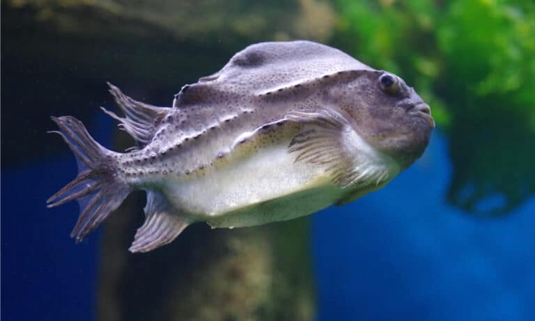
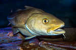
Haddock
Thumbprint of the North Atlantic
Thumbprint of the North Atlantic

Small porpoise, big sonar.
The suction-cup guardian of the North
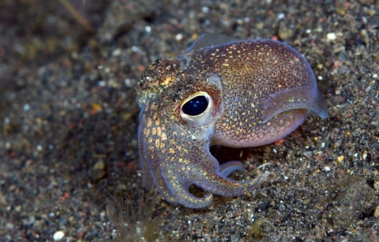
Ten-limbed sprinters of the sea
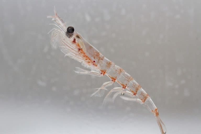
Tiny swarms, giant ocean impact
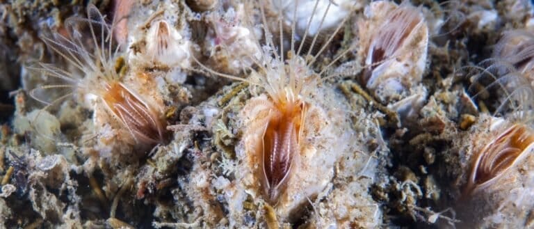
Crustaceans that live like living glue

Built of cartilage, made for the sea

Tiny fly, mighty bite.
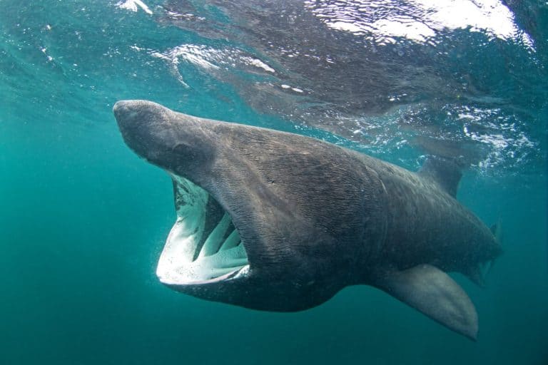
Big mouth, tiny prey.

Curved bill, epic journeys
The North Sea is a temperate, semi-enclosed continental shelf sea of the northeastern Atlantic Ocean, situated between Great Britain and northwestern continental Europe and connected to the Atlantic via the English Channel and the northern passages between Scotland and Norway.
The North Sea is a broad, relatively shallow shelf sea spanning the space between the British Isles and the coasts of Norway, Denmark, Germany, the Netherlands, Belgium, and France. Its waters are continually renewed and mixed by strong tides and winds, while major rivers (including the Rhine, Elbe, Weser, Thames, and Humber) deliver freshwater, sediments, and nutrients that shape coastal salinity gradients, turbidity, and productive estuarine-plume ecosystems.
Biologically, the North Sea is among Europe's most productive marine regions: seasonal stratification in parts of the central and northern basin, coupled with nutrient supply and vigorous mixing elsewhere, fuels large phytoplankton blooms that support rich food webs-plankton, benthic communities on sandbanks and muds, and fish such as herring, cod, haddock, plaice, and sandeel. Its mosaic of habitats includes intertidal flats and saltmarshes in the south, offshore banks and reefs (including biogenic structures), and deeper troughs in the north.
The sea is also one of the world's most intensively used marine spaces. Dense shipping lanes connect major ports, fisheries have long shaped ecosystems and management priorities, and extensive oil and gas fields, subsea pipelines, and rapidly expanding offshore wind farms make it a focal point for maritime industry. These uses intersect with environmental pressures-eutrophication, habitat alteration, noise, invasive species, and climate-driven warming-driving extensive monitoring, cross-border governance, and marine spatial planning.
Etymology: The name "North Sea" is a directional designation meaning the sea to the north from the perspective of nearby European regions. The term is documented in medieval sources and aligns with similar directional naming used by North Sea coastal communities.
Highly productive fishing grounds (e.g., Dogger Bank), major shipping routes, offshore oil & gas and rapidly expanding offshore wind
The North Sea is a temperate, shallow continental-shelf sea on the northeastern margin of the Atlantic Ocean, lying between Great Britain to the west and the coasts of Scandinavia and northwest continental Europe to the east and south.
Norwegian Trench (Skagerrak/Norwegian coastal margin, northeastern North Sea)
United Kingdom (eastern England and Scotland, including island groups that fringe the northern approaches)
Norway (southwestern and southern Norwegian coast; adjacent to the Norwegian Trench and Skagerrak)
Denmark (west coast of Jutland; gateway toward Skagerrak/Kattegat)
Germany (German Bight; Wadden Sea coast)
Netherlands (Dutch North Sea coast; Rhine-Meuse river influence)
Belgium (short North Sea frontage with intense shipping and coastal management)
France (northern coast around the Strait of Dover/English Channel entrance)
West: Great Britain (Scotland and eastern England). East: Norway and Denmark. South: the coasts of Germany, the Netherlands, Belgium, and northern France. North/Northwest: opens to the northeastern Atlantic around the northern UK (via the shelf edge) and between northern Scotland/Shetland and Norway; Northeast: connects toward the Skagerrak-Kattegat system leading to the Baltic Sea.
Surface avg: ~9-11 °C annual mean (south typically warmer; north cooler)
Deep avg: ~6-9 °C (bottom waters generally cooler and less variable; strongest seasonality in shallow areas)
Open North Sea typically ~34-35.5 PSU. Fresher coastal bands and estuaries can drop to ~28-33 PSU due to major river inputs (Rhine-Meuse-Scheldt, Elbe, Weser, Thames, Humber) and Baltic outflow via Skagerrak/Kattegat; higher salinity enters from the North Atlantic through the northern entrances and English Channel.
Winter: ~2-7 °C (often ~4-6 °C central/southern, colder in the far north). Summer: ~12-18 °C (southern shallows can reach ~18-20 °C during warm spells). Spring warming and autumn cooling are rapid due to shallow depths and strong mixing.
Dominant circulation is generally cyclonic (counterclockwise): Atlantic water enters mainly north of Scotland and via the English Channel, flows east/southeast and then northward along the continental margin. The Norwegian Coastal Current carries fresher water northward along Norway into the Norwegian Sea. Baltic outflow through Skagerrak contributes a low-salinity surface layer. Local wind-driven currents and strong tidal residuals shape coastal transport and frontal zones.
Semi-diurnal tides dominate (M2). Tidal range is large in the south and along the UK/continental coasts (~3-6+ m, locally higher in embayments/estuaries), decreasing toward the northern North Sea (~1-3 m). Strong tidal currents promote widespread mixing in shallow regions and create mixing fronts where tidal energy weakens offshore.
A temperate shelf-sea mix of Atlantic inflow, coastal/river-influenced waters, and Skagerrak/Baltic-influenced waters. High suspended sediments and turbidity are common in the southern shallow shelf. Oxygen is generally well supplied by mixing, but bottom oxygen can periodically decline in stratified areas (especially late summer) where organic matter decomposition is high.
Strongly seasonal and spatially variable: the shallow southern North Sea is often well mixed year-round due to tides and wind. The deeper central and northern North Sea typically stratify from late spring to early autumn (warm, fresher surface layer over cooler, saltier bottom water). Persistent tidal mixing fronts form between mixed and stratified waters, enhancing productivity and defining ecological regions.
Intermittent, wind-driven coastal upwelling can occur along the Danish and Norwegian coasts and near the entrance regions (e.g., around Skagerrak) during favorable winds, bringing cooler, nutrient-rich subsurface waters to the surface. Shelf-break processes and frontal mixing (rather than classic persistent upwelling) are key nutrient-supply mechanisms, especially along tidal fronts and in regions of strong vertical mixing.
Very high primary productivity supported by strong tidal mixing, river nutrient inputs, and frontal zones; frequent turbidity and resuspension in the shallow south; pronounced seasonal stratification and frontal dynamics in the central/north; episodic harmful algal blooms and hypoxia risk in stratified bottom waters during warm, calm late summers; strong anthropogenic influence (shipping, fishing, dredging, offshore wind/oil/gas) and long-term warming trends with shifts in plankton and fish distributions.
The North Sea has a cool-temperate, maritime climate with strong westerly winds, frequent low-pressure systems, and relatively small annual temperature ranges compared with continental seas. Being a shallow shelf sea, it responds quickly to atmospheric forcing: winds and tides strongly control mixing, waves, storm surges, and short-term temperature variability. Freshwater inputs (e.g., Rhine-Meuse, Elbe, Weser, Humber, Thames) create coastal salinity gradients and can enhance stratification in warmer months, while winter is typically well-mixed across much of the basin. Overall conditions are highly dynamic, with high biological productivity supported by nutrient inputs, seasonal stratification in deeper areas, and vigorous tidal/wind-driven mixing.
Winter (Dec-Feb): Coldest period with frequent gales, rough seas, and strong vertical mixing; coastal waters are cooler and fresher near major river plumes; storm surges are most likely when deep lows coincide with strong onshore winds and high tides. Spring (Mar-May): Rapid increase in daylight drives the main phytoplankton bloom; winds are often still brisk, but calmer intervals become more common; developing thermal stratification begins in deeper central/northern areas while shallow southern areas often remain mixed. Summer (Jun-Aug): Mild-to-cool summers; stratification is common in the central and northern North Sea (warmer surface over cooler bottom water), while the shallow southern North Sea tends to stay tidally/wind mixed; occasional heatwaves can warm surface waters and strengthen stratification, influencing oxygen risk in bottom waters in some coastal/stratified zones. Autumn (Sep-Nov): Cooling and stronger winds erode stratification (autumn turnover), increasing mixing and resuspension; storminess ramps up markedly, with larger wave events and more frequent coastal surge risk.
The North Sea does not experience true tropical cyclones (hurricanes/typhoons) because sea-surface temperatures are too low to sustain them. Storm activity is dominated by mid-latitude extratropical cyclones tracking from the North Atlantic into northern Europe, especially from late autumn through winter. These systems can produce gale- to storm-force winds, large waves, and significant storm surges along shallow coasts (notably the German Bight, Dutch coast, and parts of eastern UK) when winds are prolonged and onshore. Occasionally, the remnants or transitioned forms of former Atlantic hurricanes can reach the region as extratropical storms, contributing to intense wind and wave events, but they are not tropical by the time they affect the North Sea.
Sea ice is generally absent. In typical winters, the open North Sea remains ice-free; however, short-lived coastal or estuarine ice can occur during severe cold spells in sheltered, very shallow areas (e.g., parts of the Wadden Sea, fjords/inner coastal waters, harbors, and river mouths), with extent and duration highly variable and usually limited.
The North Sea is a shallow, temperate continental-shelf sea with strong tidal mixing, pronounced seasonal stratification in deeper/offshore areas, and major nutrient inputs from rivers and adjacent Atlantic inflow. This combination drives high primary productivity (notably spring phytoplankton blooms) that supports rich pelagic food webs and extensive benthic communities on sandy, muddy, gravel, and rocky substrates. Ecological patterns are shaped by strong gradients (coastal-to-offshore, north-to-south, stratified-to-mixed waters) and intense human pressures including bottom trawling, eutrophication (historically), contaminants, shipping noise/disturbance, habitat modification, and expanding offshore wind and oil/gas infrastructure.
Overall biodiversity is high for a temperate shelf sea, with particularly strong benthic invertebrate diversity and high seasonal biomass/production in plankton and forage fish. Diversity and community composition vary markedly by habitat (e.g., Wadden Sea mudflats vs. offshore sandbanks vs. hard-bottom reefs) and have been altered by fishing pressure, climate-driven range shifts, and changes in nutrient regimes.
Species count: Approximate order-of-magnitude: >200 marine fish species recorded; ~3,000-10,000+ benthic invertebrate taxa across habitats (polychaetes, molluscs, crustaceans, echinoderms, etc.); ~10-15 regularly occurring marine mammal species (seals, porpoises, occasional whales); >100 seabird species recorded with ~20-30 key breeding species around the basin (counts vary by definition and survey scope).
The North Sea's neritic zone covers most of the basin because it is a shallow continental shelf sea. Coastal waters are strongly shaped by tides, wind-driven mixing, and freshwater and nutrient inputs from major rivers (e.g., Rhine-Meuse-Scheldt, Elbe, Weser, Thames, Humber), creating pronounced salinity and turbidity gradients, especially in the southern and eastern North Sea. Nutrient enrichment and spring-summer stratification fronts promote high primary production, with recurring phytoplankton blooms (diatoms early; flagellates later) and extensive coastal nursery habitats. Key physical features include tidal flats and estuaries (Wadden Sea), sandbanks, and coastal fronts that concentrate plankton and fish, but these areas are also heavily exposed to dredging, eutrophication legacies, and dense shipping and construction (ports, offshore wind).
In the North Sea pelagic zone, the water column is productive and seasonally structured rather than truly 'open ocean' deep. Strong winter storms mix the water column broadly, replenishing nutrients; in spring, increasing light triggers major phytoplankton blooms that fuel zooplankton growth and support pelagic fish. The northern North Sea and deeper channels can stratify in summer, while the shallow southern North Sea often remains well-mixed; this creates persistent fronts (e.g., around the Dogger Bank and along shelf gradients) that act as feeding hotspots for fish, seabirds, and marine mammals. Pelagic habitats are highly dynamic, with plankton communities responding to temperature, inflow from the Atlantic via the Norwegian Trench and English Channel, and episodic events (heatwaves, inflow pulses). Human pressures include large-scale fishing on schooling fish, bycatch risk for seabirds and mammals, underwater noise, and growing offshore energy infrastructure affecting local hydrodynamics.
The benthic zone spans extensive soft-sediment seafloors dominated by sands, gravels, muds, and mixed substrates shaped by tides and strong bottom currents. Benthic communities include infaunal worms (polychaetes), bivalves (cockles, mussels, clams), echinoderms (sea stars, brittle stars), crustaceans, and burrowing organisms that recycle nutrients and oxygenate sediments (bioturbation). In the southern North Sea, mobile sands and frequent resuspension favor resilient, short-lived species; in muddier areas and deeper northern regions, organic matter can accumulate and support rich deposit-feeding assemblages. The Wadden Sea and other intertidal flats are critical benthic production zones supporting internationally important shorebird populations. Seafloor habitats are strongly affected by bottom trawling, sand and gravel extraction, eutrophication-driven organic loading, and localized disturbance around pipelines, cables, and energy installations, with increasing emphasis on benthic habitat restoration and protected areas.
The demersal zone near the seabed is a key interface where currents, resuspended sediments, and benthic prey support commercially important fish and mobile invertebrates. Typical demersal fauna include cod, haddock, whiting, saithe (north), plaice, sole, dab, turbot, brill, monkfish, and Norway lobster (Nephrops) in suitable muddy habitats, alongside skates and rays. Many species use sandbanks and coastal shallows as juvenile nurseries, then shift deeper or northward as they grow. Oxygen and temperature conditions near the bottom vary seasonally, with stratified summer periods in parts of the central/northern North Sea occasionally reducing bottom oxygen and altering distributions. Demersal communities are highly exposed to bottom-contact fishing gear (trawls, dredges), which can simplify habitat structure and directly affect benthic prey fields, while offshore structures can create localized 'reef effects' that change near-bottom food availability and shelter.
Notable migrations in the North Sea are strongly seasonal. In spring and summer, pelagic schooling fish such as herring and mackerel move to feeding areas following plankton blooms and temperature fronts, while many flatfish (e.g., plaice, sole) migrate between offshore spawning grounds and coastal nursery areas (often peaking in late winter-spring for spawning and spring-summer for juvenile settlement). Atlantic salmon and sea trout migrate through coastal corridors to and from rivers, with timing varying by river system (often spring-autumn). Seabird movements peak in spring and autumn, with large numbers of auks, gannets, kittiwakes, terns, and migratory waders using the North Sea and Wadden Sea as feeding and stopover areas. Marine mammals show seasonal shifts as prey moves: harbor porpoises commonly track fish distributions; seals (harbor and grey) undertake regional foraging trips and gather at haul-outs/colonies during pupping seasons (harbor seals typically late spring-summer; grey seals autumn-winter, regionally variable).
North Sea food webs are driven by high primary production and strong coupling between the water column and seafloor. (1) Bloom-to-fish pelagic chain: phytoplankton (diatoms/flagellates) → zooplankton (e.g., Calanus copepods) → forage fish (sandeel, sprat, herring, juvenile gadoids) → top predators (cod and other large fish, seabirds such as puffins and kittiwakes, marine mammals including porpoises and seals). (2) Benthic-demersal chain: phytoplankton and detritus settling to sediments → benthic invertebrates (polychaetes, bivalves, amphipods, echinoderms; plus Nephrops in muddy grounds) → demersal fish (plaice, sole, haddock, cod, rays) → higher predators (larger fish, seals, and occasionally larger pelagic visitors). (3) Coastal/estuarine nursery chain: nutrient-enriched coastal production and microphytobenthos on tidal flats → small crustaceans and worms → juvenile flatfish and estuarine fishes → seabirds and larger fish. These webs are strongly influenced by fishing pressure (removing top and mid-level predators), climate variability (shifting plankton composition and timing), and habitat disturbance that alters benthic prey availability and the reliability of sandeel- and herring-based pathways.

The North Sea is a highly productive, shallow temperate shelf sea that supports major fisheries, seabird colonies, and marine mammal populations, but its biodiversity is under sustained pressure from dense coastal populations and intensive use (shipping, fishing, offshore oil/gas and wind, dredging, and nutrient-rich river inflows). While management has improved in some areas (wastewater treatment, some stock rebuilding, growth of marine protected area networks), cumulative impacts-especially fishing pressure on seabed habitats, pollution, and accelerating climate-driven changes-continue to constrain ecosystem recovery.
Moderate but stressed; ecosystem health is degraded in heavily used areas, with localized improvements where management is strong.
Historically high fishing pressure (including bottom trawling) has altered food webs and reduced biomass/size structure of some stocks; bycatch affects non-target fish, seabirds, and marine mammals; seabed abrasion remains widespread on trawled grounds.
Chronic nutrient enrichment from major rivers drives eutrophication and periodic hypoxia risk in some coastal/estuarine zones; contaminants include legacy industrial chemicals, heavy metals, and emerging pollutants (PFAS, pharmaceuticals); marine litter and microplastics persist; underwater noise from shipping and construction is an additional pollutant-like pressure.
Degradation and loss of benthic habitats (sand/mud communities, biogenic reefs such as oyster and Sabellaria structures) from bottom-contact fishing, dredging/aggregate extraction, and coastal modification; reduced habitat complexity affects nursery and feeding areas.
Offshore wind expansion, oil/gas infrastructure, pipelines/cables, and port development increase spatial conflict, disturbance, and risk of habitat fragmentation; construction piling elevates noise exposure; decommissioning decisions can create trade-offs for habitat and navigation.
Warming is driving northward shifts in species distributions, altering plankton timing and fish recruitment; marine heatwaves and changing stratification affect productivity; ocean acidification stresses calcifiers and shellfish; combined effects can amplify disease and harmful algal bloom risk.
Non-native species introduced via ballast water, hull fouling, and aquaculture can alter benthic communities and compete with natives; impacts are often localized but can become persistent in ports/estuaries and spread along coasts.
Very high vessel traffic causes underwater noise, collision risk for marine mammals, and disturbance to seabirds; intense recreation and coastal use disturb haul-out and breeding sites; seismic surveys add intermittent high-intensity noise.
Extraction of sand and gravel, and localized depletion of benthic invertebrates from dredging, reduces habitat quality and can affect turbidity and sediment dynamics; cumulative effects interact with trawling impacts.
Coastal defense works, land reclamation, and altered freshwater/sediment inputs modify estuaries and nearshore dynamics; changes in nutrient loads can shift ecosystem states and favor opportunistic species.
High nutrient inputs from major rivers (eutrophication risk), persistent contaminants (legacy industrial chemicals, metals), emerging pollutants (e.g., PFAS, pharmaceuticals), oil/chemical spill risk from dense shipping lanes, widespread marine litter and microplastics; underwater noise is a significant chronic stressor.
Many stocks are managed under quotas and some have improved, but status is mixed: several demersal stocks have shown recovery while others remain vulnerable; bottom trawling footprint and bycatch remain key issues; seabed habitat impacts are a major constraint on ecological condition even where target stocks are better managed.
Rapid warming relative to global average in parts of the region is shifting species distributions and altering plankton phenology; increased frequency of marine heatwaves and changing stratification can affect oxygen and productivity; ongoing ocean acidification threatens shell-forming organisms and may reduce resilience of benthic communities.
Introductions via shipping and coastal infrastructure remain a continuing risk, with established non-natives in ports/estuaries and some coastal spread; impacts include altered fouling communities and competition/predation pressures on native benthos.
A vast, shallow sandbank (shoal) and elevated seabed plateau in the central North Sea, largely about 15-40 m deep, with extensive sand waves and gravel areas.
One of the North Sea's best-known seabed features and a major fishing ground; also a focal area for large offshore wind development and conservation discussions due to important benthic habitats and fish nurseries.
A deep glacially carved channel running along the Norwegian coast into the Skagerrak, reaching several hundred meters depth and contrasting strongly with the surrounding shallow shelf.
The North Sea's principal deep-water feature, influencing circulation, water-mass exchange, and sediment transport; important for understanding regional oceanography and carbon/sediment burial.
The northeastern gateway connecting the North Sea with the Kattegat and onward to the Baltic Sea, with complex currents and deep basins near the Norwegian Trench.
A key choke point for water exchange, nutrients, and pollutants between the North Sea and Baltic; notable for productive fisheries and heavy shipping traffic.
A shallow sea/strait between Denmark and Sweden that links the North Sea (via Skagerrak) to the Baltic system, characterized by strong salinity gradients.
Critical transition zone controlling Baltic-North Sea exchange; ecologically sensitive due to eutrophication pressures and intense maritime activity.
A large embayment on the east coast of England with extensive intertidal flats, saltmarshes, and tidal channels influenced by several rivers.
One of the UK's most important areas for migrating and overwintering birds and coastal productivity; notable for dynamic sediment processes and fisheries (e.g., shellfish).
A small German archipelago in the southeastern North Sea with distinctive red sandstone cliffs and surrounding rocky reefs uncommon in much of the region.
A classic North Sea marine research site and biodiversity hotspot for hard-substrate communities; historically significant for navigation and maritime history.
An extensive intertidal system of tidal flats, barrier islands, channels, and saltmarshes stretching along the Netherlands, Germany, and Denmark.
UNESCO World Heritage-listed for its scale and ecological importance; crucial nursery habitat for fish, major stopover for migratory birds, and a globally significant intertidal ecosystem under strong human and climate pressures.
A UK archipelago north of mainland Scotland, where Atlantic and North Sea waters interact around complex coastlines, reefs, and strong tidal streams.
Noted for rich marine life, seabird colonies, and productive waters; also associated with major offshore oil history and sensitive coastal habitats.
A small island between Orkney and Shetland, exposed to powerful currents and mixing zones that support abundant plankton and seabird foraging.
Internationally famous for seabirds and as a natural observation point for marine and avian migrations; surrounding waters are valued for wildlife watching and diving.
A large natural harbor within Orkney, sheltered by surrounding islands, with complex tidal flows and numerous historic wrecks.
One of the world's most renowned shipwreck diving areas and a major naval anchorage in both World Wars; iconic for the scuttled German High Seas Fleet wrecks.
A WWII-era American liberty ship that ran aground in 1944 in the Thames Estuary, still containing unexploded munitions.
Notable as one of the North Sea region's most hazardous wrecks due to remaining explosives; a long-standing maritime safety and coastal management concern.
A Royal Navy battleship sunk by German U-boat attack in 1939 within Scapa Flow; the wreck remains in place as a protected war grave.
A major WWII historical site and memorial; among the most significant protected wrecks in UK waters.
Concentrations of wrecks and naval debris from major North Sea conflicts, especially in and near the Heligoland Bight and along nearby shipping routes.
The North Sea contains exceptionally dense wreck heritage due to centuries of trade and warfare; these areas are notable for maritime archaeology and as de facto artificial reefs.
Chalk headland on England's Yorkshire coast with adjacent underwater chalk reefs, caves, and ledges that are popular for marine wildlife viewing and diving.
A prominent coastal landmark whose surrounding waters include notable chalk reef habitat and are part of the Flamborough Head European Marine Site (protected for seabirds and marine features).
The North Sea has been a major corridor for trade and cultural exchange since prehistory, linking the British Isles with continental Europe. During the Roman period it connected provinces and frontier zones, while later it became central to Viking-age seafaring, raiding, and settlement networks spanning Norway, Denmark, the British Isles, and the North Atlantic. In the medieval and early modern eras, the Hanseatic League and North Sea port towns underpinned long-distance commerce in timber, grain, fish, wool, and textiles. It also played an outsized role in European naval history (Anglo-Dutch wars, World Wars), and preserves extensive submerged landscapes such as "Doggerland," highlighting ancient human presence before post-glacial sea-level rise.
One of the world's busiest shelf seas for commercial navigation, with dense traffic separation schemes connecting the English Channel, Skagerrak/Kattegat, and Atlantic approaches. Major lanes run along the UK east coast, across to the Dutch/German Bight, and north-south between Norway/Denmark and the UK. Key ports and complexes include Rotterdam-Europoort (NL), Antwerp (BE; via Scheldt estuary), Hamburg (DE; via Elbe), Bremerhaven/Wilhelmshaven (DE), Amsterdam/IJmuiden (NL), Zeebrugge (BE), Dunkirk and Calais (FR), Felixstowe, London Gateway, Teesport, Tyne, Immingham/Humber, and Aberdeen (UK), plus Bergen, Stavanger, and Kristiansand (NO), Esbjerg (DK). Offshore service shipping supports oil/gas, wind farms, and subsea infrastructure; risks include congestion, shallow banks, strong tides, fog, and winter storms.
Intensive industrial fisheries operate across banks and shelf grounds, using bottom trawls, pelagic trawls, seine, dredges, and static gears. Management is shaped by national regimes and multilateral stock assessments (e.g., for shared stocks), with ongoing pressures from bycatch, habitat disturbance on soft sediments, and spatial competition with energy infrastructure and MPAs.
Small-scale coastal fleets (day boats) target seasonal and local resources using pots/creels, gillnets, longlines, handlines, and small beam trawls. These fisheries are often tied to specific communities and harbors, supplying local markets and tourism; conflicts can arise with offshore developments and conservation closures.
Temperate-water diving with variable visibility (often limited by plankton, sediment, and riverine inputs), strong currents and tides requiring careful planning, and generally cold water with seasonal ranges. Many sites are best dived on slack tide; storms and swell can quickly change conditions, especially offshore.
Coastal and marine tourism is widespread: beach holidays and resort towns along the UK, Dutch, Belgian, French, German, and Danish coasts; nature tourism in the Wadden Sea (UNESCO World Heritage) and other tidal-flat/saltmarsh areas; birdwatching and seal-watching (e.g., sandbanks and protected colonies); sailing, sea kayaking, and kite/windsurfing in exposed, windy conditions; heritage tourism focused on historic ports, maritime museums, lighthouses, and wartime sites. Ferry routes and cruises connect major cities and islands, supporting regional economies.
A major global offshore hydrocarbon province since the 1960s, with extensive platforms, subsea wells, pipelines, and onshore terminals, especially in UK and Norwegian sectors and parts of Dutch and Danish waters. Activities include exploration (historically), production, gas storage and transport, and increasingly decommissioning of aging infrastructure. The region also hosts extensive offshore wind development and associated grid connections, creating a mixed-energy seascape and complex spatial planning challenges.
Strategically vital for North Atlantic access, protection of sea lines of communication, and defense of critical undersea infrastructure (pipelines, power/telecom cables, offshore energy). NATO and national navies/air forces regularly patrol and exercise; the area remains important for maritime surveillance, mine countermeasures (legacy ordnance), submarine operations, and rapid response due to proximity to major population centers and ports. Historical strategic significance is underscored by major naval campaigns in both World Wars.
Coastal cultures span the UK (English, Scottish, and island communities), Norway's maritime west and south coasts, Denmark's Jutland and island societies, the Netherlands' seafaring and delta cultures, Belgium's Flemish coast, northern France's Channel/North Sea littoral communities, and Germany's North Sea coast including Frisians in the Wadden Sea region. Shared cultural threads include fishing and shipbuilding traditions, coastal flood-management and dike engineering, distinctive maritime languages/dialects (including Frisian varieties), and strong place-based identities tied to ports, islands, and tidal landscapes.
133 species documented in our encyclopedia
Thank you for reading! Have some feedback for us?
We appreciate your help in improving our content.
Our editorial team will review your suggestions and make any necessary updates.
There was an error submitting your feedback. Please try again.