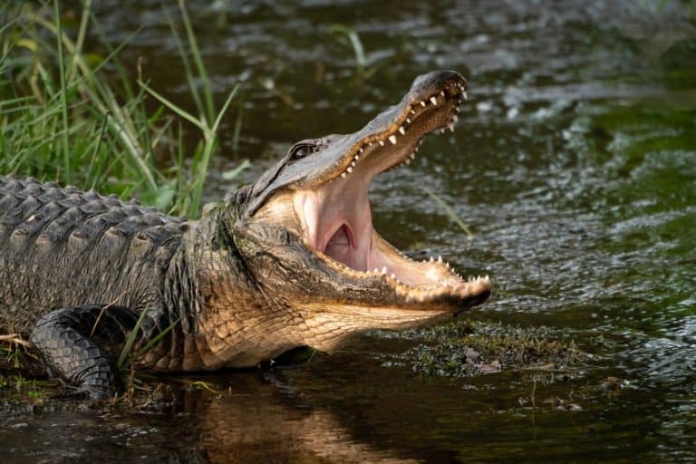
American Alligator
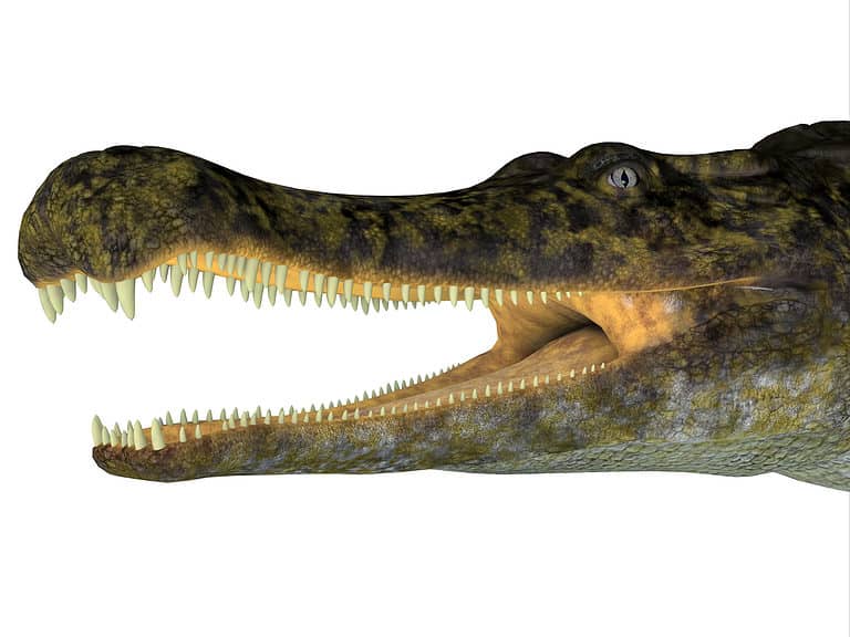
U-snout wetland engineer

U-snout wetland engineer
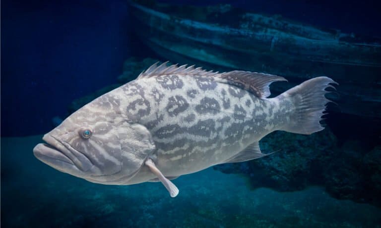
From river ambush to ocean roam
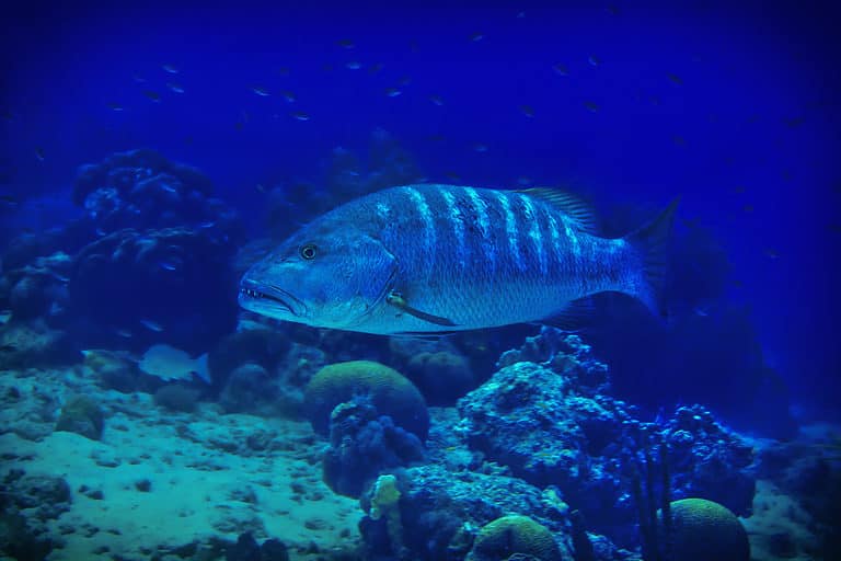
Big mouth. Bold strike. Reef ruler.

Eyes up. Mouth up. Strike up.
Big jaws. Bigger snapper.
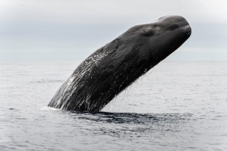
Square head, deep dives, giant squid.
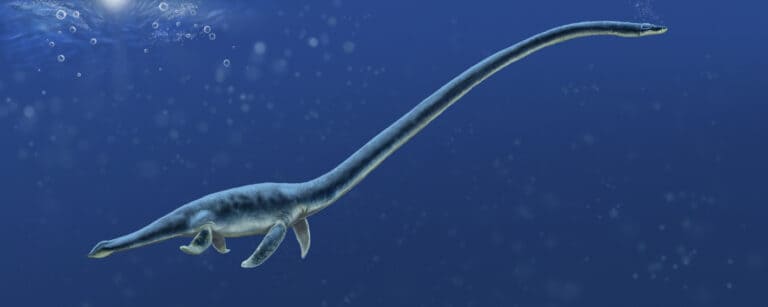
Four flippers, many lifestyles
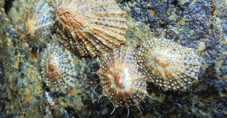
Cling hard, graze smart, ride the tide.
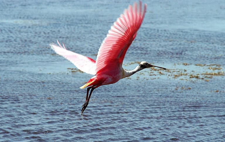
Sweep. Snap. Pink perfection.
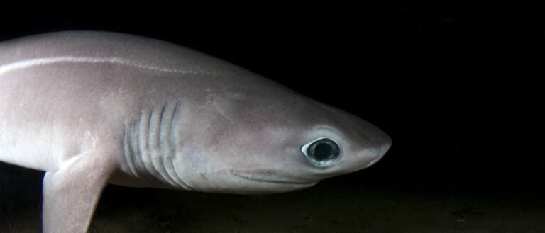
Six gills. Deep shadows. Slow lives.
The Gulf of Mexico is a semi-enclosed marginal sea of the western Atlantic Ocean bounded by the southern United States, eastern Mexico, and Cuba, comprising extensive continental shelves surrounding a deep central basin connected to the Atlantic via the Straits of Florida and to the Caribbean via the Yucatán Channel.
The Gulf of Mexico forms a vast, warm-water basin where subtropical circulation, broad shelves, and major river inflows interact to shape one of the world's most productive marine regions. Its margins include wide continental shelves off Texas-Louisiana and the Florida Peninsula, while the interior deepens into the Gulf Basin, creating sharp gradients in temperature, salinity, and habitats over relatively short distances.
Large freshwater and sediment inputs-especially from the Mississippi-Atchafalaya system-build deltas, nourish coastal wetlands, and fuel high biological productivity, but can also drive seasonal hypoxia ("dead zones") on the northern shelf when nutrient loading promotes algal blooms and subsequent oxygen depletion. Along the eastern and southern margins, clearer waters support coral reefs (e.g., Florida Keys, Campeche Bank reef systems), seagrass beds, mangroves, and carbonate platforms.
Oceanographically, the Loop Current and its eddies transport warm Caribbean water through the Gulf and feed the Gulf Stream, influencing regional climate, hurricane intensification potential, and marine connectivity. From estuaries and barrier islands to deep-sea plains, seeps, and canyons, the Gulf hosts diverse food webs and significant fisheries, while also facing pressures from coastal development, shipping, invasive species, and offshore energy activity.
Etymology: The name "Gulf of Mexico" refers to the large gulf adjacent to Mexico. The country name Mexico derives from the Nahuatl name associated with the Mexica people and their capital region; the term entered European usage through Spanish exploration and cartography in the 16th century.
Loop Current (feeds Gulf Stream), hurricanes, major oil & gas fields, Mississippi River influence, rich fisheries, coral reefs (e.g., Flower Garden Banks) and deep-sea habitats
The Gulf of Mexico is a semi-enclosed marginal sea of the western Atlantic Ocean, lying between the southeastern United States to the north and northeast, eastern Mexico to the west and southwest, and Cuba to the southeast. It opens to the Atlantic primarily through the Straits of Florida and to the Caribbean Sea through the Yucatán Channel.
Sigsbee Deep (in the central Gulf Basin)
Northern and northeastern rim (Texas through Florida); extensive continental shelf and major estuaries/river deltas.
Western and southern rim (Tamaulipas to Yucatán); includes the Bay of Campeche and major shelf areas.
Southeastern boundary; connects via the Straits of Florida and sits near the Yucatán Channel/Caribbean interface.
North: United States Gulf Coast (Texas, Louisiana, Mississippi, Alabama, Florida). West and southwest: Mexico (Tamaulipas, Veracruz, Tabasco, Campeche, Yucatán). Southeast: Cuba. Northeast outlet: Straits of Florida to the Atlantic Ocean. South outlet: Yucatán Channel to the Caribbean Sea.
Surface avg: Annual mean surface ~24-27°C (north shelf lower; Loop Current/southern Gulf higher)
Deep avg: Deep basin (≥1500-2000 m) ~4-4.5°C, slowly varying
Offshore waters are typically subtropical Atlantic in salinity, elevated within Loop Current eddies. Large river inputs (especially Mississippi/Atchafalaya) create extensive surface freshening on the northern shelf, sharp coastal salinity fronts, and pronounced horizontal/vertical gradients; evaporation can locally raise salinity in the western/southern Gulf during dry, warm periods.
Strong seasonality on northern/inner shelves (cool winters, very warm summers); weaker seasonality in the Loop Current and southern Gulf; episodic winter cold-air outbreaks can rapidly cool shallow waters; summer heat and humidity favor widespread warm surface layers and occasional marine heatwaves.
Dominated by the Loop Current (inflow through the Yucatán Channel, looping northward then exiting via the Florida Straits as the Florida Current/Gulf Stream). The Loop Current sheds large anticyclonic warm-core eddies (Loop Current Rings) that propagate westward across the basin; cyclonic eddies and frontal jets form around ring edges. Shelf circulation is wind-driven and seasonally variable: along-shelf currents on the Texas-Louisiana shelf, exchange through the Campeche Bank, and persistent eddy activity over the deep Gulf Basin.
Generally microtidal (typical ranges ~0.2-0.6 m), with mixed diurnal/semidiurnal character varying by location. Diurnal dominance is common on parts of the northern Gulf (e.g., Texas-Louisiana), while mixed tides occur elsewhere. Local amplification occurs in bays/estuaries (e.g., Laguna Madre, Mobile Bay) and narrow inlets; storm surge from tropical cyclones and winter fronts often exceeds astronomical tides.
Upper layer includes warm, relatively salty Tropical/Caribbean-derived water within the Loop Current and rings; shelf and slope waters are modified by air-sea fluxes and strong freshwater/particulate inputs from major rivers. Intermediate depths include Atlantic-origin intermediate waters entering through the Caribbean pathways; deep Gulf Basin water is cold, oxygenated but slowly renewed, with long residence times and relatively uniform properties below the main thermocline.
Strong seasonal stratification, especially from late spring through early fall: a warm, often fresher surface mixed layer overlies a sharp thermocline/pycnocline (typically tens of meters deep, deeper offshore and in Loop Current waters). River plumes intensify haline stratification on the northern shelf, limiting vertical mixing and promoting bottom-water oxygen depletion in summer. Winter cooling and wind events deepen the mixed layer and partially erode stratification, particularly on shelves.
Localized and episodic rather than basin-wide. Notable zones include: (1) wind-driven coastal upwelling along the western Gulf (Texas-Tamaulipas) during favorable winds; (2) edge upwelling and enhanced vertical exchange along Loop Current and eddy fronts (ring boundaries) that can elevate nutrients and chlorophyll; (3) topographically influenced upwelling/vertical mixing over the Campeche Bank and along shelf breaks/canyons (e.g., northern slope features) during strong wind events and eddy interactions.
Large seasonal hypoxic zone ("Dead Zone") on the Louisiana-Texas shelf driven by nutrient-rich Mississippi/Atchafalaya discharge, strong summer stratification, and high productivity/oxygen demand. Frequent tropical cyclones can rapidly mix/redistribute heat and freshwater, generate extreme storm surge, and trigger short-lived cooling and nutrient injection. Loop Current ring shedding causes major interannual variability in heat content, hurricane intensification potential, and ecosystem connectivity. Natural hydrocarbon seeps and extensive offshore oil/gas infrastructure occur in the deep Gulf, with occasional impacts from spills. High turbidity and sediment transport near river mouths contrasts with clear oligotrophic waters over parts of the southern Gulf and coral reef regions (e.g., Florida Keys/Florida Reef Tract just beyond the Gulf, and coral communities on banks).
The Gulf of Mexico has a warm, humid subtropical-to-tropical marine climate characterized by high sea-surface temperatures, strong air-sea moisture exchange, and pronounced freshwater and nutrient inputs from major rivers (especially the Mississippi). Broad shelves and the Loop Current/eddy system shape regional temperature, salinity, and productivity: generally warmer, saltier waters dominate the central and eastern Gulf, while the northern Gulf often experiences lower salinity and seasonal hypoxia near river-influenced shelves.
Winter (Dec-Feb): Cooler, drier air outbreaks from North America periodically drive strong winds and rapid surface cooling, especially over the northern and western shelves; sea surface temperatures (SSTs) are lowest and vertical mixing is strongest. Spring (Mar-May): Rapid warming begins; increasing river discharge strengthens coastal stratification in the north, boosting productivity and setting conditions that can contribute to late-spring/early-summer low-oxygen events on the Louisiana-Texas shelf. Summer (Jun-Sep): Hottest, most humid period with peak SSTs and strong stratification; the Loop Current and warm-core eddies can maintain very warm conditions in the eastern/central Gulf. Rainfall and convective storms are common. Autumn (Oct-Nov): Gradual cooling and increasing frontal passages; mixing deepens, stratification weakens, and SSTs fall. This period overlaps with late-season tropical cyclone risk.
Tropical cyclones (Atlantic hurricanes) are the dominant high-impact storm type. The Gulf experiences hurricanes and tropical storms mainly from June through November, peaking in August-September. Storms can form in the Gulf or enter from the Caribbean/Atlantic; rapid intensification is possible over very warm waters, particularly when the Loop Current or warm eddies are present. Impacts include extreme winds, storm surge along low-lying coasts, heavy rainfall/freshwater flooding, and post-storm mixing that can temporarily cool surface waters and alter salinity and oxygen conditions.
No persistent sea ice. Sea ice is absent in the Gulf of Mexico; only extremely rare, short-lived coastal icing can occur during exceptional cold-air outbreaks in shallow nearshore waters of the far northern Gulf, but it is not a regular climatic feature.
The Gulf of Mexico is a semi-enclosed, warm-temperate to subtropical marginal sea with strong gradients from nutrient-rich, river-influenced coastal waters (especially the Mississippi/Atchafalaya plume) to oligotrophic open-ocean waters shaped by the Loop Current and its eddies. Broad continental shelves support extensive estuaries, wetlands, and fisheries, while the deep Gulf Basin contains canyons, abyssal plains, and unique chemosynthetic habitats (hydrocarbon seeps, brine pools) that host specialized deep-sea communities. Productivity is high on shelves and near river inputs, but the system is also stressed by coastal development, hypoxia ("dead zone") events, hurricanes, and chronic/acute pollution (including oil and nutrient loading).
High habitat diversity (estuaries, marshes/mangroves, seagrasses, oyster reefs, coral and mesophotic reefs, pelagic Sargassum, deep-sea soft sediments, and chemosynthetic seep ecosystems) supports rich species assemblages across tropical-to-temperate ranges. While not globally "exceptional" in endemism like some isolated seas, the Gulf hosts very high overall richness of fishes, invertebrates, seabirds, and marine mammals, plus distinctive deep-sea seep fauna and several regionally endemic/near-endemic species.
Species count: ~15,000+ documented marine species (order-of-magnitude estimate); including ~1,500+ fish species and thousands of invertebrates, with ongoing discovery in deep-sea habitats
The Gulf of Mexico neritic zone spans the broad continental shelves off the U.S. Gulf Coast (including the West Florida Shelf) and the Yucatán/Campeche shelf, where sunlight can reach the seafloor across large areas. It includes highly productive estuaries, bays, and salt marsh-mangrove systems, as well as seagrass meadows and reef or hard-bottom habitats (e.g., Flower Garden Banks, Florida Middle Grounds, and reefs/banks on the Campeche shelf). Strong freshwater and nutrient inputs-especially from the Mississippi-Atchafalaya system-create salinity gradients and seasonal stratification that drive high plankton productivity but can also lead to summer hypoxia on parts of the shelf ("dead zone"). This zone supports major fisheries (shrimp, menhaden, red drum, snapper-grouper complexes) and serves as nursery habitat for many species.
The pelagic zone in the Gulf includes offshore waters over the deep basin influenced by the Loop Current and its warm-core eddies, which transport heat, larvae, and nutrients and create dynamic fronts. Surface layers are typically warm and stratified much of the year, with localized productivity at convergences, eddy edges, and upwelling zones. The open-water community includes phytoplankton and zooplankton (copepods, larval stages), pelagic forage fishes (sardines, mackerels), large predators (tunas, billfishes, sharks), and air-breathing megafauna (sperm whales, dolphins, sea turtles). Floating Sargassum mats form a distinctive pelagic habitat that shelters juvenile fishes, invertebrates, and turtles while concentrating predators along its edges.
The benthic zone ranges from soft-sediment shelves and muddy deltaic bottoms to deep-sea plains, salt diapirs, canyons, and chemosynthetic seep communities in the Gulf Basin. On the shelf, sediments are frequently reworked by waves, storms, and trawling, supporting burrowing infauna (polychaetes, clams), crustaceans, and demersal fishes. Hard-bottom patches and reefs (natural banks, coral communities, and artificial structures) provide complex habitat for sessile invertebrates (sponges, corals, bryozoans) and reef-associated fishes. In the deep Gulf, low light and high pressure favor slow-growing communities, including deep corals on hard substrates and cold seeps where methane and sulfide fuel microbial production that supports tube worms, mussels, and specialized crustaceans.
The demersal zone-waters just above the seafloor-links benthic production to higher trophic levels and is especially important on the continental shelf and along slope habitats. Demersal assemblages include shrimp, crabs, benthic cephalopods, and fishes such as red snapper, groupers, tilefishes, flounders, rays, and many sharks that forage close to bottom. These communities track bottom temperature, oxygen, and habitat type: seasonal hypoxia can compress or displace demersal fauna, while reef and hard-bottom features concentrate predators and spawning aggregations. Many species use shelf nurseries (seagrass and marsh edges) and then shift demersally to deeper reefs and slope habitats as they mature.
Seasonal movements in the Gulf are driven by temperature, spawning cycles, and currents. Many coastal and shelf fishes shift offshore in winter and return in spring-summer (e.g., red drum and some seatrout populations; various sharks). Sea turtles (loggerhead, Kemp's ridley, green) move between foraging grounds and nesting beaches, with nesting generally peaking in spring-summer and increased nearshore foraging in warmer months. Highly migratory pelagics (bluefin and yellowfin tunas, billfishes) pass through or use Gulf waters seasonally, often concentrating along Loop Current fronts and eddy boundaries. Marine mammals such as sperm whales use deep waters year-round but may shift distribution with prey and oceanographic features; many dolphin species track coastal productivity and prey pulses. Massive planktonic migrations also occur: zooplankton undergo nightly diel vertical migration, rising toward the surface after dusk and descending at dawn, forming a key daily energy conveyor between deep and surface layers.
Primary production begins with phytoplankton fueled by sunlight and nutrients from rivers, upwelling, and eddy-driven mixing; this supports zooplankton that feed larval fishes and filter-feeding invertebrates. A major coastal food web links marsh and mangrove detritus → bacteria/microbes → worms/crustaceans → juvenile fishes and shrimp → larger predatory fishes (red drum, snappers) and birds. Seagrass-based webs run from seagrass epiphytes and detritus → grazers (snails, urchins) and small crustaceans → juvenile reef and sport fishes, with turtles and some fishes directly grazing plant material. Reef/hard-bottom webs are structured by benthic algae and plankton capture: plankton → corals/sponges and planktivorous fishes → mid-level predators (jacks, mackerels) → apex predators (groupers, sharks). Offshore pelagic webs run phytoplankton → zooplankton → forage fishes/squid → tunas, billfishes, dolphins, and sharks; Sargassum mats intensify these interactions by concentrating prey and providing nursery habitat. In the deep Gulf, chemosynthetic food webs at cold seeps begin with methane- and sulfide-oxidizing microbes → seep mussels/tube worms and associated fauna → deep-sea predators and scavengers, supplemented by "marine snow" (sinking organic matter) from surface production.
The Gulf of Mexico is a highly productive but heavily used semi-enclosed sea with extensive continental shelves, major estuaries, deep-sea habitats, and coral reef systems (notably the Florida Keys/Flower Garden Banks and reef communities around Cuba and Mexico). Its conservation status is mixed: some offshore habitats and select fish stocks show recovery under management, while chronic nutrient enrichment, recurring hypoxia, coastal habitat conversion, contamination, and climate-driven stressors continue to degrade ecosystem condition and resilience-especially near large river inputs (e.g., Mississippi/Atchafalaya) and densely developed coasts.
fair-to-poor overall; localized improvements in managed fisheries and protected offshore reefs, but persistent coastal degradation and pollution pressure
Nutrient loading (nitrogen/phosphorus) from the Mississippi/Atchafalaya watershed drives eutrophication and the seasonal "dead zone" hypoxia on the northern shelf; additional stress from oil and chemical contamination (including legacy impacts from major spills), urban/industrial runoff, plastics/microplastics, and wastewater-derived contaminants in coastal waters and estuaries.
Ongoing loss and fragmentation of wetlands, marshes, seagrass, mangroves, and oyster reefs from shoreline hardening, dredging, channelization, reduced sediment delivery, and subsidence; coastal squeeze and erosion reduce nursery habitat and storm buffering capacity.
Warming waters increase marine heatwaves and coral bleaching risk; sea-level rise accelerates wetland drowning and salinity shifts; stronger storms exacerbate turbidity and contaminant redistribution; ocean acidification threatens calcifiers (oysters, corals) and can alter food webs.
Many commercially important stocks are managed, yet localized overfishing and bycatch remain concerns (e.g., reef fish, shrimp trawls affecting benthos, protected species interactions). Illegal/unreported catch and shifting distributions complicate assessment and enforcement across jurisdictions.
High density of offshore oil/gas platforms, pipelines, ports, shipping lanes, and coastal engineering (levees, canals) alters hydrology and habitats; accident risk (spills), chronic discharge, and vessel strikes/noise impact marine life.
Shipping noise, recreational boating, coastal tourism, and industrial activity disturb wildlife and habitats; vessel strikes and acoustic disturbance affect cetaceans and turtles; light pollution affects nesting sea turtles in some areas.
River management (levees, diversions) changes sediment/nutrient delivery; navigation channels and dredging modify circulation and salinity; altered freshwater inflows affect estuarine productivity and species composition.
Disease and poor water quality contribute to coral stress and mortality events; oyster diseases (e.g., Dermo) and harmful algal blooms can increase morbidity and reduce recruitment in stressed estuaries.
Sediment deficits and groundwater extraction contribute to subsidence and wetland loss; extraction of living resources and coastal materials can reduce ecosystem resilience when coupled with other stressors.
Major issue: nutrient-driven eutrophication and seasonal hypoxia on the northern Gulf shelf; chronic coastal contamination from agricultural runoff, industrial discharges, urban stormwater, plastics/microplastics; episodic and legacy oil pollution; harmful algal blooms (notably Florida red tide) affecting water quality, fisheries, and wildlife.
Management has rebuilt or stabilized several key stocks (e.g., some reef fish under quotas/closures), but pressures persist from bycatch (especially in shrimp trawl fisheries), localized depletion of reef-associated species, and cross-border enforcement challenges. Stock status varies by species and sub-region.
Warming drives more frequent marine heatwaves, shifts species ranges, and increases coral bleaching and disease susceptibility; sea-level rise and stronger storms accelerate wetland loss and shoreline erosion; ocean acidification reduces calcification rates for oysters and corals and may alter larval survival and food-web dynamics.
Lionfish are widespread on reefs and hard-bottom habitats, preying on native reef fish and competing with predators; invasive aquatic plants and non-native invertebrates occur in some estuaries/ports, with risk elevated by shipping and ballast water pathways.
A protected offshore sanctuary atop salt-dome-related banks off Texas and Louisiana, featuring some of the northernmost coral reefs in the continental U.S.
Known for exceptionally healthy coral cover, seasonal mass spawning, whale shark sightings, and as a flagship conservation area in the Gulf.
A long, shallow coral reef system along the Florida Keys, with portions and patch reefs extending into the Gulf-side waters behind the islands.
The only extensive shallow coral reef system in the continental United States; supports high biodiversity, fisheries, and world-class snorkeling/diving.
A complex of coral reefs, islands, and sand cays off Veracruz, Mexico, including shallow reef flats and channels influenced by coastal and riverine inputs.
One of the most important reef systems in the southwestern Gulf; critical for fisheries, coastal protection, and conservation amid strong human-use pressures.
A large ring-shaped reef complex with sandy islets (cays) off northern Yucatán, Mexico, forming a quasi-atoll structure in shallow Gulf waters.
The largest reef structure in the Gulf of Mexico; a key habitat for seabirds, turtles, and reef biodiversity, and a major navigation landmark.
A broad, shallow carbonate bank and continental-shelf region off the Campeche coast of Mexico in the southern Gulf of Mexico, with hard-bottom habitats and reef-associated communities in productive waters.
A major ecological and fisheries region of the southern Gulf of Mexico; its shallow banks and hard-bottom areas support reef-associated ecosystems and important commercial fishing grounds.
The deepest part of the Gulf of Mexico within the Sigsbee Abyssal Plain, reaching depths of roughly 4,300+ meters (about 14,000+ ft).
Iconic deep-sea environment central to Gulf oceanography; associated with unique abyssal habitats, deep currents, and nearby salt tectonics.
A major river-delta and associated estuarine/coastal waters where the Mississippi River enters the northern Gulf of Mexico, including wetlands, bays, passes, and marshes.
A dominant river input to the northern Gulf, delivering sediment and nutrients that strongly influence coastal habitats and productivity; its nutrient loading is also a major driver of seasonal hypoxia (the Gulf "dead zone").
A large estuary on the U.S. Gulf Coast of Alabama fed by major rivers, with extensive marshes and productive brackish habitats.
A biodiversity-rich estuary supporting fisheries and migratory birds; notable for dynamic estuarine processes and periodic coastal phenomena (e.g., "jubilees" in parts of the bay system).
A broad estuary on Florida's west coast with seagrass meadows, mangroves, tidal flats, and connecting channels to the Gulf.
One of Florida's largest estuaries; a major restoration success story for seagrass recovery and an important nursery for fish and invertebrates.
A remote group of islands and surrounding reefs west of Key West, at the transition between the Gulf of Mexico and the Florida Straits.
Renowned for clear waters, coral reefs, and Fort Jefferson; important for seabirds, turtles, and as a gateway between Gulf and Atlantic reef ecosystems.
A decommissioned U.S. Navy aircraft carrier intentionally sunk off Pensacola, Florida, creating an artificial reef.
One of the world's largest artificial reefs and a celebrated advanced dive site; has become important habitat for reef fish and a major draw for dive tourism.
Networks of decommissioned platforms and purpose-built reef structures across the northern Gulf shelf, often referred to through rigs-to-reefs programs.
Famous for aggregating fish and pelagic species, supporting recreational fishing and diving; illustrates the Gulf's unique interplay of industry and marine habitat creation.
The narrow waterway between the Florida Keys and Cuba connecting the Gulf of Mexico to the Atlantic and carrying the Florida Current (part of the Gulf Stream system).
A major current corridor influencing Gulf circulation, heat transport, and marine migrations; important for shipping routes and pelagic ecosystems.
A hypersaline lagoon system behind barrier islands along the Texas coast, with extensive seagrass beds and shallow flats.
One of the few hypersaline lagoons in the world; critical habitat for seagrass-dependent species, waterfowl, and sport fisheries.
A large atoll-like reef system off Mexico's Caribbean coast near the Yucatán Channel, connected ecologically to Gulf-Caribbean exchange.
Although Caribbean-facing, it's notable in the broader Gulf system context due to Yucatán Channel connectivity affecting species dispersal and regional currents.
The Gulf of Mexico has long been a crossroads of peoples and commerce linking North America, Mesoamerica, the Caribbean, and the wider Atlantic. Pre-Columbian coastal and riverine networks connected Indigenous societies around the Gulf rim, with intensive trade in salt, fish, shell, obsidian, and other goods among cultures along the Mississippi watershed and the Gulf coast, and between the Yucatán/Maya region and Caribbean routes. After 1492 it became a central theater of European exploration and colonization: Spanish expeditions mapped coasts and established ports from Florida to Veracruz, and the Gulf served as the maritime corridor feeding New Spain (including silver and commodities) through Veracruz/Havana toward Europe. The region also saw piracy/privateering and naval conflict during the Spanish, French, and British contest for control, later influencing U.S. expansion, the Louisiana/Florida frontiers, and the strategic development of New Orleans, Mobile, Tampa, and Mexican Gulf ports as gateways for inland trade. In the 20th century the Gulf became globally significant as a center for offshore petroleum development and as a logistics hub for hemispheric trade.
Major shipping activity concentrates along the U.S. Gulf Coast and the Mexican Gulf coast, with international routes connecting the Panama Canal/Caribbean to U.S. and Mexican ports and onward to the Atlantic. Key lanes include approaches to the Mississippi River system (for grain, chemicals, refined products, and containers), the Texas-Louisiana petrochemical corridor (crude oil, LNG, refined fuels), and routes linking Mexican ports with U.S. and global markets. Major ports and complexes include Port of South Louisiana (lower Mississippi), New Orleans, Houston (Houston Ship Channel), Galveston, Corpus Christi, Beaumont/Port Arthur, Mobile, and Tampa Bay. In Mexico, Veracruz, Altamira-Tampico, Tuxpan, Coatzacoalcos, Dos Bocas/Paraíso (Tabasco), Progreso (Yucatán), and Ciudad del Carmen/Campeche support commercial shipping and offshore supply-base functions. Dense tug-and-barge traffic occurs intracoastal and along river mouths; offshore, extensive service-vessel routes support platforms and subsea infrastructure.
Commercial fisheries are major in U.S. and Mexican waters, spanning industrial shrimp trawling, longline and rod-and-reel pelagic fisheries, reef-fish fisheries, and menhaden reduction fisheries. The Gulf supplies a large share of U.S. shrimp landings and supports significant finfish production (e.g., groupers/snappers) and highly migratory species fisheries (e.g., tunas). Management frameworks include U.S. federal/state regulations and Mexican federal management; seasonal closures, gear restrictions, bycatch mitigation, and quota/limited-entry programs are key features in many fisheries.
Artisanal and small-scale fisheries are widespread along Mexican coasts (Tamaulipas through Yucatán) and in U.S. coastal communities, especially targeting nearshore reef fish, coastal pelagics, crabs, oysters, and lagoon/estuary species. These fisheries often operate from small ports and beach landings, rely on seasonal pulses (e.g., octopus in the Yucatán, coastal finfish runs), and are closely tied to local food systems and cultural identity; vulnerability to storms, fuel costs, habitat loss, and market shifts is high.
Diving conditions vary widely: generally warm waters with strong seasonal patterns, visibility influenced by river discharge (notably near the Mississippi plume) and coastal turbidity, and clearer offshore conditions along reefs and banks. Currents can be significant, especially near the Loop Current and eddy fields; surface conditions can change rapidly with fronts and tropical systems. Water temperatures are typically warm to hot in summer and cooler in winter, with thermoclines offshore; deeper sites require technical diving due to depth, currents, and distance from shore.
Tourism is a dominant coastal economic driver, ranging from beach and resort travel to heritage and nature-based activities. Major destinations include Florida's Gulf Coast (e.g., the Tampa Bay region, Sarasota, Naples), Alabama and Mississippi beaches, Louisiana's coastal culture and wetlands experiences, and Texas destinations such as Galveston and South Padre Island. In Mexico, Gulf-facing destinations include Veracruz's historic waterfront, Tamaulipas beaches, Tabasco and Campeche coastal areas, and Yucatán's Gulf coast (e.g., Progreso and surrounding sites). Common activities include sportfishing (tuna, snapper/grouper), boating and sailing, birding and wildlife watching (wetlands and barrier islands), seafood and culinary tourism, cruises, coastal festivals, and visits to protected areas such as estuaries, seagrass meadows, and coastal national parks and refuges. Harmful algal blooms, hurricane seasons, coastal erosion, and occasional oil-spill impacts can strongly influence seasonal visitation.
The Gulf of Mexico is one of the world's most developed offshore hydrocarbon provinces, with extensive oil and gas extraction on the continental shelf and in deep water. Activities include seismic surveying, drilling (including deepwater), production from fixed platforms, semi-submersibles and spars, subsea wells and tiebacks, and a dense network of pipelines transporting crude oil, natural gas, and refined products to coastal terminals and petrochemical complexes. U.S. operations are concentrated off Texas, Louisiana, Mississippi, and Alabama; Mexico's production is prominent in the Bay of Campeche and adjacent areas, with ongoing development and modernization efforts. The region also hosts major refining, petrochemical manufacturing, LNG export/import terminals, and offshore service industries. Environmental risk management is central due to hurricane exposure, sensitive wetlands/reefs, and the legacy of major spill events that shaped regulatory and operational practices.
The Gulf's strategic importance stems from its role as a gateway to the U.S. interior via the Mississippi system, proximity to the Caribbean and Atlantic approaches, and concentration of energy and port infrastructure. The United States maintains significant Coast Guard and Navy-related presence for maritime security, search-and-rescue, counter-smuggling, and protection of critical infrastructure; training and test ranges operate in parts of the region. Mexico's Navy (SEMAR) plays a key role in offshore platform security, maritime law enforcement, and disaster response, particularly in the Bay of Campeche. Cuba's maritime security forces monitor approaches around the island. The Gulf is also a frequent theater for hurricane response, mass rescue operations, and interagency coordination on fisheries enforcement and environmental incidents.
The Gulf coast is culturally diverse, shaped by Indigenous, African diaspora, European colonial, and modern migrant histories. Indigenous cultures include (among others) coastal and riverine peoples of the U.S. Gulf such as the Choctaw, Chickasaw, Muscogee (Creek), Seminole, Karankawa (historical), Atakapa-Ishak, Houma and other Louisiana Native communities, as well as numerous Mesoamerican groups linked to Gulf Mexico (including Maya in the Yucatán and Totonac/Huastec regions historically along the Mexican Gulf). Afro-Caribbean and African American traditions are prominent, especially in Louisiana and along port cities, contributing to distinctive music, cuisine, and maritime labor histories. Spanish, French, and later Anglo-American influences shaped settlement patterns, architecture, and legal traditions on the U.S. side; in Mexico, strong Gulf-coast identities in Veracruz, Tabasco, Campeche, and Yucatán blend Indigenous and Spanish heritage with seafaring and fishing livelihoods. Cuba adds Caribbean cultural linkages through Havana's historic role as a maritime hub. Across the region, coastal communities maintain strong ties to seafood, shipbuilding and port labor, festival traditions, and place-based relationships with wetlands, barrier islands, and reef ecosystems.
238 species documented in our encyclopedia
Thank you for reading! Have some feedback for us?
We appreciate your help in improving our content.
Our editorial team will review your suggestions and make any necessary updates.
There was an error submitting your feedback. Please try again.